Hiking to la Breche du Roland
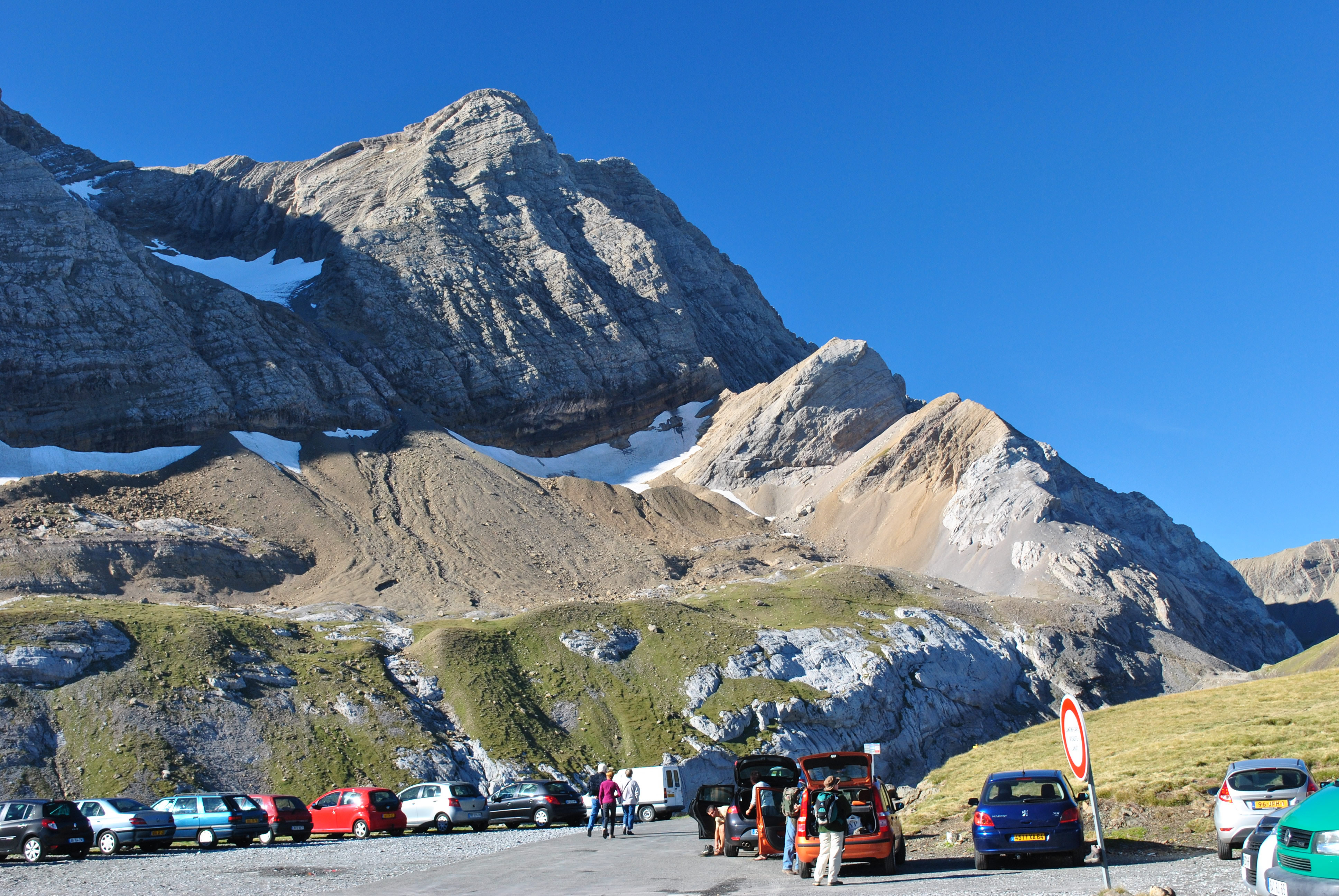 The Taillon from the trailhead
We got up early for breakfast on our last full day in the mountains. Sure enough, looking out the window the sky was perfectly clear and blue. Now we could appreciate the impressive view out of the window of our room.
We were both a little tired. Turns out that the salad at dinner the evening before had a lot of goat cheese on it. The cheese had a really strong flavor so we both ended up eating less than half of it. This got disapproving questions from our hostess. The French take their food seriously. But even though we didn't eat much, we both had stomach rumbles from it all night. But in the morning we were both anxious to go (hiking, that is).
After a quick breakfast we took a road that leads out of Gavarnie and up a side valley to a ski area. It continues until it reaches the Col de Tentes. Here there is a large carpark and the road beyond is closed to cars. Although it is possible to hike to the Breche du Roland directly from the village of Gavarnie, this gave us a starting point that was 2000 feet higher. We still had a lot of elevation to gain so we took every advantage that we could.
There was a beautiful view of Taillon from our staring point. It is usually considered the easiest 3000 meter peak in the area. It can be climbed in a single long day. The first half of the route would be our hike for today up to the Breche du Roland. From there one scrambles along the crest to the summit. But our hike was going to provide plenty of work for us - we had about six miles and over 2000 feet of elevation to gain just to get to the Breche.
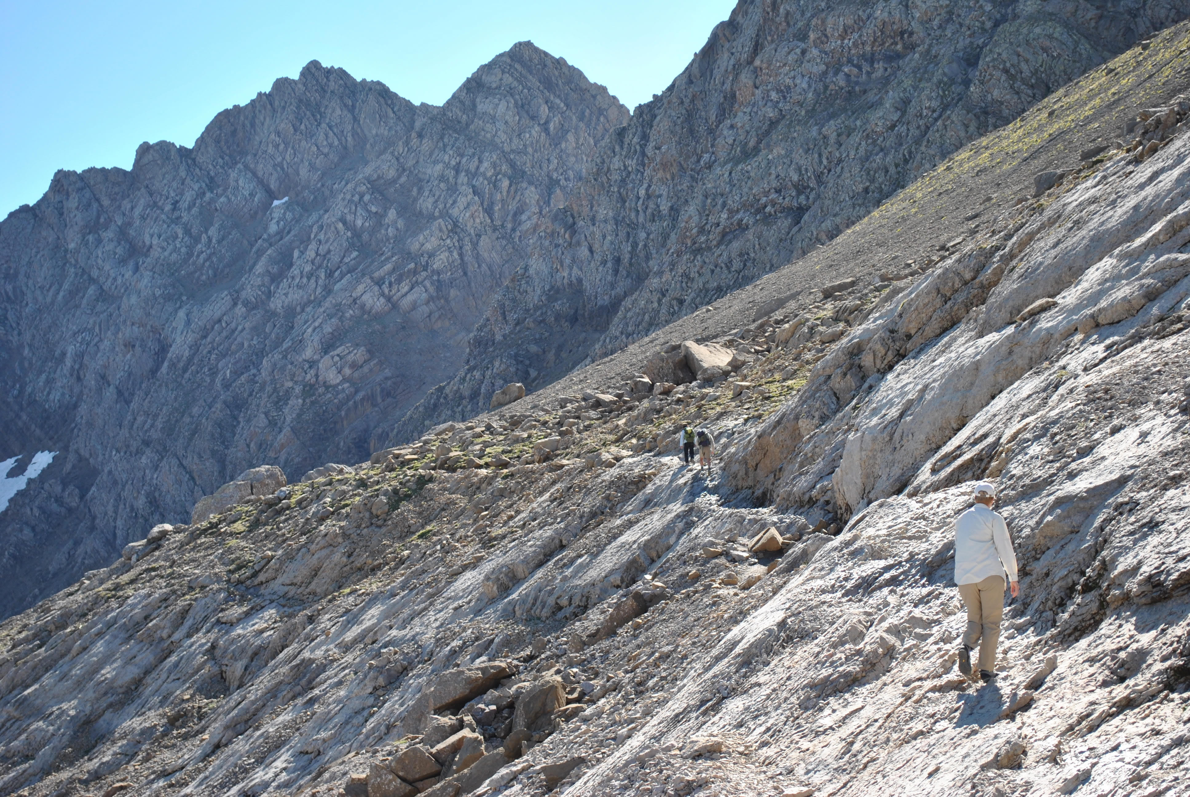 Sandy on the long, rising traverse
The first mile and a half was along the old road. After a short dip it rose steadily to a low point in the crest of the Pyrenees that formed the border between France and Spain. And that is where the road ended. Seemed like a strange road to me, to climb to a pass on one side of the range but not cross. But at least it made for easy hiking. From the crest we had a view down into Spain where we had been two days before.
From here the trail turned left and did a long, rising traverse on the slopes of the Taillon. This was great hiking. We were high up and had a great view of the mountains on the French side. The weather was ideal with a bright, blue sky and a temperature perfect for hiking. It was an awesome day.
Eventually we were below a steep valley leading up to a notch, the Col de Sarredets. To climb up to the notch required crossing some steep rock bands along a stream. There was a short via ferrata (iron way) where chains had been afixed to the rock to provide security where the route was especially steep or exposed. What made it hard though was that a stream was coming down the rocks, and in many of the shaded portions all of the rocks were coated with wet glare ice - very, very slippery. But we made it through the scramble section. Then it was just a slog up a steep trail that gained several hundred feet of elevation straight up to the col.
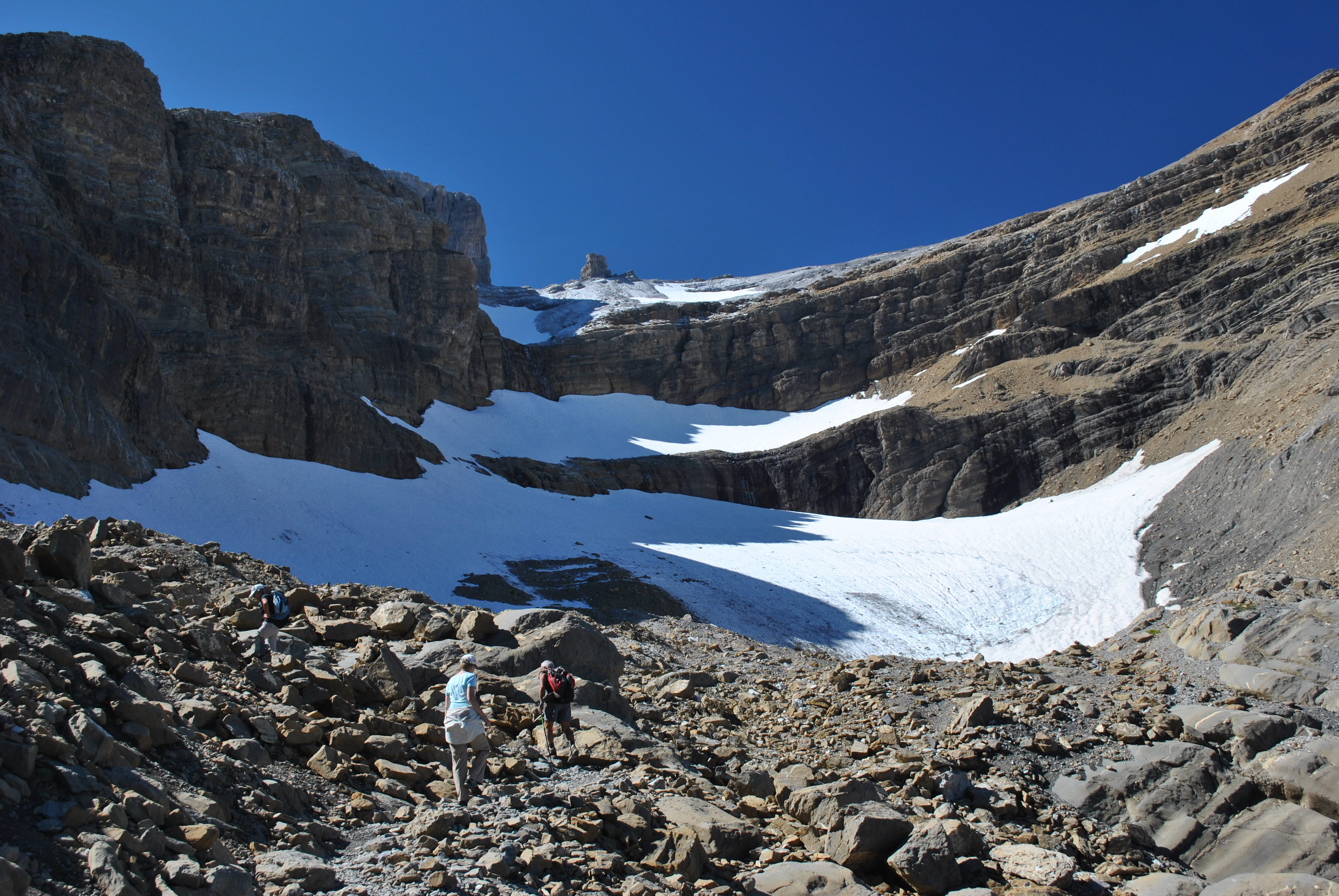 Slogging up the steep trail below the Col de Sarredets
Eventually we made it to the col. It was well worth the effort. The Col de Sarredets is at about 2600 meters. It is a low point in a ridge that runs north from the main Pyrenees crest, which runs east and west. This ridge separates two valleys that approach the main crest, one containing our trailhead, the other containing the village of Gavarnie and the Cirque du Gavarnie. Now we had a magnificent view into the Cirque du Gavarnie. But it was totally different from our view yesterday. Then we had been on the floor of the cirque and had a climb of two thousand feet to reach the bottom of the Grand Cascade. We were totally enclosed by the steep walls of the lower cirque which mostly blocked the view to the high summits. Here we were high above the top of the Grand Cascade. We had a fantastic view of the upper walls of the cirque which had all been blocked from our view down below. From where we stood now we couldn't even see the floor of the cirque where we had hiked and climbed the day before to reach the bottom of the waterfall. It took two days of hiking, and two widely different viewpoints, to give some idea of just how immense the Cirque du Gavarnie is. It is truely an amazing and beautiful place. Mind boggling.
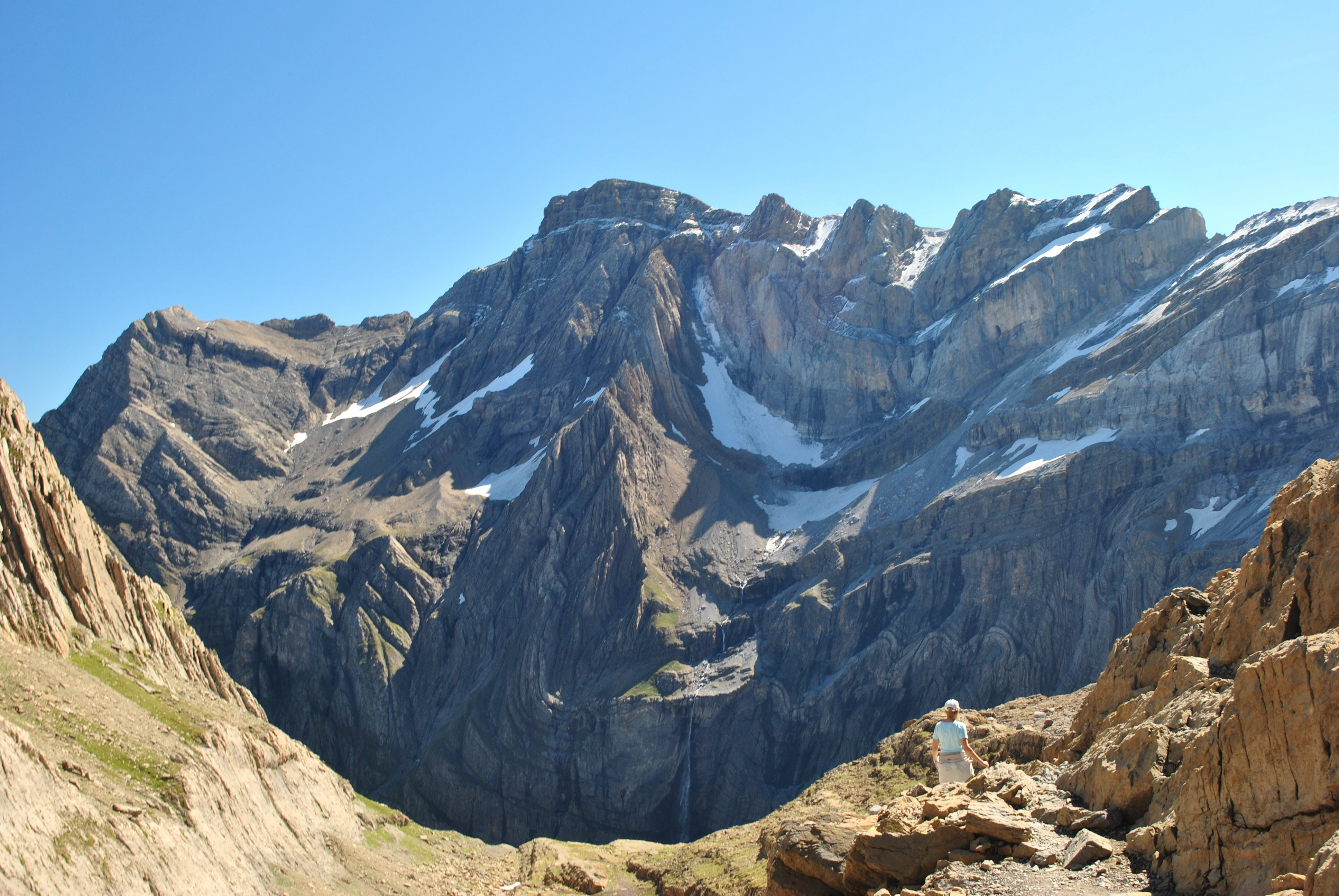 View of the Cirque du Gavarnie from the Col de Sarredets
Our next objective was the Refuge de Sarredets. We knew that the trail descended from the col to the refuge. We were glad to see that the hut did not seem to be too far away. Even better, it wasn't far down, because we knew that we would have to climb back up any elevation that we lost on our way to the hut. But it seemed pretty close. The refuge offered a place to stay overnight to people climbing the nearby peaks, crossing the range via the Breche du Roland, or hiking long distance along the crest of the range. Although the hut was quite large, it was dwarfed by its immense surroundings.
From the col we also had our first view of the Breche du Roland. This is an amazing structure in the Pyrenees crest. Here the crest is high with steep cliffs on both sides. The breche is where a section of the crest just collapsed. It is 125 feet wide and over 300 feet deep. According to legend, the breche was formed by Count Roland, a nephew of Charlemagne, when he struck the mountain in an attempt to destroy his enchanted sword, Durendal. More likely there was just a weakness in the cliffs that form the crest. But nevertheless it is an amazing formation.
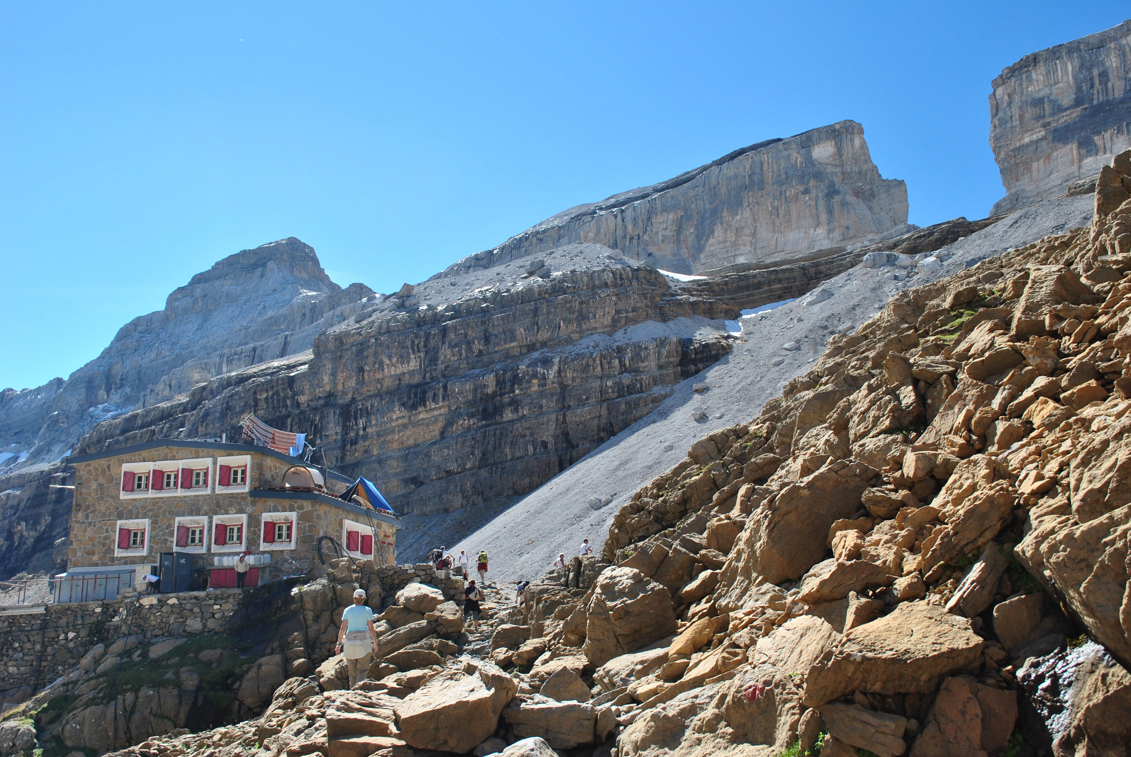 Refuge de Sarredets and la Breche du Roland beyond
After all our work to reach the refuge we deserved a break. Lots of other hikers had the same idea - they were sitting around the hut and enjoying the view. I went inside and found that I actually could buy (cold) Cokes. I got two (well deserved) drinks for Sandy and I. We stretched out to enjoy a snack, our Cokes and took in the magnificent view. It doesn't get any better than this.
From the map it looked like it was another thousand feet of climbing to reach the breche. It looked like a steep trail but straightforward. So after a long break we started on up again. We were hiking right alongside two young guys with snow boards. They were carrying their snow boards up so that they could go down the snowfield right beside the trail. Seemed like a lot of work for a few seconds of excitement.
Eventually we reached the crest of the slope that we were climbing. From there a flat stretch of rock led to a last slope which led to the notch. Unfortunately the last slope was a steep snow slope even this late in the year (September). While we rested we watched people going up and down the slope. It was pretty clear from watching them that the snow slope was tricky. Everyone on it had ice axes or ski poles. And everyone was having quite a bit of trouble on the slope. We saw a couple of people fall. The runout wasn't that horrible, but we still didn't think it was a good idea to try the last slope without any snow climbing gear. So we stopped, about two hundred vertical feet below the notch. The view from here was pretty amazing, both of the breche and looking out to the Cirque du Gavarnie.
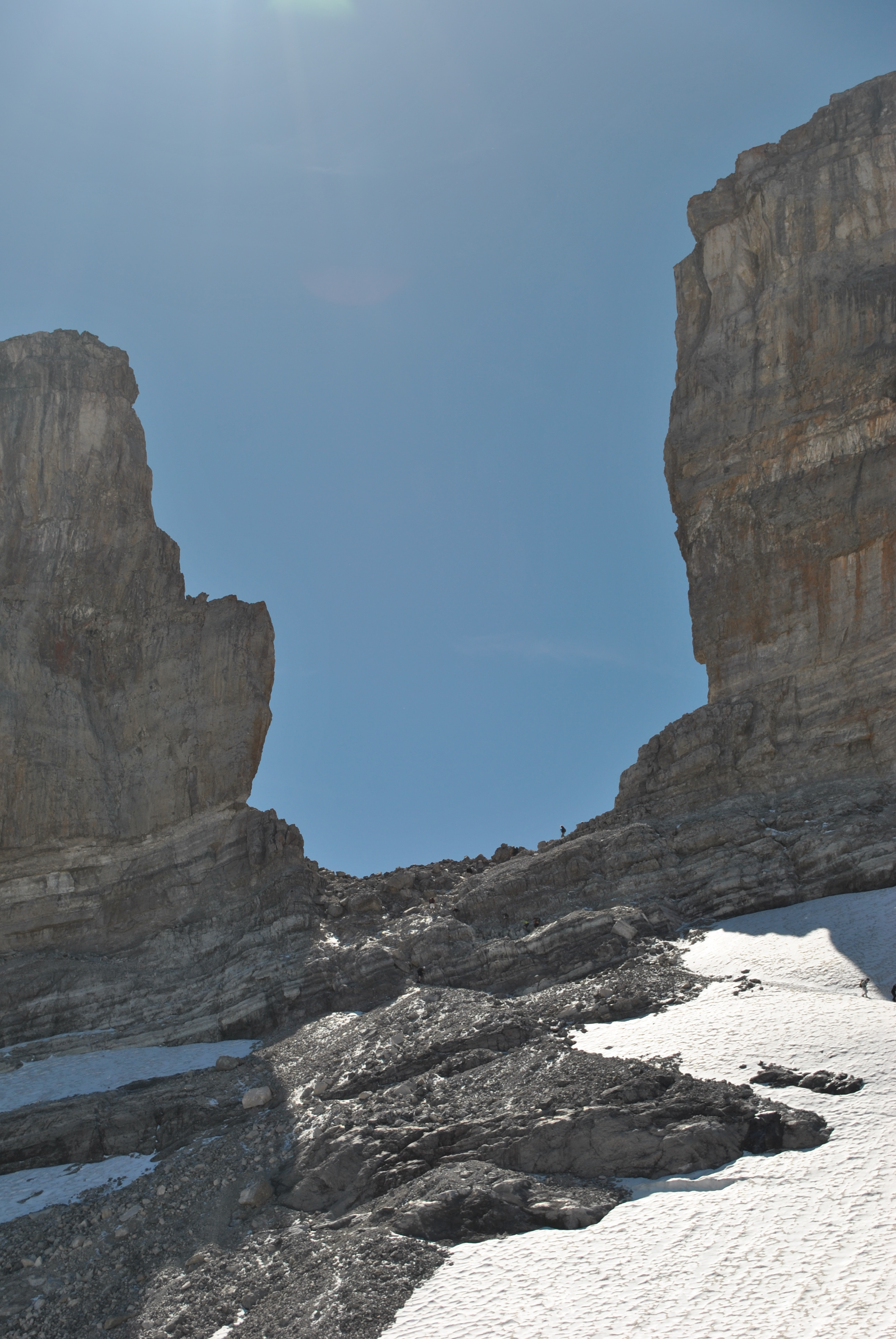 Breche du Roland from our high point
Time to head back. As always, going downhill was faster than going uphill, but not necessarily less work. While we were descending to the hut, a helicopter came flying by. After several passes above and below us, it dropped down to the hut. There wasn't really anyplace flat enough to land, so it just set one skid down and a couple of guys hopped out. The helicopter had "Gendarmerie" written on the side. Obviously they were practicing rescue operations. Turns out that the guys who were practicing were staying at our hotel. We saw them that evening at the hotel in the bar going over their pictures from the day same as we were.
We still had a long way to go to get back to the trailhead but it was downhill. When we reached the via ferrata section, I actually found a different way down for about half of the section with chains. Away from the ice it was pretty easy and we didn't need the chains. But for the last section there wasn't any choice and we had to slip/lower/crawl/climb/slither down the last bit through the rock bands. We made it through and now there was nothing but a long downhill hike to the car. We were finally starting to feel tired here. The frustration was that we could see the parking lot across the valley, maybe a mile away. But to reach it we had to go waaaayyy around for many miles. It was a long walk but eventually we made it.
The weather was perfect. The scenery was magnificent. The hiking and scrambling was interesting. All in all, as good a day as I have ever had in the mountains.
Additional pictures
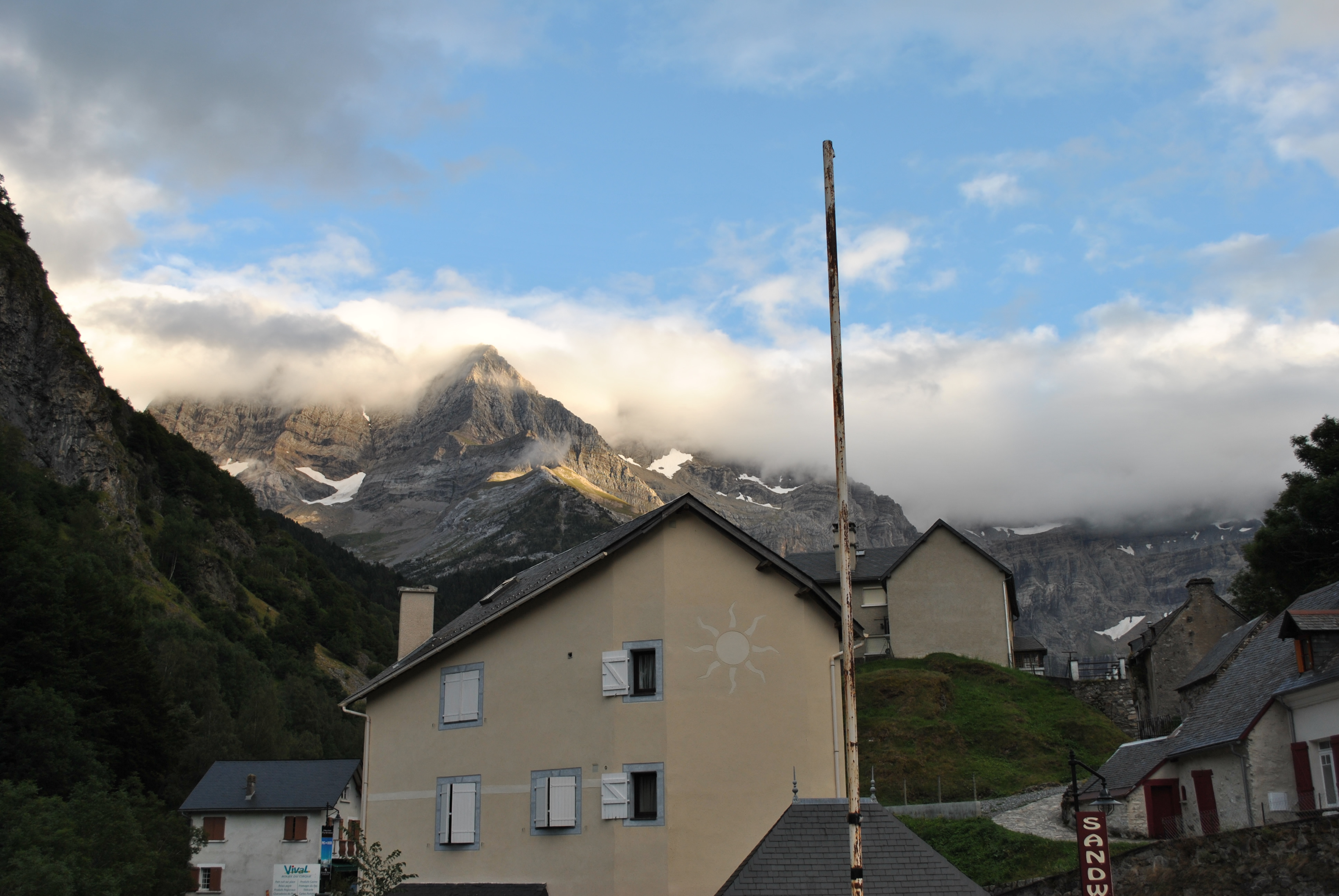
Evening - the weather is finally clearing


