Saving the best for last
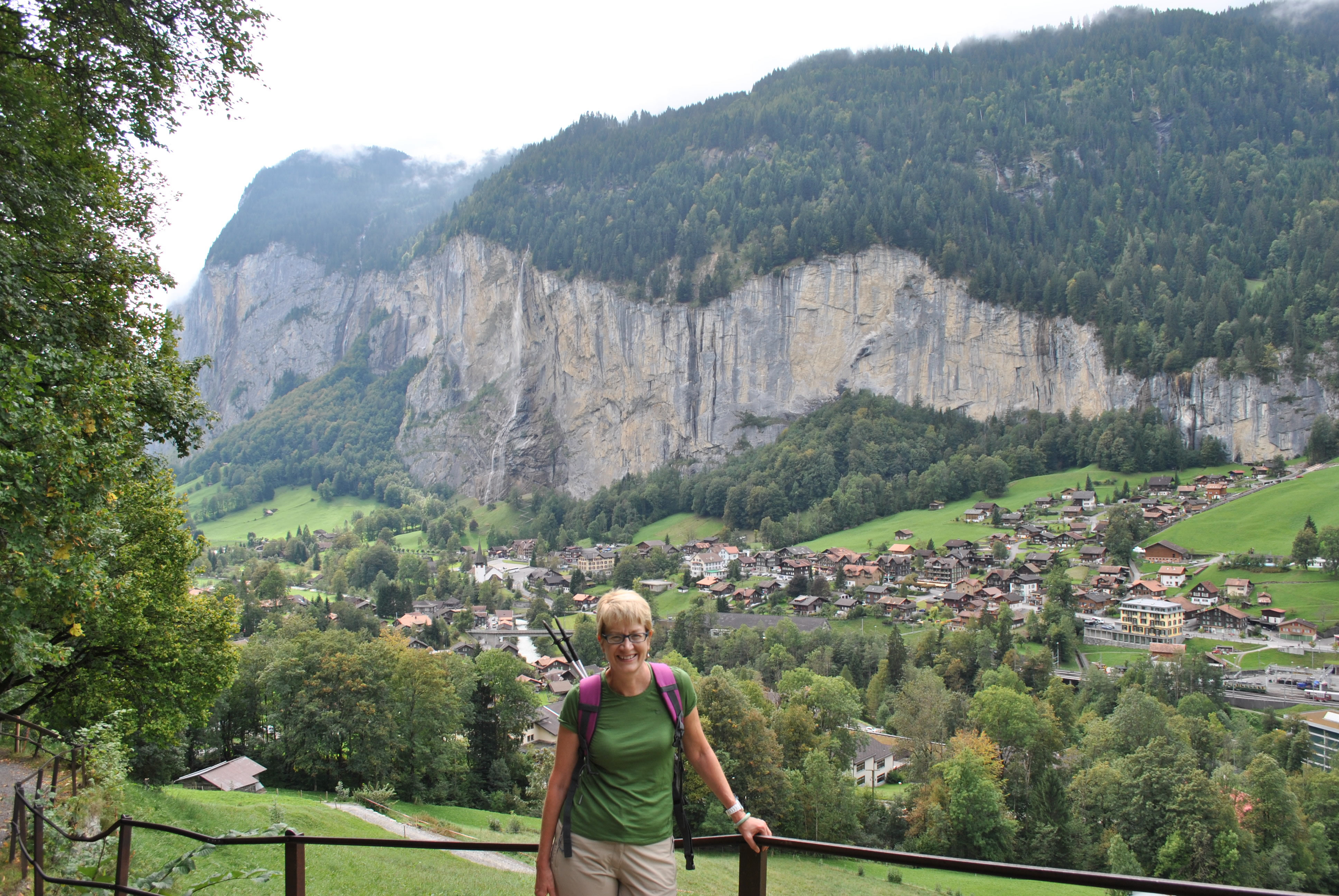 A steep hike from Lauterbrunnen to Wengen on a cloudy day
We'd had our perfect day for hiking in Grindelwald. We still had two days left but the weatherman decided that we deserved a break. He forecast clouds and a chance of showers for the next day before a clearing trend was supposed to bring sun again for our last day. We figured that a cloudy day would be a chance to explore the surrounding area. We would still get some walks in if the rain held off but nothing too ambitious.
We decided to take full advantage of our BOB passes. The Bernese Oberland Bahn operates the train lines from Interlaken to Grindlewald and the mountain village of Lauterbrunnen in the next valley over. They also operate the cog railway that goes over the pass of Kleine Scheidegg between Grindelwald and Lauterbrunen as well as up to the Jungfraujoch - the highest train station in Europe. It also included the cog railway to Schynige Platte and the lifts to First and to Manlichen. The buses throughout the valley were part of the deal as well. So for one fee we had a six day pass that allowed us to travel just about anywhere we wanted to in the area. The pass took away the consideration each day of whether to pay for a particular train ride or lift ticket. We just went where we wanted to go. It worked out pretty well.
 The BOB train heads up to Kleine Scheidegg
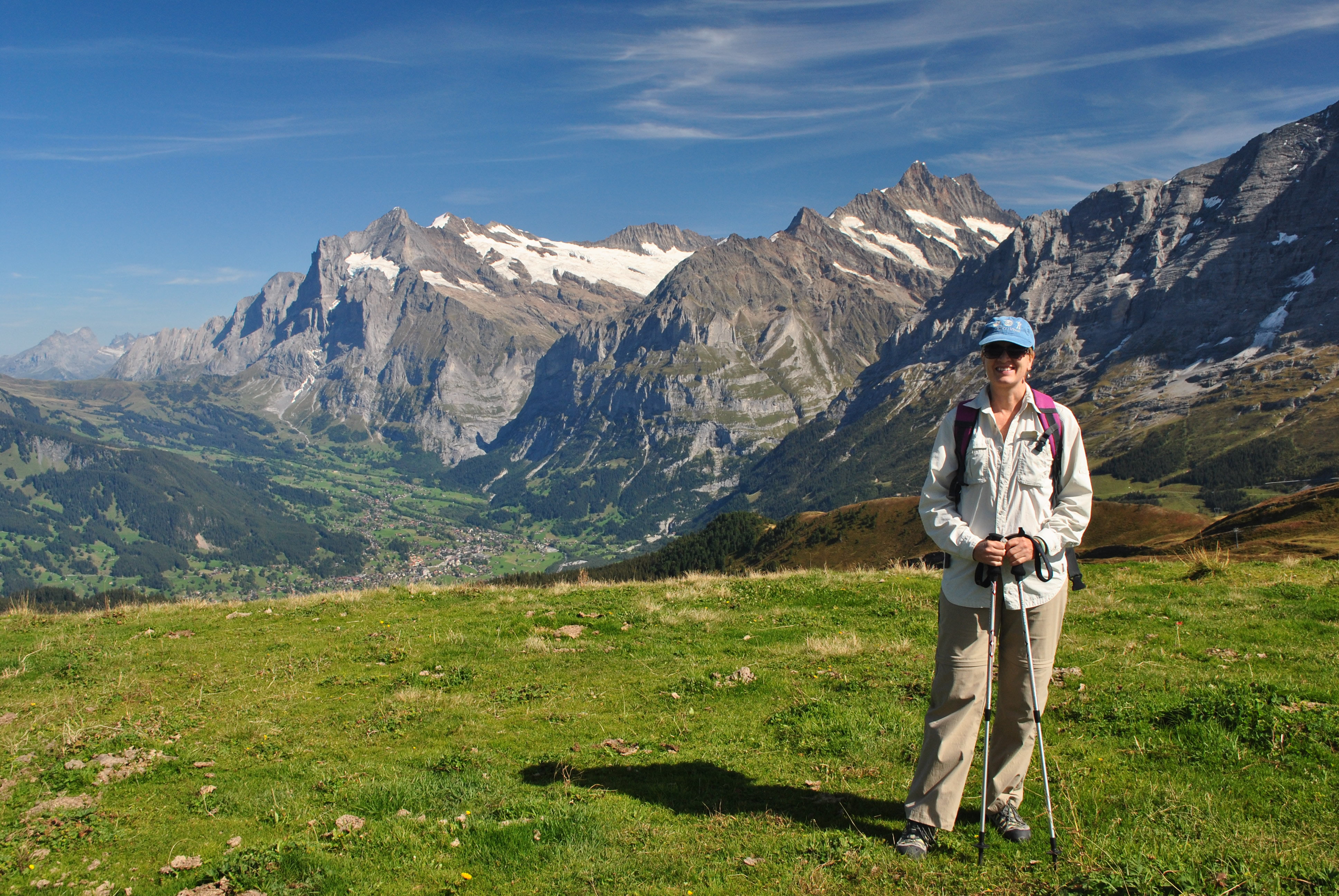
Our first destination was the village of Murren. To get there we took the BOB train back to Wilderswil and switched to a train to Lauterbrunnen. This took us into the next mountain valley over from Grindelwald. It was quite different. While Grindelwald is in a broad, green, pastoral valley, Lauterbrunnen is in narrow valley lined with cliffs. It looks like a Swiss version of Yosemite Valley.
From the train station in Lauterbrunnen (796m) we crossed the street to the gondola station. We had a very steep ride up to Grutschalp (1419m), which is above the sheer cliffs that line the bottom of the valley. From there we took a gently rising trail to the village of Murren (1645m) which is perched on a shelf high above the valley. We started our walk at Grutschalp just below cloud level and slowly ascended into the clouds as we climbed up to Murren. From the map it looked like the view from Murren should be spectacular but all we saw was gray fog. We decided not to hang around. We caught a train back to Grutschalp and rode the gondola back to Lauterbrunnen to look for a place to eat lunch.
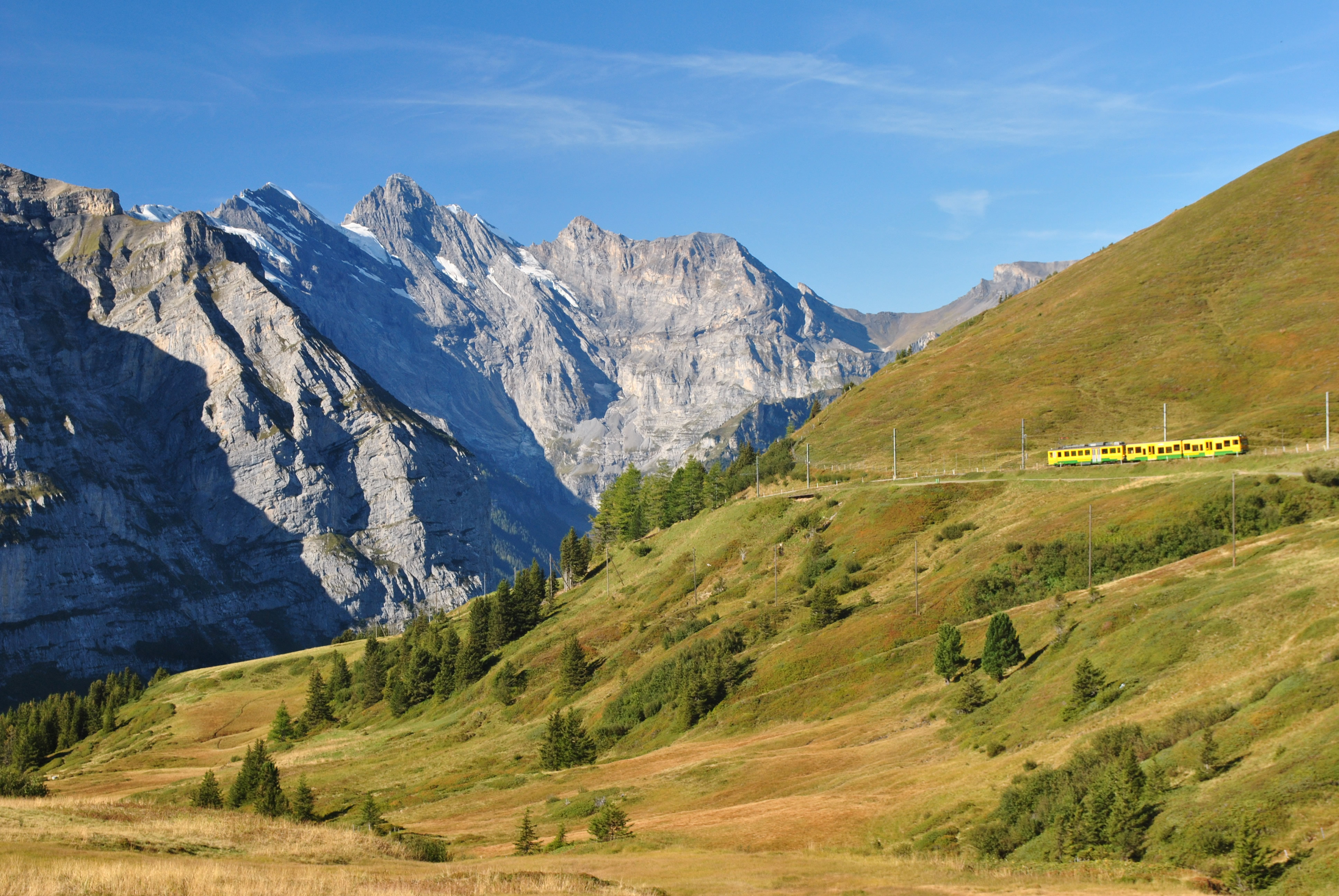
 Murren in the distance looks a lot clearer than the day before
Murren was a fascinating place. There is no public road to the village. It is reached by a train line that only connects to the gondola at Grutschalp. We noticed that each gondola that went up had a special carrier underneath that was loaded with crushed rock. That was transferred to a special cart behind the train for the trip to Murren. Apparently there was a construction project in town. It's hard to believe that everything that was needed by a sizeable village could be transported that way. It would be fun to visit Murren again sometime when the weather was nice.
In Lauterbrunnen we found a restaurant that looked good for lunch. Sandy was able to get her new favorite dish, rosti and I got spaghetti marinara. Although it was cloudy without any spectacular views for pictures the visit wasn't a total loss. Lunch was good and afterwards I got a Lauterbrunnen tshirt.
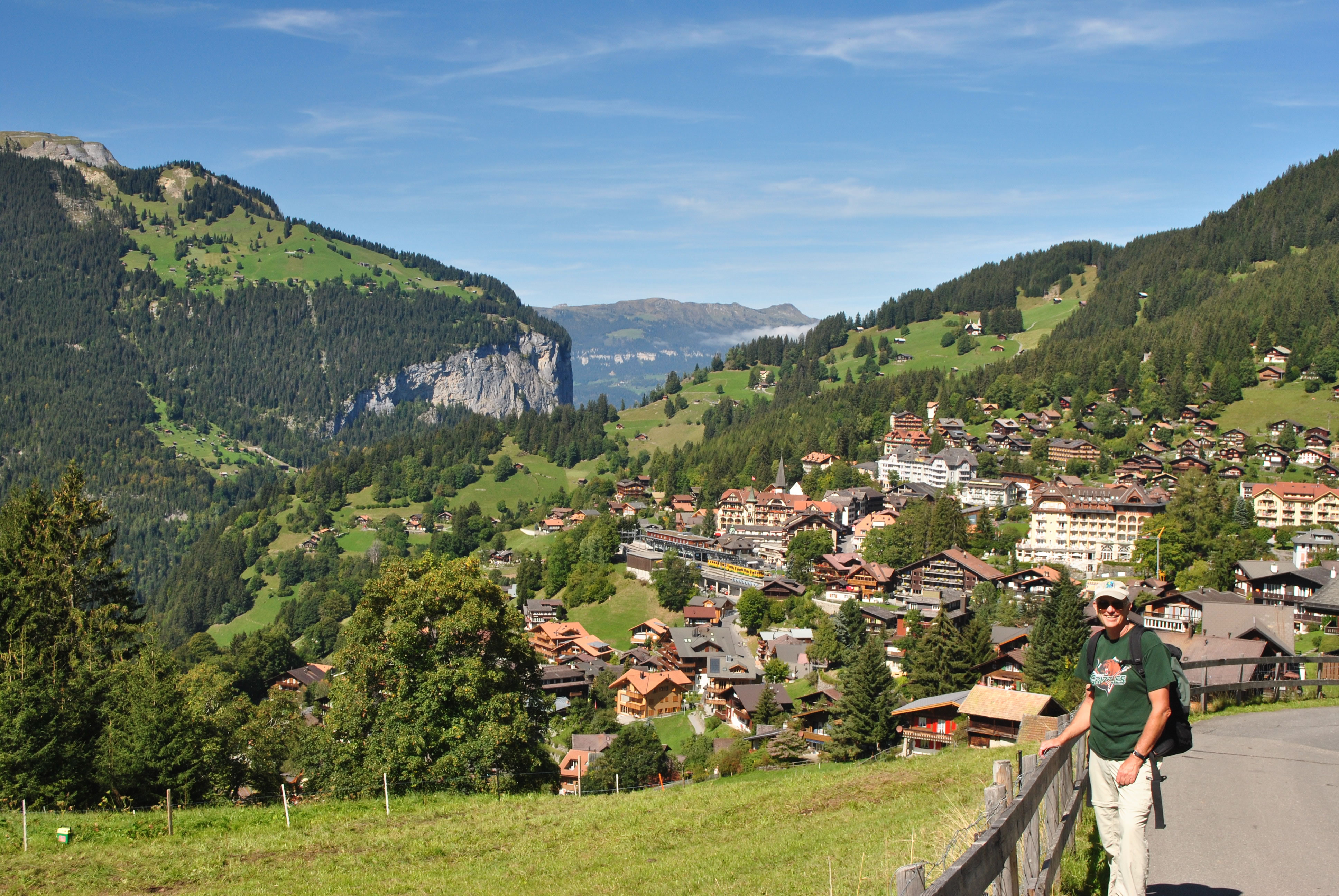
After all those carbohydrates for lunch we decided to do some more walking. The village of Wengen was the counterpart of Murren, part way up the side of the valley but opposite from Murren. The trail guide said an hour and twenty minutes so we thought it would be good exercise. We definitely worked up quite a sweat. Maybe it was climbing on such a humid day. Maybe it was doing a hard trail right after lunch. It did seem like the steepest trail we took on the entire trip. It was hard enough work that we didn't feel guilty at all flashing our BOB passes in Wengen and hopping on the train to Kleine Scheidegg and eventually back to Grindelwald.
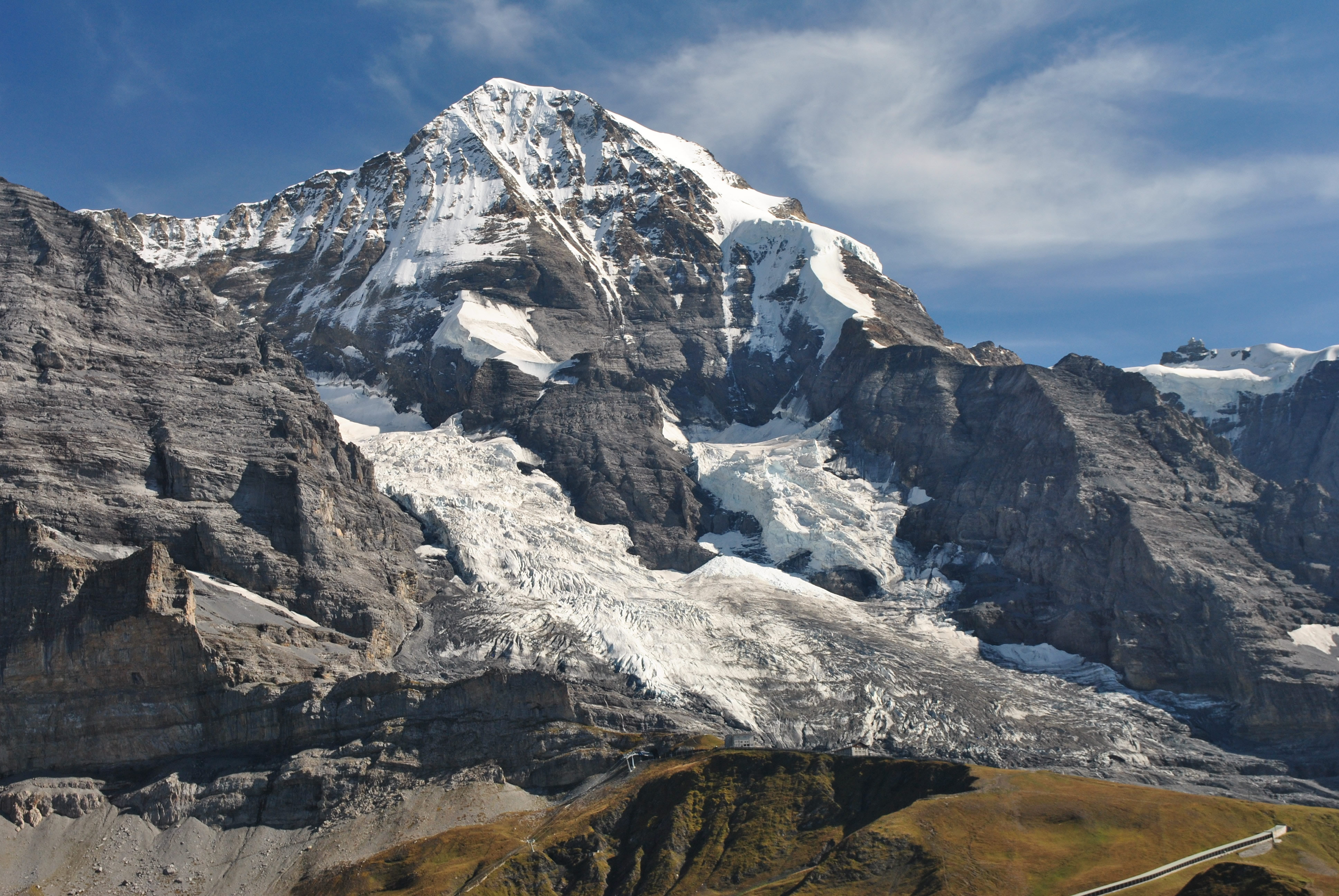
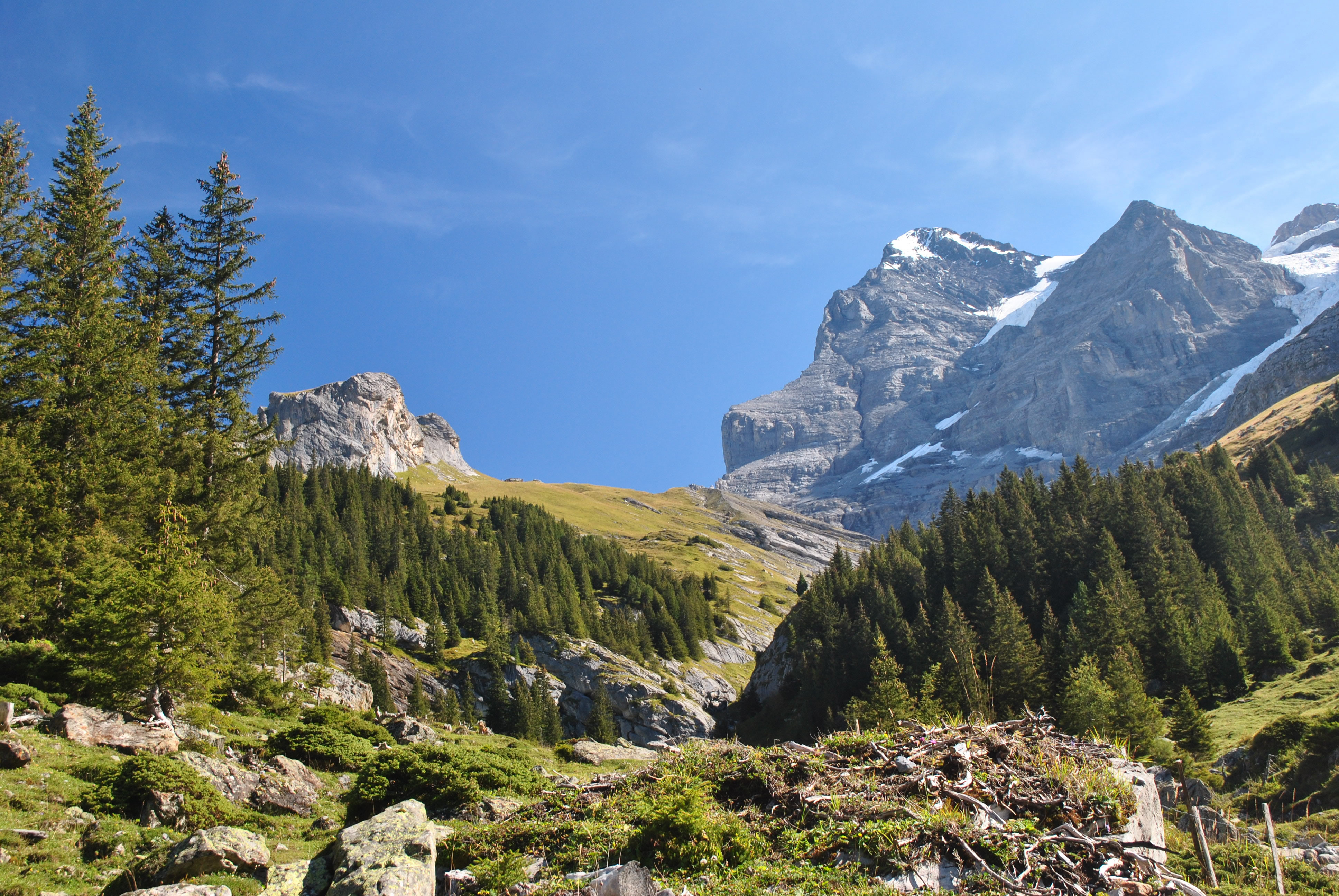 The west face of the Eiger - that's the easy side
The next morning the sky was clear blue without a cloud in sight. It looked like we would have beautiful weather for our last hiking day of the trip. We started by riding the BOB train to Kleine Scheidegg. From there we took a trail that descended through a hanging valley beneath the north faces of the Monch and the Jungfrau and eventually dropped into the Lauterbrunnen valley. Our plan was to hike to Wengen. Our knees still felt good after almost two weeks in the mountains so we opted for another downhill hike, although a long one.
There was a crowd at Kleine Scheidegg, mostly to take the train to the Jungfraujoch. It's an impressive cog railway that travels through a tunnel inside the Eiger to emerge at the col between the Monch and Jungfrau. At one point it passes by a series of windows that open out into the middle of the North Face of the Eiger. They're the windows where Clint Eastwood was rescued at the end of the movie The Eiger Sanction and have featured in real life rescues on the mountain. The Jungfraujoch station is at 3454 meters (11,332 feet) which makes it the highest train station in Europe. From there tourists can take an elevator to the top of the Sphinx for an amazing view of the heart of the mountains of the Bernese Oberland. It's spectacular but we opted for viewpoints that we could reach by walking rather than just riding.
 After three hours of hiking we were just about to Wengen
Once we started down the trail we left the crowds behind. The trail descended through a valley beneath the giant peaks of the Eiger, the Monch and the Jungfrau. We had a great view of the west face of the Eiger. Although vastly easier than the famous North Face it is still a challenging route. We could also see huge glaciers coming off the north faces of the Monch and the Jungfrau. Because of the access to the upper parts of both mountains provided by the train to the Jungfraujoch the mountains are not difficult climbs. In fact I had climbed the Monch back in 1985. But starting from the valley the mountains would be long and hard climbs. We had the views in this valley mostly to ourselves. We only saw a half a dozen or so people in our first two hours of hiking. By then we had turned the corner and could see the village of Wengen. It still took us over three full hours to get there. Even though we thought that we were hiking at a good pace we just made it in the standard time.
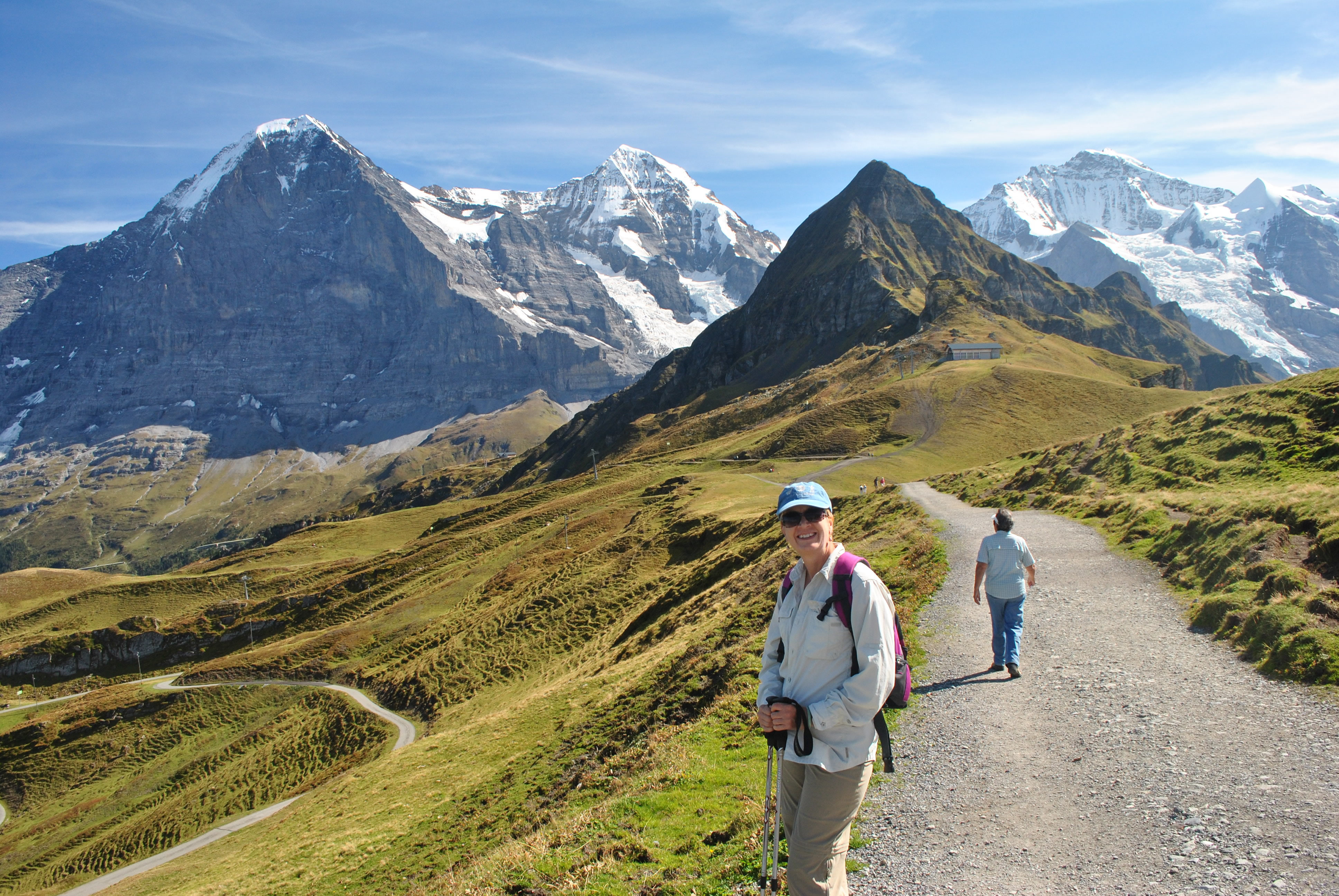 Starting out from Mannlichen towards Kleine Scheidegg
Wengen was much more impressive on a warm sunny day than it had been the day before in the clouds. Walking down the main street there was a tremendous view of the north side of the Monch. Unfortunately we couldn't find a patio restaurant where we had a view of the mountains. Still it was pleasant to be outside and we had a delicious lunch. We took our time so that we could get our energy up for one more stretch of hiking in the afternoon.
From the restaurant it was a short walk to the gondola station. We had to wait almost twenty minutes but then the lift took us up quickly more than 3100 feet from Wengen (1274m) to Mannlichen (2227m). The gondola dropped us at the top of the long ridge that separated the Grindelwald valley from the Lauterbrunnen valley. We were at the end of the ridge. From there a trail led along the ridge crest to Kleine Scheidegg, right at the base of the famous trinity of peaks, the Eiger, Monch and Jungfrau.
 The Monch - a peak I climbed back in 1985
The walk from Mannlichen to Kleine Scheidegg was an easy hour and a half, slightly downhill all the way. The trail was at or near the ridgecrest the entire way. It was truely hiking in the sky with the beautiful Grindelwald and Lauterbrunnen valleys on each side. The whole time we were walking straight at the three famous mountains of the Bernese Oberland: the Eiger, the Monch and the Jungfrau. In Swiss folklore the monk (Monch) stands between and protects the maiden (Jungfrau) from the ogre (Eiger). In the afternoon the light on the peaks was fantastic and the view the entire way was breathtaking. We had truely saved the best hiking in the Bernese Oberland for the last. It took us longer than the normal hour and a half to hike to Kleine Scheidegg because I kept making Sandy stop so I could take pictures. I had a tough time picking out photos to include with this post. But you can only show so many pictures of the Eiger, Monch and Jungfrau no matter how many good ones you have.
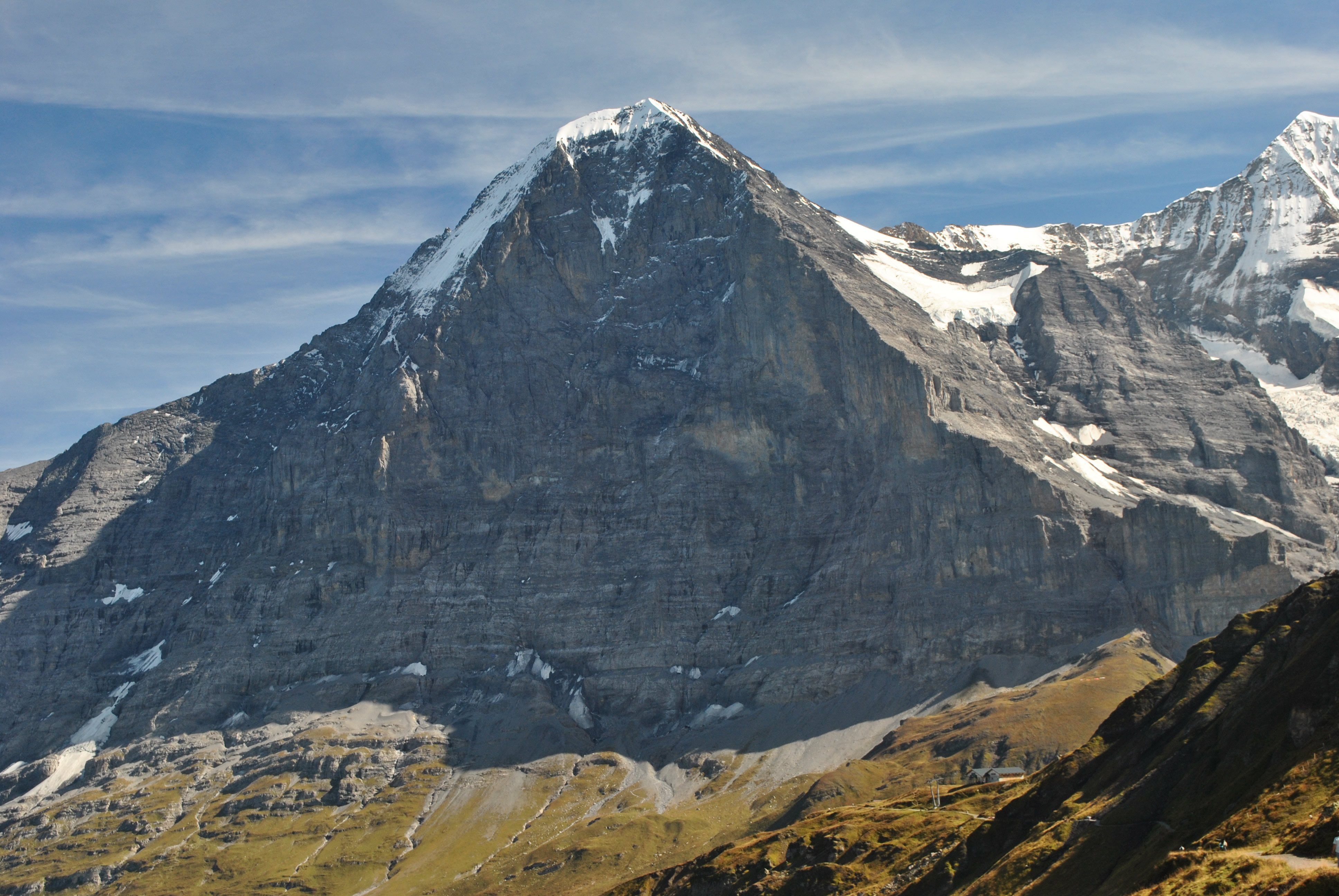
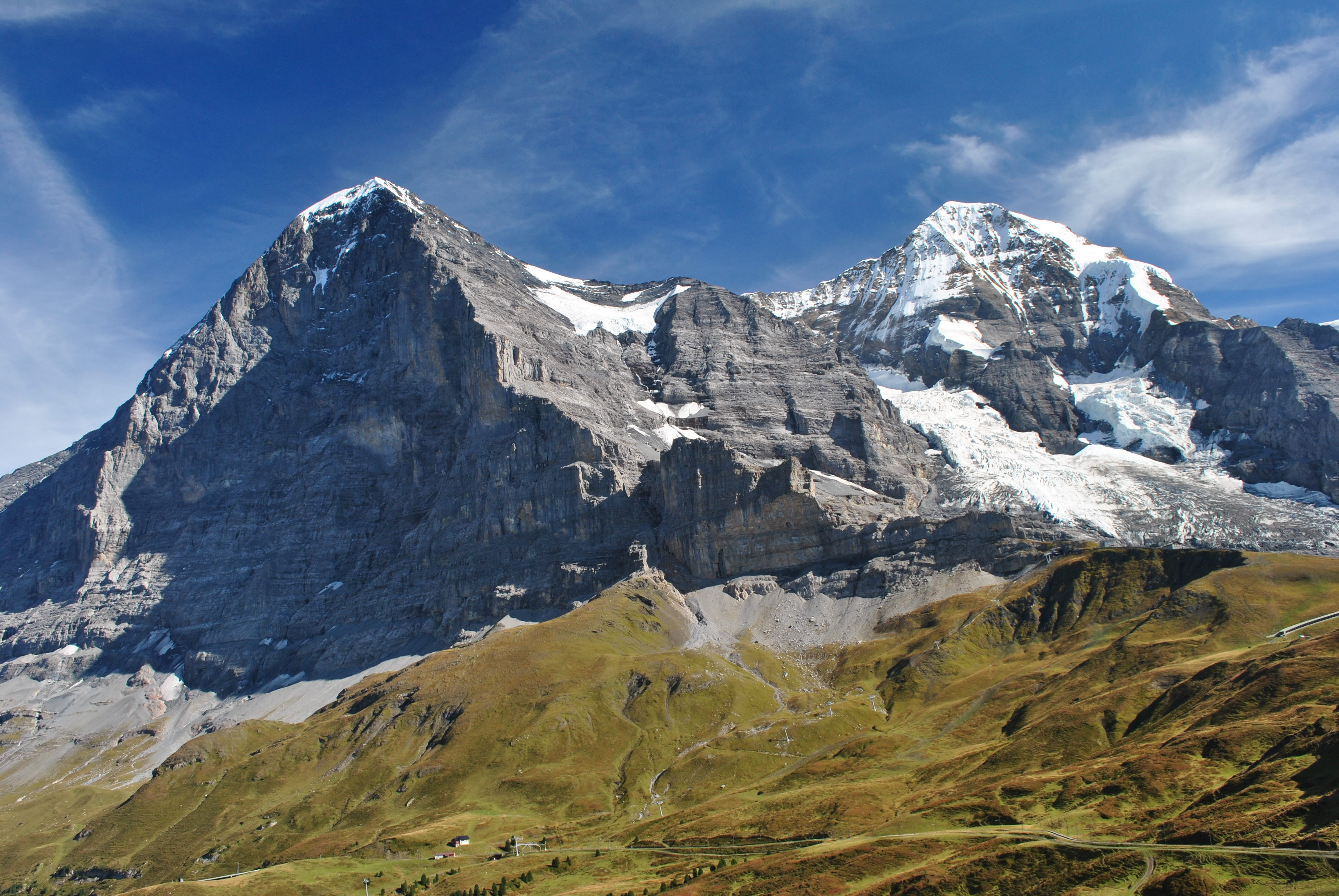 The Eiger North and East faces and the Monch
We had hiked the Eiger Trail our first day in Grindelwald, designed to give a close up view of the famous North Face of the Eiger. But the face is so big, and the trail is so close, that you cannot really get a sense of its size. From the ridge trail between Mannlichen and Kleine Scheidegg we had the chace to really appreciate the huge scale of the Eiger North Face. It is one of the six great north faces of the Alps (along with the Matterhorn, Tre Cime di Laveredo, Grandes Jorasses, the Petit Dru and Piz Badile). But it is the most famous of them all, or perhaps the most notorious. It was the last of the six to be climbed. In the 1930's several parties attempted the first ascent. The first two parties were totally wiped out. The face was so big, and took so long to climb, that bad weather would move in and strand the climbers on the mountain where they eventually succumbed to the elements. In 1937 it was considered a major accomplishment when two climbers started up the face, were forced to turn back by bad weather, and made it down alive.
 The Wetterhorn and the Schreckhorn from Mannlichen
The face was finally climbed in 1938 by four German climbers. Two of them were killed in the Second World War. Anderl Heckmair had a long career as a mountaineer. Heinrich Harrer was interned by the British on a climbing trip to the Himilayas and had an epic adventure that was described in the book (and later movie) Seven Years in Tibet. Today the face is not considered difficult by modern standards of alpinism. Although the first ascent took three days the current record for climbing the north face is the ridiculous time of 2 hours and 28 minutes. You can get an idea of the unbelivable level of skill of modern climbers by watching this speed climb done in 2008. But it is a very serious climb. Rockfall is a major hazard. During the filming of the movie The Eiger Sanction one of the climbers in the film crew was killed by rockfall. In all sixty five climbers have been killed attempting the north face since 1935. The face is often referred to as the "Murder Wall". This is a pun in German, where "nordwand" means "north wall" and "mordwand" means "murder wall". Indeed. The face can only be climbed in relative safety when the rocks are frozen in place. With global warming, the classic 1938 Hinterstroisser route can only be climbed safely now in winter. It is too dangerous in summer.
 The North Wall of the Eiger - the Murder Wall
For those interested in the history of climbing on the Eiger, I highly recommend the book The White Spider. It was written by Heinrich Harrer, one of the first ascent party. I also recommend watching the old Clint Eastwood movie The Eiger Sanction. Although a corny spy movie, many of the scenes were actually filmed on the north face of the eiger. Another movie with dramatic climbing sequences on the Eiger is North Face, a recent German film (with English subtitles) about one of the early attempts on the face. Or watch the excellent documentary The Beckoning Silence in eight parts on YouTube.
But we didn't climb the north face of the Eiger. We just did the hike from Mannlichen. But that was truely spectacular, a fitting end to our two weeks exploring some of the most beautiful places in the Alps. We ended up hustling (don't we always?) to catch the train at Kleine Scheidegg at the last second before it pulled out. We rode down to Grindelwald to a nice dinner at our hotel. A fantastic day of hiking that was a fitting finale for our trip.
The next day the weather was beautiful again. But it was time for us to go home. We had another four hour train ride to Geneva. We had a brief excursion into Geneva but it wasn't much compared to the mountains. Then after an overnight in an airport hotel, we flew back to the US. Our trip to the Alps had been spectacular. On the way home I was already planning for when we could go back.
