Hike #3 - Lower Calf Creek Falls
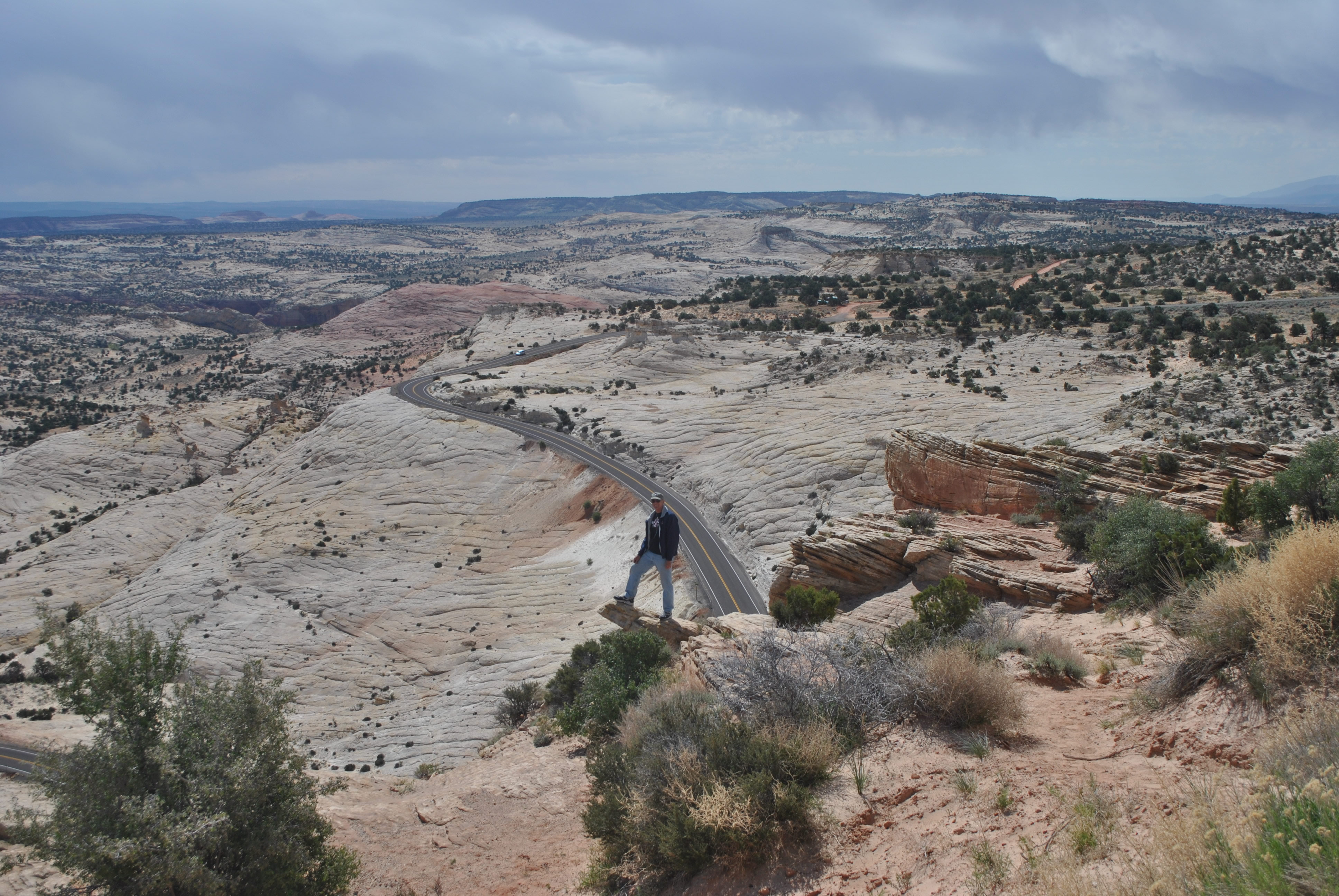 Vast slickrock landscape a few miles outside of Escalante
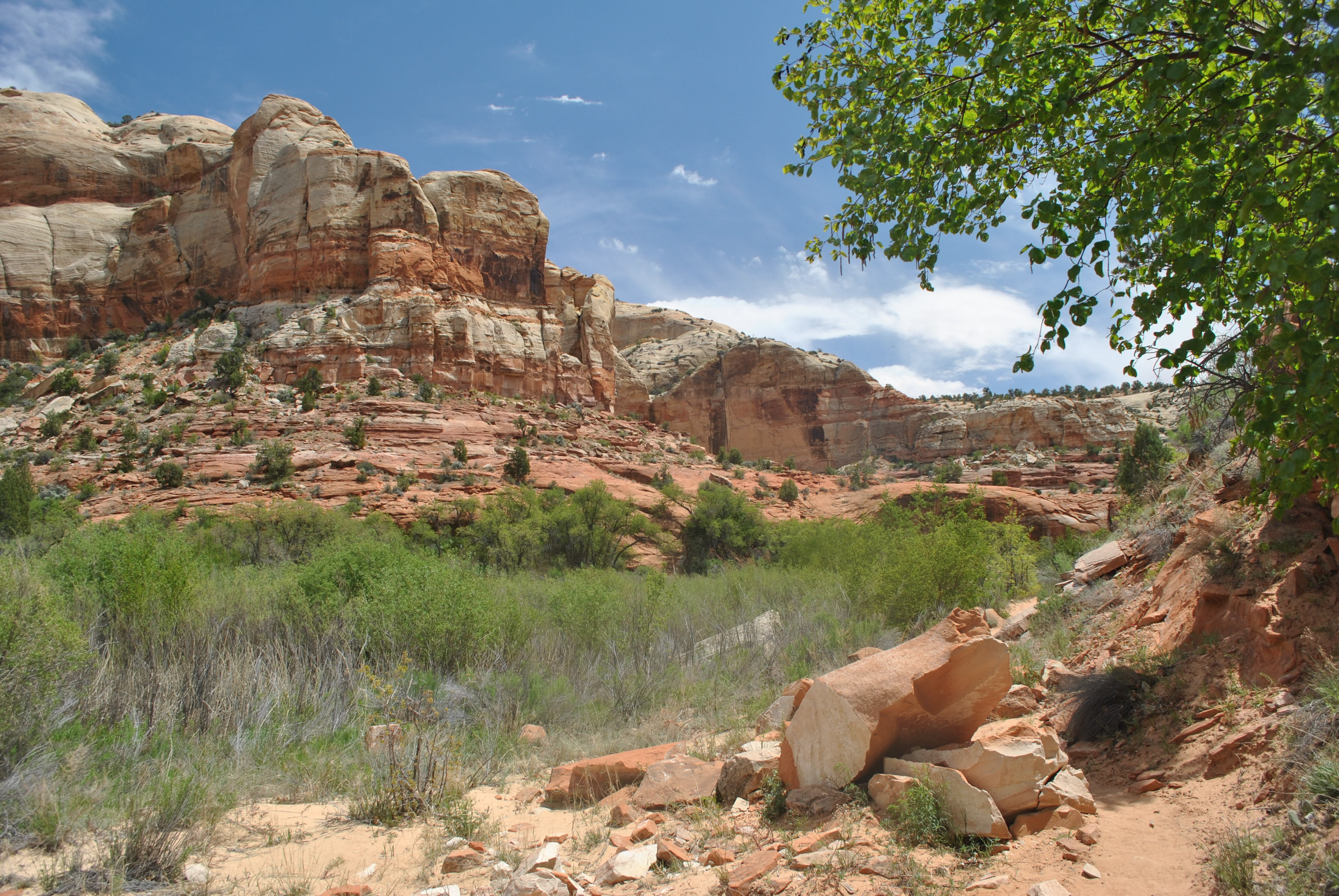
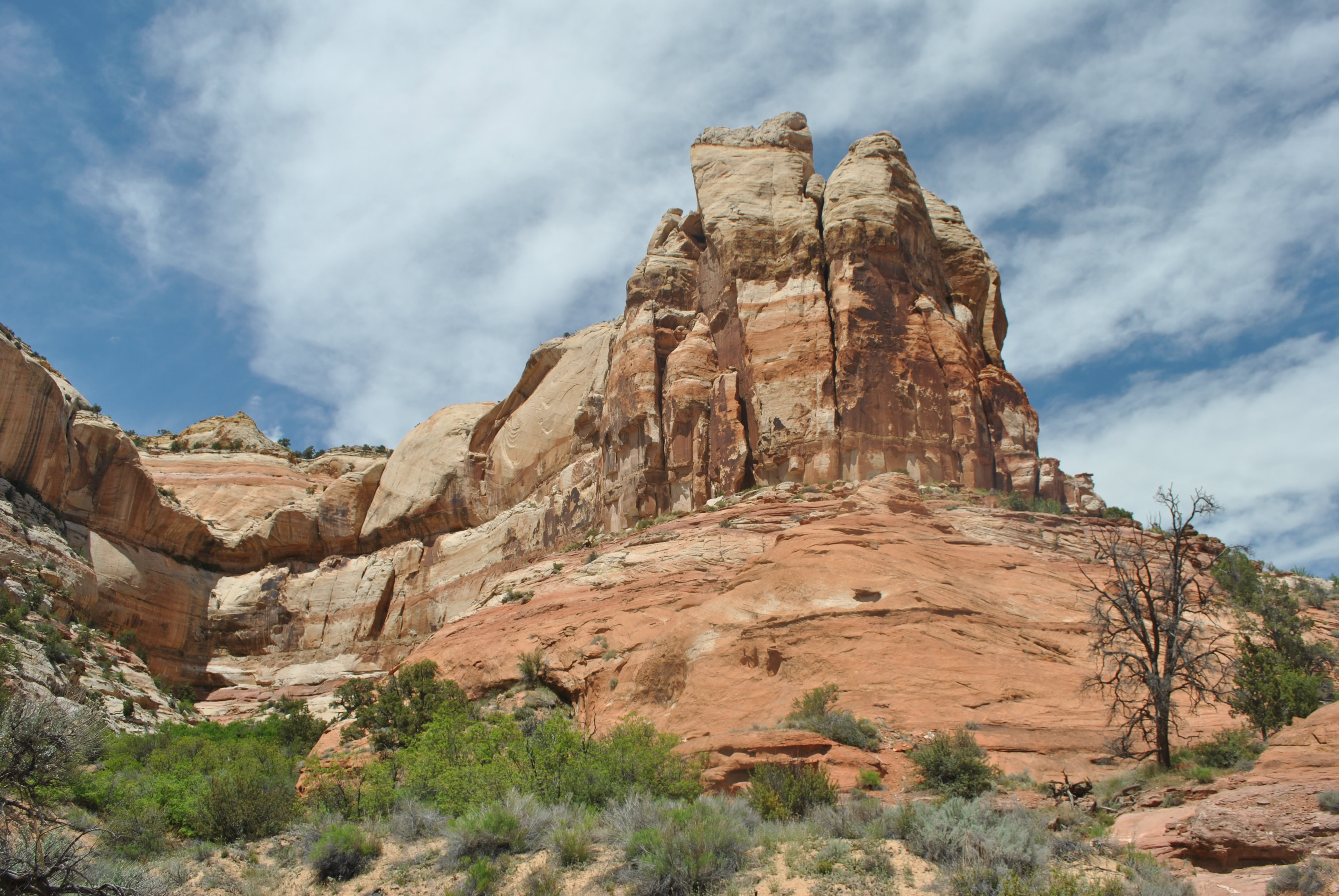
Grand Staircase-Escalante National Monument is huge. It is almost 1.9 million acres. By comparison the Sawtooth Wilderness in Idaho (my home mountains) is 216,000 acres. Zion National Park is about 145,000 acres. Grand Staircase is ten times as big. It is managed by the Bureau of Land Management rather than the Park Service or the Forest Service. The BLM is less recreation oriented so there isn't as much development for recreation as in national parks. Hiking is rougher, with trails more primitive or nonexistent. Access roads are also more difficult, often needing 4WD vehicles. But these drawbacks are also virtues as far fewer people visit the Escalante country. There is a lot more opportunity for solitude and wilderness experience. After hiking and riding the shuttle with the crowds the day before, we were ready for fewer people.
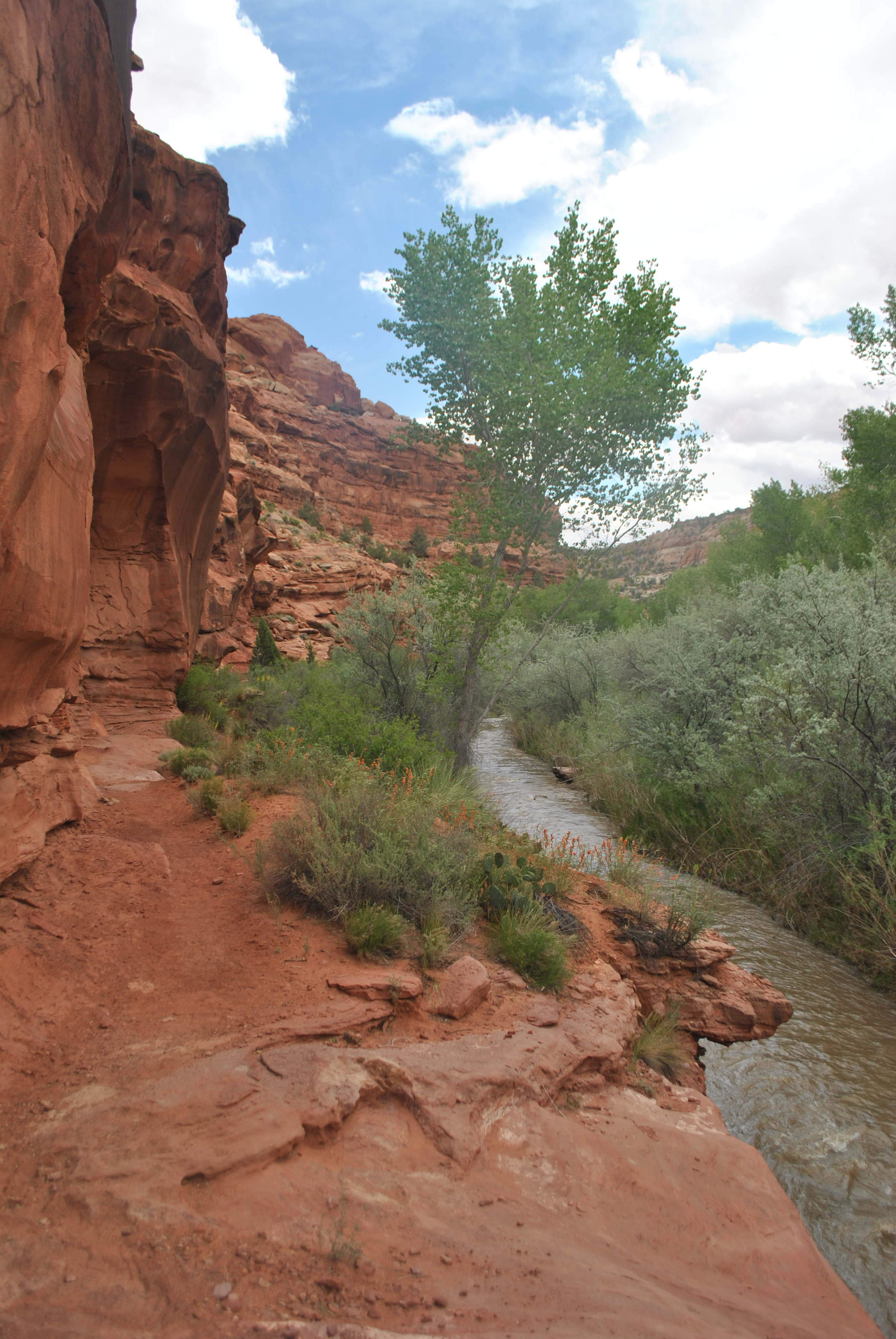
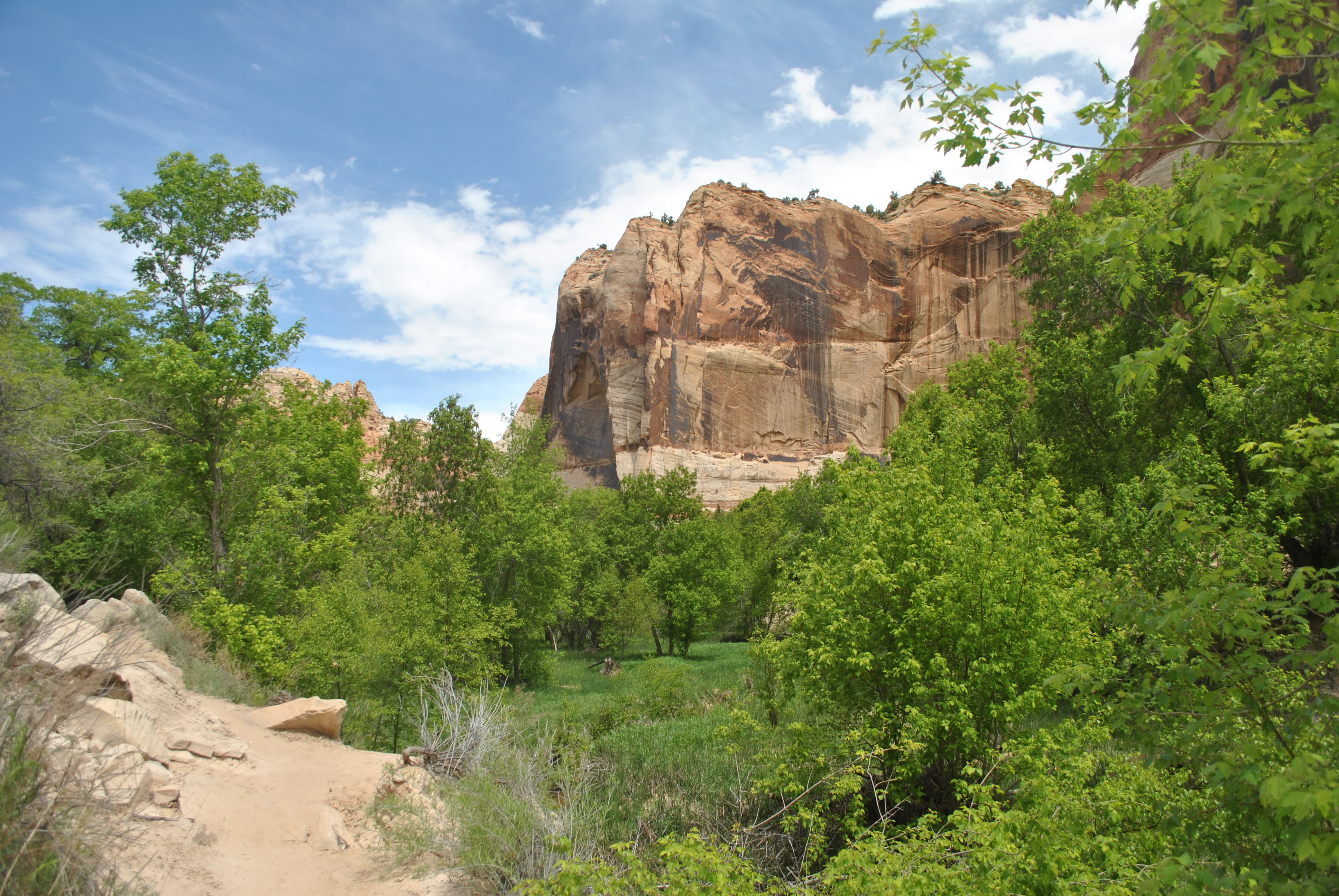 Red cliffs contrast with green trees along Calf Creek
I had driven through Escalante once many years before. I had never done any hiking. I did some research on the web before our trip and came up with some possible hikes. But they were all down a long dirt road, the Hole-in-the-Rock road that went south from US12 near Escalante for 62 miles to Lake Powell. Now the weather forecast was for scattered showers. The road is a challenge for non-4WD vehicles under good conditions. There were stories of cars getting stuck for a week when it rained. So we needed a Plan B.
The evening that we arrived in town I walked over to Escalante Outfitters. Escalante is a small enough town that everything is in walking distance. They had a good selection of hiking guides and maps. They also had hiking gear, cool tshirts and the only pizza in town. My favorite place in Escalante already. I picked up the Falcon Guide to Grand Staircase-Escalante and the Trails Illustrated Map of the Canyons of the Escalante. I took them back to the motel to study.
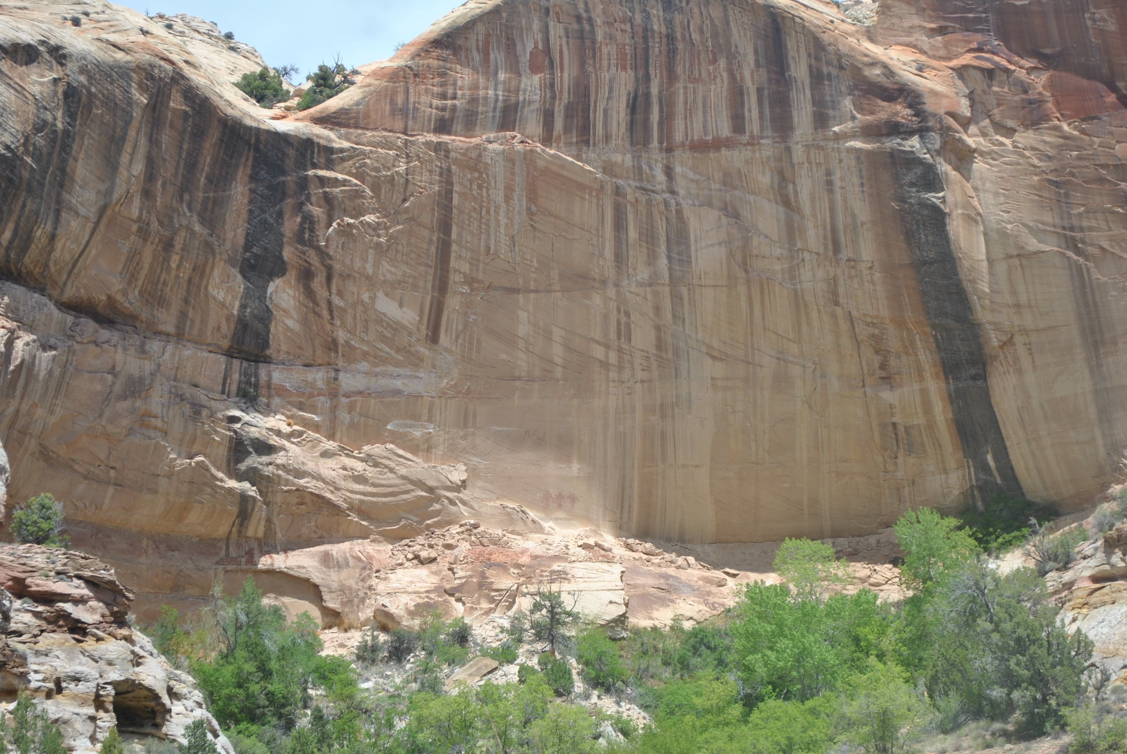 Petroglyphs on the cliffs of Calf Creek Canyon
I came up with a couple of candidate hikes. Lower Calf Creek Falls seemed like a good choice. As backup I had Upper Calf Creek Falls and two hikes along the Escalante River. The advantage of all of these hikes was that the trailheads were just off US12 so they would be easy to reach in any weather. No long, rough dirt roads. No chance of getting stuck in mud.
The next morning did not look good. We got up at 7 am but it was overcast and looked stormy. Dave came over to my room so that we could discuss the options that I had researched the night before. I will readily admit that I am a fair weather hiker, so I was not very excited about the weather. Dave is a lot more resolute than I am. But just as he came into my room and started to tell me how it wasn't that bad, a loud crack of thunder sounded nearby and we both jumped. Ten minutes later it was raining. No hiking now. We decided to go to the BLM visitor center in town.
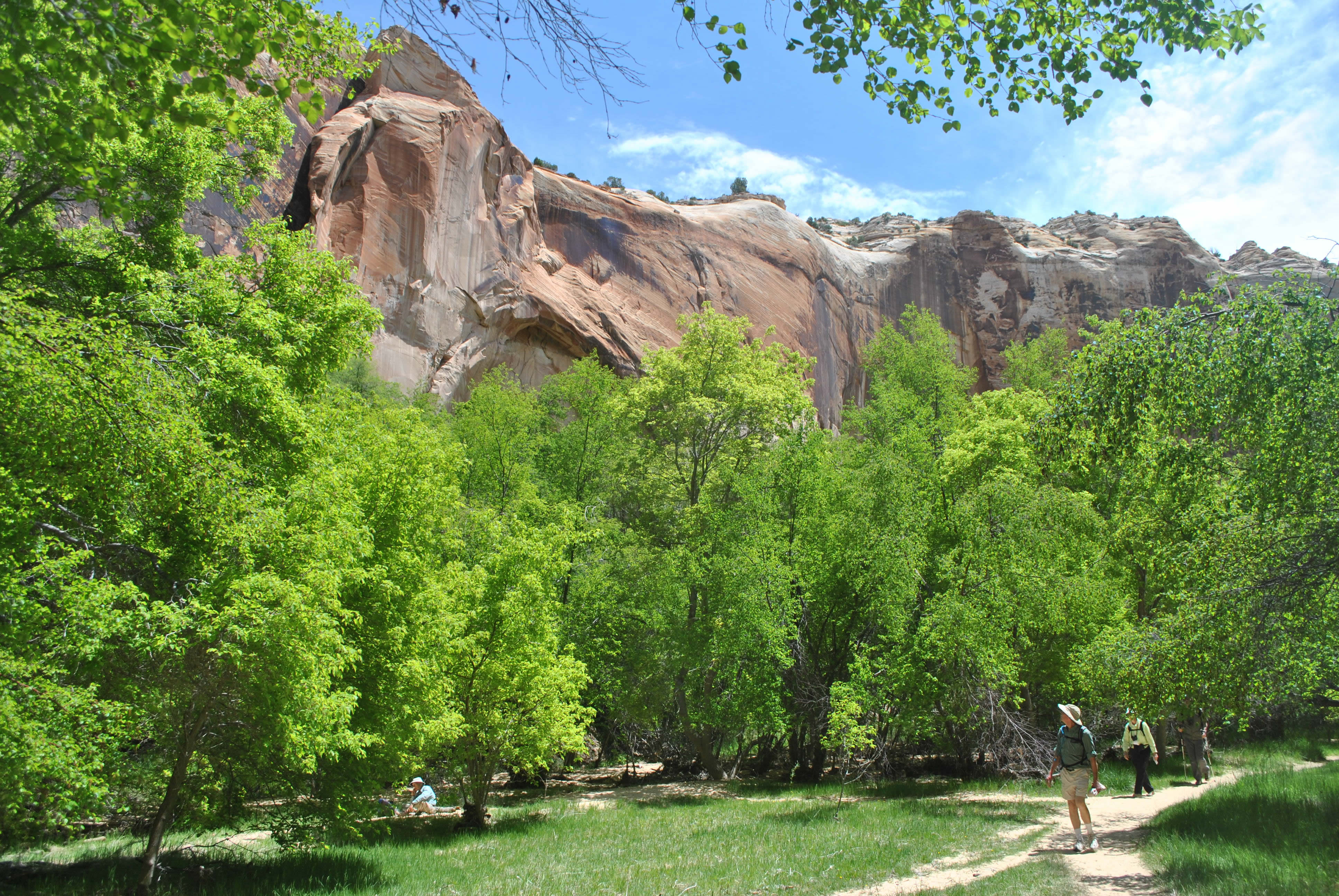 Hikers on the trail near Lower Calf Creek Falls
We spent about 45 minutes there. We watched their movie on the monument. Dave looked at a lot of the exhibits. I browsed the books and found an interesting one for Sandy on Wild Bunch Women. Butch Cassidy's gang, the Wild Bunch, had a hideout in Eastern Utah (Robber's Roost). Since Sandy and I had recently been to Captiol Reef National Park and had hiked to Cassidy Arch, I thought that she would be interested in the history. This book was on some of the women who were members of the gang. Nineteenth century pioneers of equal rights for women. If men can rob banks, so can women. And I got a Grand Staircase-Escalante National Monument tshirt. Surprise! We managed to kill time till the rain stopped. Now we could think about a hike. We drove to the grocery store (there was one in town), got some snacks for the hike, and headed for the trailhead.
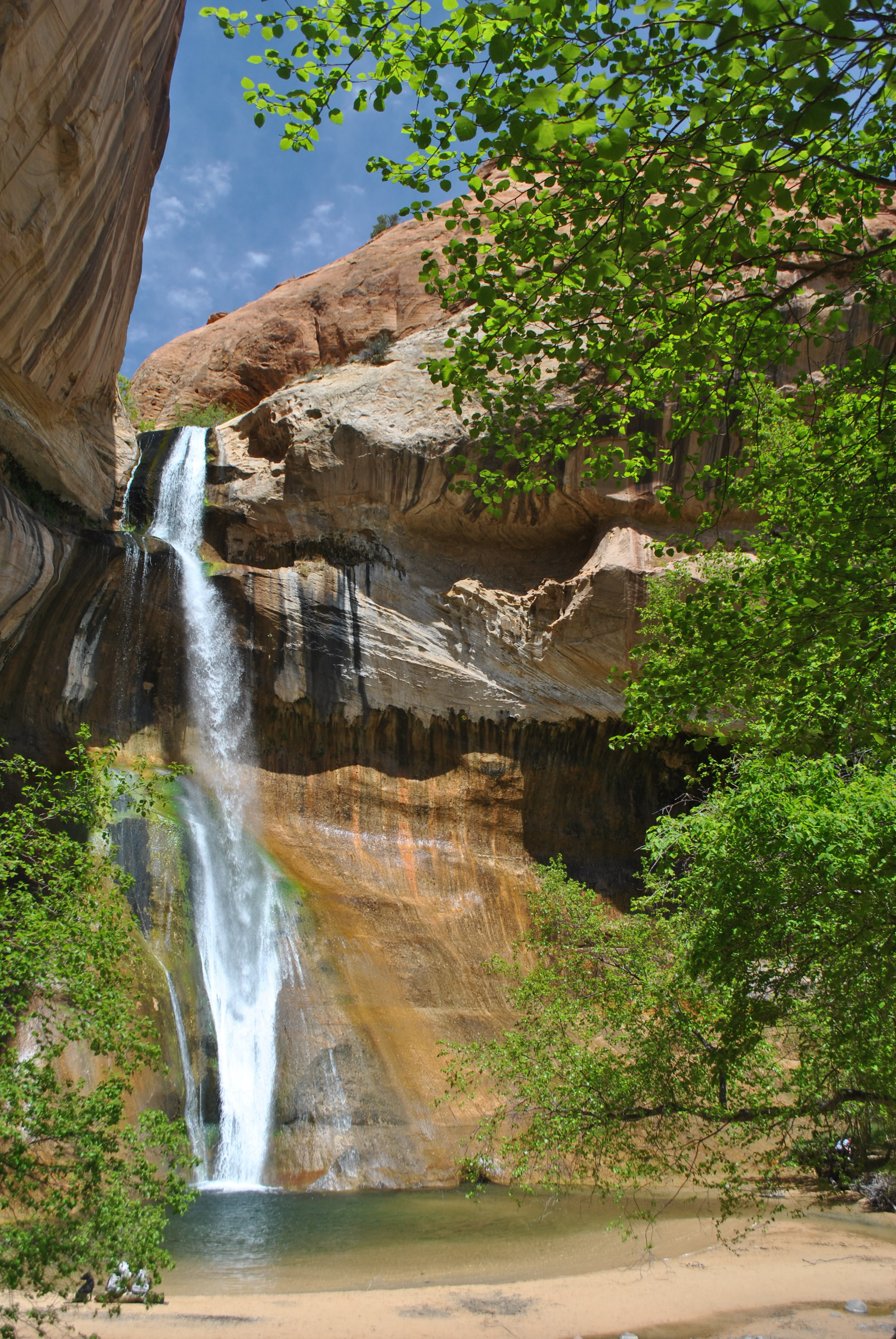 Lower Calf Creek Falls
From the town of Escalante the area did not look very interesting. Just a small town in the desert with some dry hills in the distance. But about ten miles outside of town we came over a rise and stopped at a viewpoint. As far as we could see was an incredible slickrock landscape. Now this was more like it. We took some pictures and then hopped back in the car.
The hike that we decided on was Lower Calf Creek Falls. The hike wasn't real long - less than six miles roundtrip. If the weather got nasty we could get out quickly. It was the one hike recommended if you could only do one hike. Even though the weather wasn't that good the parking area at the trailhead was full. We had to park along the access road. I guess everyone else had read the same trail guide I did. So much for solitude. It is one of the few well maintained trails in the Escalante. so it was easy hiking. It follows Calf Creek so there is very little elevation gain. Easy hiking.
It was still solid overcast when we started out. Not long afterwards we started to get a little bit of drizzle. It lasted just long enough to make me stop and get my rainshell out of my pack and put it on. That seemed to appease the rain gods so of course the rain stopped right after I put my rainshell on. Soon it started to clear. It wasn't long before the sun came out and there was real blue sky. Things were looking up.
Besides hikers there were several runners on the trail. Since the trail was short they ran it multiple times. It's a little discouraging to be hiking and to be lapped multiple times. But hey, it's not a race. It was also one of the few trails where the BLM allows dogs so lots of people had their dogs with them. The dogs certainly enjoyed the pool below the waterfall at the end of the trail.
 Blue skies over Calf Creek Canyon
The canyon was pretty. Not as big or spectacular as Zion canyon but still very nice. And although there were other hikers it wasn't mobbed. The contrast between the bright green trees in the canyon bottom and the red cliffs was quite pleasant. At one point along the trail there were large petroglyphs that were clearly visible on a cliff on the other side of the creek. There were three stylized human figures. They were very distictive. I saw the figures on logos, ads, tshirts, etc. in the Escalante area. Kind of like Kokopelli is used everywhere in the rest of Utah. Although they were clearly visible from the trail, they were a long distance away across the creek. So they are protected by the effort required to reach them. To see them better click on the picture in this post to get the enlarged version. The petroglyphs are clearly visible in the center of the cliff at the base.
After winding through the canyon we reached the end of the trail. It was an impressive ampitheatre with a surprisingly large waterfall. I didn't expect much because the creek running through the canyon had very little water. But the waterfall was actually quite impressive. The setting was beautiful in a semicircle of rock cliffs. One of the prettiest waterfalls I have seen.
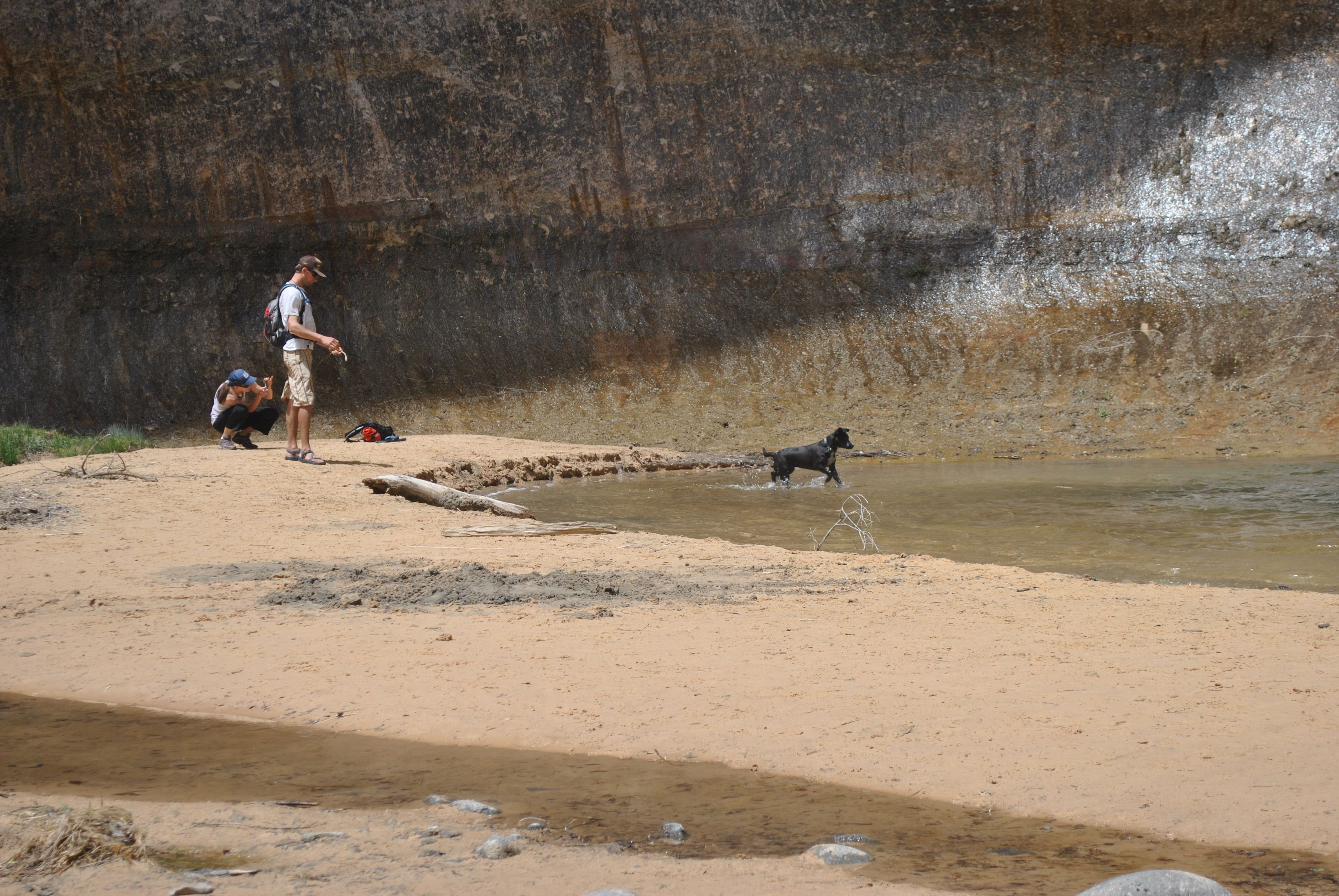 This dog had a blast fetching a stick thrown in the water
It was a beautiful spot. There was a guy with a mondo camera outfit on a tripod taking artsy pictures of the waterfall. Since I have a Nikon D3000 (low end of their DSLR line) and he had a Nikon D300 (professional model) we talked for a while about Nikons, DSLR's and photography in general. His recommendation - get a neutral balance filter. There was a couple with a dog that was throwing a stick into the pool at the base of the falls. The dog was having a blast fetching the stick. Made me think that Laney would have had a great time. There just isn't any way to get her there though. She wouldn't have cared to hike there on a leash either. We took lots of photos of the falls but one guy said the best view was from a particular spot on the left. Turns out he was right. That's the photo that I have included here.
Time to head back. This was a great hike. But as we hiked back the clouds started to return. By the time we reached the car at the trailhead it was overcast again. We did about as well as we possibly could have done. There were only about two hours of blue sky. They came while we were on the best part of the hike. It's better to be lucky than good.
 Spectacular scenery on the hike out from the falls
Since the hike we did wasn't that long (in other words, we weren't exhausted afterwards) we decided to check out the Escalante River. Although it is highly regarded, we hadn't picked that hike because the guide said that there were a lot of river crossings required. We didn't really have the right footgear for that. But the Escalante River is the primary drainage in the upper half of the national monument so we wanted to check it out. Most people hitch a ride from Escalante to where US12 crosses the river and hike back fifteen miles along the canyon to town. It is also possible to hike the other direction from the trailhead. That hike can be as long as you like - the river flows into Lake Powell.
Just to get a feel for the hike, our plan was to go as far as the first river crossing. Turns out that was less than a hundred yards. So much for that idea. So we decided to hike the other direction along the river. It wasn't very pleasant. The trail was very overgrown. About a quarter of a mile down the river there was a route over the rocks that avoided obstacles along the river. But another quarter of a mile along and we hit more obstacles. Not a good route. We weren't impressed by the Escalante River although it is supposed to be one of the best hikes in the region. Oh well. The Calf Creek Falls hike had been great.
 Our turnaround point on the Escalante River
It was looking threatening as we headed back to the car. It started to rain just as we reached the parking area - we had to hustle the last hundred yards to the car. We had done well. We got maximum value out of the two hours of good weather that day.
That evening we went to Escalante Outfitters for dinner. I had pizza and Dave had a calzone on the patio. Nothing like a good dinner after a great day of hiking.
The weather still wasn't done with us. While we were eating dinner on the patio it started to rain again. We were the first to jump to a table that was under cover. Who wants to eat wet pizza?
We had one more day for hiking. The forecast was for clear weather, but windy. Really windy, like gusts up to fifty mph. My proposal was to do Muley Twist Canyon in Capital Reef National Park. Dave was skeptical so he asked the guy at Escalante Outfitters. He said it was a great hike. That was good enough for him so the plan was set. Tomorrow - Muley Twist Canyon. We just had to decide if we would do the upper or lower canyon.


