Hike #4 - Upper Muley Twist Canyon
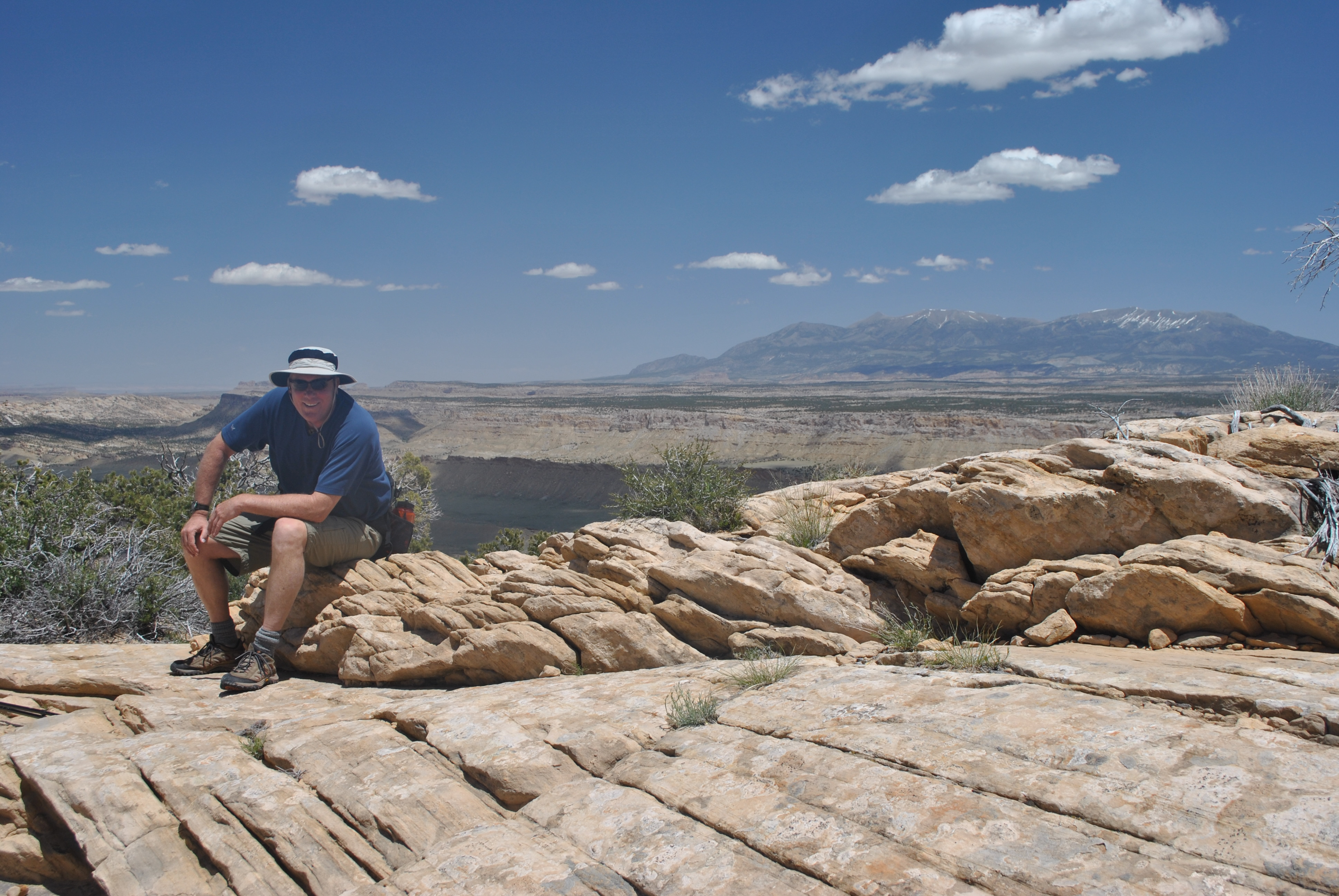
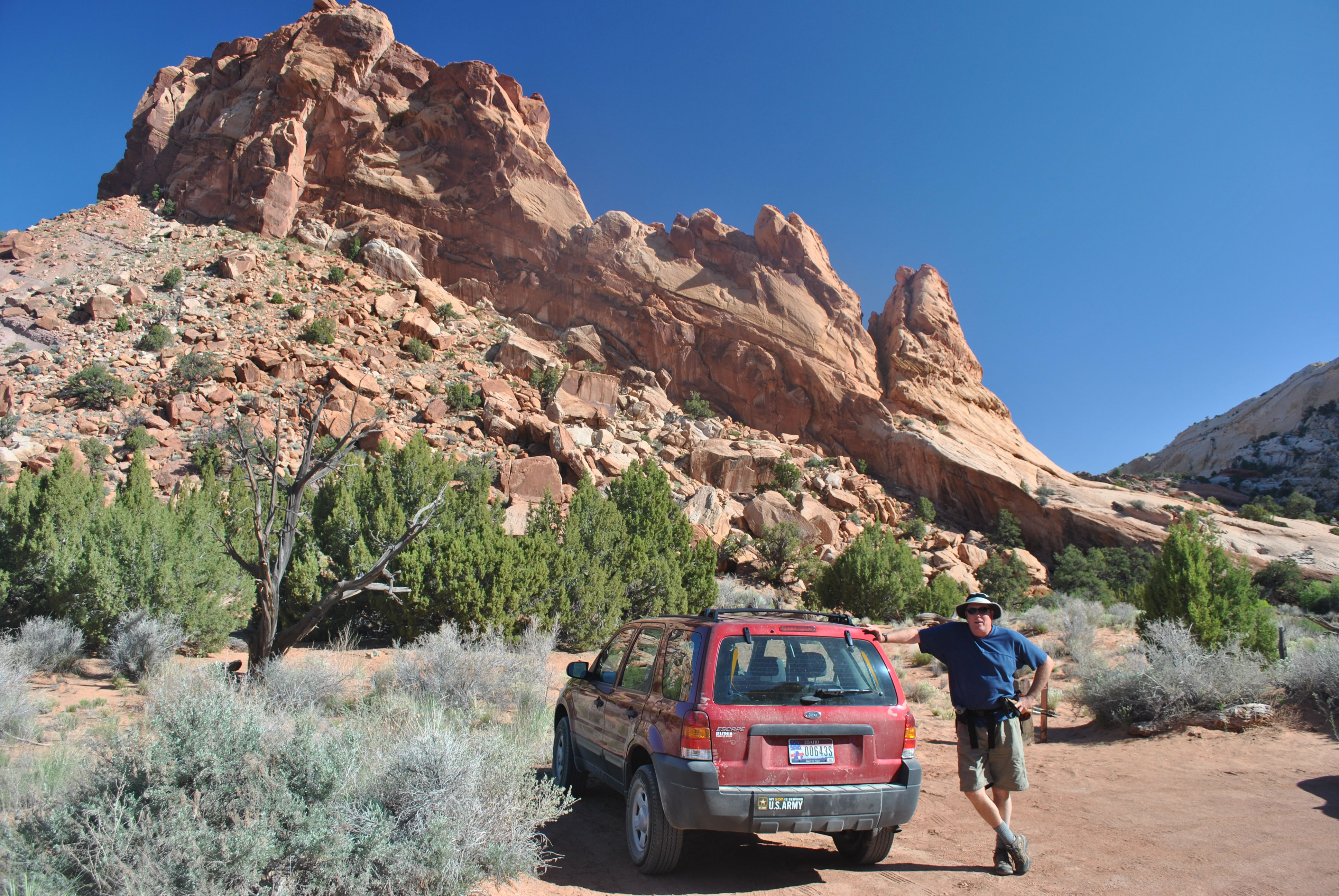 Dave at the trailhead - leaning on the car to rest already
Our last hike was going to be Muley Twist Canyon in Capitol Reef National Park. It's mentioned as an outstanding hike in several guidebooks. I had been interested in doing it when Sandy and I had visited Capitol Reef earlier this spring. But it was not convenient to reach the trailhead from our base in Torrey, which is the standard place to stay when doing hikes in Capitol Reef. The park is very long and narrow and Muley Twist Canyon is near the southern end. It would have required an hour and a half to two hours driving from Torrey each way. Neither of us were been up for that.
But on this trip we could hit it "on the way". Starting from Escalante we drove north, which meant that we were actually heading towards home. At the town of Boulder we turned off onto a side road, the Burr Trail. It was about an hour drive along this road to reach the trailhead. After the hike we would drive back to Boulder and turn north again to continue to head towards Boise. We figured that we could get in a couple of hours of driving before stopping for the night. It would make our trip home that much shorter the next day.
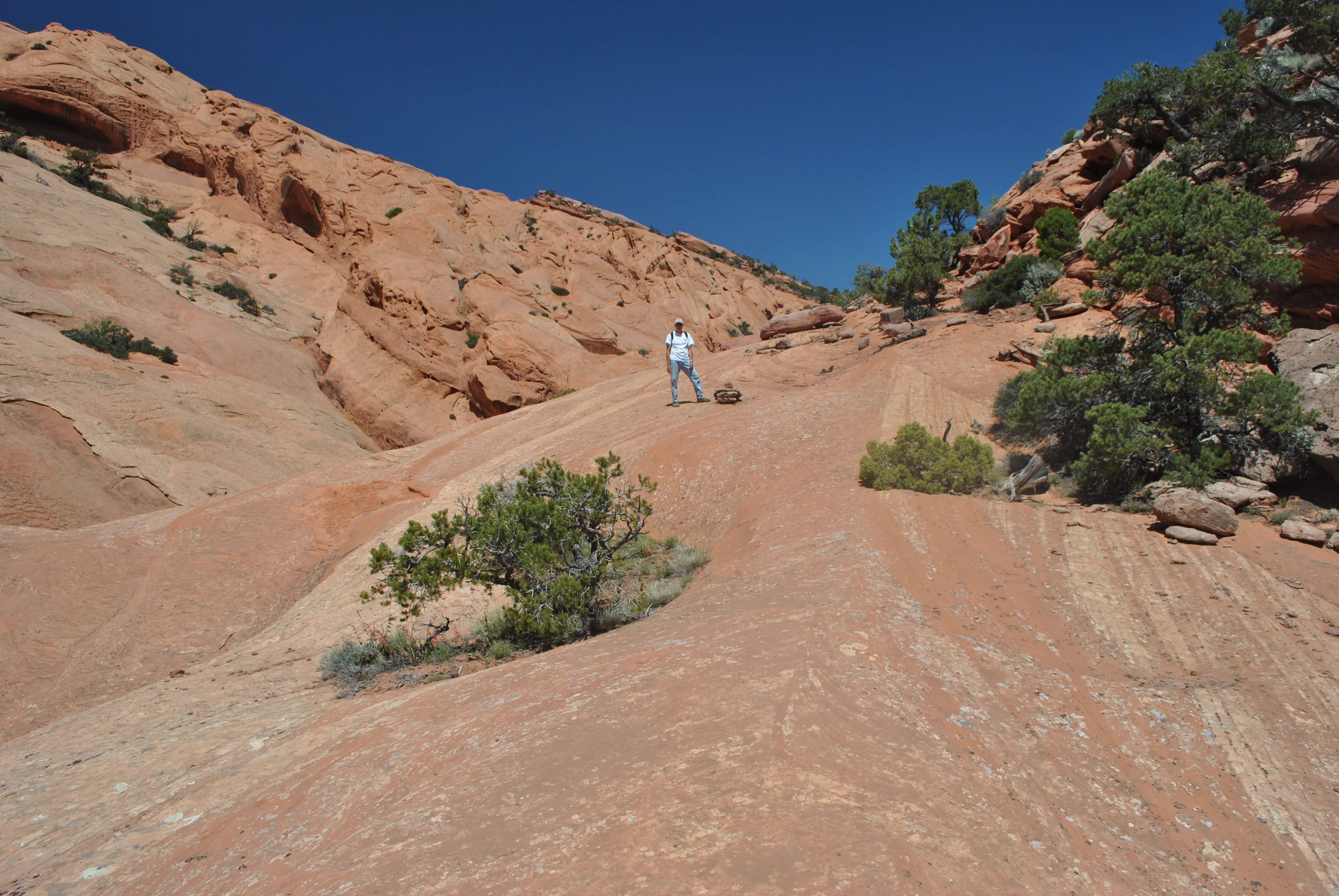
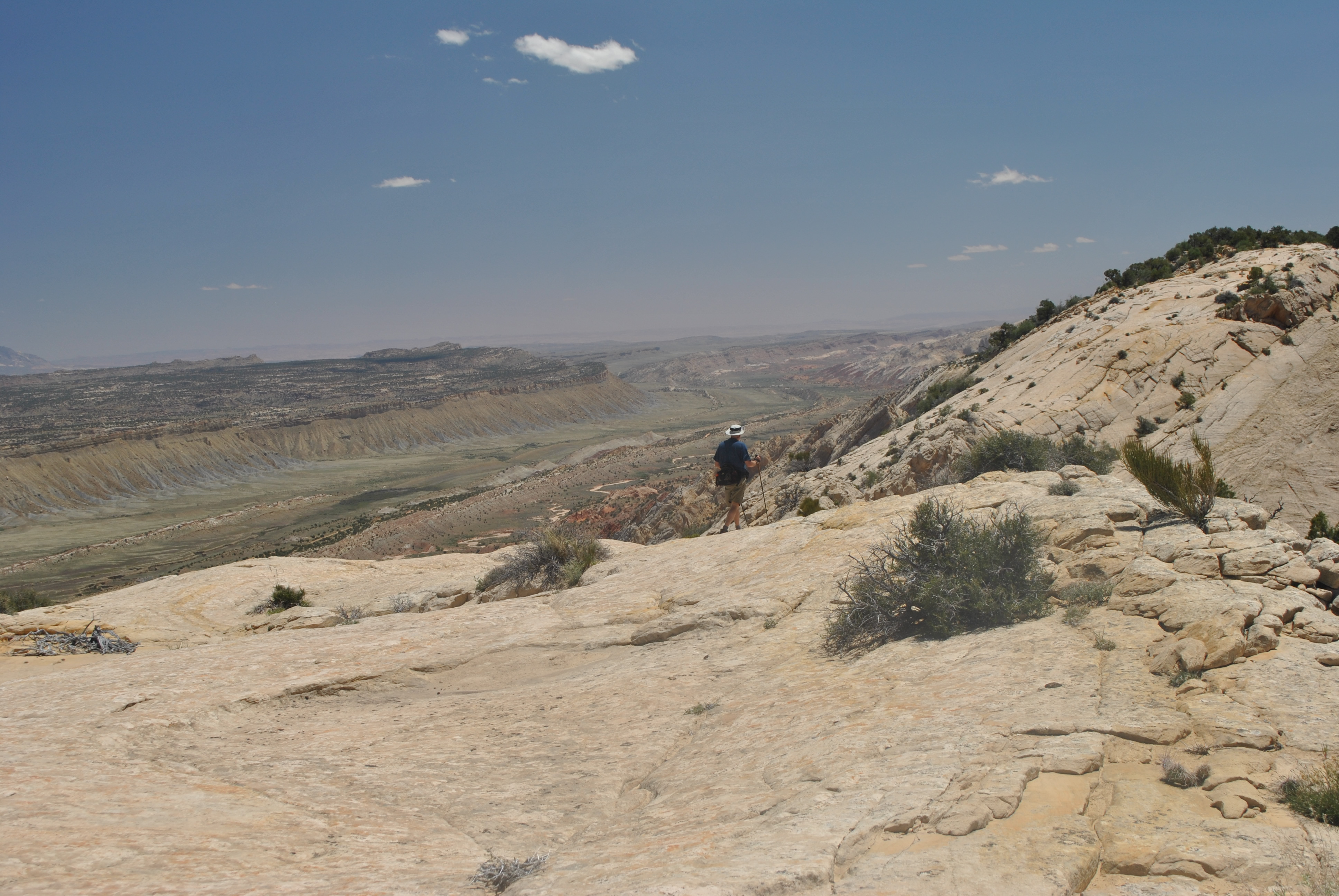
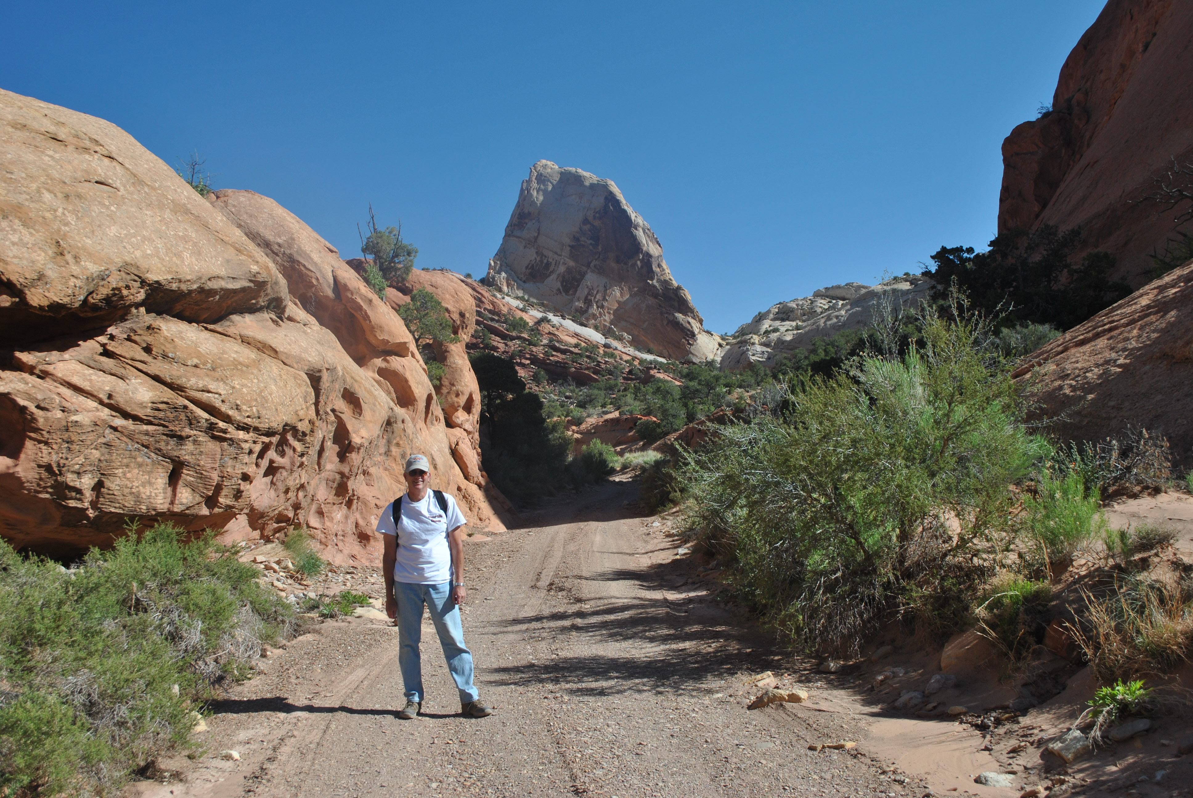 Steve hiking in on the 4WD road
Driving the Burr Trail was an extra benefit. A lady at the Visitor Center in Escalante had told Dave about it the day before, saying it was the most scenic drive in the area. Dave thought that it would be a good activity if the weather didn't clear. But when the rain stopped we went hiking instead. Our hike today would give us a chance to check out the scenic drive, and we would have a nice sunny day for it as well.
We had originally reserved our rooms in Escalante at the Prospector Inn for three nights. But with our new plan we would be leaving a day early. Normally that wouldn't be any problem but for some reason when we checked in they charged our credit cards for all three nights. Now we had to ask them to give us a refund for one night and I figured that they would be irritated. I'm a really good trip planner so I had done most of the work in that regard. But I am not even in the same class with Dave when it comes to sweet talking the ladies. He was already great buddies with Berta, the little old lady at the front desk. So I let Dave handle it. I just got out of the way and let The Master work. We got our money refunded to our credit cards.
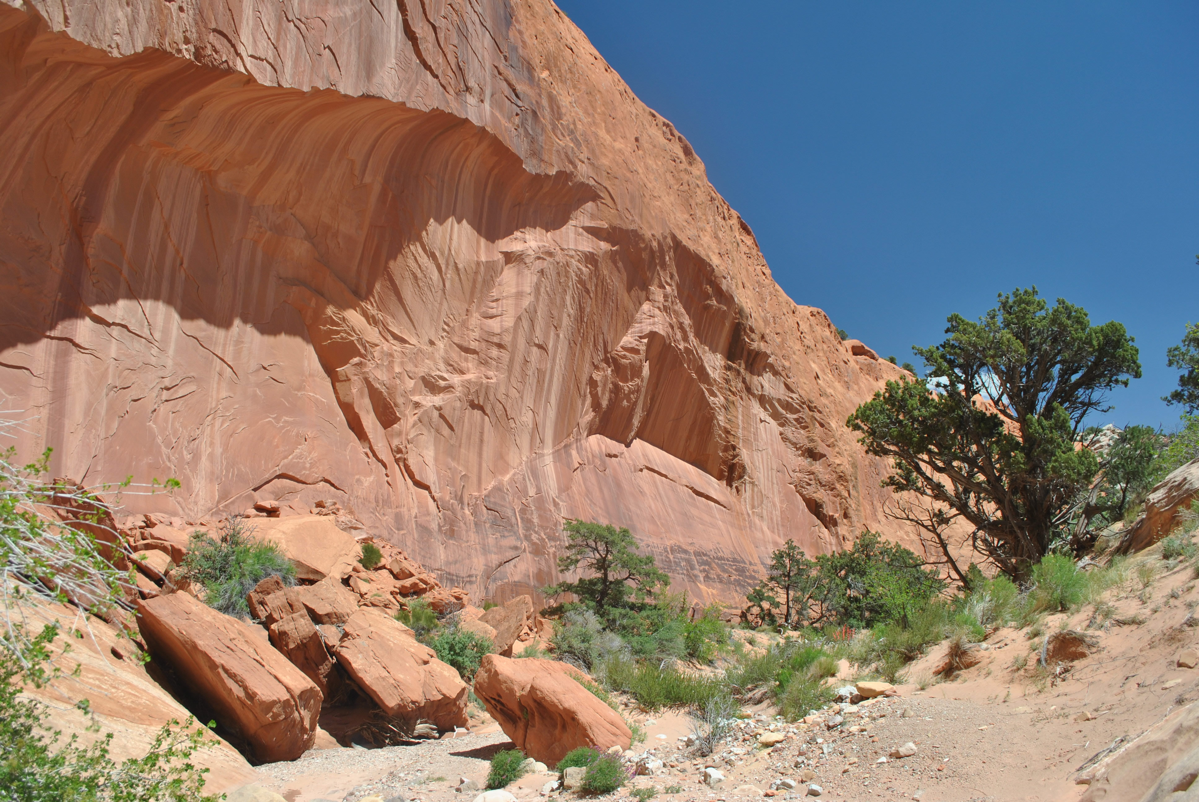
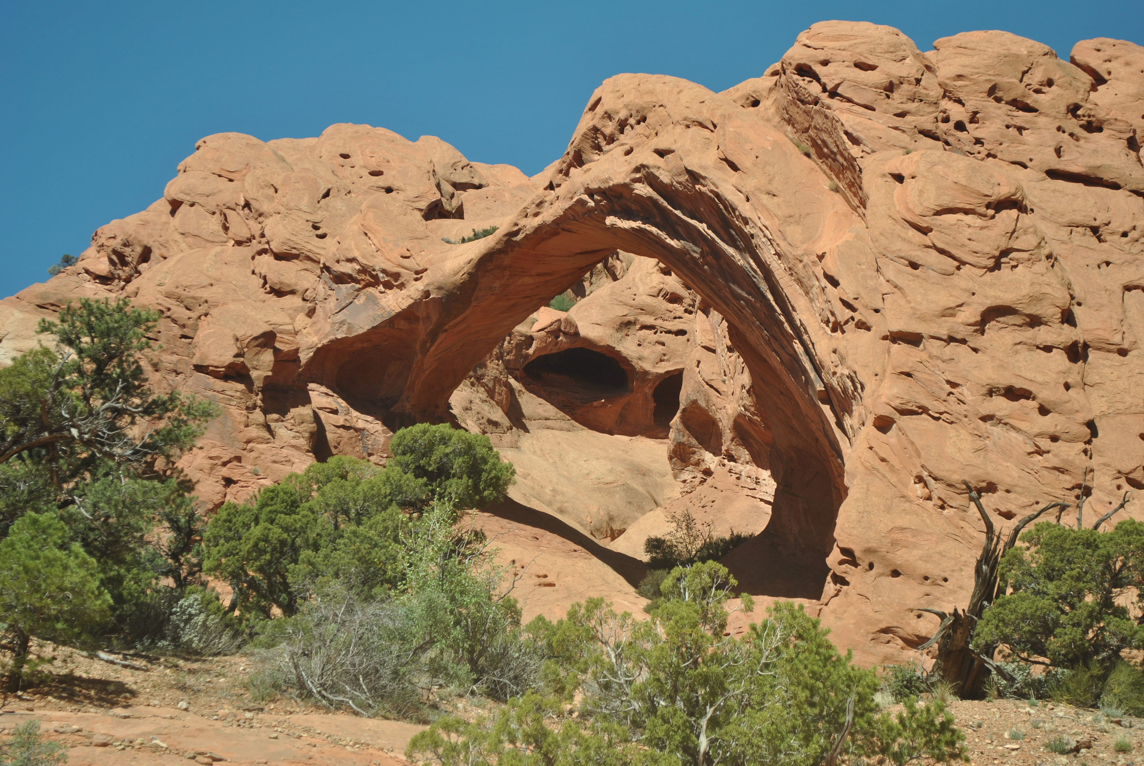 Saddle Arch
As we drove north we passed the turnoff for the trailhead for Lower Calf Creek Falls. From there the road climbed above the canyon. We stopped along the road and had a beautiful view down into the canyon that we had hiked the day before. A different perspective and very pretty in the early morning light. We could see the ampitheatre where the falls was but the not the falls themselves. Still a spectacular view.
At the town of Boulder we turned onto Burr Trail road. About ten miles out of town it entered Long Canyon, a spectacular canyon with shear vertical walls of rock that were a deep, rich red color. The first view of the canyon was from the rim above. Then the road descended to the canyon floor in a couple of steep swithchbacks. The road continued through the canyon for many miles. Long Canyon was, after all, well, a long canyon.
It was 27 miles to the boundary of Capitol Reef National Park. The road through the national monument was paved and easy travel. At the park boundary the road became dirt but was still a good road. It was only three more miles to the turnoff for the first trailhead.
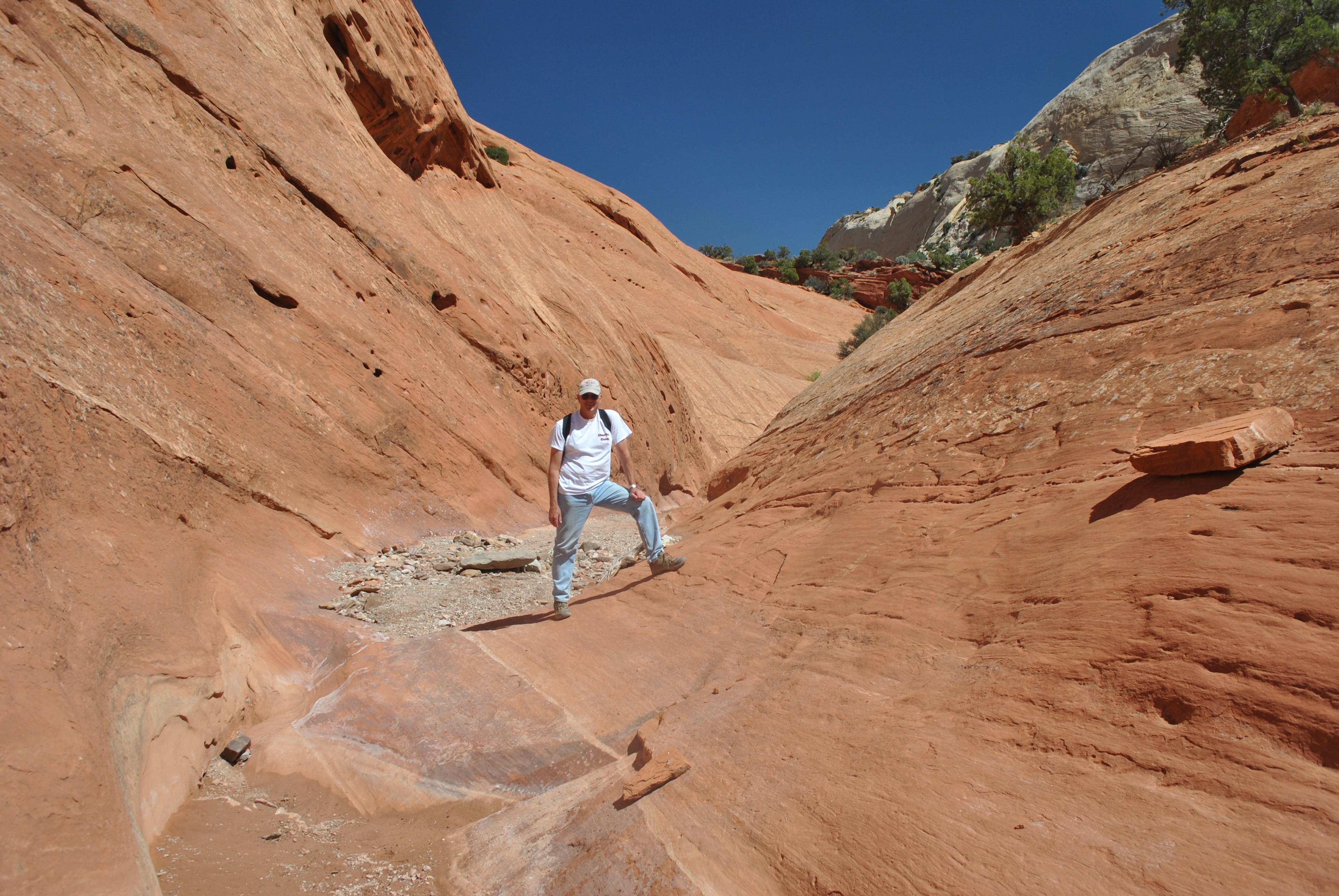 Steve hiking on slickrock in a narrow stretch of the canyon
We had two options at this point. To the south was Lower Muley Twist Canyon. From the Burr Trail road you could enter the north end of the lower canyon and follow it for over twenty miles. The lower section was deeper, bigger, and had a spectacular narrows near the end. The narrows gave the canyon the name "muley twist" because mules in pioneer days had to twist and turn inside the narrows. But we didn't have three days for a backpack trip nor a shuttle for a one way trip. There is a spur trail that allows you to bail out of the canyon into the next valley over at "The Post". That was only four miles down canyon. But that option didn't sound too exciting. The first part of the lower canyon isn't the most spectacular. It's the last section that's famous. And after taking the cutoff trail to The Post we would have to walk back several miles on dirt road to our car since we didn't have a shuttle.
 We climb over slickrock to avoid an obstacle in the the canyon
Upper Muley Twist Canyon sounded more interesting. The trail started in the bottom of the canyon. But a few miles in there was a loop. You hiked through the bottom of the canyon, then climbed up to the rim to hike back along the top. The loop was nine miles. The only problem was that you needed a 4WD to get to the trailhead. Without one, there was an extra three miles of 4WD road to be hiked on the way in and the way out for a total of fifteen miles. But hey, what's fifteen miles to a couple of stud hikers like us? The upper canyon it was.
The guide said that ordinary cars could drive the first mile after the turnoff from the Burr Trail. But to do the next three miles required 4WD. Being an optimist I figured that I could do at least part of that stretch to shorten our walk. I would just park the car when the road got really rough. But neither Dave nor I are into four wheeling. We would rather walk a rough road then drive it. So by the time we reached the first parking area about a mile from Burr Trail we had both had enough. I pulled over and parked. Ok - add six miles to the hike for walking in and out on the approach road.
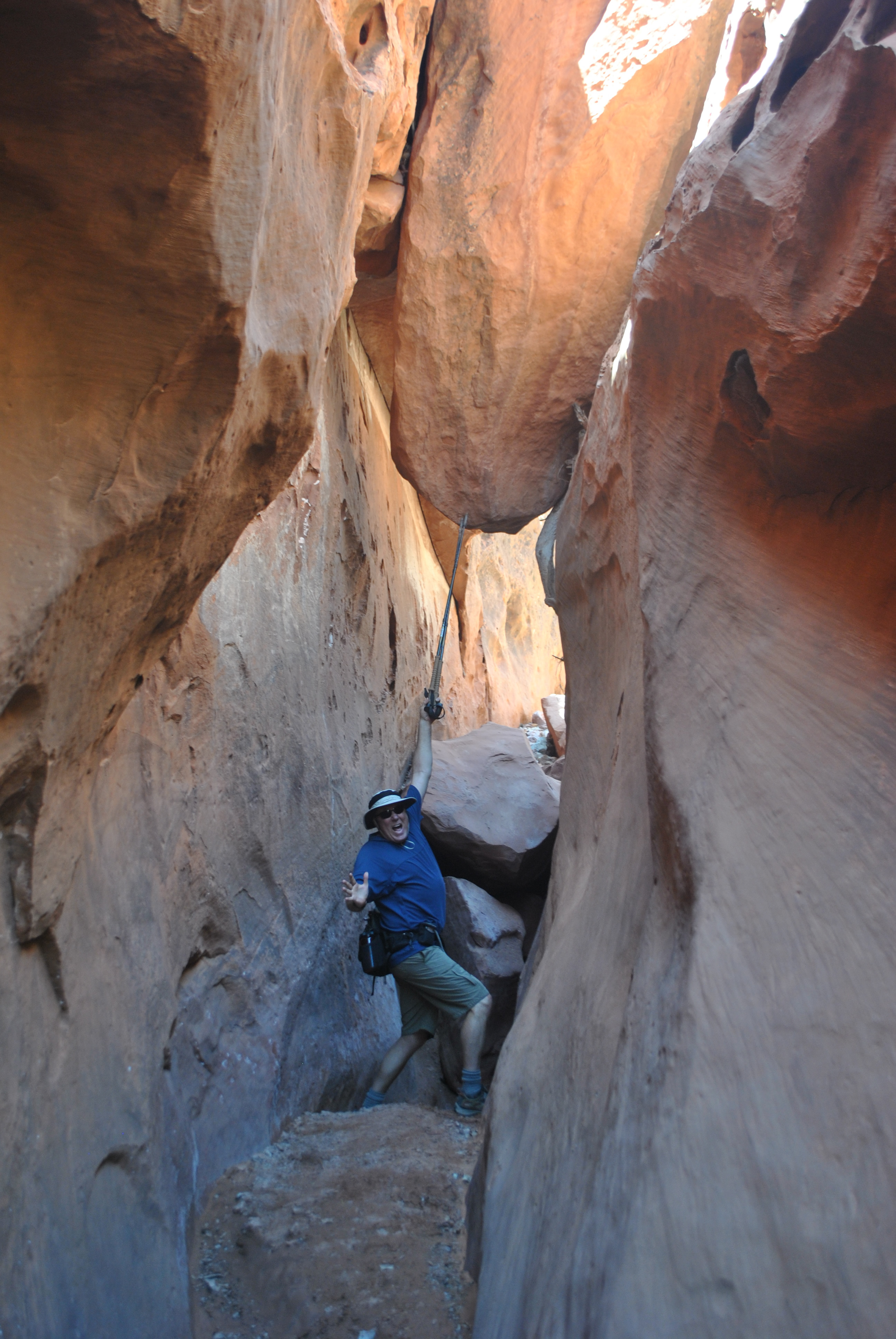 "Save yourself! I'll hold it as long as I can!!!
It actually was quite nice hiking in on the road. I thought it would be a boring approach but the canyon was already very pretty. In fact I think that driving it would have meant missing some really great scenery. On very rough roads you have to be totally focused on driving and can't spend your time staring out the windows. Walking it definitely seemed to be the better choice.
Only a mile in we encountered three hikers coming out. They said that they had gone only about a mile further up the canyon. Very strange. They must have spent more time driving to the trailhead than they spent hiking. Why did they bail out so early? It was still only midmorning and the weather was great.
At the 4WD parking area there was a park ranger. His nametag said "Ray". We talked to him about the hike. No, it wasn't a trail. In the canyon you just followed the wash at the bottom. In a couple of places there were cairned routes which climbed above obstacles in the bottom of the canyon. At one point he said the canyon got very narrow and traveling in the canyon bottom required technical canyoneering. The two points where the high route intersected the canyon bottom route were cairned and signed. We couldn't miss them. The high route on the rim was signed. He said that we shouldn't have any problem following the route. That was good news. We kept on going up the canyon.
It wasn't long till I saw a big cairn marking the junction with the rim route. We decided to continue on the canyon floor and take the high route back.
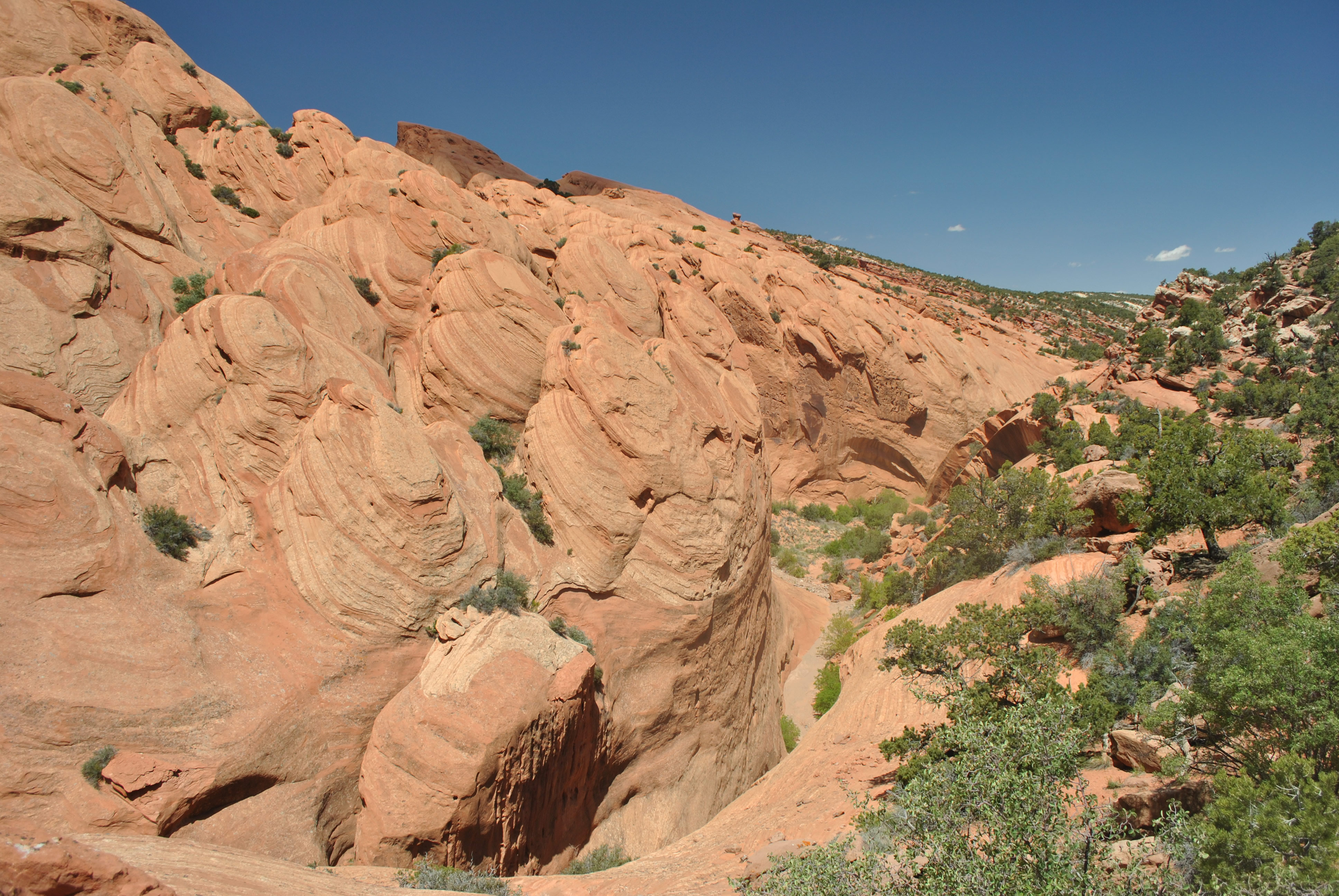 Unusual erosion patterns in the upper canyon
After a while we came to some cairns that marked a detour. We climbed the slickrock to avoid some obstacle. Where we left the canyon floor didn't look bad but who knows what was ahead. We followed the route markings. We returned to the canyon floor and continued to hike up the wash.
As we hiked we kept watching for arches. There are quite a few on the south side of the canyon. I saw at least five major arches as we hiked. Who knows. I might have missed some. At first we were excited but after a while it was, ho hum, another spectacular arch.
We reached the markers for the route around the canyon narrows. This was a major diversion onto the slickrock above the canyon floor. This time we hiked a short way up the bottom of the canyon to check out the narrows. Yup, it did indeed narrow down to where the canyon was only inches wide. We backtracked to the markers for the route around the narrows and climbed up above. At one point we lost the route. Dave was leading and he looked at what we were going to cross. It looked like it could be done, but you definitely wouldn't want to slip and fall. Dave's instincts were to double check and he was right. We had missed a cairn that took us around the exposed section. It's always best to look two or even three times to find the easiest route through difficult terrain.
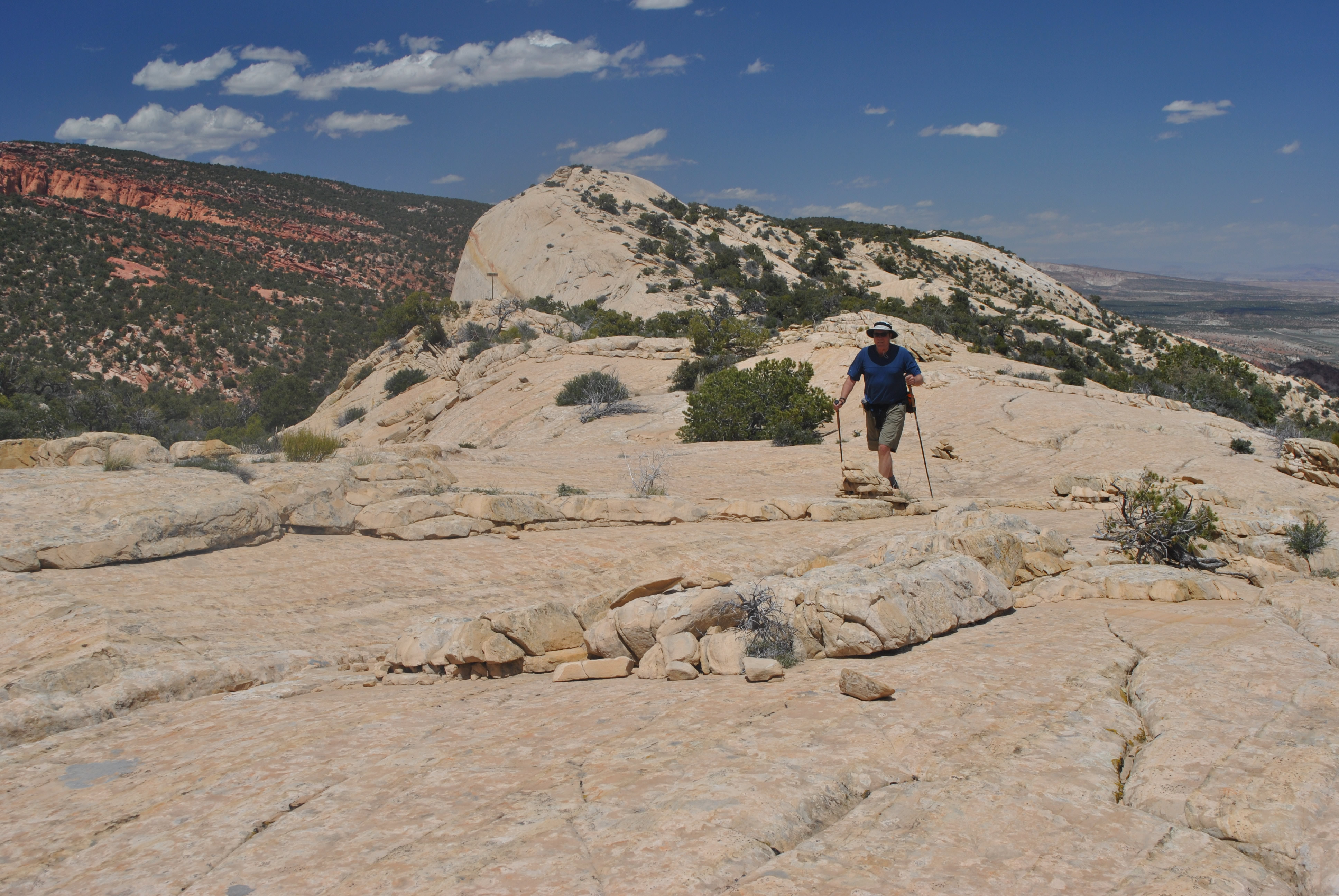 Dave following cairns that mark the high route above the canyon
After the narrows we dropped back into the bottom of the canyon. The ranger had said that the high route split off only a quarter of a mile or so after returning to the canyon bottom past the narrows. Sure enough, we found the cairns and a sign that marked the route. We climbed up the side of the canyon. I was curious where the high route actually went through. I had been watching as we hiked the canyon and although there were some places where it looked like a trail could go through above, there were a lot of spots where there was nothing but sheer cliffs. As we climbed out of the canyon I found the answer. The route went to the very top and did indeed travel above all of the cliffs. Up above the cliffs we were on the tops of big rock domes and travel across them was easy. When we reached the rim we had a spectacular view into the Strike Valley to the east and to the Henry Mountains in the distance. These are a group of 11,000 foot peaks between Torrey and Moab. Sandy and I had good views of them when we had been in Torrey earlier in the spring.
 Dave on the rim with the Henry Mountains behind
The route along the top of the domes was surprisingly easy. It was also really well marked. There were cairns every fifty feet or so. Someone had put in a lot of energy to mark the route. So we traveled along the rim of the canyon. We had a great view down into the canyon that we had hiked up earlier in the day. We had a different view of the many arches on the other side of the canyon. And the wind kept it from being too hot.
But the wind was something else. The forecast had said "very windy". Specifically it said winds from 25 to 35 mph with gusts up to 50 mph. That's pretty windy! The good thing about the wind was that we never got hot all day. But at times the wind blew lots of dust into our eyes, especially when we were down in the bottom of the canyon. Good thing that I don't wear contacts or I probably wouldn't have survived this hike. On the rim the problem was different- the wind could almost blow you over. And since sometimes we were near sheer cliffs that dropped all the way to the bottom of the canyon, that was worrisome. Although we didn't have as good a view we tended to hike a healthy distance from the edge of any cliffs.
 Hiking in the sky - what could be better?
The route along the rim kept going and going and going. Had we really hiked this far up the canyon? Probably yes. We just kept walking. Eventually we came to the sign that marked the route back down into the canyon. It didn't take long and we were back at the junction that we had passed early that morning. Now all we had to do was hike a short way to the 4WD parking area and then the long three miles down the 4WD road to the car.
When we reached the bottom of the canyon we saw a lot more hikers. We hadn't seen anyone since we left the ranger at the parking area early that morning. I guess a lot of people have SUV's and can get to the high trailhead and do short hikes. Not us though. We were short on expensive equipment and long on hiking effort.
It wasn't long until we reached the 4WD parking area. Good - only three more miles to go. But as luck would have it, someone was just leaving the parking area to drive back to the highway. Dave was quick to pounce. He stuck out his thumb, ran out in the road, started waving. He did everything but lie down in the road to prevent the poor guy from driving away. But the driver was a nice guy and he stopped and was willing to give us a ride.
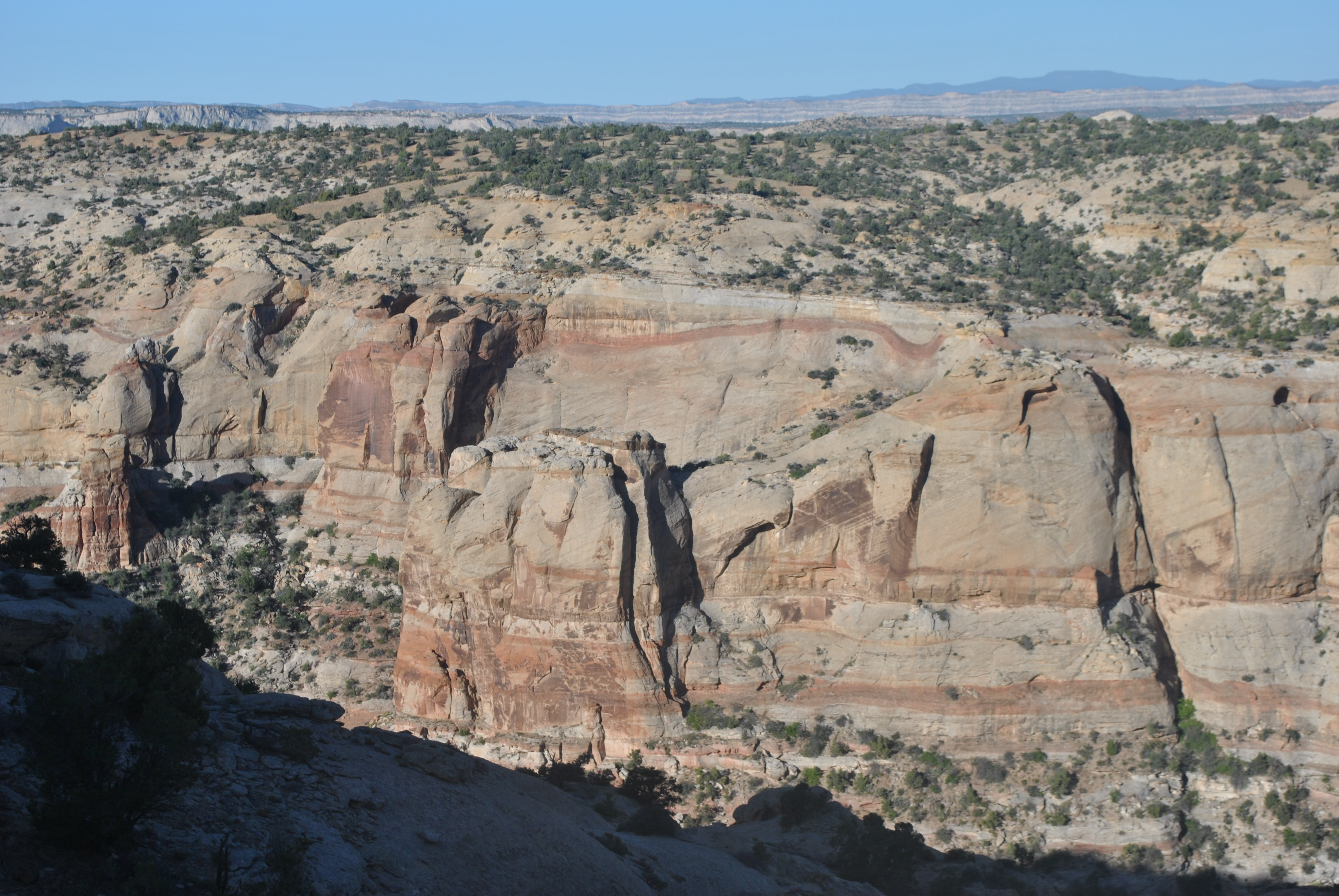
 Back in the canyon surrounded by spectacular cliffs
I guess Dave was pretty tired. We had already done twelve miles that day and had another three miles to go to the car. I was ready to do the last three miles. So I rolled my eyes. But I did get in the car. As Dave was quick to point out, I could have walked the last three miles if I really wanted to. I rationalized that this would save us time. I was already thinking ahead to where we would stop for dinner.
We had a good chat with the guy who gave us a ride. He was a retired geoligist from California. He had worked for oil companies and lived many places around the world. Turns out we both had lived in SE Asia - me in Singapore and him in KL. He had also lived in Pakistan for a long time. He actually had been to Abbottabad and even knew how to pronounce it correctly.
He told us that he had done a hike in Lower Muley Twist Canyon earlier in the day. He only got about three quarters of a mile before he was stopped by pools of water. We were golden. We had made absolutely the right choice to do the upper canyon rather than the lower canyon. Again, better to be lucky than good.
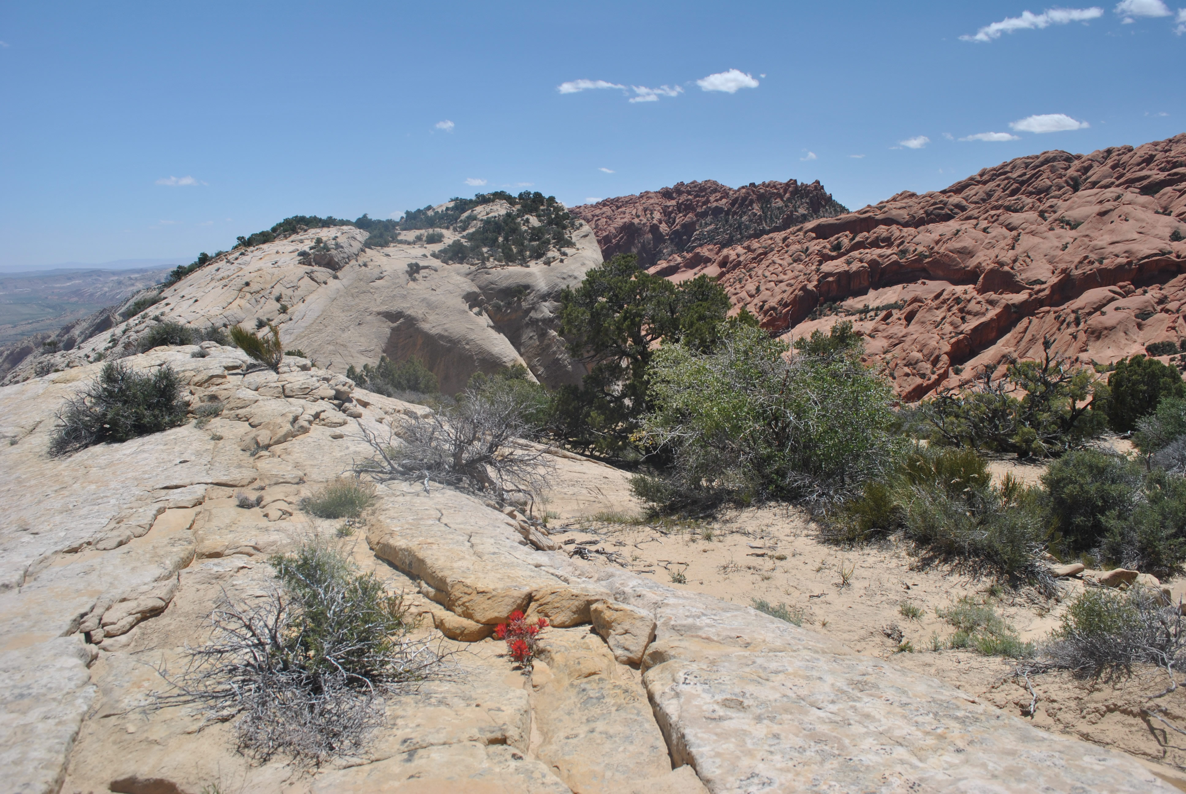 Indian Paintbrush blooms in an improbable spot in the rocks
Once we got back to our car it took us two hours to drive to Torrey. We stopped there for dinner at the Rim Rock Restaurant. Sandy and I had found this place on our visit to Capitol Reef and really liked it. I had a good steak and a glass of wine. By the time we left I was feeling pretty mellow, with an awesome hike, a good dinner, and some wine. I wasn't even worried anymore that we were pretty scroungy in the restaurant coming right off the trail after over six hours of hiking.
We drove for another couple of hours after dinner and stopped for the night in Scipio, the town where our route intersected I15. The next day we only had about eight hours of driving to get back to Boise. Dave and I had some good talks as we drove. We talked about philosophy, physics, religion, philosophy of physics, philosophy of religion, and more. I thought Dave was very brave during a conversation on quantum mechanics when he said "remind me about the dual slit experiment again?". Wow. I can do that. For an hour or two.
It was an awesome trip. I got to do some old favorite trails in Zion National Park. I got to explore in the Escalante and Capital Reef National Park. Now if I just could have gotten to the game store too it would have been perfect.
Additional pictures
View into Calf Creek Canyon where we had hiked the day before


