Alps pt7 - Britannia Hut
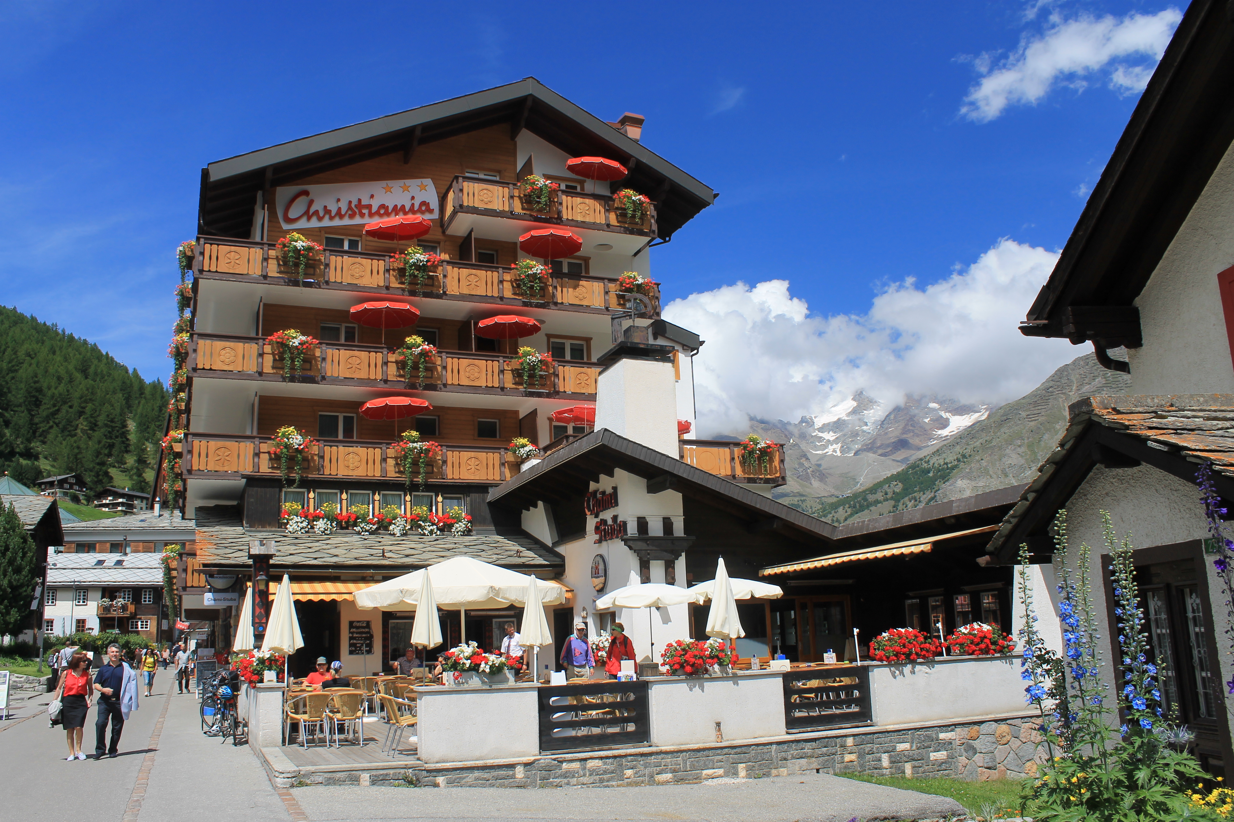 The main street in Saas Fee - less crowded than Zermatt
It took us four hours to travel from Zermatt to Arolla even though it is less than fifteen miles as the crow flies. It was easy - the Swiss trains and buses are very efficient and reliable. They run on time (hey, it's Switzerland). But we had to go a roundabout way - down a long mountain valley, through the Rhone valley and then up another long mountain valley. We needed to take a mixture of cog railroads, regular trains and buses. This time our trip was faster. From Arolla to Saas Fee was farther but took only about three hours. We caught the bus in Arolla at 8:25 and were in Saas Fee before noon.
As soon as we arrived we looked at the town map posted outside the bus terminal. It didn't look like it would be easy to find our way to the hotel. I had gotten enough exercise hauling our luggage up hills to hotels in Pontresina so I didn't want to drag them all over the village of Saas Fee. We wimped out and called the hotel. The lady there was glad to come and pick us up in a cart. Turned out to be a wise move as it would have been tough to find our own way there.
 Starting out through the boulders on the way to the Britannia Hut
We got settled into our hotel and decided to explore the village. First thing on our agenda was to find a place to eat lunch. It didn't take us long to find a restaurant with a large terrace where we could sit in the sun. We ordered our Standard Swiss Lunch - Sandy had roesti and I had pasta. Ok so we're predicatble. We like what we like.
Saas Fee has a huge car park and parking structure on the edge of the village. People either drive and park their cars on the outskirts of the village or take the bus like we did - there isn't a train that goes up the Saas Valley. Like Zermatt there are no cars in the village. But that's where the similarity ends. The main street of Zermatt is always filled with people. Sometimes it's hard to walk there are so many people in the street. It's always a zoo. Saas Fee is much less crowded and you can actually get around easily.
 Two chamois in the boulder field
Since cars are not allowed in the village guests who stay in hotels for more than one night are given a Burger Pass (Citizen's Pass) for transportaion. It is good for the free use of any lift, cable car or bus in the Saas Fee area. We really liked this. Saas Fee is known for its high level ridge hikes that involve a cable car at one end (to get up to the start) or the other (to get down from the end). In Zermatt it had cost us quite a bit for the cable cars. Here they were included with the price of the hotel. The free bus service was nice as well because we could get rides to and from the various trailheads. In fact, all of the hikes that we ended up doing in Saas Fee were one way hikes. We would take a bus or cable car to one end, hike to another point many miles away, and then take a lift or bus to get back to the hotel. It worked out really well. A rental car would have actually have been a real liability here.
 More boulders, and now clouds have rolled in
Since we had free passes for the cable cars we decided to take advantage of them. After lunch decided to take a ride up to Felskinn. This is a lift terminal at 3000m which we thought would be a good view point. There is also a particular one way hike that we were thinking about that ended by crossing a glacier to reach the Felskinn terminal. The crossing was supposed to be easy and safe for hikers but we thought that we would check it out. Turns out that this was easier said than done. There are several cable car and gondola lines that start in Saas Fee. The first one we went to was to Felskinn but was closed. The next terminal was for a different line. Finally we found the right one. Whew! By now it was getting later in the afternoon so we rode up but didn't stay long. It was 3:30 pm by the time that we got there and the last departure was at 4:00. We didn't want any mistakes that would cause us to miss. We didn't want to spend two or three hours hiking back down to the valley. But we did make it in plenty of time for the ride down.
 Weissmies - a four thousand meter peak across the valley
That night we ate dinner at the hotel. They had a fondue with beef and chicken that was very good. They kept bringing more meat, more vegetables, more pomme frites. By the time we were done we could barely make it up the stairs to our room. Any hiking the next morning was going to be tough.
Earlier in the week the weather forecast for our time in Saas Fee didn't look so good but it had improved as the time got closer. I also learned as the trip went on that the forecasts were more reliable if I checked the Swiss weather service instead of checking US sources like Yahoo Weather. Now it looked like the weather for our first full day in Saas Fee was uncertain but that we would have good weather after that. We studied our guidebooks, tourist info handouts and the web and came up with a list of four hikes that we wanted to do while we were here.
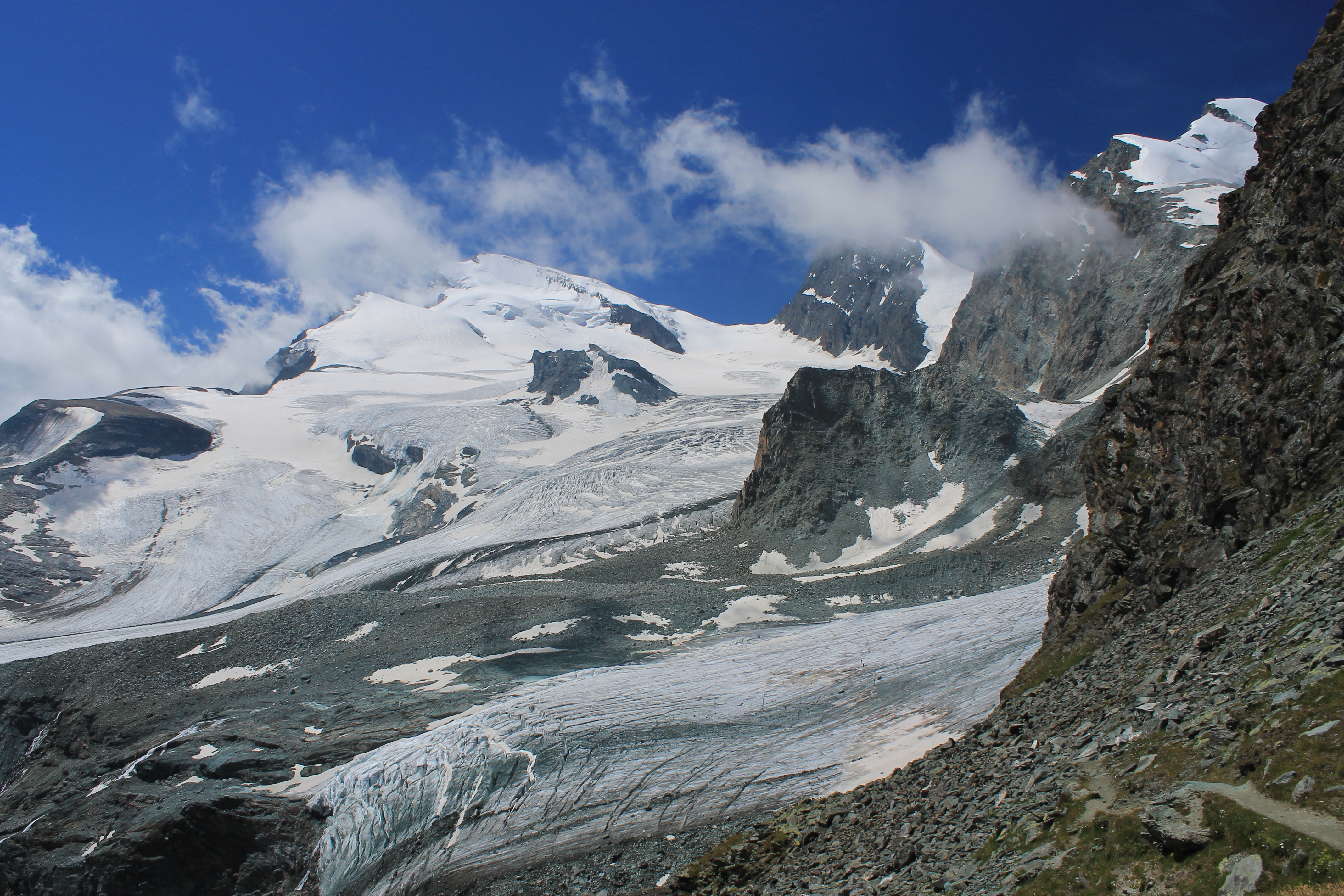
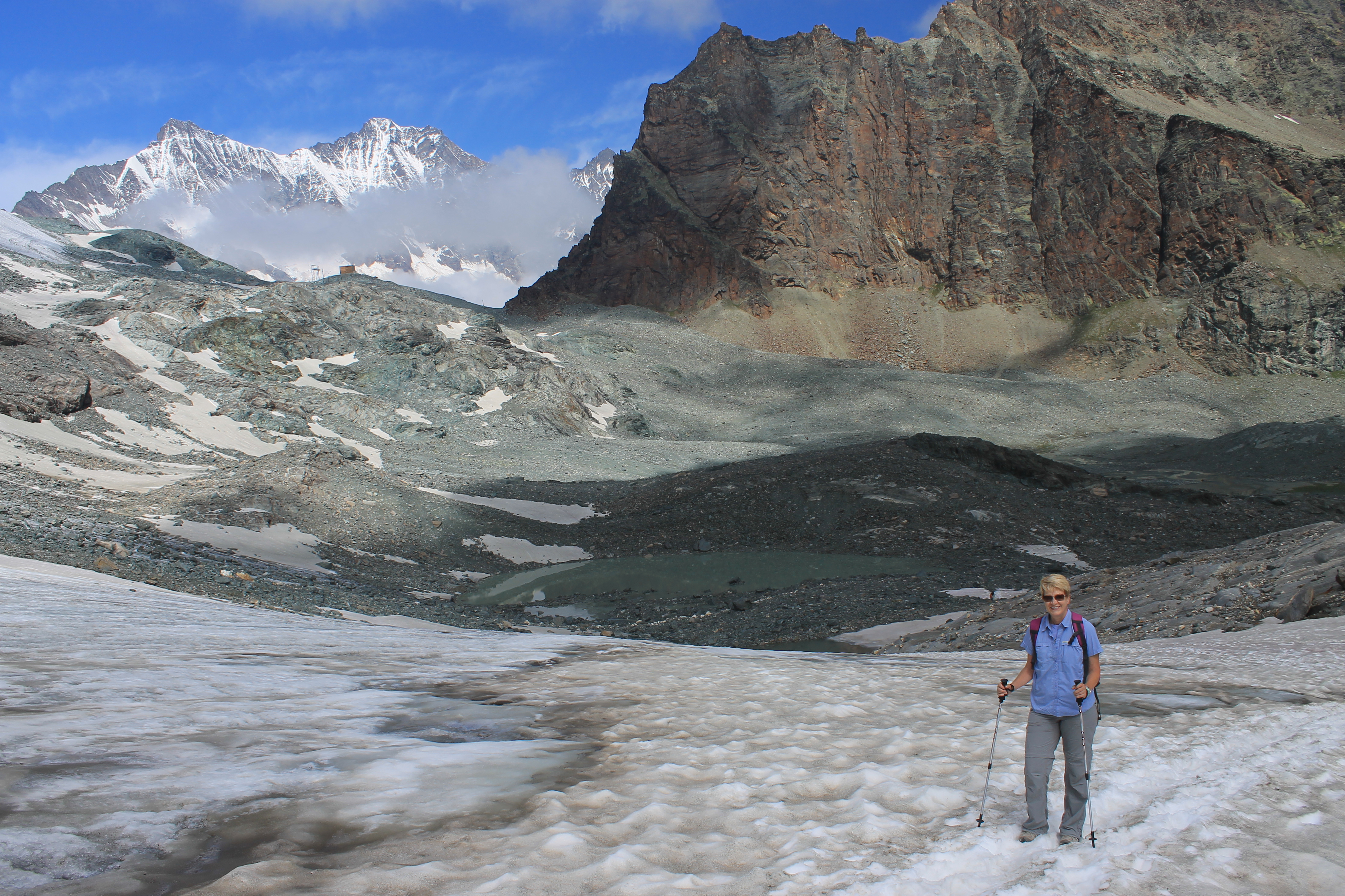 The long climb up the Chessjen glacier
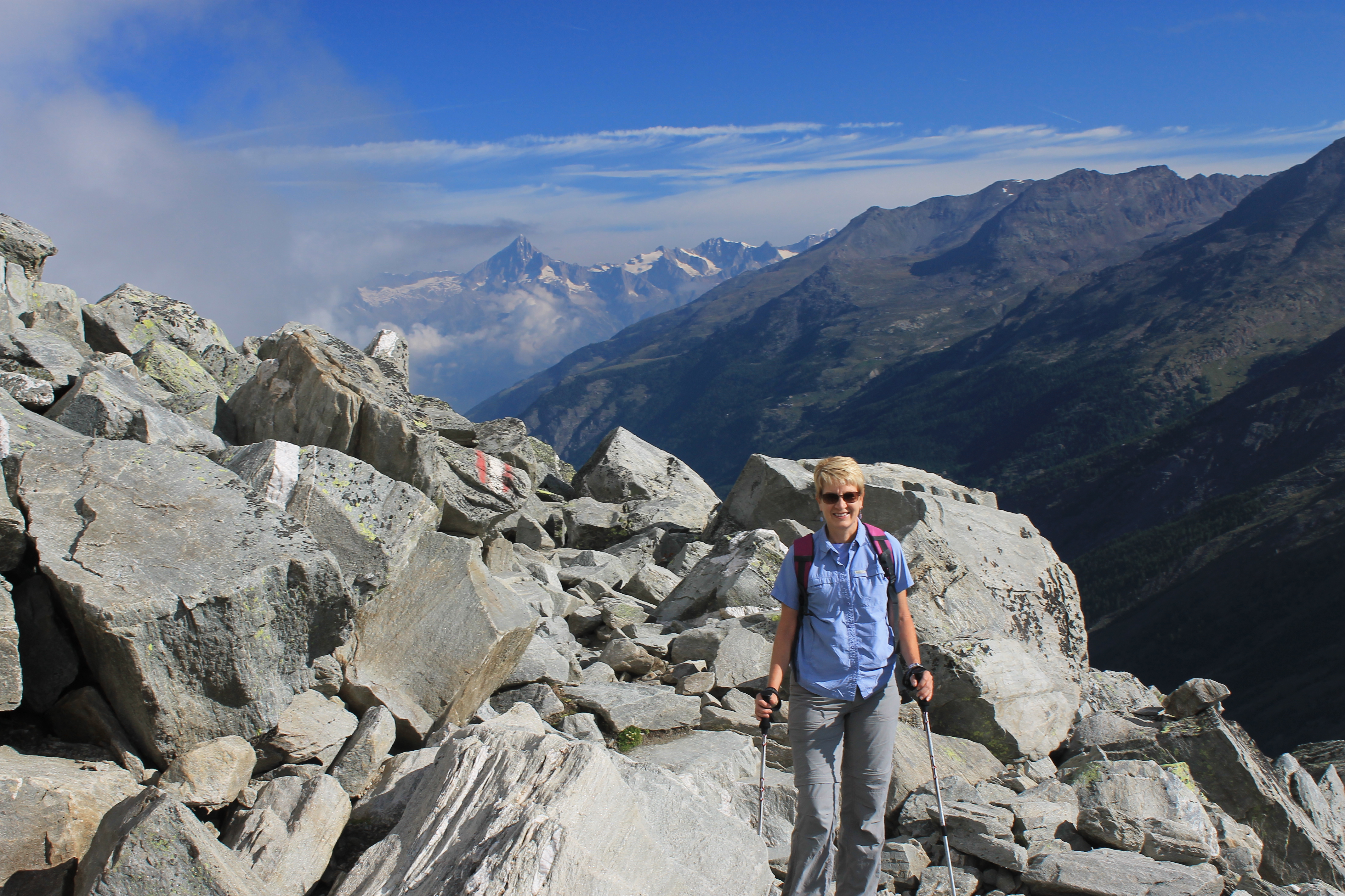
The next morning I woke up at 6:15 as usual and got up to check the weather. Some blue sky but it looked like clouds on all the high peaks. Probably ok for hiking but nothing to jump out of bed for. Sandy was still sleeping soundly (snoring) so I decided to let her sleep and went back to bed for an hour. We took our time getting ready and having breakfast. It looked like the weather was clearing so we decided to go for a serious hike after all. One of the hikes on our list required that we take a cable car to the start. That particular cable car didn't even start till 8:45 am so we hadn't lost any time by sleeping in. Our hike involved a ride up to Plattjen at 2570 meters and hiking from there to the Britannia Hut at 3030 meters. From there we would traverse over to the Felskinn cable car station at 3000 meters and ride back down. We had scouted it out the day before on our ride up to Felskinn. We figured that with only 460 meters of elevation gain it would take us about an hour and a half to climb to the hut. It didn't look far on the little hand-out hiking map that we got from the tourist office. But when we talked to the guy from the hotel he said it took two and a half to three hours. One of the guidebooks we had also said three hours. In fact most of the references we had on the web hiked in the other direction which was downhill. We figured that was wimpy and that we could do better than that. It turned out to be a lot harder than we thought.
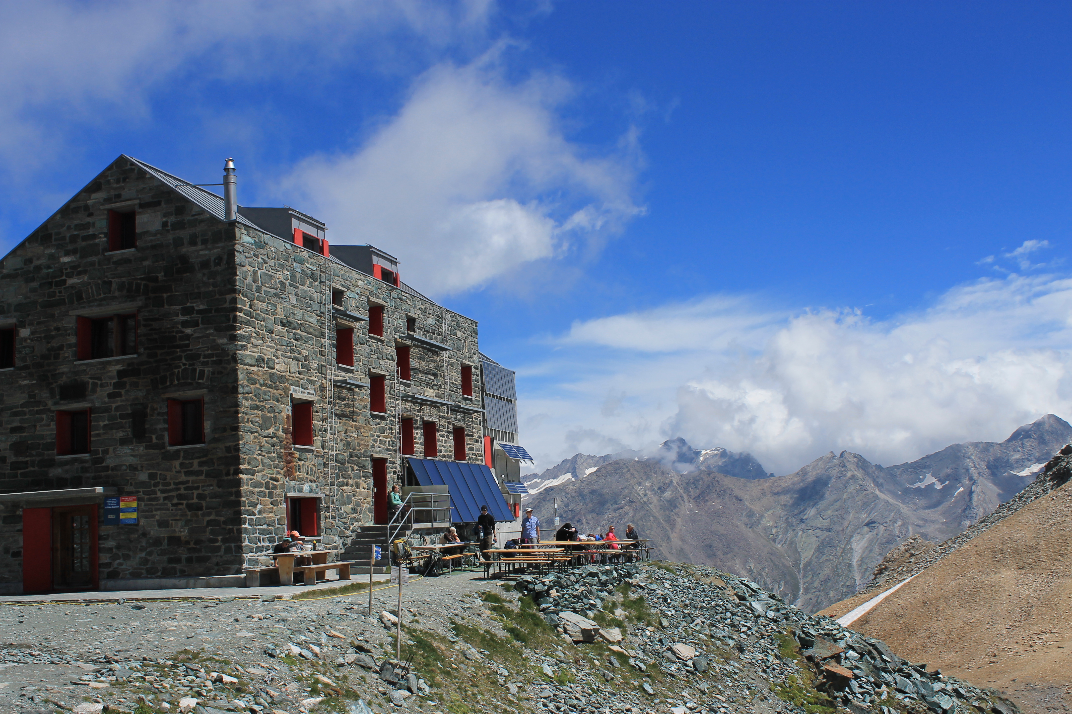 Britannia Hut - I did some good climbs from here back in 1986
We used our passes and got a ticket up to Plattjen. When we asked how to get a ticket to return via Felskinn, the guy just gave us a ticket that he said was good for all lifts, all day. Cool. Now we could do whatever we wanted. We rode up to Plattjen and started out on the trail at 9:15. Although the ridge to the east was in the sun, we were under a cloud that made it seem much cooler than we had been used to on our hikes. Once we started though the trail quickly went into a a large boulder field. Even though it was level it was a lot of work hopping across and climing through the large boulders. That helped us warm up quickly.
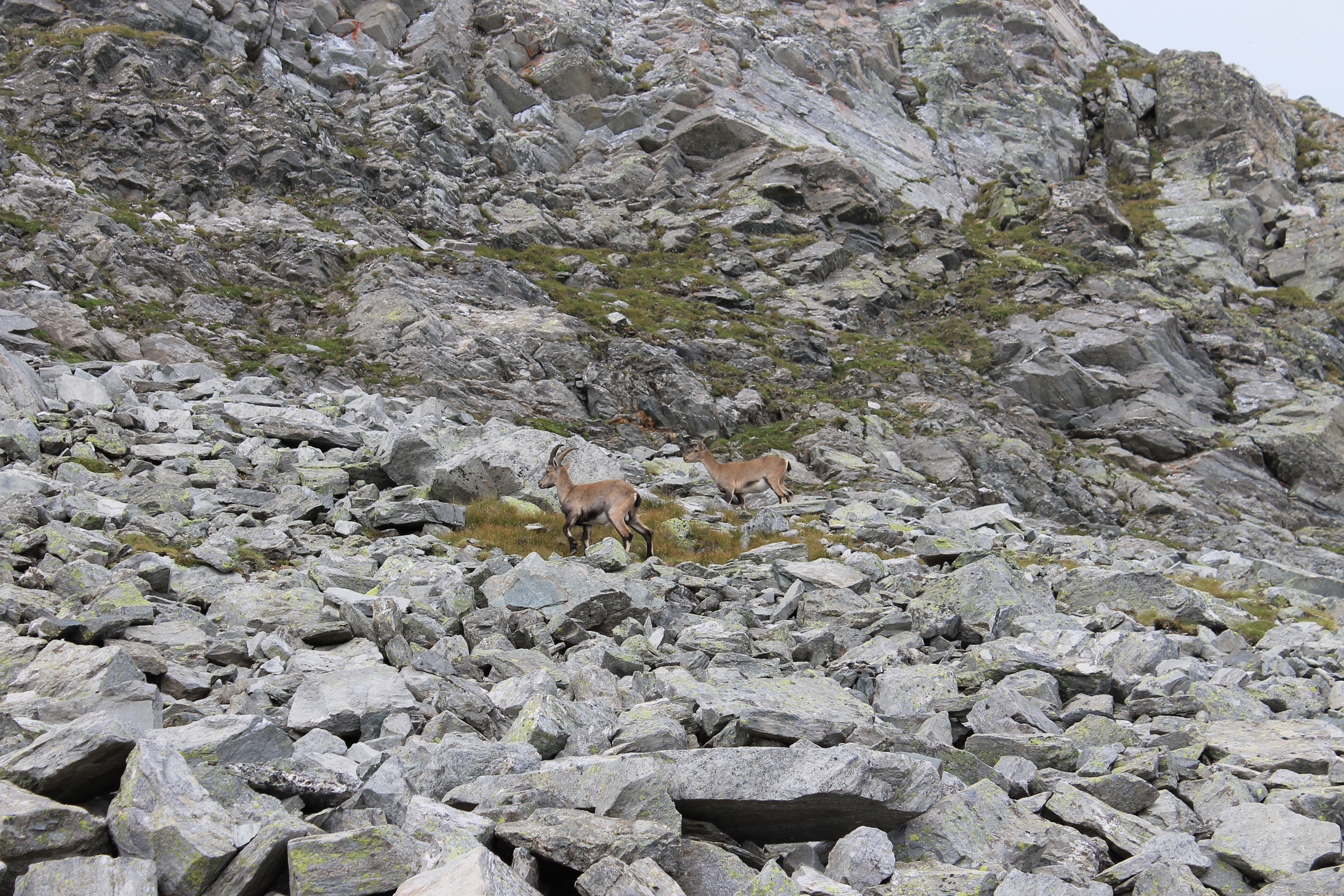
As we were moving through the boulder field both Sandy and I spotted a large animal only about fifty meters away. Then we noticed a second. It looked like some type of mountain goat. We checked after our hike and it turns out that these were chamois, a type of mountain goat common in the Alps. I moved closer to them to get a better picture and they didn't seem to be bothered at all by my aproach. Then suddenly they both startled. I thought it was due to me but a second later I heard some loud noises. At first I thought maybe they were gunshots. Could someone be shooting at the animals? But then I noticed some rocks bounding down the slope. They weren't real large, about the size of baseballs. Still I wouldn't want to get hit by one. They stopped about fifty feet away from us so it wasn't even close. Still it was a reminder about how the large area of boulders that we were traversing got filled up with boulders in the first place. We decided that the chamois weren't that interesting anymore and continued moving quickly to get out of the rockslide area.
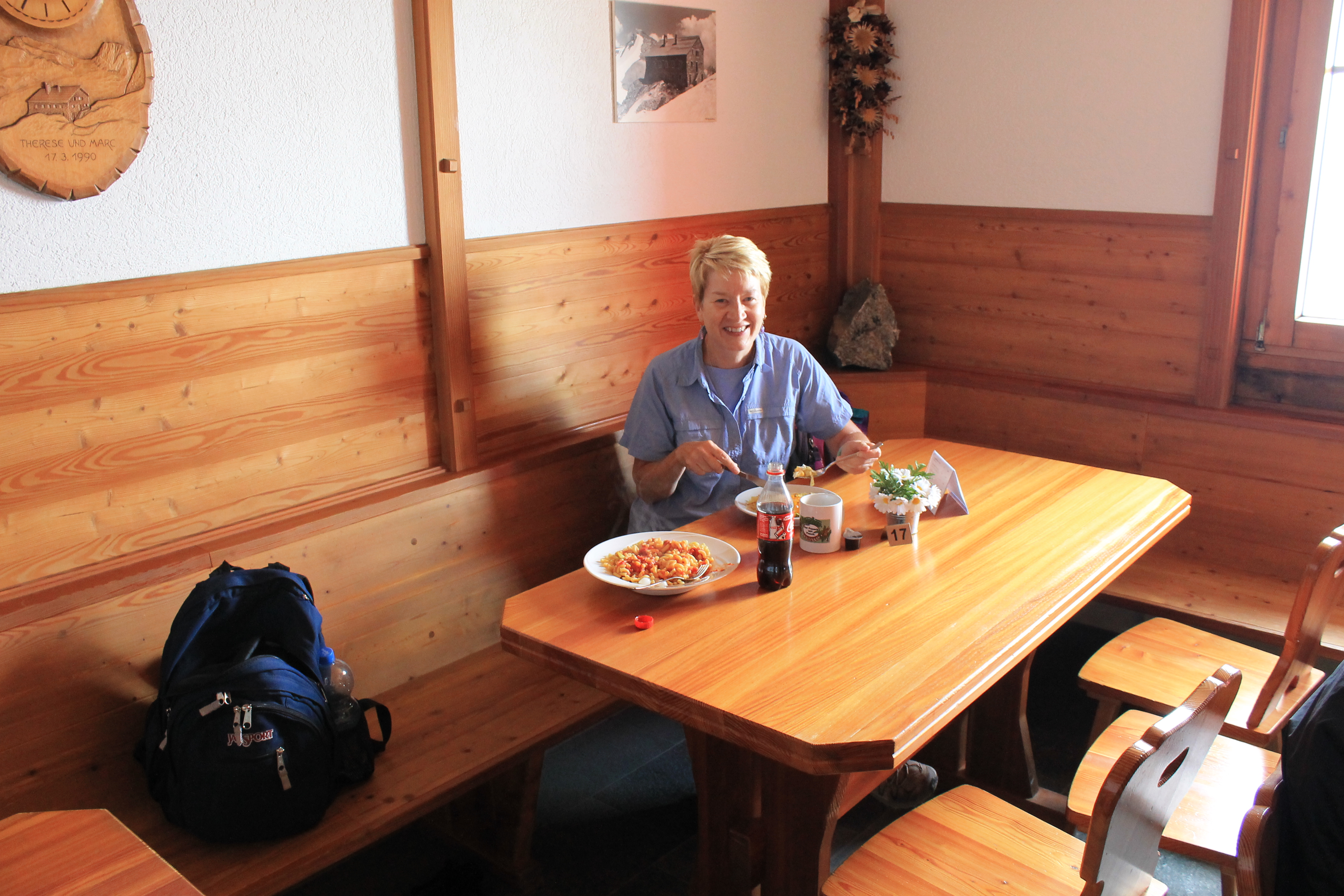 Enjoying lunch in the hut - any guesses what we had?
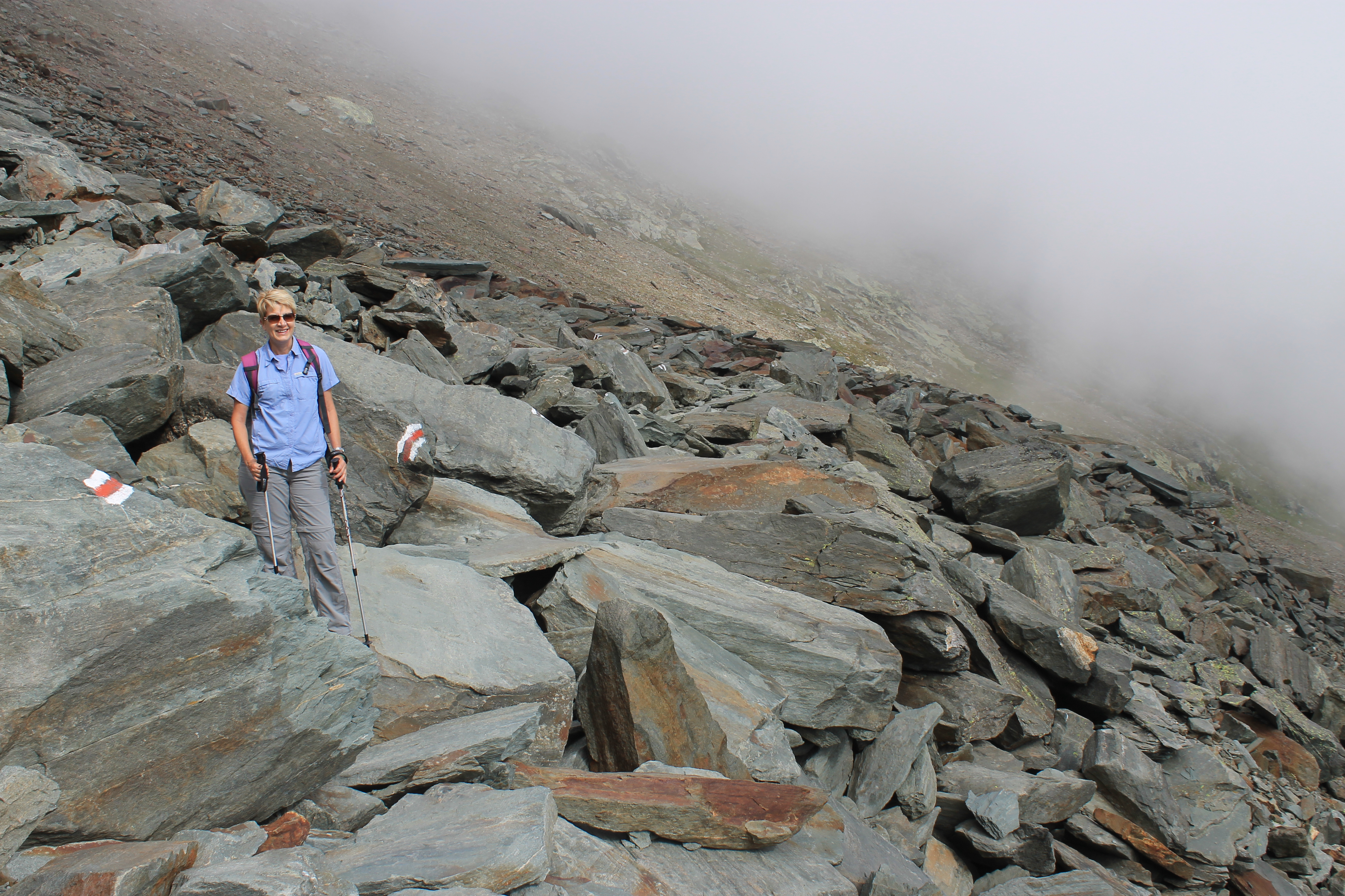
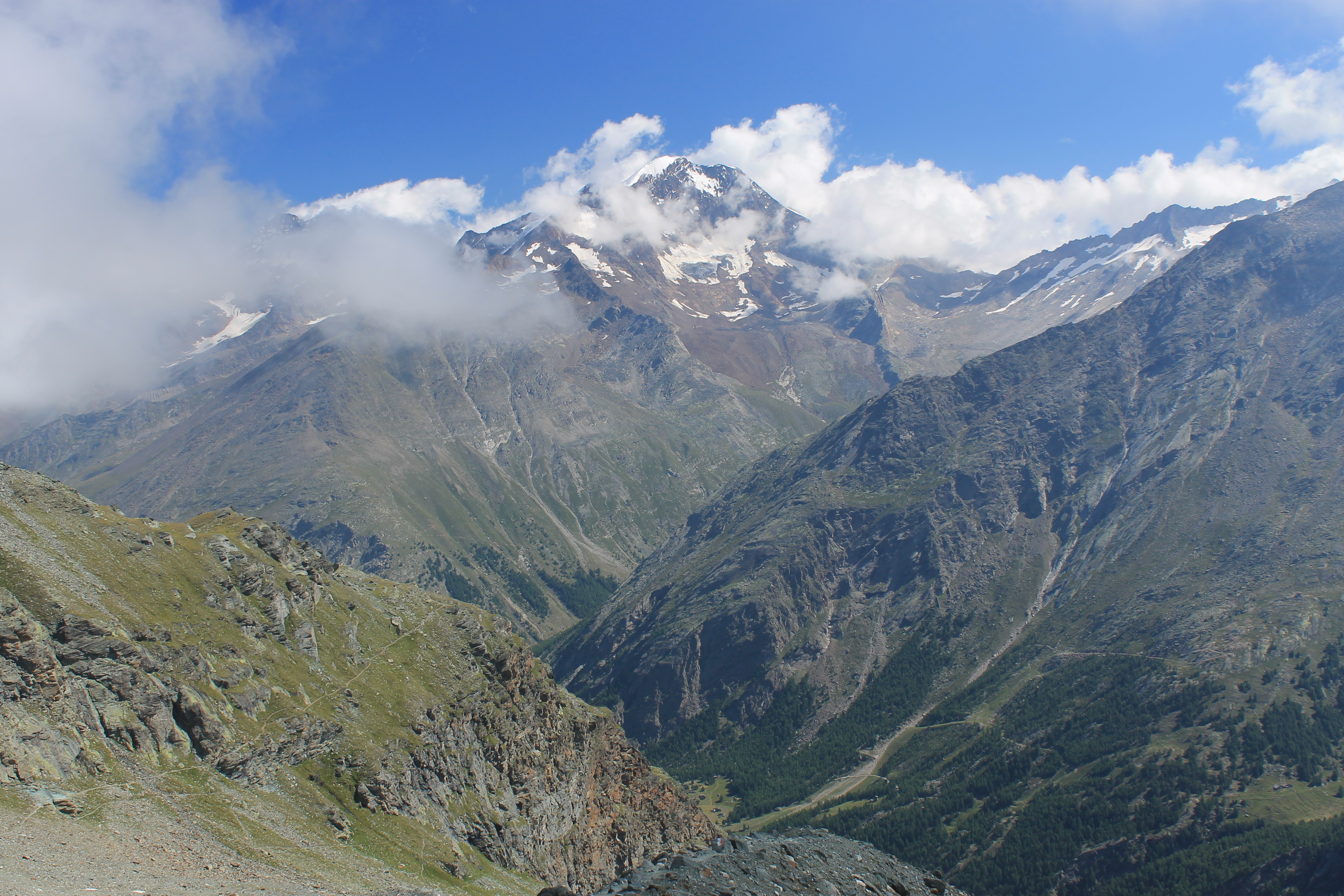
As quickly as we could that is. The rockslide area went on for a long way and it was slow going. Eventually we made our way out of the boulders and onto regular trail. Up to this point we had been in the clear but now fog rolled in. It was a mostly sunny day but some of the peaks had clouds on the tops or sides. We just happened to be in one of the clouds now and were for the next hour. The dampness and gloom along with a cool wind made it feel quite chilly even though the trail had started climbing and we were working hard. The position of the trail added to the ambiance. At this point it was traversing a very steep slope on the side of the Mittaghorn. The trail was wide enough but the slope fell away to the valley very quickly. The fog prevented you from seeing the bottom. There was just a steep cliff that fell off into...nothing. It was an eerie feeling.
We were begining to see why the normal time was so long. It was not just a matter of hiking a short distance with a certain elevation gain. The trail wound in and out of side gullies. It dropped down into them and then climbed right back out on the other side for a lot of work but no net elevation gain. We passed through several rocky areas that were hard going and slowed us down. But we kept making steady progress. Eventually we came out of the cloud and were back in the sun. That improved my mood. The clouds were clearing in general although not from the highest summits. It was actually a nice day.
 Strahlhorn - it looks like a long climb from the hut
We finally could see the hut. It looked to be a long way off and quite a bit higher. I guessed that it was about half an hour away. We kept going for fifteen minutes. It still seemed like it was half an hour away. The final climb was up the Chessjen glacier and seemed to take forever. Climbing long snow slopes is deceptive because there is nothing for reference. You just keep going and going and don't seem to get anywhere. The tiny hut that we were climbing towards didn't seem that far away but it was after all a three story building. Eventually we made it. It took us two and a half hours, just as our host at the hotel had predicted.
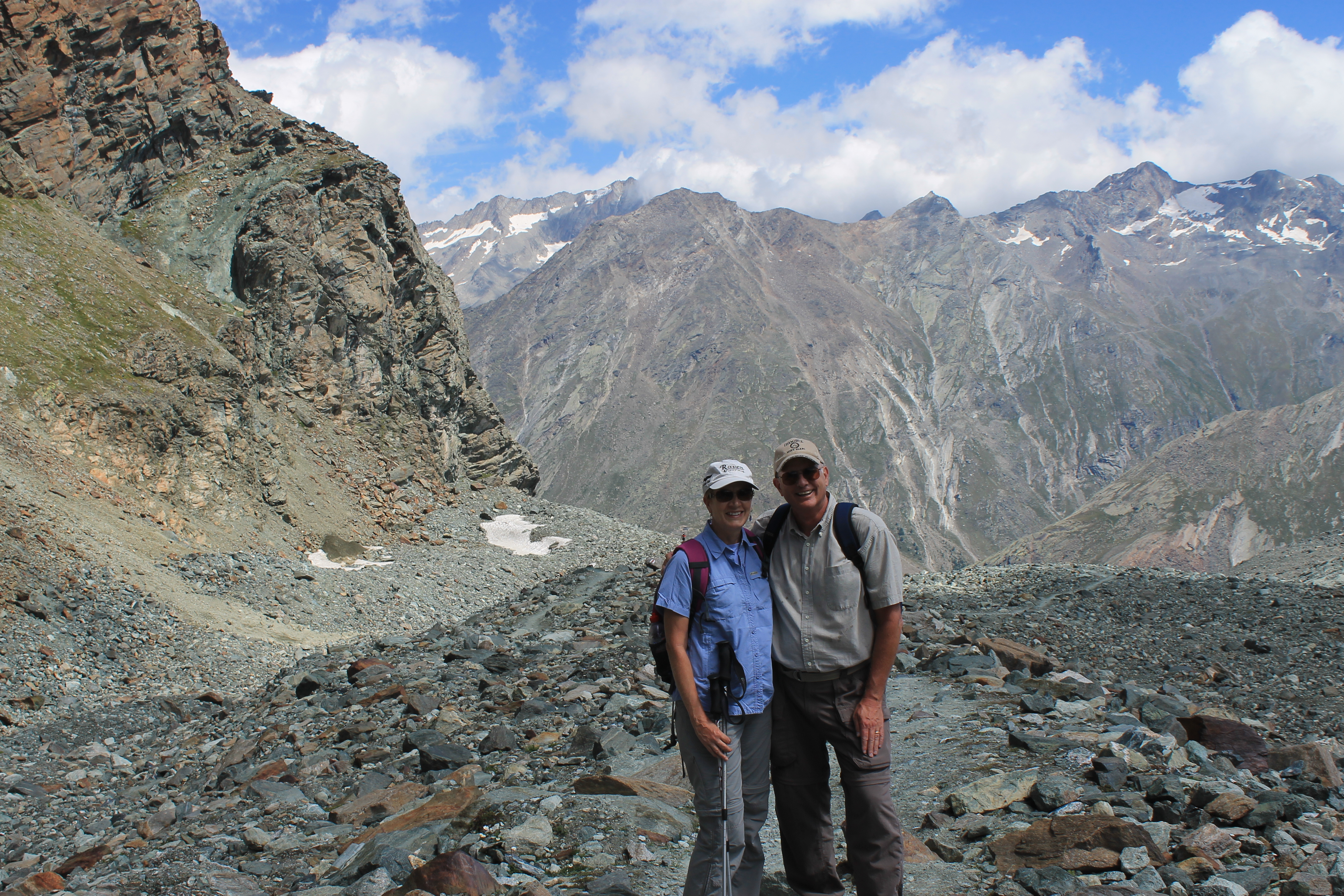
The Britannia Hut is especially nostalgic for me. Back in 1986 my climbing partner Vern and I had spent sevearal days there climbing the nearby peaks. We climbed the Strahlhorn, an easy snow climb but a long way from the hut. We also climbed the Allalinhorn. This is another easy snow climb that is not quite so long. Today it is more common to take the cable car and train to the Mittlel Allalin station from which the Allalinhorn is just a day climb. But that lift hadn't been built yet back then. Then we traveresed over to the Langflue hut and stayed another night there before climbing the Alphubel. So with a spell of good weather and a lot more energy and ambition than I have now we climbed three 4000 meter peaks in four days.
 On the way back to Felskinn under sunny skies
Sitting on the terrace and admiring the Strahlhorn it looked a long way off. The hut keeper would wake everyone up at 3am for breakfast so that they would get an early start. He did it by playing traditional Swiss music at full blast over the loudspeakers in the hut. Vern and I would joke about getting the CD of "Britannia's Greatest Hits" to replace our alarm clocks at home. All kidding aside, those were long climbs. The normal time to reach the summit from the hut is five hours and almost as long coming back. We were slow climbers so we would take ten to twelve hours round trip. We put in a lot of hard work for those summits.
Since we were quite sweaty from the long haul up to the hut we decided to eat inside instead of outside in the chill wind. The inside of the hut was really nice. Although it is 100 years old this year it has been kept up very well. I even bought a Brittania Hut post card to mail to my old climbing partner. It should be a real blast from the past.
 We look happy because we are almost to Felskinn
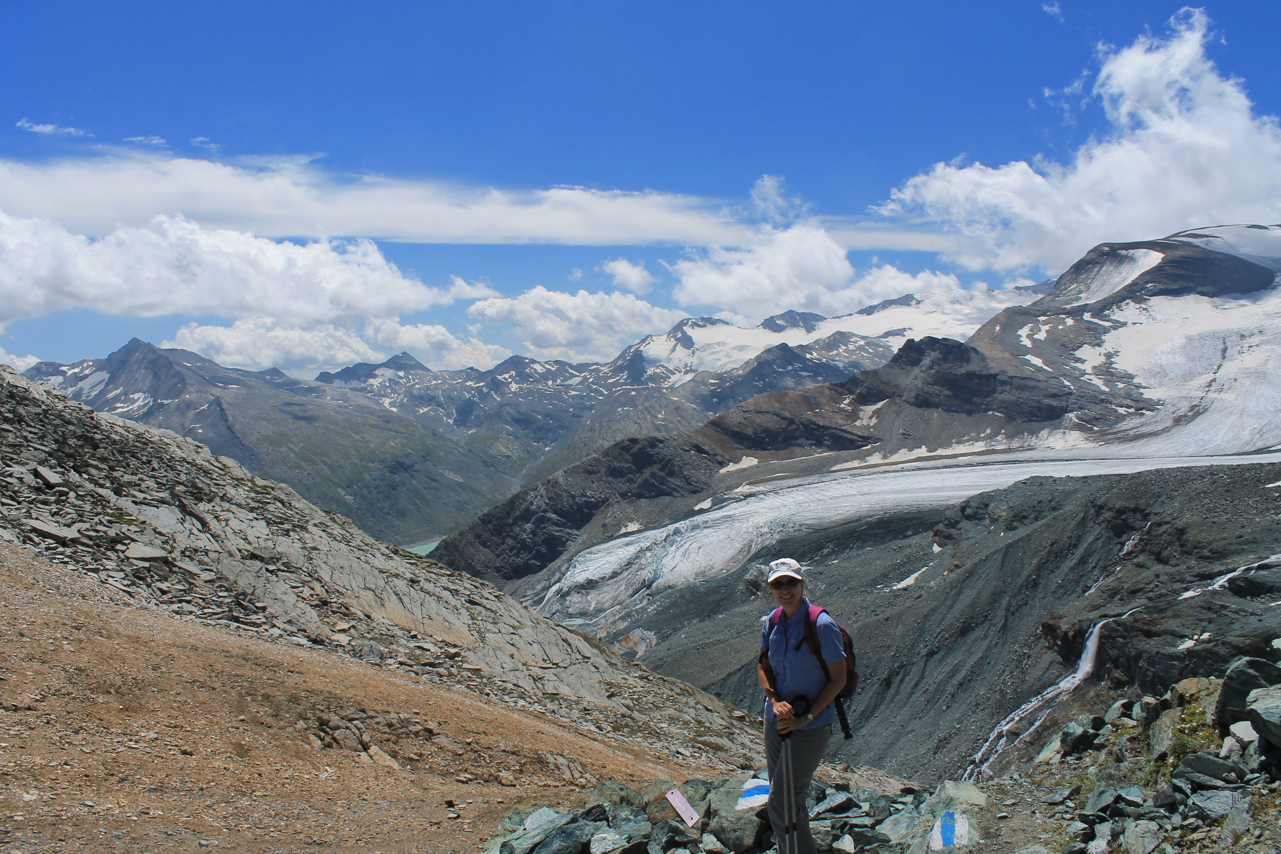
After lunch we left for the Felskinn cable car station. It's only 30 meters lower than the Britannia Hut and not very far. I remember doing the traverse years ago and it was quick and easy. The guidebooks give the time as only 45 minutes. But not anymore. The glacier has retreated to where the traverse is no longer across easy snow but difficult scree slopes. It has also become exposed to rockfall that makes it very dangerous. So the route is closed. Thank you global warming. The new route doubles back a long way, circles around and drops about 800 feet down the glacier just to climb right back up on the other side. It's not that hard but we were expecting a short easy stroll after our lunch. Instead we had an hour and a half heavy workout. By the time we were done we felt like we had done a pretty good hike for the day.
When we made it to Felskinn we were tired but we decided to go up instead of down. Since I had been here years ago they had added another stage that went up to 3500 meters on a train through a tunnel in the mountain. At the top, at the Mittel Allalin station, there is a revolving restaurant, claimed to be the highest in Switzerland. We went in and ordered a beer and enjoyed the view. The beer lasted for a full revolution so we got our money's worth. We also wanted to check out the approach to the Allalinhorn from the high station. There was an obvious track in the snow and we could see climbing parties coming down. It looks like it would be an easy climb from the Mittel Allalin station. It may be on our list for our trip next year.


