Mt. Nebo
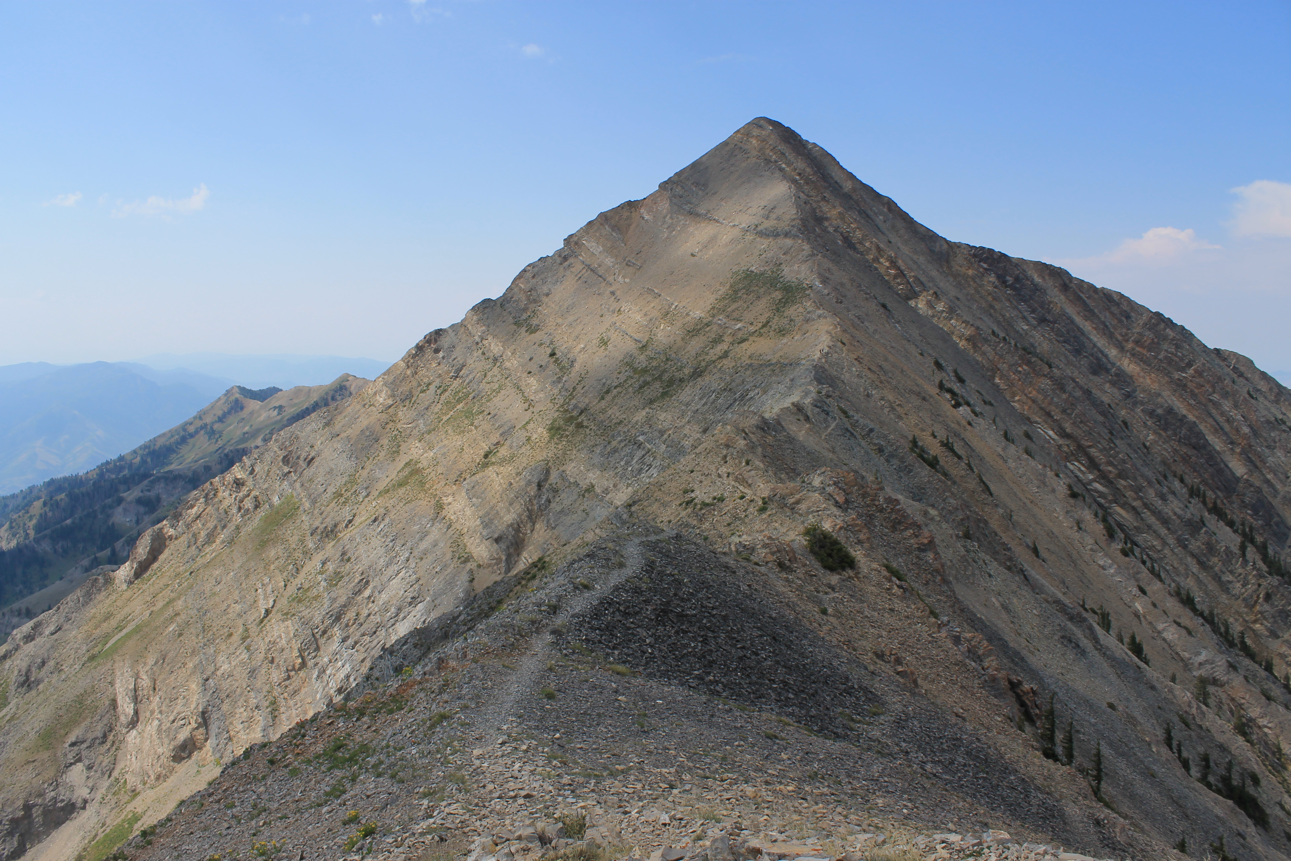
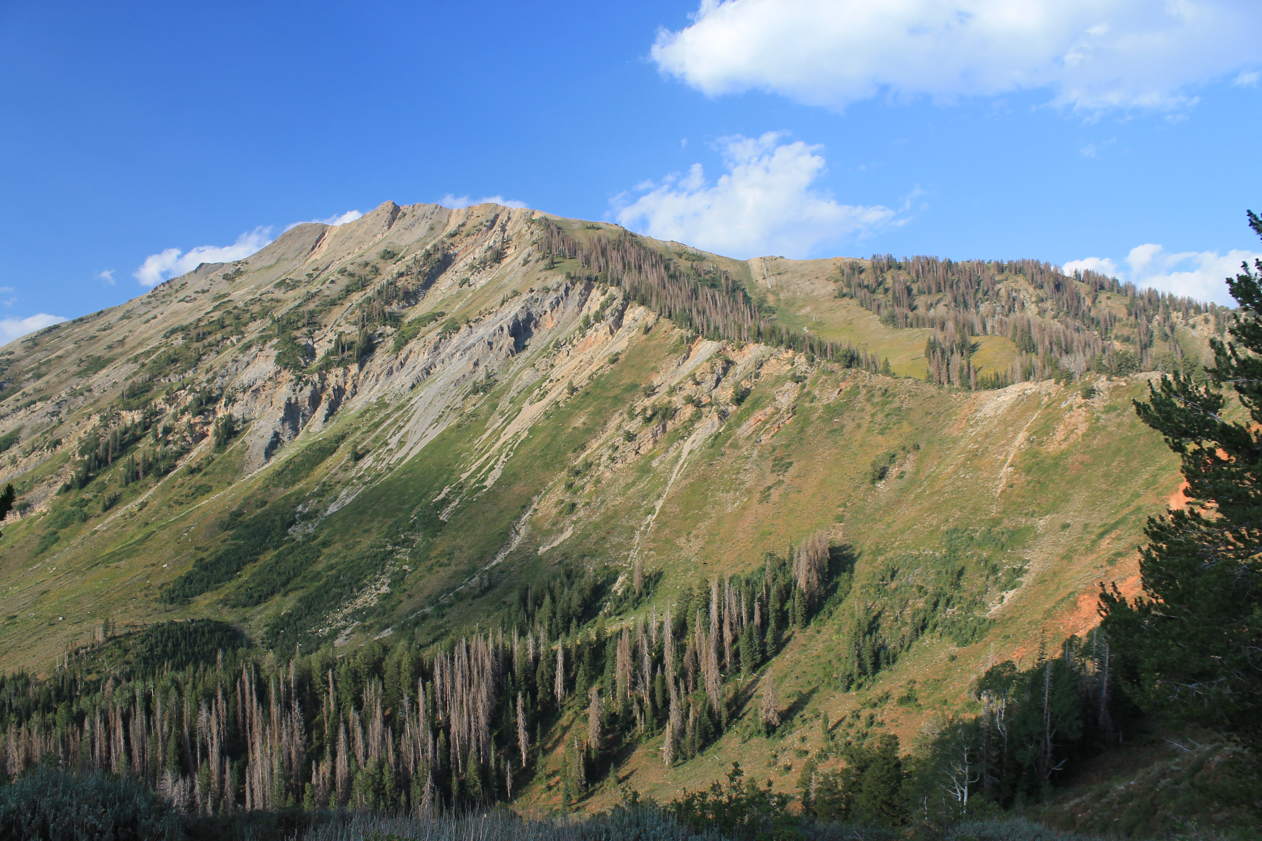 North Peak dominates the view as we start out
My nephew Devin, who lives in Sun Prairie Wisconsin, graduated from high school this spring. Sandy and I went back to the Old Country for his graduation party. While we were there Devin and I were talking about hiking and he was very interested. Since he grew up in the Midwest he has never really had a chance to try hiking in the mountains. I suggested that he come out for a visit this summer so we could go to the mountains together. He took me up on the offer and came for a visit this August.
There was one problem that I hadn't expected. This is the worst forest fire season in the Western United States in decades. Two very large fires in central Idaho have the Sawtooth and Pioneer mountains completely covered in smoke. I was monitoring the Stanley web cam and most days you couldn't even see the Sawtooths. I had been dodging the smoke for the past two weekends on trips to the mountains. Both times I ended up going to Mt. Rainier National Park, one of the few places I could reach in a weekend where the smoke wasn't bad. But Sandy discouraged that for this weekend. She was hoping that we could be back by Sunday afternoon since her sister Lynn, Devin's mom, was visiting too. So I looked at options and picked Mt. Nebo, a climb in the Wasatch Mountains in Utah.
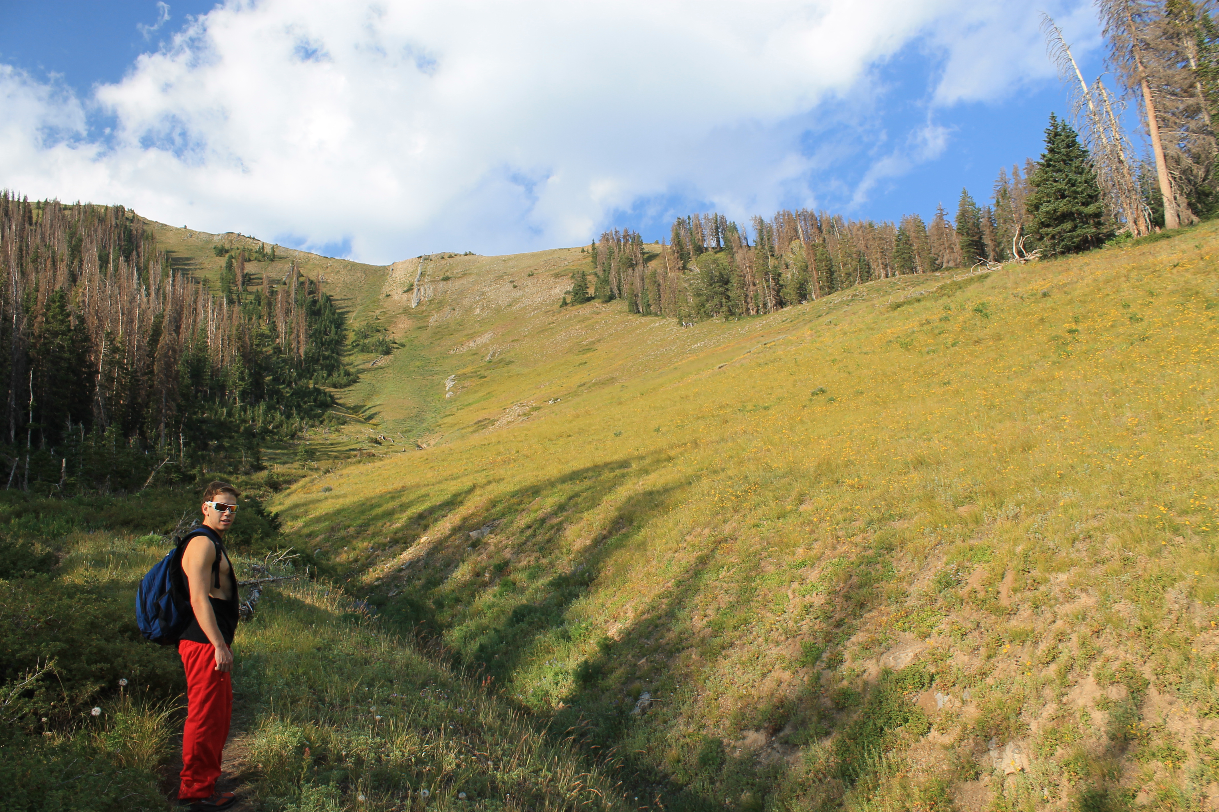 The serious climbing starts - up this long slope to the ridgecrest
This fall I am covering classes till 9 pm one night a week so I get to have Friday afternoons off. That's perfect for weekend trips. Devin and I packed on Thursday night, loaded the car with our stuff, and were ready to go. Sandy brought him down to work on Friday morning and we left right from there just before noon. That gave us plenty of time to reach the town of Nephi, Utah Friday evening and find a place to stay. We got a room, had dinner, and turned in early.
Our alarm went off at 5:30 am. It was still pitch dark and not easy to get up. But we wanted an early start. The forecast called for a chance of afternoon thunderstorms. We wanted to get up to the summit and off the upper part of the mountain by early afternoon before any storms had a chance to develop. We got dressed and were downstairs at 6 am sharp when breakfast started. After a quick bowl of cereal we were on the road by 6:15.
Except that it was the wrong road. We needed to drive a few miles from Nephi to the Mt. Nebo National Scenic Byway, a highway that circles to the east of Mt. Nebo through the national forest. It connects Payson and Nephi on the east side of the mountain while I15 connects them on the west side. Except that there are two Nephi exits. We got off at the main one where the motels, restaurants and gas stations were. But I had forgotten to look at the highway number when I got off. So that evening I just asked the desk clerk if we were on highway 132. She assured me that we were. So we started out of town expecting to hit our turn off quickly. After ten miles we hit the town of Levan with no sign of the Mt. Nebo Scenic Byway. I stopped at a gas station and actually asked directions. The lady there sent us back to Nephi and told us how to find the road we needed.
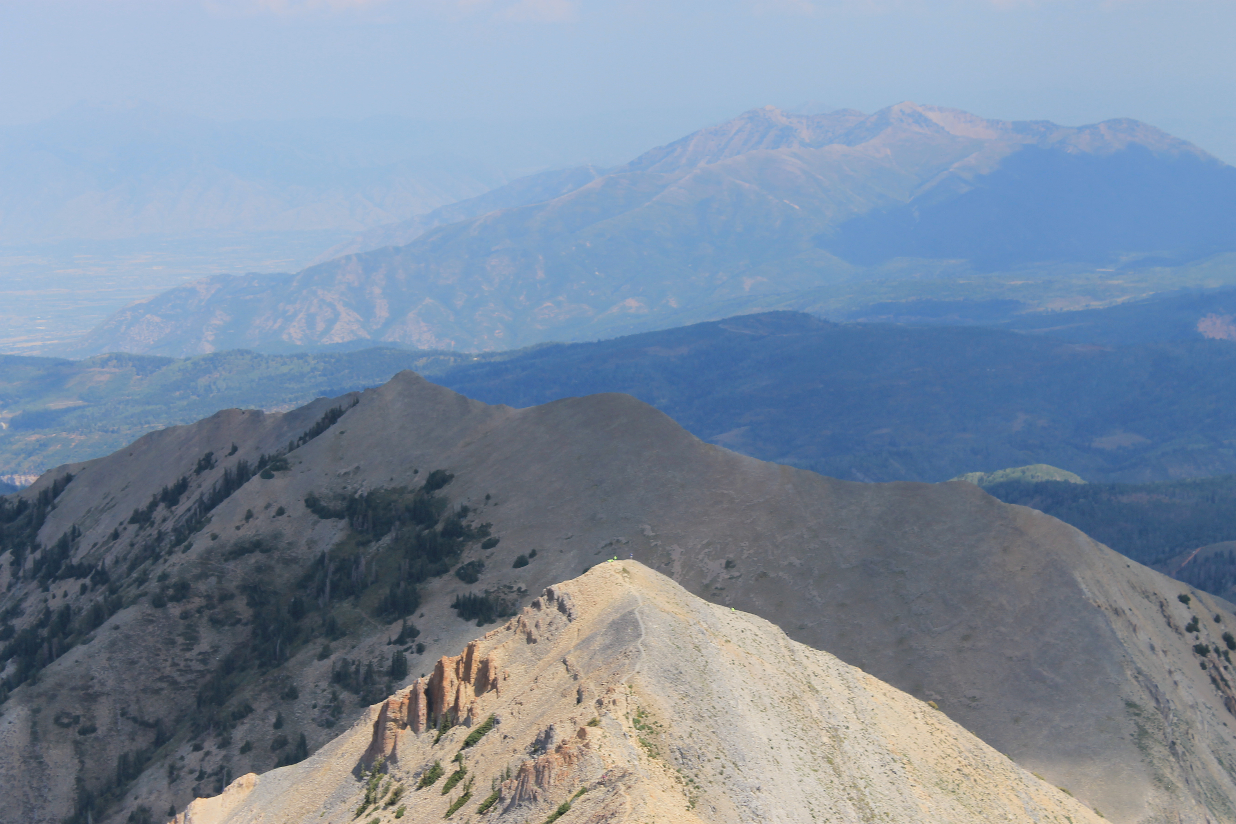
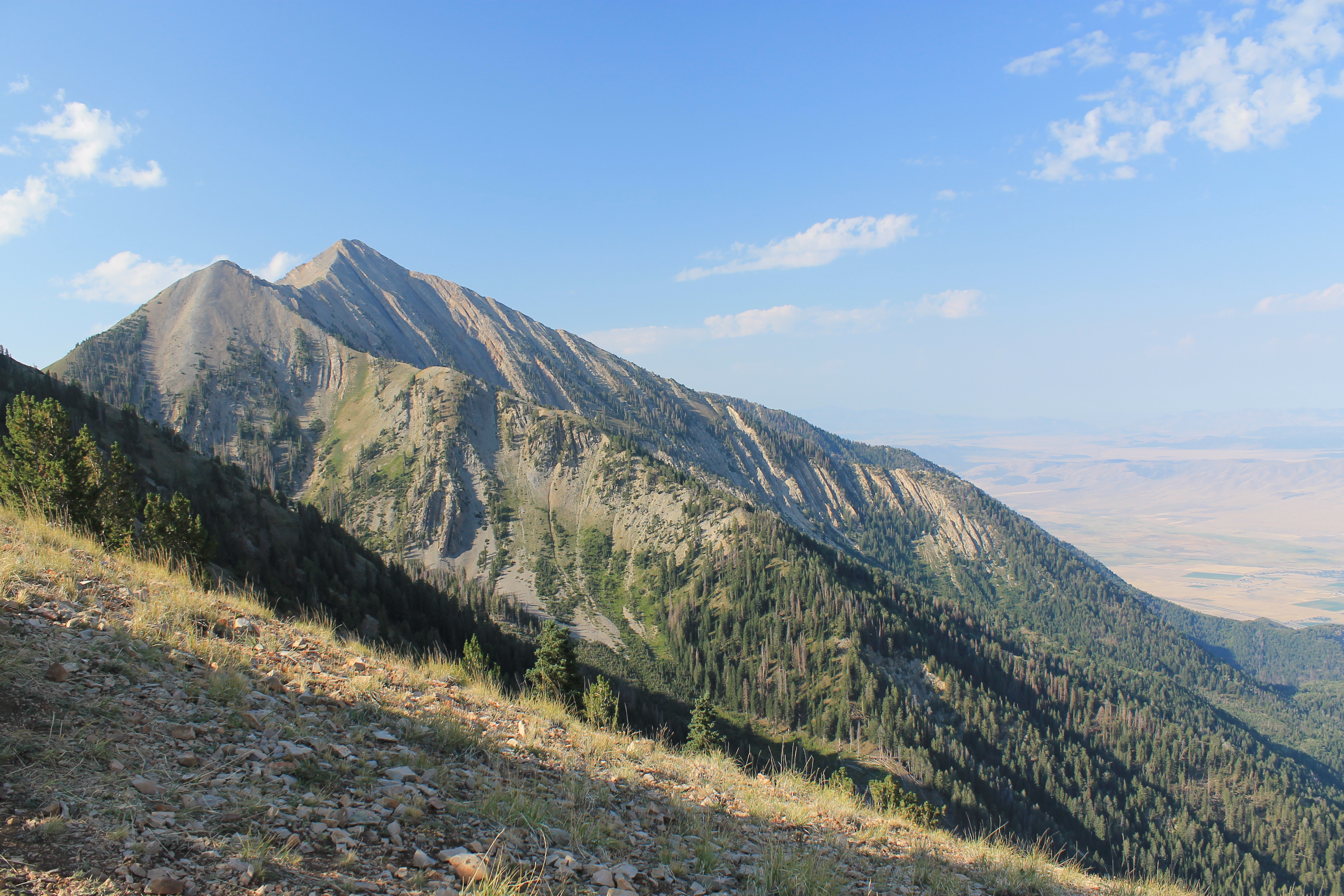 We reach the ridgecrest - and see Mt. Nebo a long way off
Now we were on track but we had lost about twenty minutes. No big deal - part of the reason for leaving early was to give us margin. Turns out the drive took us longer than I expected too. The road was narrow and winding. When we reached the trailhead there were already about fifteen cars there and we were lucky to get a parking spot. We were finally on the trail at 7:40 am.
At 11,928 feet Mt. Nebo is the highest mountain in the Wasatch range. It is very prominent from the valley to the west so we had a good view of it as we drove along I15 the evening before. Climbing Mt. Nebo is a demanding 10 mile round trip. The summit is only 2640 feet higher than the trailhead but there are major ups and downs along the way. Some descriptions give the gross elevation gain as over 3800 feet. Climbing a big hill near the end of a hike is tough physically and psychologically. Besides the elevation gain, there is a long ridge traverse that requires a lot of energy. Devin enjoys playing sports and trains for them. I thought that he would get a good workout on this route.
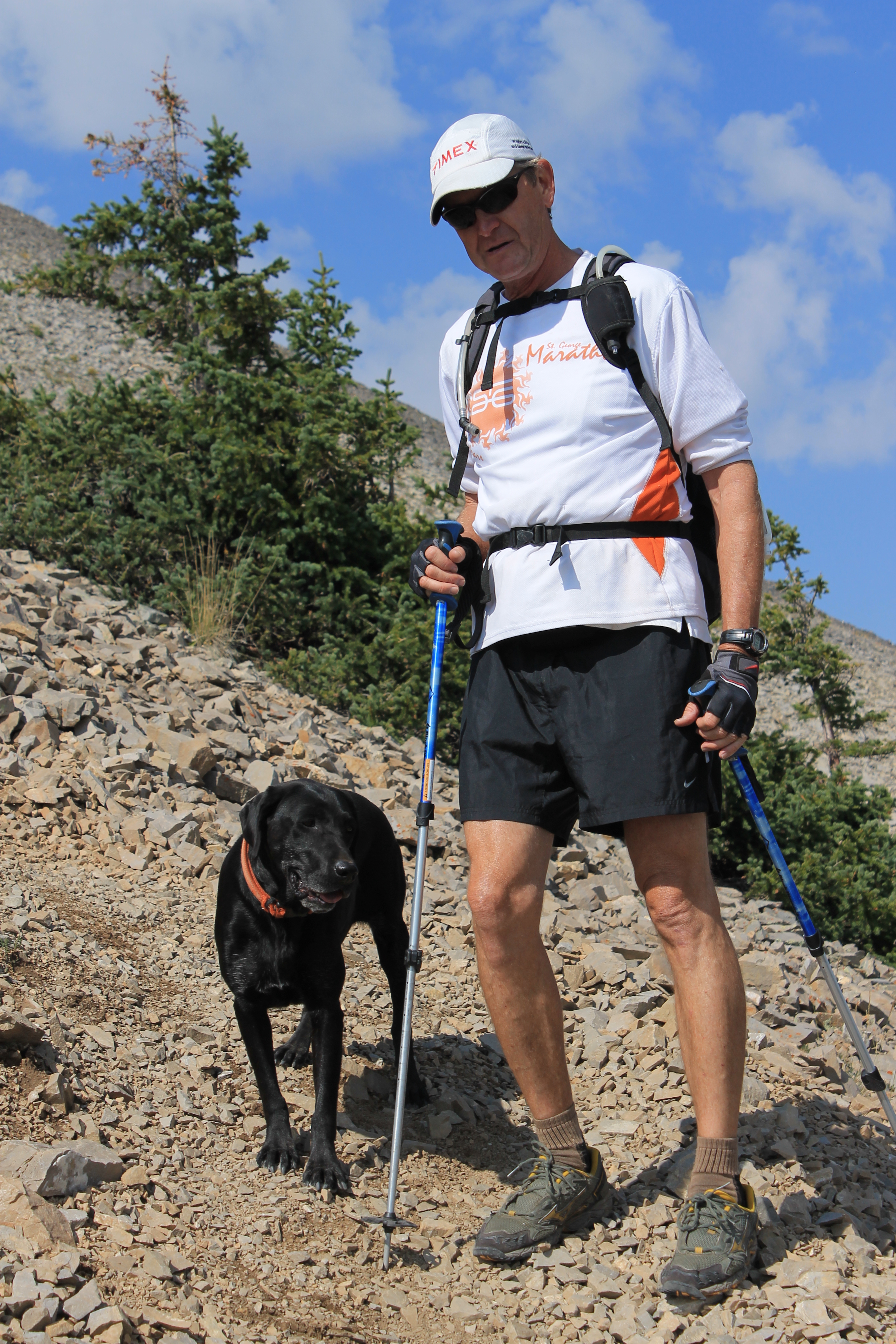 We meet a distant cousin of Laney
The summit of Mt. Nebo was visible from the trailhead but soon disappeared behind the mass of North Peak. The first two miles or so were gradual up and down hiking through forest. We weren't on a Forest Service trail but more of a climbers track. That meant that when it started up a steep slope it went straight up. No switchbacks. The steepness of the trail increased the amount of work as you were always working hard to stay in balance and take care not to slip on the steep dirt (more on that later). After an hour and a half of hard effort we crested the north ridge of North Peak and could clearly see Mt. Nebo and the final part of the route. It looked far off and there was an ominous dip between North Peak and Mt. Nebo, a saddle known as Wolf Pass. We lost enough elevation (which we consequently would have to climb on the return) that we couldn't even see down to the saddle. If there is one thing that hikers and climbers hate it's having to give up hard won elevation just to have to regain it again.
We made a long descending traverse along the west side of North Peak to reach Wolf Pass. We were two hours from the trailhead and were finally going to get onto Mt. Nebo itself. From the pass the track went straight up a long slope to a false summit, sometimes called Fourth Peak (Mt. Nebo has three official summits with the North Peak being the highest). If the route wasn't obvious just from the topography you could see a continuous line of hikers ahead climbing the big slope like so many ants.
 The main summit and ridge traverse from the false summit
I was taking some pictures so Devin got ahead of me. He was going well and just zoomed up the slope. I was feeling the altitude, my age, and my weight so I took it slowly. At this point I passed a group of hikers coming down who had two black labs with them. Laney would have liked the hike but would not have liked the sharp rocks on the upper part of the mountain. Her pads are quite senstitive. I stopped and chatted with one of the guys and got a picture of one of the black labs whose name was Heinie.
A little later I passed a father and his teenage son. The teenager was carrying a golf club in his pack. "So just how far can you hit an eight iron?" I asked. His dad replied with "About 700 yards, although it is a four iron."
I kept trudghing up. The slope seemed to go on forever but I eventually reached the false summit and found Devin waiting there for me. He had taken advantage of the break to have one of his favorite snacks - peanut butter and jelly on tortilla shells. Apparently some of the other hikers there had commented to Devin that this was a rather unusual food. From the false summit we started on the last part of the route. There was about a half mile of narrow ridge between us and the true summit. It dropped down (again!) about 300 feet before climbing back up. The track was usually about twenty feet below the crest on the west side and I followed that. Devin stayed on the crest of the ridge. It was more solid but it was also more up and down. But he had the extra energy for that.
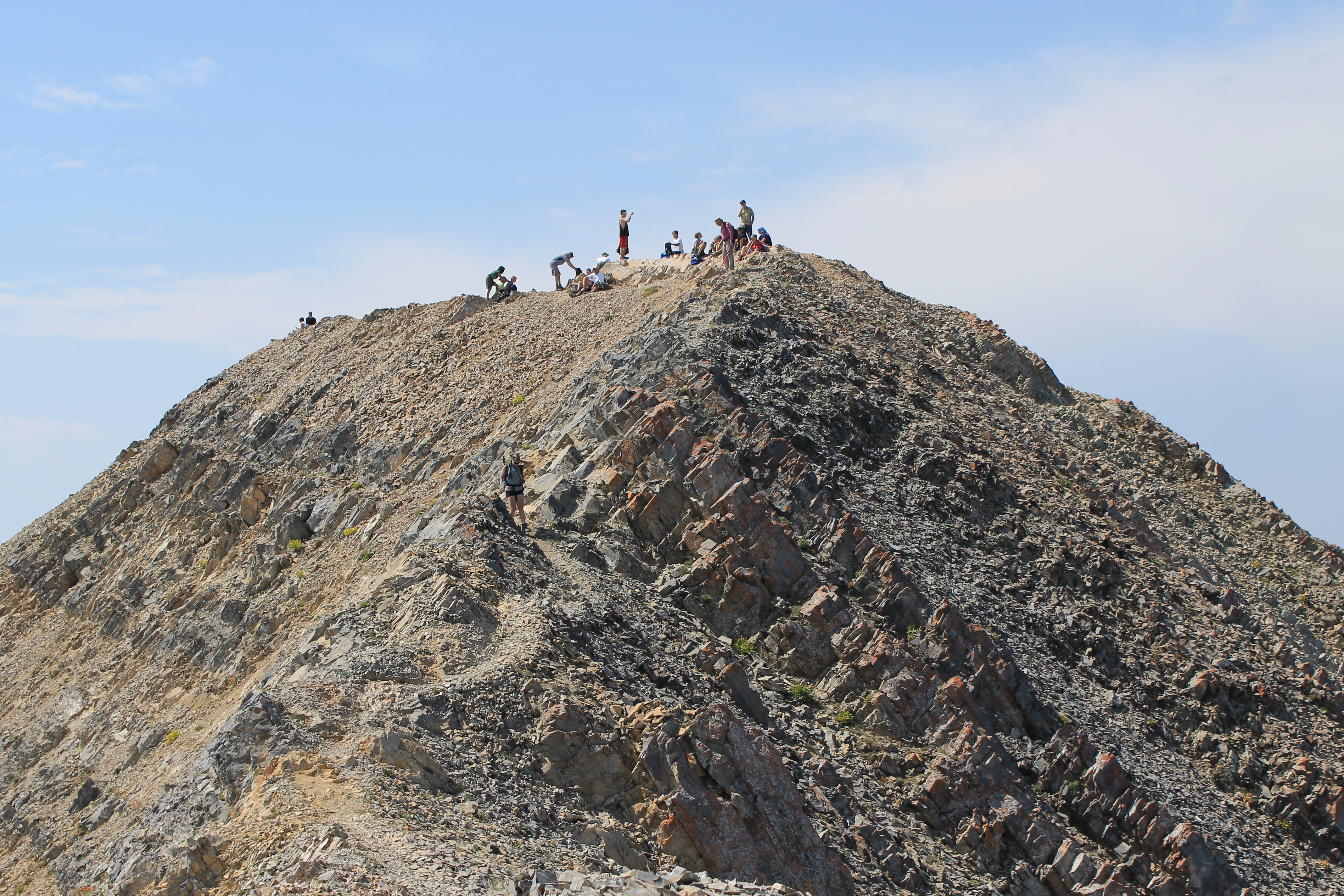 Almost there - but there's already a crowd on the summit
Eventually we reached the base of the summit block and the route steepened. The last fifty feet was a pretty good scramble that required hands and feet as well as careful routefinding to find an easy way up. When we got to the top of the slope the actual summit was only two minutes away. There were at least twenty people already on top. This was a busy peak considering how much work it was. There were two groups of Boy Scouts and various other hikers. But the summit area was large so there was plenty of room for everyone. We chatted with some of the other hikers and did the obligatory "we'll take your group shot if you take a picture of both of us". We ate a snack and drank some water while we enjoyed the view. There was some haze from smoke but it wasn't bad. We admired the ridge which continued on to the middle and south summits of Mt. Nebo. A very ambitious trip would be to continue along the ridge all the way to the south summit and then to take the Nebo Bench trail back for a large loop. Devin was all set to take off on it but I had to admit that I was pretty tired. And it would be very long. Besides the ridge (twice as much still as we had already done), one of the scoutmasters told Devin that the Bench trail was over ten miles each way with lots of ups and downs. That along with the fact that we could see stormy weather starting to form across the valley argued against trying the loop, even if I had the energy.
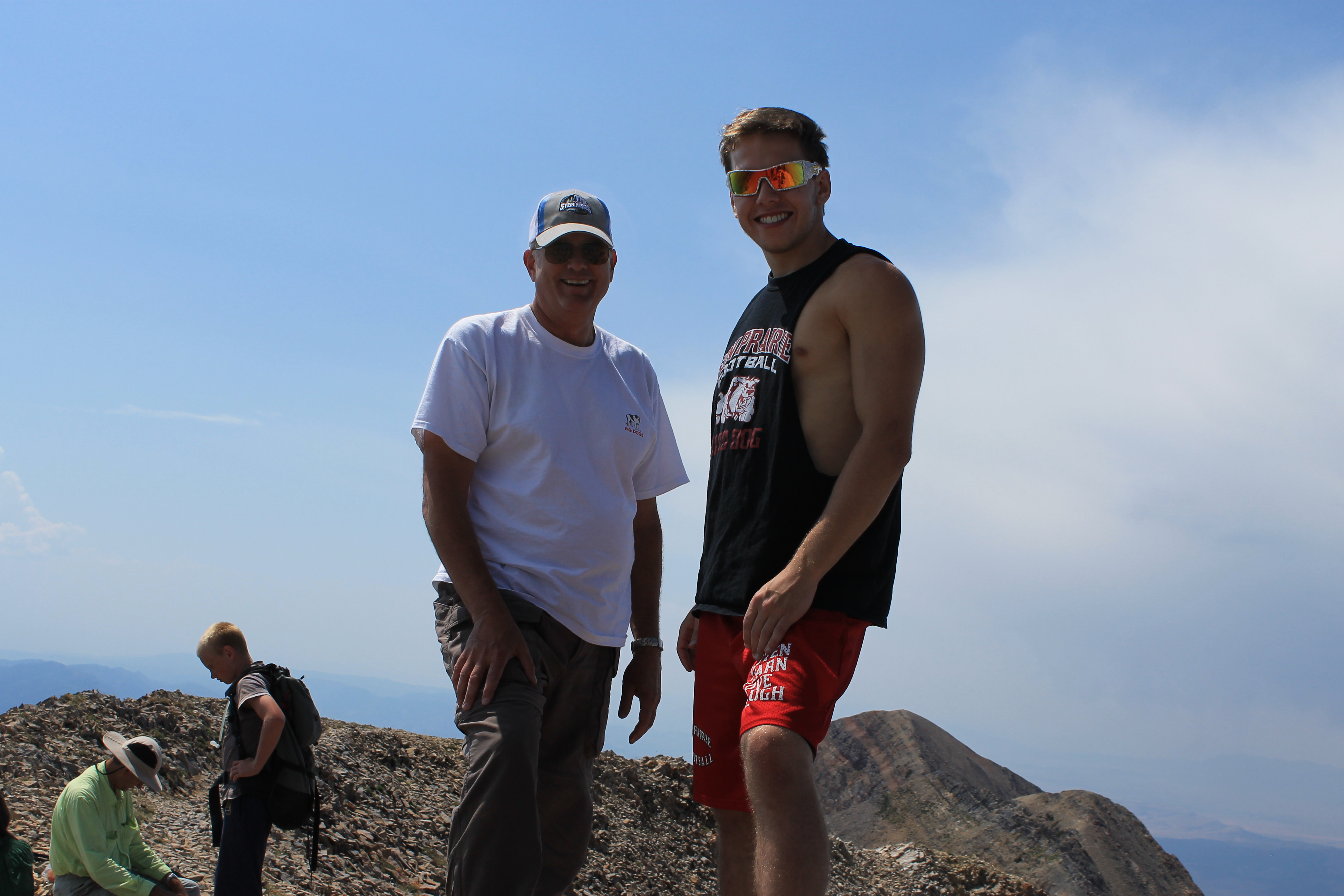 We look pretty happy to be on top of the world
With bad weather forming in the west we decided to start down. One of the attractions of this route was that a lot of it was along high ridges. That would not be a good thing in a thunderstorm. We wanted to get off the upper part of the mountain before bad weather arrived. No one else seemed worried though. As we headed down we passed lots of people still on their way up. Not a good idea at this point in my opinion. It's tough to turn around after you have worked hard to get so far and the summit is in reach. But if the conditions aren't good it is better to play safe. You can always come back another day.
We went down the ridge the way that we went up. Devin kept to the top which was more solid, more fun, but more work. I followed the track in the loose rock/scree/dirt/crap just below the ridgecrest. This worked well until I came to a short section of really steep, loose dirt. There was solid rock alongside for handholds that I had used when I climbed up. I started down and slipped. Just in the nick of time I grabbed the rock and caught myself, almost, yes! No. Down I went on my butt.
 False summit in sun - North Peak and Mt. Timpanogos behind
That was fine. I wasn't worried about my dignity. Ok I did get a bruise but not where anyone is going to see it. But as I went down my arm brushed against the rock and I ended up with several long scratches. At first I was worried that they were deep cuts but they turned out to be very shallow. After bleeding for a little bit they closed up and were fine. But I looked like a refugee from a horror movie heading down the mountain. People would ask if I was alright and if they could help. Sure - call for a helicopter. Otherwise I couldn't think of anything that would help.
We made it down to Wolf Pass in a little over an hour. On the way up we had thought about returning by going over North Peak instead of around. The weather was still good but the bad weather looked closer. I voted to head down by the quickest way. Even at this point though we were still passing people heading up. Our decision was vindicated. We were about a hundred yards from the car when we felt the first sprinkles. We made it to the car, changed clothes and drove off just as the rain started to get serious.
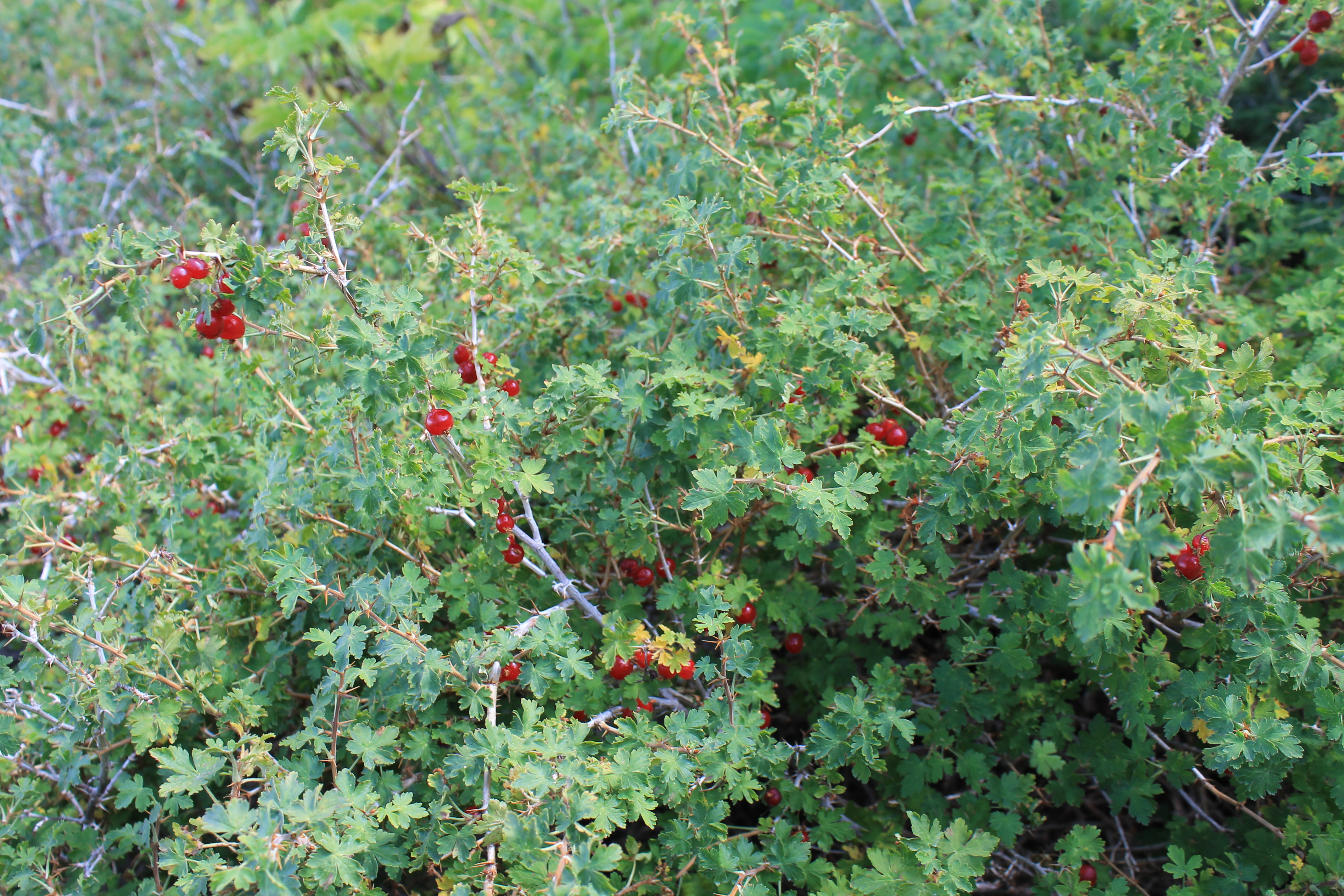 Sandy - there really were wild currants all along the lower trail
It was a great climb. We made it up in four hours and fifteen minutes and down in three hours. Not great but respectable times. Devin did really well for his first time in the mountains. He said that he really liked it. He was strong on the route but was patient when I was slow. He agreed with the decision to go down when it was the right thing to do rather than trying to do more. He loved being in the mountains, enjoyed being up high on the ridges, and liked the physical challenge of the climb. On the way driving home we resolved to do more hiking/climbing together next summer.
One final note. Sometimes you are lucky and find delicious wild berried in the mountains. Several times on recent hikes with Sandy I thought I saw something that looked like wild currants but always turned out to be something else. On this trip there were lots and lots of bushes in the forest which had ripe currants on them. I ate some (Devin tried them too) and they were very sweet. A special treat on this hike.
