Zion Hiking 2012
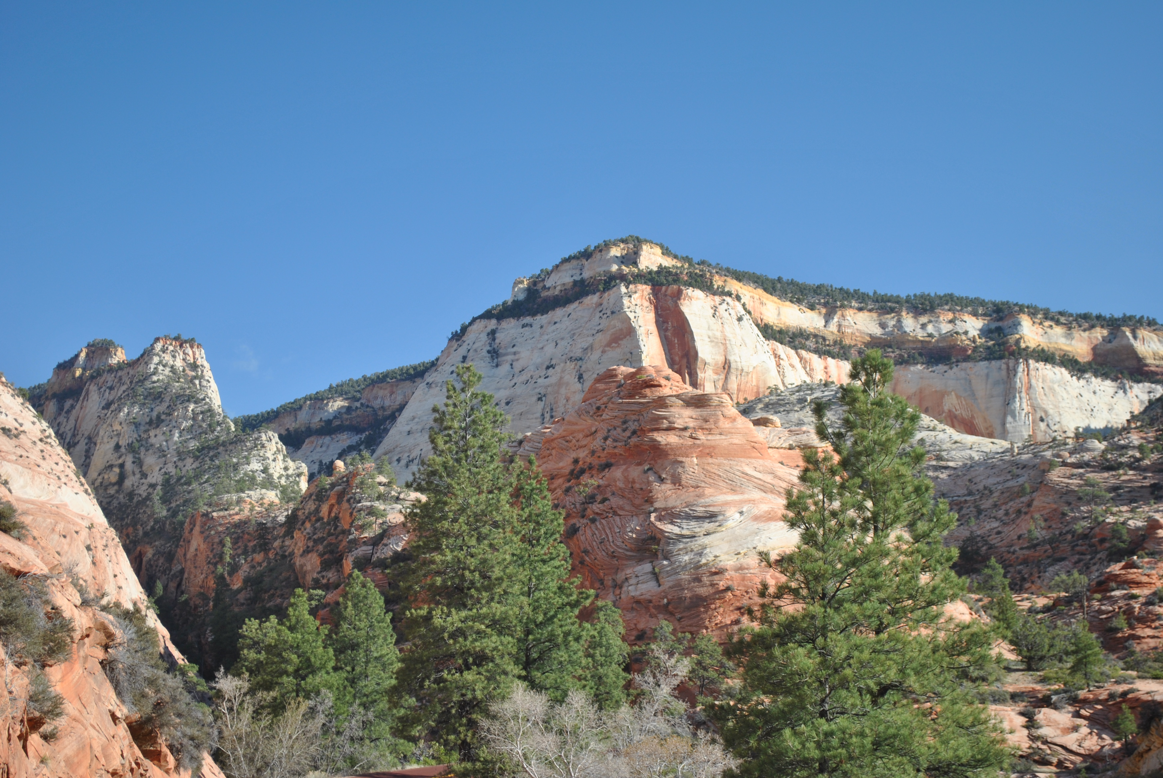 Near the trailhead for the East Rim Trail
I'm always anxious to start hiking when spring comes around each year. The snow in the mountains doesn't melt enough for trails to clear until about the beginning of July. An excellent spring alternative though is the canyon country of Utah. As soon as the first weekend of April rolled around I was ready to go. Sandy was back in Wisconsin for her mom's birthday. I made arrangements for Laney to stay with the dogsitter and took off for a three day weekend to Zion, one of my favorite national parks.
At work I had covered a couple of evening events for Ivan so I was able to leave midday on Thursday. I didn't get away as early as I hoped but at 12:27 I was at the stop light at Avenue A and Front Street, leaving the parking lot to start the journey. I made good time for the first half of the trip, only making the usual gas stop in Burley. It didn't take me long to figure out that I would hit Salt Lake City at the worst possible time. Sure enough. At exactly 5 pm I was just driving past the Temple in downtown SLC. The traffic was heavy but moved pretty well. For years there had been construction on I15 through Salt Lake so now there were lots of lanes to handle the traffic. I made good time for a while but I knew I'd hit a problem eventually. When I215 came in from the West Valley it created massive congestion. Traffic slowed to a crawl and I probably lost a half hour till I finally got out of South Salt Lake and over the hill. From driving through the area many times the past two years I knew that the construction had just moved south to the Utah Valley. Before I hit Orem the construction started. Traffic got totally snarled again. The lanes were really narrow. Just all around not fun driving. I probably lost another half hour till I got through the construction which extended all the way through Spanish Fork. But after that it was clear sailing. I stopped for dinner at McDonalds and made it to Cedar City before 9pm.
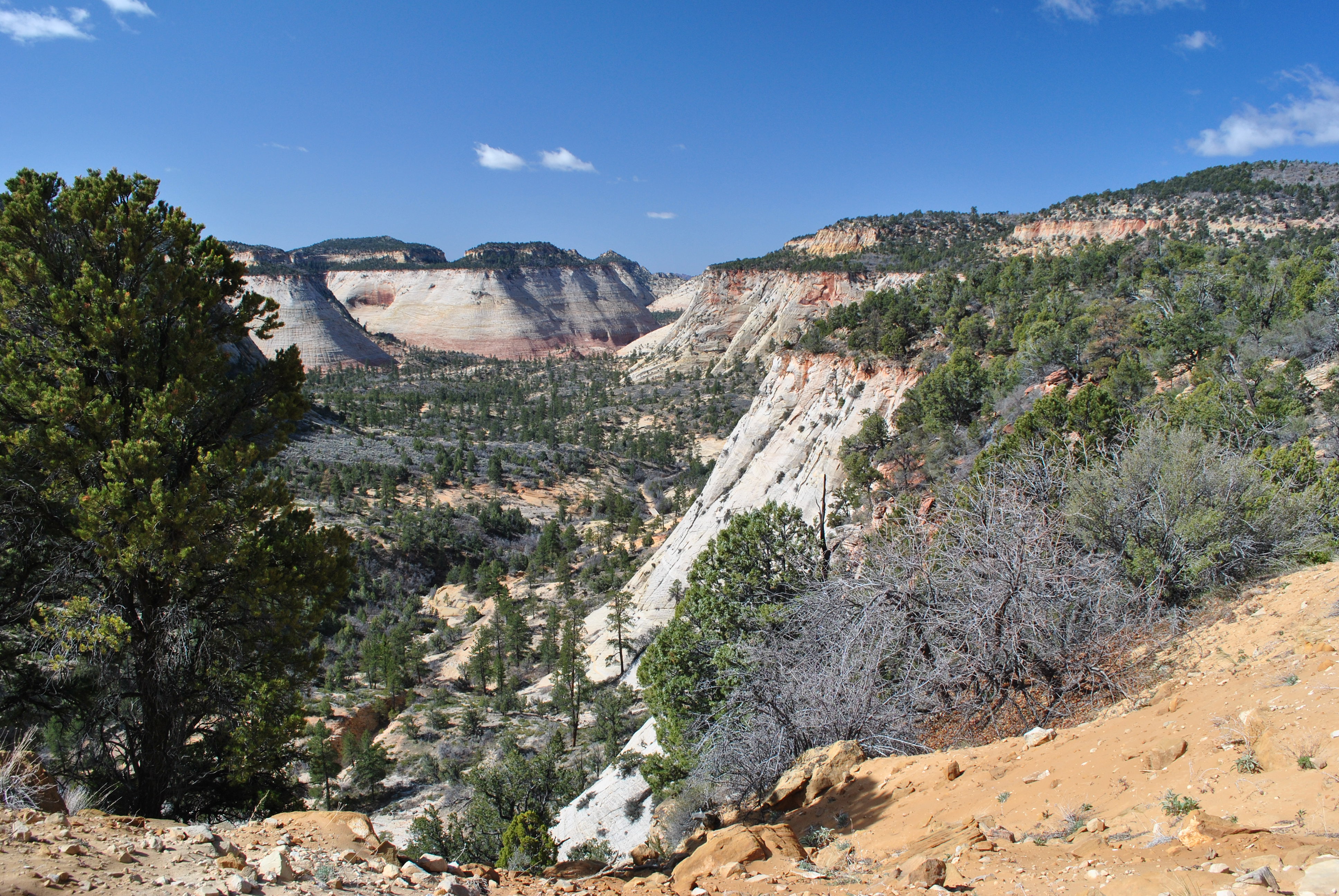 Looking back on the trail in Clear Creek Canyon
Cedar City is my standard stopping point on my way to Zion National Park. There are lots of places to eat and lots of places to stay. It's cheap too, especially if you leave the freeway and drive downtown. I got a deluxe room for $35, complete with wifi and free breakfast. By comparison a room in Springdale, just outside the park, is about a $135. I did some email, read my book and turned in early.
I was up bright and early at 6:15. I had breakfast (two bowls of Cheerios - I knew I would need energy), filled up with gas, and left Cedar City. It was a beautiful day. The drive to Springdale, just outside the park, took about an hour and fifteen minutes. I stopped at the motel that I was going to stay at for the night. I knew I couldn't check in first thing in the morning but I wanted to make sure that my reservation was good. The lady at the desk assured me that I would be fine no matter what time I showed up. From there I drove into the park. You can't drive into the valley anymore - you have to take a shuttle for that. It's too bad but there are just too many people so it is the right thing to do. I feel like an old codger when I say "I remember when you could drive your car through the valley". But today I wasn't going to Zion Canyon, at least not by car. I drove up the hill and through the tunnel to the Zion high country. The trailhead was just inside the East Entrance to the park. I found a parking spot and got ready to hike.
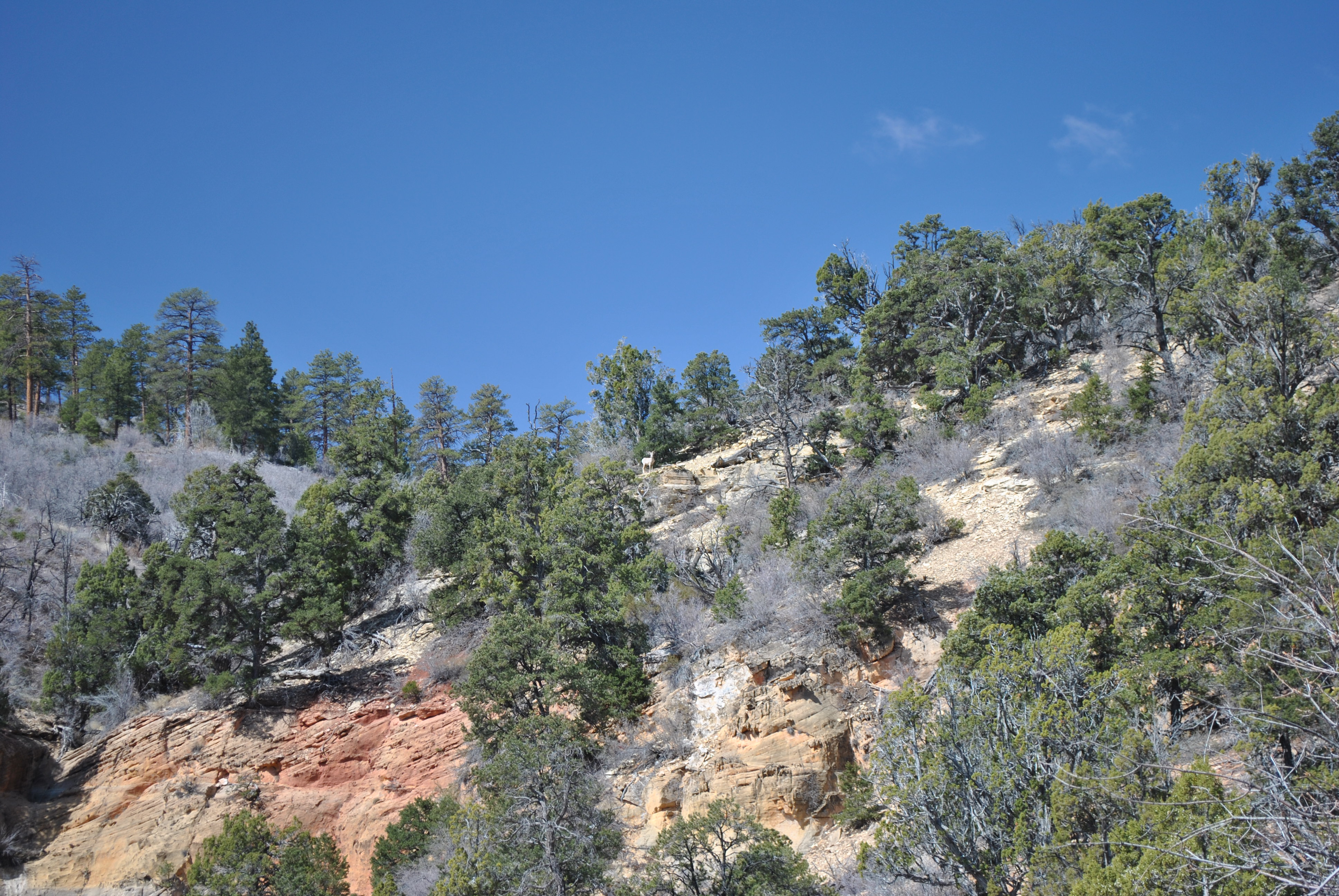 A mountain sheep watching me hike from high on the hill
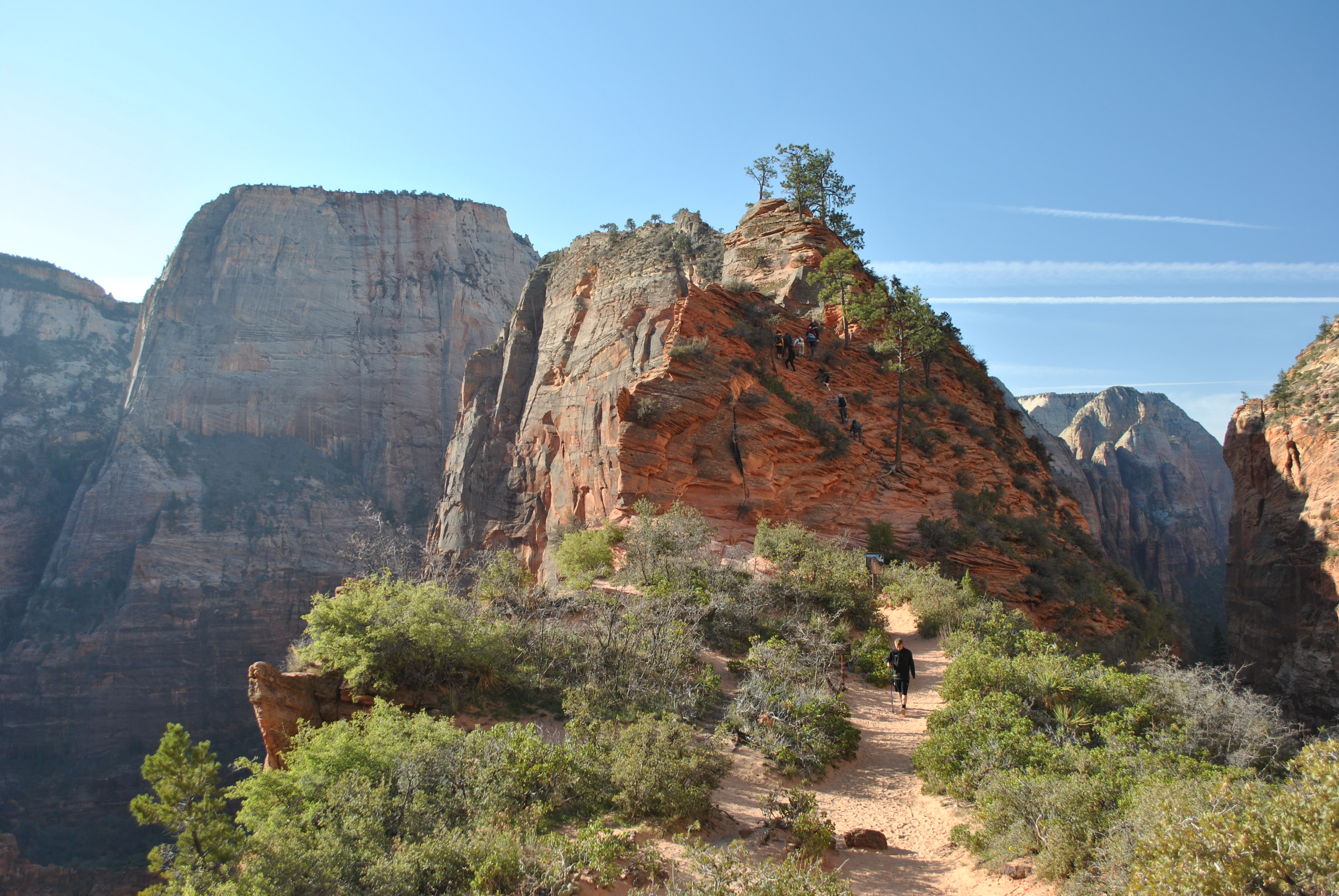
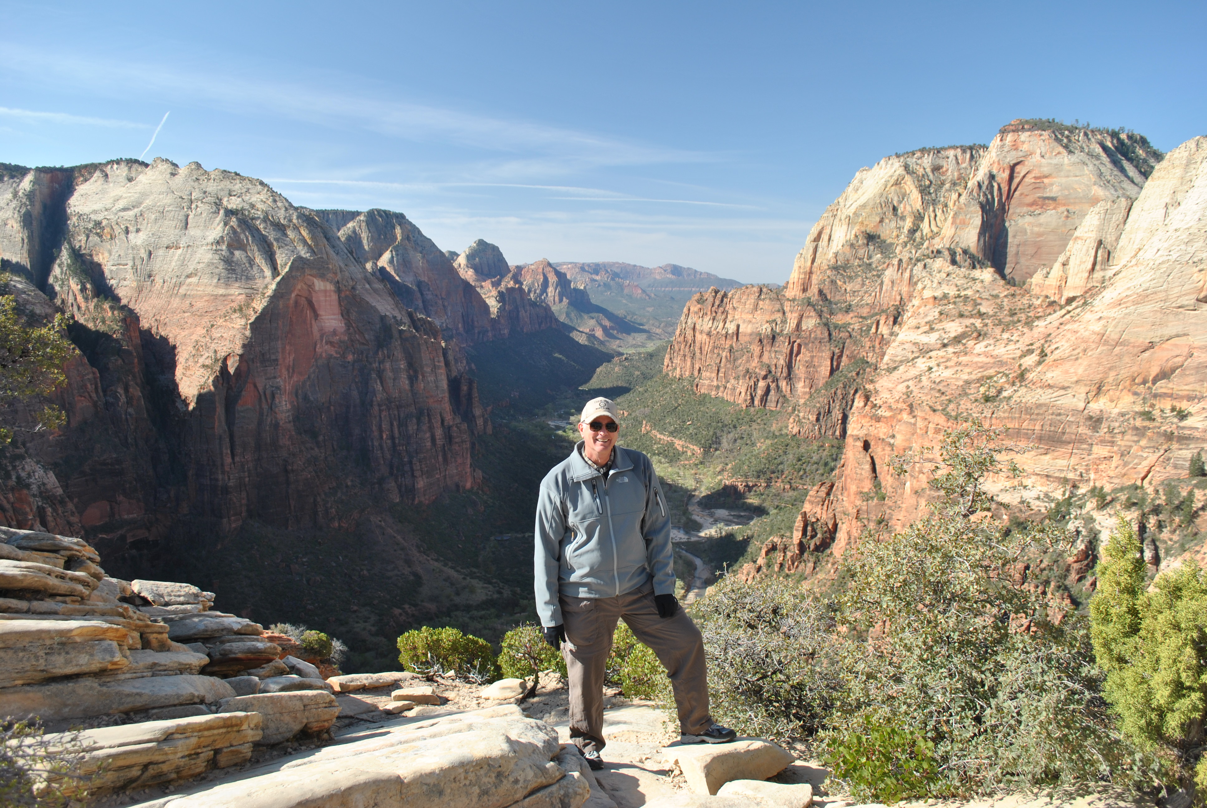
Since I have been to Zion NP many times I have hiked all of the trails from the valley, most of them multiple times. Today I was going to do something different. The East Rim Trail runs from the valley floor up to the high plateau. There it splits and one trail goes to Observation Point. I have hiked that many times and it is one of my all time favorite hikes. The other fork heads towards the East Entrance of the park, with branches that go to other points on the rim of Zion Canyon - Deertrap Mountain and Cable Mountain. My goal today was to start at the East Entrance end of the trail and hike to one of the points on the canyon rim. Some people do it as a through hike. That is shorter but requires a two-car shuttle between the trailheads. Since I was on my own I had to do the long hike to the rim and back again in one go. The sign at the trailhead said eight miles to Cable Mountain. A long way there and back but I had the whole day to do it. Unfortunately because of my new job I wasn't in as good a shape as I had been when I went hiking the previous spring.
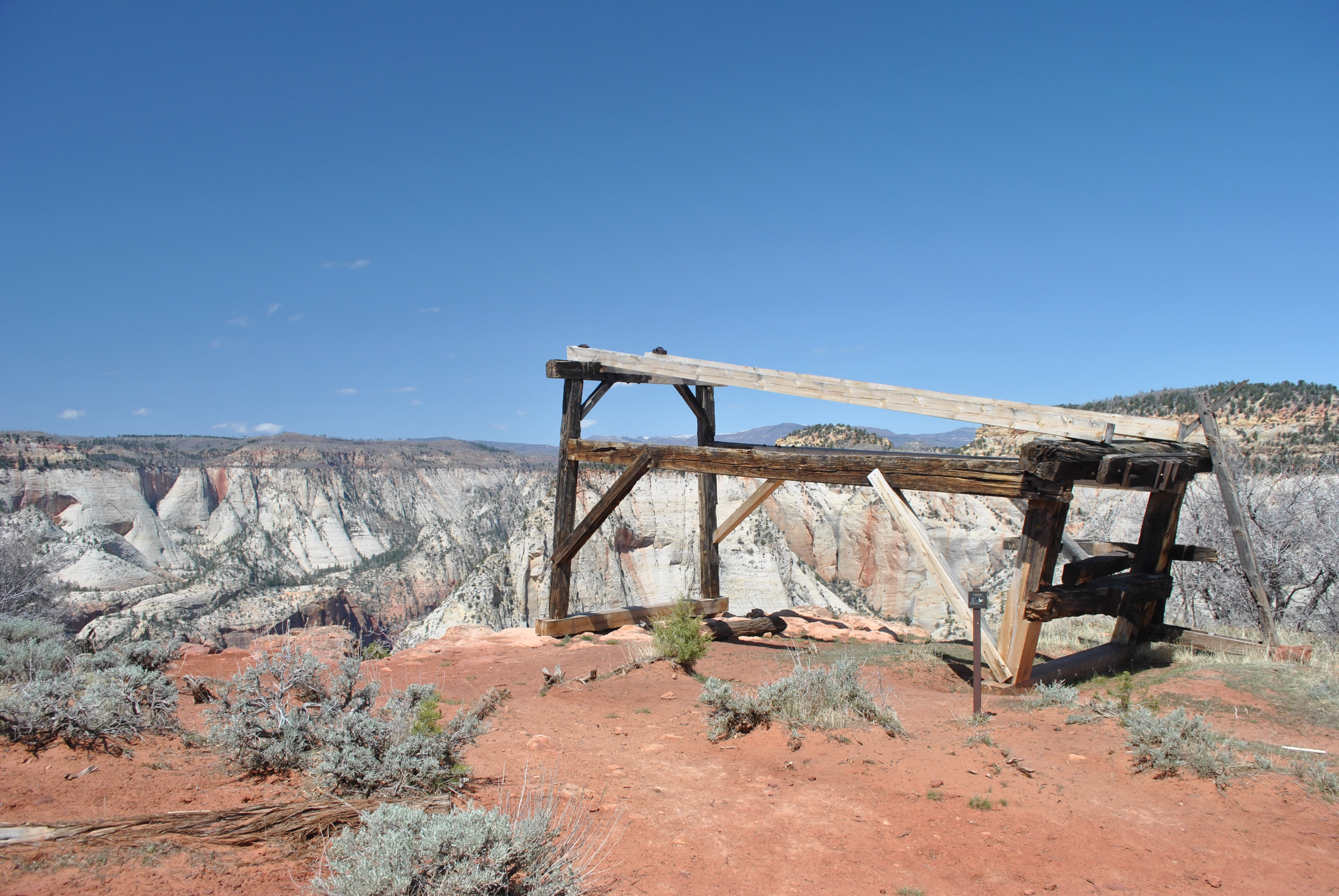 Cableworks on top of Cable Mountain
The trail started up Clear Creek (dry) gaining elevation very slowly. Eventually it got high enough to give views of the white cliffs and Checkerboard Mesa, one of the landmarks of the Zion high country near the east entrance. Good hiking and very scenic. As the trail moved onto the forested plateau I noticed a mountain sheep on a nearby hillside watching me. I hike in the mountains a lot but I haven't seen them very often. Very cool. Then the trail passed the head of Jolley Canyon, a steep canyon that provides impressive views but would not be fun to travel through. The trail took a wide circle to avoid it and pass by the head of the canyon. From there the hike went for several miles through easy but not very interesting country. I was on a high plateau with gentle hills that were covered in pine forest. So the next two hours of hiking were not too difficult but not that remarkable. The only section of the trail that had any views allowed me to see some private homes off to the east that were just outside the park. They were impressive but to be honest they kind of spoiled the whole national park, hike in the wilderness thing.
 View of Angel's Landing and canyon floor from Cable Mountain
At about five miles I reached Stave Spring. It was just a half inch pipe sticking out of the ground with a trickle of water flowing out of it. Not very exciting unless you are doing the trip as a backpack. Then it is the only place where you can camp where there is any reliable water supply at all. That is a big deal in the high desert country of Zion. From there it was a gently rising forested trail until at eight miles I finally broke out of the trees and was at the rim of the canyon at Cable Mountain.
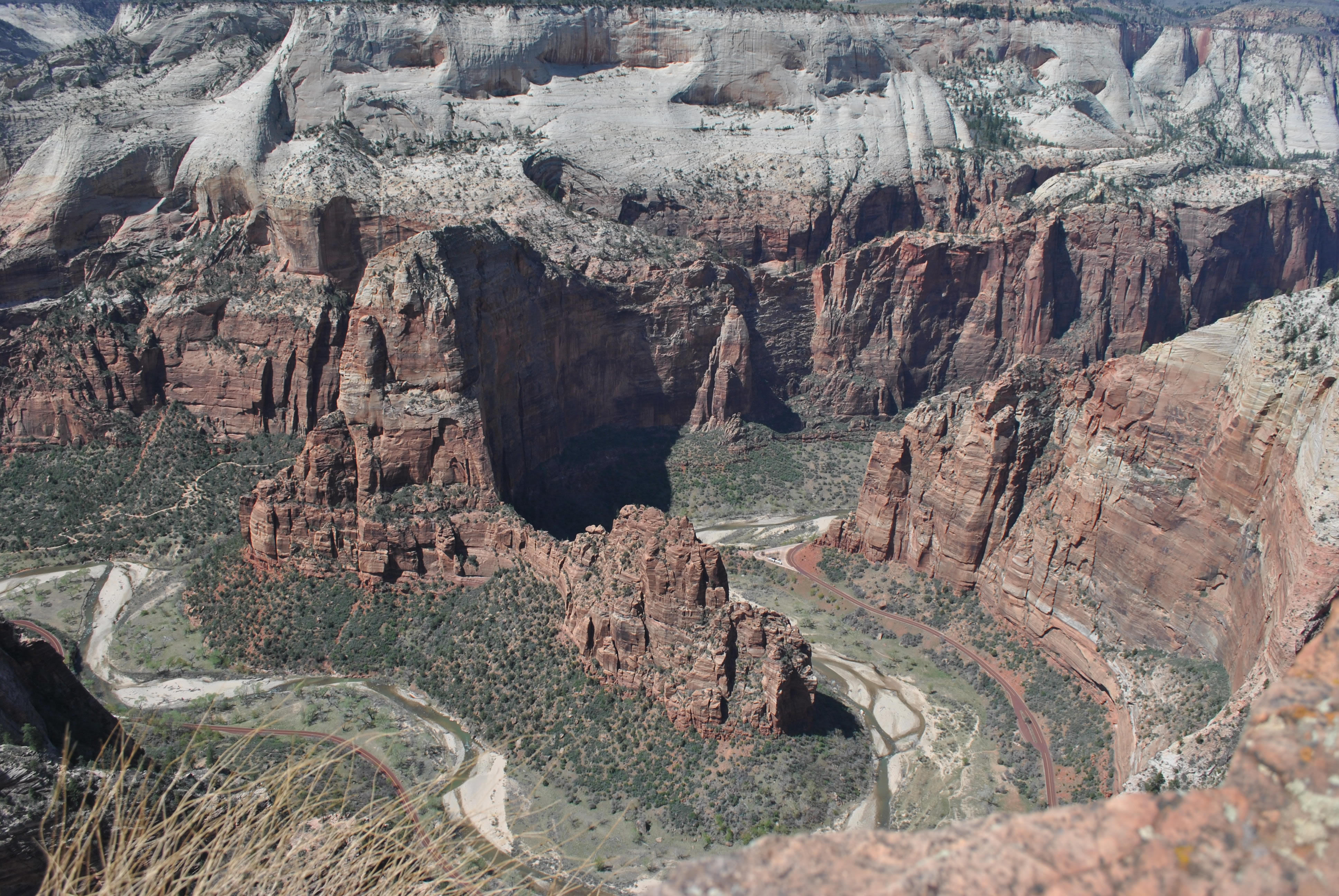
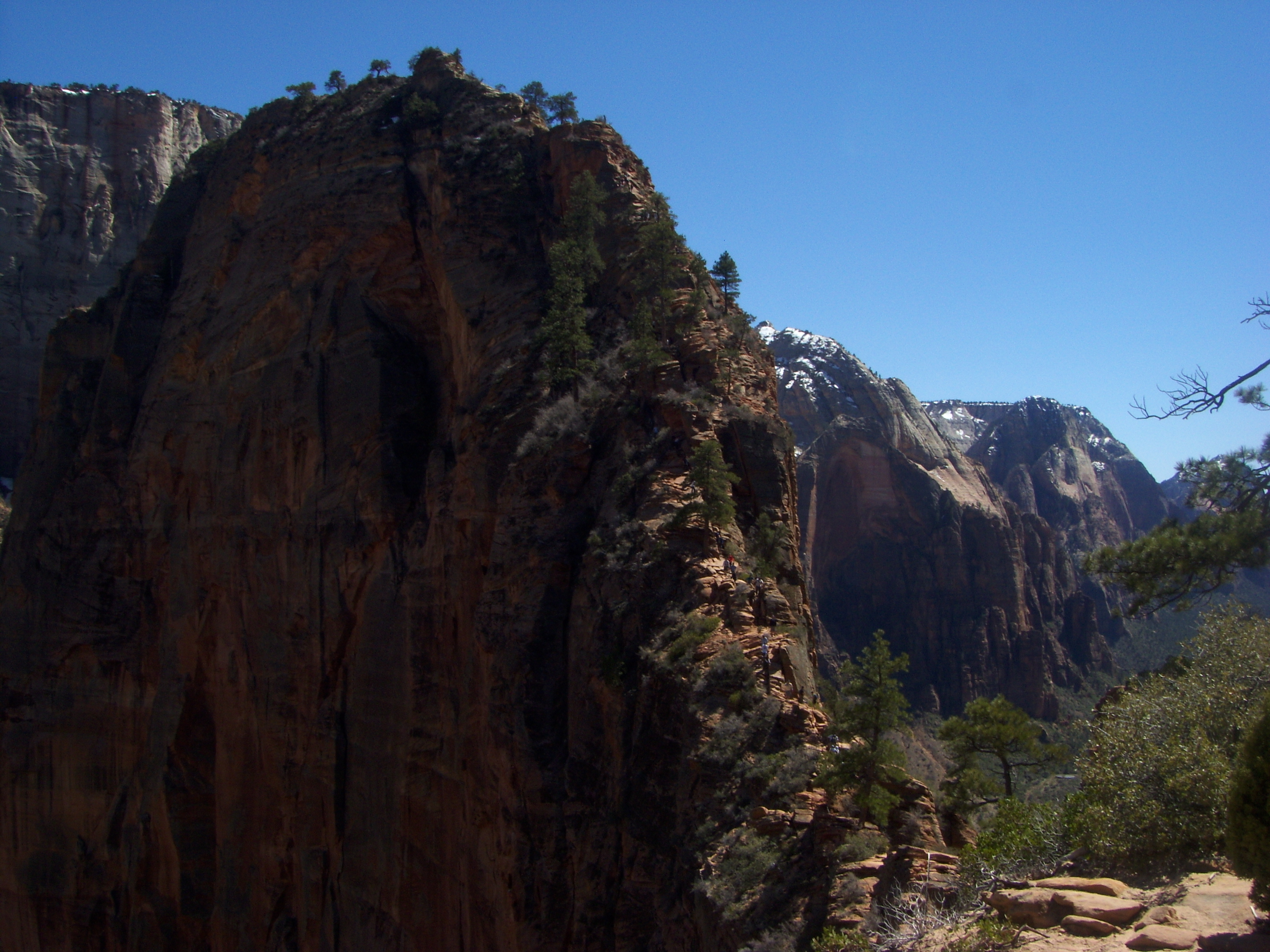
Cable Mountain is named for the cableworks on the rim of the canyon. It is not really a mountain - just a high point on the rim of Zion Canyon. In the early 1900's the cableworks was built to lower timber cut on the plateau into the canyon. It saved several days of heavy hauling to get the lumber into the canyon the long way. The frame of the cableworks is still there although it looks quite rickety. Signs warn visitors not to climb on, touch, or even walk under the frame. I lived dangerously by actually walking under the frame to get to the rim. On many previous trips to Zion I had seen the cableworks from many vantage points in and above Zion Canyon. It was fun to actually be here now. I will admit that I got down and crawled to the edge to look over the cliff that logs were dropped down to the valley floor below. It was a spectacular view. I could see the valley floor and landmarks like Angel's Landing. I could see down into Echo Canyon, part of the hike to Observation Point that I had done several times. And I could see the Observation Point trail blasted out of the cliff with people hiking up and down. Quite a vantage point.
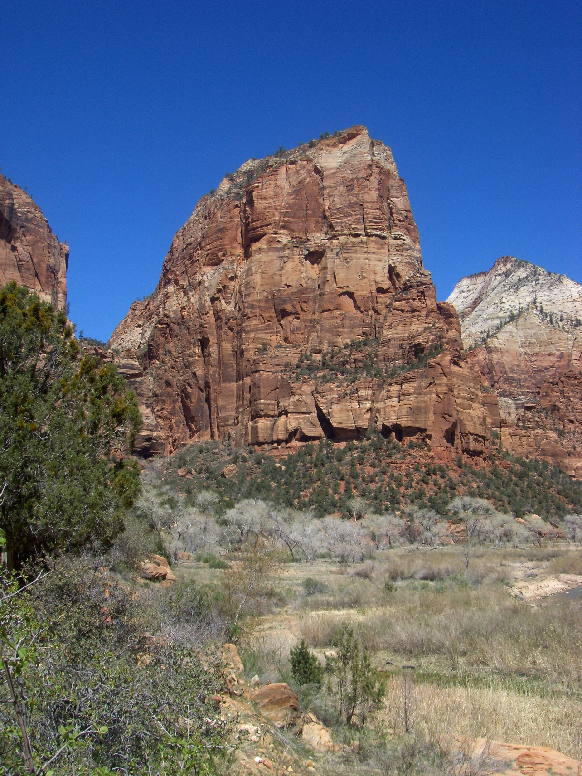 Angel's Landing - route follows the left skyline
Eventually I crawled away from the rim, sat down, and ate my trail lunch. Then it was time to head back. The return trip was several hours. Hard work but uneventful. I was glad to get back to my car. My take on the trail was that it was good but not great. There were nice views at the start and the rim viewpoint was spectacular. It had the advantage of being virtually empty - I only saw three parties past the first couple of yards from the trailhead. But when I compare it to the Observation Point trail it doesn't match up. I did the trail and I am glad that I did. But when I go back to Zion I will repeat the Observation Point trail for the fourth? fifth? sixth? time rather than do this trail again. This one is in the bag and done.
When I reached the car I headed for Springdale and checked in at my hotel for the night. I had a really nice room but didn't have much chance to enjoy it. The hotel was almost a mile from the main part of Springdale. Since my hike had been quite long I felt that it was ok to take the free shuttle. I needed to save some energy for the next day's hike. I checked out my favorite restaurant in Springdale, the Zion Pizza and Noodle Company, but the line was down the stairs and out the door. I was too hungry to wait around for a couple of hours. I still had memories of my experience at the Salt Lick on my visit to Texas. I went to look for other options. I found a restaurant that I could get into and had a good dinner of salad and spaghetti and meatballs. After dinner I was tired. I didn't even do any tshirt shopping. I just went back to my hotel and went to bed.
 Switchbacks leading up to Refridgerator Canyon
My objective for the next day was the Angel's Landing Trail. This is one of the classic hikes in North America. Angel's Landing is a steep fin of rock that soars 1600 feet above the valley floor at a bend in Zion Canyon. It is connected to the canyon walls by a thin ridge of rock. Although it looks impossible to reach the top there is actually a trail that was built by the park service back in 1926. It is not your typical hiking trail. The lower portion is blasted out of a steep cliff face while the upper section follows an exposed knife-edge ridge to the summit with steel cables strung to provide handholds. There is a lot of exposure on the route and it definitely isn't for people who are not sure footed or who are afraid of heights. Along with the cable route on Half Dome, it is more like an easy European-style via ferrata than a hiking trail. From my vantage point on the canyon rim at Cable Mountain I had an incredible view looking down onto Angel's Landing from above. I was psyched to do it.
 View from Scout Lookout - Cable Mountain on the right
I had been to the top of Angel's Landing twice before. Sandy and I did it back in the 1990's on her first trip to Zion. I am actually quite impressed because my wife is not inclined toward climbing and mountaineering like I am. She likes to hike but isn't into the whole hang-from-a-cliff-by-your-fingernails-technical-climbing thing. But we did make it to the top way back then. I don't even remember any screaming or crying or threats - from me or her! A few years later we had a family vacation in Southern Utah when Mickey and Shannon came to Zion with us. We all hiked up to Scouts Landing, the viewpoint just before the real difficulty and exposure start. Sandy waited there while the kids and I started up. We didn't get far before they felt uncomfortable so we turned around. It's important for everyone to make their own decision about whether they want to do the Angel's Landing Trail or not. Instead we spent the rest of that vacation playing golf in St. George, which was also a lot of fun.
 Beginning of the cable route above Scout Lookout
The second time I did Angel's Landing was in April 2010. I did a trip to Zion on my own. I arrived in Springdale around noon, had lunch, checked into my hotel, and then decided to do a half day hike in the afternoon. Angel's Landing seemed perfect. It would be a good chance to prove myself again since we hadn't made it all the way to the top on the last try. It was a warm, sunny afternoon in the first week in April (the eighth to be precise). A perfect day to try Angel's Landing again. Wrong! The trail was mobbed and on the exposed upper part the crowds of people on the cable route were a major hazard.
Zion is one of my favorite national parks but I am not the only one who thinks that. It is in the top ten most visited national parks with between two and three million visitors every year. Since summer is too hot and winter too cold and snowy, most visitors come in April/May or September/October. My 2010 trip was the first time that I encountered the canyon shuttle system. There is a huge parking lot near Springdale at the west entrance to the park. If you are going into Zion Canyon you hop on the shuttle for the ride in. Private cars are only allowed in with a special permit - which you only get if you are an overnight guest at the Zion Lodge inside the canyon. You can drive your car into the park - US highway 9 goes through the park and continues to the town of Mt. Carmel Junction in the next valley over. But the spur road into Zion canyon is prohibited for private cars.
 The final steep ridge leading to the summit comes into view
Ok, back to hiking Angel's Landing in 2010. I parked my car just outside the entrance in one of the huge parking lots provided for people who are catching the shuttle. I grabbed my hiking stuff and walked into the park. Not along the highway. No standing in line with cars breathing their exhaust fumes. There is a special hikers only entrance. The Virgin River is the park boundary here and there is a pedestrian bridge with a small entrance kiosk. Pay the (lower) pedestrian entrance fee and walk into the park. The new Visitor Center is just across the river and that is where I caught the shuttle into the canyon. The shuttles run often during the middle of the day and there is plenty of room to sit. The drivers even give a narrative of the geology and history of the park which is quite interesting, at least the first five times that you hear it. Not too bad a system although there is the potential for getting separated from your hiking partner. Of course there's no way I could be that dumb. But with the number of visitors to Zion National Park every year there is no choice. The shuttle system is the best way to deal with the huge crowds of people. The only other options would be limiting visitors with some kind of quota system, or complete chaos.
 Following the cables up the home stretch
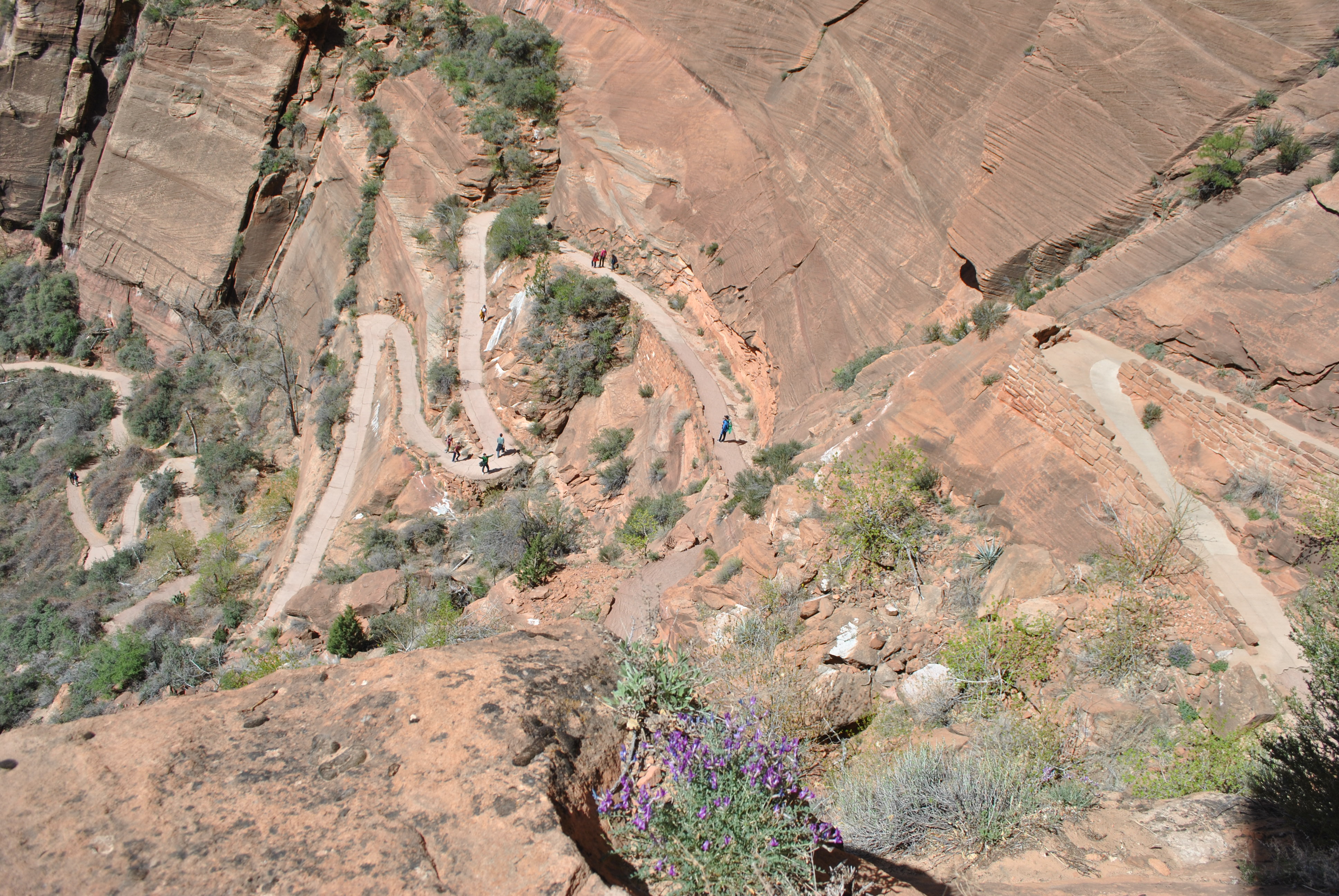
The shuttle dropped me right at the Grotto trailhead along with dozens of other hikers. The trail starts across the road and immediatly crosses the Virgin River on a footbridge. It rises gradually as it follows the river for about half a mile. There is a beautiful view of Angel's Landing on this section and it looks absolutely impossible. The trail continues toward what looks like a dead end of cliffs. But it climbs out of the apparent cul de sac in a series of switchbacks that were blasted out of the cliffside. Although the trail is at least five feet wide here you begin to hear the first complaints about exposure. It is guaranteed that the people who are worried on this section will not make it anywhere close to the top. Lots of people only go as far as Scout Lookout, which is a spectacular viewpoint and well worth the hike for itself.
At the top of the first set of switchbacks the trail enters Refridgerator Canyon. This is a narrow hanging canyon that one would never guess was here when looking from the valley floor. It is very narrow with steep cliffs on both sides. Because it is so narrow and deep the sun rarely reaches the bottom of the canyon. That makes it shady and quite a bit cooler than the trail either above or below. Hence the name Refridgerator Canyon. It is a welcome relief on a warm afternoon after the steep switchbacks in the sun. It's not so pleasant on chilly mornings when a freezing wind always seems to be rushing through the canyon like it was a wind tunnel.
 Hikers cautiously enjoy the view from the top
Warm or cold the level floor of Refridgerator Canyon is the only respite from steep climbing on this trail. After about fifteen minutes of easy strolling it is time to start up Walter's Wiggles. This is a series of twenty one short, steep switchbacks that zigzag up a weakness in the cliff wall. Named for the first park superintendent who helped design the trail, they are made famous by numerous "I hiked Walter's Wiggles" tshirts for sale in town. Yes, I have one. Did you even have to ask?
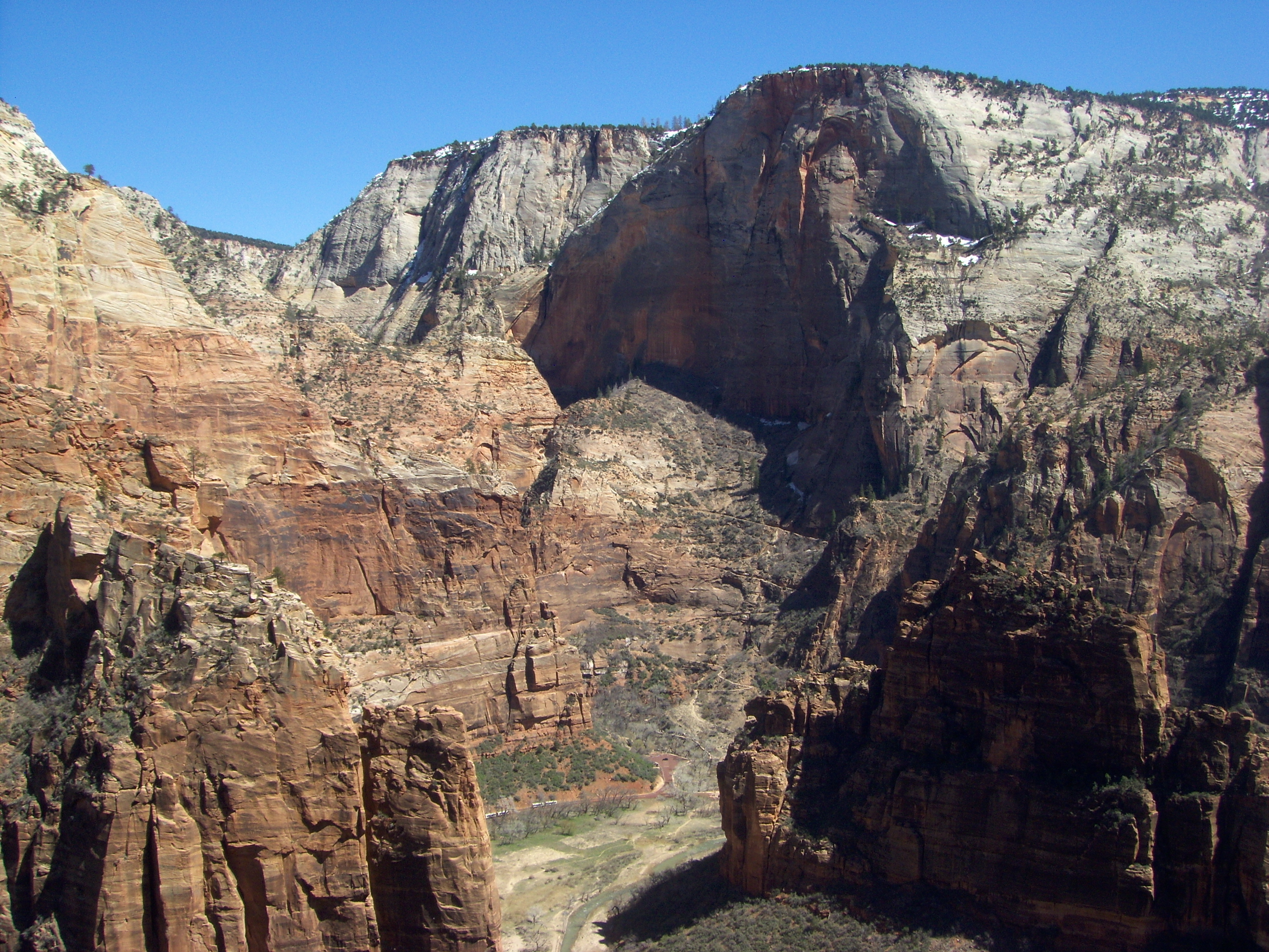
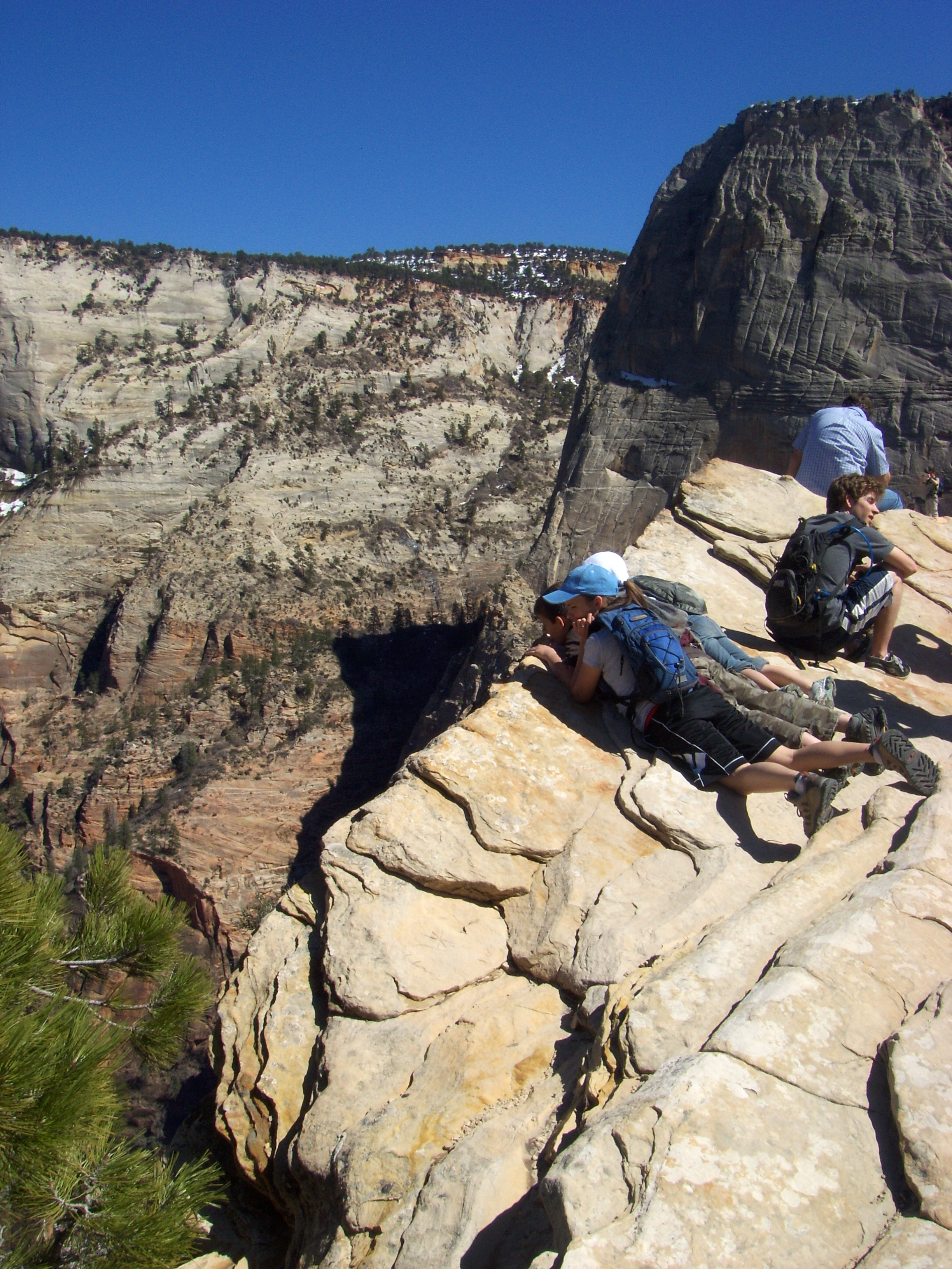
After you "squiggle the wiggles" you emerge at Scout Lookout. This is the large saddle between the peak of Angel's Landing and the main canyon wall. The view looking towards Observation Point and Cable Mountain is spectacular. The dropoff on the other side is even more spectacular - twelve hundred feet straight down. It is an impressive place and half the hikers either turn around here or wait while the more adventurous in their party continue on to the top. While there is a large flat spot at the saddle the edge on the east side is a sheer dropoff and there are no guardrails. Accidents occur even here. Exactly three weeks after I was there a hiker fell to her death.
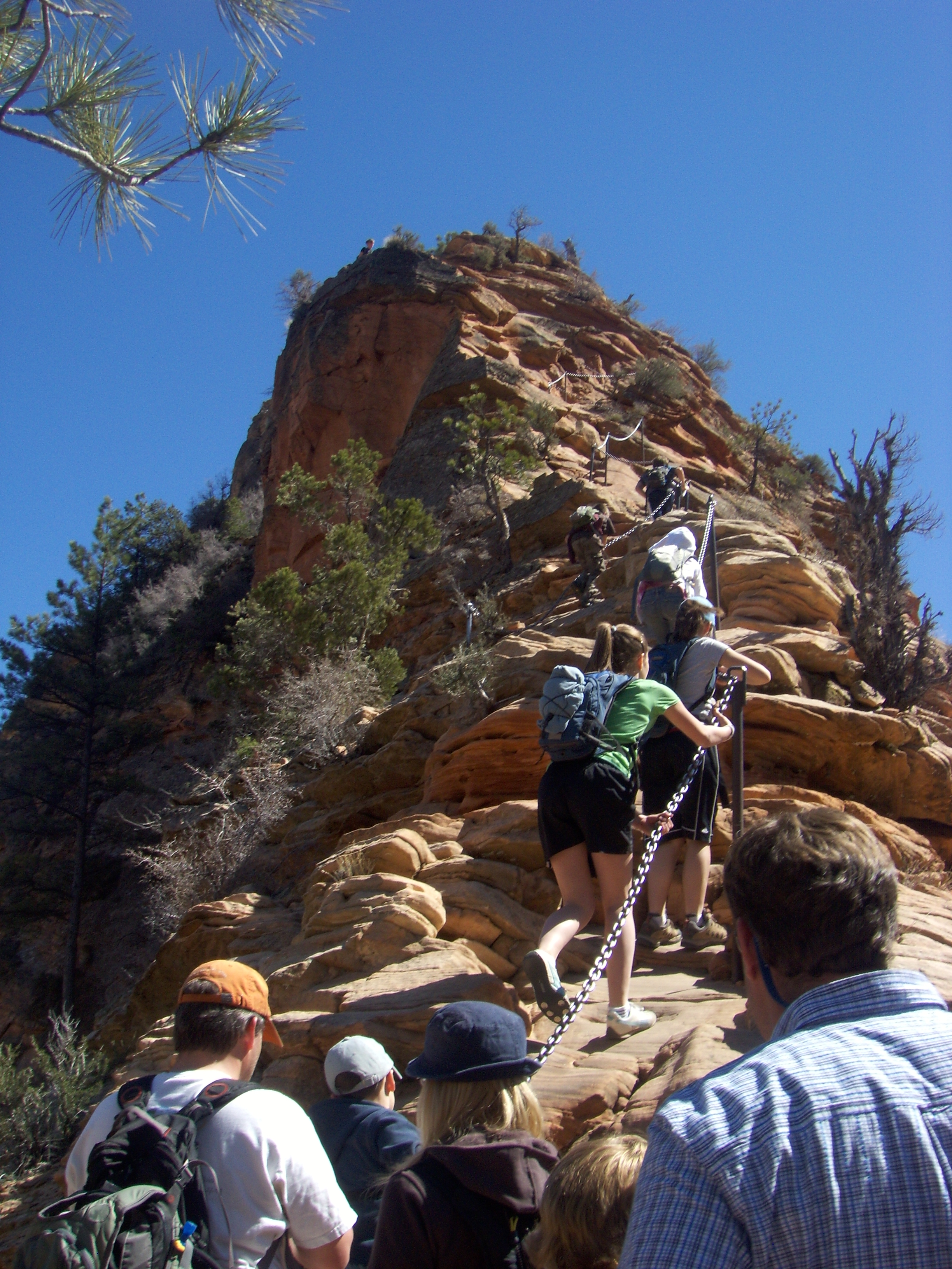
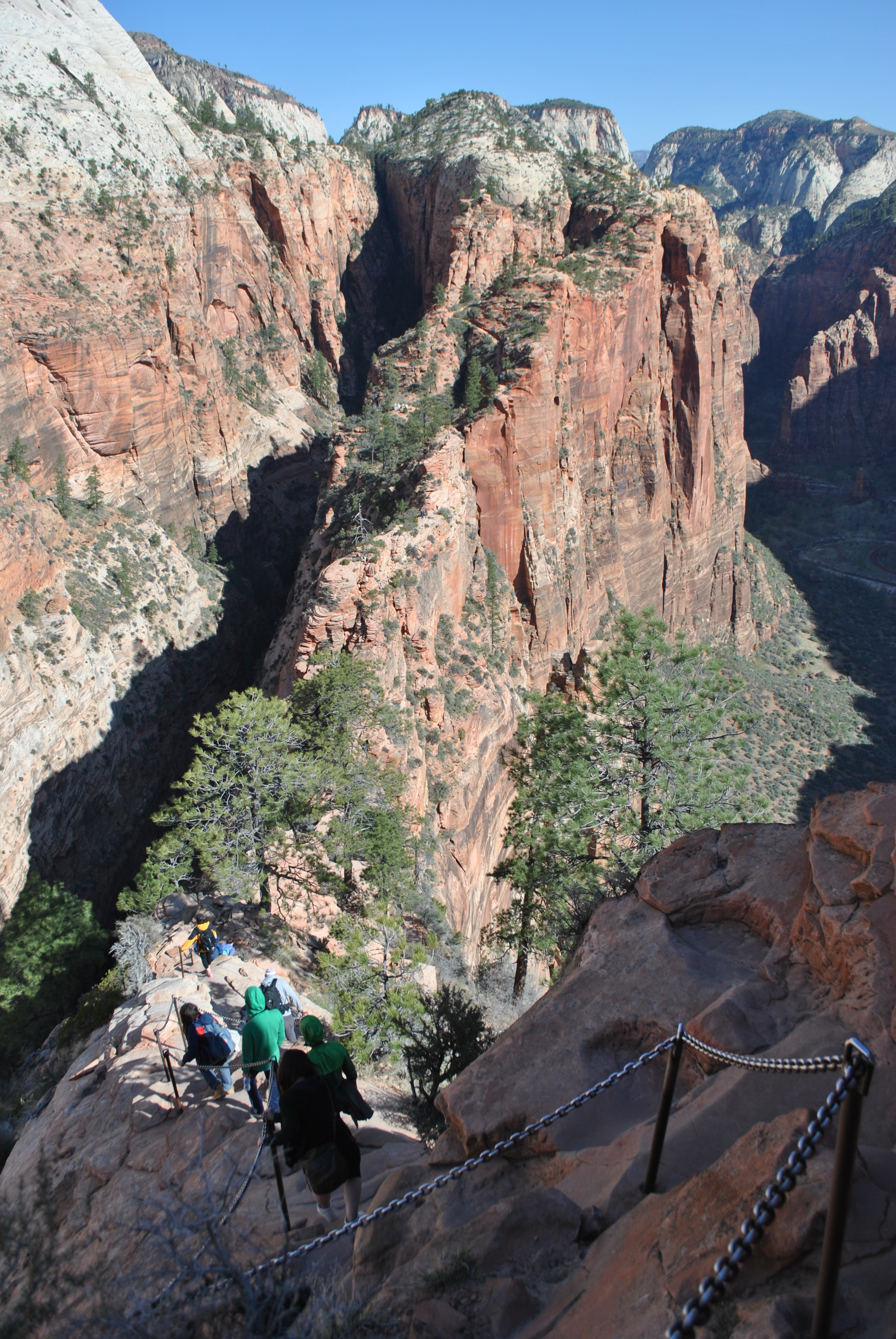
Beyond Scout Lookout is the real challenge. The trail follows a narrow ridge over a rocky hump, across a knife edge traverse with sheer drops on both sides, and up the final ridge to the summit. It is about four tenths of a mile of scrambling and 400 feet of elevation gain. Some but not all of the narrow ledges and scrambling sections have heavy iron chains for hikers to hold on to as they move across. Since I'm a climber (although not a very good one at that) I think that it's easy. But the exposure is real and very significant. Anyone who is bothered by heights shouldn't even think about this hike. But in good conditions a strong hiker should have no problems. The decision of course is up to each individual.
 On the summit - April 2012
There is more to bad conditions then just rain or wind. Unfortunately there is no equivalent of the shuttle system high on Angel's Landing. It is the most famous trail in the park so on a nice afternoon it will be mobbed. It's no big deal on the lower section. There are crowds of people but the trail is paved all the way to Scout Lookout. But on the scramble to the summit along the final narrow ridge the crowds of people are a major problem. It seemed like the entire way there was a steady stream of people in both directions. So for a lot of the way I was blocked from the chain. I had to pass people on narrow ledges with lots of exposure. It was made even worse by the fact that the idiots seemed to be out in force. People wearing street shoes or sandals or flip flops. Teenagers racing past people on the narrow sections and laughing and goofing around. And lots of people who just didn't seem to have common sense. What should have been an enjoyable hike turned into somewhat of an epic. I made it to the top and back but I resolved that if I did Angel's Landing again I would choose a time when the route was not so crowded. I was amazed that no one fell off just on the afternoon I was there.
 Starting down the ridge back to Scout Lookout
Fast forward to April 2012. I had done Cable Mountain the day before. It was a long hike and I admit to being tired. I even had some blisters which is very unusual for me. Still I couldn't pass up a good weather hiking day in Zion. Angel's Landing seemed like a good option. Not too long a hike but well worth while. I really wanted to give it another try after my climb to the summit in 2010. When I woke up at 6:30 again I figured it was a sign. I didn't quite make it to the visitor center in time to catch the very first shuttle into the canyon at 7 am but I was in time to get the second one at 7:15. I figured that an early start would enable me to avoid the crowds. The only drawback of such early starts in Zion is that it can be chilly in the morning. Because of the shuttle you have to make a choice. Wear warm clothes so that you are comfortable early and you have to carry them in your pack all day after it warms up. Go light and you freeze for the first hour or two. I opted for warm clothes and it turned out to be a good choice. It didn't warm up till much later. It was breezy too. Dawn is usually a calm time but for some reason there always seems to be a stiff wind blowing up Zion canyon at sunup. Maybe because it was cold the wind was particularly noticeable. But it wasn't bad once I was on the trail and climbing the switchbacks.
With relatively few people on the trail, Angel's Landing was once again a superlative experience. The route is amazing. Even when you know where it goes it is difficult to believe it from below. The scrambling is fun and the exposure is exhilerating. The views from the summit are spectacular. But for me the most fun is when I have climbed down and hiked back to the trailhead, to turn around and look at that amazing pinnacle and think that I had just been up there.
