Alps pt8 - Almageller Alp high trail
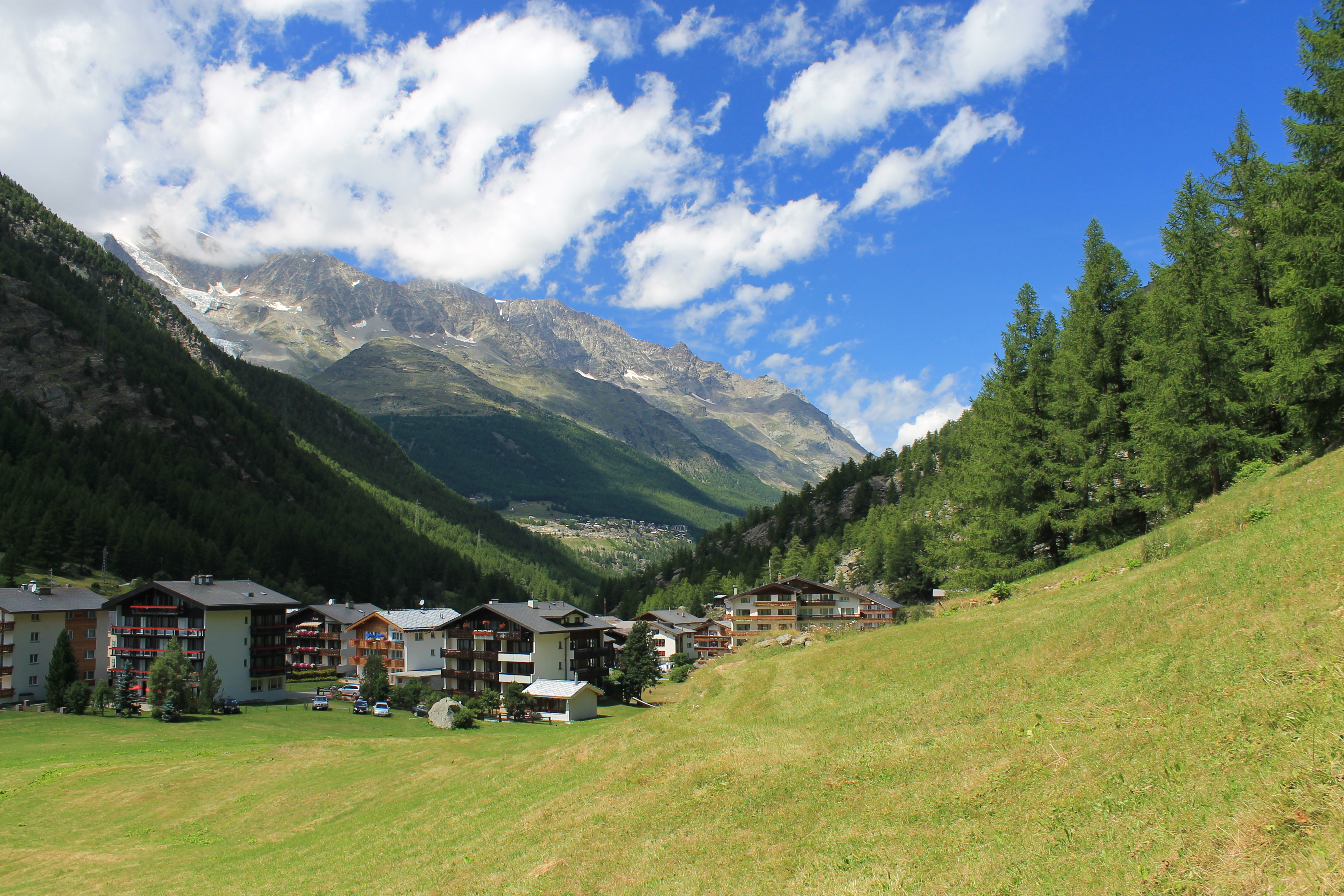
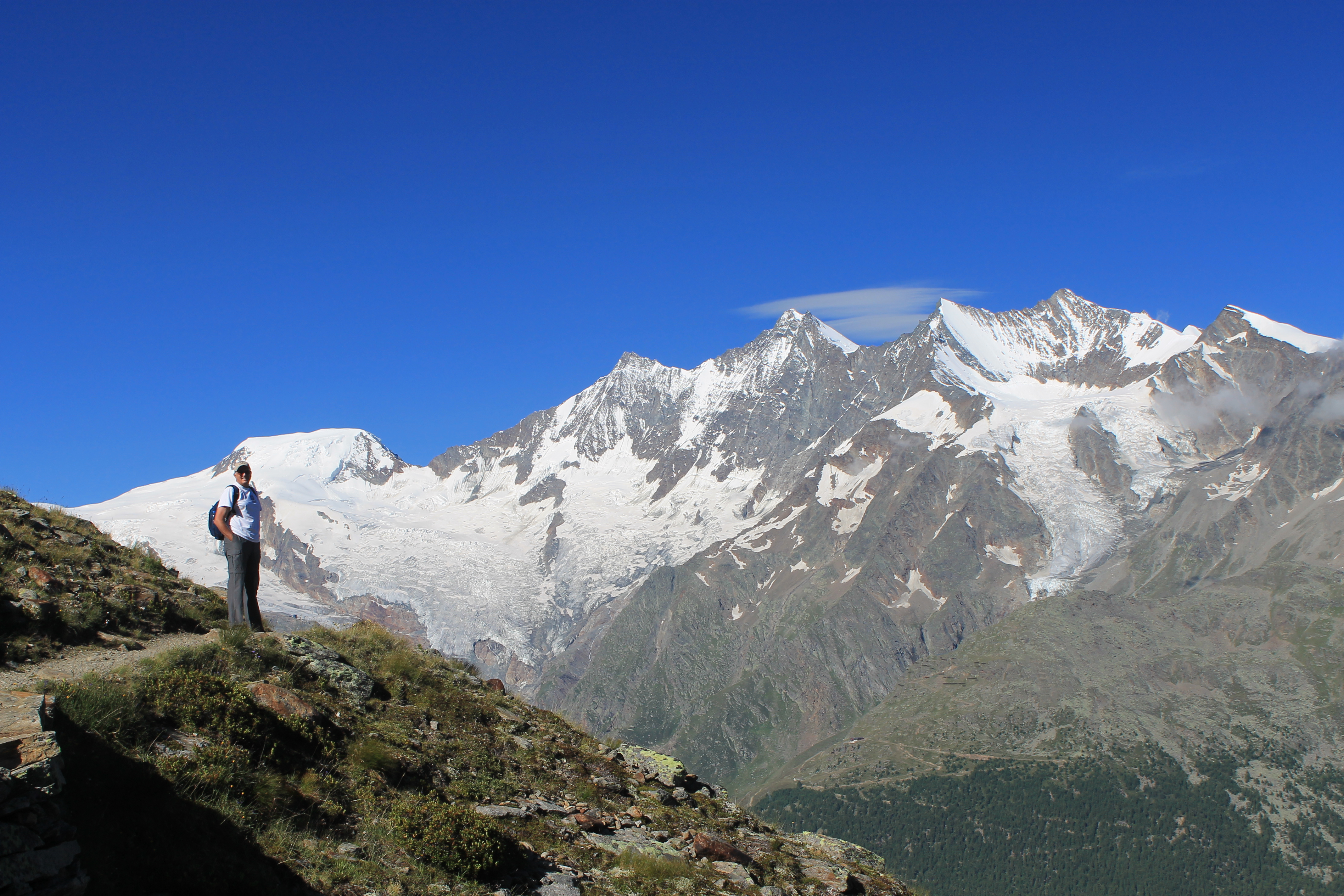 A great view of the Mischabel peaks
The weather the previous day for our hike to the Britannia Hut had turned out to be pretty good. But now we were excited. The forecast for the next two days was for clear, sunny weather. Of course the high peaks make their own weather. Even when the weather is good local clouds can form on the summits. We would still do an early start to beat the afternoon buildup. But it looked like we were in for a couple of days of ideal hiking weather.
The Saas Fee area is known for it's high level trails. They start at high elevation, usually after a cable car ride to the start, and traverse along ridges high above the valley. These trails are known for the expansive views that they provide of the many high peaks around Saas Fee. You can actually walk all the way from Stalden, which is where the valley forks to go to either Saas Fee and Zermatt, to a pass that leads into Italy. For many years there was no passable route through the lower part of the Saastal along the valley floor so the medieval trading route followed the high ridges. We would be walking a portion of this old route for our hike.
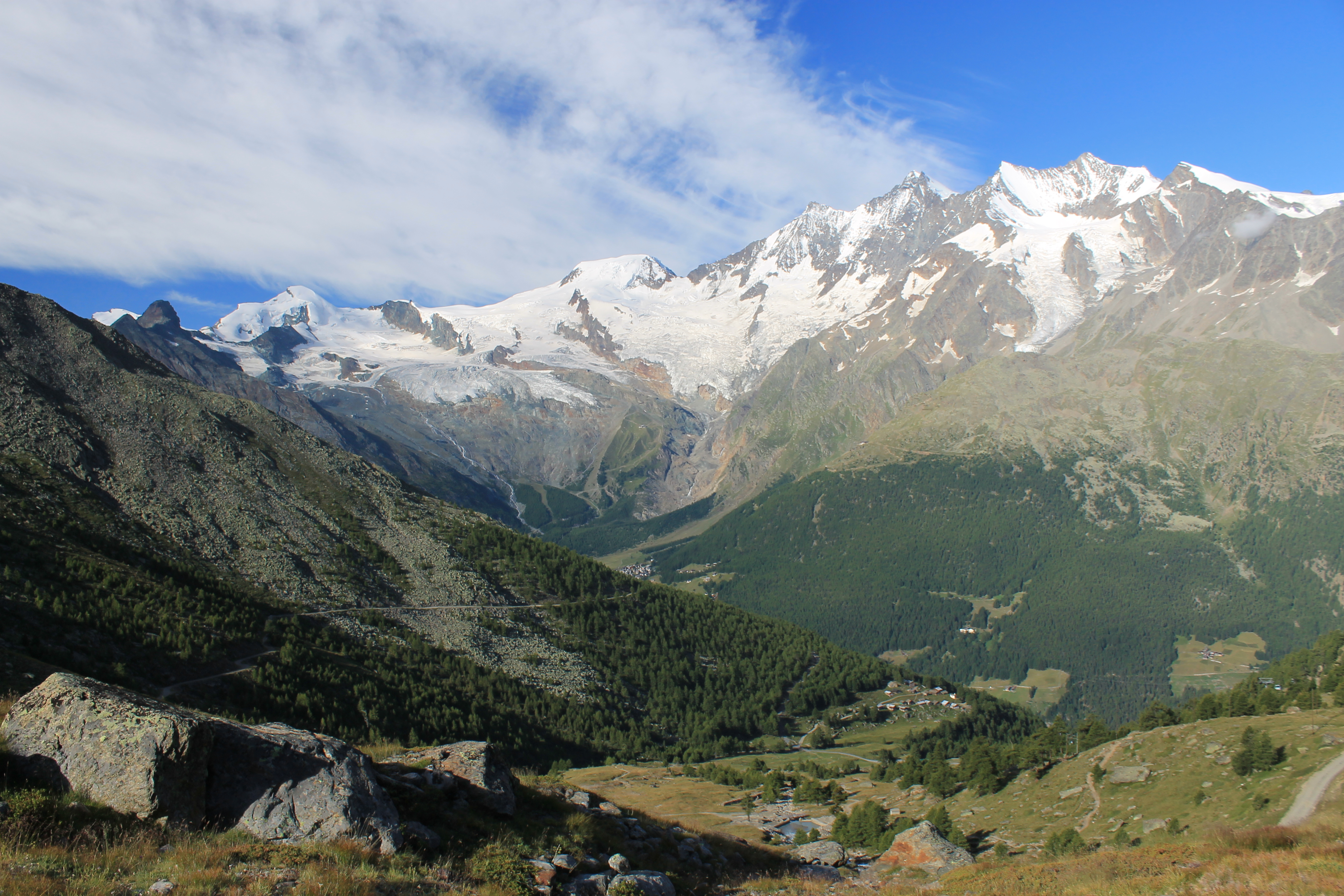
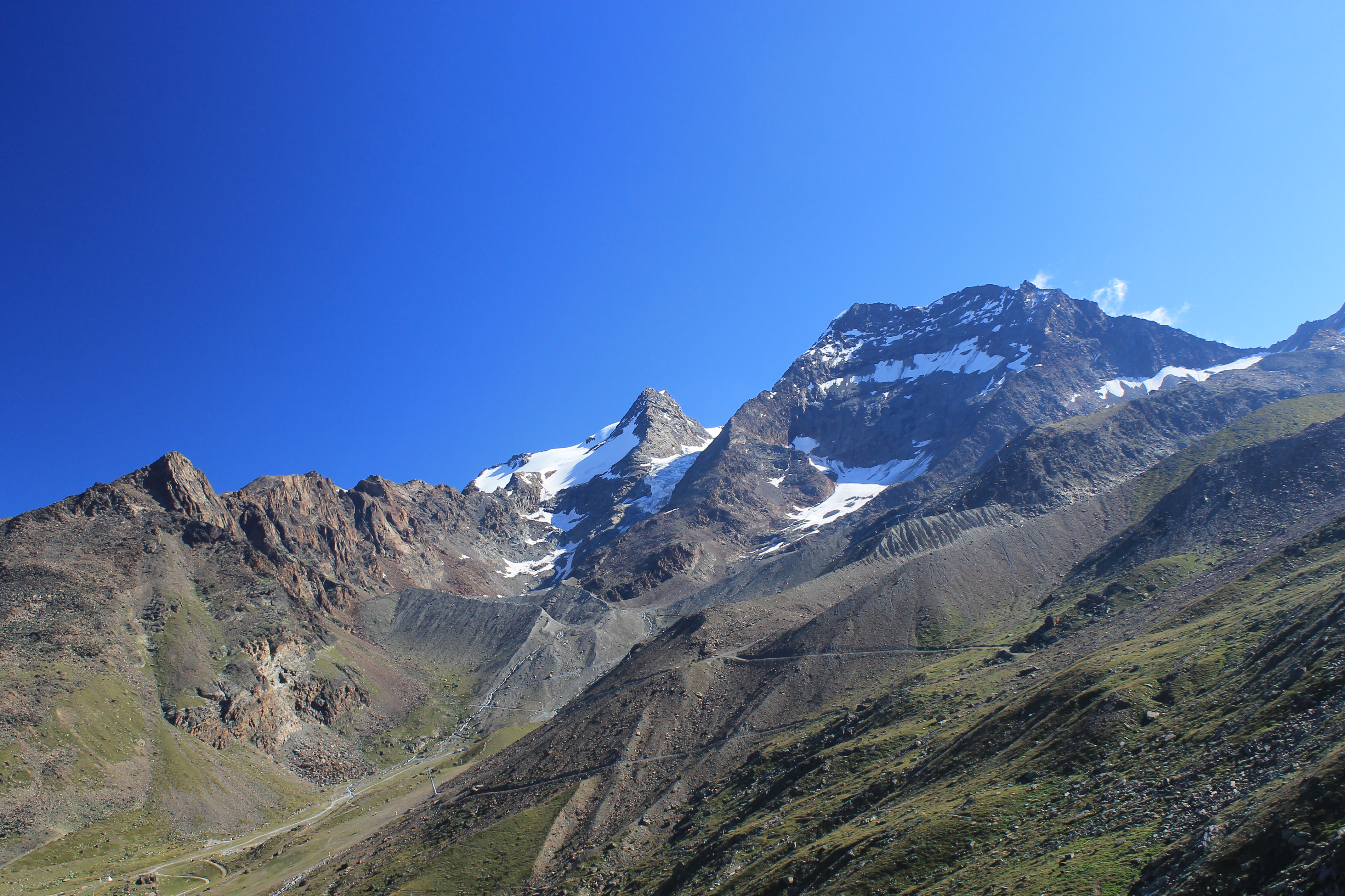 The Fletschhorn and the Lagginhorn
We started out with a ten minute bus ride from Saas Fee to Saas Grund. There we took a cable car up to Kreuzboden at 2400 meters. It is only the middle station on the cable car route which continues up to Hohsaas at 3200 meters - a starting point for climbing the four thousand meter peaks of the Weissmies and Lagginhorn. Our hike would start from Kreuzboden and traverse the high ridge for several miles before dropping into a side valley and down to Almagelleralp and it's mountain hotel (lunch anyone?). Then we would hike all the way to the valley floor to the town of Saas Almagell. From there we could catch a bus back to Saas Fee.
The trail started with a rising traverse from Kreuzboden. Soon we hit a stretch of large boulders (Sandy's favorite) that took time and a lot of work to get through. But other than that the trail was quite good. We didn't have to gain a lot of net elevation to climb over the shoulder of the ridge into the next valley, but of course the trail was never content to just be level. It always climbed up a little just to drop down again, or vice versa. But this trail had no killer uphills. The weather was great and we had wonderful views of the four thousand meter peaks around Saas Fee.
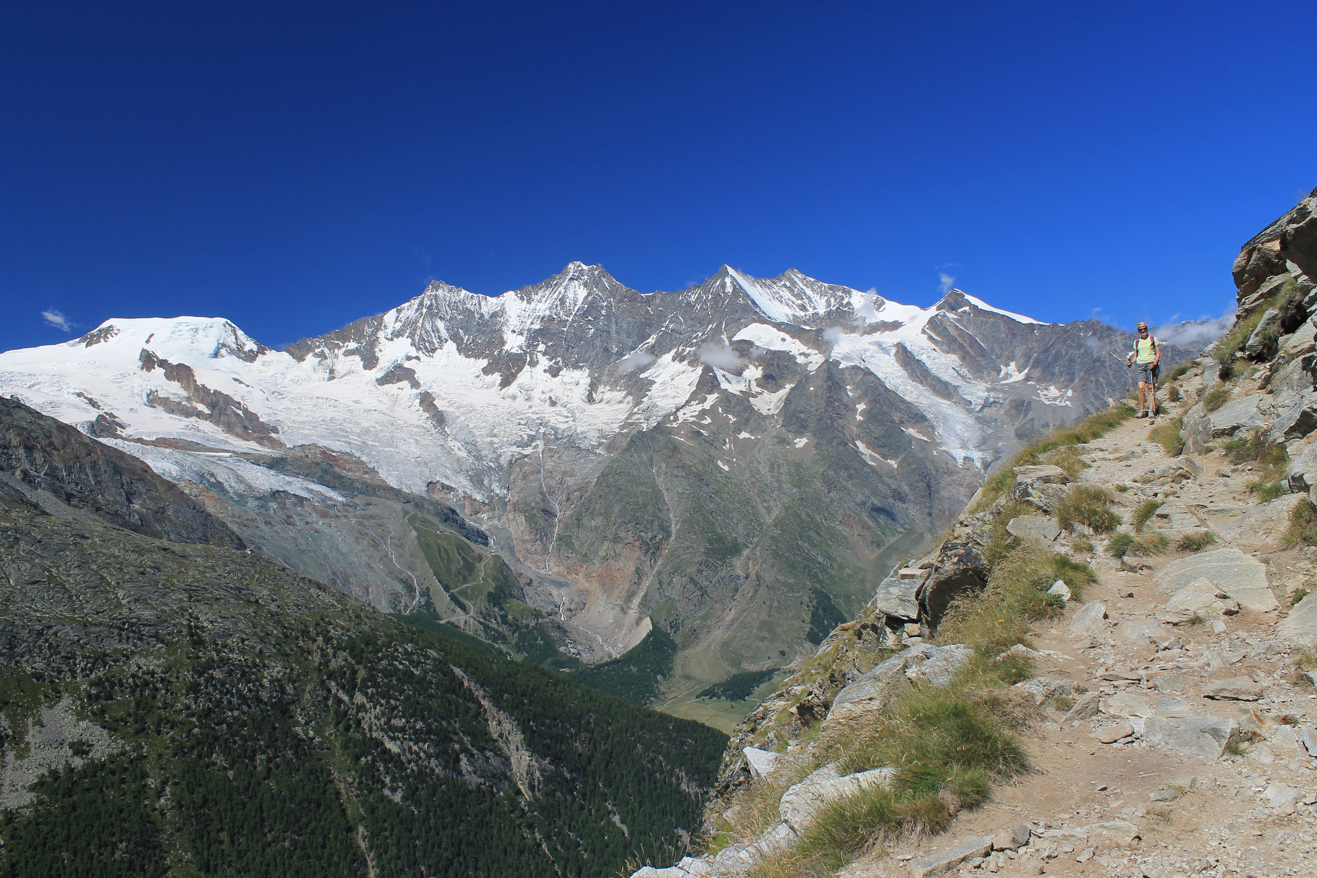 Starting the long descent to Almagelleralp
One section of the trail had some signs identifying various mountain wildflowers. The flowers were really in bloom on this trip. I had never been to the Alps in July before and didn't know how impressive the wildflowers were. They definitely added to every one of our hikes. We tried to identify flowers while we were hiking but didn't know that many of them. This signed trail wasn't really much help because it gave the German names. I did learn that what we called Bluebells are called Glockenblumen in Switzerland. I probably would have guessed what they were if I had seen the name though. The one thing we did learn though was what Edelweiss looked like. Sandy had been meaning to ask the lady at the hotel because she had said she had them in her garden. But since the German name is what is used in English, the sign actually helped when we came across it (good eye, Steve). We resisted the urge to start singing a song from The Sound of Music.
Eventually we turned into a side valley and could see the Almagelleralp Hotel way below us. This was the opposite of our hike the day before. This time we saw a large building that looked like a tiny spot because it was so far below us. The trail traveresed the side valley then had a series of switchbacks to drop some serious altitude fast. Our calf muscles certainly got a workout.
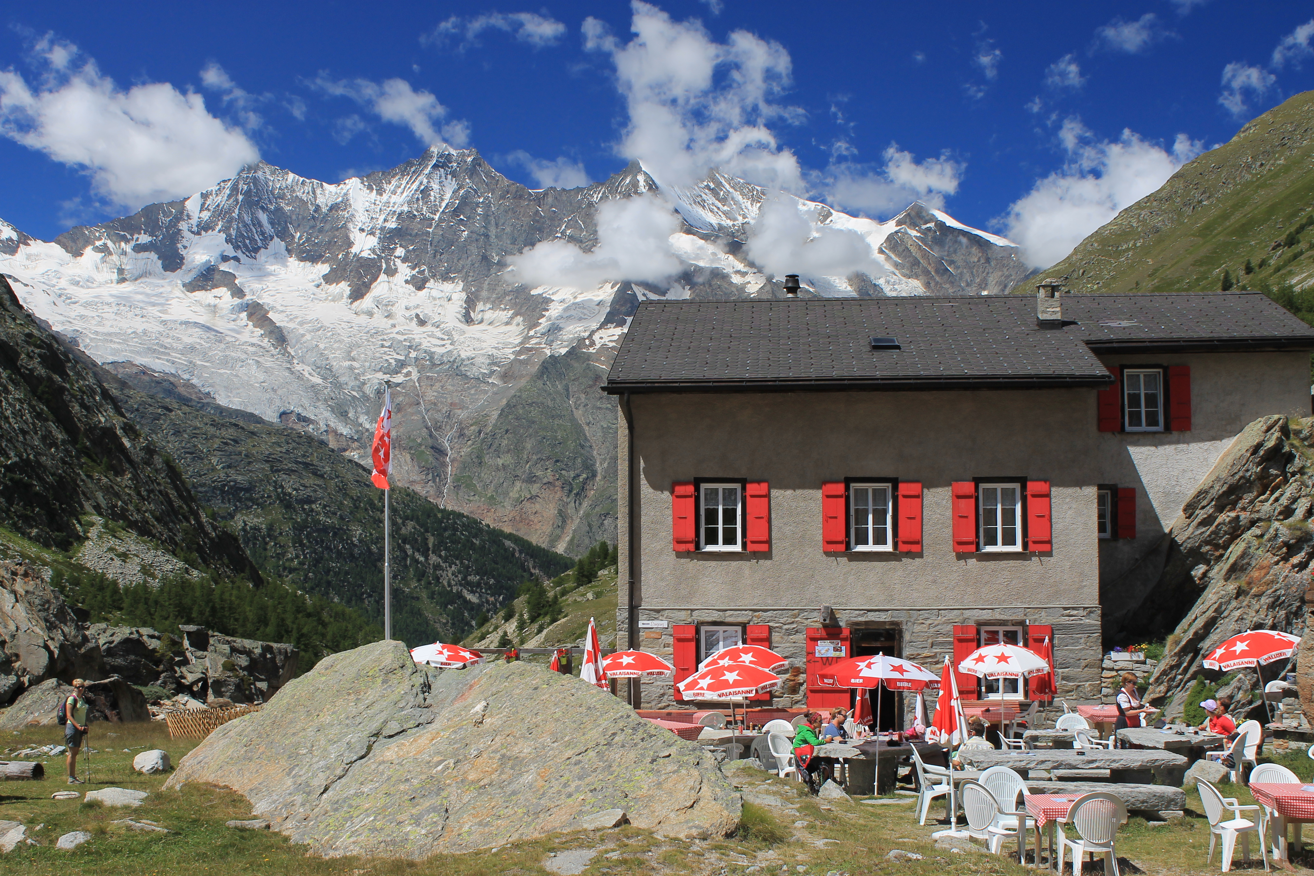 Break for lunch at the Almagelleralp Hotel
We reached the hotel and found a table on the terrace for lunch. There were a lot of people considering that it was a long walk to the hotel, either up from the valley or down from the cable car. We had a leisurely lunch and enjoyed the view of the Mischabel peaks across the valley. Then we grabbed our packs and hit the trail. We still had a long descent to Saas Almagell in the valley.
There were a lot more people on the trail heading up as we went down. For some reason people just don't seem to start early here, inspite of the advantage that it gives with the weather. Descending through the side valley we had nice views but I didn't bother with pictures. The electic wires running up to the hotel would have spoiled them. I understand the need to get power up to the hut but I wonder if there wasn't a better way to do it.
 We're finally all the way down - village of Saas Almagell
Eventually we reached Saas Almagell on the valley floor. We had originally planned to catch a bus from here but since we hadn't done any big uphill climbs on this hike we figured that we could walk back to Saas Fee. It took us another hour. At one point as we were going up the broad trail between the two villages a bike rider passed us and shouted hello. We looked and realized it was the owner from our hotel. As we got close to Saas Fee we started to slow down but finally made it. Ok, we were tired now.
We decided to go out for dinner that night. We found a pizzaria where Sandy ordered a mini and I unwisely ordered a regular pizza. It was really good but I'm not sure if I was slow getting back to the hotel because I was full, tired or sore. Maybe (d) all ot the above. Whichever it was, it had been a fantastic day of hiking in the mountains.
Additional pictures
Starting out from Kreuzboden


