Sierras pt1 - Yosemite
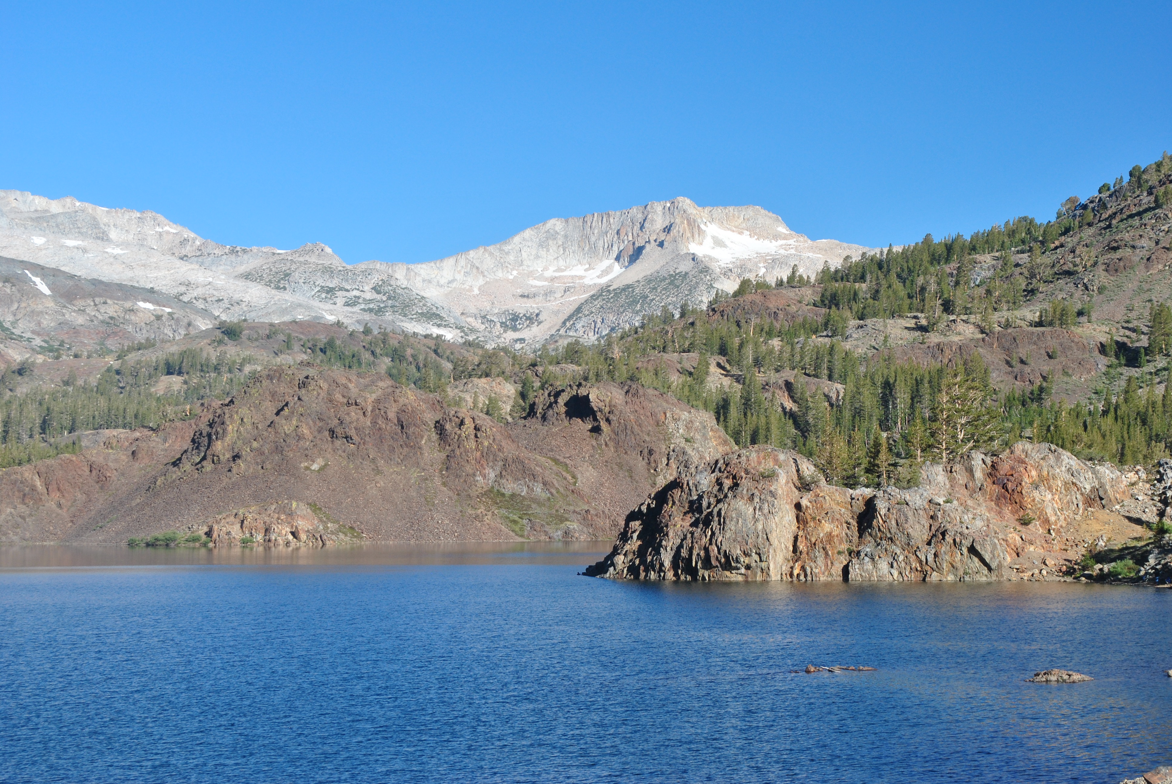 Early morning at a mountain lake off Tioga Pass Road
Last year Sandy and I had a fantastic trip to the Alps. Even while we were there we were making plans to return. Since I am fairly new in my job I don't get that much vacation time. So I talked to my boss about taking a leave without pay again this summer. It's a pretty slow time anyway. She was gracious enough to agree for me to take off five weeks. Now I had the whole month of July (and a few days in August) off for our trip. When we had finished our planning we had two and a half weeks scheduled for our Alps trip this year (stay tuned to the Dog Blog for all the details and fantastic photos later this month). That left me with an extra two and a half extra weeks off. That time would be well spent in the mountains. Because of work I have not had the time to condition like I did last year before our trip. Better late than never. Sandy and I decided to do a warmup trip the week of July 4. We picked the Sierra Nevada mountains. Sandy has seen very little of the Sierras and I haven't done many trips there either.
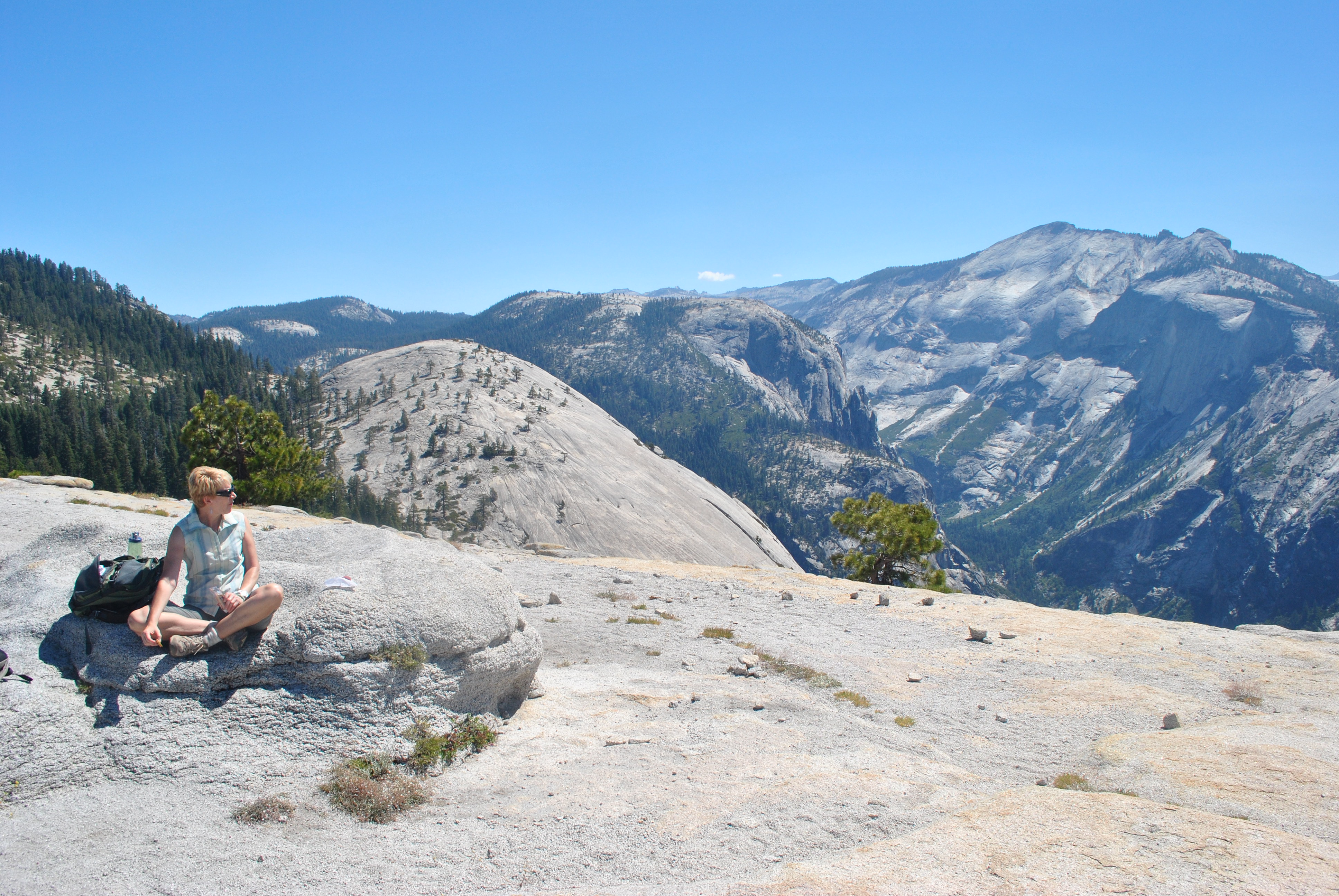
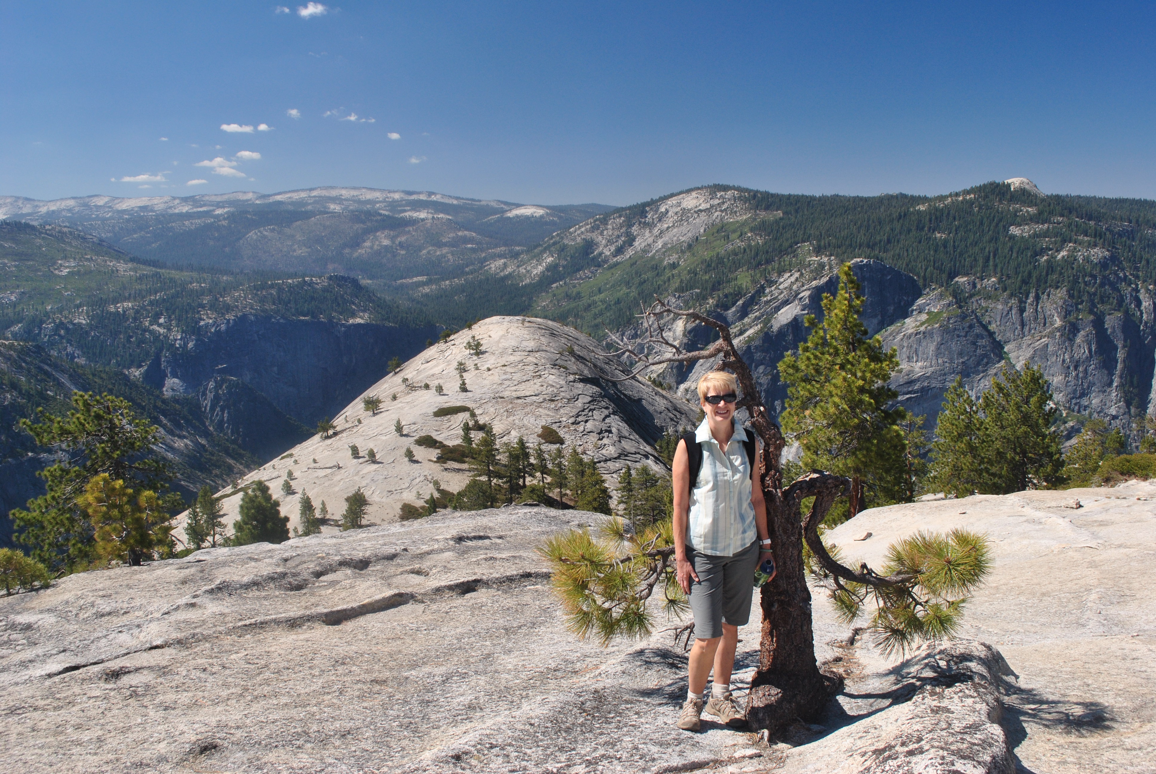 Sandy on Indian Ridge - North Dome behind
Sandy had taken a long weekend to visit Shannon in Kansas City. She is working there for the summer as an intern at Serna. Since Sandy didn't get back till Monday afternoon, I gave her a day to recover and we left on July 4. Besides my plan was for our first hike to be in Yosemite National Park and I didn't want to be anywhere close to there on the fourth of July.
After dropping Laney with a friend we hit the road. We drove to Hawthorne Nevada that day. It was an easy day - it only took about seven hours. Hawthorne is the last town in Nevada on the way to Yosemite so I have used it as a stopping point on two previous trips. There isn't much to it. The only thing there is an army depot. There is one casino and it isn't very fancy. That's where we stayed though. Hey, at least it was cheap. It seemed like half of the businesses on the main street were shut down. The wind was blowing and it was very dusty. Kind of a depressing place. But we were there for only one night. We had dinner at a family restaraunt that was quite good. I couldn't remember the name so I tried looking it up on the web. I couldn't find it! That more than anything else probably tells you about Hawthorne Nevada. We went to bed early - engineers aren't drawn to casinos. They never gamble - they're too good at math. So neither Sandy nor I was interested. We were up early and on the road by 6:30 am.
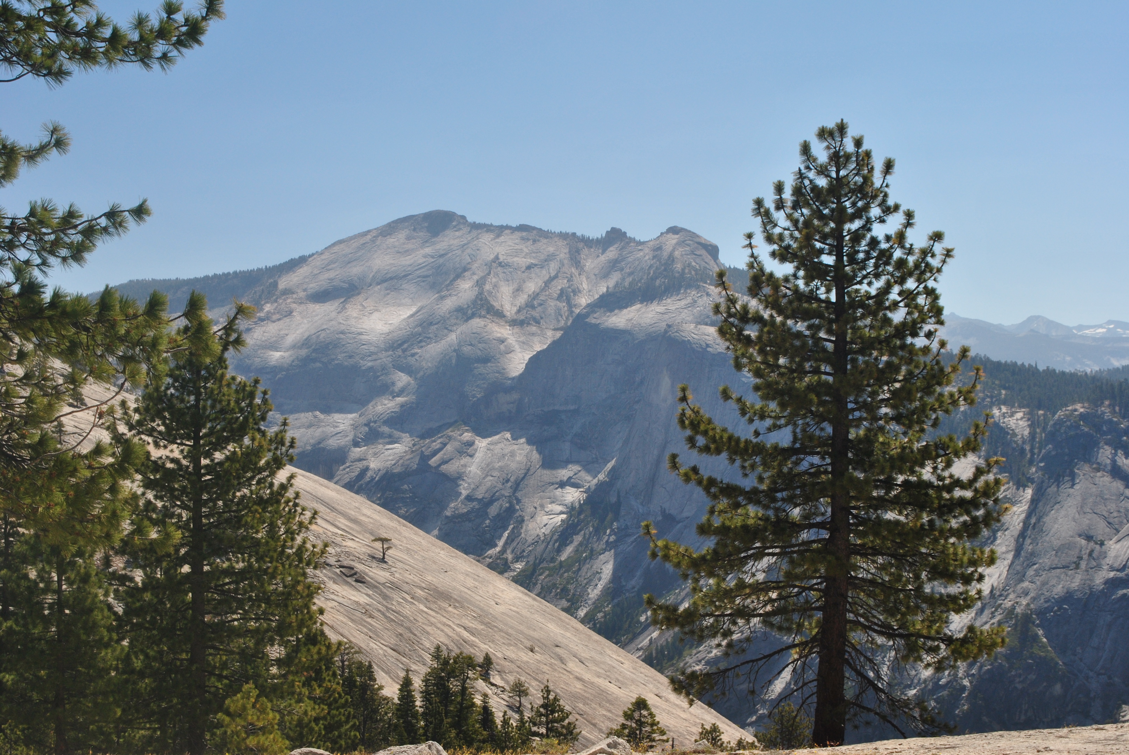 Clouds Rest - at 9930 feet the highest point above Yosemite Valley
From Hawthorne we had to drive for about an hour to reach US395. That is the main highway that travels along the east side of the sierras. Our plan for today was to turn off of 395 as soon as we reached it and head into Yosemite National Park on the Tioga Pass road. That is one of the few roads that crosses the sierras. From there it is 200 miles south before another highway goes over the sierras. From the Tioga Pass road we could do a hike in the northern part of the park. Afterwards we would drive back to US395 and head south to the town of Bishop. It would be our base for the next several days.
We were at the trailhead and ready to go by 8:30. Since it was the Sierras, and Yosemite, you always have to be conscious of bears. We had two big bags of food that we had brought with us for the trip to take on our various hikes. Every trail head in Yosemite has food storage lockers. It is a bad idea to leave food in your car. It may seem secure but bears can peel back the trunk of a car without any problem. With our food safely stored away, our packs ready and our boots laced up, we were ready to hit the trail. There was a large group of asian students milling around at the trailhead. They were making enough noise but didn't seem anxious to actually get going. We got moving and left them behind. In a few minutes we were in the quiet of the forest.
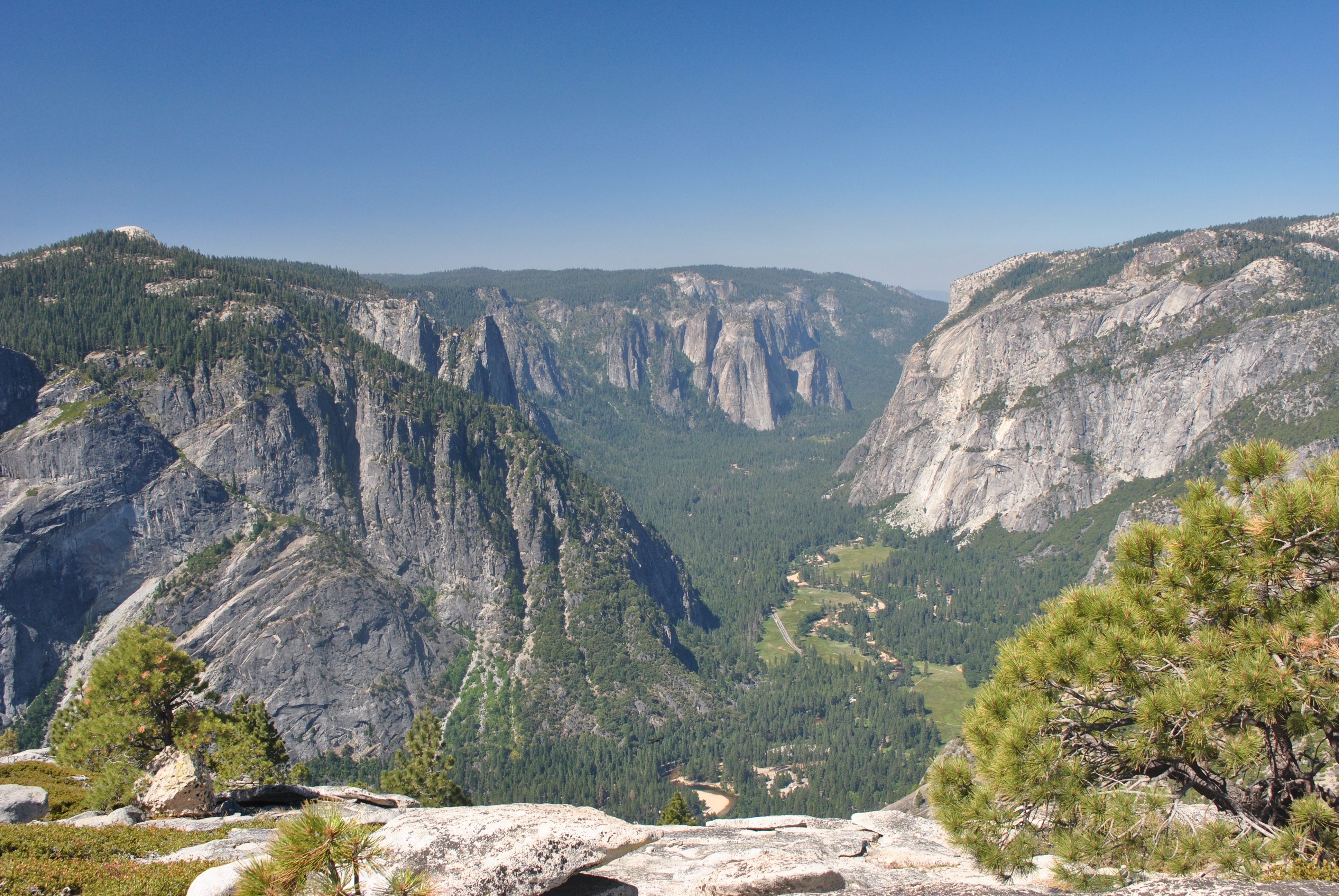 The crowds in Yosemite Valley are 3500 feet below
Our first hike was to the summit of North Dome in Yosemite National Park. Although the trail was to the summit of the dome, it was not a typical mountain climb. The trailhead is 600 feet higher than the top of North Dome. From Yosemite Valley, North Dome has huge imposing cliffs and towers over the valley. But from the Yosemite high country off of the Tioga Pass road, it is actually downhill to North Dome. That makes it sound like an easy hike but it is not! There is net elevation and there is gross elevation. This trail had serious ups and downs all the way. It started out with a steep descent of about six hundred feet from the trailhead to a stream crossing. Then it climbed out of the drainage on the other side onto Indian Ridge at about the same height that we had started. From there we got our first views of Clouds Rest and Half Dome across the chasm of Yosemite Valley. After traveling along the ridge we reached a point where we could see the top of North Dome - about eight hundred feet below us. The descent to the saddle was described in our hiking guide as "airy and not for the acrophobic". Well the person who wrote that hiking guide was a wus. It was easy. In just under two hours we reached the summit of North Dome.
 Sandy admires the view from the top of North Dome
The view was fantastic. We could see Half Dome and Clouds Rest across the gulf of Yosemite Valley. We could see the Yosemite high country both north and south of the valley. From our vantage point we could see most of the park. The day was perfect with a bright blue sky that was perfect for photos. The temperature was in the high sixties with a light breeze. It was very comfortable for hiking although on the top of the dome in the bright sun and with the white granite reflecting all around it felt very warm. Best of all we had the whole national park to ourselves. We had seen one party of two coming back from the dome as we had hiked up. We had also seen a group a ways back on the trail. They had asked us directions - they seemed to be totally lost. They had fallen way behind us and we assumed that they had given up. Not so as we saw them on the way out. But at least for now we had the mountains as far as we could see all to ourselves. And we could see a long way!
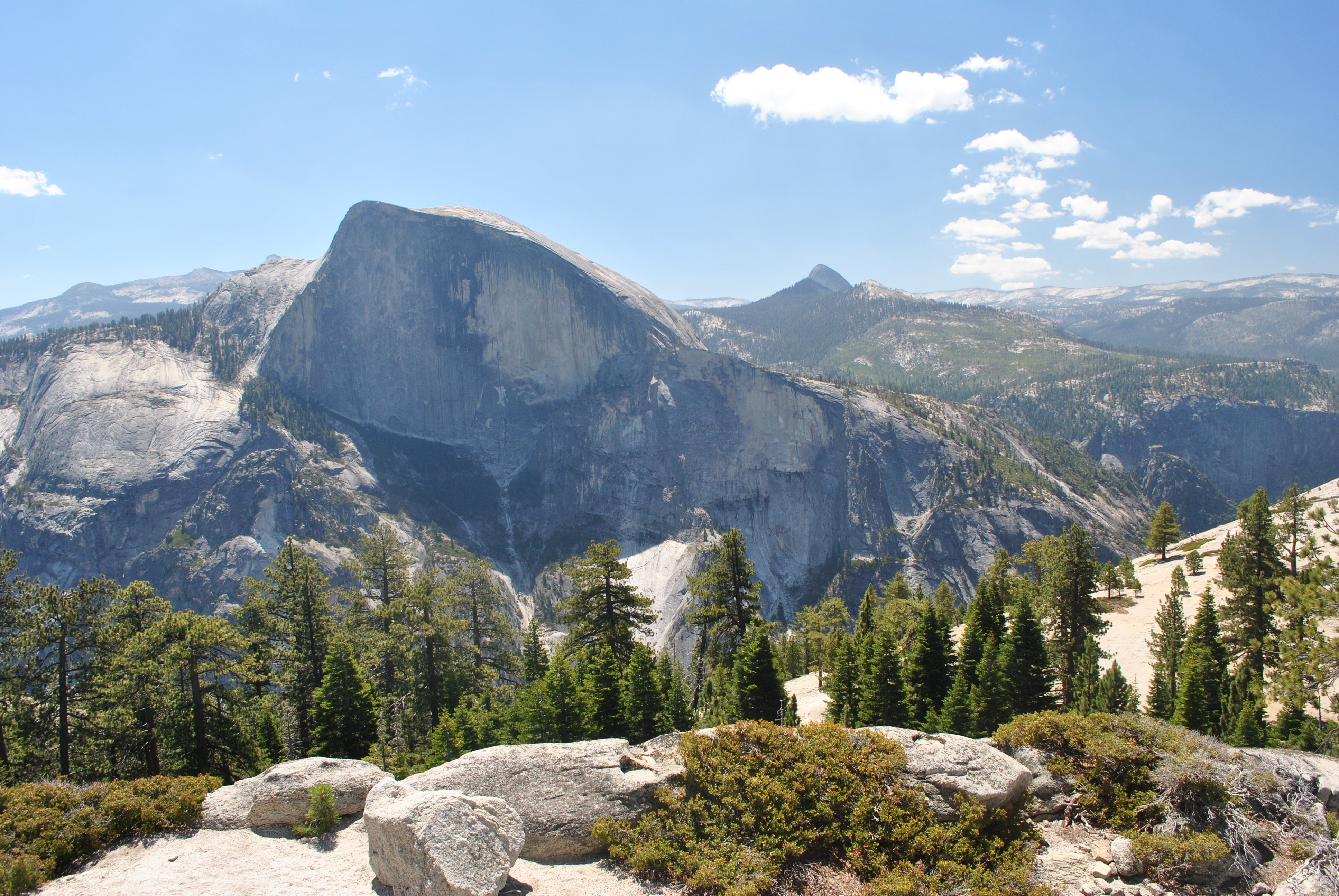 Half Dome rises across the valley
After some snacks we started back. From the top of Indian Ridge we had descended a long way. The way back was steep and at altitude was a lot of work. It had to be the altitude. It couldn't be that we weren't in shape. It was a long, hard, hot climb back to the top of the ridge. On the way back we encountered lots of parties. So much for solitude. I guess our advantage was in an early start even though we had to drive two hours to the trailhead. But we got to sound very authoritative as parties kept asking us if this was the right way? How far was it? Was it really hard? (Yes. Incredibly hard. Turn back now and save yourselves.)
About half way back was a decision point. There was a short spur trail to Indian Rock. This is the only natural arch in Yosemite National Park. It is three tenths of a mile each way and a 400 hundred foot climb to the arch. On the way in we had said we would decide on the way out if we wanted to do the side trip or not. I wasn't too keen on it. I had seen pictures on the web and the arch didn't look very impressive. But as we approached the trail junction on the way back I spotted the arch on the hillside above and pointed it out to Sandy. "What! That's it?" She was not impressed. Remember that we had been to Arches National Park in May. Compared to what we had seen there this was pretty pathetic. That made the decision when we reached the trail junction easy. Home!
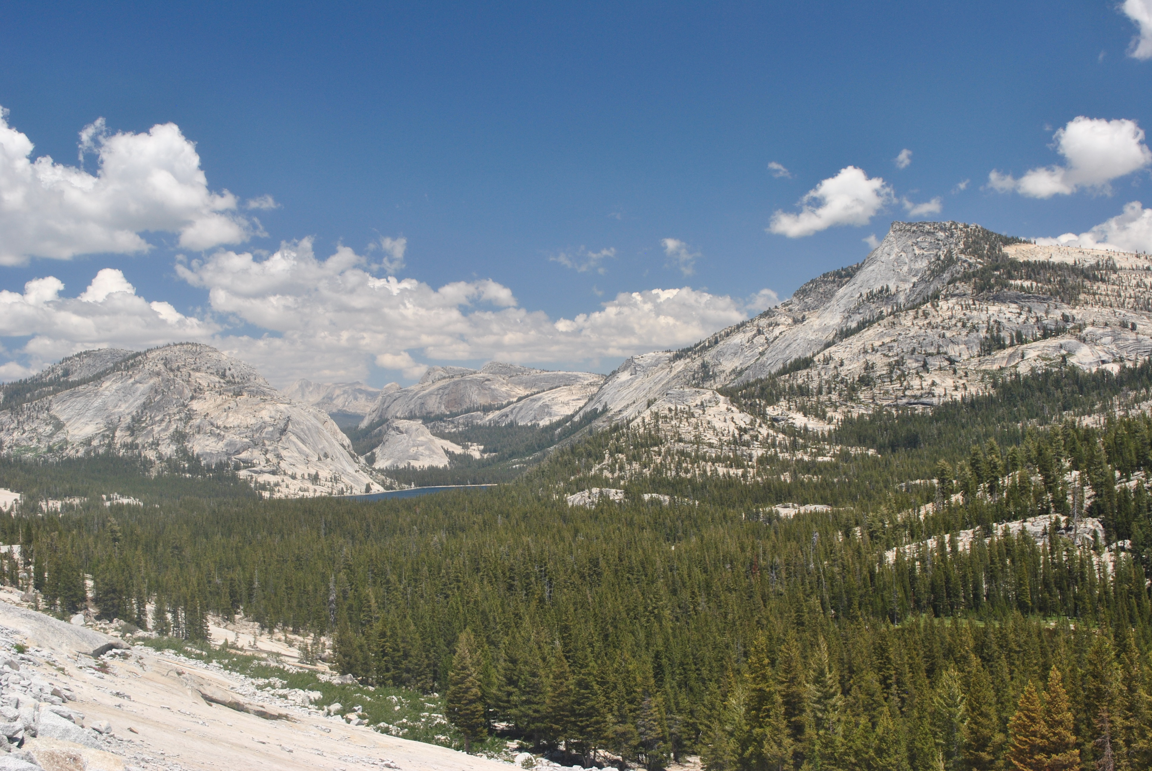 Yosemite high country from Tioga Pass road
Towards the end it got to be a bit of a slog, as all hikes are towards the end. The last climb up the big hill to the trailhead wasn't a lot of fun. But we made it back to the car. On the way back we stopped at the Visitor Center and we each got a tshirt. Hey! We earned it. Then we stopped at the Tuolumne Meadows store and got cold cokes. Those tasted great as we drove back out of the park. We stopped at a number of viewpoints for photos. As was typical for a national park, every car viewpoint was a total zoo. But we had the trail to ourselves for the whole morning. Too much work I guess.
Eventually we got back to US395 and turned south towards Bishop. It was a nice drive with big mountains looming off to the the west the entire time. But we were tired and dirty and anxious to get to our hotel. We got to Bishop about 4pm and checked into our hotel. Compared to the place in Hawthorne we thought we were in the total luxury (even though it was only the Comfort Suites). We cleaned up and then had an awesome dinner at Pizza Factory.


