Sierras pt2 - Chocolate Lakes and Peak
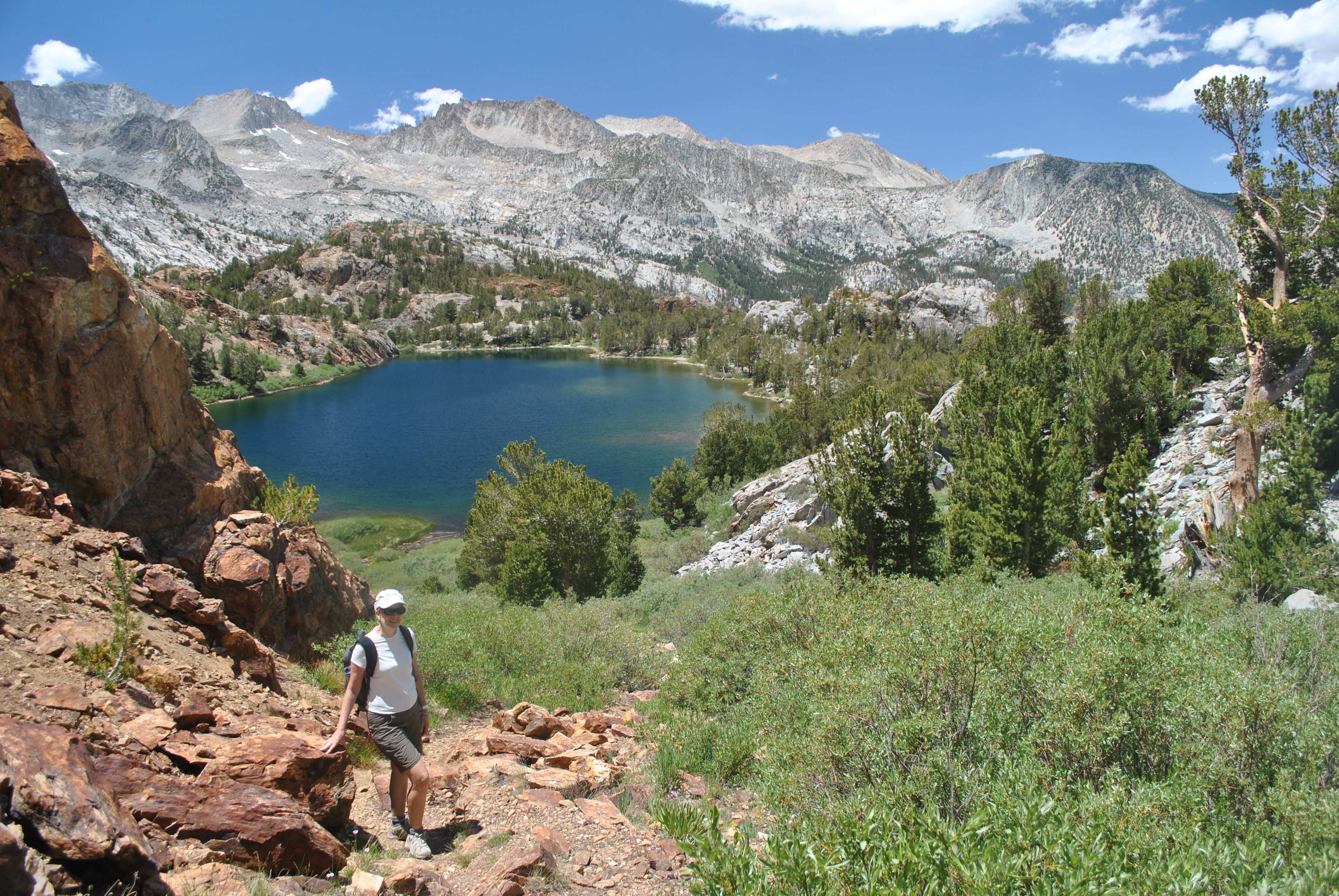
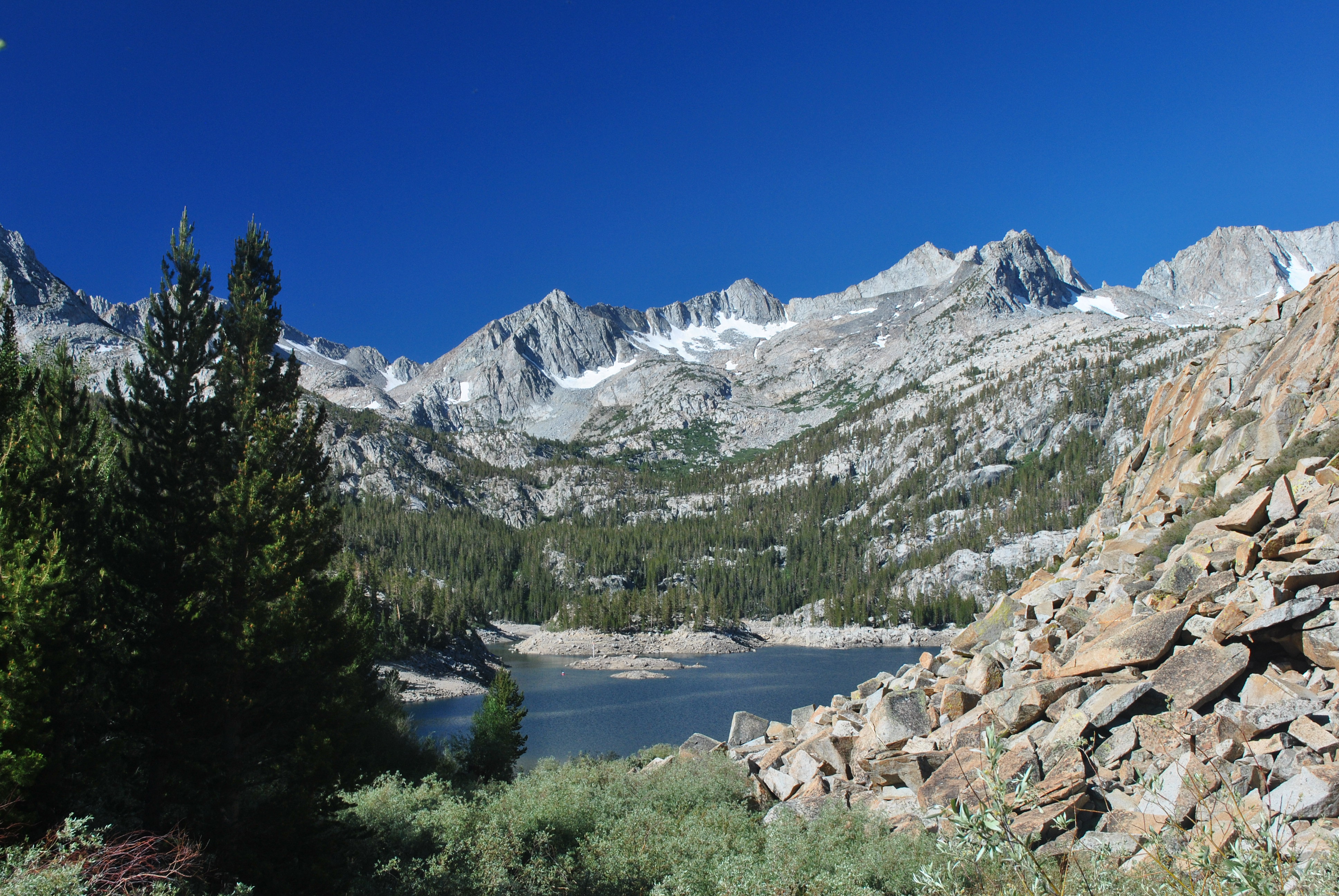 Minutes from the trailhead we had a great view of South Lake
This is going to be an experiment. Usually posts for the Dog Blog take me two or three days to write. That means that when we do a trip which requires several posts they tend to lag by a couple of weeks even if I work hard on them. This time I am going to try to keep up. That means I will try to do a post each day on what we did that day. We'll see how it turns out and how long I can keep it up.
Since we had been driving a fair amount the past two days, we decided to do a hike close to Bishop. There are actually quite a few good hikes that are accessible along California Hwy 162 from Bishop. Just turn west at the stop light right in the center of town and head for the mountains. Although the road doesn't cross the range, it does drive up quite a ways and provides access to North Lake, South Lake and Sabrina Lakes, all of which have trailheads. The descriptions for all the hikes sounded good. We had lots to choose from.
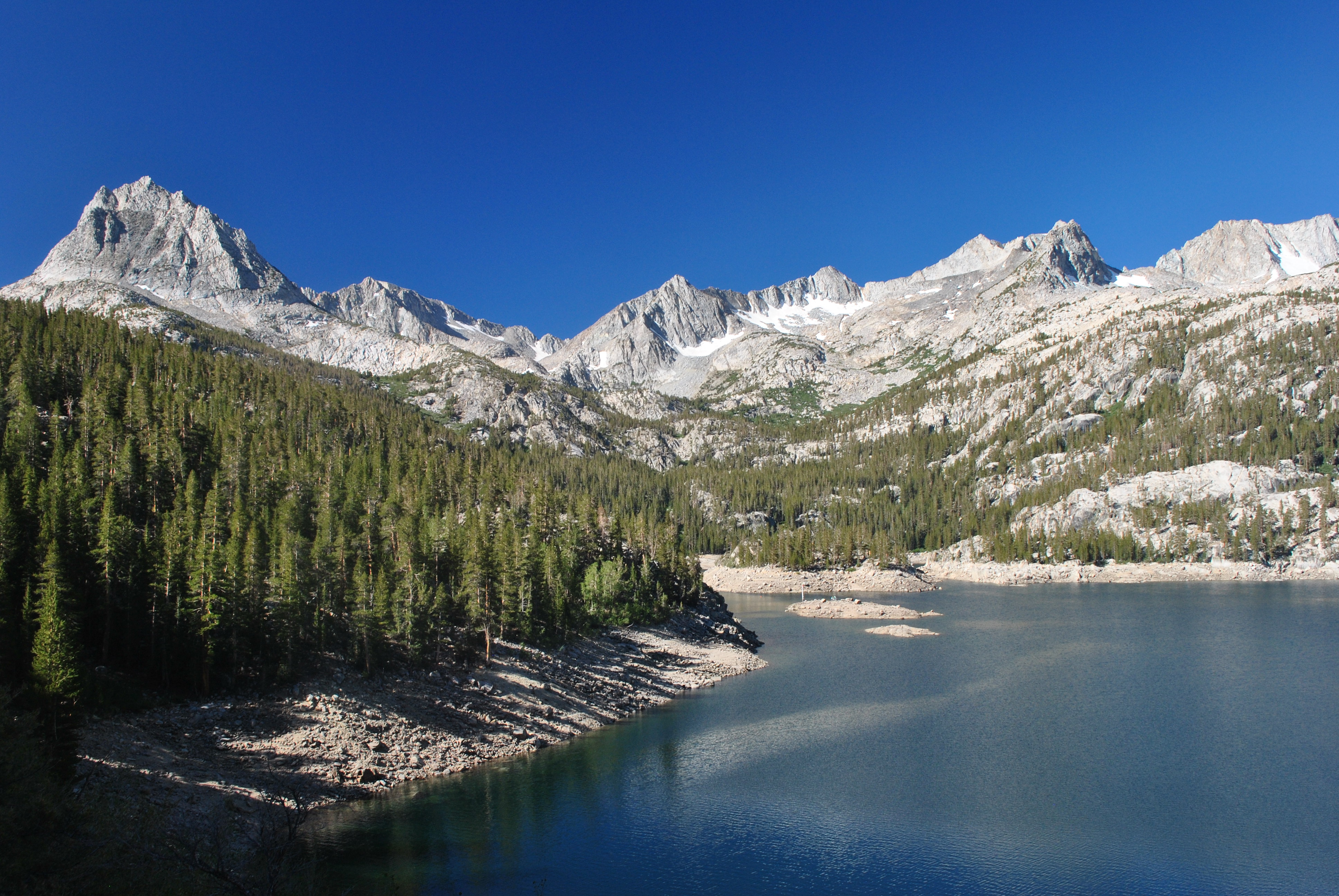
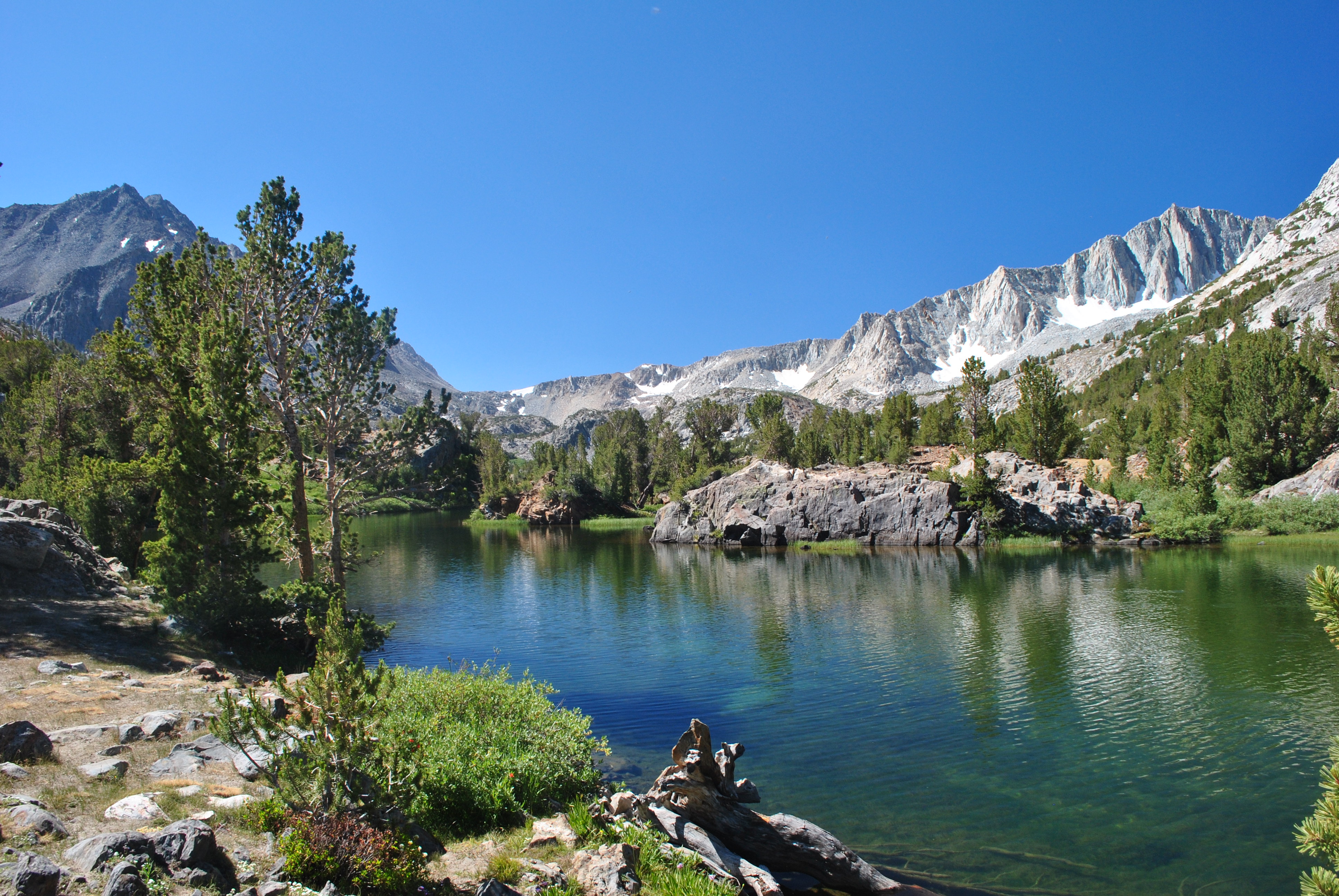 Spectacular view of Long Lake and Mt. Goode
We ended up deciding on the Chocolate Lakes loop. Our guidebook said that it was seven miles and about fifteen hundred feet of elevation gain. Not bad at all. It went up one drainage to several lakes, crossed a saddle to the next drainage, and then descended that valley past several more lakes. But it was at high elevation - the trailhead was at 9800 feet. Since we didn't have much chance to acclimatize we knew that it would be slow going and hard work. Most importantly though, Sandy thought that any hike called Chocolate Lake loop is one that we should do.
Since the trail head was fairly close we didn't need as early a start as the day before so I slept in later. We got to the trailhead at South Lake and were ready to go a few minutes before nine. Discouragingly the trail started with a descent just like yesterday. But this time it was less than a hundred feet. Not too bad but we knew that it would not be welcome when we were tired and almost back to the car.
 Sandy at Long Lake
The trail made a rising traverse on the slope above South Lake. There were beautiful views right away of the lake below with a backdrop of high Sierra peaks. The sky was clear blue and I got some good pictures right off the bat. Then we turned into the forest and began a long climb. We could definitely feel the altitude and were moving slowly but there was no rush so we just kept plodding gradually upward. It was pleasantly cool at such high altitude. It was supposed to reach over a hundred degrees in the Owens Valley. We only saw one other party on the trail. We were just enjoying the hike.
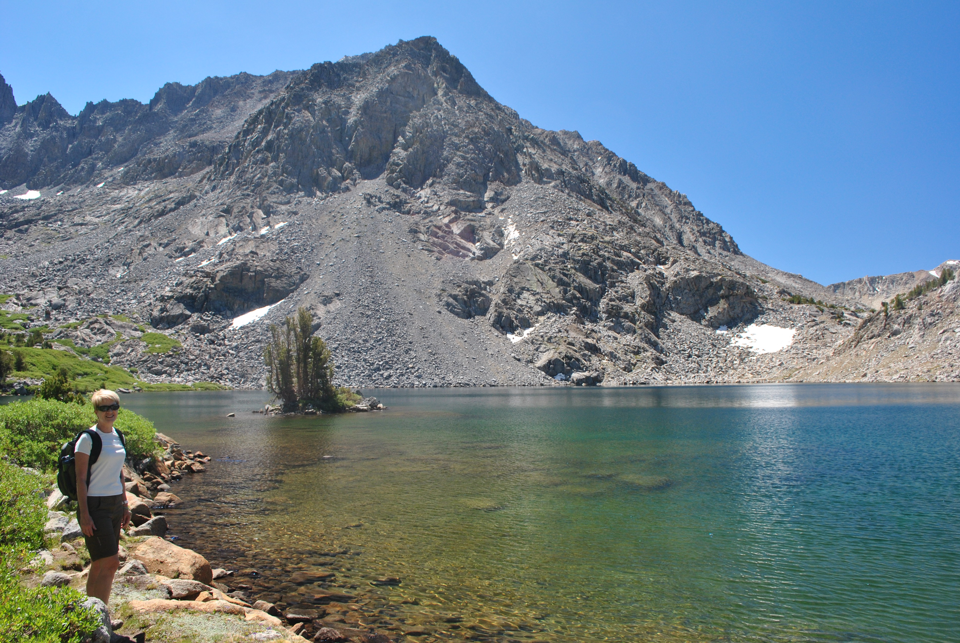
After an hour we reached the trail junction that was the start of the loop. This was where we had our first view of Chocolate Peak. It was composed of a dark brown rock that gave it its name. Our route was going to take us around the mountain in a counterclockwise direction so we took the right hand trail. In just a quarter of a mile we reached Long Lake. Our first glimpse of it was just a tiny corner with a beautiful peak in the background. I made Sandy stop so I could get a picture. Then we turned the corner and got the full view. The setting was just gorgeous. Since we were coming from the east the morning light was perfect. It was definitely a calendar-quality scene. There were a few parties camped at the lake. Although it was a beautiful spot I didn't envy them. About two minutes after stopping the mosquitos would find you. And there were lots of them. They were slow and not too aggressive. While we were moving I hardly noticed them. But when you stopped they found you and it didn't take long for them to make it very unpleasant. So we stopped (several times) and enjoyed the view (briefly), took some pictures (quickly), and then got moving again. Reminded me of the sand flies in New Zealand.
 Chocolate Peak towers above Bull Lake
Although we couldn't see all of it at first, we hiked alongside Long Lake for quite a while. It definitely lived up to it's name. Then just past the lake we reached a trail junction. The main trail continued on to several more lakes and eventually crossed the Sierra crest at Bishop's Pass. But we turned off on a small trail, really an unmaintained track, that climbed up to Ruwau Lake. It was only 300 hundred feet of elevation gain but it started off very steeply before leveling off for the final stretch to the next lake. It was set in a spectacular cirque that was dominated by the peak of Cloudripper. Any peak with a name like that has to be impressive. But here we were looking east instead of west - into the sun. So photos were difficult. I'm sure it would be a spectacular spot late in the afternoon or evening but we were there at 11 am. You can't have everything. We had gotten fantastic pictures at South Lake and Long Lake. But it was the wrong time of day for Ruwau Lake.
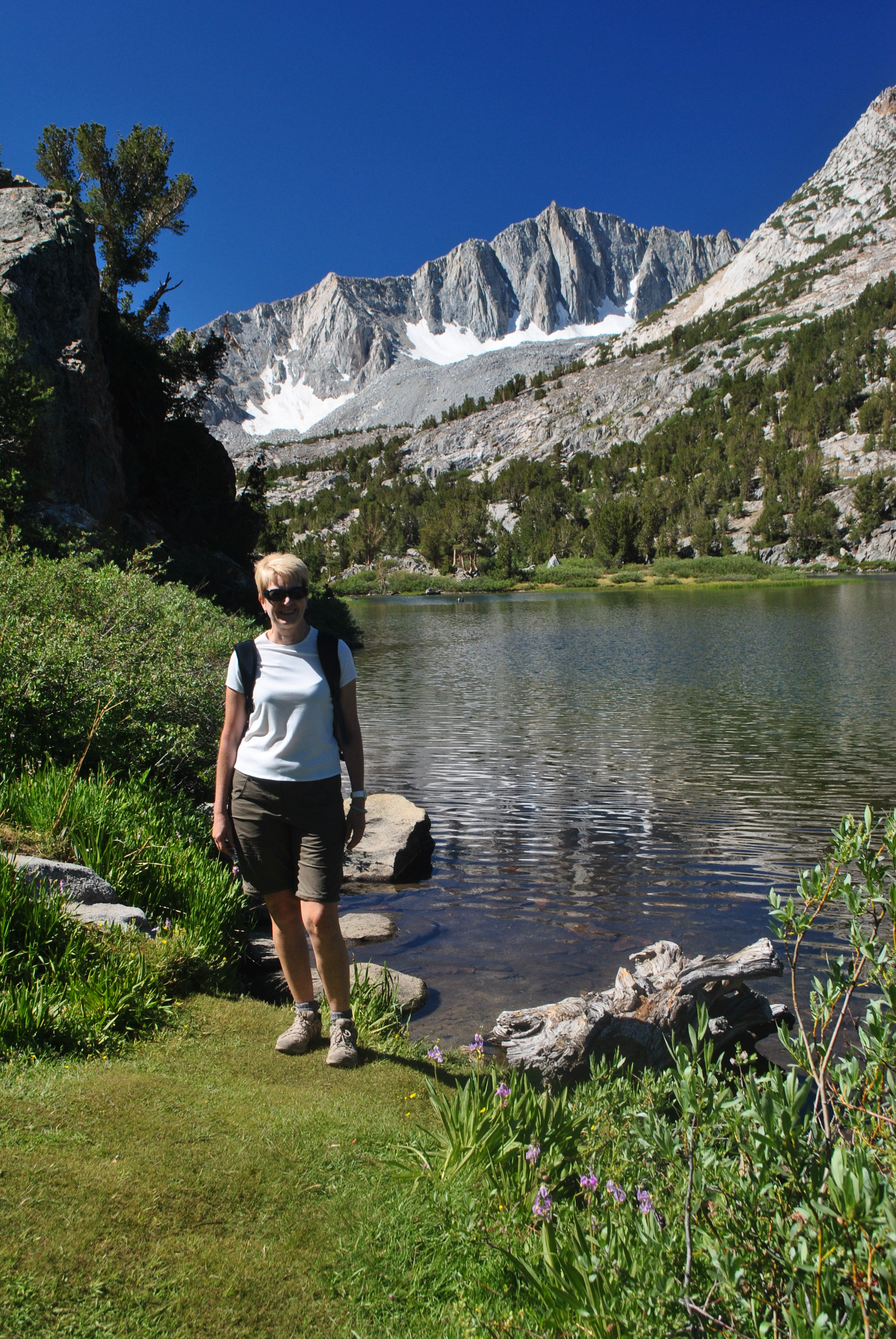
 Sandy at Ruwau Lake
Here we had to make a decision. The guidebook said that the track continued over a pass behind Ruwau Lake and dropped down to the Chocolate Lakes in the next drainage, picking up the trail that would take us back to the junction we had been at early in the morning. The guidebook said that the track was very difficult to follow. In fact it said it was the hardest hike in the book. But we had not been impressed by the difficulty level expressed for the North Dome hike. So we figured that we could do it pretty easily. Well, this time the guidebook was a little more on target. Sandy led most of this section and did a great job of finding a sketchy track that led around the lake. She also spotted where a track split off and started up to the pass. We followed without too much difficulty. But when we got near the pass we were too far to the left, maybe only by a hundred yards. And the track seemed to keep going up. So we could have done a traverse across to the saddle. It would have been hard work but was definitely doable. But by now we figured that the track we were following probably went up Chocolate Peak itself. I checked the topo and it looked like a pretty easy slope, another 300-350 feet and maybe a quarter mile to the summit. Sandy suggested that we go for the top and I quickly agreed.
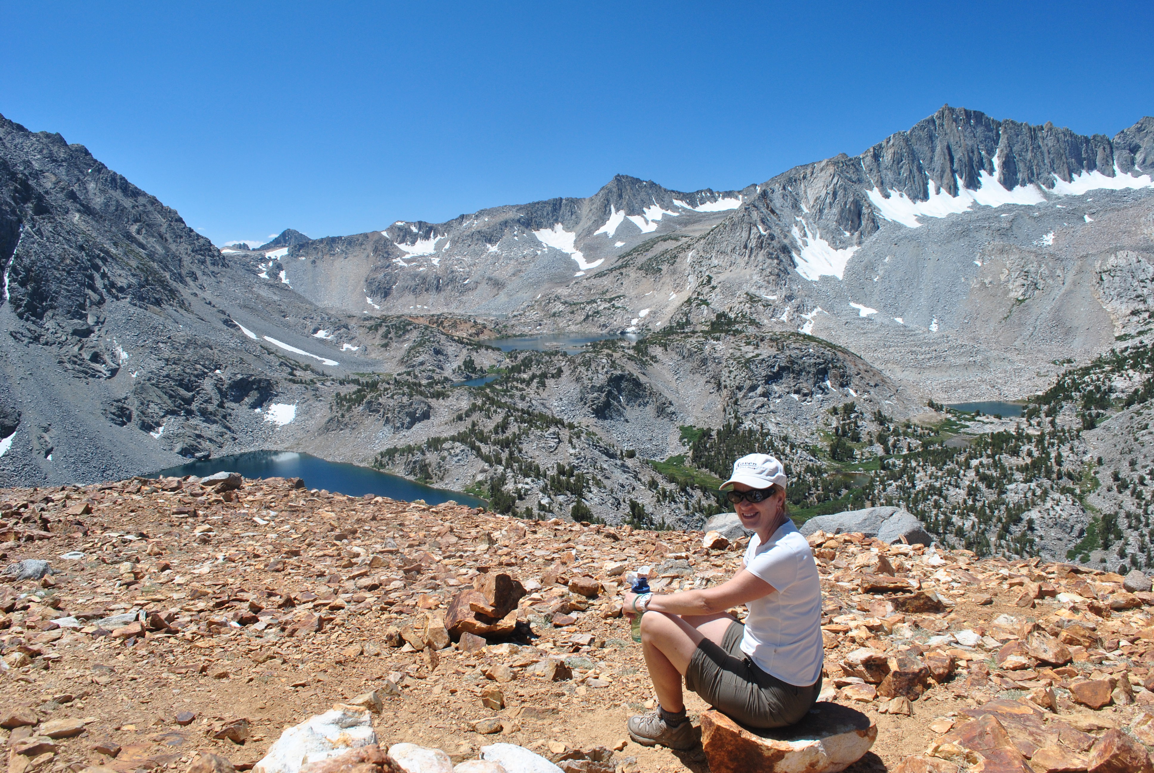 Enjoying the view on the summit of Chocolate Peak
The final slopes of Chocolate Peak weren't that steep. But there was a fair amount of trees/brush on scree slopes with broken rock bands. So it wasn't hard but it was work to find the best route. I led most of this section and eventually we were getting close to what looked like the top of the mountain. I rushed up the last slope ready to let out a whoop but it turned out to be a false summit. But the true summit was not too far away - maybe another two hundred yards and fifty feet higher. Finally we got to the top and both of us let out yells.
We had an outstanding viewpoint. We were at 11, 682 feet. Spectacular thirteen thousand foot peaks were all around us. But we could see over all of the alpine valleys and at least ten mountain lakes were visible. It was time for a snack and taking lots of photos. We found the summit register and added our names. Sandy read some of the previous entries. The peak had been climbed the day before by a sixty six year old guy who was out to reach sixty six summits this year. I don't think that I will come close to fifty nine but I wish him luck. Even though we could see over a huge area we couldn't see a sign of a single person. Once again we had an incredible mountain world all to ourselves.
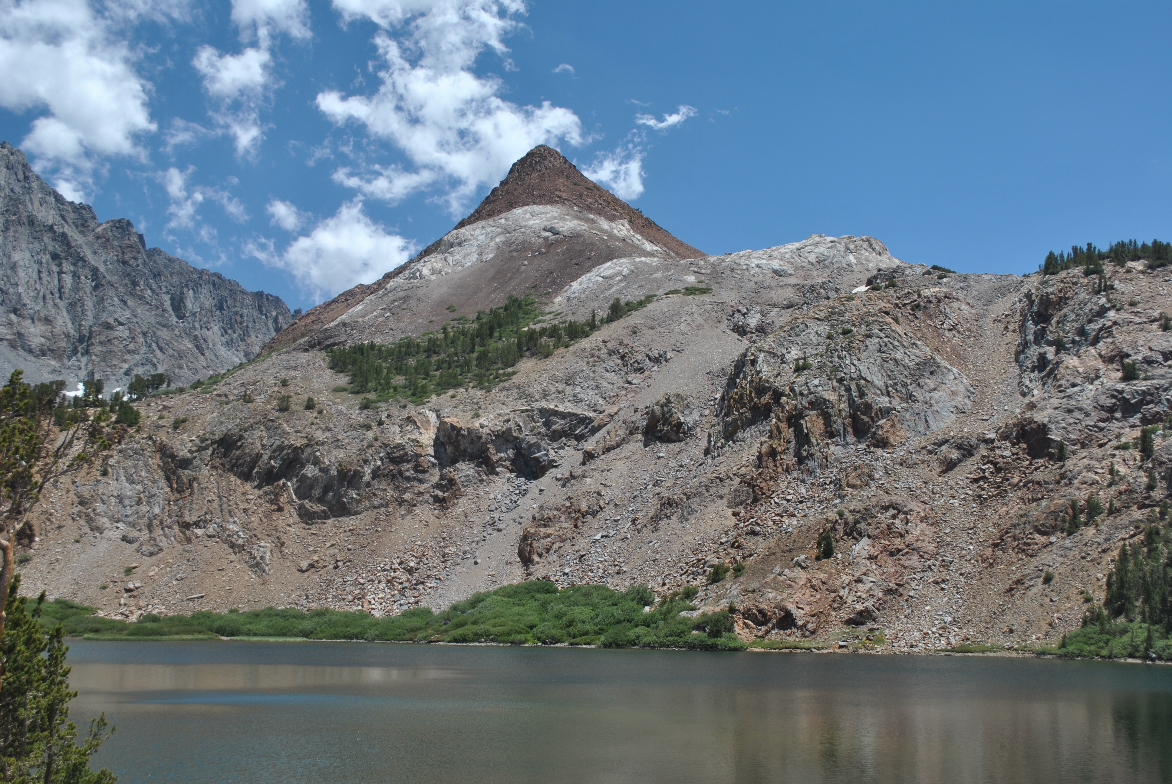
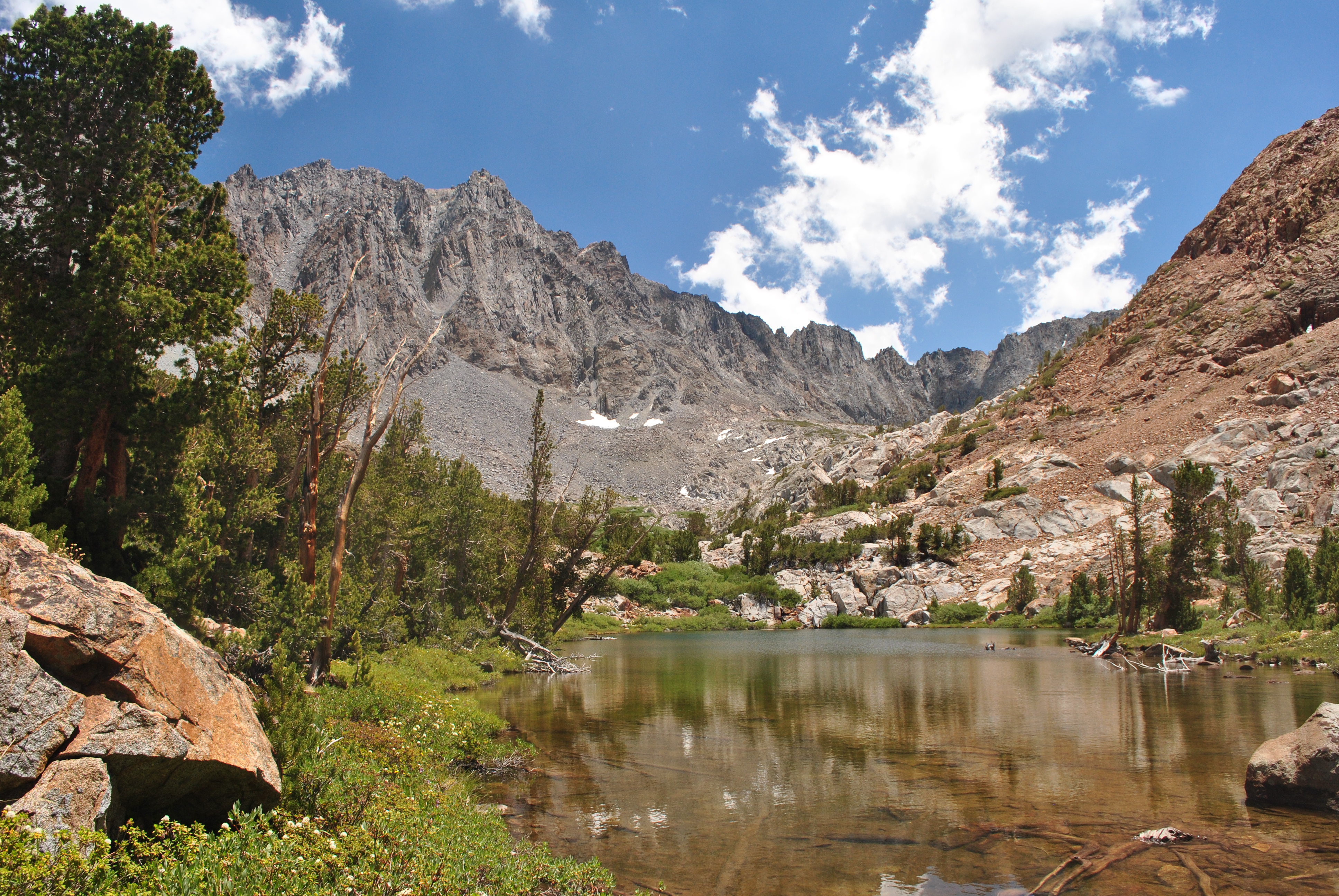 Cloudripper dominates the view above middle Chocolate Lake
Finally it was time to go down. I made a mistake early on and went too far to the right. We had to do a long traverse to get back on track to the saddle. We managed to get down but it was a lot of work. We were either scrambling over rocks or descending steep scree. It wasn't technically difficult but it demanded constant care to avoid slipping, which probably would have resulted in nasty cuts and scrapes. It took a lot of effort. When we finally reached the saddle and were all set to find a nice track down to the upper Chocolate Lake, we had no such luck. There were light tracks here and there which we would follow for two minutes before they would peter out. Then there would be some more scrambling and scree sliding to reach the next level section. When we finally reached upper Chocolate Lake there was a better track to follow but it was still up and down, pushing through brush and climbing over rocks in places. But the valley we were in was beautiful. We hiked by all three of the Chocolate Lakes and then Bull Lake. We had an impressive view of Chocolate Peak towering above the lakes. I always enjoy looking back up to a peak that I have climbed. We had gone a long way to get up there and come a long way back down. And we still had a long way to go to get back to our car.
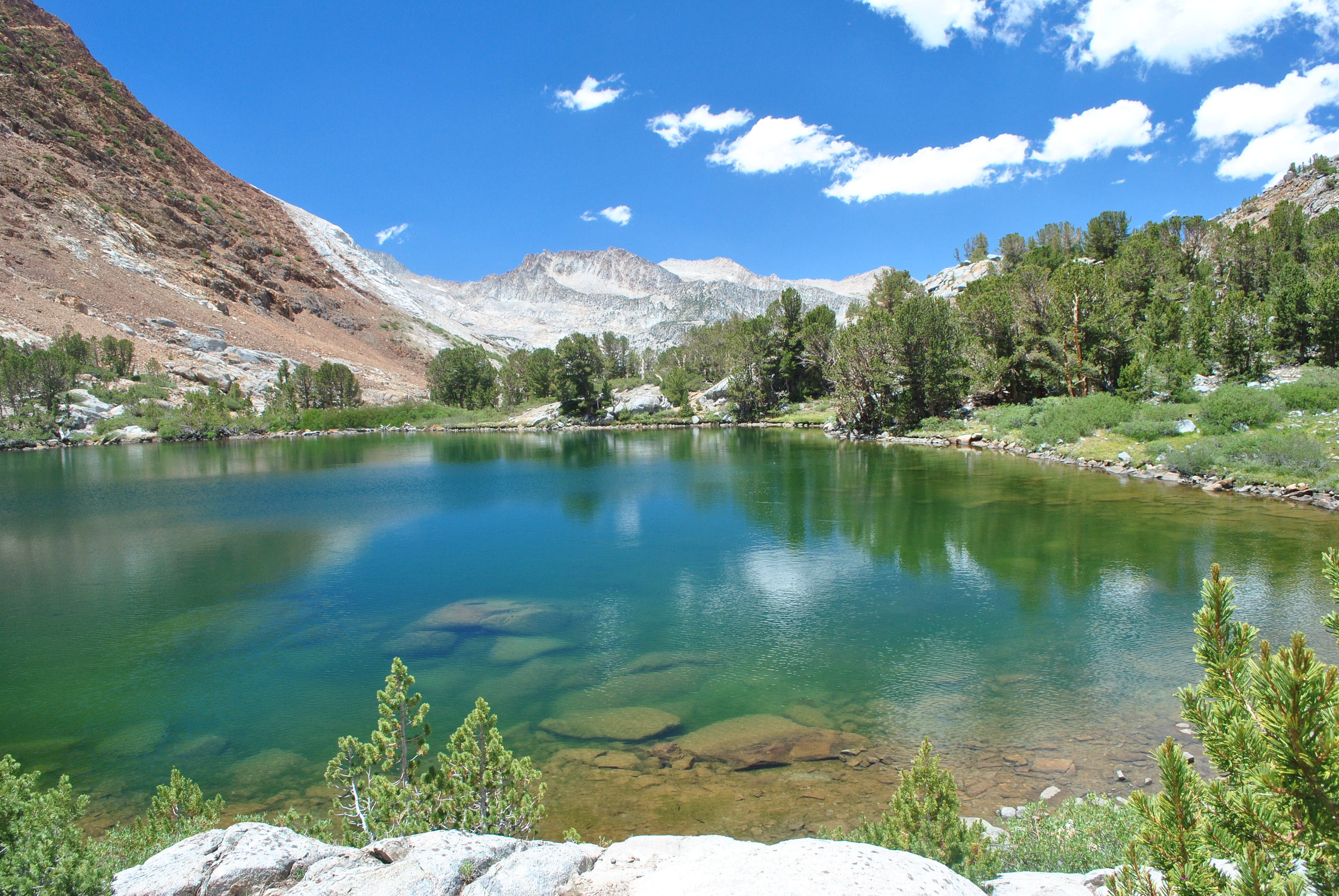 Middle Chocolate Lake
We hadn't seen anyone since we had left Long Lake. Coming down we didn't see anyone till we reached the far end of Bull Lake. There was a family fishing there. They looked like backpackers. This was where we finally picked up real, maintained trail. It was long overdue - much farther than we had expected. We were both worn out. We still had three miles to go back to the car - now just a mindless slog. We started to watch for features on the trail that we remembered from the way up. The next one was the trail junction for the loop. Finally I told Sandy that I could see it ahead. She looked and asked me where. "Right where those two guys are sitting on lawn chairs". ??? Yes, there were two guys at the trail junction sitting in lawn chairs in the shade. They were backpackers on their way in who had stopped for a long rest. Apparently they brought the chairs with them so that they could rest in style. We talked to them for a while. They asked if we were camped at the lake. We explained that no, we were camped in Bishop. On Main Street. At the Comfort Inn. They really didn't have an idea of where they were going. I showed them my topo map and we told them about the lakes above. They said they would head up to Long Lake but they still hadn't moved when we headed down the trail.
 Tired but still smiling - Sandy descending towards Bull Lake
From the junction it took us a very long hour to get down. We were both really tired by now. It had been a long, hard hike and we had done more than we planned. But eventually we spotted South Lake and knew that we were getting close. As expected when we started, climbing the short hill back up to the trailhead was no fun. But we made it back to the car. Sandy had the foresight to pack some sodas and ice in the cooler. Ice cold drinks tasted delicious as we drove back to Bishop.
When we got back Sandy actually had to do some work. She has a portable MFP that she needs to test in different environments. I thought she was awfully dedicated doing scans in the back of our car when it was 98 degrees out. That night we tried Holy Smoke, a place in Bishop that was supposed to be really good Texas BBQ. It was good but not anything to fuss about. If someone was coming to Bishop I wouldn't tell them that they had to try it. We topped it off with ice cream after dinner, although it took a lot of looking to find a place that served it. Then it was back to the hotel and a lot of work to get this post done. The area that we hiked in was spectacularly beautiful and picking which pictures to include was tough. Another awesome day.
Additional pictures
Mt Hurd above South Lake in morning light


