Kane Gulch to Grand Gulch
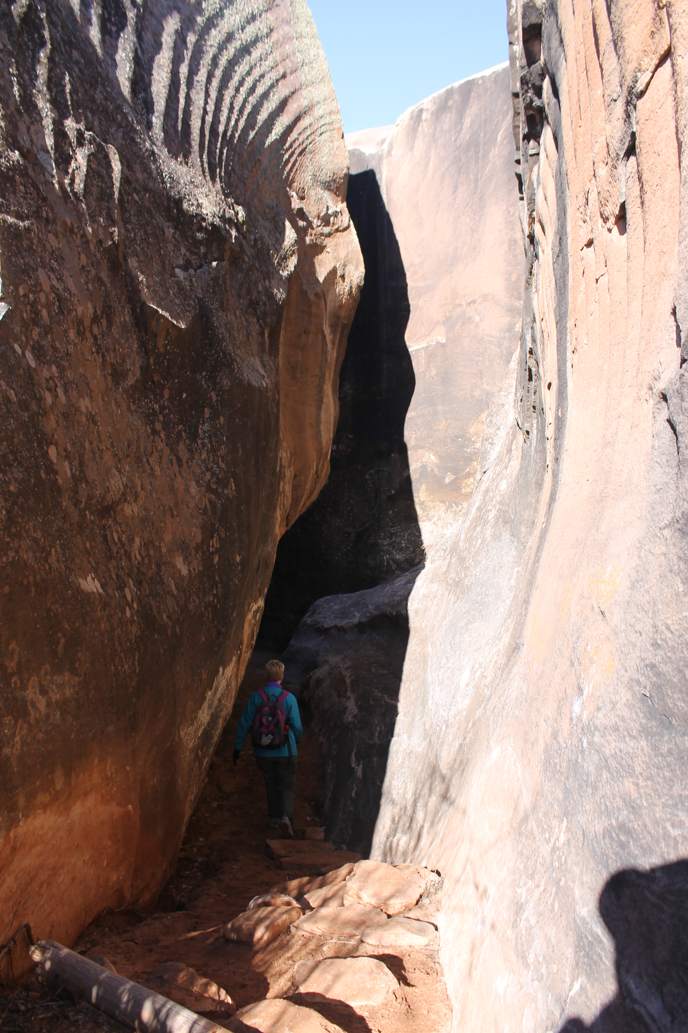 Sandy descends the gap leading to Kane Gulch
It was another perfect day. After a good breakfast, we retraced the last part of our trip the day before and drove back to Kane Gulch Ranger Station. It took us about forty minutes. Since it was early the ranger station was open this time. They had some good books and maps of the area as well as Grand Gulch Primitive Area tshirts. I did buy the USGS 7.5 minute topo map for the area that we were going to hike as well as the Trails Illustrated map for the whole Cedar Mesa area. With an incredible show of self control I didn't buy a tshirt. Later I was sorry that I hadn't.
Although this is a remote area and doesn't get a lot of visitors, the BLM charges hikers a day use fee. I paid the two bucks for each of us at the ranger station. We figured that if it is used for maintenance of the area it is for a good cause. That plus the practical consideration that if we were going to get busted somewhere for not having a receipt sitting on our dashboard, it would be while our car was sitting in the parking lot of the ranger station.
By 10 am we were ready to hit the trail. We were going to hike down Kane Gulch to Grand Gulch. But when we started out by crossing the highway from the parking area at the ranger station there were no gulches to be seen, grand or otherwise. The trail started out in highland mesa forest land. After about a quarter of a mile we came to some rocks with a narrow cleft between them. The trail plunged between the rocks and on the other side came out in a small canyon, the beginning of Kane Gulch.
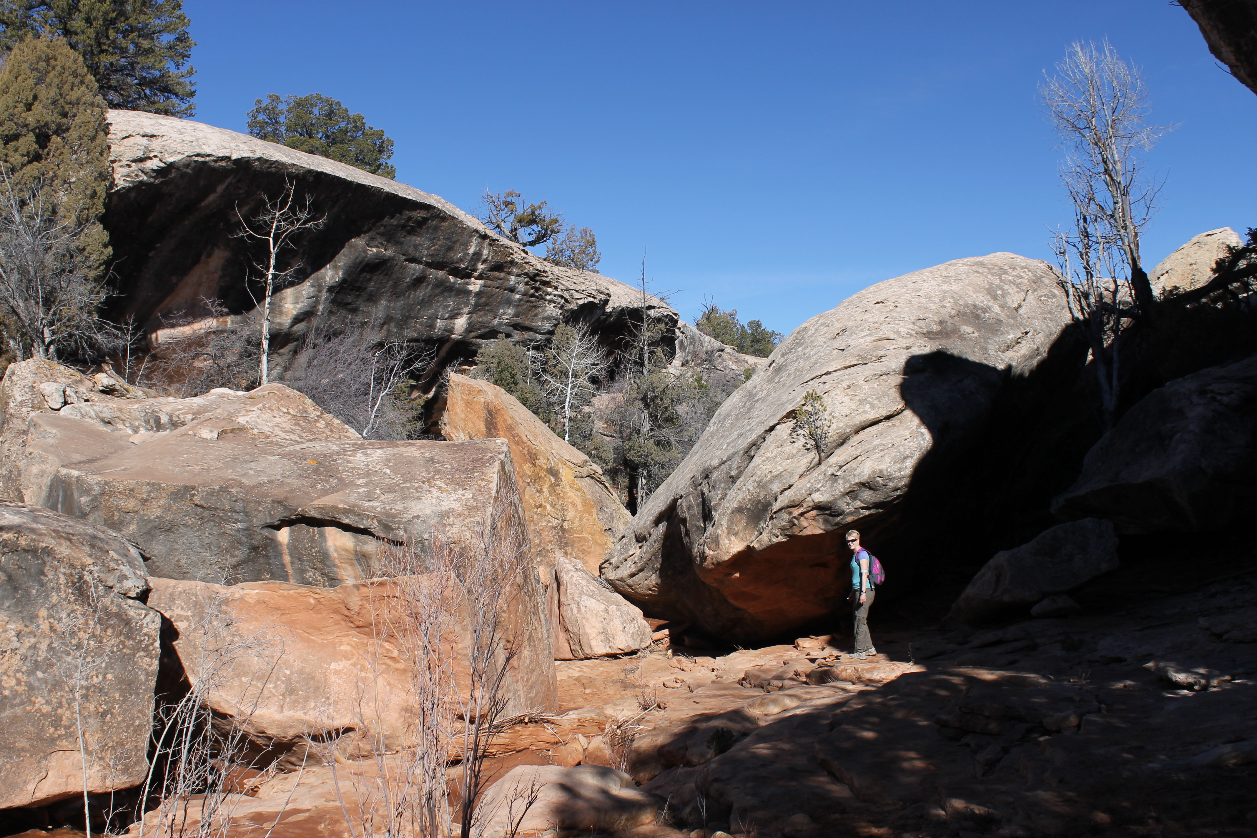 Sandy leads the way through the upper part of Kane Gulch
At Grand Canyon National Park the trails were paved and well signed. They were built to handle crowds of hikers. They were the hiking equivalent of a multilane interstate. Here in the Cedar Mesa region there are few maintained trails. Many canyons entail challenging routefinding and feature bushwacking, scrambling, boulder hopping and/or wading through stream bottoms. But we had chosen Kane Gulch because it is one of the most heavily traveled routes in the area. Our WOW Hiking Guide to Utah Canyon Country called it "Grand Gulch for dummies". It's all relative though.
We followed the trail, cairns, footprints, whatever down the canyon. It was more of a track, following where others had gone before. Sometimes they knew where they were going, sometimes they didn't. It was primitive hiking although by Cedar Mesa/Grand Gulch standards it was easy.
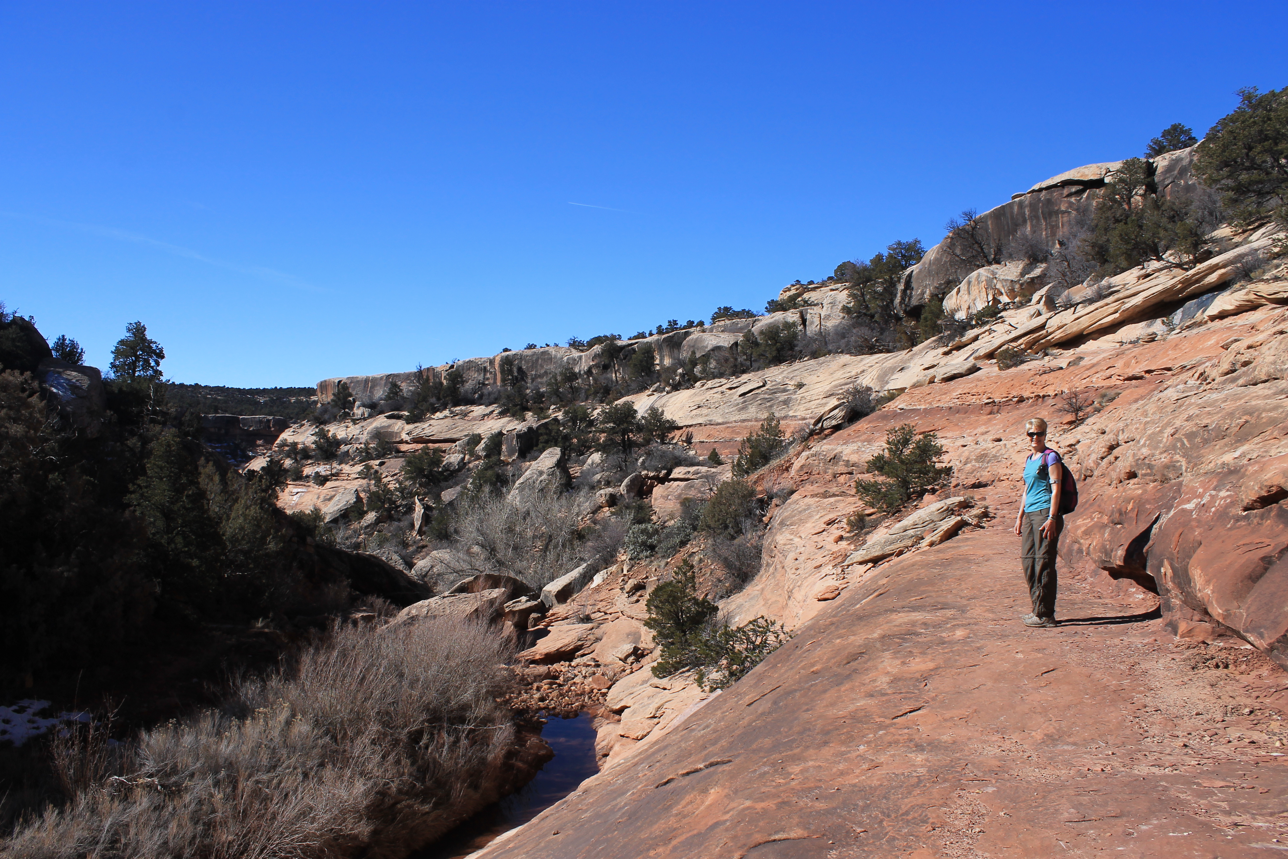 Sandy follows sandstone ledges through Kane Gulch
Usually the way followed broad sandstone ledges along the side of the canyon. Often there were cairns to mark the way where it crossed slickrock. Sometimes the route followed the bottom of the gulch. There wasn't much water so we didn't have to worry about getting our feet wet. Sometimes the path climbed out of the floor of the canyon. Usually it wasn't clear why but after a hundred yards or so there would be an obstacle on the floor of the gully that the trail climbed around. Someone was looking out for us.
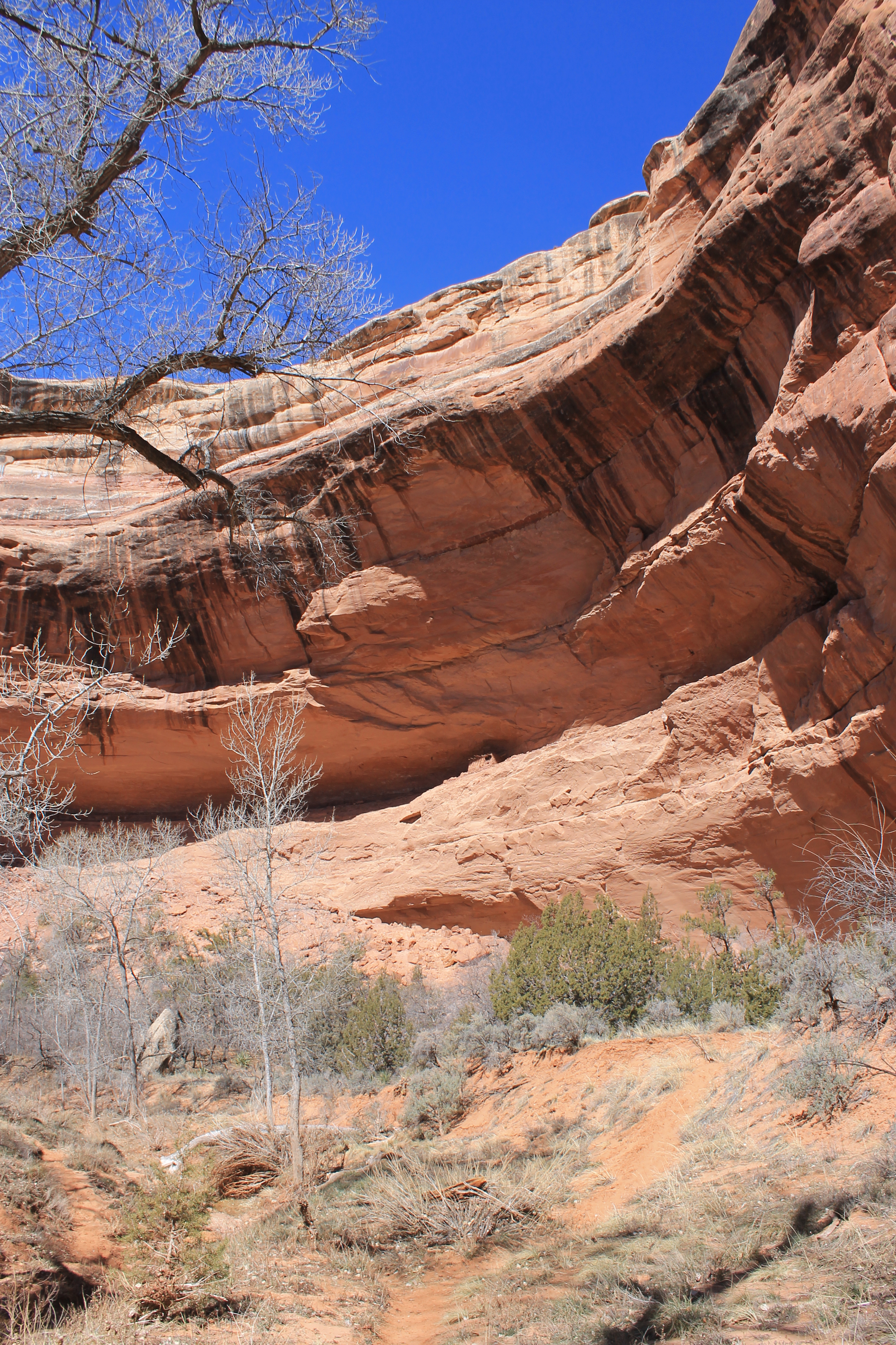
We made steady progress down the canyon. As we traveled, Kane Gulch got deeper. First we were at the bottom of thirty foot limestone cliffs. Then fifty feet, then a hundred feet. At about the two mile point we reached a place where the track climbed hign onto the right wall of the canyon. Leaving the easy rock ledges we dubiously followed the trail up a steep slope. Not too much farther we saw that the stream bed ended in a thirty foot pour off. Ok - the trail knew what it was doing. There was almost no water in the creek but otherwise it would have made an impressive waterfall.
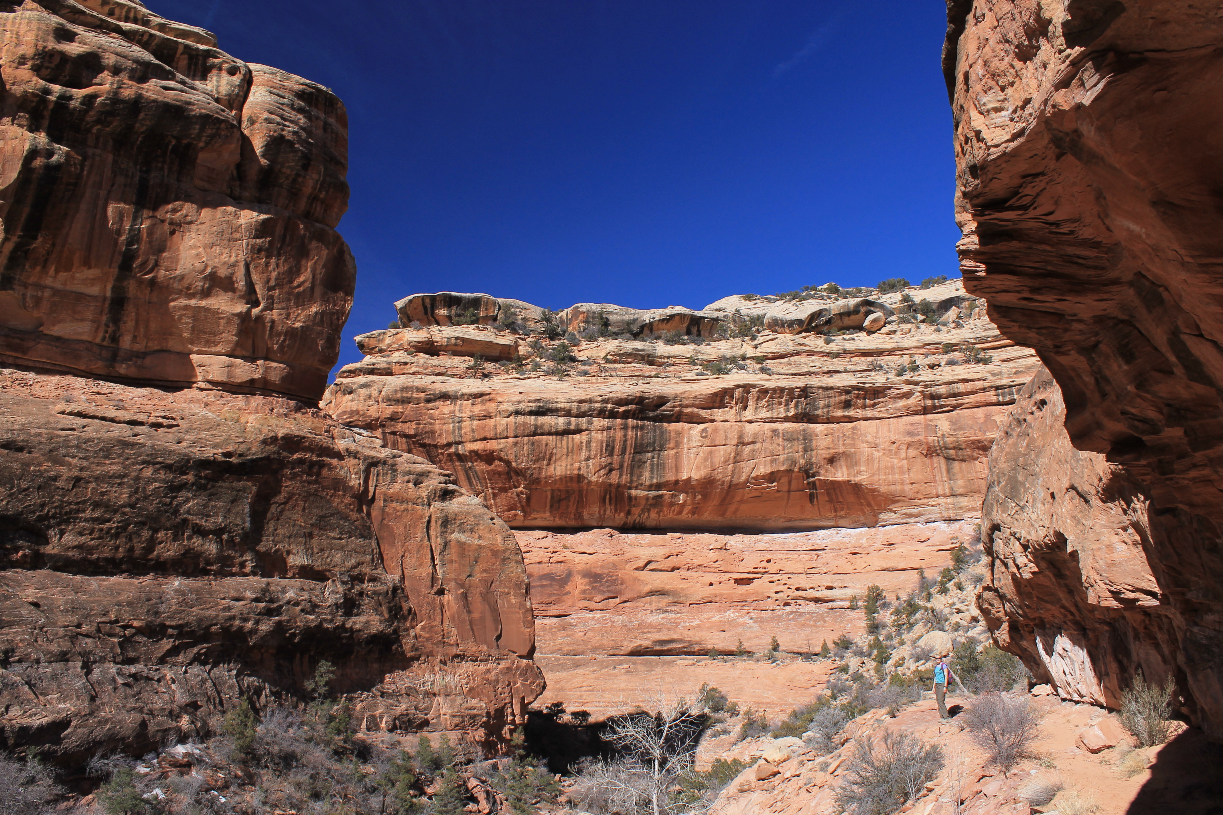 Lower Kane Gulch is a serious canyon
Below the pouroff the canyon deepened considerably. Now we were hiking below sheer sandstone cliffs hundreds of feet high. We followed the canyon through a series of sharp bends. It seemed like it never went straight for more than a few hundred feet. It was a spectacular hike through the lower part of Kane Gulch. Quite a change from the start of the hike.
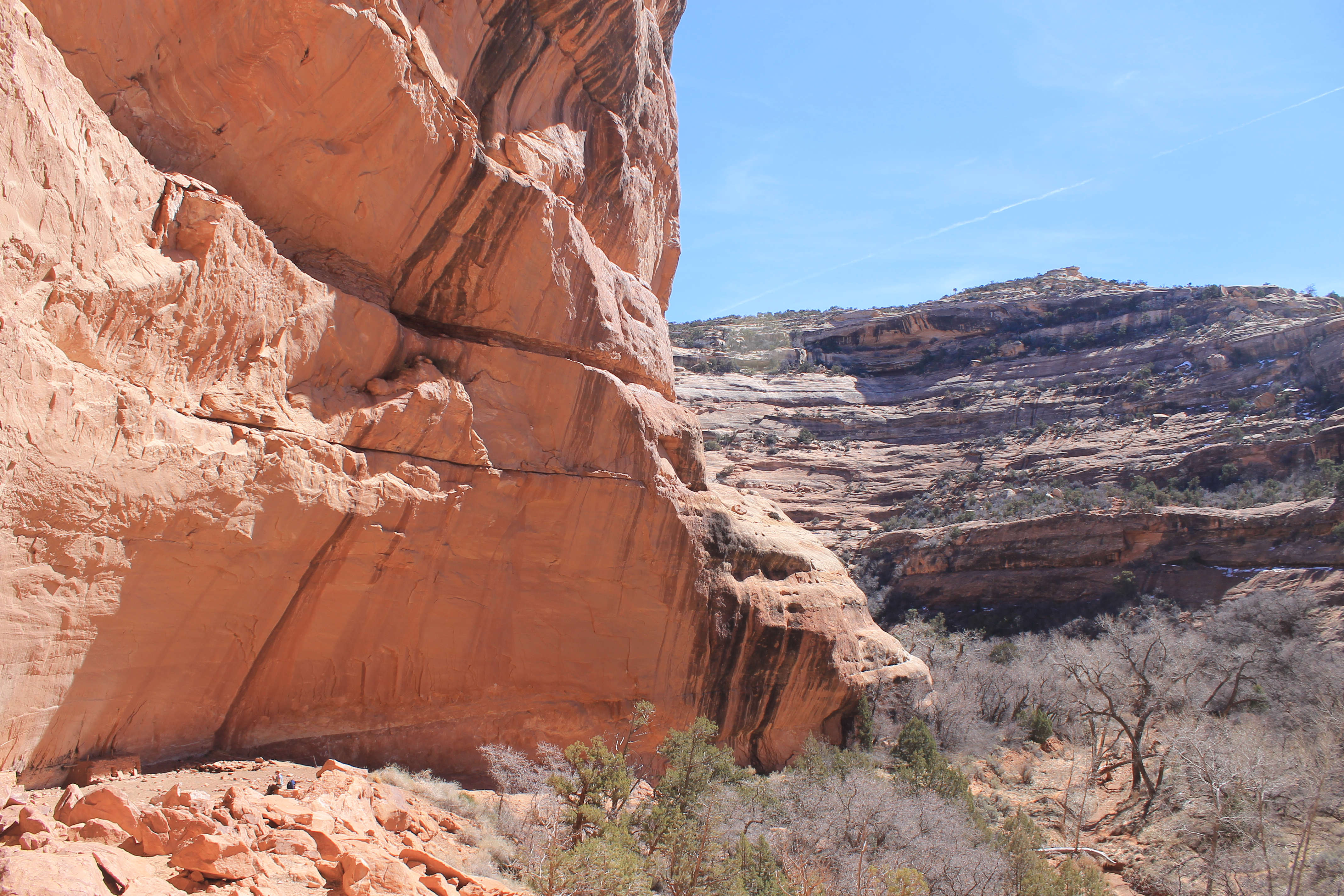
At four miles we reached the junction with Grand Gulch. There was a grove of cottonwoods at the confluence that is a common camping spot for people doing overnight trips. Grand Gulch is big. It's over 50 miles long. It's torturous. The canyon has bends every 200 to 600 yards throughout its length. Some hikers visit it the way we did - a day hike down a tributary to the main canyon. Others do an overnight loop trip down one canyon, along Grand Gulch for a distance, then back up another canyon. Others take five days to do the entire length of Grand Gulch.
 A ruin perched high in an alcove
The trail guide indicated that from the confluence it was possible to see some ancient ruins. Sure enough we spotted Junction Ruin in an alcove part way up the cliffside on the other side of the canyon. It looked quite hard to climb up to the ruins so so we didn't bother crossing over to them. We could see them pretty well from the trail although it was hard to get a clear photo through the cottonwood branches.
We had made it to Grand Gulch but we wanted to go a bit further before we turned back. Three quarters of a mile from the junction we hoped to find Turkey Pen Ruin, which is even more extensive than Junction Ruin. From the photos we had seen of people at the ruin we assumed it was more accessible too. After about twenty minutes of hiking we were wondering if we had missed it when we spotted a side track heading off from the main trail. It went towards an alcove in the cliff along the west side of the canyon and we spotted a ruin high up the cliffside in the alcove. We climbed up a short dirt slope to be base of the alcove and found several well preserved buildings nesteled against the rock wall. They were incredibly well preserved and it was exciting to actually be able to walk right up to them. This was no museum or fenced off site. We could explore the ruins in their natural state. There was a sign saying that the ruins on the ledges above were closed off but I'm not sure we would have been able to scramble up to them anyway.
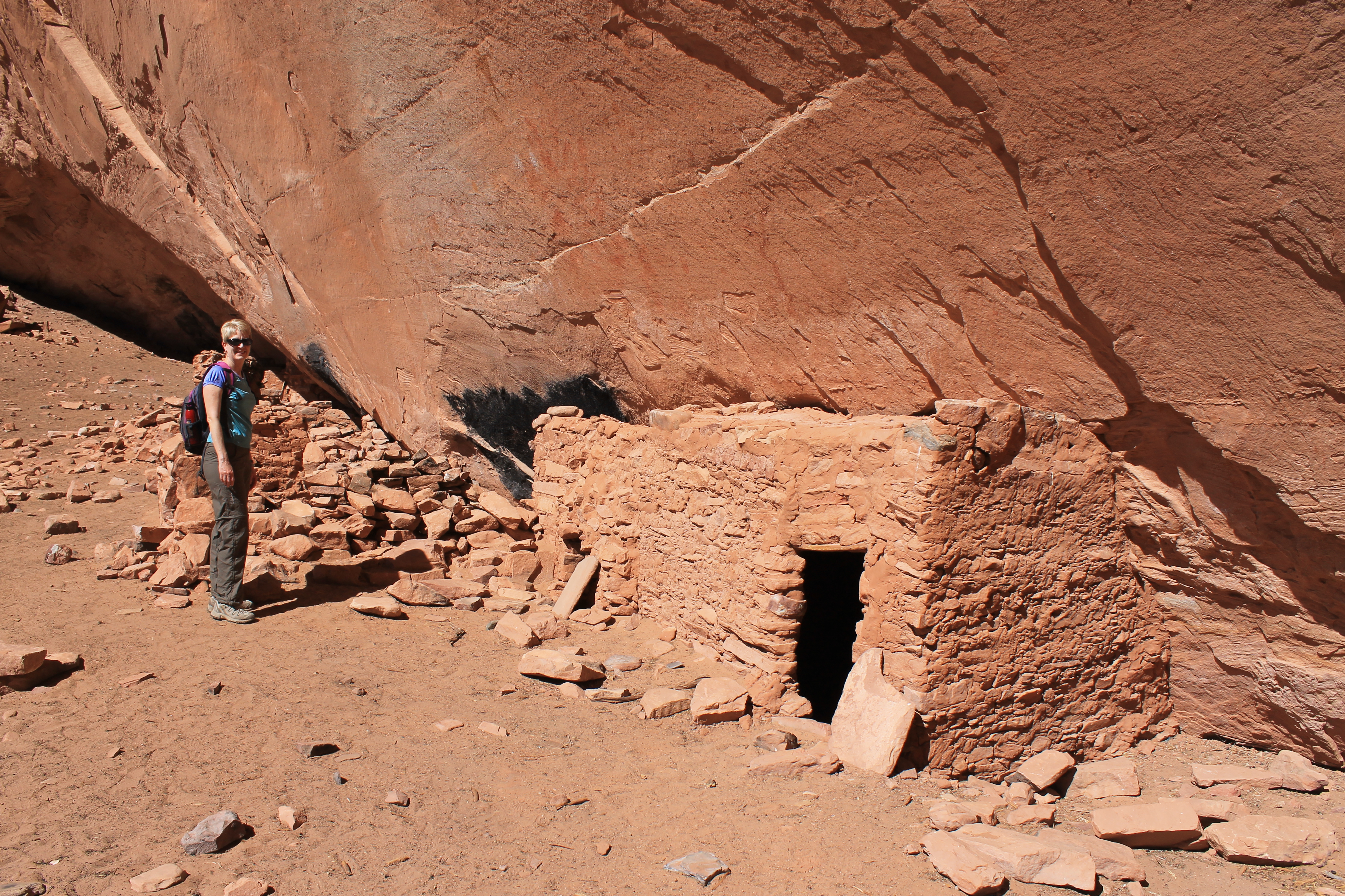 Sandy at Turkey Pen ruin
The Turkey Pen Ruin site is almost a thousand years old. It is estimated that it was occupied off and on for two hundred years from about 1050CE to 1250CE by the Anasazi. These were a prehistoric people who inhabited the American Southwest for thousands of years up until their civilization vanished about 1300CE. Turkey Pen Ruin was an attractive site for ancient people because it has a southern exposure to keep it warm in the winter, but is under an overhang to keep it cool in summer and to protect it from rain and other bad weather. The upper ledges are difficult to reach and easily defended and even the lower areas cannot be approached without being seen. This portion of Grand Gulch is not easily reached either. There are no nearby breaks in the cliffs so it can only be accessed through long tributary canyons like Kane Gulch. The indians who lived here hunted on the surrounding mesa, grew crops in the canyon, and kept livestock. These included turkeys. Turkey Pen Ruin really does have ruins of turkey pens.
 Setting of Turkey Pen Ruin showing upper and lower levels
It was pretty amazing how well preserved the buildings that we explored were considering that the site is remote but accessible. Sadly it was badly damaged by systematic looters in 1979. A major effort to recover archeological information and to restore the site was sponsored by the BLM. Since then information on the location of antiquities in the area is not advertized as much as before. The BLM does not highlight it at the trailhead. There are no signs or other indications along the route to point out the ruins. Even the hiking guides only give general directions on how to find most sites. One guidebook author mentioned that he explicitly excluded GPS coordinates even though he recorded them for all the sites he visited. Visiting this remote site still in its natural state was an incredible experience. Hopefully people will show respect for the ruins and leave them exactly as they are for future hikers to enjoy.
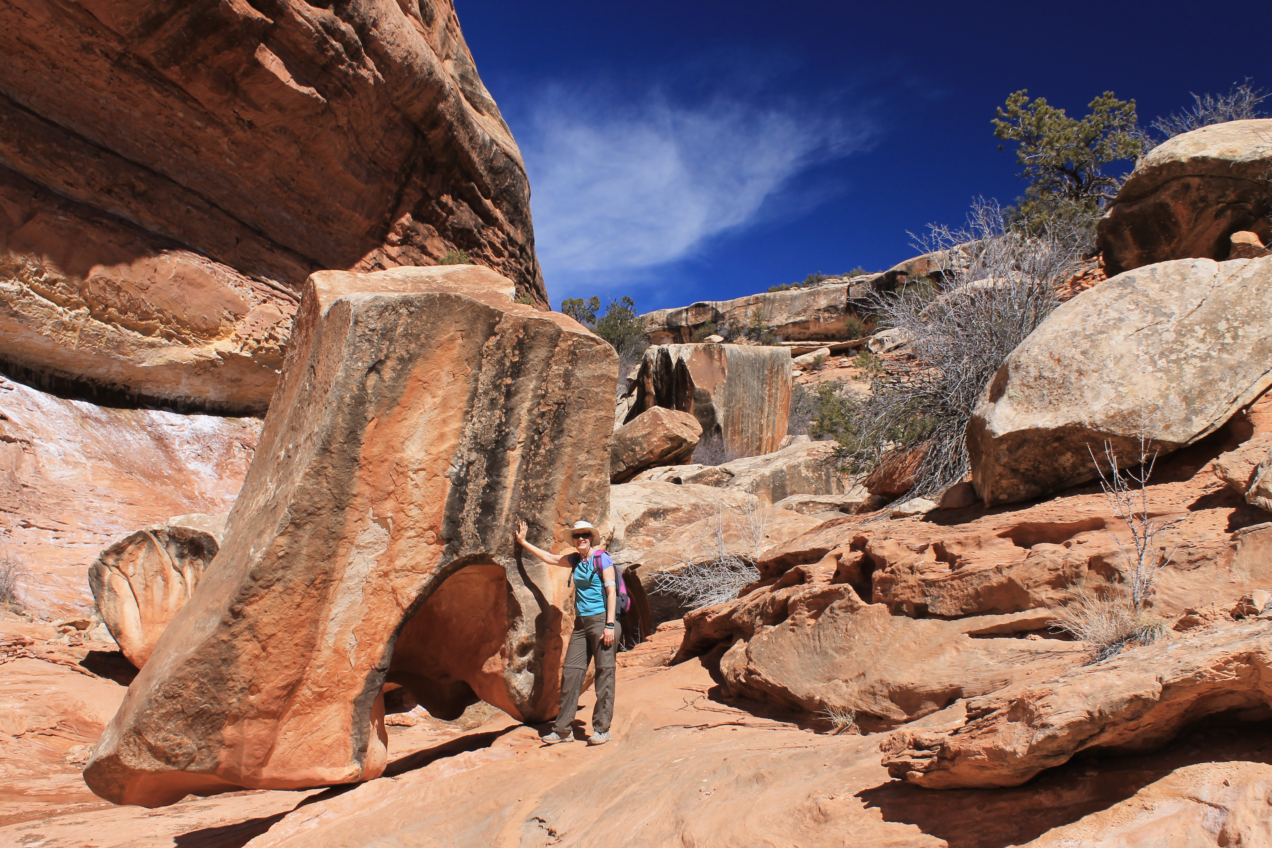 An unusual rock blocks our path in lower Kane Gulch
After exploring the ruins we had a drink and a snack. It was fun to sit there and imagine what it was like when an active community lived here hundreds of years ago. But then it was time to return. We headed back through Grand Gulch and followed the trail into Kane Gulch. Through the bends of the lower canyon and over, around and through various obstacles. There wasn't much net elevation gain - it was only about 500 feet back to the trailhead. But there was a lot of up and down along the route. Gradually the canyon walls sunk on both sides of us and the gulch grew smaller and smaller. Eventually we were back on the high mesa and we spotted the ranger station ahead. Sandy had thought to have cold sodas in the cooler for the drive back to Blanding. With a hike of roughly ten miles round trip we decided to drive rather than walk to the Homestead restaurant. We shared a good pizza to finish off an excellent day.
