Natural Bridges National Monument
 Sipapu Bridge from the viewpoint on the scenic drive
Our next hike was in Natural Bridges National Monument. It's close to Cedar Mesa. In fact it's only a few miles past the turnoff to the Kange Gulch Ranger Station which was the start of our last hike. We decided that we didn't want to do an hour drive to the trailhead and then drive another hour back to Blanding again. Our plan today, since we were heading northwest which was the direction towards home, was to continue on after the hike to the town of Hanksville for the night. Although the Super 8 in Blanding was adequate we really wanted to get somewhere that had a real internet connection. We could only take so long roughing it in the wilderness. The dinners that we had at the only restaurant in town had been good but two nights in a row at the same place was enough. Plus I had worn a tshirt that Sandy bought for me at a winery in Wisconsin when we went to dinner the night before. That is a sure way to get a lot of dirty looks from everyone in a small town in Utah. I certainly couldn't be mistaken for a local.
 Sandy climbs down a steep rock band
It's definitely a conservative area. There wasn't a state liquor store in Blanding so there was nowhere in town that you could even buy wine. We had driven to Blanding through the town of Kaylenta, which is in the Navaho Nation where it is prohibited to serve alcohol. I think the closest place we could buy wine was in Moab which is 75 miles north of Blanding. Talk about being far from civilization. Fortunately we had planned ahead and packed a couple of bottles of wine in the car for our trip. Serious BYOB. Yes it was definitely time to move on.
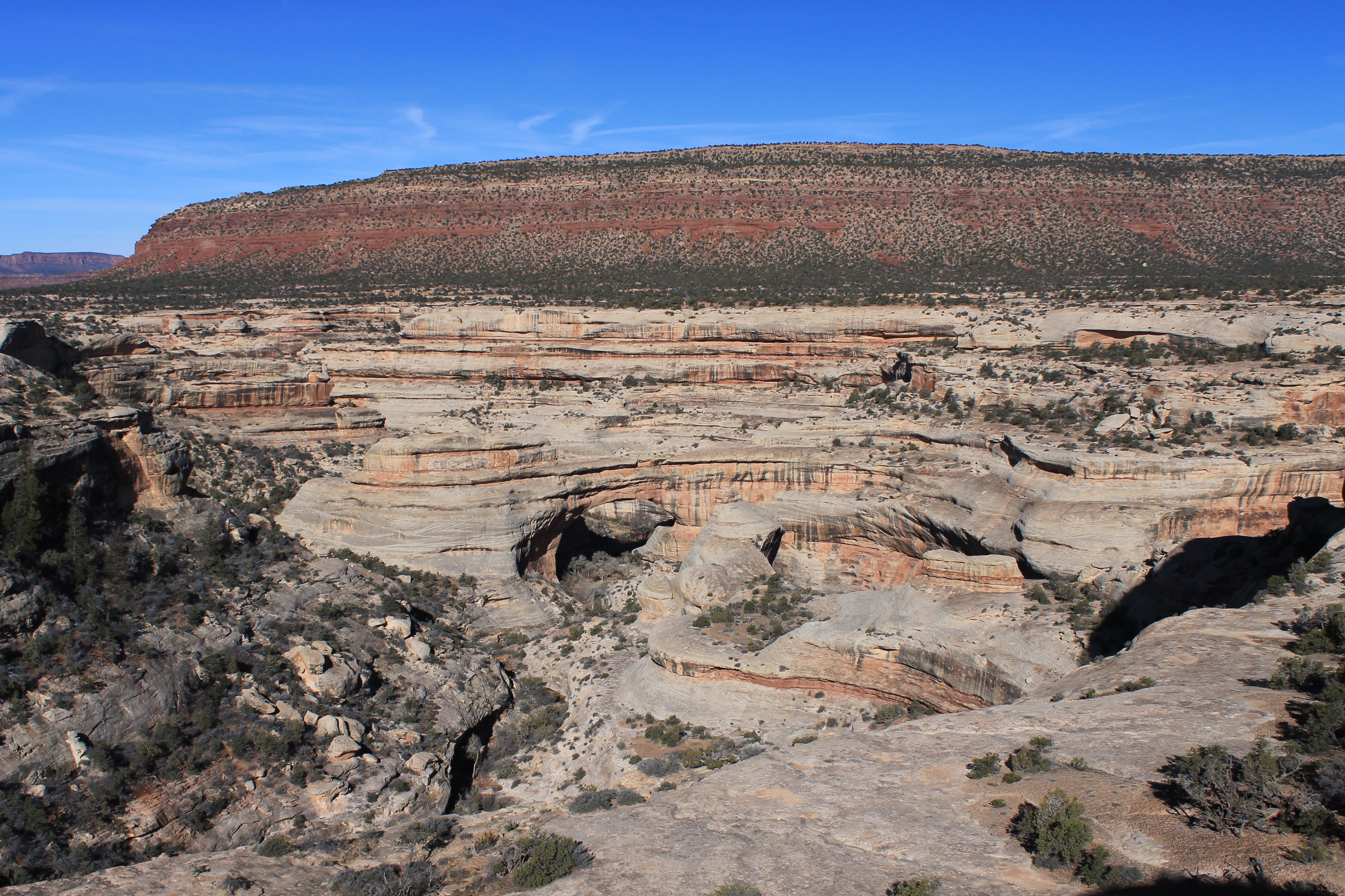
Natural Bridges National Monument is remote. It's an hour drive from Blanding and two hours drive from Hanksville. And those are very small towns! So like the Cedar Mesa area, it doesn't get a lot of visitors. It's not very large - only 7600 acres. The centerpiece is three natural bridges that are some of the largest in the world. The park literature makes a big deal about them being natural bridges and not arches. I will admit that I had to look up the difference. It turns out that it is somewhat of a judgement call. Usually a natural bridge is a specific type of arch that was primarily carved by running water and straddled the water flow. The official definition comes from the Natural Arch and Bridge Society which is considered the ultimate source on the subject. The society is also the official authority on how the size of arches are measured, both length and height. They are considered the keepers of the definitive list of the size of natural arches and bridges.
 On the descent to Sipapu Bridge
With three of the largest natural bridges in the world in a small area, Natural Bridges was designated a national monument by Theodore Roosevelt in 1908. Natural Bridges was the first park service area in the state, although now Utah has the most national parks of any state in the continental US (it's tied with California at five). Zeke Johnson, the first ranger/superintendant of the monument, was paid $1/month by the park service. Because of its remoteness it had few visitors for many years. In 1923, the earliest year that I could find Park Service visitor statistics, the monument only had twenty visitors. Utah state highway 95, the current road access to the monument, wasn't even paved until 1976. Natural Bridges only had 90,000 visitors in 2012, which is not very many compared to more popular parks. In fact the total number of visitors to Natural Bridges all time is only about four million people, less than the number that visit Grand Canyon National Park every year.
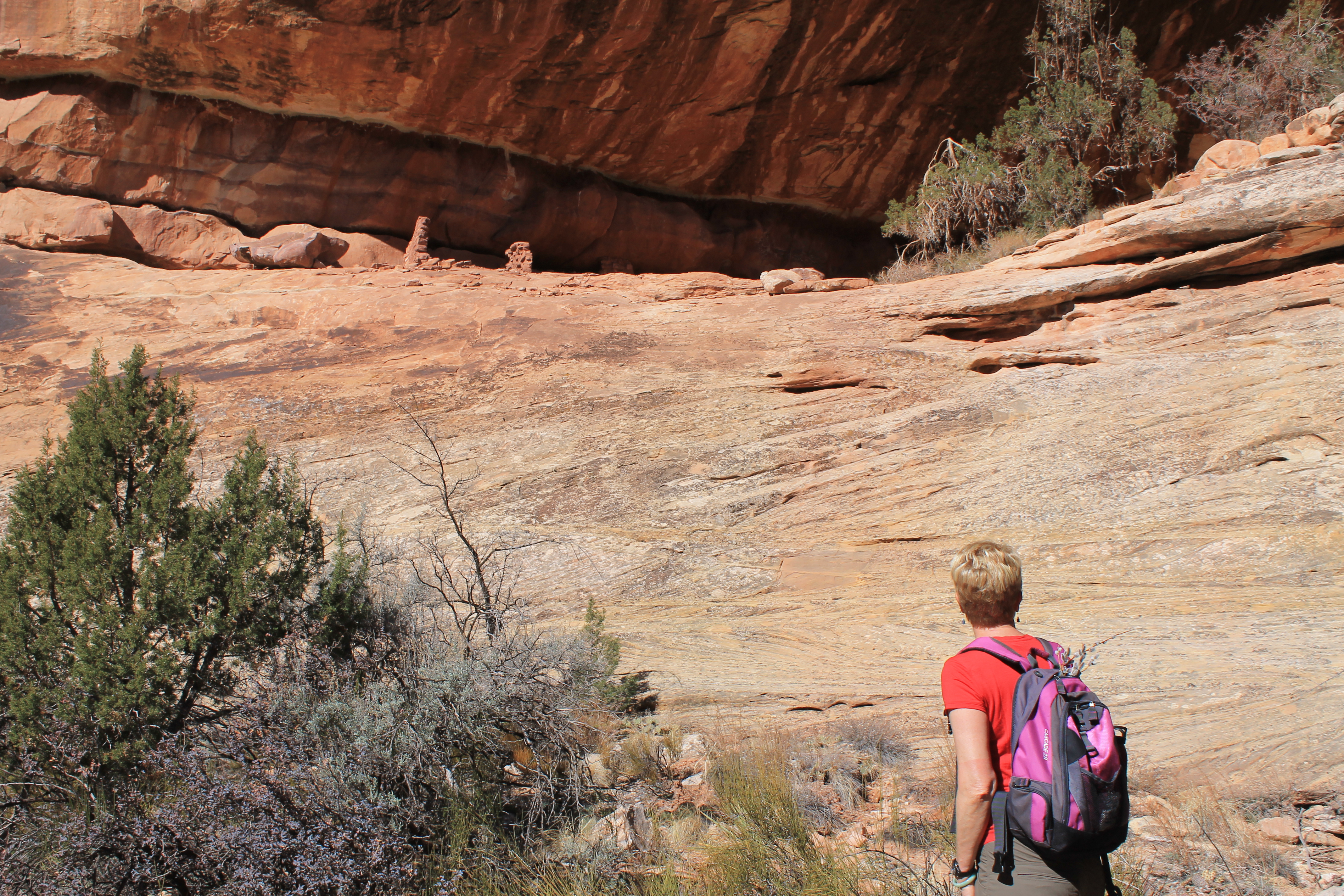
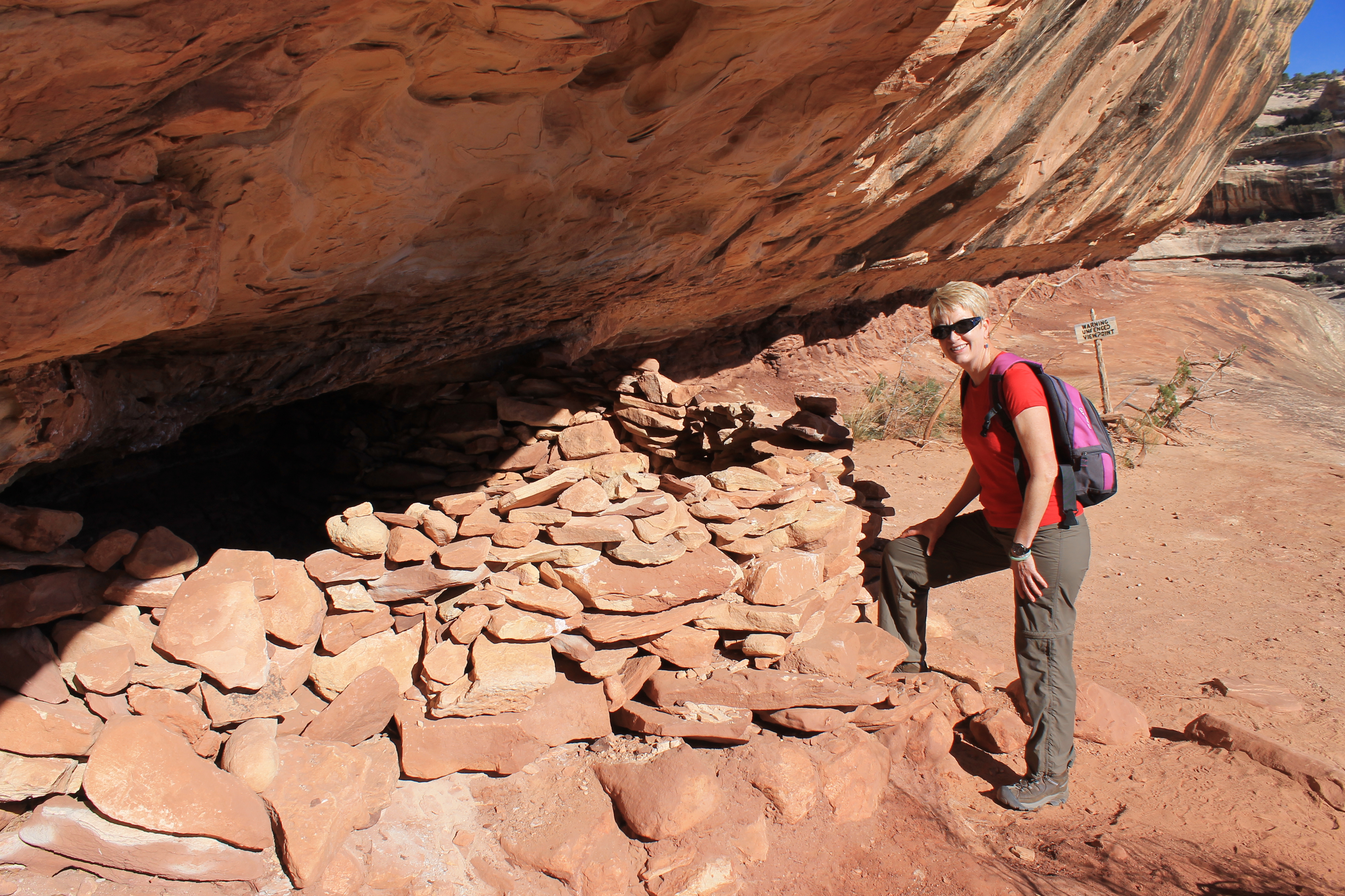 An ancient indian ruin along the trail to Sipapu Bridge
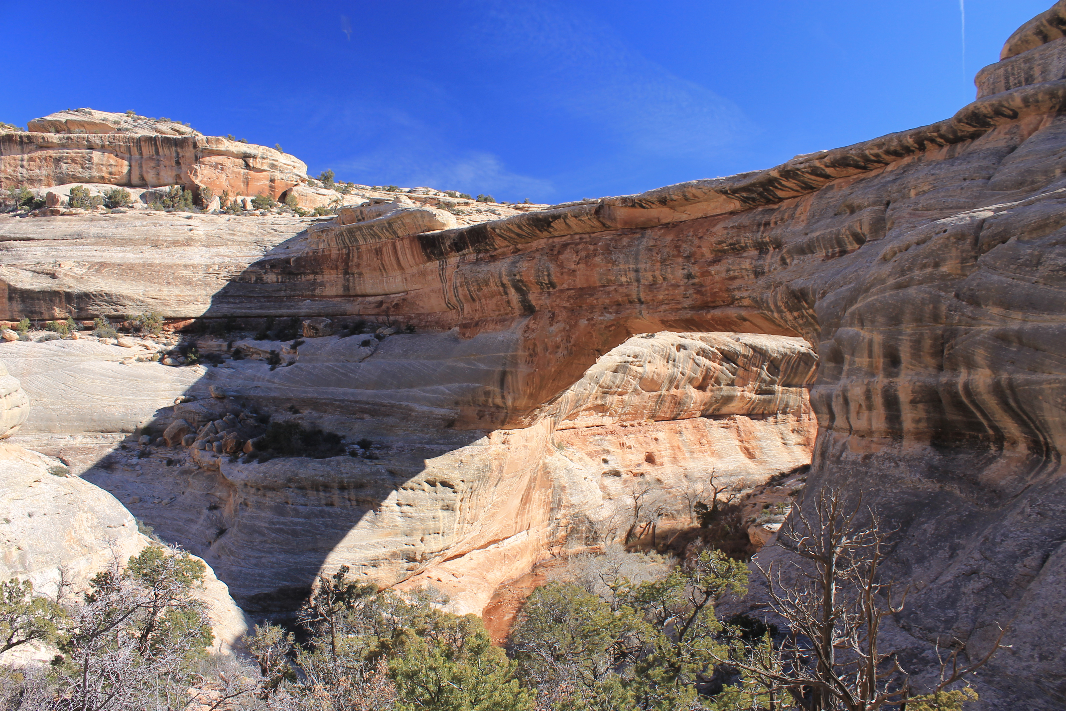
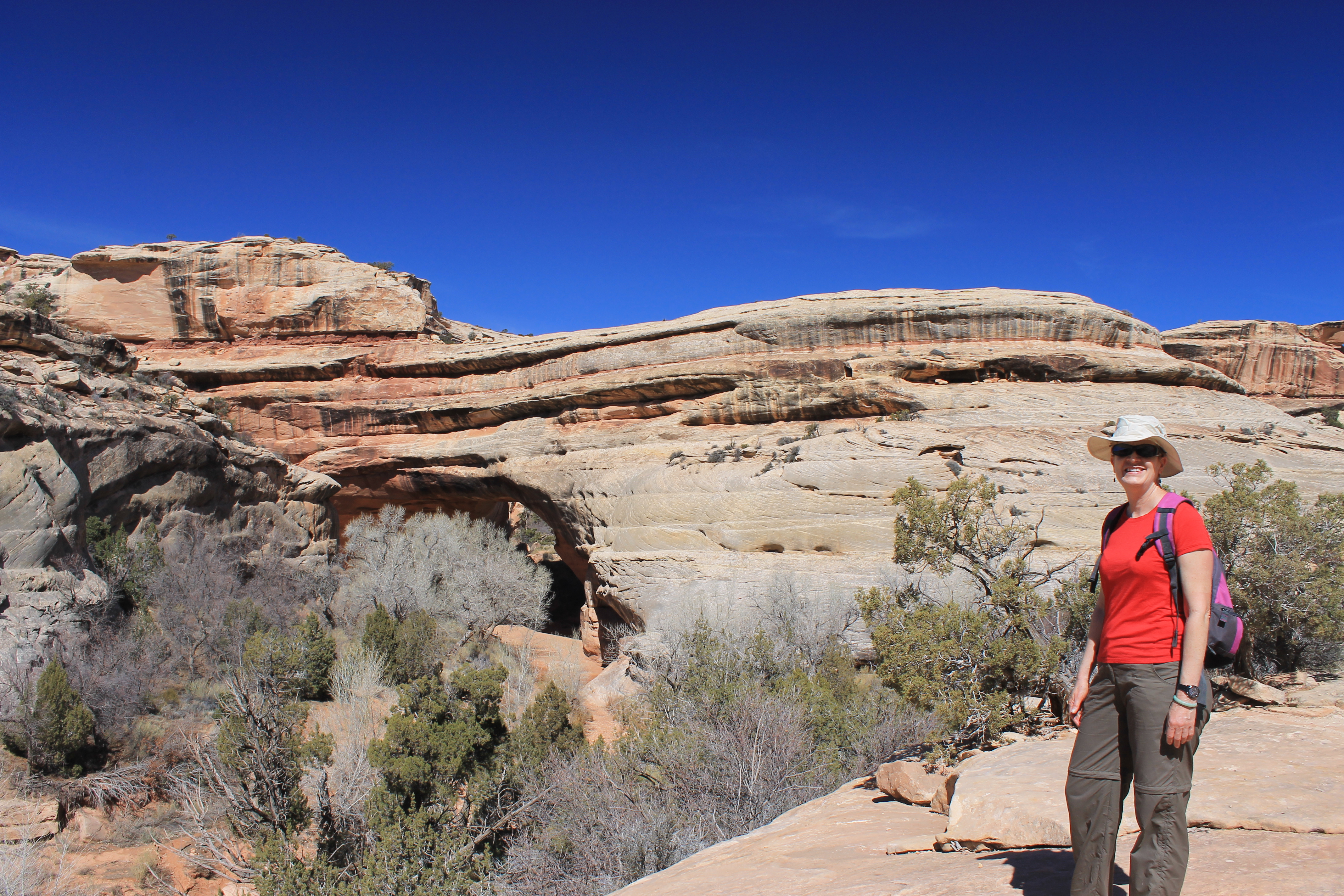
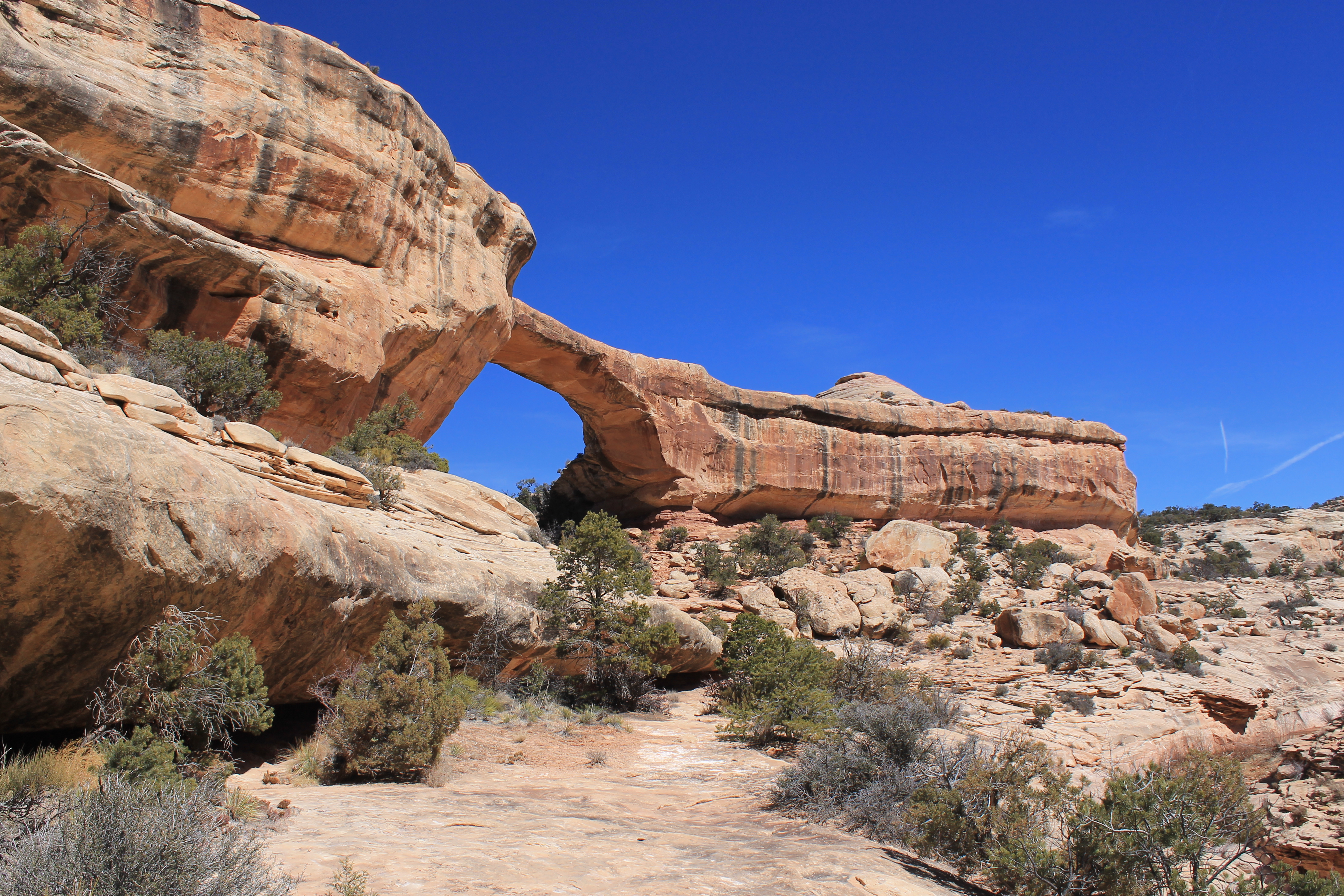
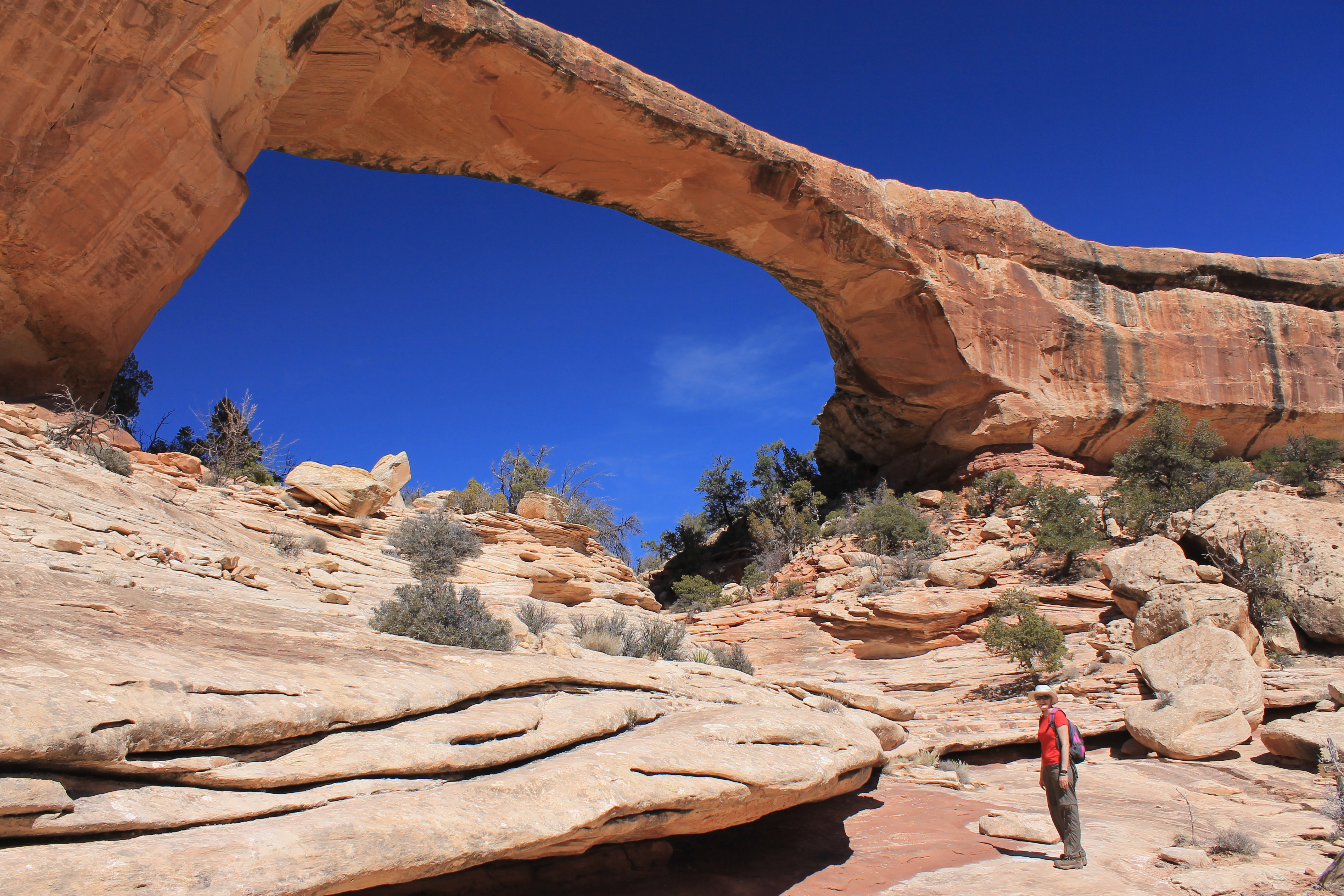
The main attractions of the monument of course are the three natural bridges: Sipapu, Kachina and Owachomo. They have Hopi Indian names but they weren't named by the native peoples of the area. Rather the local Land Office chose Hopi names for the bridges in the early 1900's. Better than the usual practice of naming things after local politicians or white settlers. There is a nine mile loop drive that has overlooks of each of the three bridges. From the overlooks there are also trails that drop down into White Canyon so that you can stand underneath the huge bridges. But best of all there is an eight mile loop trail that drops down to Sipapu Bridge, follows White Canyon past Kachina Bridge, then follows Armstrong Canyon and ascends back to the canyon rim at Owachomo Bridge. From there a two mile trail cuts across the top of the mesa back to the starting point. Besides getting to see all three natural bridges up close, the canyons are a worthwhile hike in itself. The icing on the cake is that there are indian ruins at several points along the trail.
 Sipapu Bridge
Our first stop was at the Visitor Center. As usual there were some interesting books covering trails, geology and history of the area. I had my eye on a Natural Bridges National Monument tshirt but I didn't think it was legitimate to buy the tshirt before we did the hike. Now I had another incentive to complete the whole loop.
There was also an interesting astronomy display at the Visitor Center. Since Natural Bridges is so far from any cities or even small towns, there is almost no light pollution. It has extremely dark skies. It has a rating of 2 on the Bortle Dark-Sky scale, a measure of how dark the sky is. This is the lowest rating of anywhere in the continental US. The Visitor Center has a cool photo that showed a night view of the region taken from the International Space Station. Various places were labeled. There were large blobs of light for Salt Lake City and Phoenix. Small spots for towns like Blanding. Even Grand Canyon Village, where we thought it was really dark when we went to the canyon rim a few nights before, was an obvious spot of light. But there was a huge dark area in southeast Utah with Natural Bridges right in the center of it. Very impressive.
 Below Sipapu Bridge
Because of its extremely dark skies, Natural Bridges National Monument was the first designated International Dark Sky Park. To preserve the dark skies the park does everything it can to limit light pollution. Any lights at the Visitor Center, nearby campground, and park service employee residences are shielded so they don't shine light into the sky. There is a very active astonomy program with rangers giving star gazing talks at night. One of the two rangers at the park is an avid amateur astronomer. I would have liked to have seen the stars from Natural Bridges but we only planned to be there during the day for a hike. Camping is the only option for staying overnight and Sandy is not much of a camper. Maybe I'll go back there sometime and stay at the campground. It's common for people to come there with their telescopes to take advantage of the exceptionally good viewing conditions.
 Hiking up White Canyon
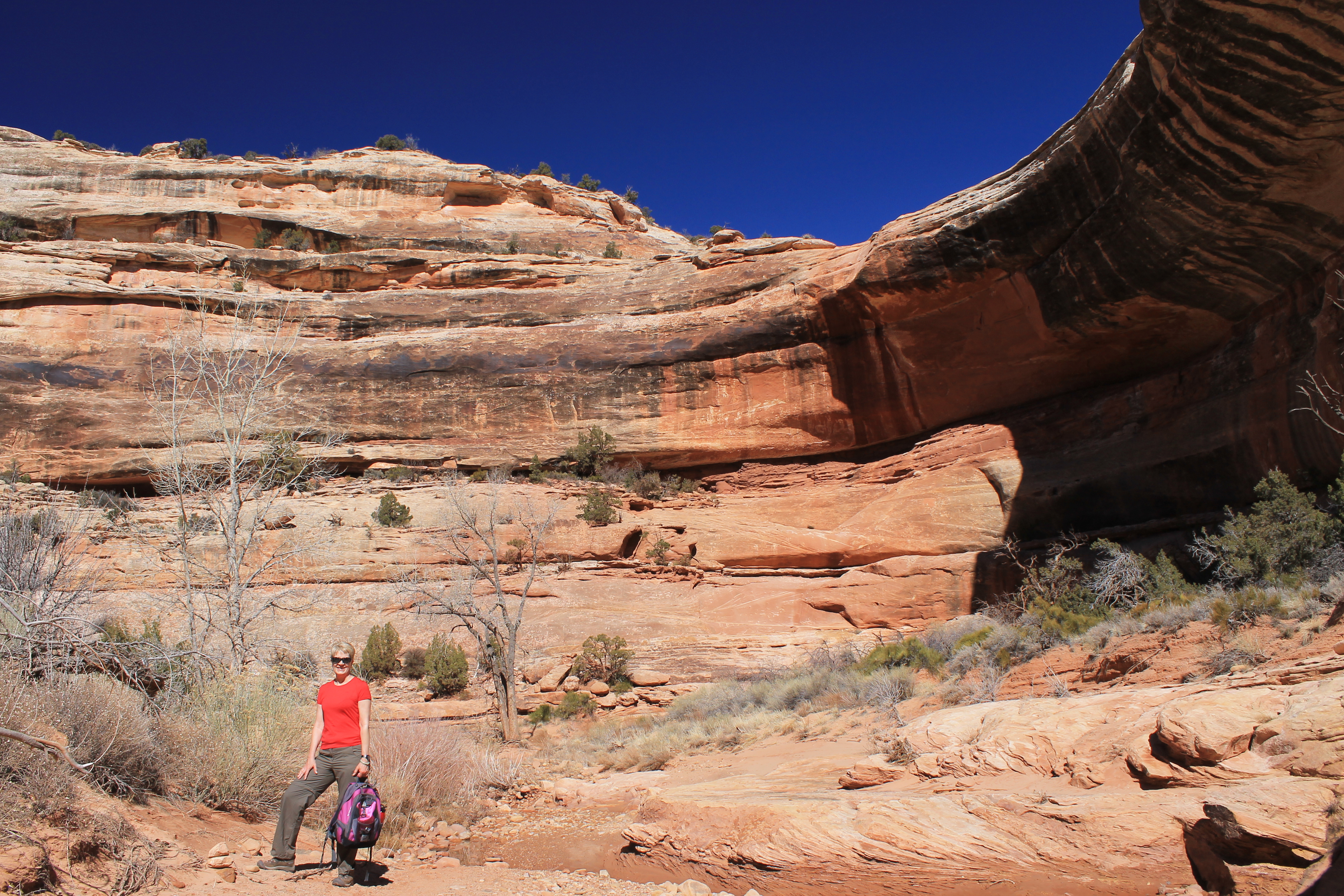
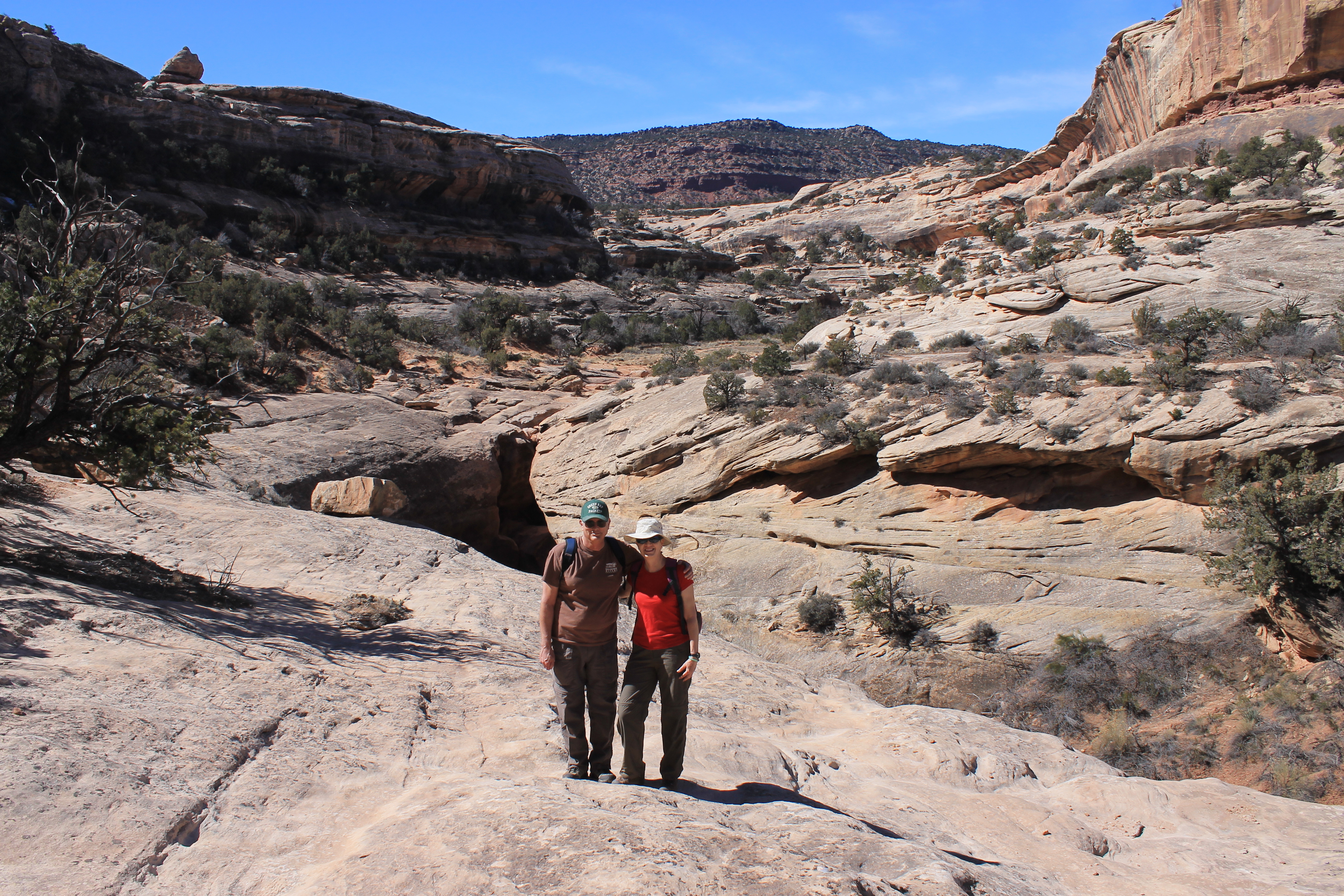
From the Visitor Center we started on the scenic loop road. After a short distance we reached a viewpoint of Sipapu Bridge. We stopped to check it out. The bridge was huge and very impressive. But it was quite a distance away and far below inside the canyon. We wanted a better view. So we drove a bit further to the trailhead for Sipapu Bridge.
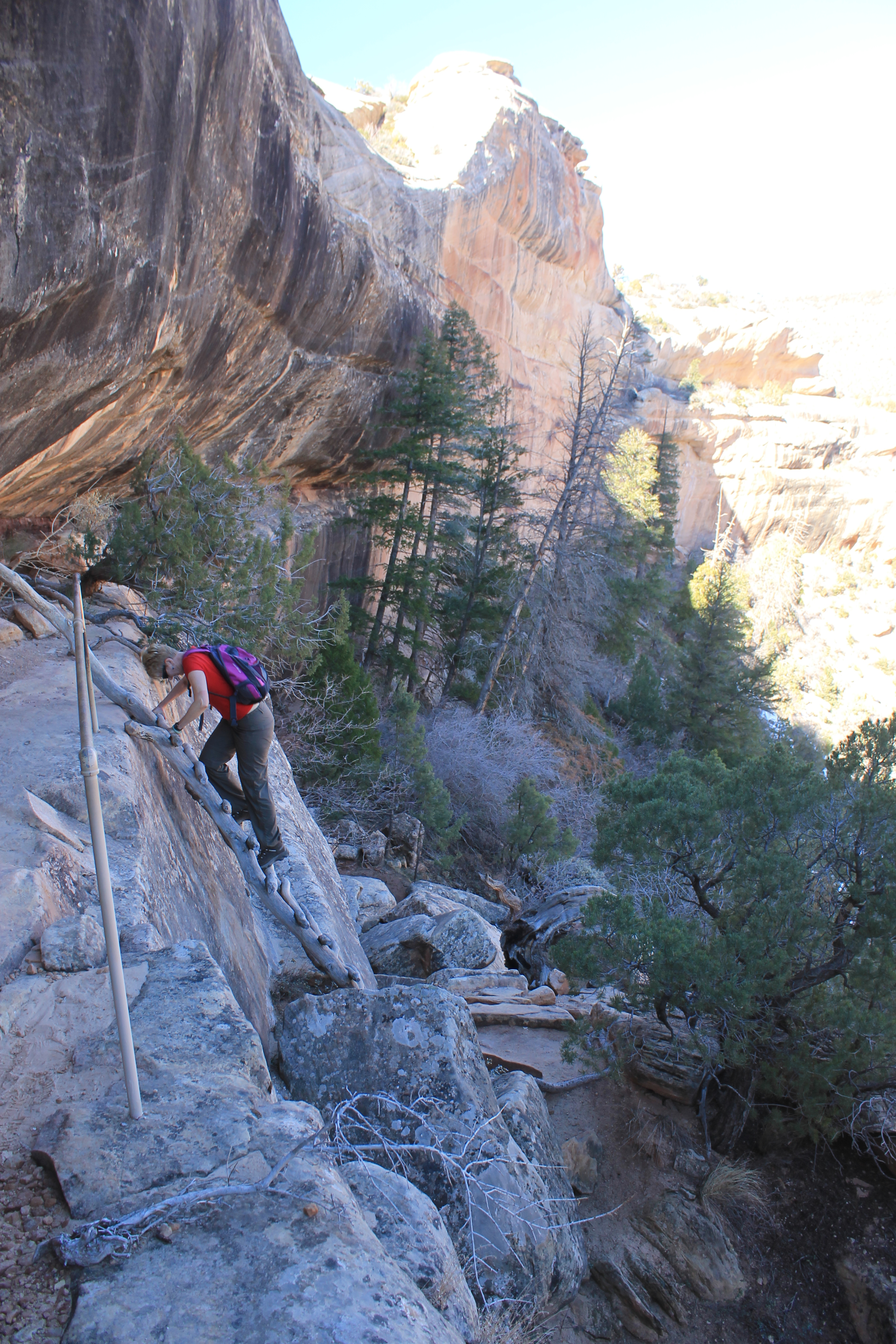
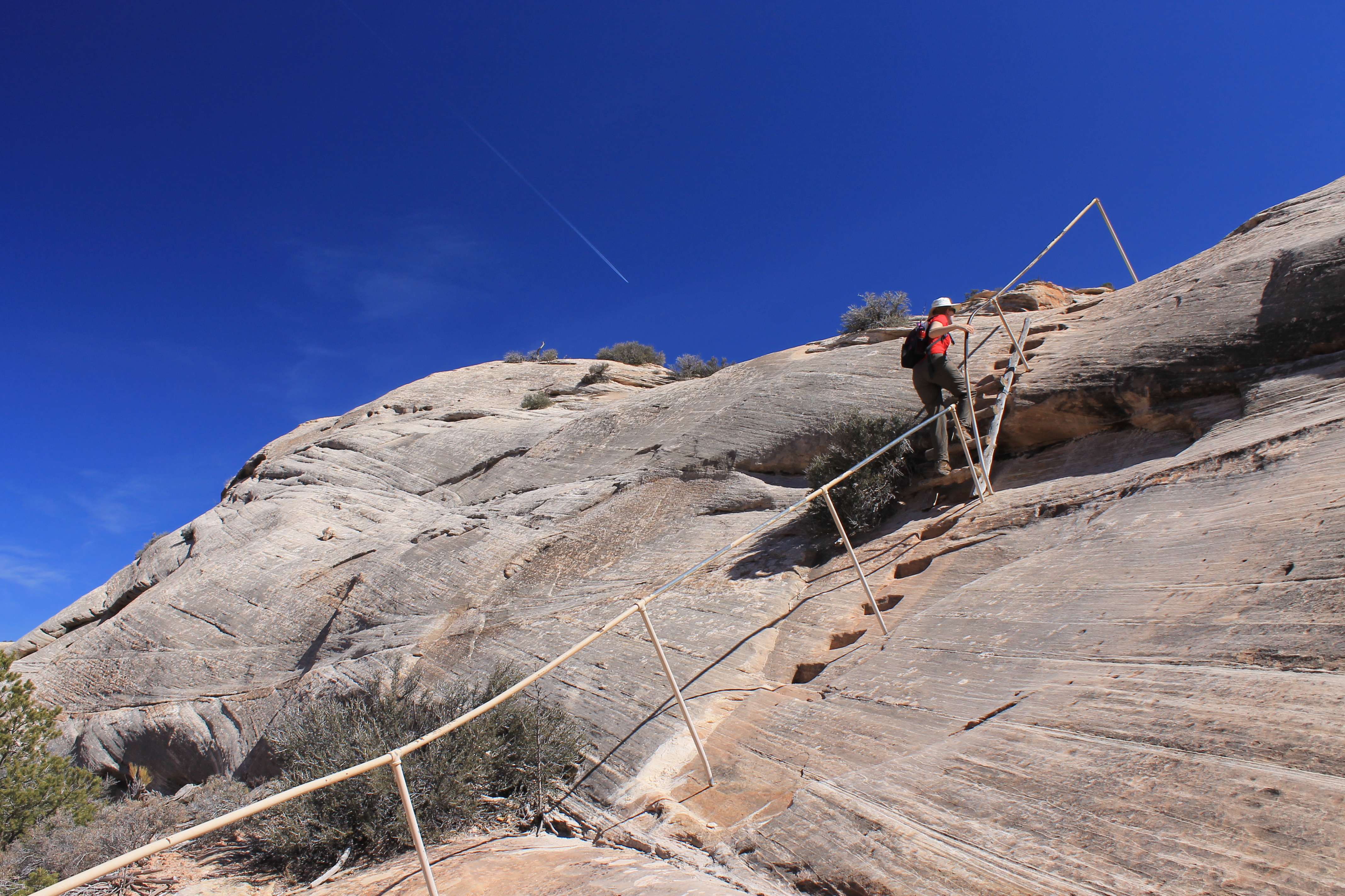
We didn't see much snow left from the storm over the weekend. We had asked about trail conditions at the Visitor Center. They said that all the snow had melted except for some on the start of the trail down to Sipapu Bridge. That is the only place where the trail is on a sheltered north slope. There were also steep parts descending into the canon, places with handrails, steps and even ladders. So if snow was going to be a problem it would be there. We decided to start there. If we were going to be stopped it would be better to have it happen right at the start rather than after many miles of hiking when we would have to backtrack a long way.
 Sandy looks up to Jailhouse Ruin
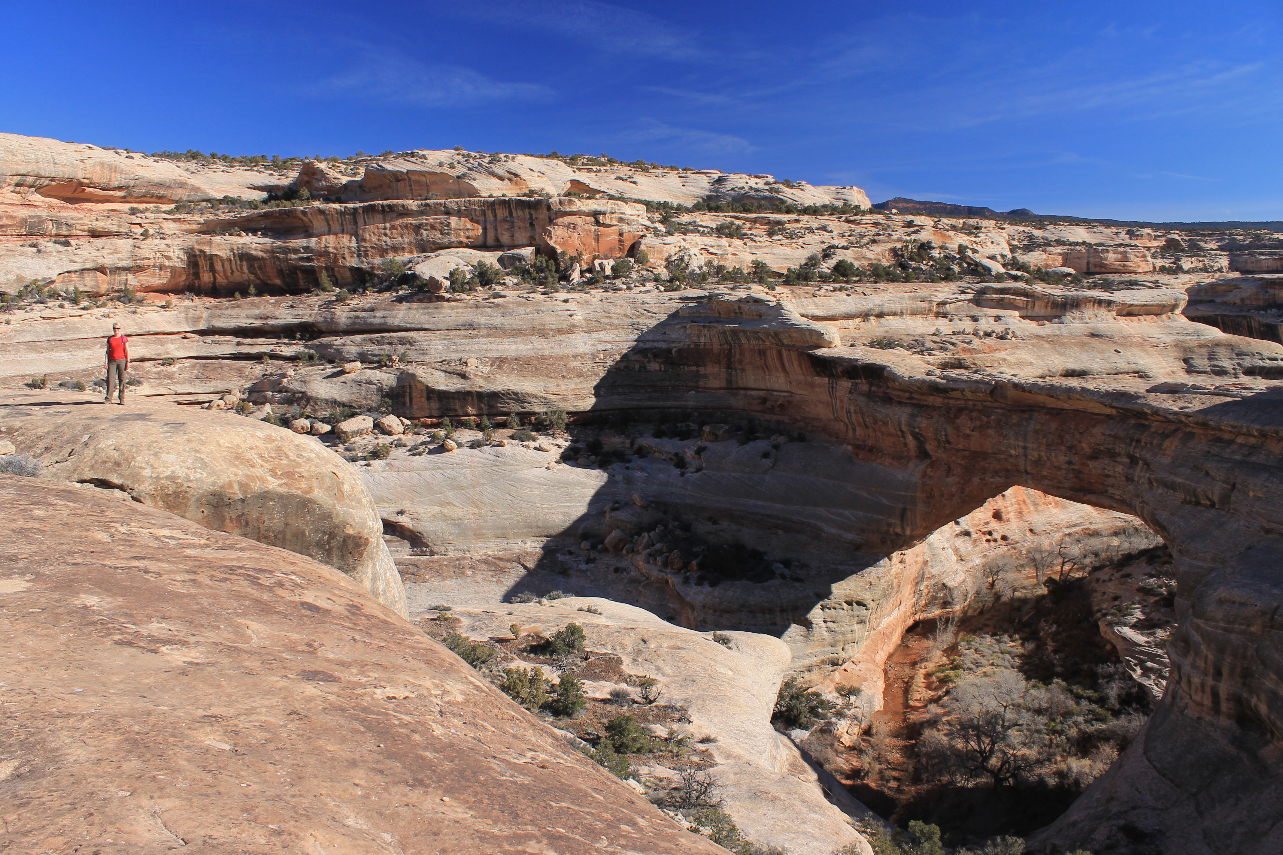
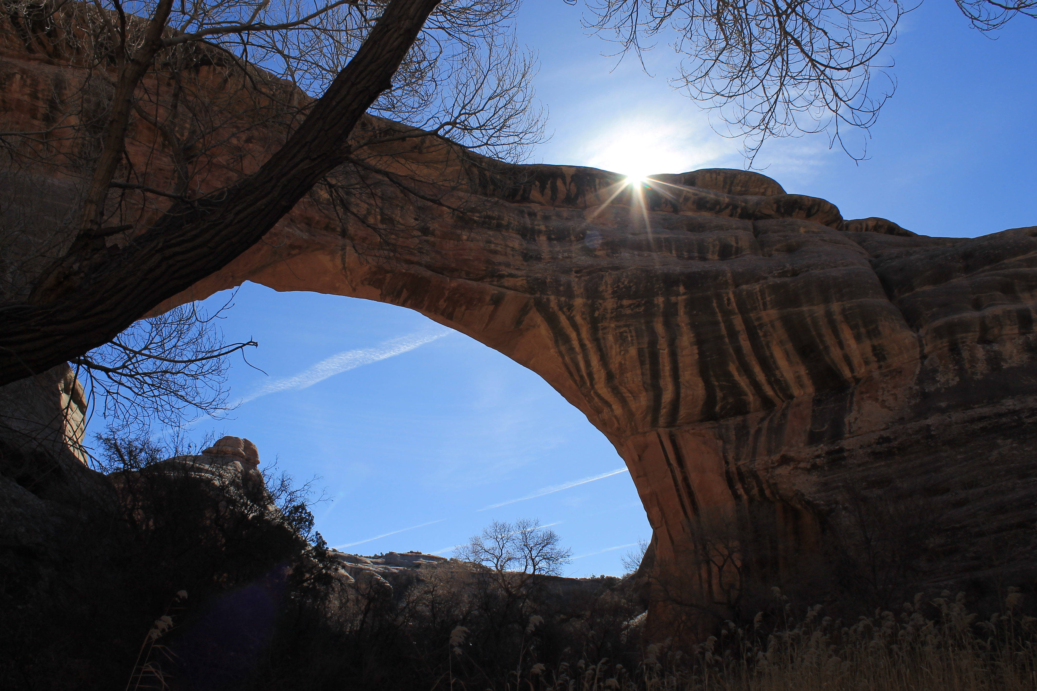
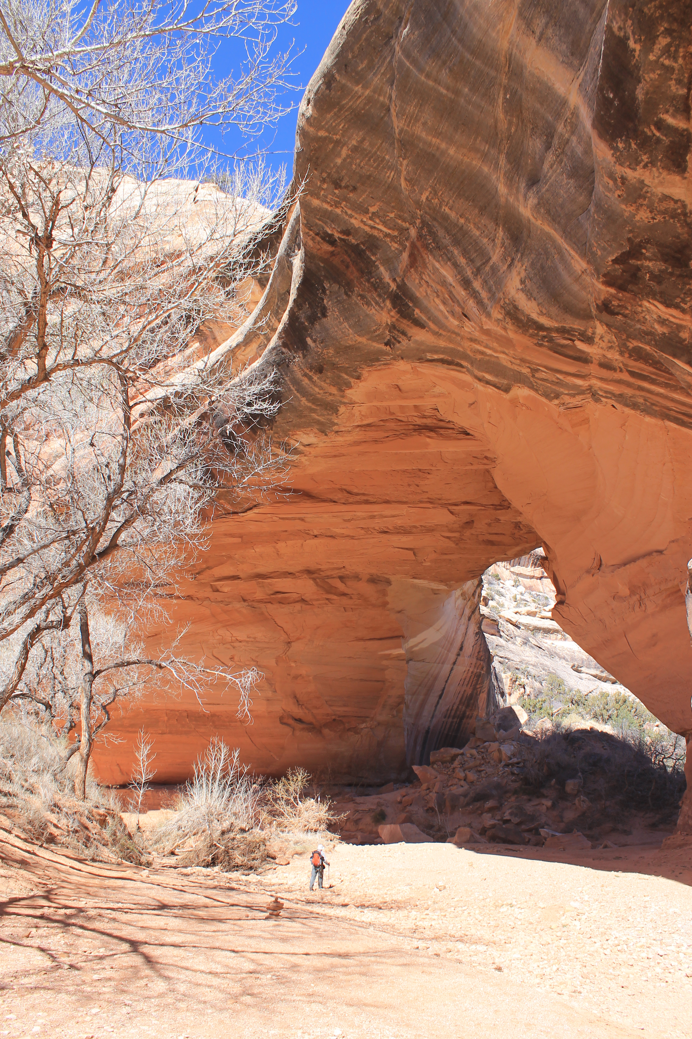
The descent into the canyon was actually a lot of fun. We crossed snow in one or two shaded spots very close to the top but it wasn't a significant obstacle. The path down was very steep but that was what made it fun. There were steps cut into the rock, steep slickrock with handrails, and even a few ladders to climb down. About half way down we came to a long ledge at the base of a large alcove. There was a well preserved indian ruin there. From the far end of the ledge there was a fantastic view of Sipapu Bridge. Continuing down it took us about half an hour to reach the bottom of the canyon. Now we were right underneath Sipapu Bridge. It looked impressive from the rim viewpoint but it was spectacular from below. The bridge was huge. It's an incredible structure.
From Sipapu Bridge we turned upcanyon. As we hiked along we found another ruin site in an alcove along the canyon wall. The ruins were not that impressive but there were handprints everywhere on the rock. It looks like that was the thing to do - leave your mark. There were no other petroglyphs but there must have been a hundred sets of handprints.
 Taking a water break during the hike through White Canyon
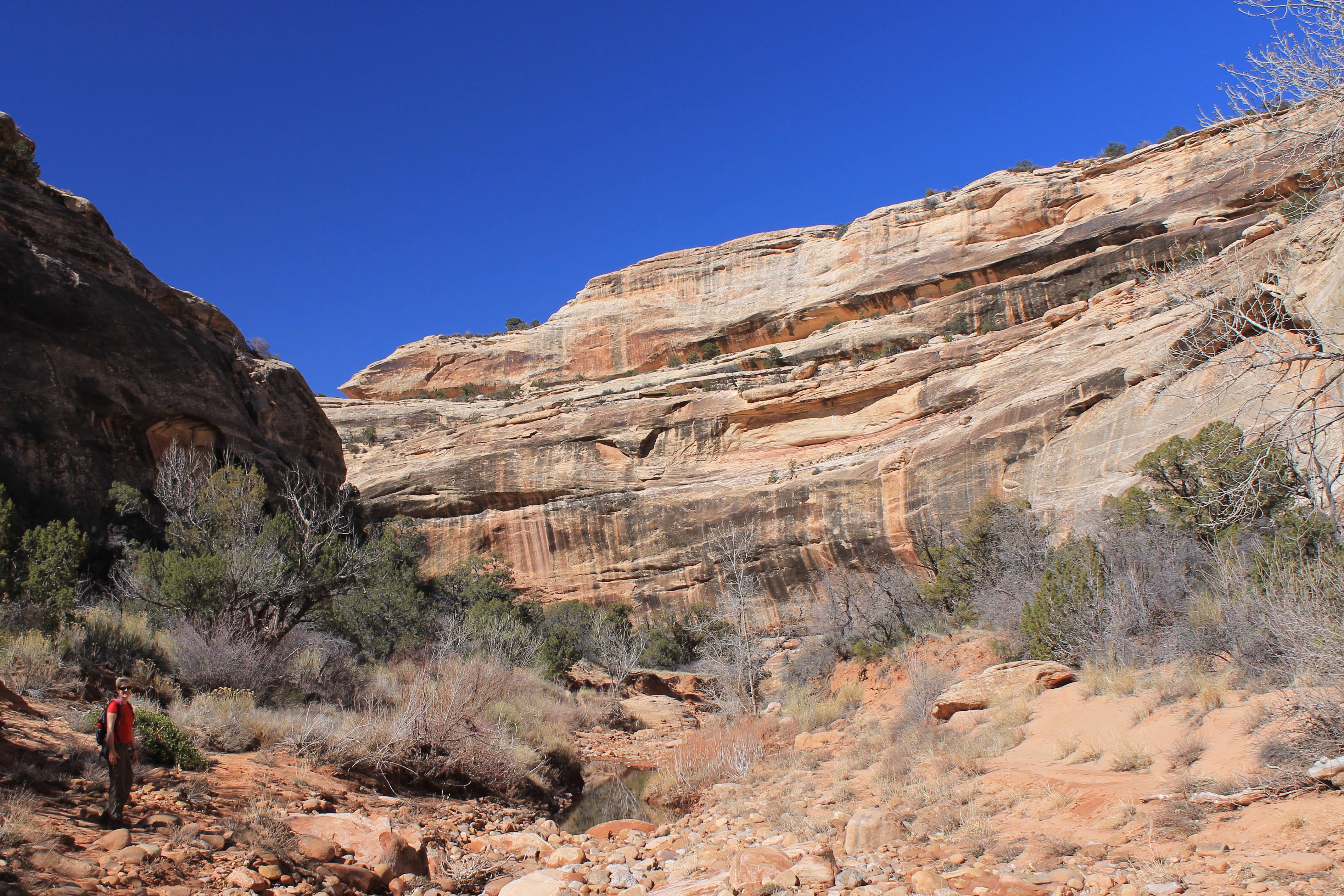
The hiking was similar to Kane Gulch. Some places there was trail. Some places we crossed slickrock. There wasn't much water in the lower canyon so it wasn't a major obstacle as we hiked. About a mile from Sipapu Bridge we noticed some ruins in an alcove up the cliffside. This was Jailhouse Ruin, which is quite extensive and can be seen from a viewpoint on the rim. But from the canyon bottom the rock was quite steep leading up to the ledge where the ruins were. We didn't feel like scrambling up. We were already getting a little blase about the incredible ruins along the trail.
White Canyon was quite impressive and would have been worth hiking even if the bridges weren't there. We hiked along for an hour and a half from Sipapu Bridge. Just when we were wondering if we had somehow missed Kachina Bridge we saw it ahead. It was not as high above the canyon floor as Sipapu Bridge so we really had a closeup view of it as we hiked beneath it. The path crossed right under it. We had to weave through huge boulders that were the result of a collapse in 1992 when an estimated 4000 tons of rock fell from the underside of the bridge.
 A hiker is dwarfed under Kachina Bridge
Needless to say we didn't waste time under the bridge. Once we passed through to the other side we had a better view (and better light) looking back at the bridge. We also got a shock - we came across another hiker. Up to that point we had the trail all to ourselves. We chatted for a while. He was from Oregon and was on an extended trip through the area. Although we thought we had been slow he estimated that he was only making about a mile an hour. He was nice enough to take a picture of us together. Then we continued on while he went back to the base of the arch to look for petroglyphs.
We heard voices in the distance and looked up. Far above us on the canyon rim we could see a family at the viewpoint for Kachina Bridge. Although it was more work to get there our viewpoint was way better than theirs. Not many people come to the monument and even fewer hike the trails.
Just after Kachina Bridge the trail climbed steeply up the side of the canyon. Again there were handrails and stairs cut into the rock in places. As we went further we saw that the climb was necessary to get around a pouroff in the canyon. At the higher level we continued on. Now we were hiking in Armstrong Canyon. It was a nice hike but it was long. At one point we ran into another party, this time a couple, hiking the other direction. Those were the only three people that we saw on the trail all day. This certainly wasn't like Grand Canyon National Park! Although the Grand Canyon was impressive, this was much more enjoyable hiking when we virtually had the whole place to ourselves.
 Looking back to Kachina Bridge
But it was long. The canyon wound through a series of bends for several miles. Sometimes we had to climb up the side to avoid obstacles. Although there wasn't really a flowing stream in the canyon bottom there were a lot of standing pools of water and side streams that we had to cross. At one Sandy slipped on a rock and stepped into the water with one foot. It's what we used to call a "soaker" when I was a kid. At another crossing there was a rock in the middle of a sidesteam and then one very long step onto a sloped, muddy bank on the other side. Sandy went first and lunged across and just managed to reach the other side. For a few seconds she teetered on the far bank and I thought she was going to tumble backwards and land flat on her back in the stream. But she got her balance and made it across. Whew! That was a close one. My stride is a little longer and I was able to make it across too.
At one point we followed the trail to an alcove where it just ended. Obviously people had hiked to the alcove looking for ruins or petroglyphs, although we couldn't find any there. We had to backtrack for several minutes back down the trail till we found where we had missed a junction. Now we were back on track.
 Climbing around the pouroff upcanyon from Kachina Bridge
After we had been hiking for several hours, each time we rounded a bend we expected to see Owachoma Bridge. But it was always just a little further to the next curve. Eventually we turned a corner and could see a long way down a straight section of canyon. There was no bridge. I have to admit that we were a little discouraged. The trail out of the canyon was at the bridge and we were ready to be there. But we had been tricked. Suddenly Owachoma Bridge appeared on the left straddling a side canyon. Although it is the smallest of the bridges Owachoma is perhaps the most spectacular of the three. While the other two bridges were massive Owachoma is slender and elegant. It is probably the oldest of the three and definitely looks the most fragile. The trail led us right under the bridge but then vanished on slick rock. We weren't sure where it went from there. I explored up and under the bridge and found a rock stairway hidden by brush on the left. It was a short climb and we back to the road and the viewpoint for the bridge. Although the views were spectacular this was the one place where my camera failed me. The view was partially into the sun and I got lens artifacts in all of my pictures. So you will just have to take my word for how spectacular it is.
 The intrepid hikers take a break
After we reached the road we still had two miles of boring hiking to get to our car. We figured it would be pretty easy - just a straight, flat trail across the mesa. Well it was straight but it wasn't flat at all. We had to climb up and over several hills and climb down into and then back up out of two deep gullies. This was no fun. I was pretty tired and ready to be done. At least it was better than taking the road which would have been at least two miles longer. So we were grateful for the trail. Eventually we staggered back to the car.
Of course before we left the park we stopped at the Visitor Center on the way out. I had earned my tshirt and I was going to get it! Sandy also picked out an interesting book called House of Rain about the history of the ancient indian civilizations of the American Southwest. After visiting so many impressive ruins we were anxious to learn more about the people who built them. I'm hoping that I'll get to read it soon but of course I always have a long list of books queued up to read.
 We finally spot Owachoma Bridge hiding up a side canyon
It was a two hour drive from the park to Hanksville where we would stay the night. I had never driven that road before. It was amazing just how empty it was. From Blanding all the way to Hanksville, which is 122 miles on Utah 95, we passed exactly one building, the Fry Canyon Lodge. During a uranium mining boom in the 1950's there were up to three thousand miners who lived at Fry Canyon. The lodge was built in 1955 mainly to sell beer to the miners. After the mines closed the lodge shifted to the (small) tourist trade. It continued for many years as "the most remote lodge in Utah". It's most famous guests were fictional. George Heyduke stayed there in "The Monkey Wrench Gang" as did Arthur Dent and Ford Prefect in "The Hitchhikers Guide to the Galaxy". The lodge closed in 2005 because the ground water was contaminated with heavy metals from the mines. Because it is so remote and there is nothing between the two endpoints, Utah 95 between Blanding and Hanksville is still a famous and challenging cycling route.
There was a lot of spectaular scenery with impressive rock formations on both sides of the road. It crossed the Colorado River on an impressive bridge at the very upper end of Lake Powell, but there the lake was nothing but a series of shallow mud flats that were quite ugly. Not an improvement to the view. I have to agree with George Heyduke/Edward Abbey that the Glen Canyon dam was a horrible idea. Still there are supposed to be some cool hikes in the side canyons accessed from the highway and I would like to come back to explore the area sometime.
 The path climbs out by passing under Owachoma Bridge
After two hours of driving through absolutely nothing we reached Hanksville. There's not much there. It has two restaurants and two motels and two gas stations. That's it. According to Trip Advisor one of the motels was quite good and the other was terrible. We got into the better one, the Whispering Sands Motel. After our bad experience last summer at the Packwood Inn last year on a trip to Mt. Rainier we were not anxious to stay in any small-town motels with a lot of "bad" and "terible" ratings. We ate dinner at Stan's Burger Shack which was right next door. It was pretty good. It seemed like we were the only ones there who weren't locals. It was a Friday night and everyone in town must have gone out for dinner. When we got back to our room the weather strip on our door broke off. It took the lady at the motel front desk a half hour to find a screw driver but then it only took me one minute to fix it. After that the rest of our stay was uneventful.
Next day we planned to do a short hike and then head for home. But in the morning it was mostly overcast, although it didn't look much like rain. But we had been spoiled by five days of perfect sunny weather so we decided to just head straight back home. That way we could get to Boise in time to pickup Laney that night. Not that we were tired or anything on the first hiking trip of the year. Nope. And Laney was really glad to see us.
