A Tale Of Two Hikes
 Threatening weather up the Yoho Valley
After our perfect weather day climbing Fairview Mountain, the forecast didn't look as good for the next day. It predicted increasing clouds with thunderstorms in the afternoon. We're both fair weather hikers, but we figured that as long as we started early, we should be able to get a hike in before the weather turned bad. The forecasts on the trip had all been conservative so far anyway.
The hike that we picked was the Iceline Trail in Yoho National Park. It was rated as Premier (four stars - the highest rating) in our opinionated hiking guide. The trailhead wasn't too far from where we were staying. The hike wasn't real long although there was a lot of elevation gain. When we got up in the morning and saw that it was sunny with just a few clouds, it looked like we had a window of good weather to do our hike. We ate breakfast, packed our gear, and set off for the trailhead. The trail started from a hostel with very limited parking for non-guests. The guidebook recommended parking half a mile down the road at the lot for Takakkaw Falls. But we were the first ones to reach the trailhead and managed to grab one of the few spots along the road. That saved us half a mile of walking each way.
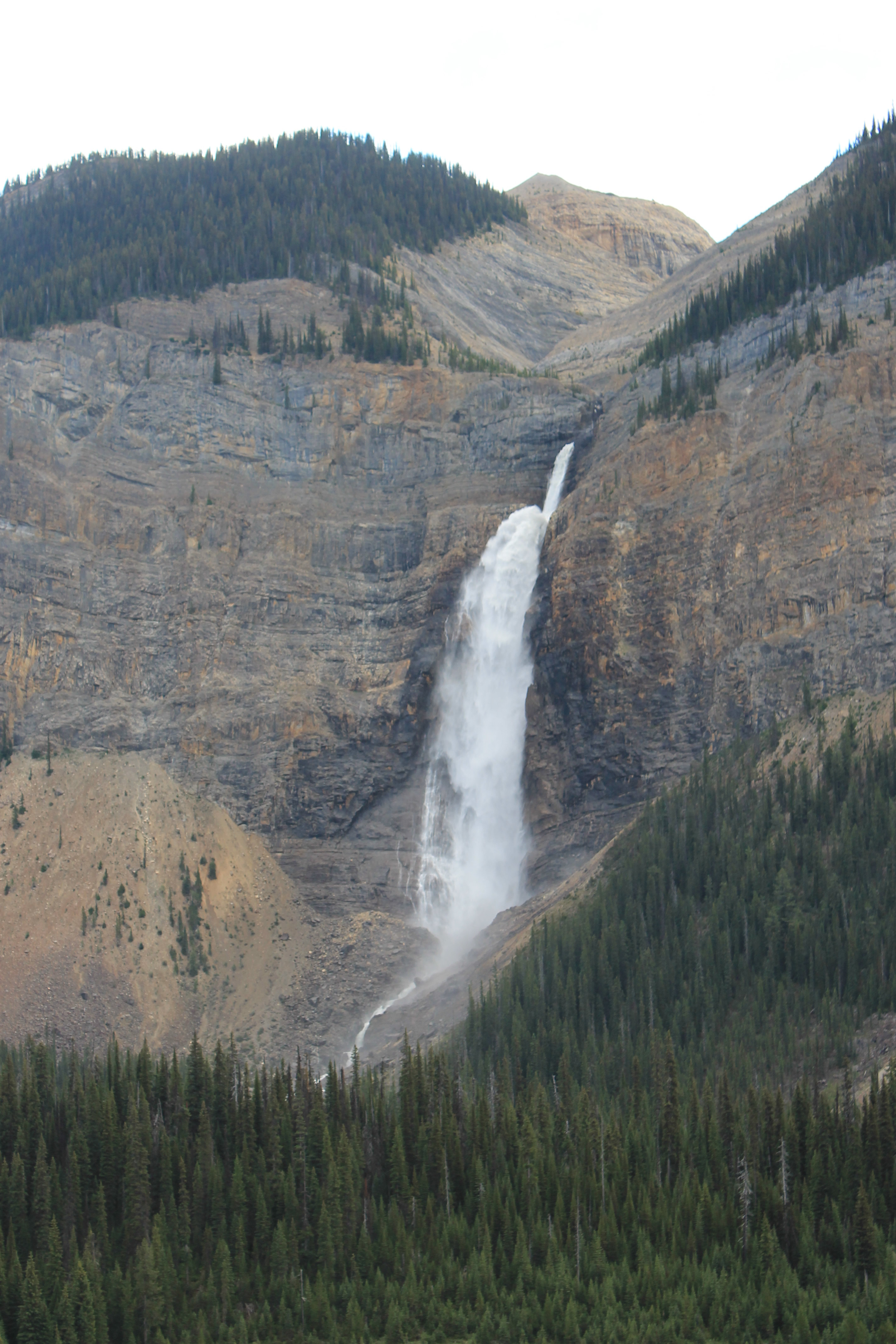 Takakkaw Falls from the Iceline Trail
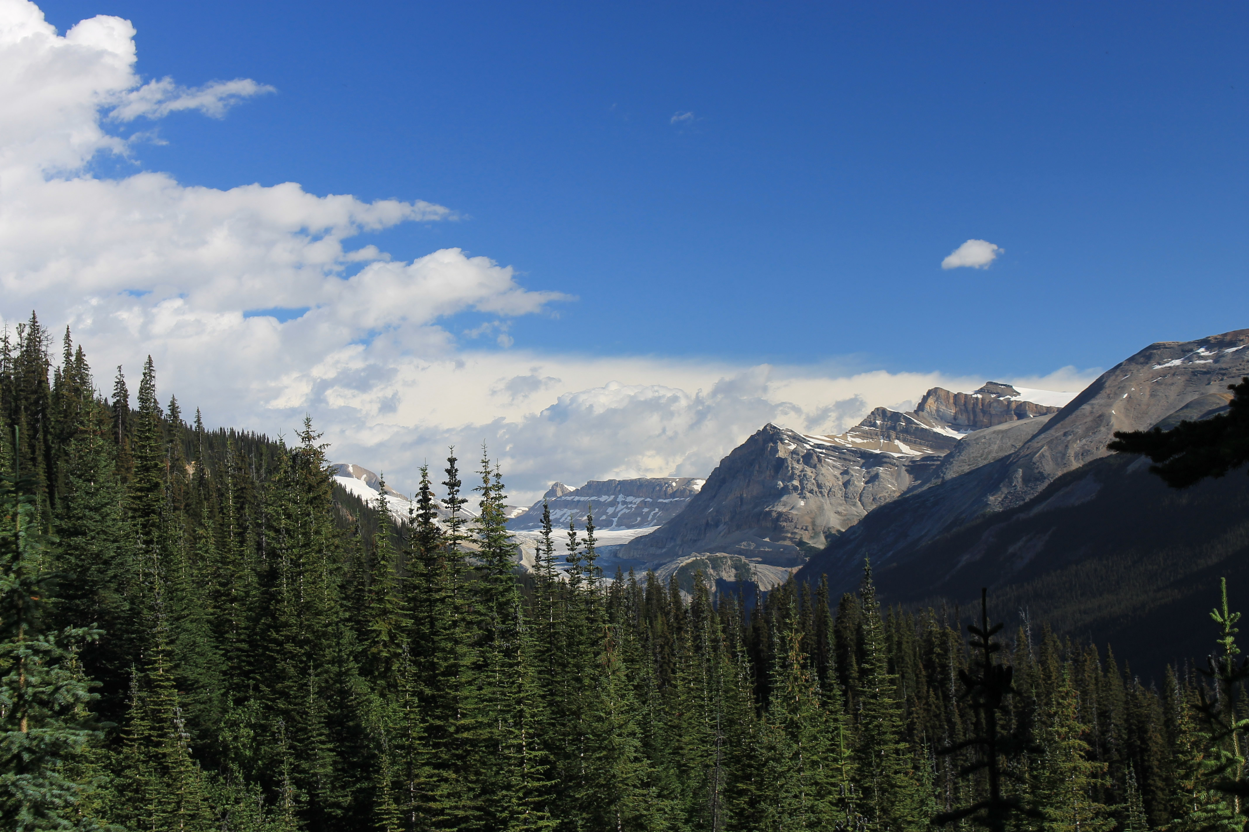
As usual the hike started with a steep climb through forest. We were the only hikers on the trail so I wore our bear bell. Since the trail had frequent switchbacks and blind spots, we were clapping a lot as well. After an hour or so we started to climb out of the trees and had views across the valley to Takakkaw Falls as well as far to the north up the Yoho Valley. We could see lots of clouds in that direction moving our way. It confirmed that we only had a limited time of good weather to hike.
We had two options for the hike. It was four miles each way to a high point that provided a good view of the Yoho Valley area. That's a standard spot for a lot of people to turn around. Or we could continue past the high point, drop down into the Little Yoho Valley, and make a large loop back for a total trip of thirteen miles. From the weather we could see to the north, we already had decided that the four mile turn around point would be far enough for us today. It still meant over 2200 feet of elevation gain. It would be a good workout.
After a long, rising travese we entered a huge amptheatre below the President, a 10,296 ft peak that's the highest mountain in the Yoho Valley area. At the upper end was the Emerald Glacier, a large mass of ice but it was obvious that it had previously filled the entire basin. As it had retreated it left behind a landscape of moraines and large boulders. It was a really desolate landscape, like I'd imagine the surface of the moon would look. The trail was easy to follow but was more boulder hopping than trail walking. It was a lot of work and slow going.
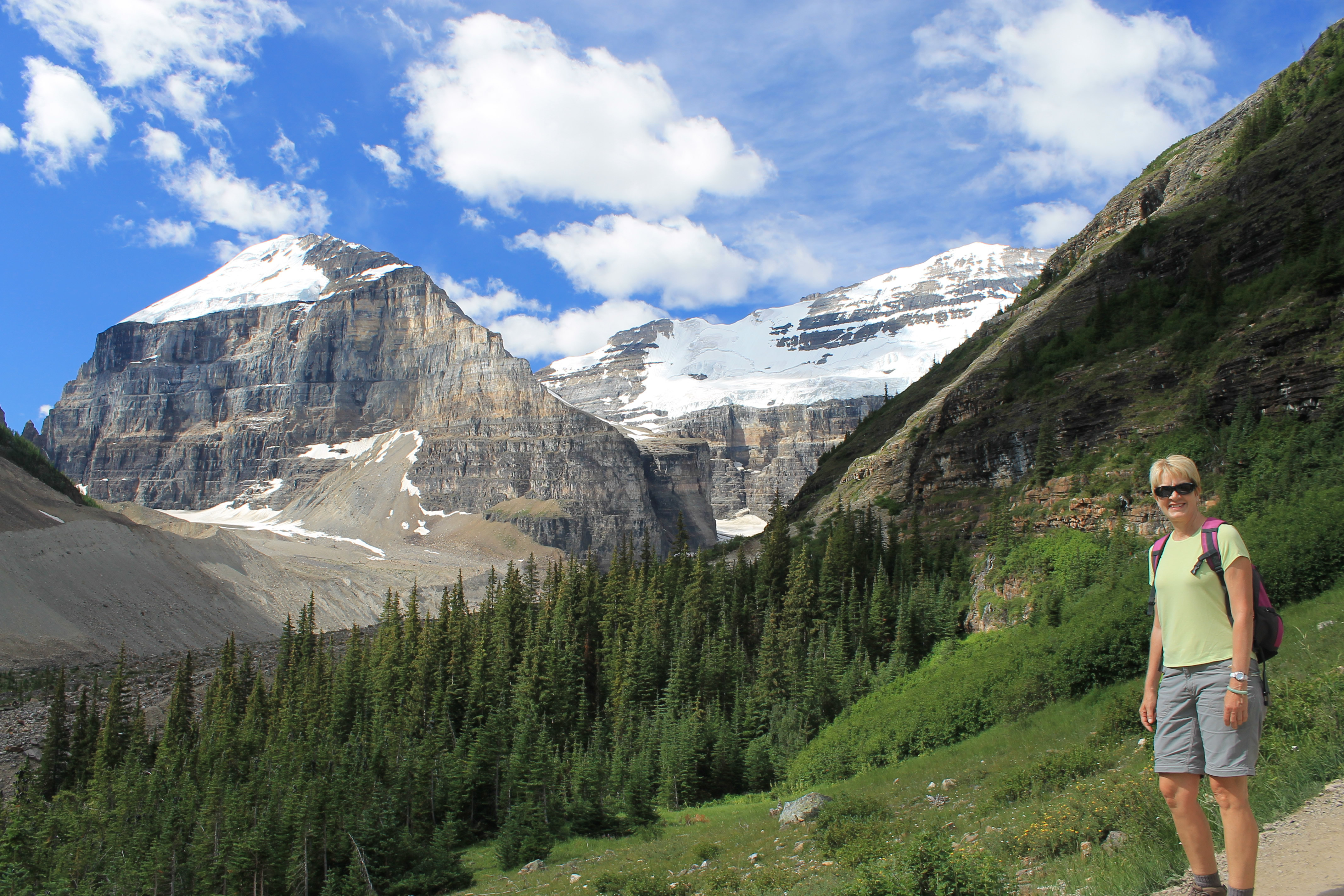
 Warm and sunny starting out the next morning
After about two hours of hiking the clouds had moved in and a cold wind was blowing from the north. We were hoping that we would hit the turn around point at four miles pretty soon. We had crossed the basin and were about to climb up a big moraine that we were hoping was the high point or close to it. Just then we met a hiker coming the other way, the first person we had seen. We asked if we were almost to the high point but he didn't seem to have any idea where it was, or where he was either for that matter. So we climbed up the moraine to see for ourselves.
As soon as we reached the top we stepped into a cold, blasting wind. Now that our view to the north wasn't blocked by the moraine anymore we could see ugly black clouds, not very far away and moving towards us fast. We could see the trail undulating over more terrain that was exactly like what we had just crossed. No lake was visible below - the guidebook said it could be seen from the high point. Although we had been fast the day before, today we had obviously been slow. It was clear that we still had a way to go. The weather had deteriorated and nastier weather was moving in fast. Up high in open terrain is not a good place to be in a thunderstorm. We didn't even consider continuing any further. We started back down, and fast. We didn't make it very far. We weren't even half way across the basin when the wind really picked up. Fortunately going back the north wind was behind us. With our wind shells on and hoods up it wasn't too bad. It would have been uncomfortable heading into that wind.
 M.t Lefroy at the far end of Lake Louise
Then to top things off, it started to hail. It was small hail, about the size of a pea, but it was coming down hard and actually stung a little through our wind shells. By now we were hiking as fast as we could to turn the corner, get out of the high basin, and start to drop into the shelter of the trees. Incredibly we passed a pair of hikers who were going the other way. Even with the hail, walking into a howling wind, they were going higher. They were obviously tough but they were also obviously crazy.
When we finally turned the corner we were sheltered a little from the wind. Not long after that, the hail stopped. That was a relief. As we started to descend back into the forest the wind had died down and we could see a few spots of blue to the north. All the way down we kept passing people who were still going up. That seemed crazy to me given the conditions we had just experienced earlier up high. But maybe they were right. By the time we reached the car there was a lot of blue sky to the north. We had had enough though and headed back to Lake Louise Village for a late lunch. One of those iffy weather forecasts had finally caught up with us.
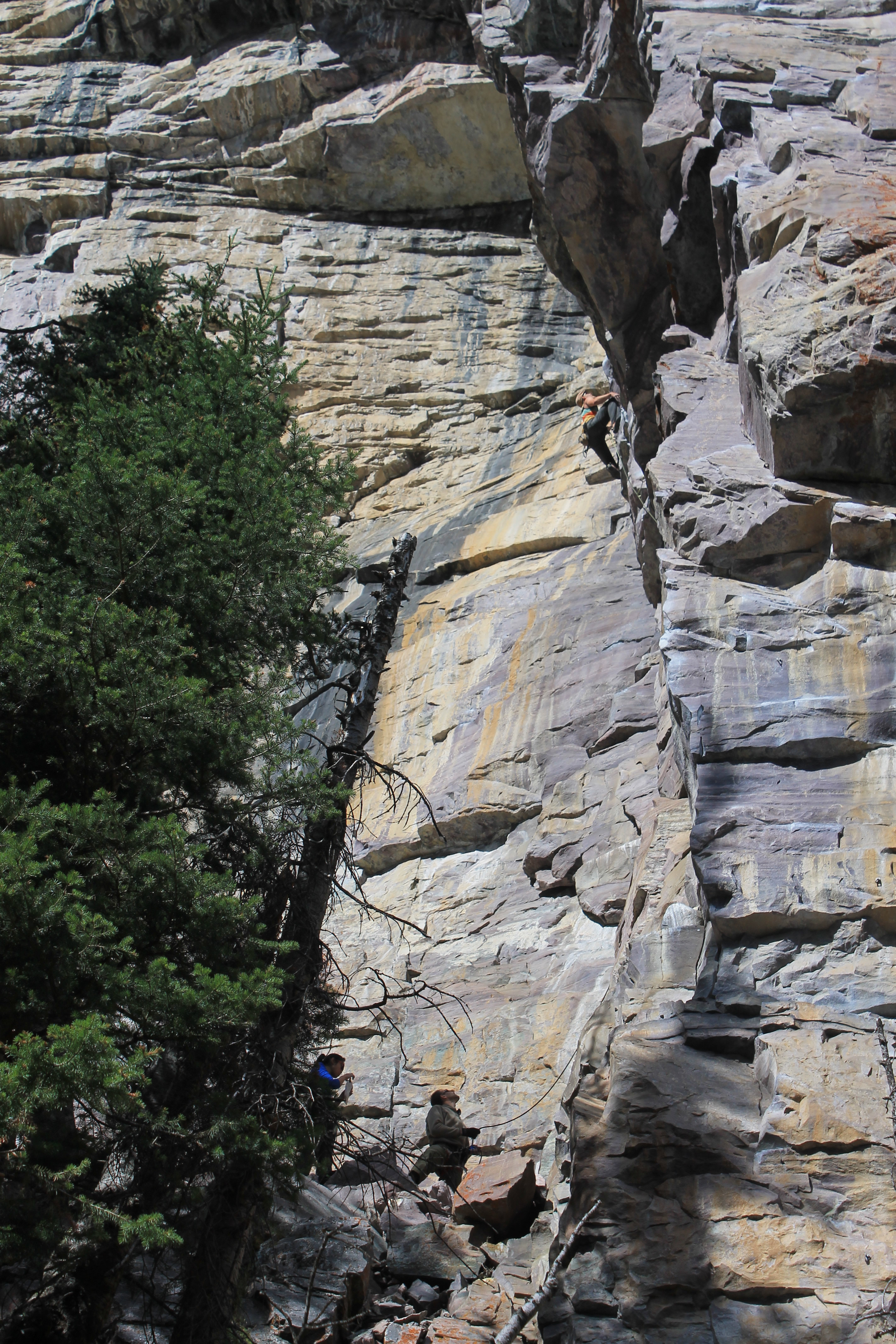 Rock climbers at Lake Louise
Although it was highly recommended in our guidebooks, neither Sandy nor I thought the Iceline Trail was that spectacular. It had some nice views but we rated it as one of the least impressive hikes we did on the whole trip (the other being Goat Lake in Waterton Lakes National Park). Maybe it was the weather though. The views might have looked better with sunny blue skies. Not to mention that we did get chased off the mountain.
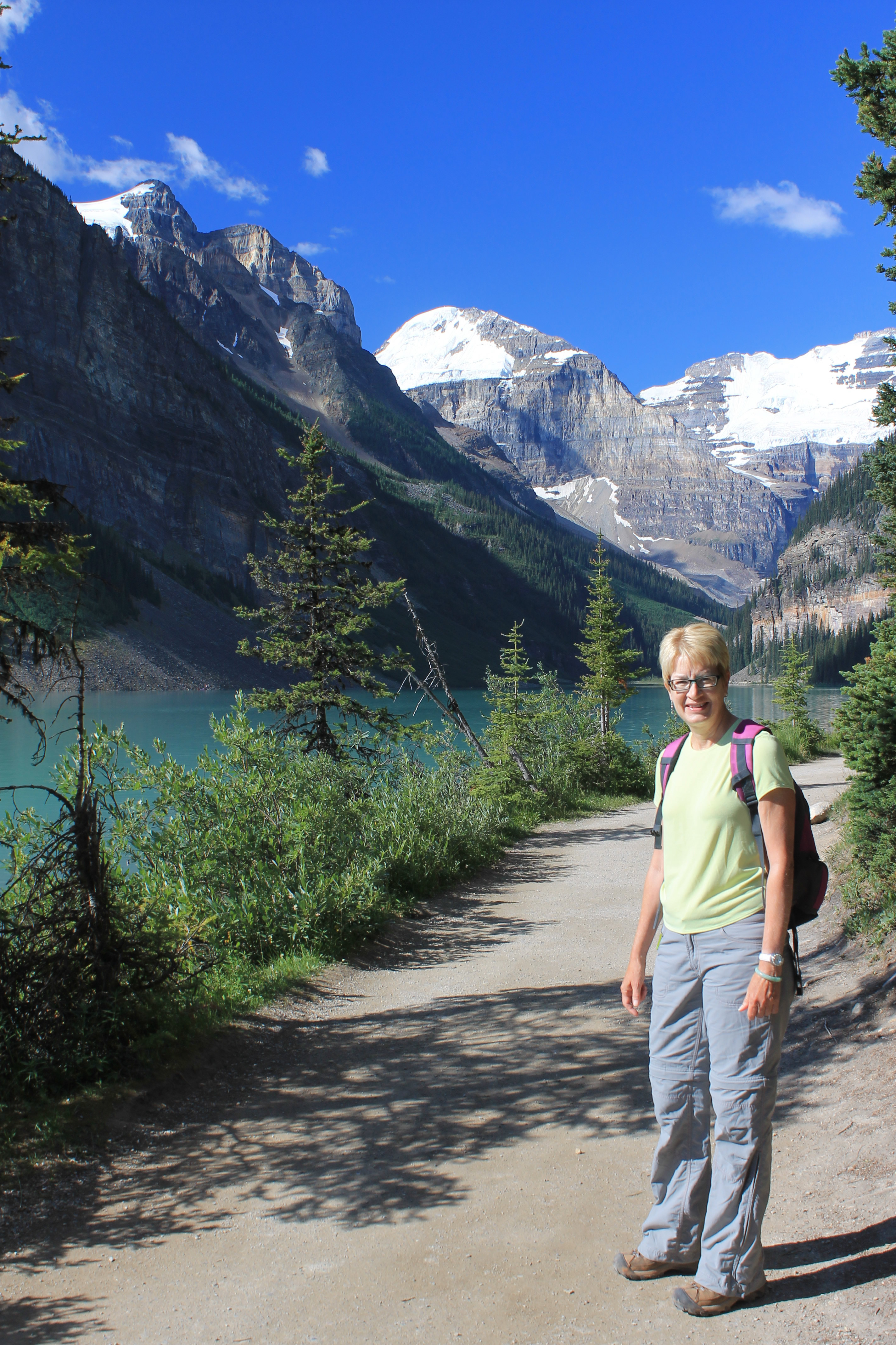
With another iffy forecast for the next day, we decided to be more conservative even when the morning had clear blue skies. Fool me once, shame on you. Fool me twice, shame on me. The hike that we picked was to the Plain of the Six Glaciers Teahouse. The trail starts right from the Chateau Lake Louise, walks around the lake, and then climbs up the valley towards Mt. Victoria to a backcountry teahouse. We had hiked there on our very first trip to the Canadian Rockies together back in the early 1990's and remembered it as a beautiful trail. We also remembered that they served very good chocolate cake at the tea house. It had the additional advantage of being at a lower elevation and in a sheltered valley rather than high up on an exposed ridge, just in case the weather turned bad on us again suddenly. We were taking our lesson from the day before seriously.
Since we were starting from Lake Louise we had to brave the cougar warning signs again. But we weren't starting quite as early as usual for us and there were a lot of people on the trail. The first 1.2 miles around the lake are level and paved so there are a lot of people. We even saw people pushing baby strollers. But it is right next to the lake and is incredibly beautiful so it is still worthwhile. Most of the tourists turn around before they even reach the end of the lake.
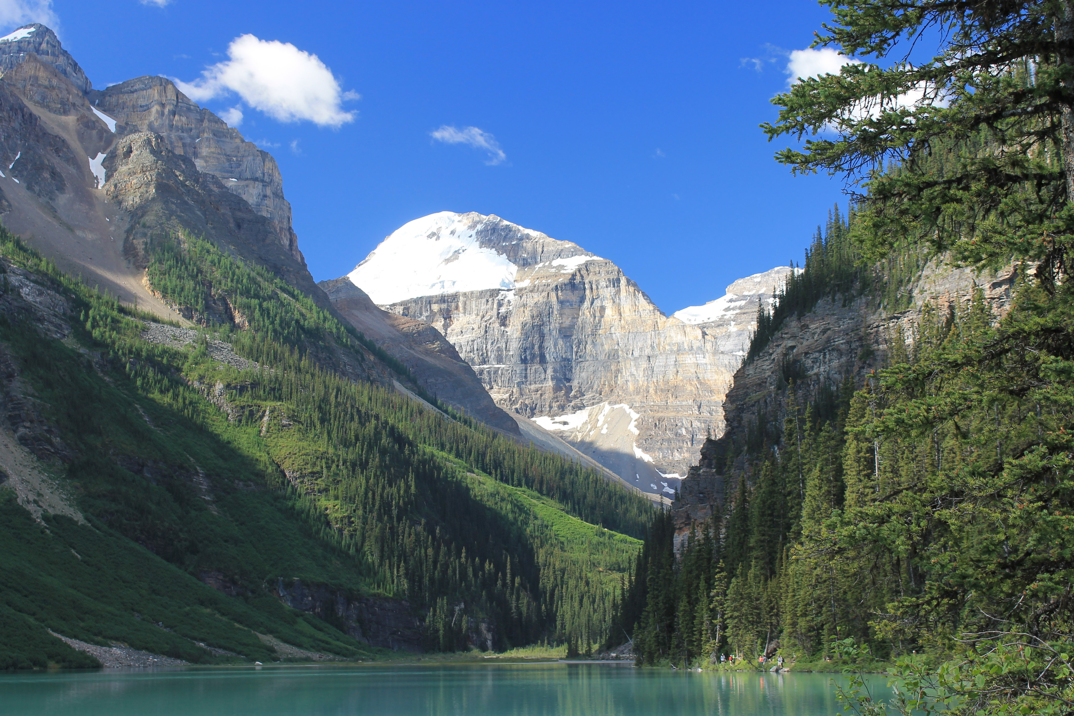
 Mt. Lefroy and Mt. Victoria from the upper valley
At the far end is a series of bluffs that are popular for technical rock climbing. There must have been at least a dozen parties climbing on the rocks. The warm sun on the rocks, great scenery and a short hike to reach the base of the rocks combine with easy accessibility from Calgary to make it a very popular climbing area. The tourists who made it all the way to the end of the lake thought that it was pretty exciting. Most of the climbers had an audience along the trail.
Just past the rock climbing area was a minor obstacle. There had been very heavy rains in Banff two or three weeks before we got there and the inlet to Lake Louise was still running high. It covered the trail at one point for about a hundred feet, but just barely. People had set flat rocks about two feet apart to make a path. Unfortunately that made it one way. There wasn't room for people going in opposite directions to pass each other. We were lucky when we got there the first time as no one else was around. We hopped across the rocks quickly and continued on. It did stop anyone with baby strollers who had ideas about making it to the tea house.
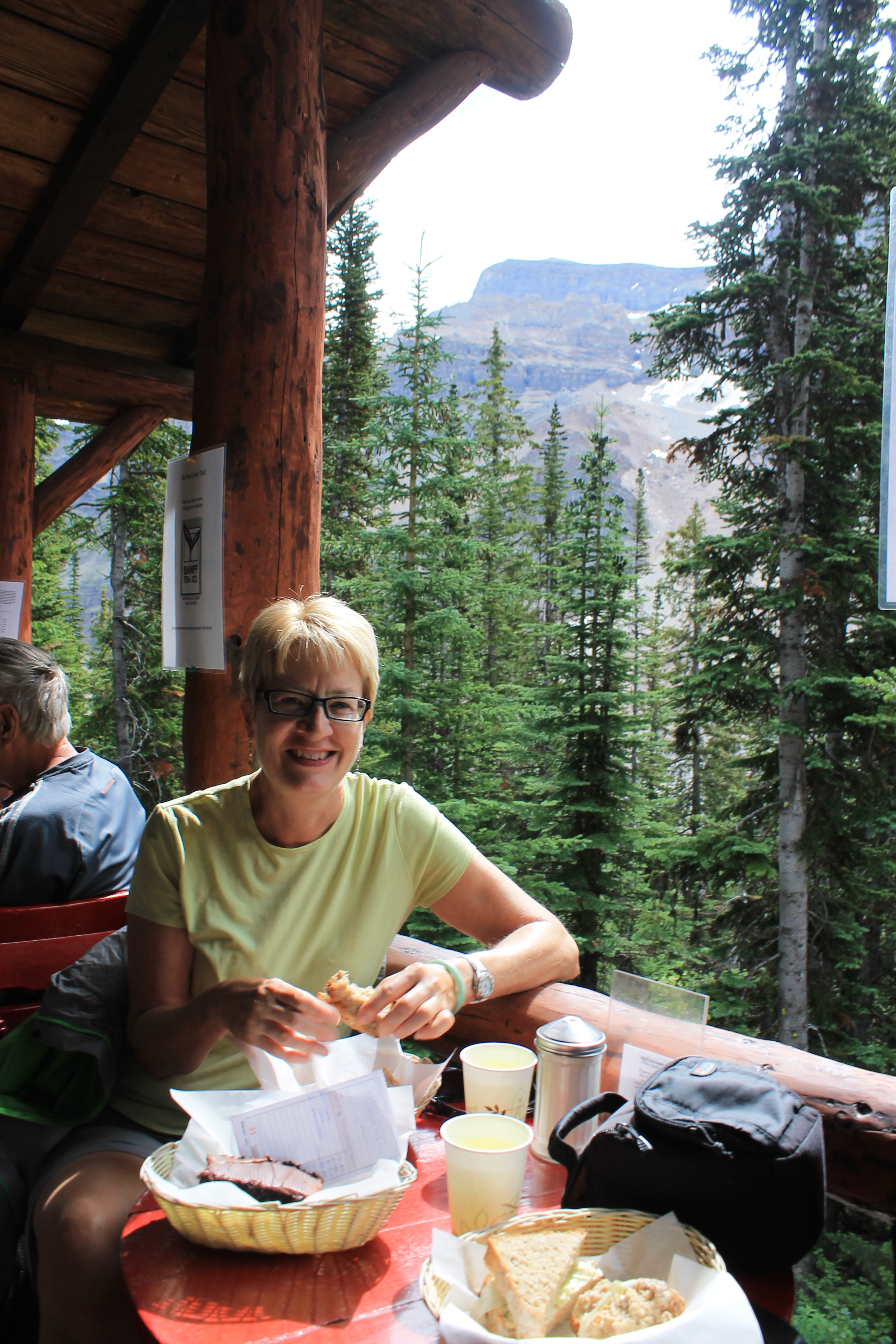 Lunch (and cake) at the teahouse
It was a great hike up the valley. The trail climbed 1100 feet over the next two and a half miles. Not too steep but it was good exercise. The views were fantastic and the weather was beautiful. No sudden changes like yesterday. We made it to the tea house and had lunch, complete with chocolate cake. And yes, it was still delicious. While we were eating clouds began to move in. By the time we started to hike back it was clouding up. The afternoon showers were on time today rather than early like the day before. We made good time going down, except for the water crossing where we got stuck. Every time the person coming towards us was almost across, someone else would show up and start. Eventually we got our break and made it across.
Two days of hiking that were completely different. The first day the trail was so-so but the weather made it exciting and gave us a good story to tell. The second day was an easy hike on a warm, sunny day on a classic Canadian Rockies trail. It even had chocolate cake. Hiking doesn't get any more luxurious than that.
