Peru - Starting the Trek
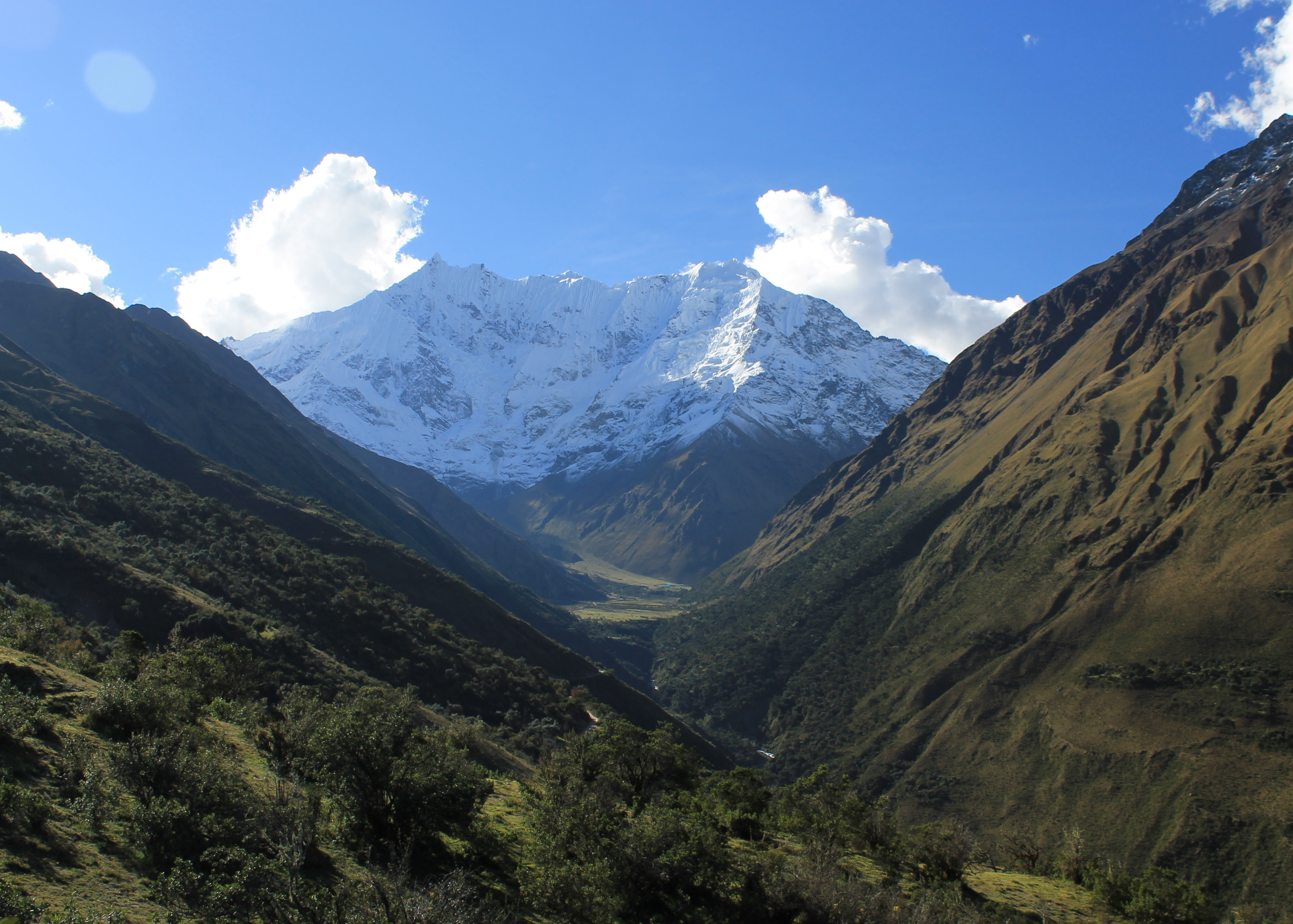 Humantoy with Soraypampa barely visible in the distance
Most tourists who visit Machu Picchu get there the easy way. They travel from Cusco via a combinataion of train and bus. Some do it as a very long day trip. Some stay at the town of Aquas Calientes at the base of the mountain that Machu Picchu sits on.
But some visitors reach Machu Picchu by hiking. The standard way to do this is via the Inca Trail. It begins at a stop along the train line to Aguas Calientes at an elevation of about 8000 feet. It takes four days to hike to Machu Picchu, crossing three passes with the highest one being Dead Woman's Pass at 13,780 feet. The scenery along the way is spectucular. The route passes a series of ruins culminating on the final day when you hike down a ridge right into Machu Picchu itself. The down side is that the Inca Trail has become very popular. In 2002 the government of Peru put a quota system in place to protect the monument of Machu Picchu and the trail from degradation due to the number of people using it.
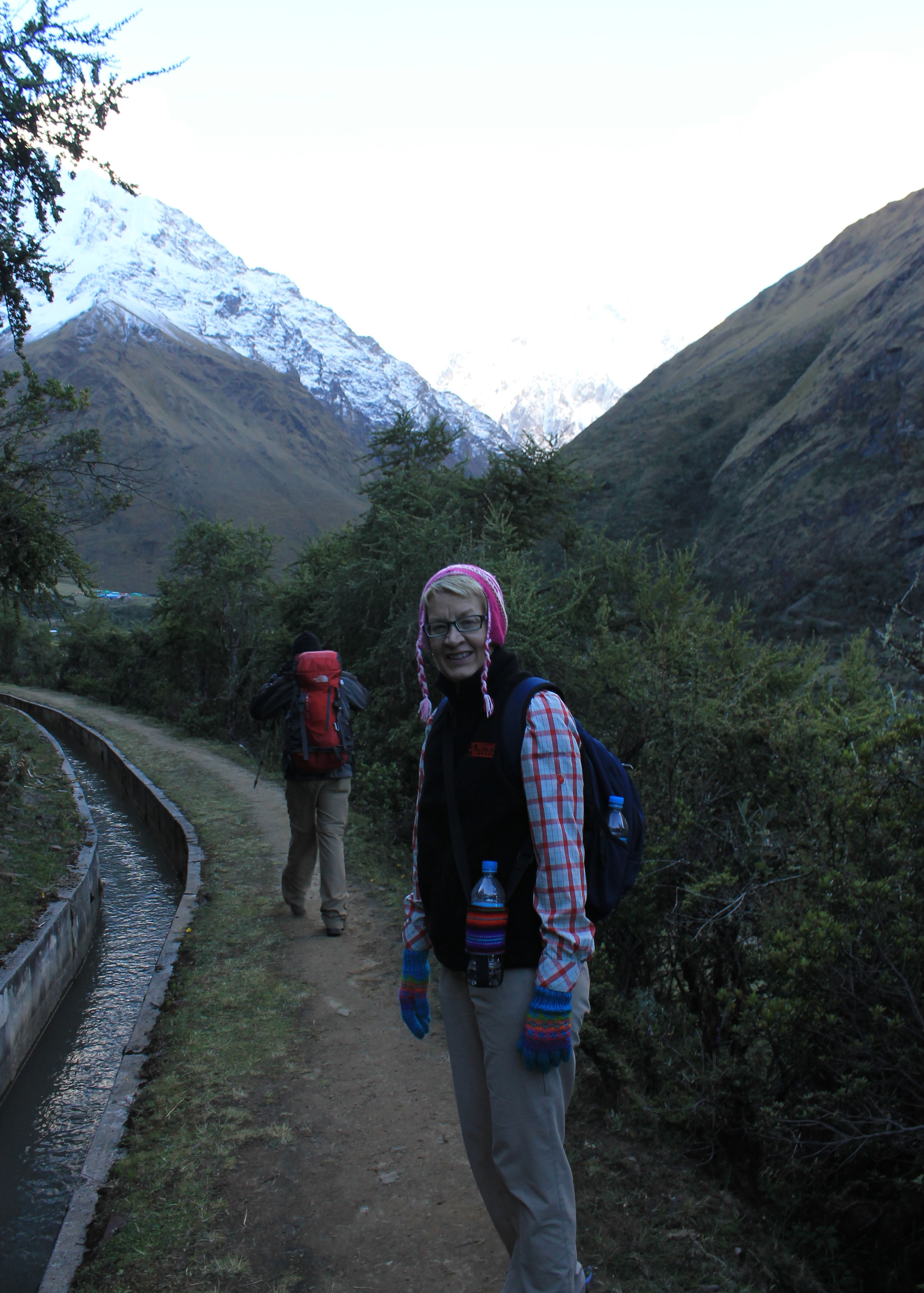 Hiking along the Inca canal
Only five hundred permits are issued for the Inca Trail per day. That includes support staff as well. Of the five hundred permits, two hundred are designated for tourists and the other three hundred are reserved for guides, cooks, porters, mule drivers, etc. There is an online system for making your own reservations, or you can book with a commercial outfit that takes care of getting the permit. Once the permits are given out, you are out of luck if you want to hike the trail. There are warden huts along the way to check permits and make sure that there are no unauthorized hikers on the trail. Even with the quota system, the Inca Trail is not a place for solitude. Five hundred hikers per section per day is a lot of people. Because of the high demand to hike the Inca Trail, alternatives have been developed. They start on the other side of the Cordillera Vilcabamba, the massive range to the south of the Inca Trail and Machu Picchu that culminates in 20,574 foot Nevado Salkantay, and cross the range by one of several different very high passes.
The nomenclature is quite confusing. One route crosses the Inka Chiriasqa Pass (over 16,000 feet) to the east of Salkantay and joins up with the standard Inca Trail at Huayllabamba for the last two days of hiking. This is sometimes called the High Inca Trail and sometimes called the Salkantay Trek. It isn't done very often anymore because you still need to get a permit for the Inca Trail for the last two days.
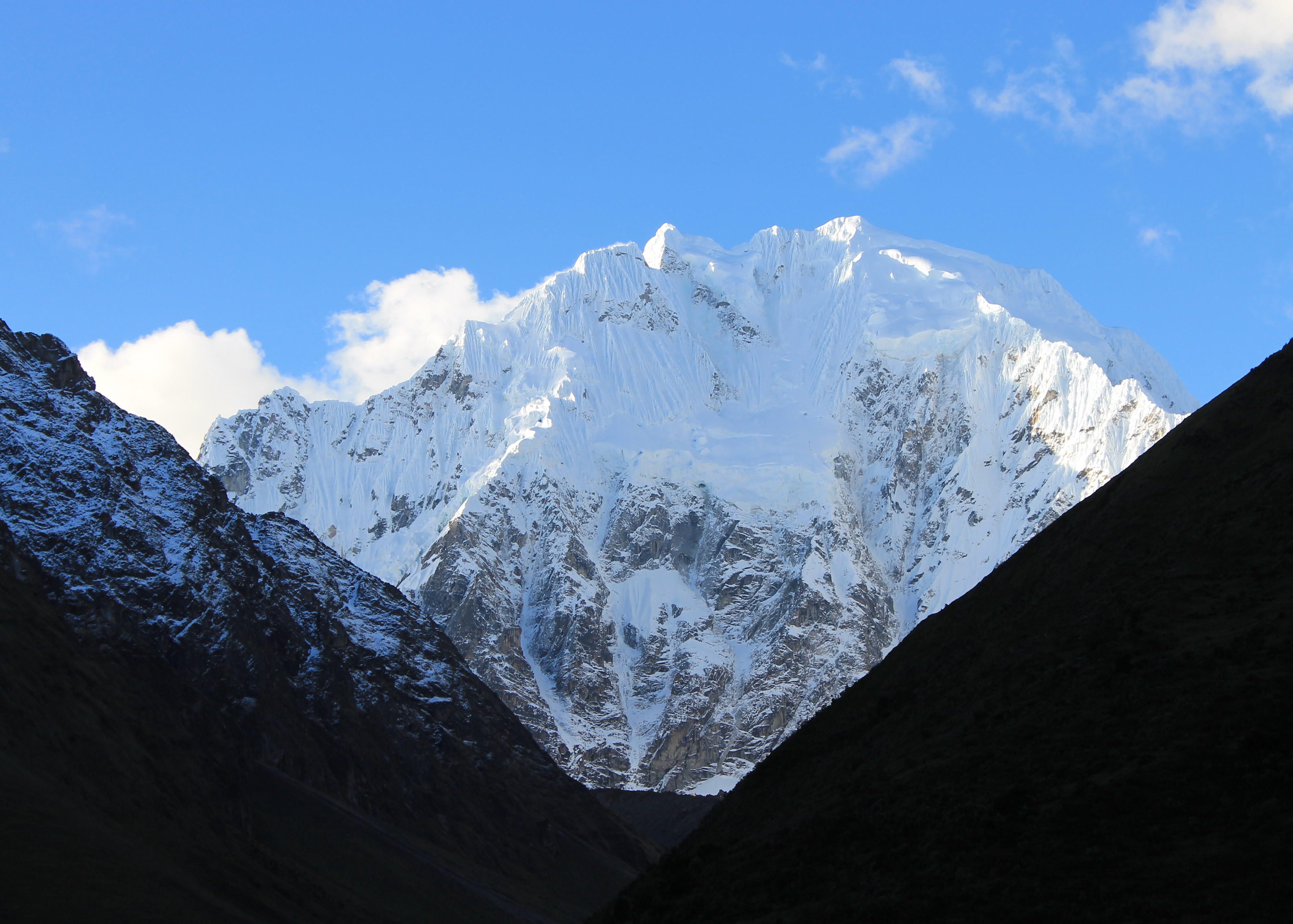 The South Face of Salkantay in the late afternoon sun
The other variant crosses Salkantay Pass (15,213 feet) to the west of Salkantay and then descends the Santa Theresa valley to the town of Santa Theresa. This is sometimes referred to as the Santa Theresa Trek (duh!), which is unambiguous. Our guidebook referred to it this way, and called the other variant the Salkantay Trek. But since the other variant is rarely done, most outfitters refer to this as the Salkantay Trek. Confusing. But whatever you call it, this is the trek that we did. I'll just go along with most people and call it the Salkantay Trek.
Most hikers who do the Salkantay Trek on their own take the bus to the village of Mollepata and start hiking from there. We stopped there to eat lunch and visit the craft guild shop. From Mollepata people hike to the campground at Soraypampa. It's an easy hike that takes about half a day. There is some trail but most of the time you have to hike along a rough dirt road. Whenever a vehicle passes you end up covered in dust. The views are pleasant but not spectacular until the last section when the south face of Salkantay comes into view at the end of the valley. Our group, like most commercial groups who have their own transport, skipped the tedious part of the approach and rode up in our vans. We drove up the road for about an hour. The road got rougher the higher we went. There were a couple of stream crossings that were tough but our drivers made it through. But it would have been boring and way too easy to ride all the way to the first lodge. We all were anxious to get out and do some hiking. Finally the vans pulled over, we got out, grabbed our packs, and started to hike to the lodge. We had started the trek!
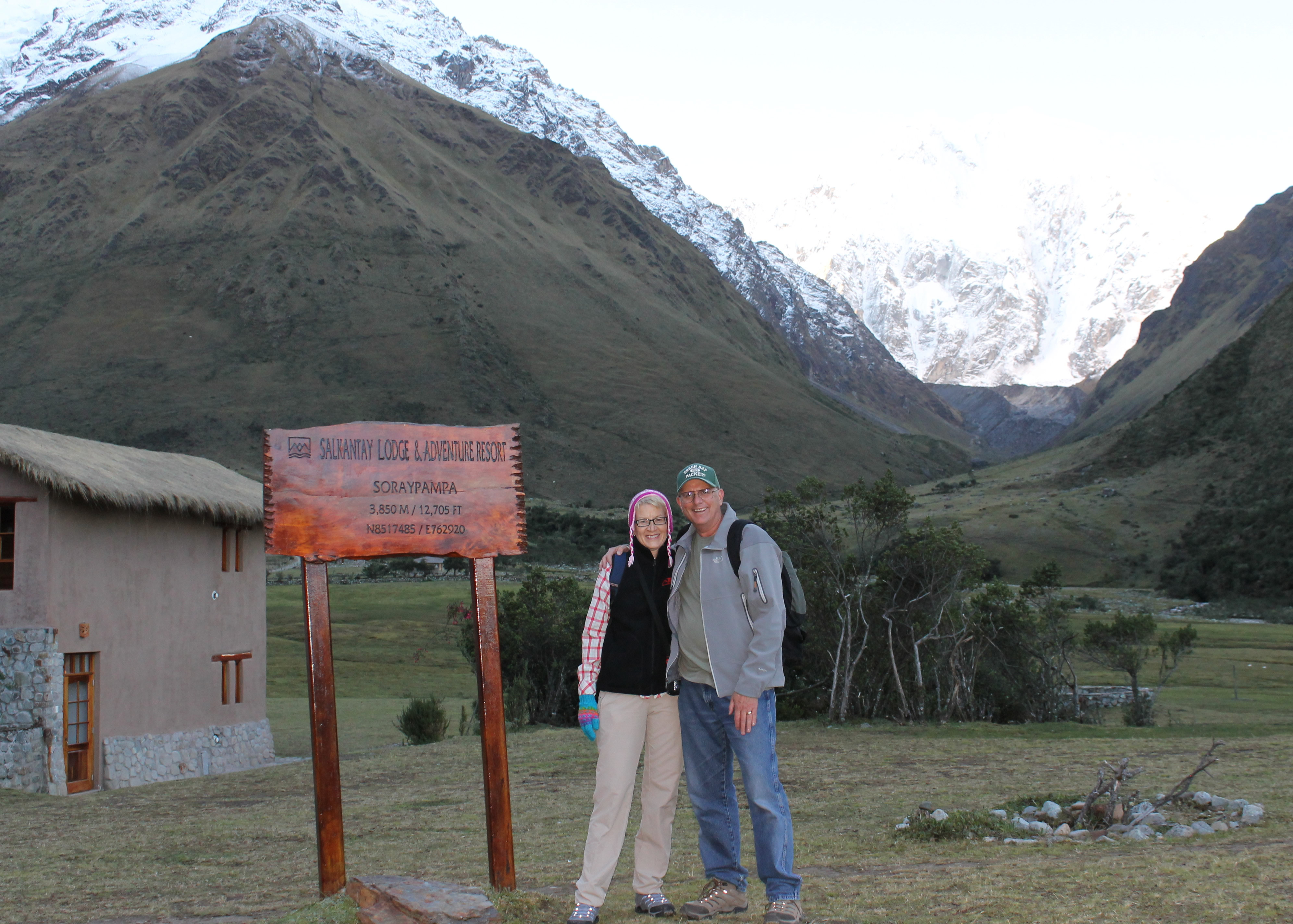 The intrepid hikers make it to the lodge
We started off by climbing straight up the hill from the road. We were around 12,000 feet - it wasn't long before I was breathing pretty hard. Maybe I wasn't acclimatized as well as I thought. But the steep uphill didn't last that long. In less than half an hour we reached an old Inca canal designed to bring water from the high glaciers to Mollepata. For most of the rest of the hike we followed the well designed canal, which was a very gradual uphill walk towards Soraypamapa. This was easy going all the rest of the way. We had a beautiful view of the South Face of Salkantay at the end of the valley. The mountains to the side and behind us were impressive. And we were following a very gentle incline designed by the Incas centuries ago to optimize the flow of water in the canal. This was more like it. We had passed into the shade which made the temperature drop quickly. We had been hiking in tshirts even though we were at high elevation. Now most people dug in their packs for sweaters and jackets and vests. With the effort of walking I was still very comfortable in my tshirt but I was the only one. This hike was the start of my reputation on this trek of being impervious to cold. It kind of surprised me because I don't really think of myself as being particularly brave when it comes to cold weather. But then again half of our group was either from the South (Virginia) or California, so maybe I was the tough guy of the group when it came to weather.
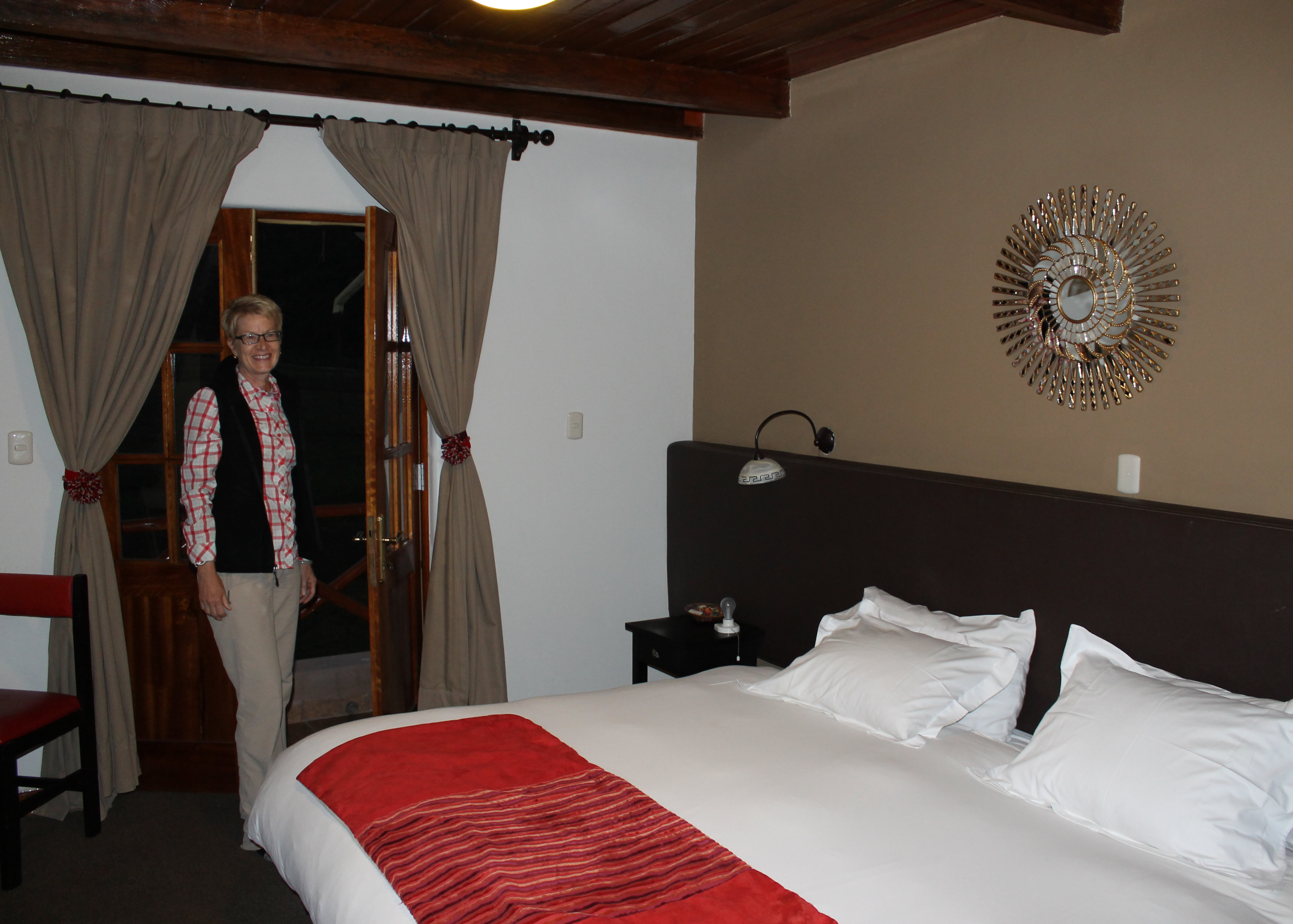 Our bedroom at the lodge - luxurious
As we walked along the canal there was a weird optical illusion. Looking up the valley we could clearly see Soraypampa ahead. But it clearly looked like it was below us. But we were walking along a canal and the water was running down from Soraypampa. I could see the canal running up the valley all the way. Since I do have a BS degree in physics I had to conclude that my eyes were deceiving me. The water was flowing downhill and Soraypampas was higher than we were. But no matter how long I looked at it I couldn't convince myself that it looked that way.
After about two hours of hiking we reached the lodge. It was a great start to the trek. The short hike was just enought to get the heart pumping and the blood flowing. But it wasn't so much that it would wear anyone out at such a high altitude. We had some hard days ahead after all. The lodge itself turned out to very luxurious. The accomadations were fantastic for being in the high mountains. We sat in the lounge with a beautiful view of Salkantay and enjoyed a cup of tea (ok - I admit that I had a Coke Zero instead). At 12,705 feet we were higher than the top of Mt. Borah, the highest mountain in Idaho. This was a pretty good start to our trek.
