Goat Rocks Wilderness - Snowgrass Flats
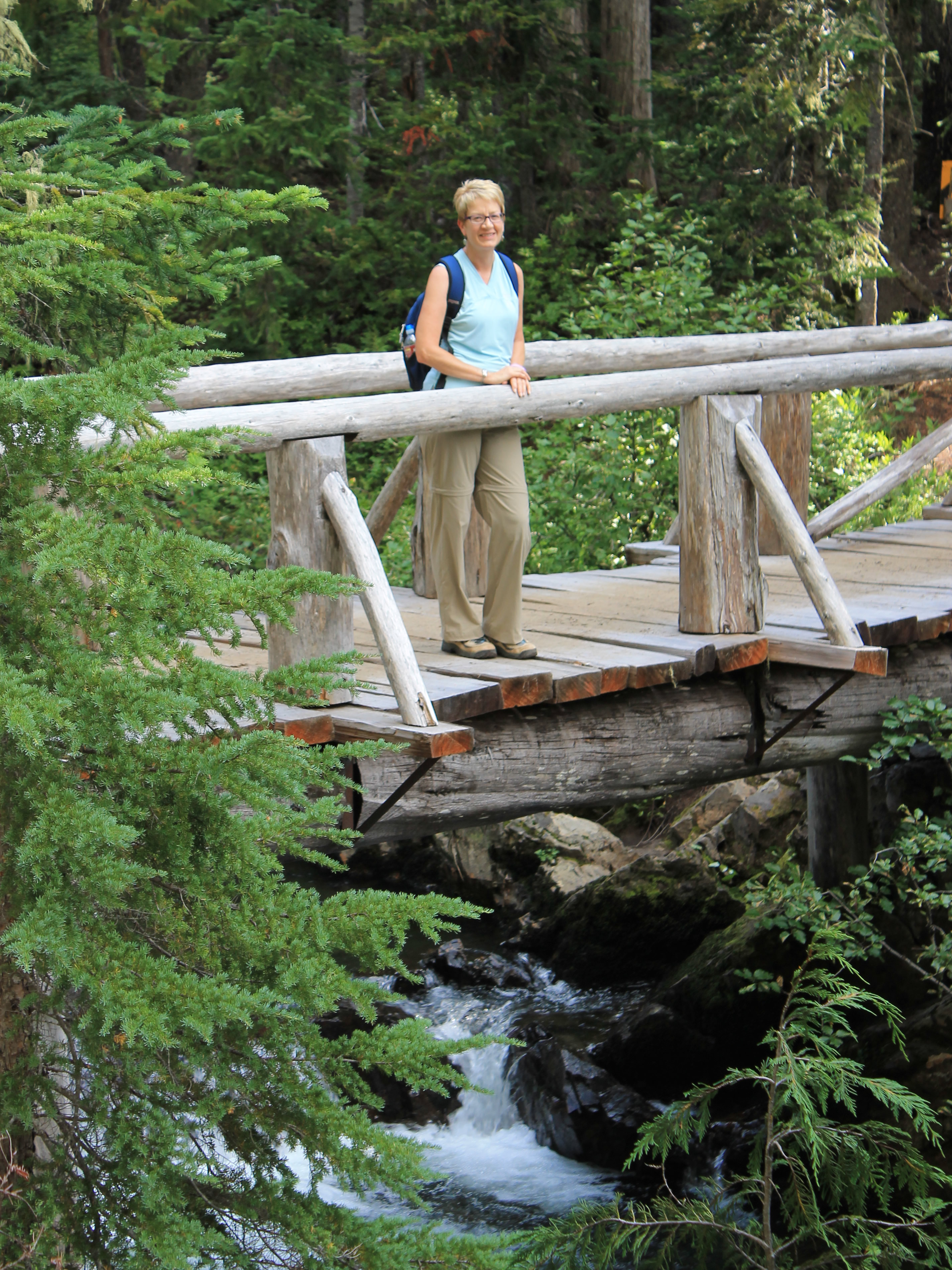 Crossing Goat Creek
Our Friday hike to Packwood Lake was nice. It was a good choice for a cloudy day. Fortunately the weather was supposed to clear up Saturday and I was psyched to do something more challenging, someting with distant views and a chance to take lots of pictures. We already had a great hike picked out, the Snowgrass Flats - Goat Lake Loop. It's probably the most famous (and popular) hike in the Goat Rocks Wilderness. I've been wanting to do this hike for many years.
Now the weather forecast just had to turn out to be correct. Earlier this year I read Nate Silver's book "The Signal and the Noise". It's a book which I highly recommend. Silver is a statistician and he analyzes how successful people are with various types of predictions. He has a chapter on weather forecasts and his conclusion was that the ones from the National Weather Service are pretty good and are getting better every year (the ones from tv weathermen he thinks are not so good). My own experience with weather forecasts is that they tend to be aggressive about major weather changes, predicting them to occur a little earlier than they actually happen. So I was pretty confident that it was going to clear up. I just wasn't sure whether it would happen early Saturday, late Saturday, or not until Sunday. And of course we were on the west side of the Cascades, where it can decide to rain at absolutely any time it wants to no matter what the forecast or general trend of the weather is.
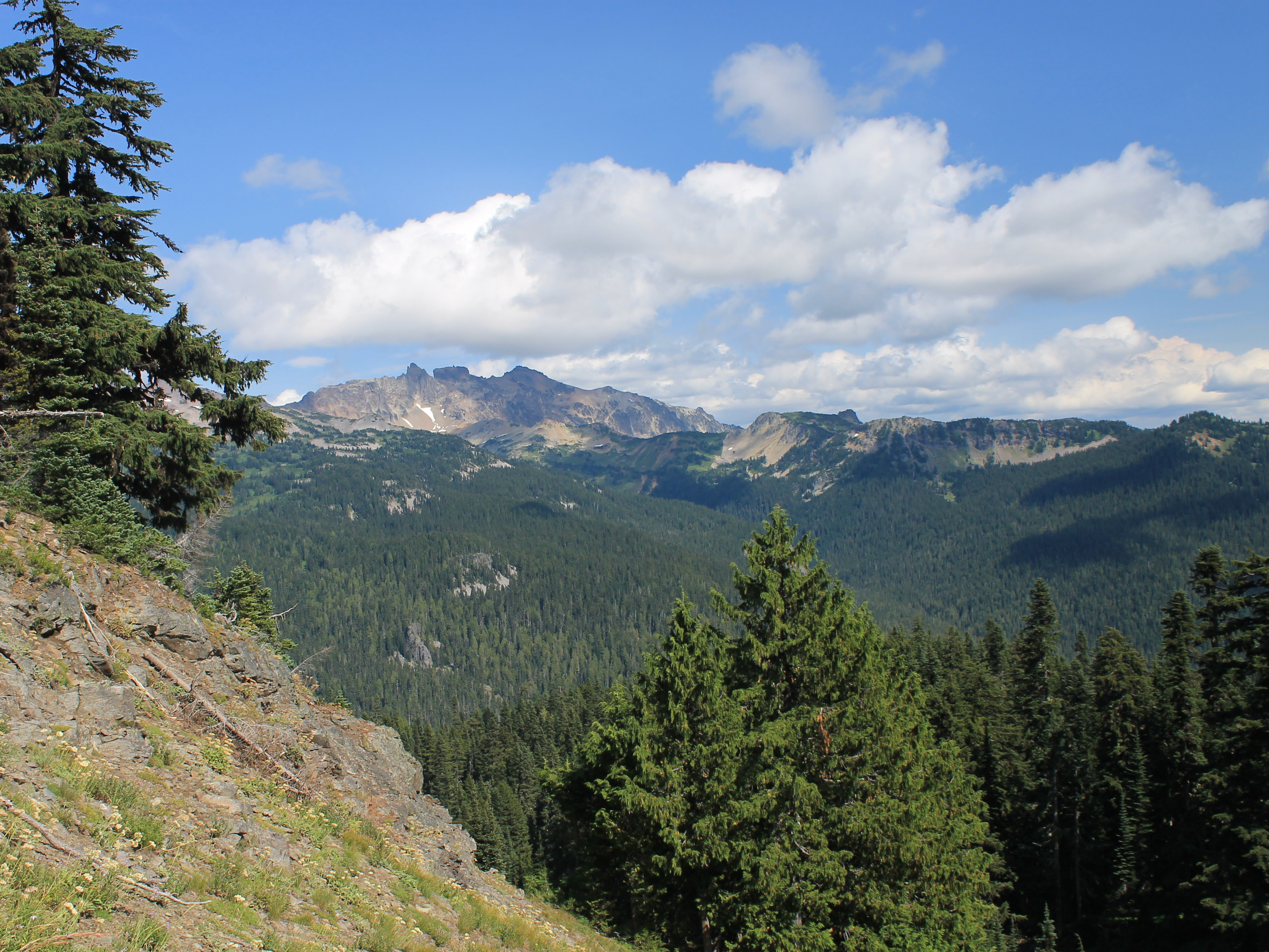
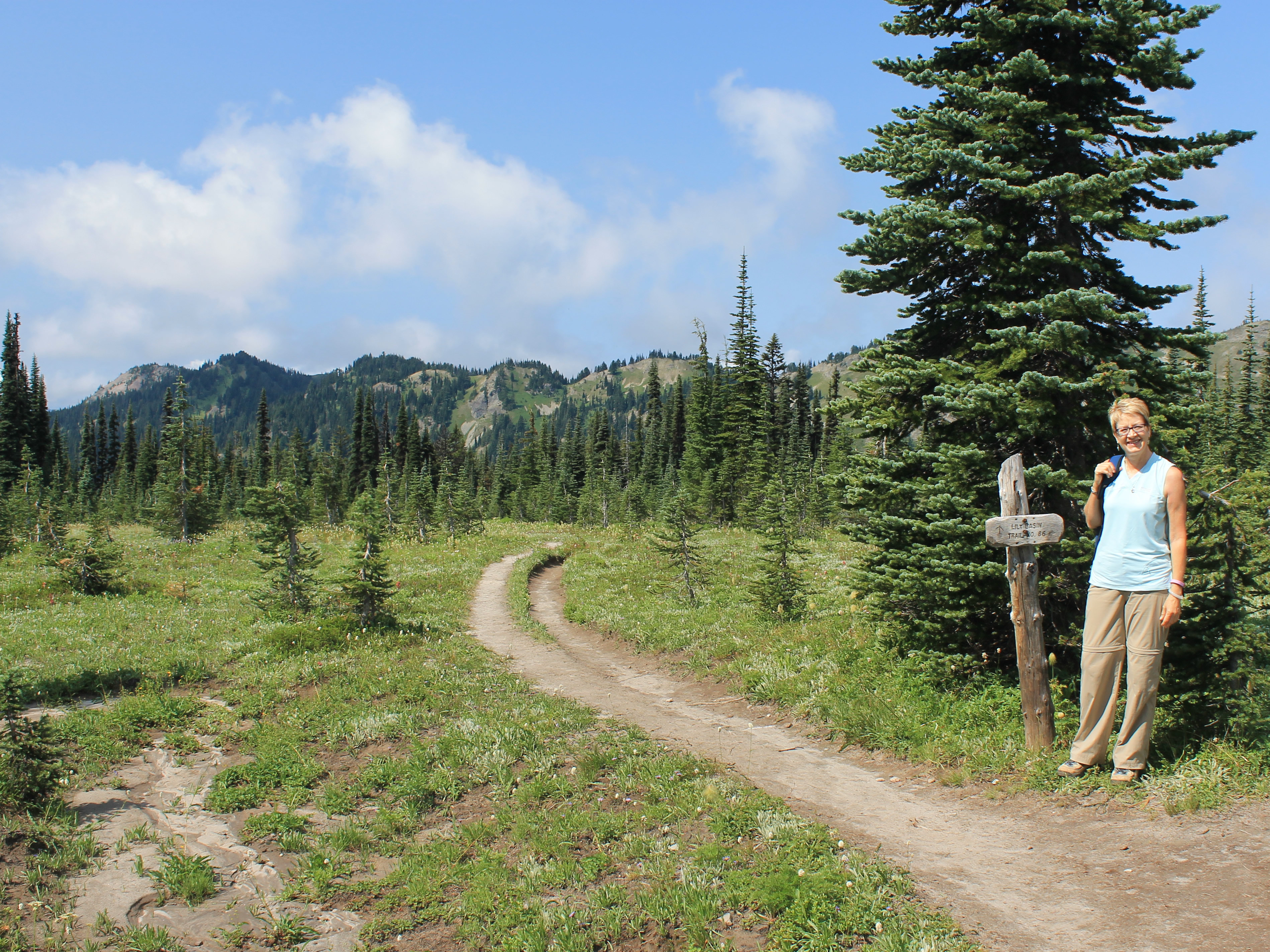 We finally come out of the forest at Snowgrass Flats
Since the trend was for improving weather through the day we decided against an early start. Usually we try to hit the trail as early as possible to beat the heat and the bugs. Instead we slept in (relatively, for a hiking trip) and had breakfast at the hotel when they started to serve at 7:30. Of course Packwood was totally socked in. Since we were in one of the cabins away from the main building we didn't have internet access. We didn't even have cell phone reception in Packwood, at least not on our ATT phones, so we couldn't check webcams from higher elevations in Mt. Rainier National Park. Of course I started to wonder if we should do something else., maybe just ride up to Paradise or do an easy hike. Sandy didn't pay any attention to my mumbling. After decades of hiking with me, she knows that I am a Weather Wuss. I always fret about the weather before starting a hike. I do have to admit that I am a fair-weather hiker. During my climbing days in my youth I used to be even worse. Eventually I settled down and we left for the trailhead to do the hike that we had planned.
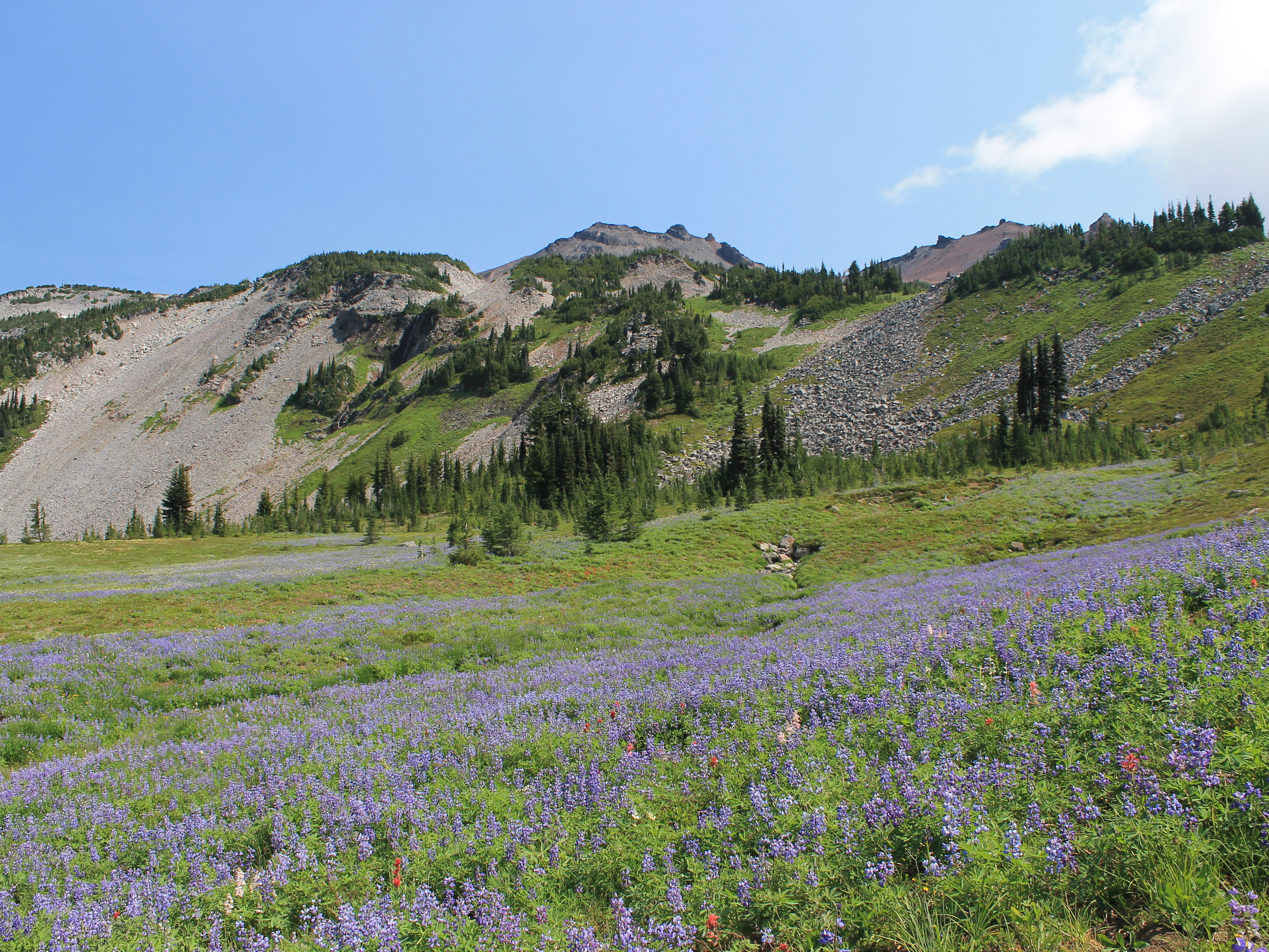 Fields of lupine at Snowgrass Flats
After only three miles on the highway we turned off onto a dirt road. From there it was fifteen miles but the road wasn't rough, just slow. It took us over forty five minutes to reach the trailhead. What we found there was quite a contrast with the day before. The Packwood Lake trailhead had a paved parking lot with room for about thirty cars, and only three cars parked there. Here there was no parking lot, but the trailhead was on a half mile long spur off the main road that did a loop back to the main road. It was parked up most of the way. There had to be at least fifty cars. Ok. The guidebook had said to expect to see plenty of other hikers on this trail. So far the description seemed to be accurate. We were lucky to find an open parking spot only fifty feet from the trailhead and squeezed in. As we left the car it was still cloudy but it had lightened up considerably. We were optimistic that the clouds would burn off later in the day. For now it would keep the beginning of the hike cooler. We were starting out in the forest anyway. It would be a couple of hours before we would come out above timberline and have any views.
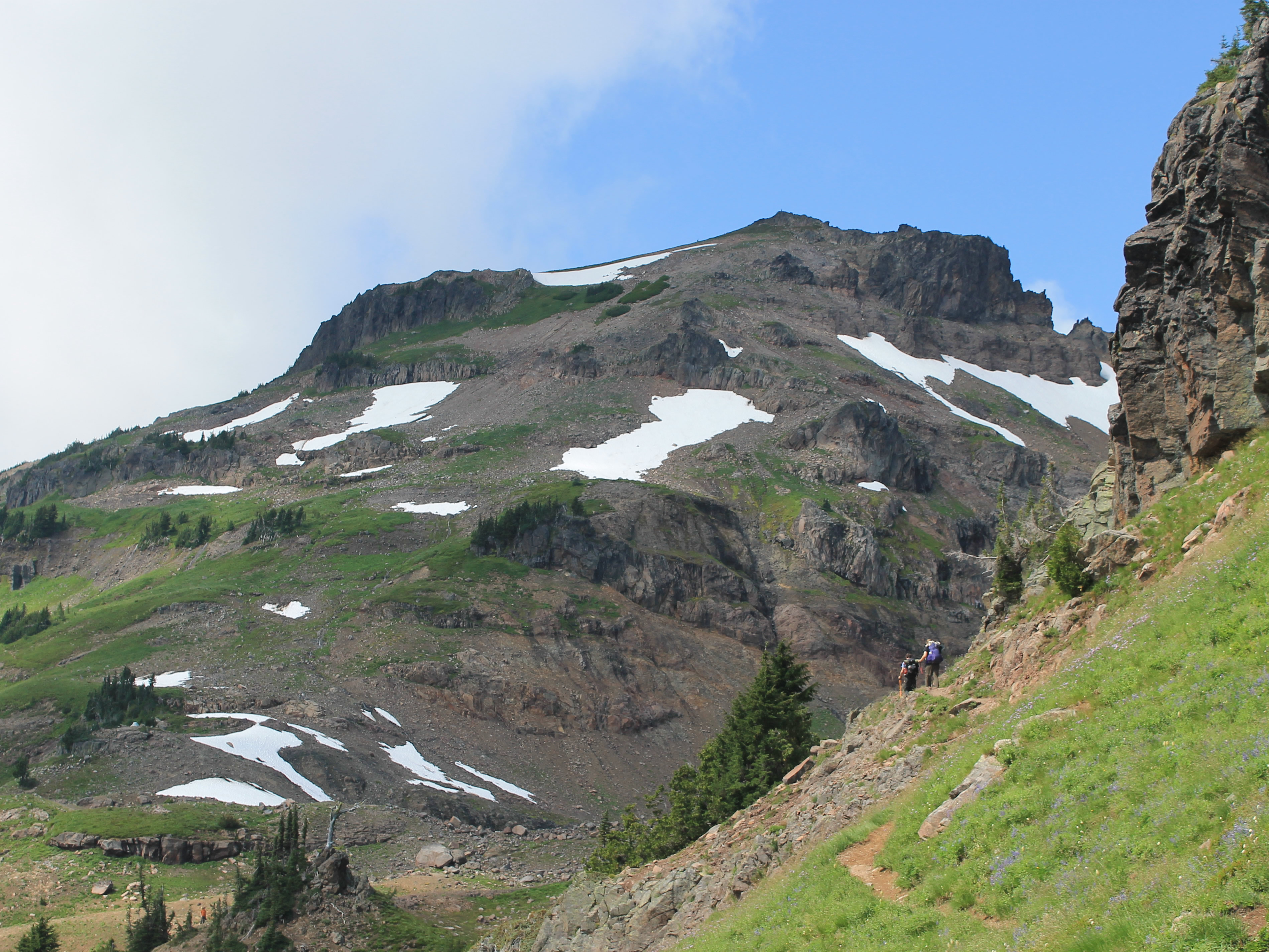
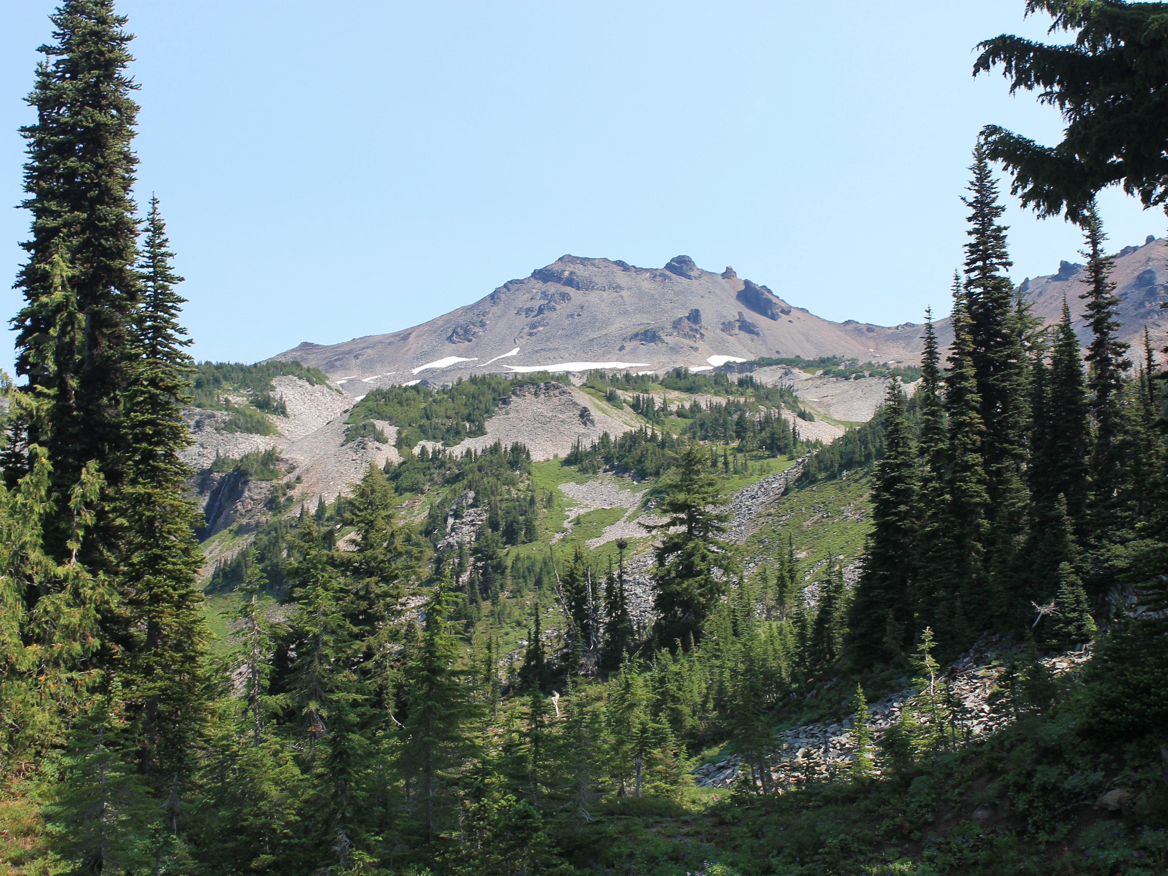 View of the Goat Rocks crest through the trees
We had an ambitious hike planned. It was a thirteen mile loop that climbed up to Snowgrass Flats, which is famous for its flower fields. Then it did a long traverse to Goat Lake, which stays frozen till late in the summer. Then it descends a ridge on the opposite side of the valley and returns to a different trailhead about three quarters of a mile from where we were parked. We were hoping that there would be a cutoff trail that would go back to our car. If not, we would have to do the last section along the road. Easy enough hiking but unpleasant when a car passes and covers you with dust.
Sure enough, after only five minutes on the trail we reached a junction with a trail coming in from the left, the direction of the other trailhead. It was signed "Pack Access Trail" but we were hopeful that it would provide a shortcut at the end of the loop. We wouldn't know for many hours though. (Plot spoiler - it did provide a shortcut at the end of the hike.)
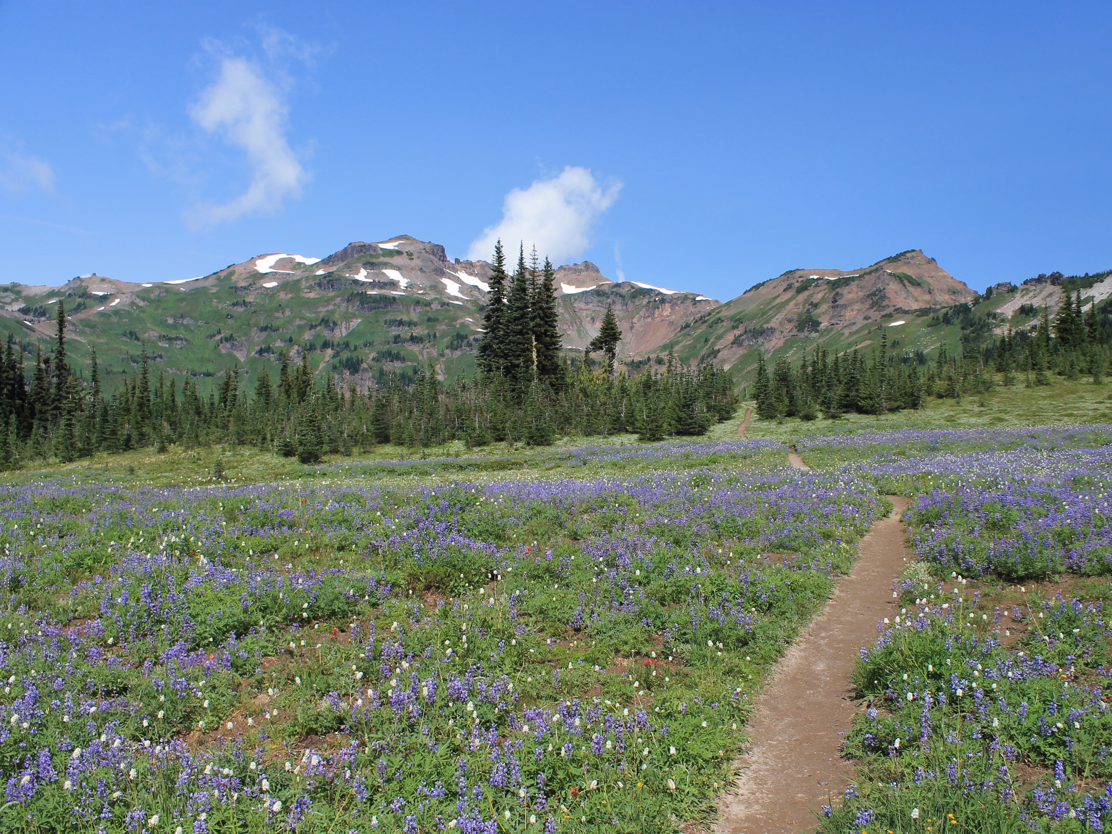 Trail running through the flower fields
The net elevation gain for the loop was 1900 feet, a good days work but not terrible when spread out over a hike that long. We were just wondering how much up and down would get added in the process. Sure enough, the trail started by descending for the first two miles to a crossing of Goat Creek. Although it makes for easy walking, no hiker likes giving up elevation when they know that they just have to earn it back again. The trail finally bottomed out at Goat Creek, a pretty stream descending in a series of cascades which we crossed on a sturdy wooden bridge.
I was not looking forward to the next stretch. According to the route descriptions that I had read on the web, it went through a cedar swamp and was notorious for lots of mosquitoes. After some of the hikes that I had done earlier in the summer in the Olympics, I felt like I had spent enought time fighting with bugs on the trail for one season. But this time we got a pleasant surprise and didn't have any problems. It wasn't because we started early so I don't know why we weren't bothered. Climate change? Phase of the moon? Cosmic rays? Who knows? I wasn't complaining though.
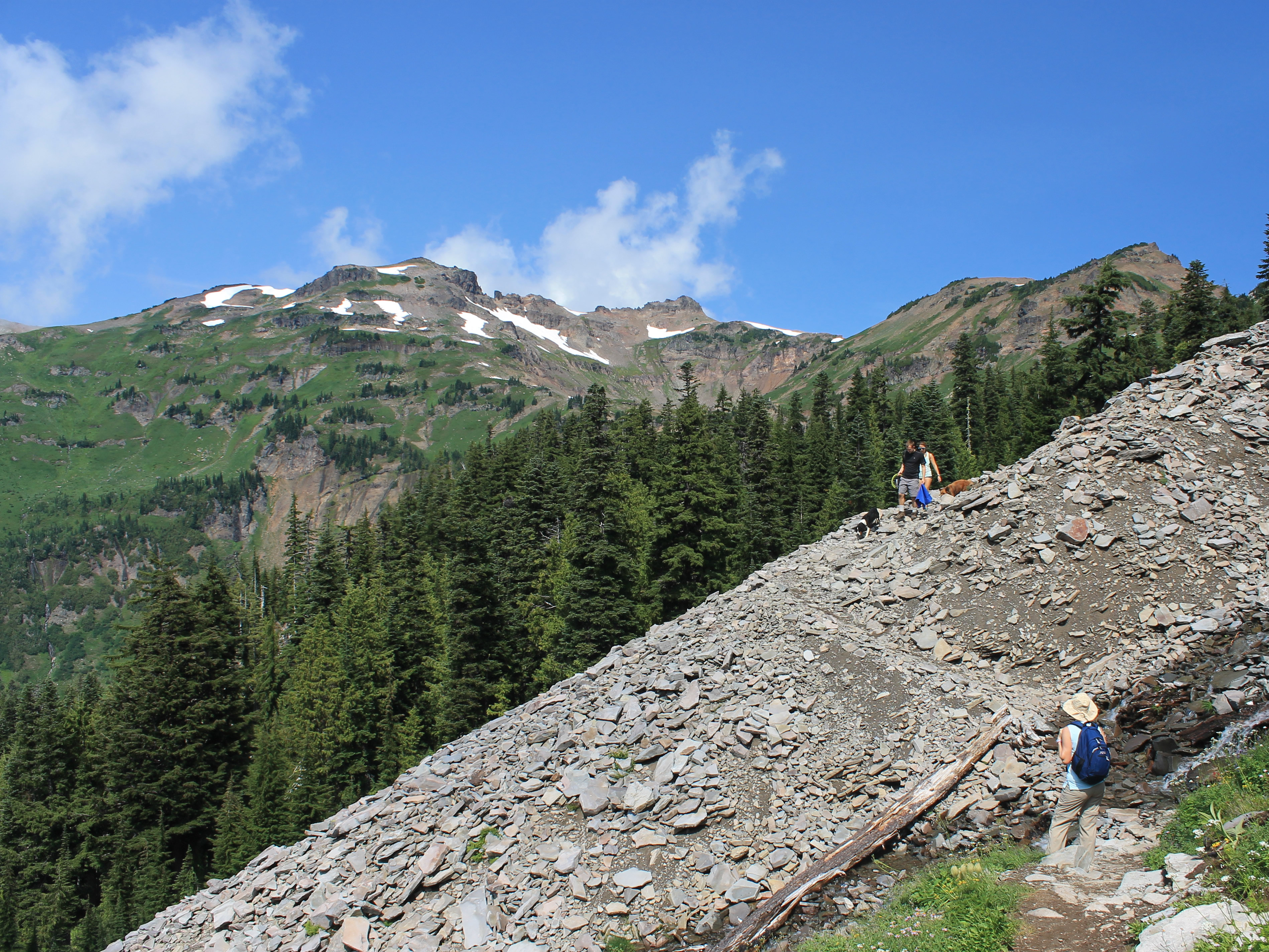 Traffic jam on the trail
It wasn't long before we started to climb. We had to regain the elevation that we had lost before we could even start on the "real" elevation gain. It was a well-built trail so we just took our time. As we climbed the light got brighter, the clouds started to break up and we could see patches of blue sky. We met a group of backpackers coming down the trail. As we chatted with them they lamented having to leave just as the weather was improving. They also told us that Snowgrass Flats was well worth the climb up to it. When you are slogging up a big hill it's always good to hear that it's going to be worthwhile.
About three hours from our starting point the trail finally leveled out and we broke out of the trees. We were in a large meadow that was the beginning of Snowgrass Flats. Not too impressive so far. Trees still blocked most of our view of the Goat Rocks crest. There were flowers in the meadow but nothing outstanding. There were several parties camped in the trees around the meadow. We were on a huge, flat shelf that contoured around the mountainside so there were good campsites everywhere. At a three-way trail junction I pulled out the map. This was where we decided if we committed to the loop or turned around and went back the way that we had come. The hike so far had been straightforward but nothing exceptional. We both still felt good. We decided to go on.
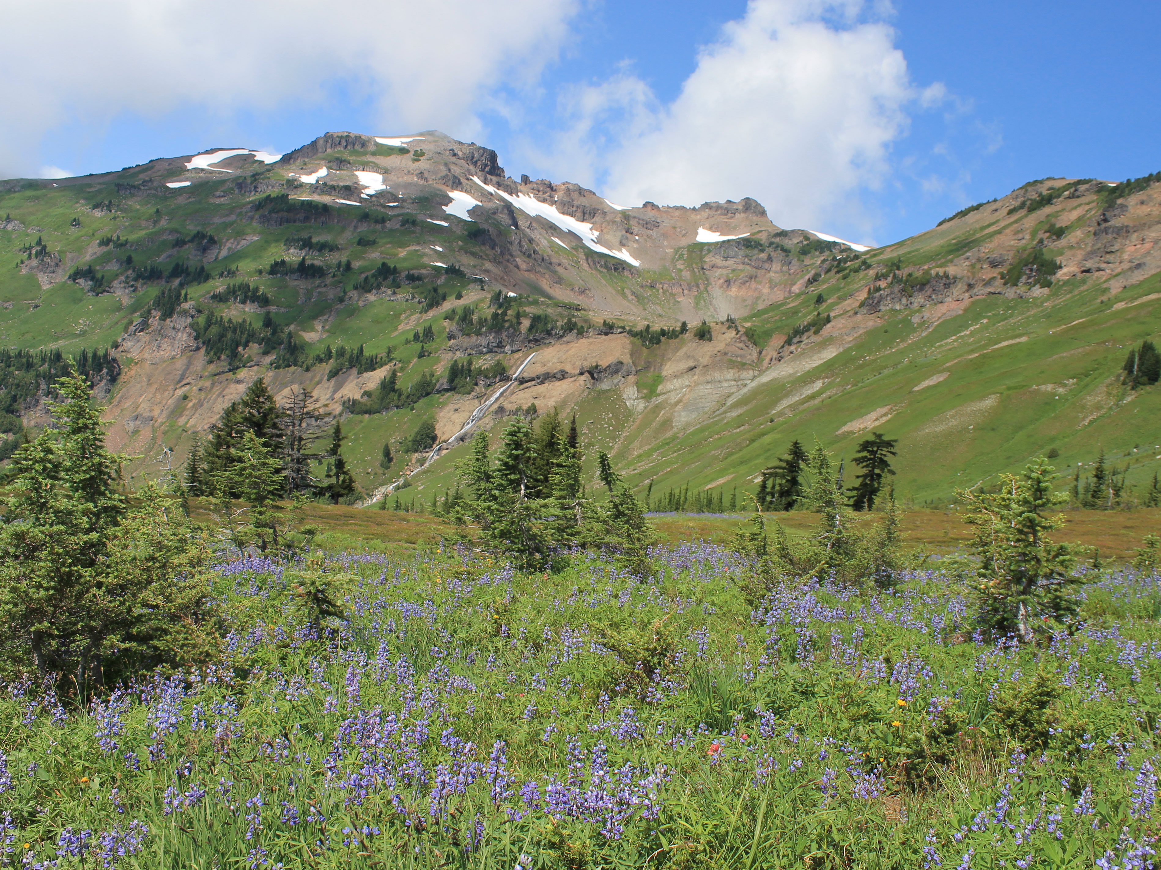 Looking up to the Goat Lake basin
This turned out to be a good decision. Over the next fifteen minutes we came completely clear of the trees and could see in all directions. And we found the flower fields.
The Goat Rocks are a series of peaks about eight thousand feet high that are the remains of an ancient volcano. Two million years ago, the Goat Rocks Volcano was similar to nearby Mt. Rainier and Mt. Adams and was probably ten thousand feet high or more. Over time it has been eroded till only a portion of the rim remains as the current Goat Rocks peaks. Once we were completely clear of the trees we could see our route contouring along the slope of the ancient volcano rim, making a long rising traverse to a basin that we suspected contained Goat Lake. The entire slope was covered with meadows, making the mountains a soft, fuzzy green from a distance. Close up the meadows were filled with flowers, millions of them. Lupine was the most common, which made the meadow look blue from close up. There were also whole fields of beargrass, and of Indian Paintbrush, as well as some that were mixtures of dozens of different flowers. It was indeed impressive.
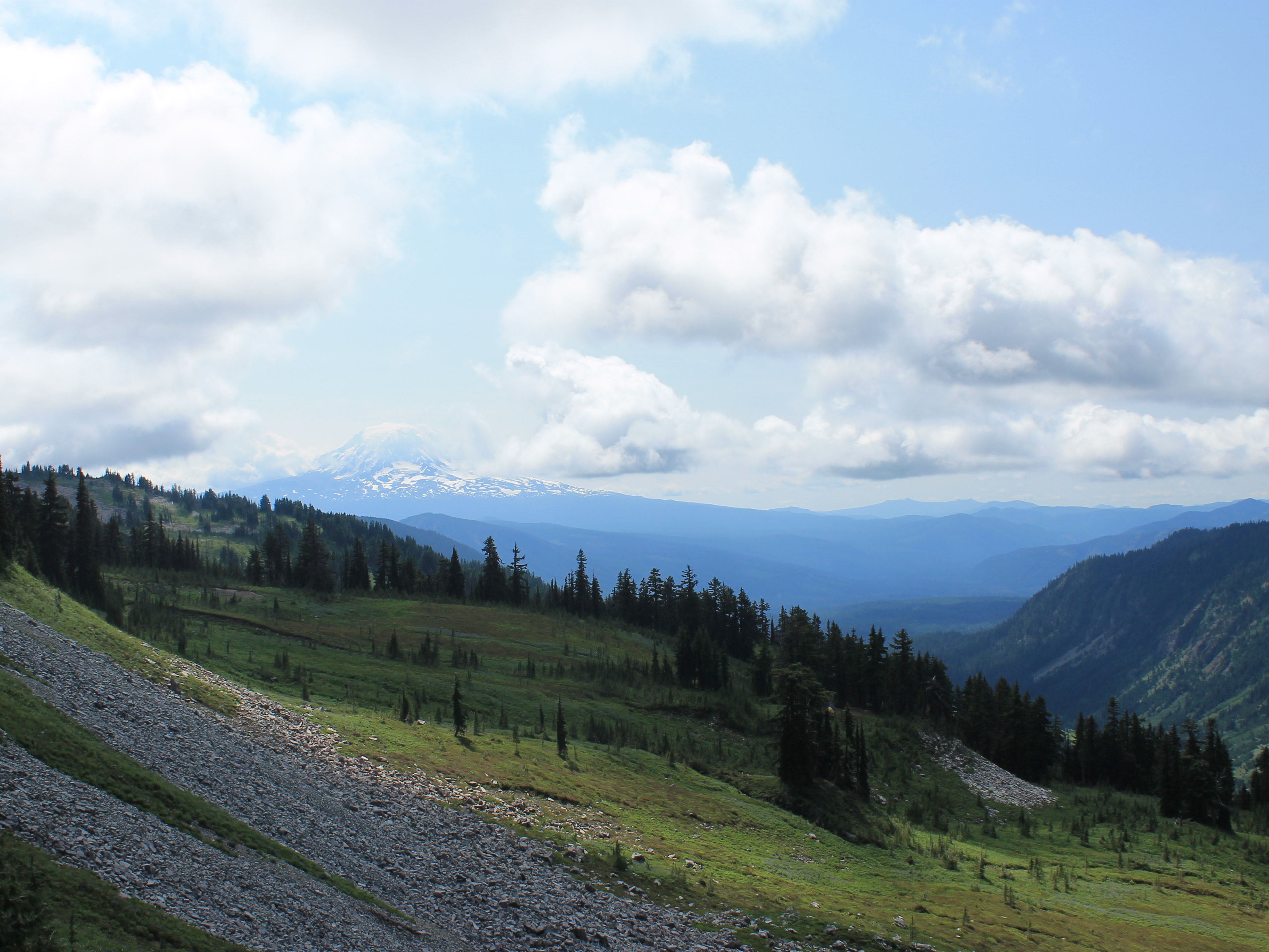 Mt. Adams is briefly visible far to the south
Along with zillions of flowers there were also a lot of people. On the way up we had seen very few, but once we reached Snowgrass Flats there were quite a few people camped there. It is a very popular backpacking spot. Besides being beautiful, there are literally dozens of campsites scattered along the trail, all in flower-filled meadows with beautiful views. We also started to encounter day hikers coming the other way, people who were doing the loop like us but in the other direction. But that was ok. The hiking along the traverse was awesome and I didn't mind sharing it with other people. The point of this hike wasn't a remote, solitary wilderness experience. If that was what we were looking for we probably would have turned back when we saw all the cars parked at the trailhead.
When we passed a couple going the other way I asked them if the basin we could see ahead was where Goat Lake was. One of them said it was. I asked how long ago they had left. Forty five minutes? He said it took them at least an hour.
 A pair of backpackers about to enter the Goat Lake basin
For the record, even though we were going uphill, we made it to the lake in fifty minutes. Although it was over seven miles from the trailhead it was quite crowded. There were probably thirty or so people scattered around the lake. True to the description, the lake was still about three quarters covered by snow. Quite impressive considering that it was the middle of August, in a year that had a hotter than usual June and July.
We took a short rest at the lake. We had been going for four hours, and working hard all of that time. But we still had just as far to go to get back. As we approached the lake we were hoping that it was the high point and that there was no more climbing to do. We kept scanning the slopes beyond the lake to try to spot the trail, without success. After we passed the lake the trail started climbing again, up several hundred feet to a low point on the crest of Goat Ridge. When we finally reached the pass we could see that the trail descended from there, following a different ridge than we had taken on the way up to go back to the trailhead. Although there were still some ups and downs, from here it was mostly downhill.
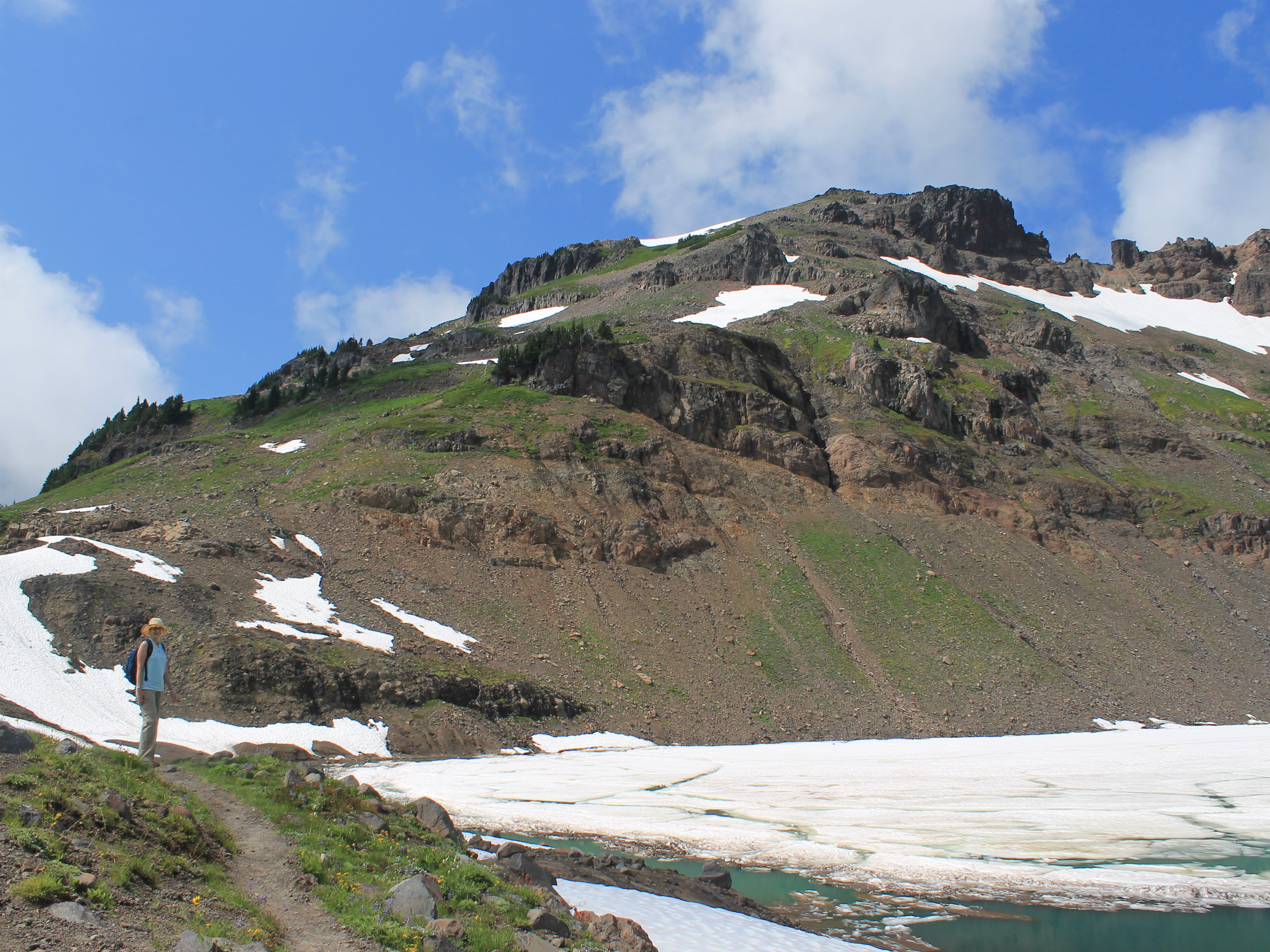 Goat Lake is still mostly frozen over, even in mid August
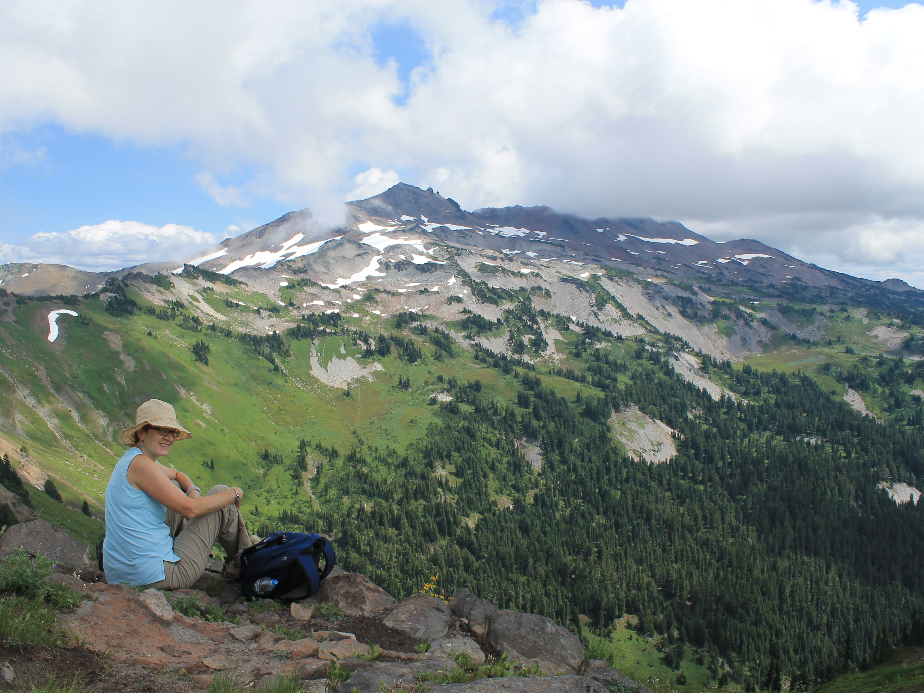
We rested for a while at the pass. We could see the Goat Rocks crest across the valley. We could see the trail that we had followed, from where we emerged from the forest, through Snowgrass Flats, to Goat Lake, and then up to where we were sitting. Two hours of hard work. Far to the south we could see the base of Mt. Adams. The upper part of the mountain was hidden in clouds. We had a brief view of the whole mountain on our way to Goat Lake when Sandy happened to look back and spotted it in the distance before the clouds moved in.
It was indeed an awesome hike, one that I was glad that I finally got a chance to do. But it was hard work too. While we were sitting there a group came up to the pass from the other side. It looked like a mom with two of her kids. We were sitting on some rocks enjoying the view off to the side of the trail, not easily visible. When she reached the the pass she let out a loud "Shit!", took off and dropped her pack on a rock, then dropped onto another rock herself. At that point she noticed us, looked embarassaed, and apologized. No need we told her. That was exactly how we felt when we reached the pass.
 Enjoying the view from the pass before the last push home
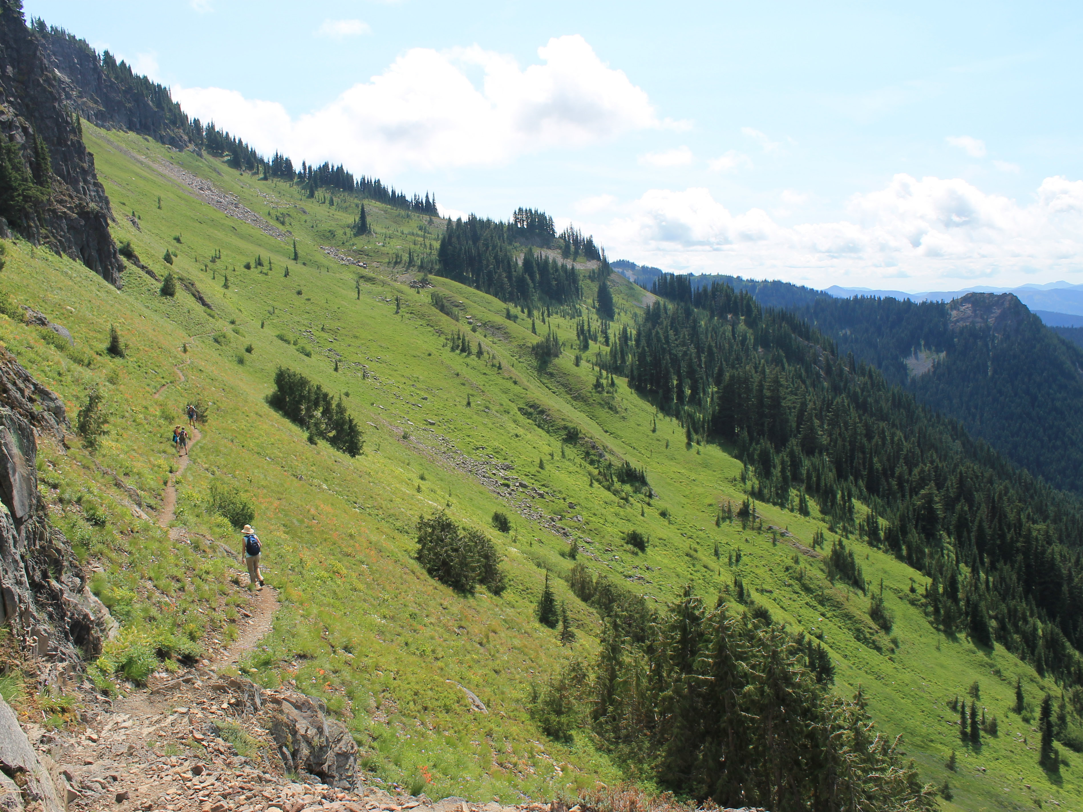
Then it was time to head back. We had a little over five miles to go to reach the trailhead. Part of it was still above treeline, contouring along a slope with beautiful views. We were moving through an ocean of wildflowers. But we were getting tired, and while the hiking was enjoyable, now it was about getting back to the car. We still didn't know exactly how far we would have to go, or how easy (or hard) it would be to get from the second trailhead back to where we were parked.
Now there were more and more people. We passed lots of backpackers heading in for the weekend. I sure was glad that I was going downhill, and not heading up with a heavy backpack filled with camping gear, especially now that the sun was out and the afternoon had gotten quite warm. On this stretch the trail was quite narrow as it contoured along the hillside. Whenever we passed someone going the other way there wasn't room to step off the trail, so we would just put one foot on the uphill slope and lean in as far as we could to get out of the way. That usually left enough room for them to slide past.
 Sandy following the narrow trail just before she slipped
About three miles from the trailhead, on this stretch of narrow trail, Sandy almost had a disaster. She stepped a little too far to the side and the edge of the trail gave way beneath her boot. Her right leg fell down the slope and she collapsed on her left leg, twisting her ankle in the process. I helped her up and it was clear she was in pain but she was game to keep going. Good thing, as I would have hated to have abandoned her there (-:
We still had three miles to go. She was going ok on her bad ankle but now she didn't want to stop. Sandy was afraid that it might swell up and she wouldn't be able to get going again. Finally we knew we were getting close to the other trailhead and watched carefully for a cutoff trail to the left that would take us back to our car. Eventually we saw a parking lot. We had reached the other trailhead. Just as we got there two guys came in from a trail on the left. We asked them if it went to the other parking lot and they said yes. Now we were in business. They said it was about half an hour away.
 Beautiful views even near the end of the hike
That was a long half hour but we finally reached our car. Sandy had been pretty tough getting back with an injured ankle. The drive back to Packwood took us almost an hour and we went straight to Cruiser's Pizza. We were starved. By the time we got there Sandy's ankle had swelled up and she could hardly walk on it. She did end up taking it easy and limping around for the next week or so.
Next day was Sunday and we had planned to do a short hike in the morning before heading back to Boise. I had a couple in mind and was going to figure out which one to do that evening. Now I didn't have to worry about that. We had a wounded soldier. We drove straight back to Boise the next morning. But it was ok. We had two good hikes. The one to Snowgrass Flats had been awesome. And Sandy had even found a cool quilt shop in Packwood. All in all, it was a fun trip.
