Vancouver Island - Strathcona Provincial Park
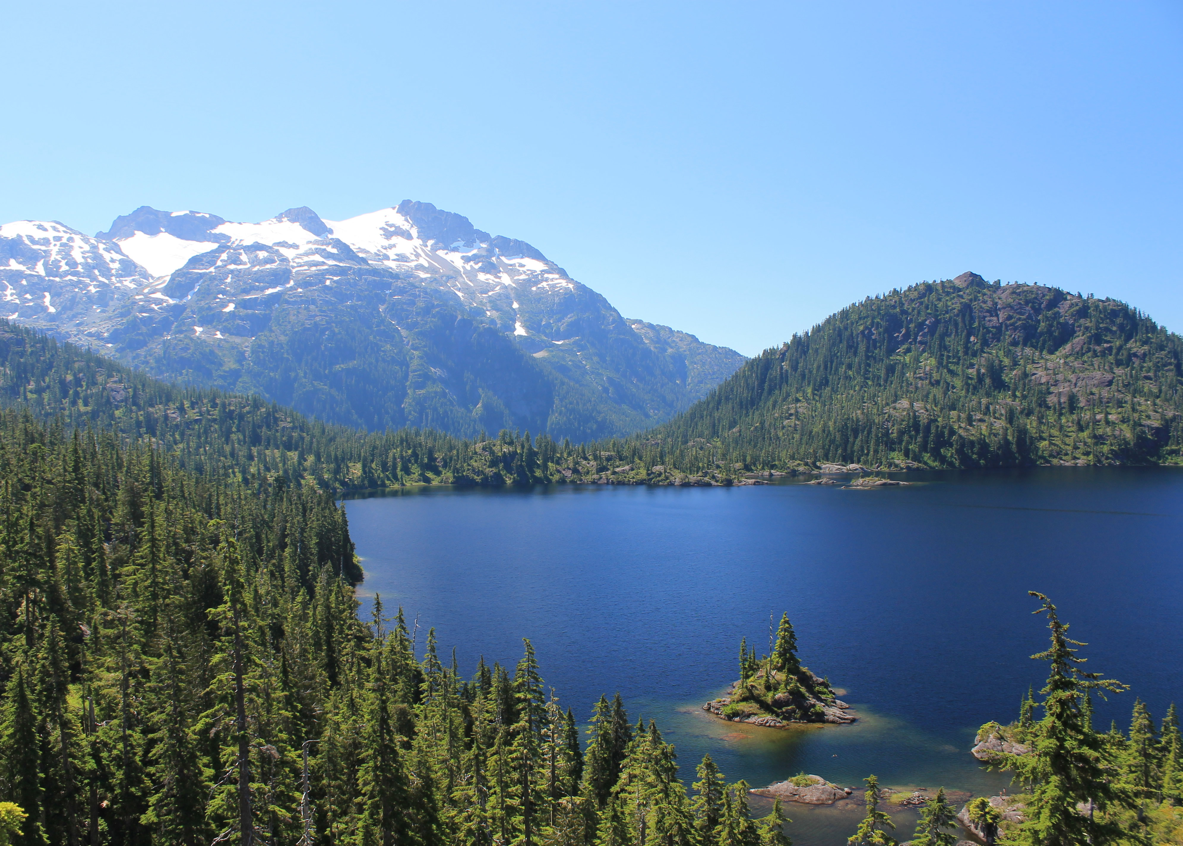
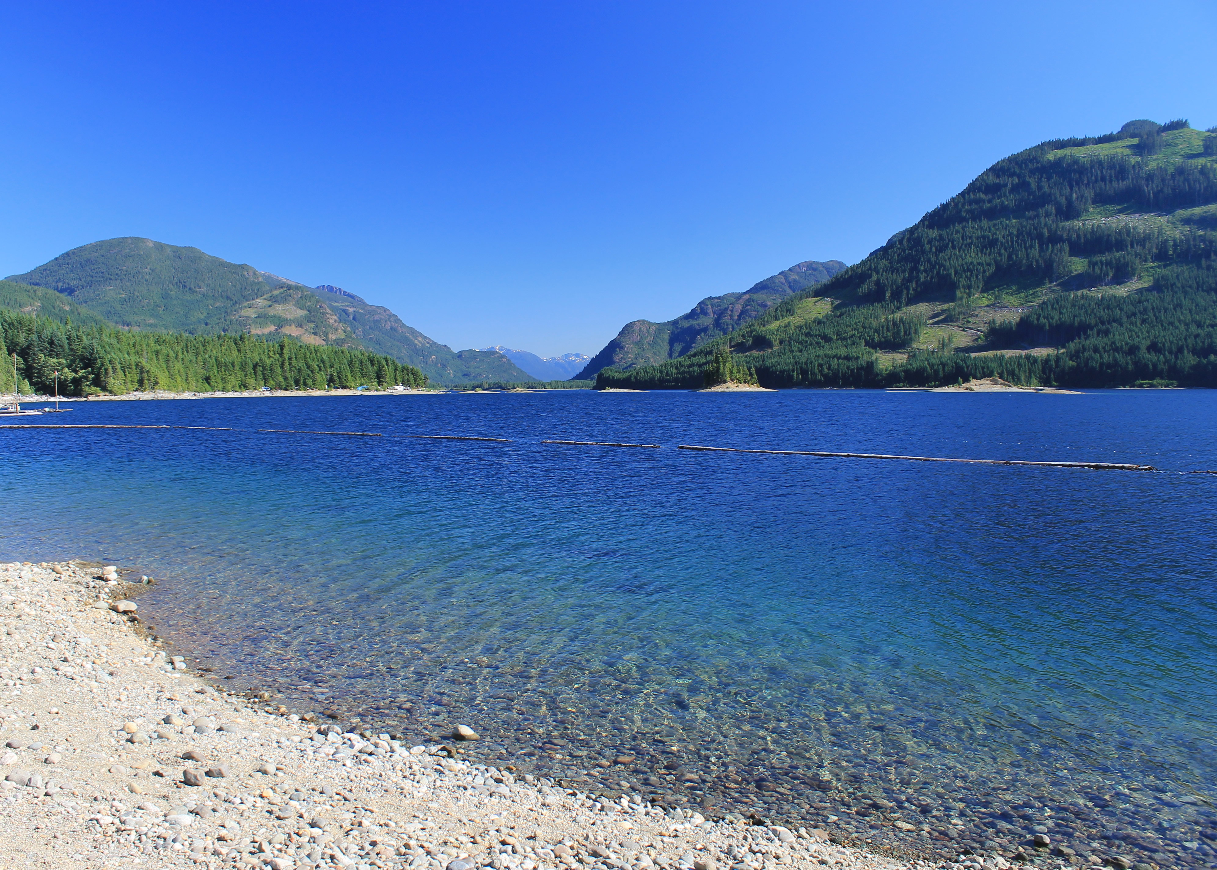 Upper Campbell Lake - looks like a beautiful day for hiking
There were a lot of things that we wanted to do on our trip to Vancouver Island. We wanted to see the coast, visit wineries, check out quilt shops and yarn shops (Sandy) and buy tshirts (me). But I'm a mountain guy and my number one thing to do was to hike in the mountains. The most spectacular mountains on Vancouver Island are supposed to be in the north central part of the island in Strathacona Provincial Park so those were my top priority to check out.
I couldn't find out much about the park. Some pictures that I found seemed to show impressive snow and ice peaks but it wasn't clear what peaks they were or exactly where the photos were taken. I ordered the hiking guide from Amazon weeks before the trip. (In fact, I ordered all three volumes covering hiking on the entire island.) It turned out that the guidebook wasn't very much help.
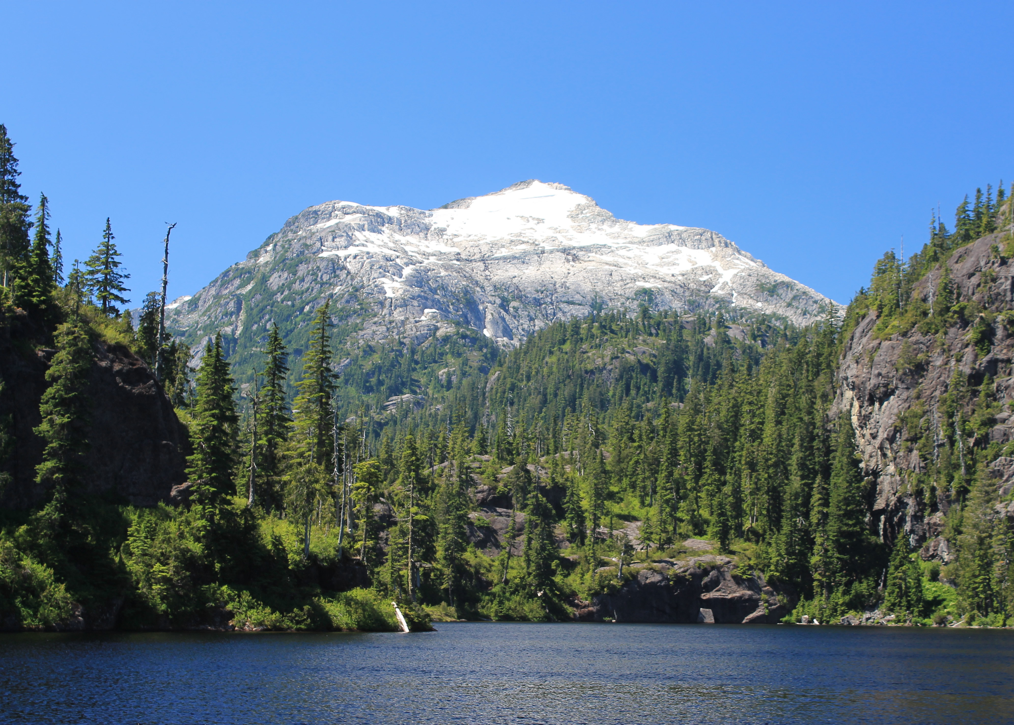
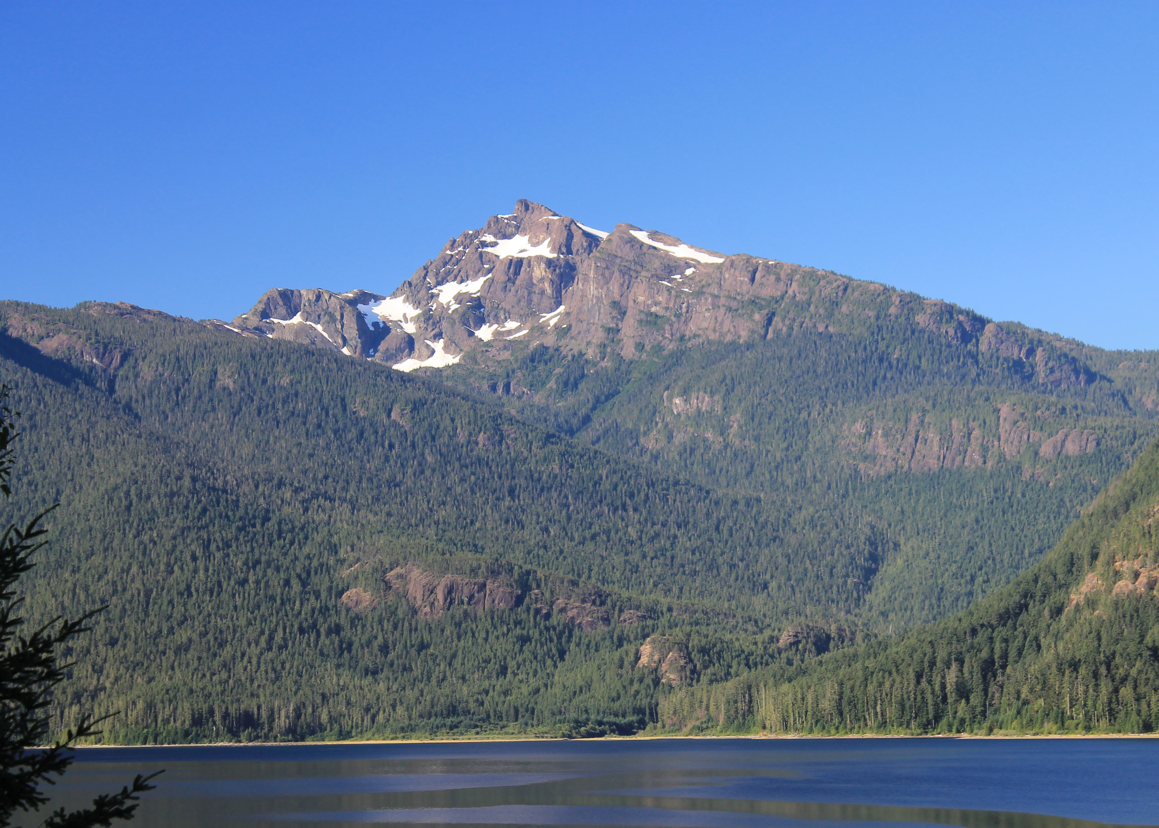 Mt. McBride rises above Buttle Lake
As I studied it the first problem that I ran into was that the guidebook wasn't very good. At least, it certainly wasn't what I needed. It tended to give "how to get from Point A to Point B" type information. What was missing was whether I wanted to get to Point B or not in the first place. I wanted to know which lakes were pretty, which trails led to viewpoints or where I could see the big peaks. There wasn't anything like that. What information it did provide was inconsisitent. It was hard to tell what was a maintained trail and what was a cross country route. Distances were usually given but elevation gain, which is even more important, often wasn't. Times varied tremendously. Often it wasn't even clear if it was meant as one way or round trip distances and/or times. Many trail descriptions neglected to mention that the starting point was deep in the backcountry and the access to it was described in a different chapter. I would get all excited that I had found a really good trail and then learn that I had to hike fifteen miles to get to the start of the trail they were describing. I was definitely not happy with the trail guide. I could get some supplemental information from the web but even that turned out to be quite limited.
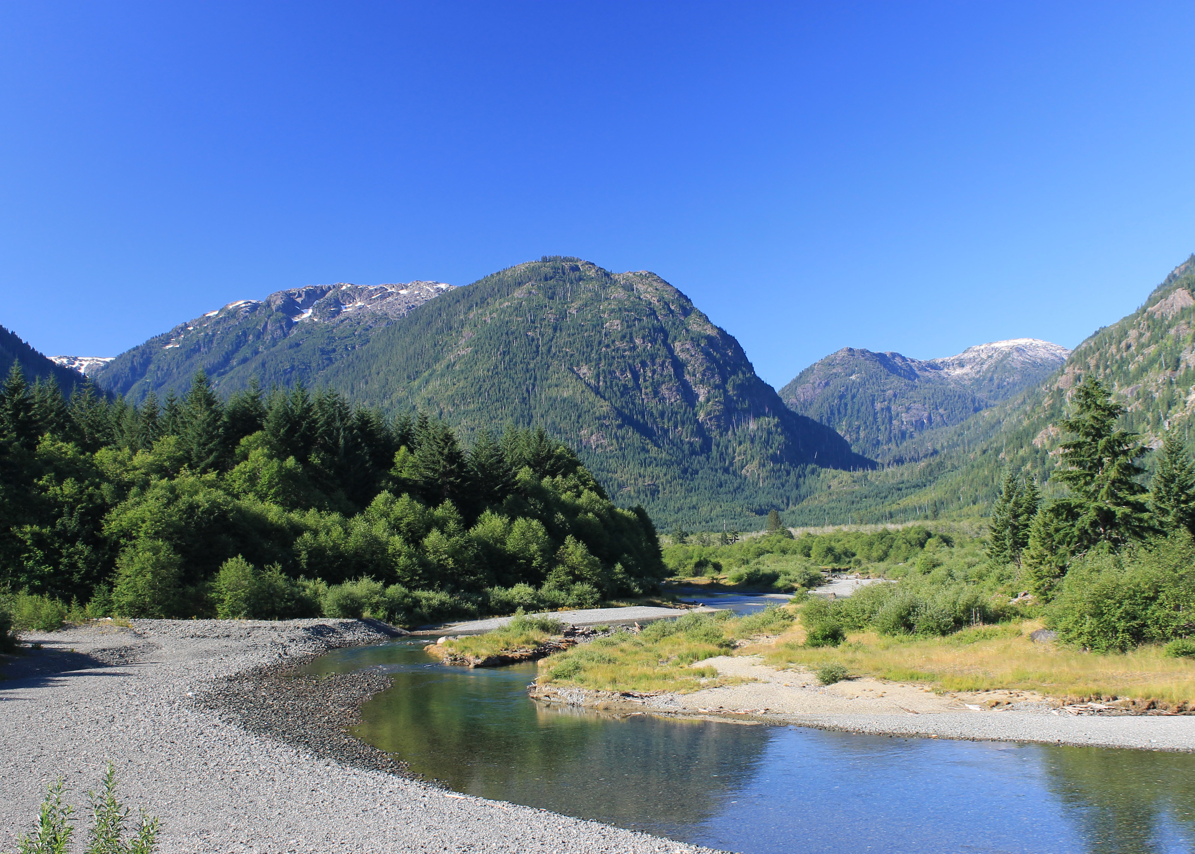 Looking up Thelwood Creek from the end of Buttle Lake
I did figure out a few things. The park is large, over 600,000 acres, which is almost as big as Yosemite National Park. I learned that access to the park isn't easy. Most of the park is managed as wilderness so there are almost no roads in the park. Even trails into the central wilderness are limited. There are no towns nearby and little development in or near the park. It was going to be a challenge to get in and see the central peaks. I really had no idea what to expect. It might be spectacular or it might be a bust.
I did manage to find a place to stay that was just outside the park boundary. Strathcona Park Lodge was right on the shore of Upper Lake Campbell. It had a pretty view of the mountains and lake, but we could see a lot of the effects of logging in and near the park. Areas had been clearcut, some recently, some years ago. It definitely detracted from the setting which could have been post card quality.
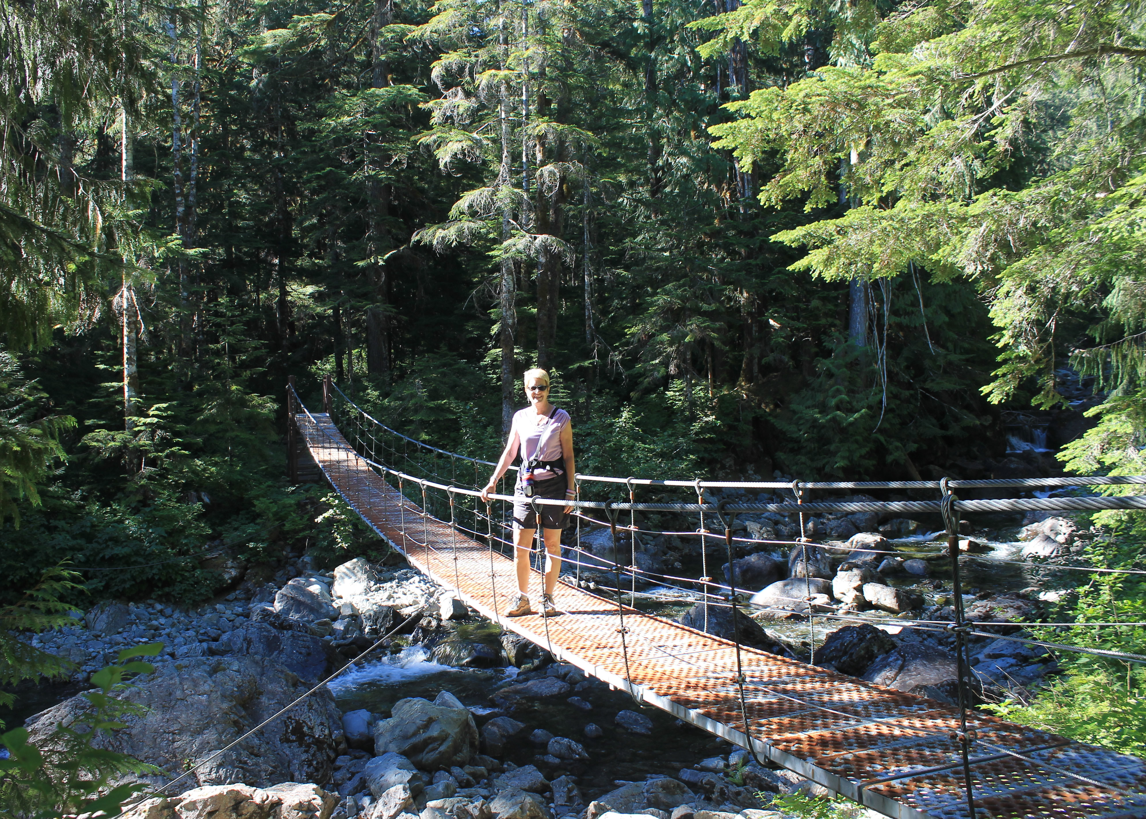 Sandy on the suspension bridge - the climb is about to start
Some good news was that the staff at the lodge were all avid hikers. We talked to the lady at the front desk and the lady working in the bar about the hikes that I was considering. They had both done all of the them and gave us a solid recommendation for our first Strathcona hike - Bedwell Lake.
The weather had been another big uncertainty. In British Columbia you never know what to expect, even in the summer. So far it had been clear and hot and the forecast was for more of the same. Things looked good for the hike tomorrow.
The heat posed a different problem though. Strathcona Park Lodge was a rustic mountain lodge - not the kind of place to have air conditioning. That would be out of character. It was fine in the evening when we were outside on our patio watching the sunset but the room was hot after a long day of the sun pouring through the windows and temperatures in the high eighties. (Actually, since we were in Cananda, the high had been 28 degrees.) Fortunately Sandy had thought ahead and brought a fan along. It really helped to cool the room down and made sleeping tolerable that night.
 The climb pays off - view of Mt. Tim Taylor above an alpine tarn
In the morning the sky was perfectly blue again. Sandy had a good breakfast at the lodge although I skipped. I'm not a breakfast person and I especially don't like to eat before a hard hike. Then it was time to grab our boots and packs and hit the road.
Now our positioning paid off. By staying at the lodge we saved forty five minutes of driving from Campbell River. Even with that, it still took us an hour to drive to the trailhead. First there was a short drive to the end of Upper Campbell Lake. Then when the highway turned west towards the town of Gold River, we took a road into the park that drove along the east shore of Buttle Lake. Soon we passed the entrance sign for the park, with it's larger than life size moose. There was also a sign for Park Headquarters. It's a tiny building with one small room that is only open on weekends and manned by local volunteers. Not exactly like visiting the busy national parks in the US.
 I enjoy the view at Baby Bedwell Lake
It took quite a while to drive to the end of Buttle Lake. It's 23 kilometers long and even though the road is paved it's a slow drive. The road winds along the lakeshore with many sharp curves. When we finally reached the southern end of the lake we stopped on the bridge over Thelwood Creek. We had a nice view of the drainage that we would be traveling up next.
Everything had been easy so far. Now it was time to leave the pavement. We turned onto a dirt road that went to Jim Mitchell Lake. There was an ominous sign at the turnoff that said four wheel drive was required for this road. But when we had talked to the lady at the lodge, she said that the rough part was at the very end. It was 6.2 kilometers to the trailhead, which was not all the way to the lake. She said that if we only went as far as the trailhead, we could make it in a regular car. She also warned us to watch for truck traffic as there was an operating mine along the road. Sure enough, after only a few minutes we passed a big truck going the other way. Fortunately we had been driving slowly and watching out so there was no problem. And although the road was steep in places our two wheel drive did just fine. It wasn't that rough either so clearance wasn't an issue. We easily made it to the parking area for the trailhead. So far the advice we received had turned out to be good. We were hoping the description of the trail and ther endorsement of the view at the destination would prove to be accurate as well.
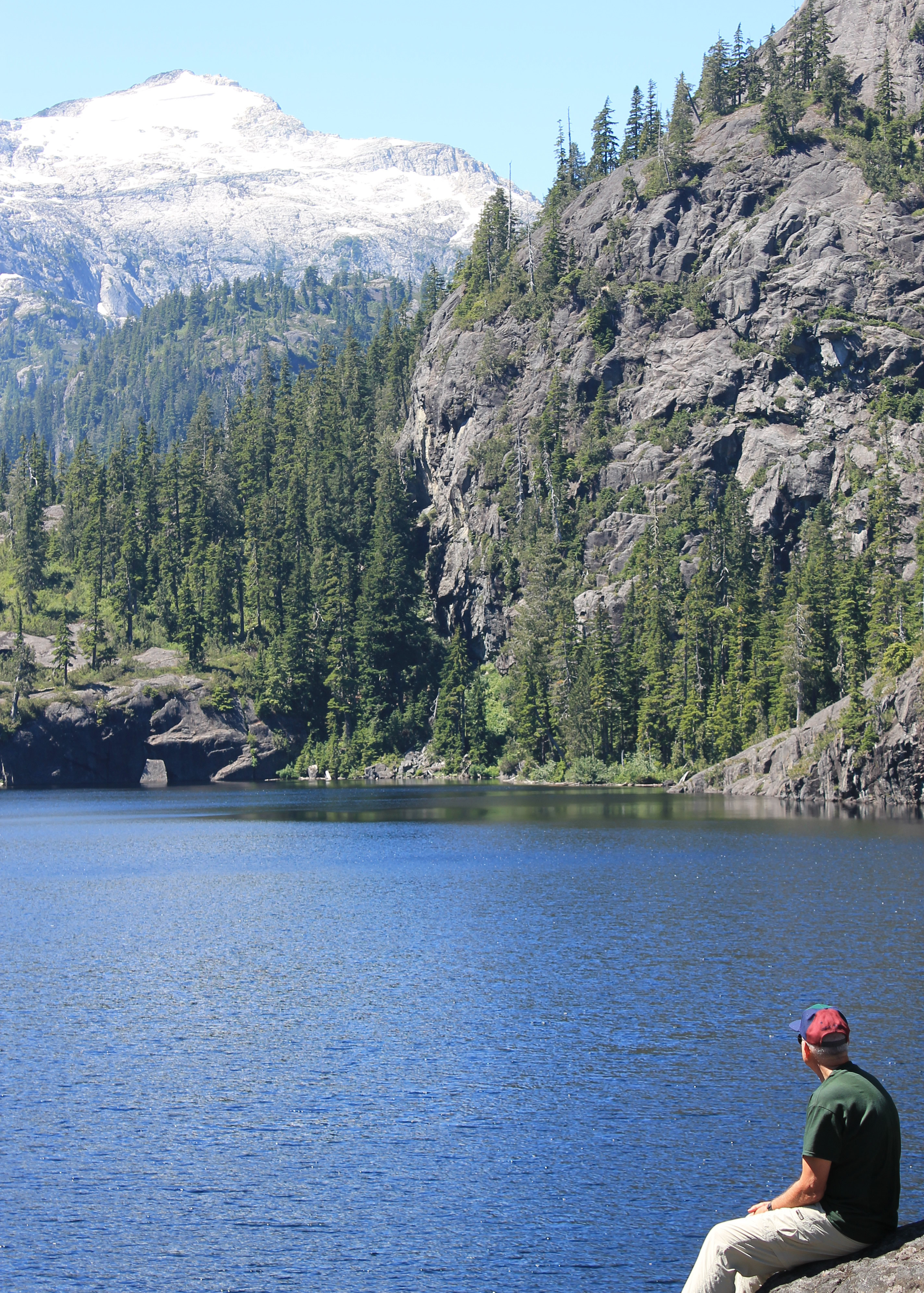
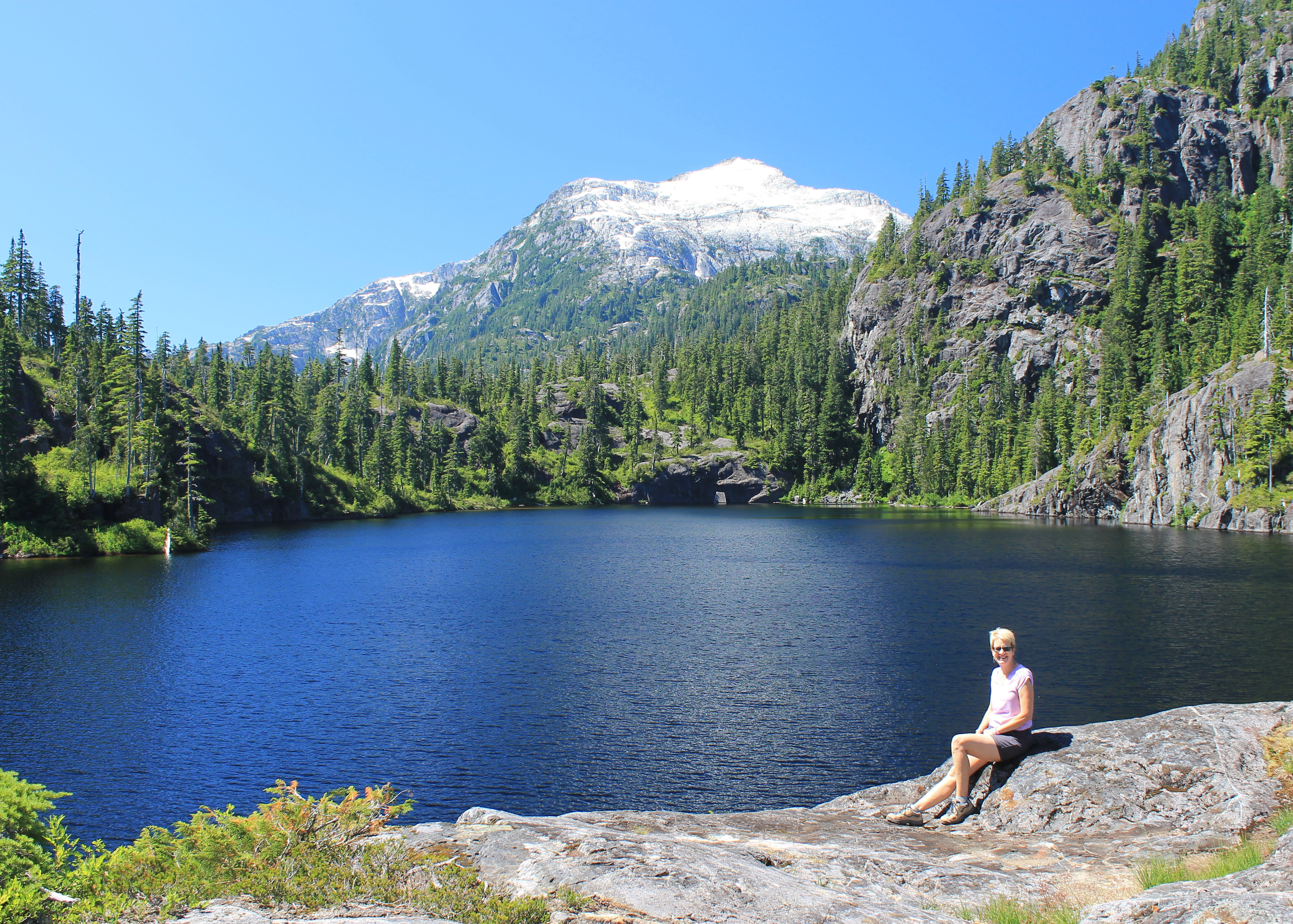
 Sandy at the viewpoint above Bedwell Lake
The stats for this hike were that it was 6 kilometers to Bedwell Lake, with 600 meters of elevation gain. Not very far but quite a bit of climbing to do. It would be a lot of work. The guide book said it would take three hours but that didn't make sense. That was too long for one way but too short for round trip. Another example of where the book wasn't very helpful.
A sign at the parking area said to walk along the road for 200 meters to reach the trailhead. We found it easily but it dropped down from the road. Wait a minute! We had lots of uphill to do. Why are we going down? Fortunately it leveled off quickly. It stayed level for almost half an hour, till we reached a large iron suspension bridge over a stream. We didn't have far to hike and had traveled quite a bit of the distance already. The last part was going to be steep. As soon as we were across the bridge the trail took off up the hill and started some serious climbing. That was the next two hours. It was steep. There were so many switchbacks I couldn't possibly count them. Short ones. Long ones. There were wooden retaining walls to prevent erosion on the steepest switchbacks. In many places there were wooden cross braces across the trail essentially turning it into a stairway. And in some places it was so steep there were actual wooden stairways, or sometimes even iron stairs to climb through steep rock bands. A lot of effort had been put into making a nice trail but it was still really hard work.
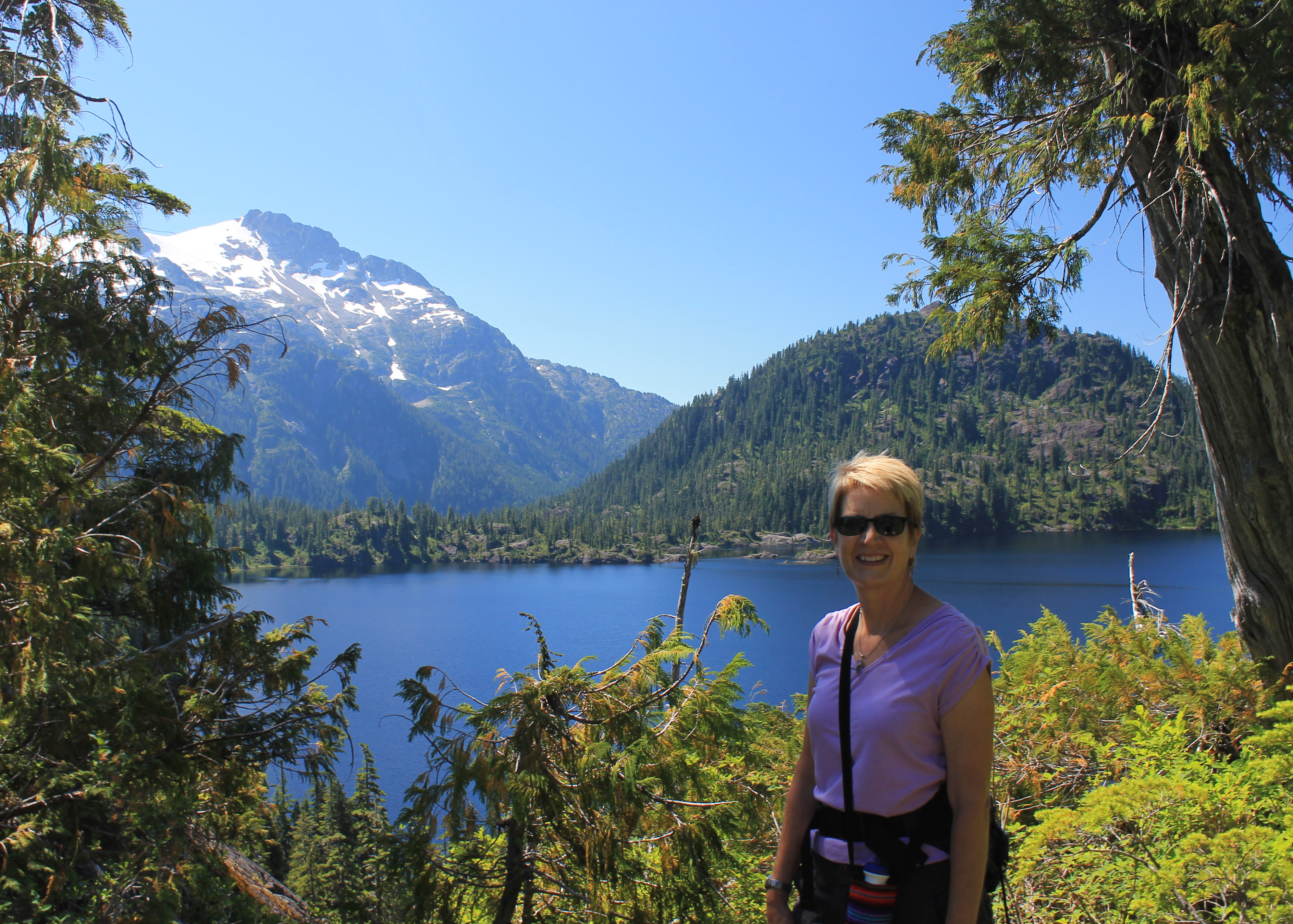
 Bedwell Lake and Mt. Tim Taylor
At least we were in the forest so we were in the shade. It also wasn't as hot as it had been at the lodge the afternoon before. It was warm and it certainly was humid, so we were sweating profusely. But it wasn't that bad. An even bigger, pleasant surprise was that the bugs weren't bad. This time of year in the Washington Cascades or Olympics or the Canadian Rockies bugs could be a real problem. We saw a few mosquitoes but not really enough to be annoying. So it was just a matter of putting our heads down, pacing ourselves and grunting it out.
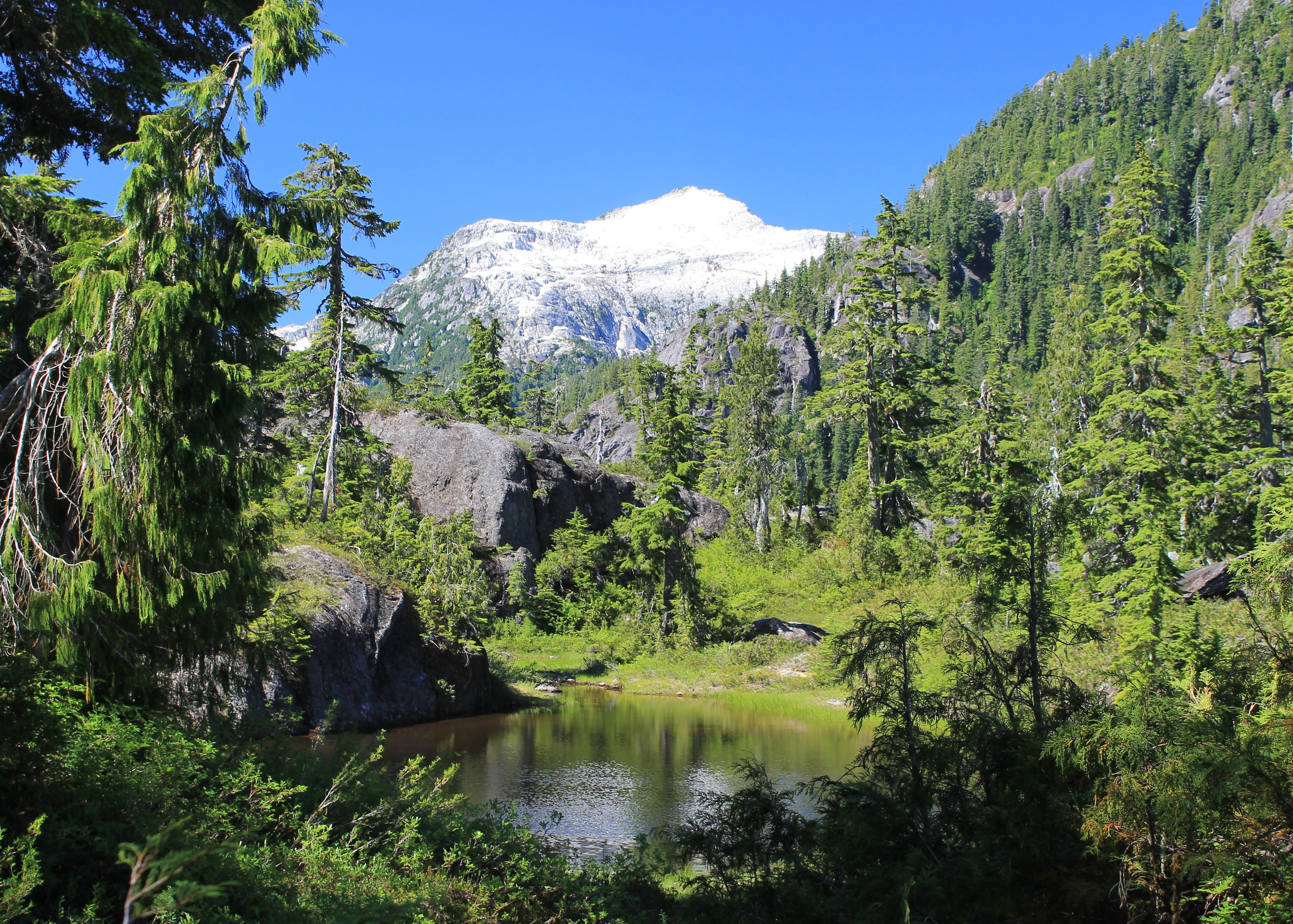
Finally the slope started to relent. Now it was just steep instead of ridiculous. The forest opened up and we were in the sun a lot of the time, but we were nearing a pass and we started to get a breeze from it. At least we stayed acceptably cool. Finally we got our first view. There was a small tarn and behind it in the distance we could see Mt. Tim Taylor. Wow. Sure enough, the mountains here were spectacular. After snapping pictures we continued and found that we had to drop down a long slope to reach Baby Bedwell Lake. We hated to give up elevation that we had worked so hard to get, knowing that we would have to climb back up again. But when we reached the lake the view of Mt. Tim Taylor was even better.
 Big Interior Mountain above Bedwell Lake
The name Baby Bedwell Lake was cool too. More original than Little Bedwell Lake, or First Bedwell Lake, or Lower Bedwell Lake like in other mountain areas. I had to give some credit to the people who named it. But that must have used up all of their creativity, as the names of the mountains in Strathcona were pretty boring. Like Mt. Tim Taylor.
According to our map it was only a short distance from Baby Bedwell Lake to Bedwell Lake (maybe it should be called Mama Bedwell Lake). Of course we had to climb up another ridge to get there. From the top we had a great view of the lake. We could see and hear the first people we had encountered all day. They were swimming in the lake. It looked like a dad and two kids. Since it was actually quite a way down to the level of the lake, we decided that the view from above was good enough and saved ourselves the descent and then climb back up from the lake. So after a break at the viewpoint, and lots of photos, we headed back to Baby Bedwell. We circled around to some large rock slabs where the view was perfect and sat down for our lunch. What a spot. Beautiful view. Nice day - the temperature was just right with a nice breeze. Bugs were not a problem. Yes, coming this far to Strathcona Provincial Park was worth it.
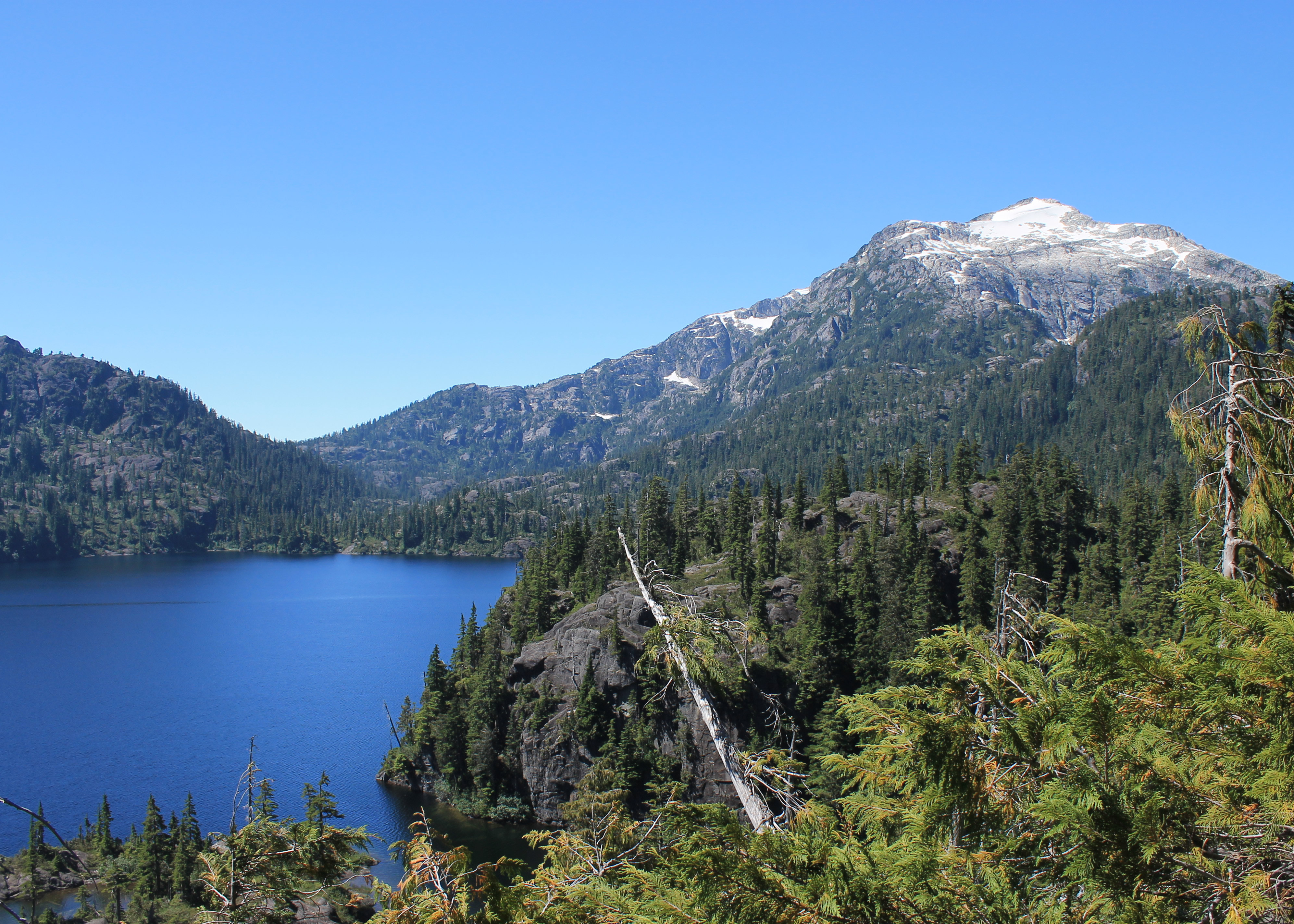
 View from our lunch spot at Baby Bedwell Lake
Eventually it was time to head back to our car. Although it was mostly downhill it was so steep that it was still very hard work. We had to be very careful to avoid slipping. At one point I did slip on a section of steep, loose dirt and went down on my butt. Normally the only thing that would have been hurt was my pride, except for maybe a few scratches. But my other heel caught on something so my left leg folded under me and I sat on it with my full weight. My knee doesn't usually bend that far. It definitely hurt and I let out quite a yelp, which scared Sandy. She was having enough trouble getting down the hill and didn't want to have to carry me too. But after dusting off and taking a short breather, it turned out that my knee was ok and we could continue. I was lucky that nothing had torn or popped inside.
Heading down we passed two parties going up, both with full packs for overnight camping. I thought that the uphill was tough enough with just day packs. Hauling backpacking gear up that hill would not have been fun. Maybe it would take three hours, just like the guide book said. We were surprised that althogh this was supposed to be one of the most well-known and accessible trails in the whole park, we only saw three parties on it all day. It was the middle of summer and the weather was perfect. Even the Sawtooths are more crowded than that. Pretty amazing.
 Sandy relaxes after our hard climb up to Baby Bedwell Lake
Driving out on the dirt road I took the sharp turns carefully remembering that there could be large trucks on the road. We came around one corner and instead of a truck there was a big black bear right in the middle of the road. Sandy reached for her camera but as soon as the bear saw us he took off into the brush and disappeared. That was a good thing actually. When bears or other big animals aren't afraid of humans is when they are dangerous.
Back at the lodge we cleaned up and went to the restaurant for a nice dinner. Sandy had quinoa cakes. I guess she was still in a South American mood after our recent trip to Peru. I had salmon which was excellent - very fresh. Nearby Campbell River considers itself the salmon fishing capital of the world. We topped it off with a glass of Rigamarole wine, which we had enjoyed the night before. After dinner we went out on the patio again. We nodded to a German couple that was staying in the room next to ours - they were the only other people around, and we all watched the sunset from the deck.
An outstanding day in the mountains.
