Eagle Cap Wilderness - Aneroid Lake
 What happened? Cloudy skies as I drive to the trailhead
Because Abby got sick, Sandy and I came back early from our Vancouver Island trip. I still had almost two weeks left before I had to go back to work and I wanted to do more hiking. We got back to Boise on Monday. I spent Tuesday taking care of the car - a trip to the car wash and an oil change. Then I was thinking about where to go. My only constraint was that Sandy worked at The Quilt Crossing on Saturday so I had to be back by then to look after Abby.
My first thought was the southern Washington Cascades, somewhere in the Goat Rocks Wilderness. I've never done any hiking there. I checked the weather forecast and it didn't look good. Scratch that idea. Maybe next week. I ended up spending Wednesday trying to get my two backpacking tents into shape again. I haven't used either one in years but I wanted to try to do a backpacking trip somewhere. Unfortunately I ran into problems with the tents. Now I was down to just two days. I thought about a lot of possibilities. I decided to spend those two days doing day hikes in the Eagle Cap Wilderness in the Wallowa Mountains in northeastern Oregon.
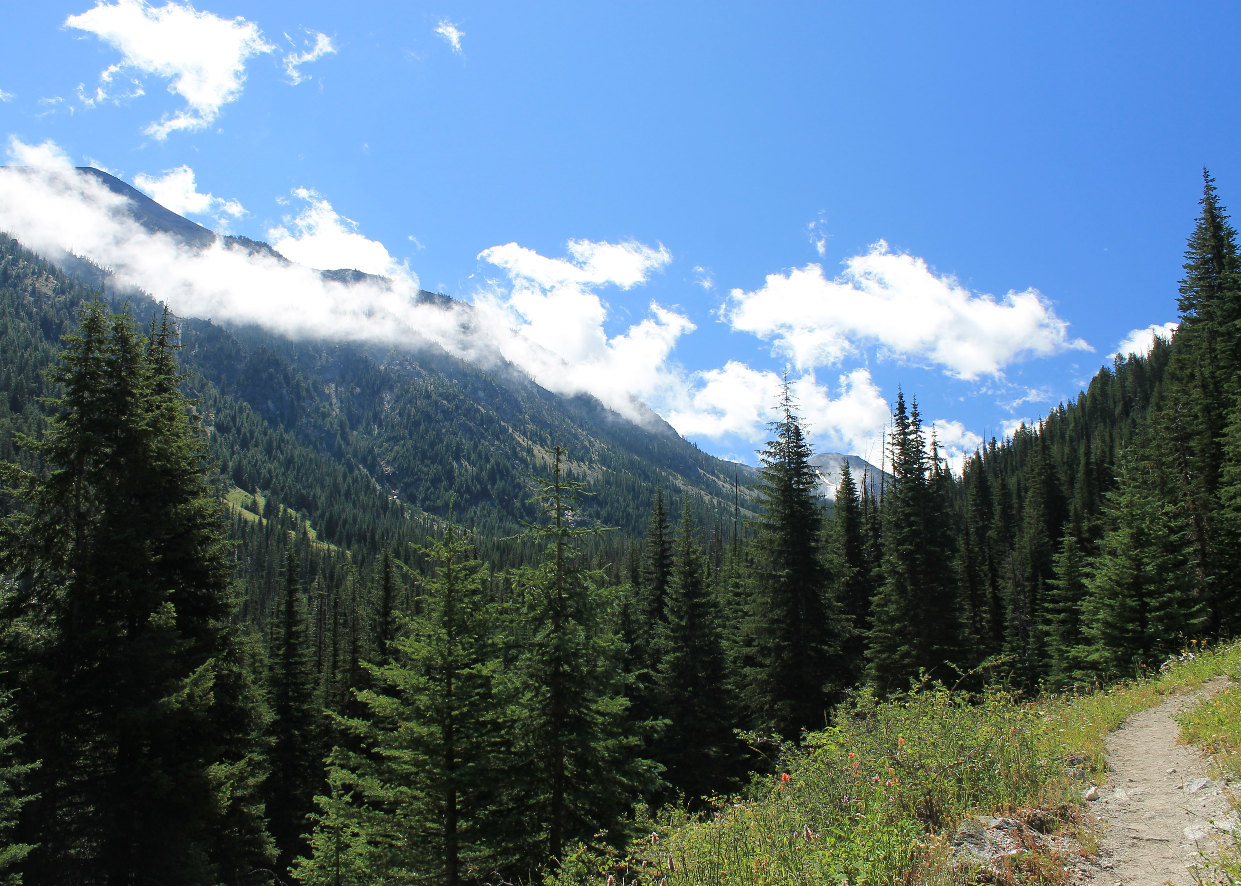 Mist clears from the peaks over the East Fork of the Wallowa
Once I decided on the Eagle Cap Wilderness I was excited. The first thought when you mention Oregon mountains is always the Cascades and the big volcanoes: Mt. Hood, Mt. Jefferson, Mt. McLaughlin and the Three Sisters. Surprisingly the Eagle Cap is the largest wilderness area in the state. It's not far from Boise, but the main access requires circling 270 degrees around the wilderness. That means four to four and a half hours of driving. That's one reason I haven't hiked there much. The other is that most hiking destinations and climbs require long approaches with a lot of elevation gain. For day hikes or weekends, the Sawtooths were always more convenient. When I had more time, I would always go to more distant ranges like the Cascades or Sierras. As my friend Jim Brusseau would say, the Eagle Cap is a "tweener".
I did hike there once back in the early 1980's. That's over thirty years ago! My friend Brian and I did a three day backpack. We hiked to Glacier Lake, climbed Glacier Peak, hiked to Lake Basin, and then out. I remember two things about that trip. The first was that the initial day of hiking to Glacier Lake was really, really long. The second thing is that the last day I was extremely sick when I woke up and had to hike out with a bad fever, chills and body ache. It's how I imagine the Bataan Death March was. All kidding aside, that last day was probably my worst experience in forty years of hiking.
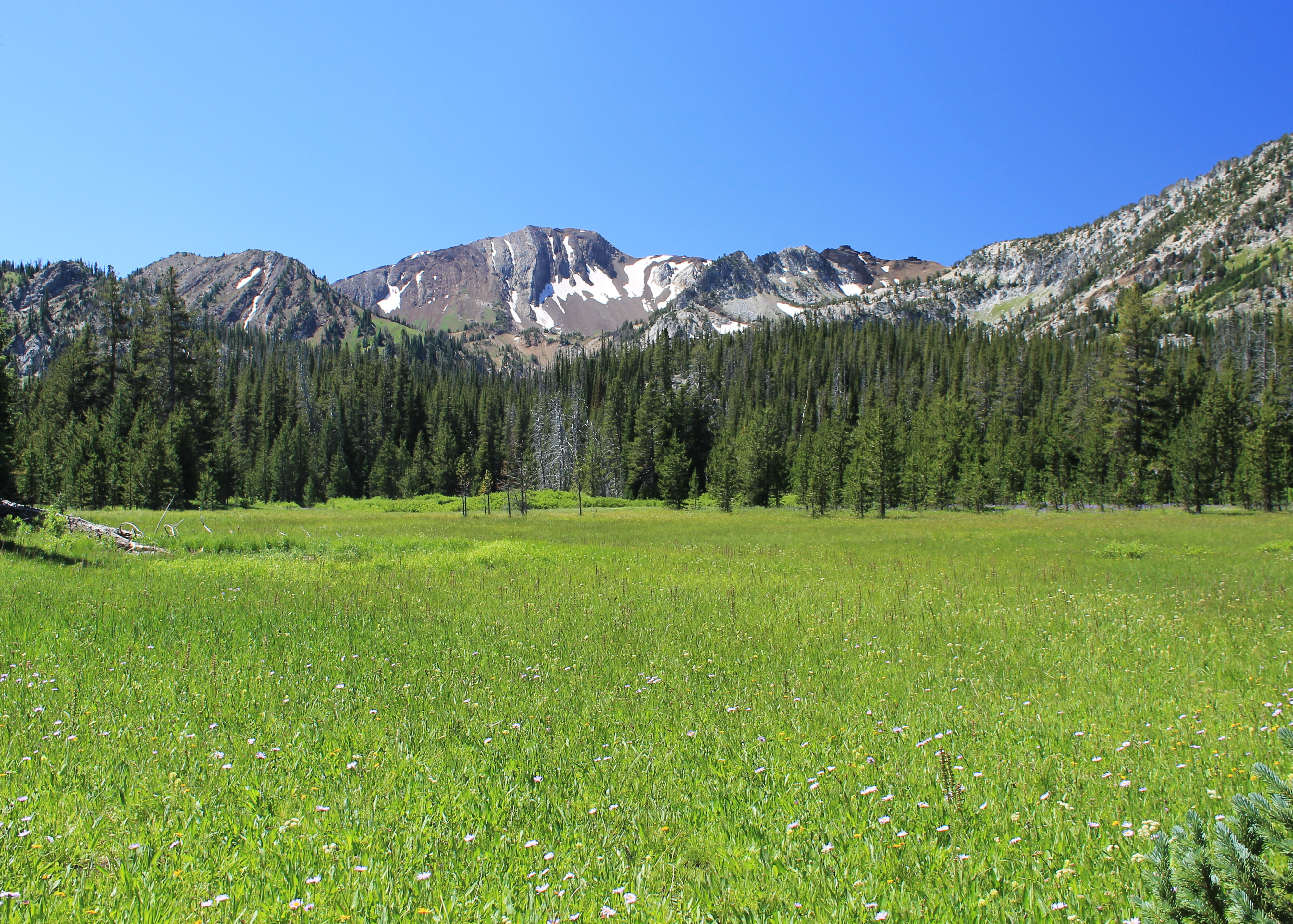 Huge meadows in the Upper East Fork, filled with flowers
Sandy and I did stay at Wallowa Lake for a weekend in 2009, the first summer that we were back from Singapore. It rained the whole time.
I should have gone back a long time ago but at least I was going there now. The weather forecast was for sunny skies and I was psyched to do some good hiking and explore these mountains. I must have been excited because I woke up at 4 am and couldn't go back to sleep. I finally decided to get up and get going. I was on the road at 5 am.
Things started to go wrong as I got close to the mountains. When I stopped for gas in La Grande it was only fifty degrees out and windy. Brr! It felt like winter. Obviously a front had come through. It was a big change from a hundred degrees a day or two ago in Boise. It started to cloud up and was completely overcast when I got to the mountains. As I drove along Wallowa Lake the last bit to the trailhead, the tops of the mountains were all lost in heavy cloud. Things didn't look too good. But I had rain gear and warm clothes. After driving four and a half hours to the trailhead at least I could get some exercise.
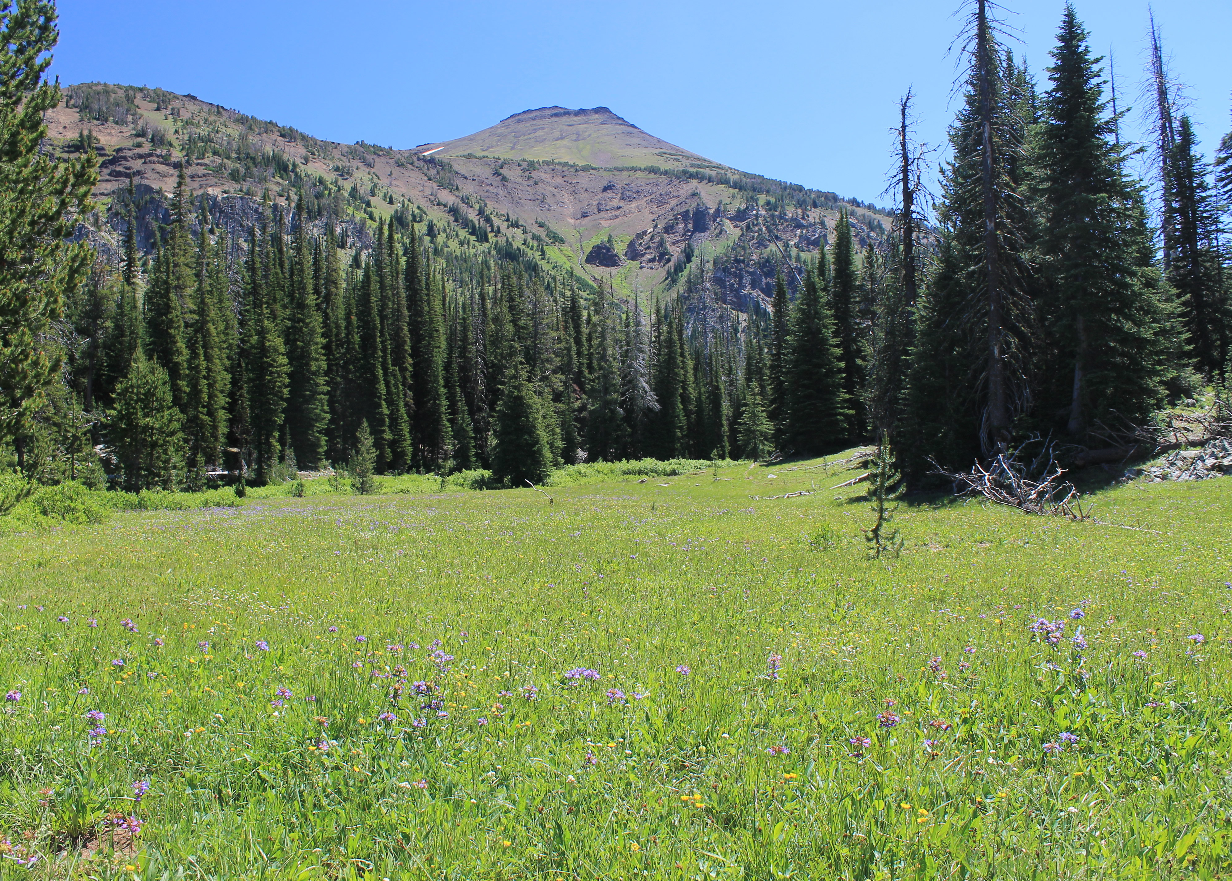 Aneroid Mountain above more flower fields
I started from the trailhead at the end of Wallowa Lake. My goal for the day was Aneroid Lake. It was six miles and 2850 feet of elevation gain from start to finish - a good days work. I took my heavy schoeller jacket instead of my GoreTex parka and started out.
The trail climbed steadily but at a reasonable grade. It was unusual in that it was monotonic. It always went up, sometimes steeply, sometimes gradually. It never went up and down. So what the book says was the elevation gain, that was the elevation gain. Going in was uphill. Going out was downhill.
One drawback of this trail is that while it follows one side of the river, there is a dirt road that follows the other side. Both trail and road converge after two miles at a small dam a thousand feet above the trailhead. As I approached the dam I could hear and see a bulldozer working on the other side of the river. I heard later that it was cleaning up a recent rockslide. It was very annoying, especially after an hour of hard work to get that far. Instead of wilderness solitude it sounded like I was at a construction site.
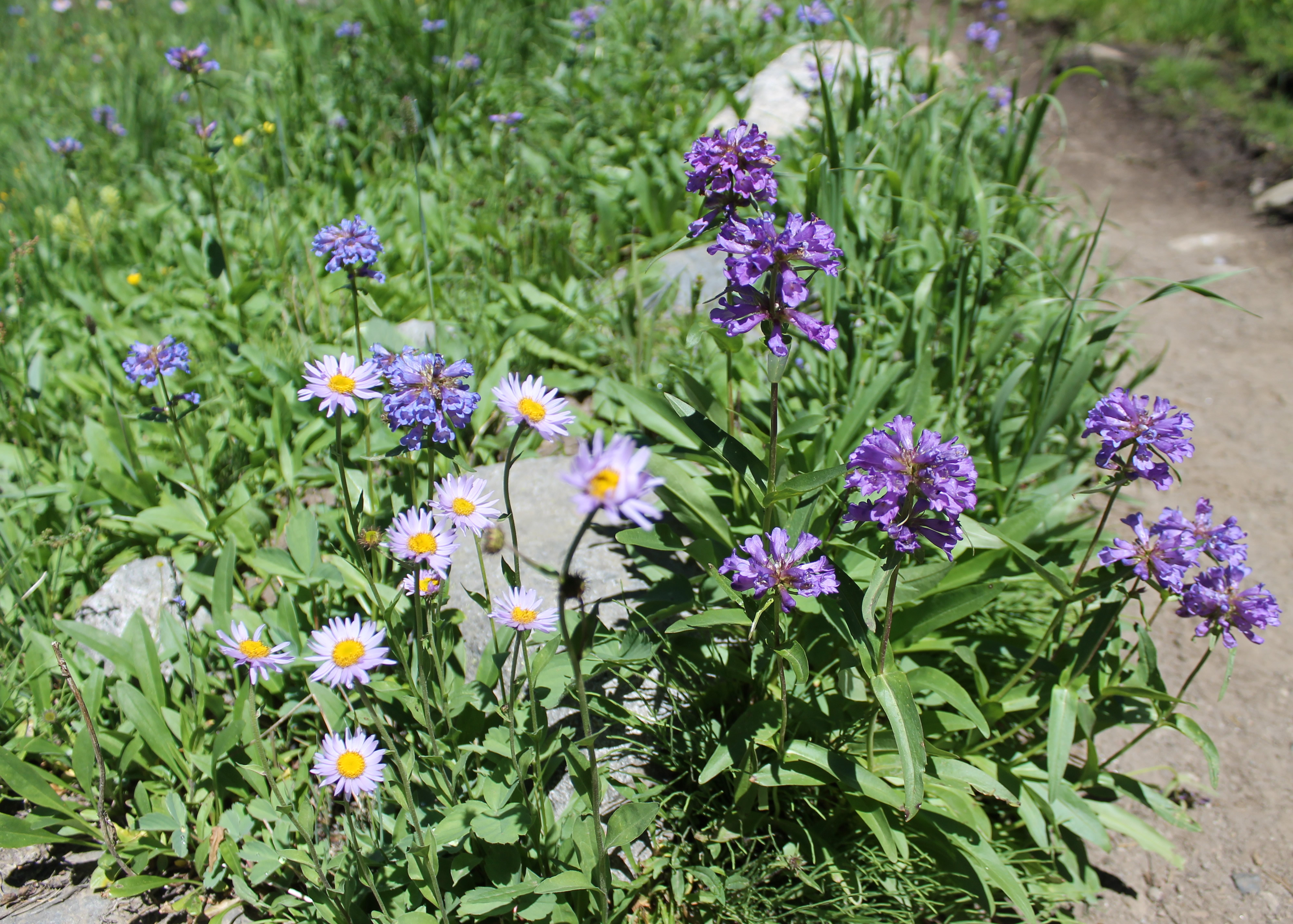 Purple daisys and penstemon filled many of the meadows
The other annoyance was horses. It was obvious that a lot of horses used the trail. I definitely had to watch where I stepped. At one point I was on a fairly steep slope on a narrow trail (the two are not unrelated) when a large group of horses with trail riders passed going down. There must have been at least fifteen of them. They passed me at a spot where it was tough to get out of the way. I had to scramble up the hillside and balance on some rocks while they went by. Jeez people, can't you walk?
After I passed the dam the hike became more enjoyable. It was only a short distance to the wilderness area boundary so the noise of the bulldozers was soon left behind. The horses and riders were gone and I didn't see anyone else on the trail for another two hours. It seemed like I had the whole mountain range to myself. The trail was no longer switchbacking up the slope above the trailhead. Now it was climbing up the valley of the East Fork of the Wallowa River. The clouds had been clearing and there was more and more blue sky. Even the clouds on the peaks began to dissipate. It was turning out to be a beautiful day after all.
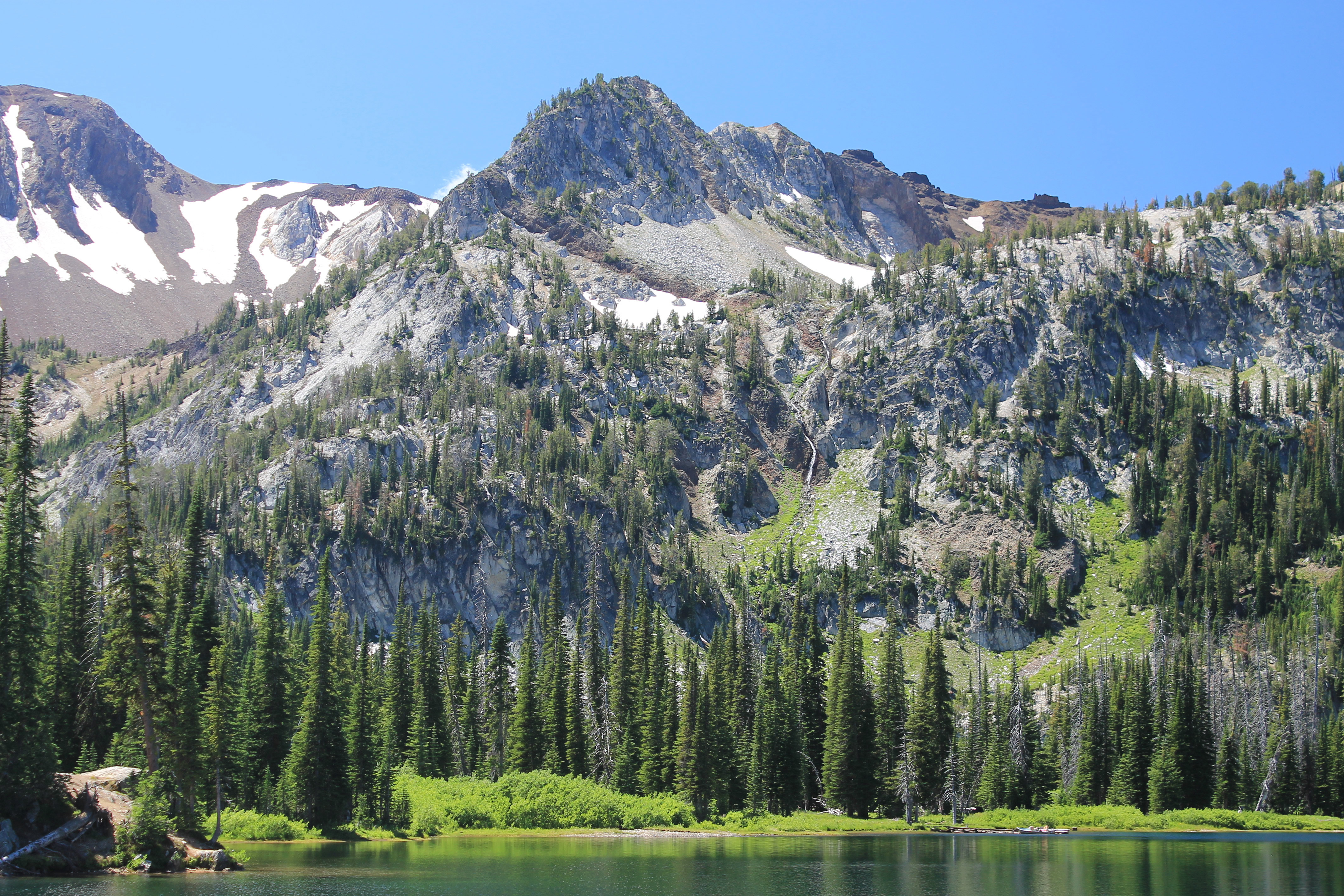
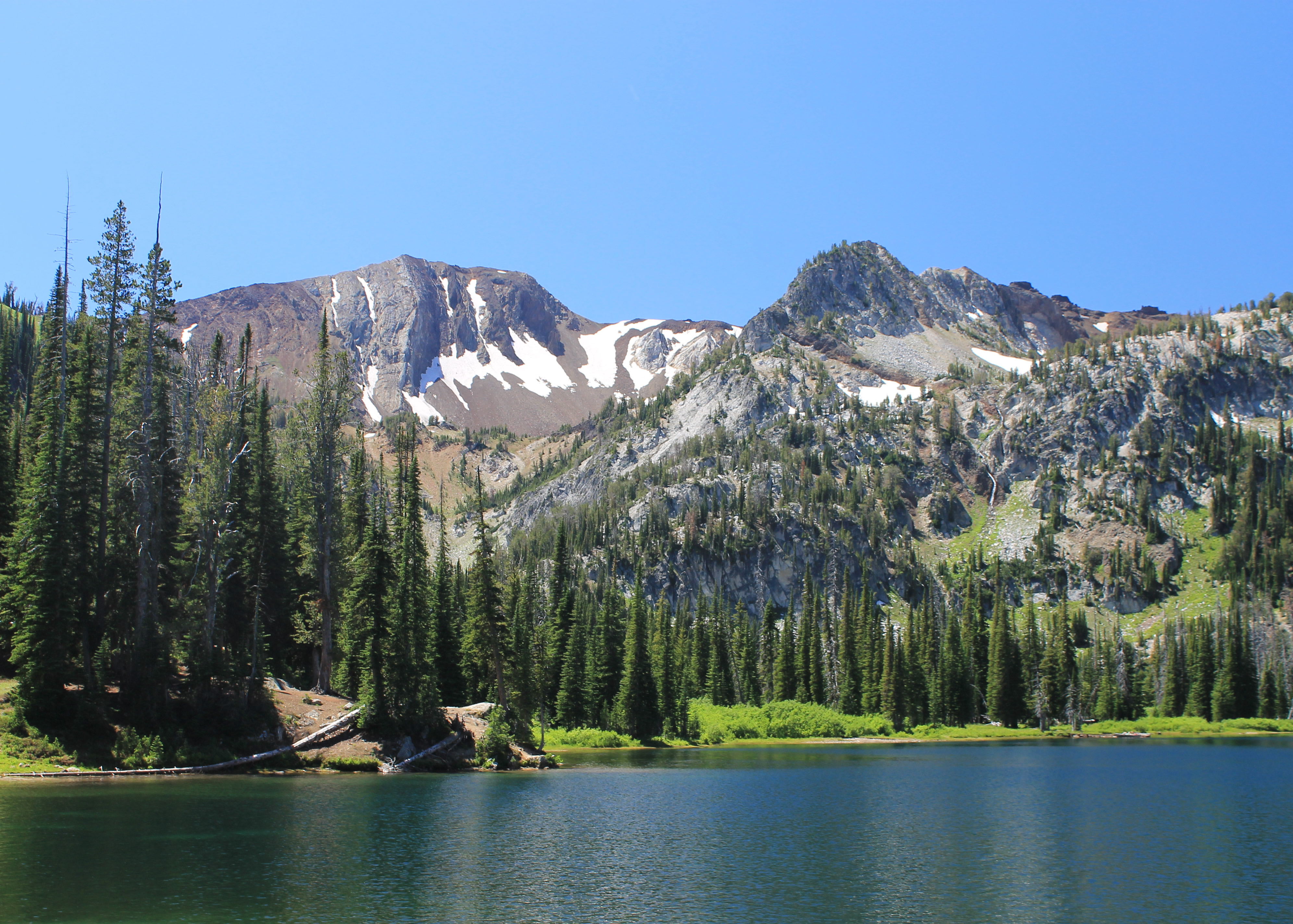 Worth it - Pete's Point provides the backdrop for Aneroid Lake
It was a long walk up the valley, but nice hiking. It was pleasently cool. There were no bugs (surprising). There were lots of flowers. I saw Indian Paintbrush, purple daisys, syringa, lupine, and lots of flowers that I didn't recognize. One in particular seemed to be everywhere. I had just passed a Forest Service crew that was working on a bridge and was taking a picture of the mystery flowers so that I could identify them later. One of the Forest Service guys came over and mentioned that a woman working on the crew knew all about the local flowers. He called her over and she told me that it was penstemon, and showed some ways to identify it since there are many types that can vary quite a bit. The trail passed several large meadows that were filled with flowers. They looked very pretty with the mountains as a backdrop.
Finally I reached Roger Lake. There was a tent pitched there so someone liked the spot. I didn't think it was that impressive. The shores were muddy. There were a lot of dead trees around the lake so I couldn't find anywhere to get a good view, much less a picture. I kept going. It was only a short disance more to Aneroid Lake.
 Look closely. A boat on Aneroid Lake?
The trail skirted the lake to the left to continue to Tenderfoot Pass. I went to the right instead to get the best view of the peaks behind the lake. I dropped down to the lake and found a spot to sit and eat my lunch and admire the view. It took me almost four hours, with very few stops, to get to the lake. But it was a gorgeous spot and well worth the effort to reach it.
Interestingly I noticed that there were two people on the other side of the lake that had a boat. It looked like a small aluminum fishing boat. I'm not sure how they got it up there but it must have been a lot of work.
The walk back took three hours. I passed a lot more people that were coming in, mostly backpackers. They often hike in later since they don't have to hike out again that day. I did have two amusing conversations as I got near the trailhead.
Two day hikers stopped to chat for a minute. The man said hello and sounded American. The lady had a very heavy accent and asked "How far to lake?". I didn't want to sound discouraging but this late in the day a round trip might not get back before dark. I told them that I had left the lake well over two hours ago. "Good. We make in hour and a half then." WTF lady? She didn't look any younger than me. I have to admit that I was miffed that she thought she could hike much faster than me with all that elevation gain she had to do. I'm usually quick to admit that I'm a slow hikker and have never viewed how fast I walk as a point of pride. Until now that is.
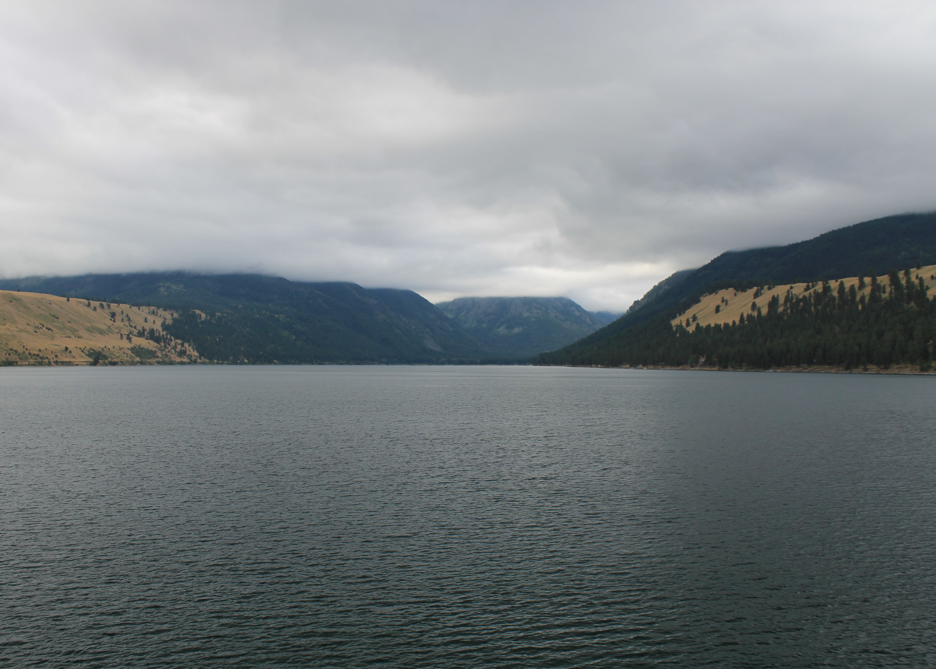
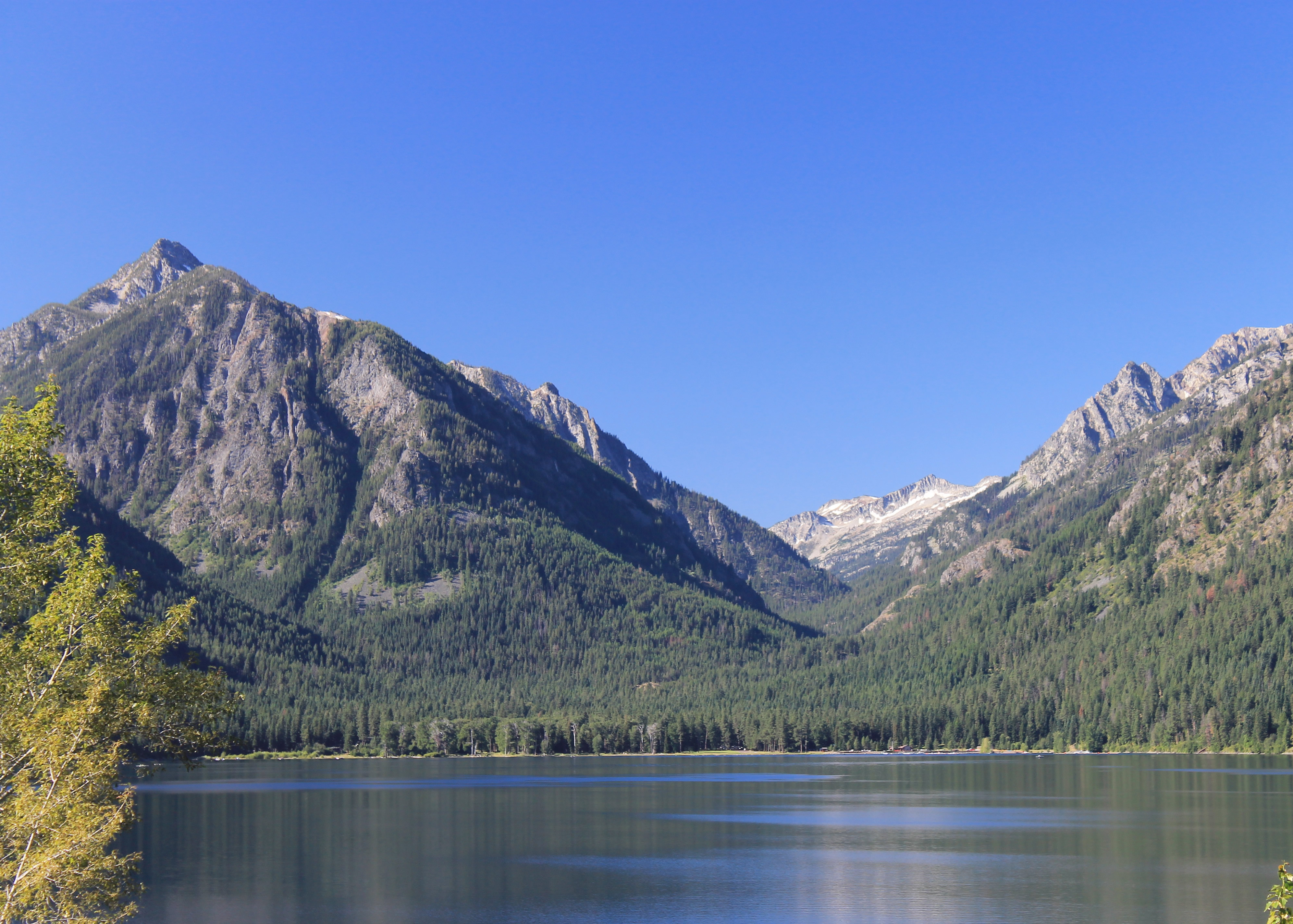 West Fork of the Wallowa River canyon from Wallowa Lake
Soon after two young guys with large backpacks were powering up a steep section of the trail, going faster uphill than I was going downhill with just a daypack. They stopped and one of them asked how far it was to the lake. I looked at my watch and told them I had left the lake two hours and twenty minutes ago. The guy smiled and said "Great, then we should be able to make it in three hours." and they took off up the hill again. Now that was better. The guy actually derated my time. Probably incorrect but I was still flattered. Show a little respect for a fellow hiker. At the same time I had to admit that I couldn't imagine thinking that "only" three more hours of steep uphill hiking with a heavy backpack was good news. Now there is a difference between an older, experienced hiker and a couple of young studs.
Soon I reached the trailhead and was in my car and driving to my motel in nearby Enterprise. I was ready for a quick shower and then a pizza for dinner.
