Peru - Salkantay Pass
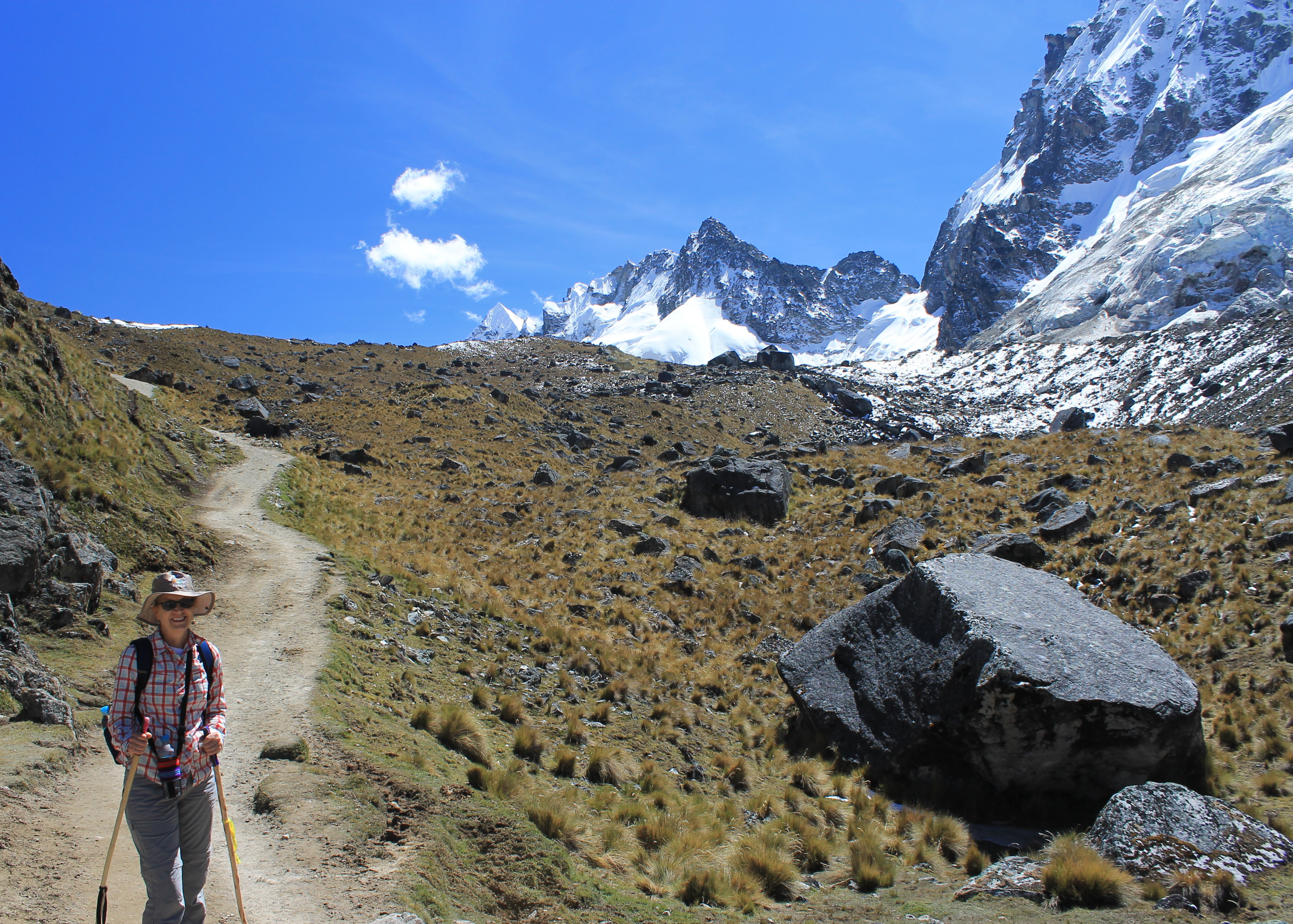
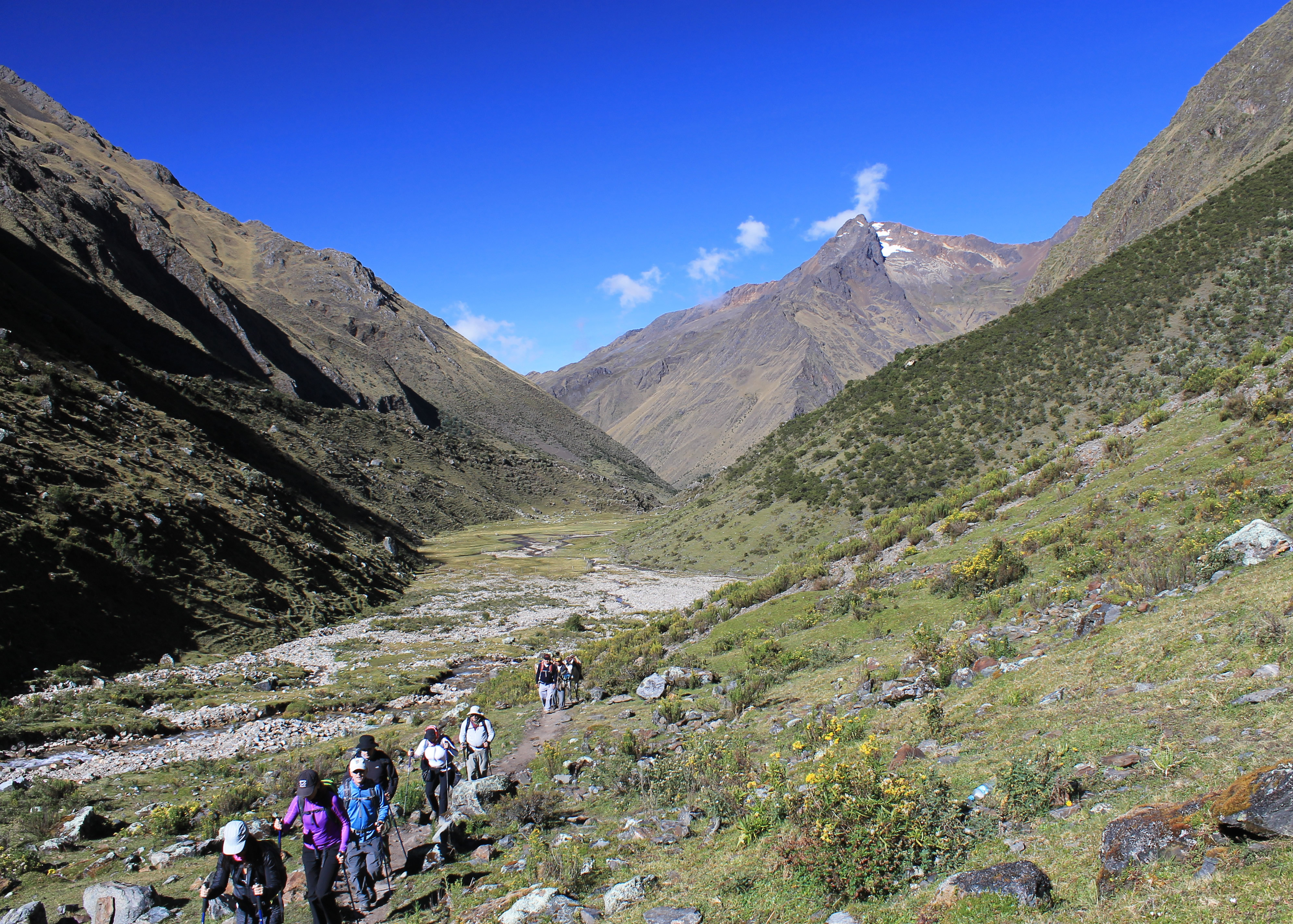 Another beautiful morning as our group starts up the valley
The profile for the hike on day three was the toughest of any day on the trek. We had to hike ten miles to reach our next stop, Wayra Lodge. In the process we had to cross Salkantay Pass, the highest point on our route. It is hard to get a reliable number for the elevation of the pass. Every article or blog that I could find on the web seemed to give a different value. Jairo and Juan said that we had to climb 2650 feet to reach the pass, which would make it 15,355 (assuming the elevation on the sign at the Salkantay Lodge was correct). The sign at the pass said that it was 4630 meters, which would be only 15,130 feet. One of the signs anyway. Another sign at the pass said 4600 meters, but that seemed like too even a number to be correct. It looks like someone rounded off. Plus that's not as high. Let's be honest - I'd rather use the higher value. Whatever the exact value, the pass is very high. It's higher than the tallest summit in the continental United States, Mt. Whitney, which is "only" 14,505 feet.
 Yes I was on the hike too
I have only been that high a few times on trips to the Himalaya (in Nepal) or the Andes (in Bolivia) or the Mexican volcanoes (Popocatepetl and Ixtaccihuatl). For Sandy, this would be the highest she had ever been, although she had been close before. She and I have climbed eight fourteen thousand foot peaks in Colorado together, so she was confident that she could handle the altitude. We have always done ok at altitude as long as we increased height gradually and took time to acclimatize. On this trip we took extra days in Cusco before the group trip started. Since Cusco is over 11,000 feet high, three days and three nights gave us a good start on our acclimatization. Then we were at Salkantay lodge for two more nights, hiking to almost 14,000 feet at Humantoy Lake and spending two more nights sleeping well over 12,000 feet at the Lodge. With five days and nights that high we felt confident that we wouldn't get sick from the altitude. That's not to say that it wouldn't slow us down though. The air pressure at 15,000 feet is only 56% of the pressure at sea level. That means that we got a lot less oxygen with each breath. One of the ways that your body adjusts to high altitude is to produce more red blood cells so that you are more efficient at getting oxygen from the thin air. But that's still not enough to compensate completely. Your heart rate and respiration rate go up, even when you are resting. You can actually get tired lying down. When you are hiking or climbing at high altitude the miles are long, the pace is slower and uphill is always tough.
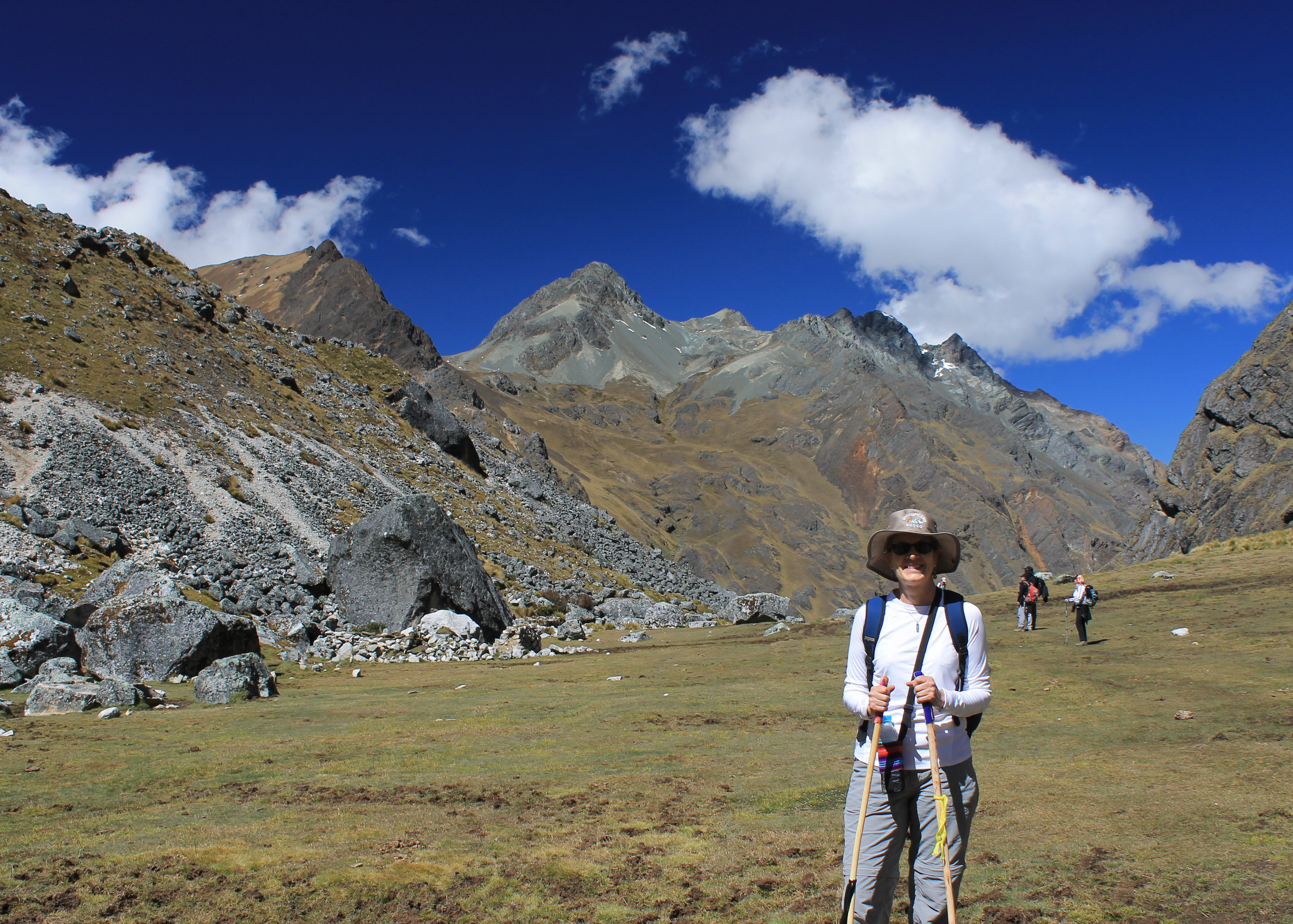 Sandy is pleased to be on a rare stretch of level hiking
The basic problem at high altitude is due to some simple physics and chemistry. When you breathe two things happen. Oxygen is absorbed into your blood and carbon dioxide goes from your blood into the air. At high altitude, the air is thinner so you don't get as much oxygen with each breath. It's a linear relationship. Since there is only half the pressure at 15,000 feet, you only get half the oxygen with with each breath compared to sea level. But because the air pressure is less, more carbon dioxide leaves your blood. The effect is one you see every day. If you buy a bottle of Coke at the store, it has carbon dioxide dissolved in it under pressure. When you open the bottle and the pressure is released, you see a lot of bubbles of carbon dioxide leave the liquid and go into the air. The effect is the same inside your body at high altitude.
The problem comes because of some basic chemistry. Carbon dioxide gas dissolved in water forms carbonic acid, a mild acid but an acid nonetheless. That's why the carbon dioxide is in the bottle of Coke. The carbonic acid gives the soda a bit of a sharp taste. Nobody likes flat soda.
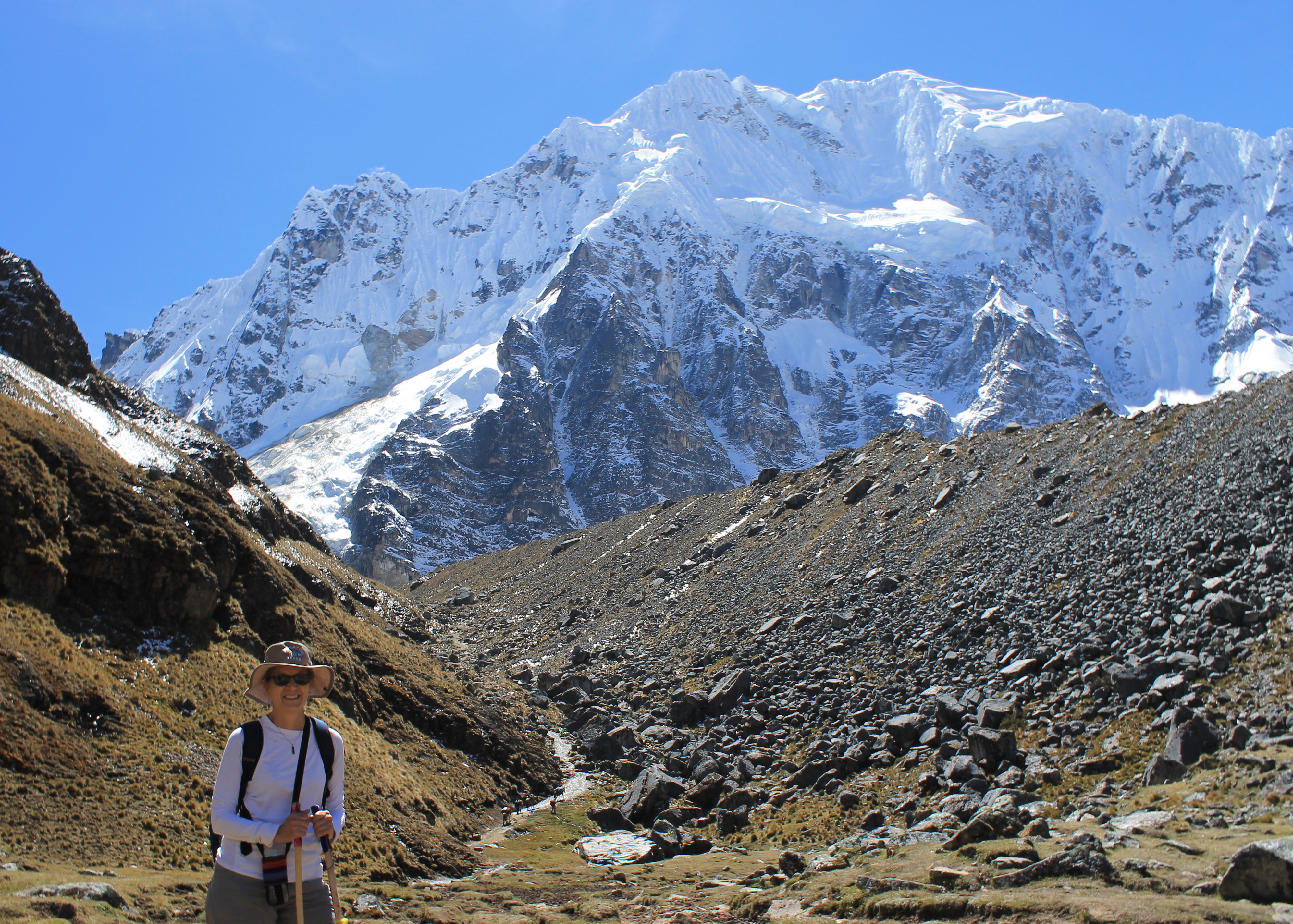 The pass is still up and around the corner
But that has an effect on your blood. Because there is less carbon dioxide in your blood at high altitude the acidity of your blood goes down. This along with less oxygen in the blood and higher levels of effort (your heart rate is up and you are breathing faster, even when resting) can cause AMS, or Acute Mountain Sickness. Symptoms are headache, nausea, loss of appetite, lethargy and difficulty sleeping. It usually goes away in a day or two, but it can make you miserable on a hike or even prevent you from reaching your objective. On a through hike like we were on that would be a problem and was why we had a horse along as a backup. Sometimes altitude sickness takes more severe forms. In High Altitude Cerebral Edema, fluid builds up on the brain. In High Altitude Pulmonary Edema, fluid builds up in the lungs (similar to pneumonia). Both HACE and HAPE are very serious and can be fatal. If you get symptoms of either one it's important to go down to a lower elevation, right away.
 Home stretch - the pass is up ahead by the snowbank
Some people take a drug called Diamox to try to speed up acclimatization. It acts by making your kidneys secrete bicarbonate, which offsets the blood acidity problem caused by high altitude. Some trekkers and lots of high altitude climbers take it when going to very high mountain ranges like the Andes or Himalaya. Some of the people in our group took it. But it isn't guarenteed to be effective and it can have side effects so Sandy and I preferred to be more conservative and just rely on taking extra time to acclimatize.
Now it was time to do the hike and we felt good. We were ready to go at 7:15 am, our usual fifteen-minutes-later-than-we-said start time. After the near disaster with someone taking the wrong boots, we had separated our boots from those belonging to the other group last night. It was probably an unneccessary precaution since we were the early group today but we wanted to be safe.
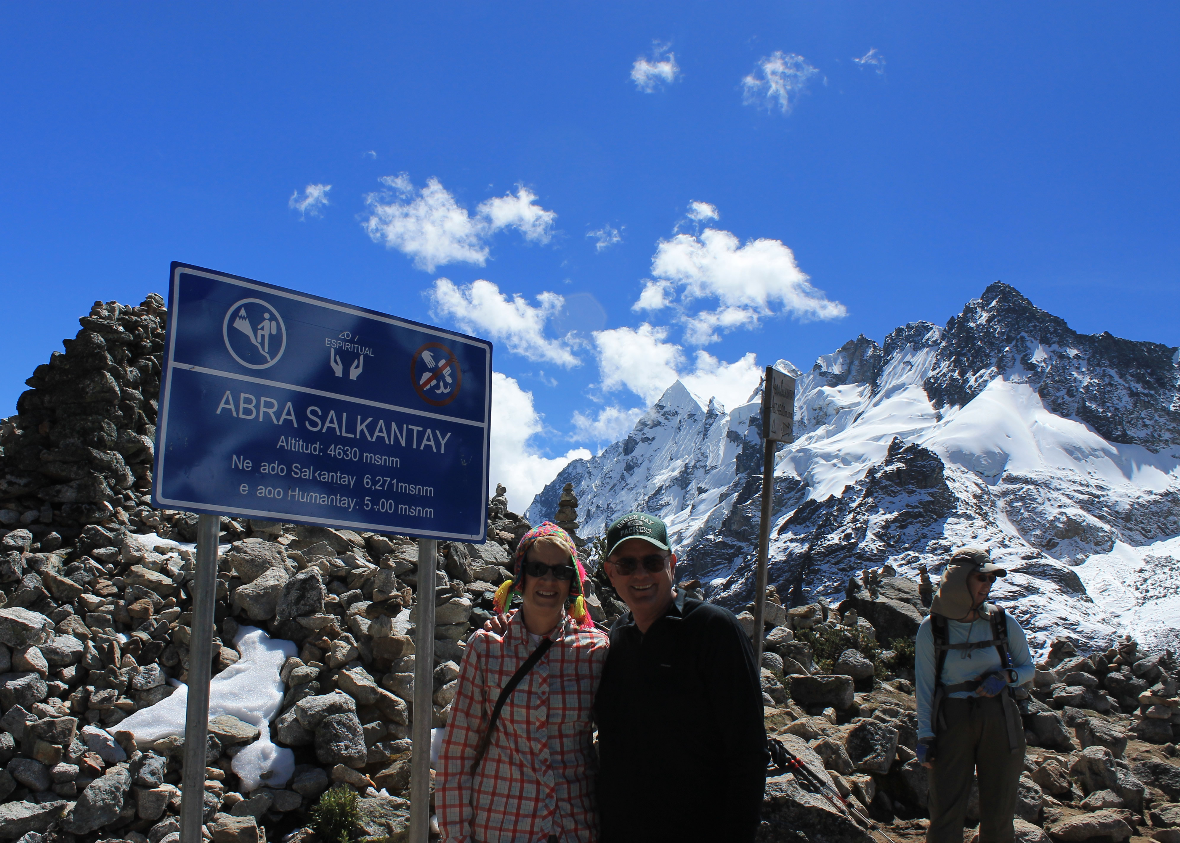 Made it - the required sign shot
It ws another beautiful day. The sky was blue and it was quite warm for early in the morning above twelve thousand feet. Since today would be our highest day and the pass was supposed to be windy I wore a long sleeved tshirt. I had one along and wanted to wear everything that I brought. I figured this would be the coldest day of the trek. For the rest of the trip we would be descending several thousand feet every day. It turned out that I still got too warm on some parts of the uphill climb. It was downright balmy for such high mountains. We couldn't complain about the weather.
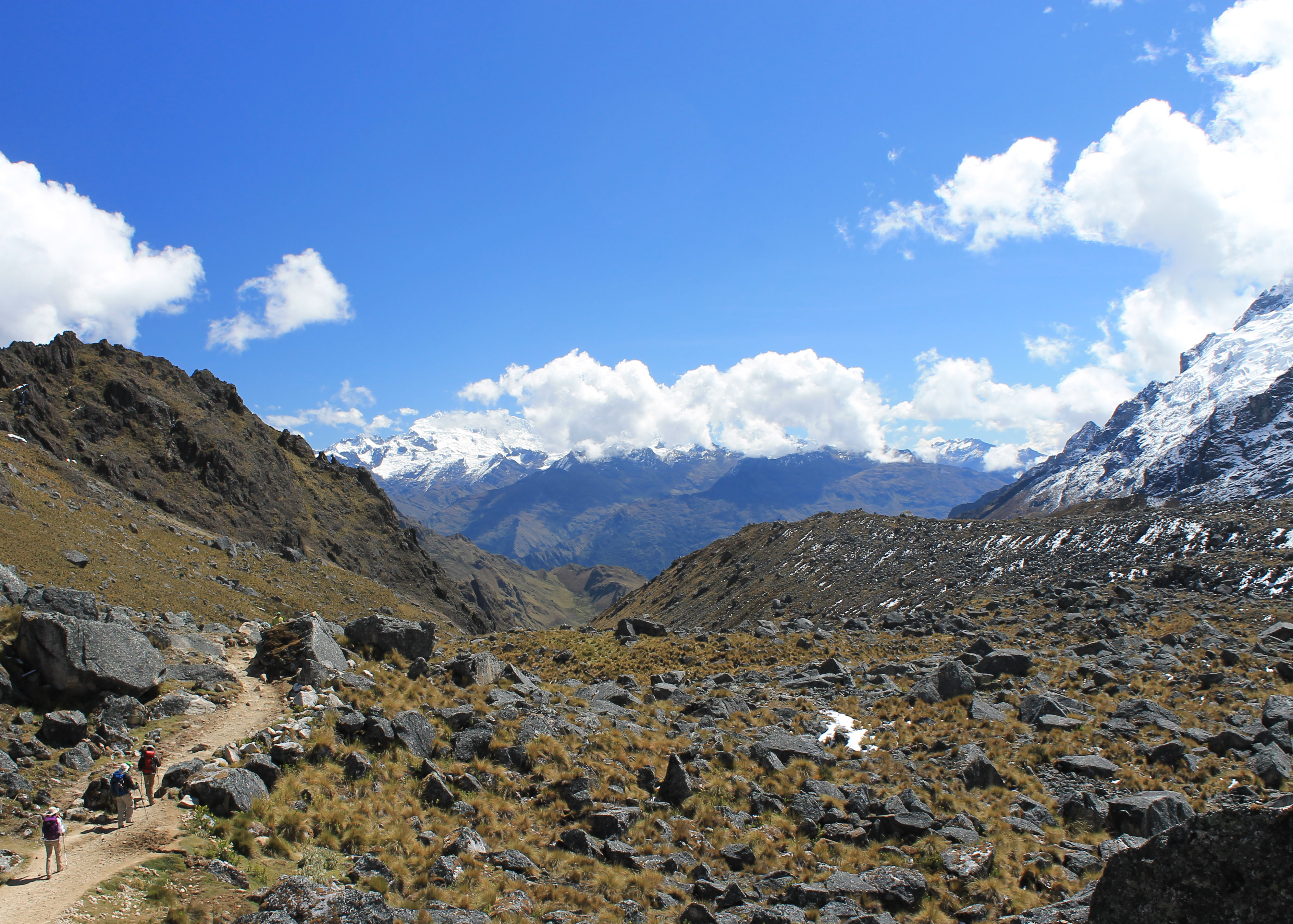
We quickly reached Soraypampa where most trekkers camp. Instead of turning left like we had the day before to go to Humantoy Lake, we continued straight up the valley toward the huge South Face of Salkantay. We would circle around behind Humantoy and climb to the pass between it and Salkantay. The climb was gradual but steady and we spent the early hours of the morning moving slowly up the valley, taking frequent rest breaks, and steadily gaining altitude.
 Yes, I have a big white glob of suncream on my nose
Eventually we reached the head of the valley where it was blocked by the huge mass of Salkantay. A small side valley rose to the right with the trail that led to the Inka Chiriasqua Pass and eventually connected with the last two days of the standard Inca Trail. That route isn't used much anymore. Instead we turned left and continued to climb towards the gap between Humantoy and Salkantay, still far away, much higher and out of sight around the corner. Behind us we could see far down the valley we had just traveled. I could just make out Salkantay Lodge far below, a tiny dot in a huge landscape.
At this point the trail split into two parallel trails. We took the one that went up the bottom of the valley. The other climbed up the left side of the valley and contoured upward along the slope. Although I was puzzled at first the reason for having two trails became clear soon enough - it was to avoid traffic problems.
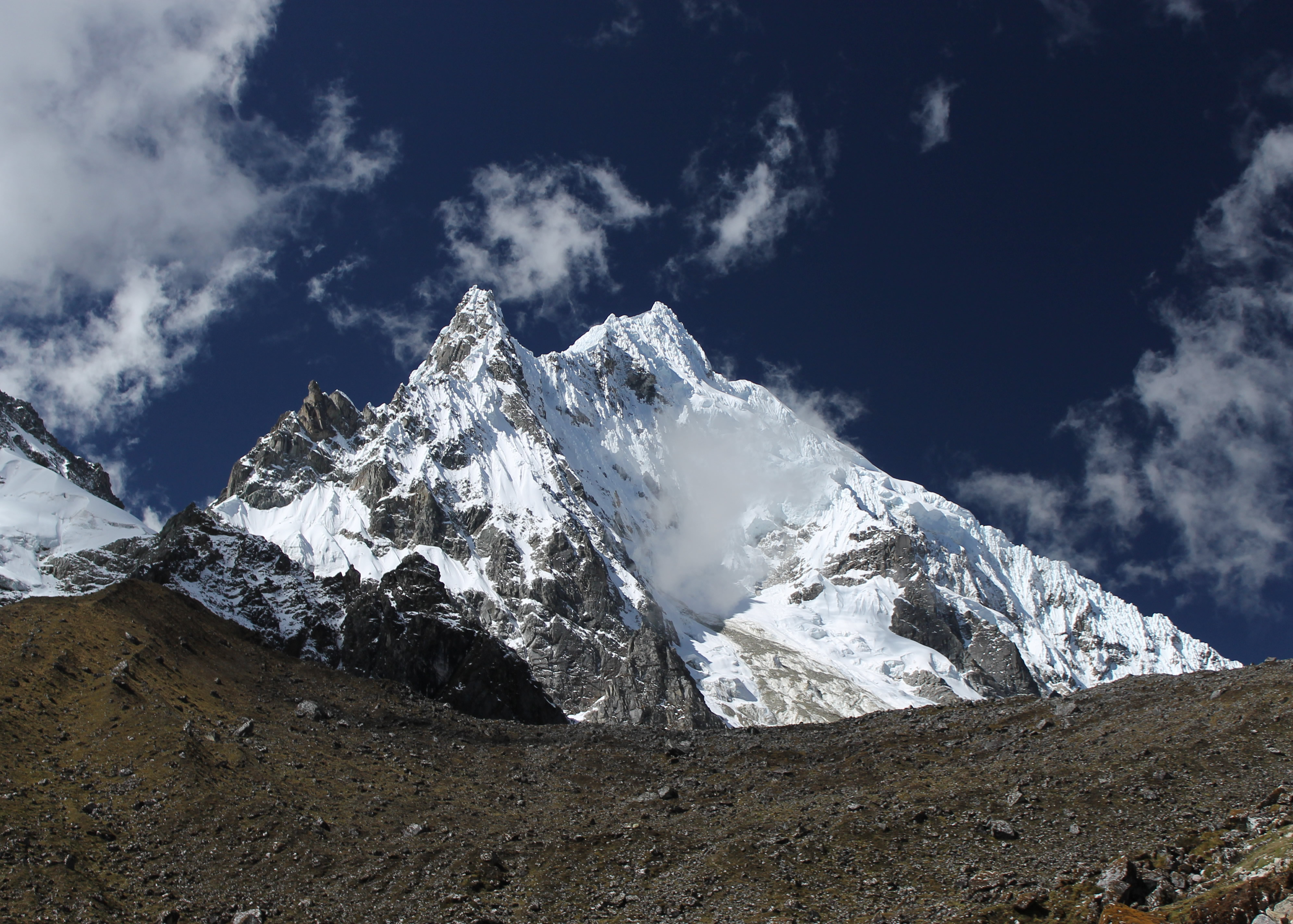
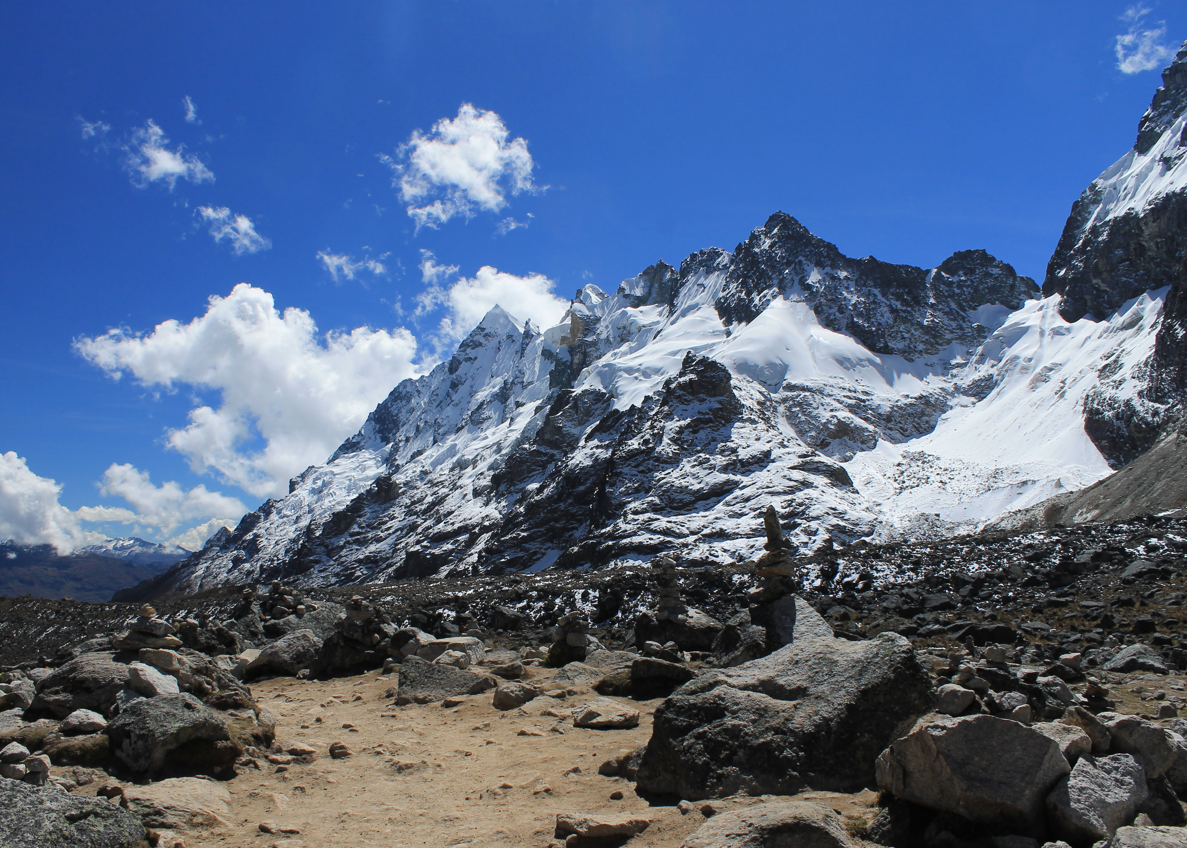 Unknown peaks on the ridge extending from Salkantay
The previous day we had been the only hikers on our trip to Humantay Lake. It was a pleasant surprise that we had the trail to ourselves. I would have expected some of the independent trekkers camping at Solaypampas to do it as an acclimatization hike as well. Today since we were on the main trail there were some other hikers. That wasn't a big deal. It wasn't like there were crowds.
What was a problem were the horse trains. Except for Salkantay Lodge, all of the other lodges did not have road access. The only way to get supplies of any kind to our next destination, Wayra Lodge, was to have it carried by horses or mules. This wasn't a bad thing as it provided work for lots of the local people who hauled stuff to the lodge. But it did cause traffic problems on the trail when a long train of horses passed a group of hikers on a steep slope. All experienced hikers know to stay on the uphill side when horses pass. A hip check from a horse can send you flying down a steep slope or even over a cliff. But even on the uphill side there is some risk of getting butted or kicked by a passing horse if there isn't much room. Anytime a group of horses passed, either going the other way or overtaking us, it caused a problem for all of us to get well out of the way.
 Starting the descent, Cordillera Urubamba in the distance
That was where the two parallel trails came in handy. Fortunately for us the horses took the branch that climbed extra elevation before dropping back to merge with the other trail. For quite a while we didn't have to worry about any horses passing us. It seemed well timed as most of the horses that started out behind us seemed to catch up with us on this stretch.
But just because we didn't have to worry about getting out of the way of all the horses didn't mean that the trail wasn't a steep uphill climb. The air just kept getting thinner as we climbed. I remember this stretch as a real trudge. Even with Jairo setting a slow pace and making frequent stops I felt like I was working awfully hard. But eventually we topped out on the slope and entered a huge meadow. We weren't there yet but at least we had a rare stretch of flat trail where the going was easier. At the far end of the meadow we reached a small pond. There was a sign that said "Soyroccocha 4200 m.s.n.m.". It wasn't much of a lake but it was an excuse for an extra long rest stop. The view of the surrounding mountains was certainly spectacular. Some people stop here to camp before the final push to the pass but after our break we pushed on. There was still a long way to go.
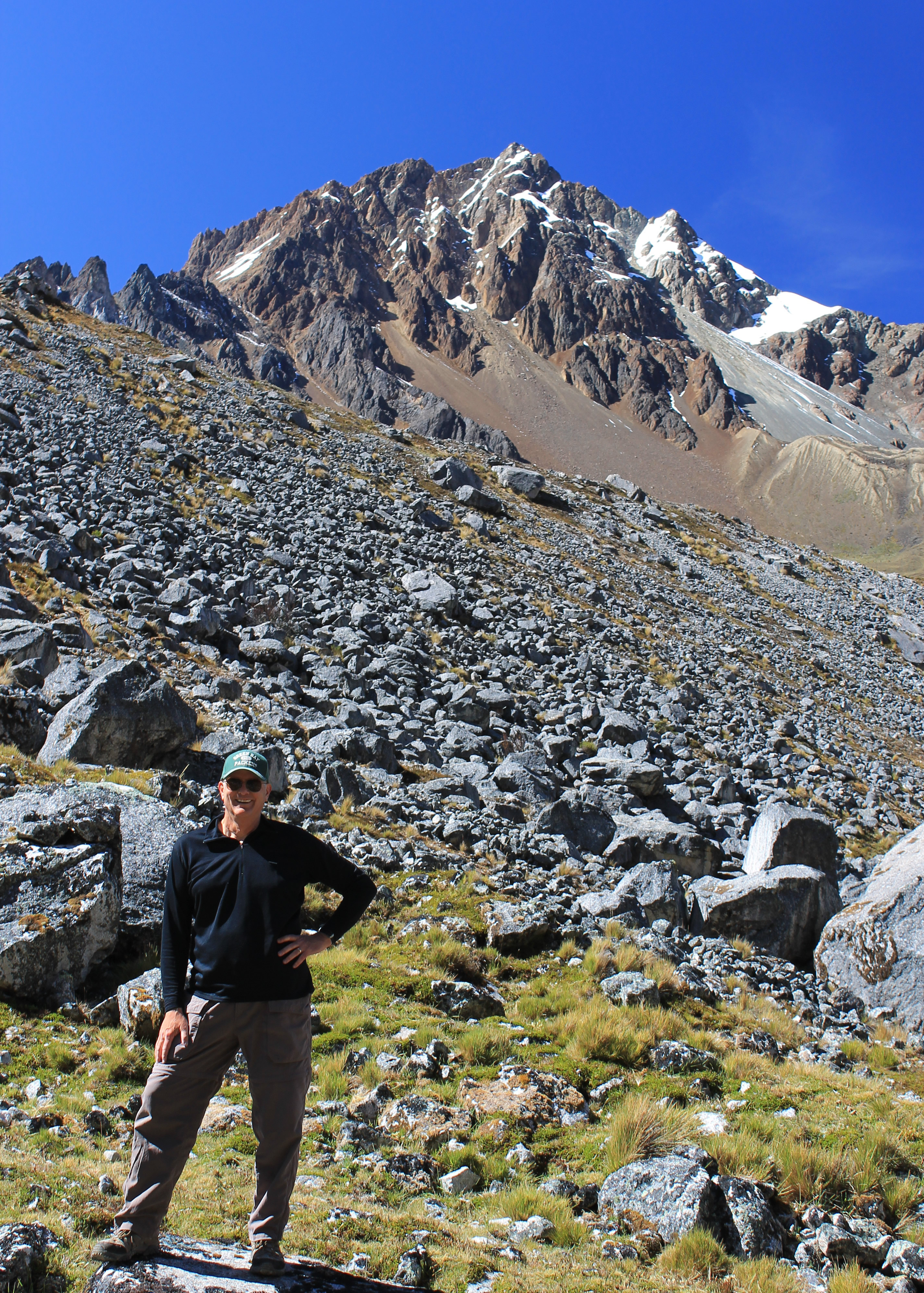
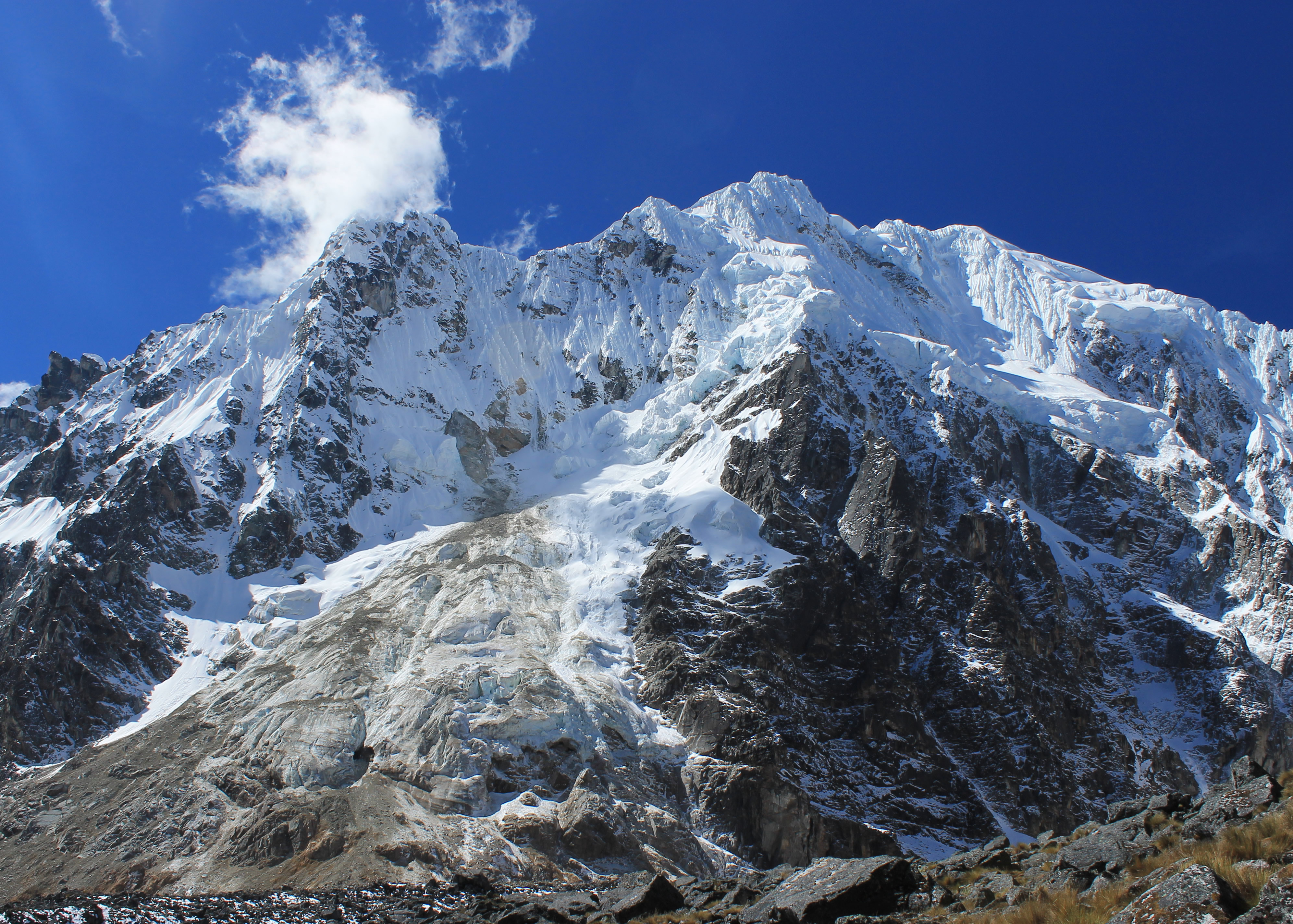 Nevado Salkantay
The trail rose to what looked like a pass. But on closer inspection it was pretty obvious that the real pass was probably out of sight around the corner, and probably a lot higher. If the sign was to be believed we still had over 1200 feet to go. Sandy and I were anxious to "get 'r done" and started out first. Sure enough, after a long slog we reached the false pass and could see the trail climbing higher around the corner to the left. But eventually we could see what looked like the pass. As we got closer it still looked good. Eventually we were there. Salkantay Pass.
After all the pictures I had seen on the web of people on the pass with clouds and rain, we had almost perfect blue skies. There was a cool breeze so we put on our Goretex windbreakers but we still couldn't complain about the weather considering that we were over 15,000 feet. We were the first ones from out group to get there but eventually everyone made it, and under their own power too. We took lots of photos of the surrounding mountains and of course with us posing by the signs for the pass.
 Sandy descends with Wayra Lodge very distant
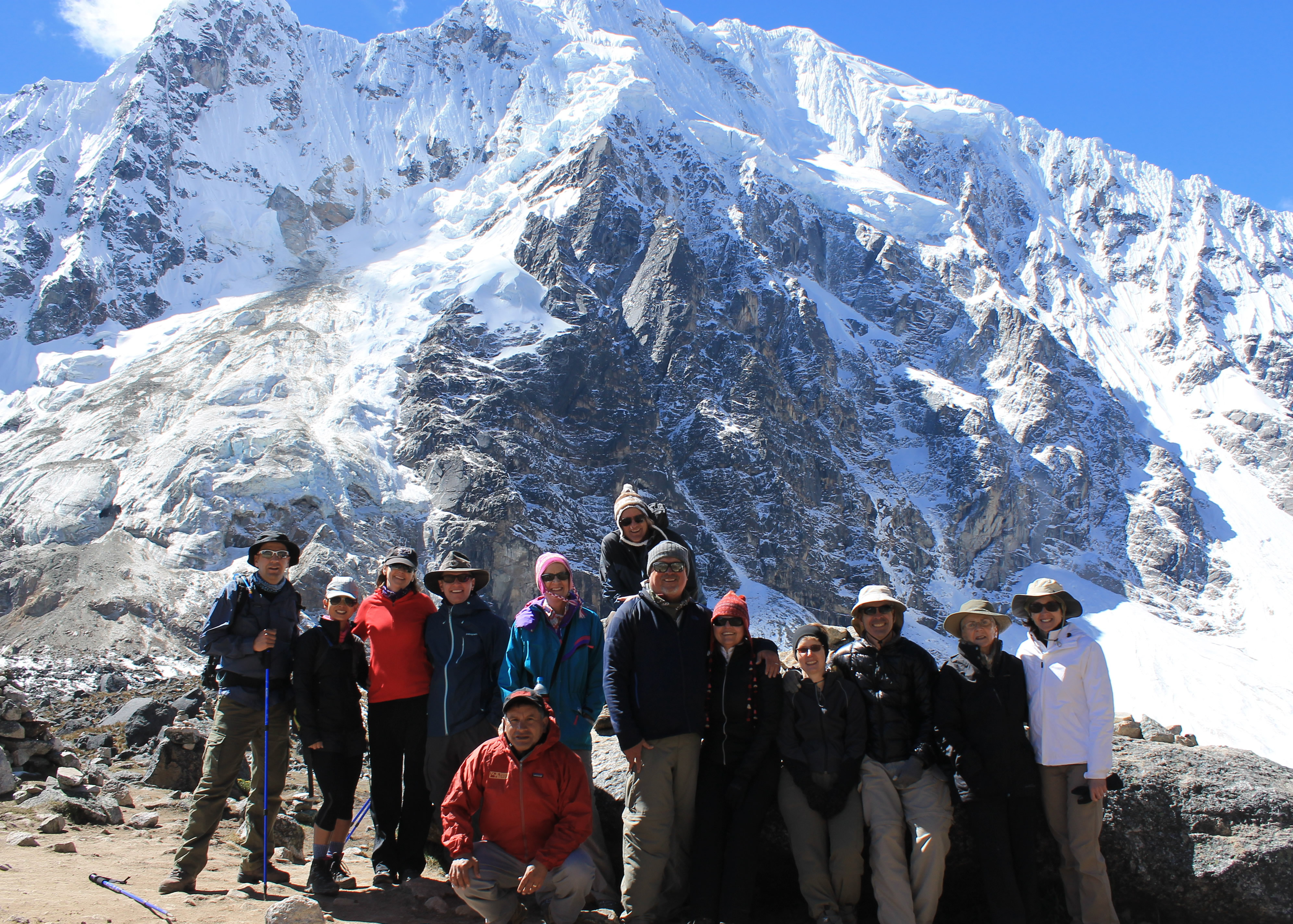
We all got together for a group picture. It was a lengthy process as everyone gave their camera to Juan and Jairo. We would pose as they went through all the cameras one by one, taking pictures of the group. It wasn't until I was home and working on the blog that I saw the mistake that I had made. When I got to the pass I applied more sunscreen. Ultraviolet light at high altitude and all. But when I did it I left a great big glob of white sunscreen on my nose. So if you blow up the group picture of us at the pass, you can see this huge blob of sunscreen on my nose. It's hard to look intrepid when you're a dork.
We spent a lot of time at the pass. The scenery was fantastic. The weather was as good as it could be. It was the highest that Sandy had ever been. I was excited because anytime that you can get higher than is possible in the continental United States it's a big deal. But eventually it was time to pack up and get moving again. We had a long way to go and a lot of altitude to lose to get to Wayra Lodge.
 The north side of Humantay comes into view
When we started down the views were just as spectacular on the far side of the pass. In the distance we could see another snow-capped mountain range, the Cordillera Urubamba, which is where the standard Inca Trail leads to Machu Picchu. The afternoon buildup on the highest peaks was probably the most cloud that we saw on the entire trip. Behind us we still had a fantastic view of Salkantay. Looking like an entirely different mountain, the north face of Humantoy was coming into view. We had walked all the way around the mountain since we started that morning. A very large mountain.
Going down was faster than going up but was still hard work, especially at high altitude. There were also a lot of horse trains coming the other way that forced us well off the trail to get out of the way. We lost altitude fast but there was a lot that we needed to lose. We were all looking ahead, trying to spot the tents that we were told would be set up at our lunch stop, but they never seemed to come into view. Eventually we spotted them. We reached the tents, dropped our packs outside, and headed in to find a chair. It felt great to finally be able to sit down.
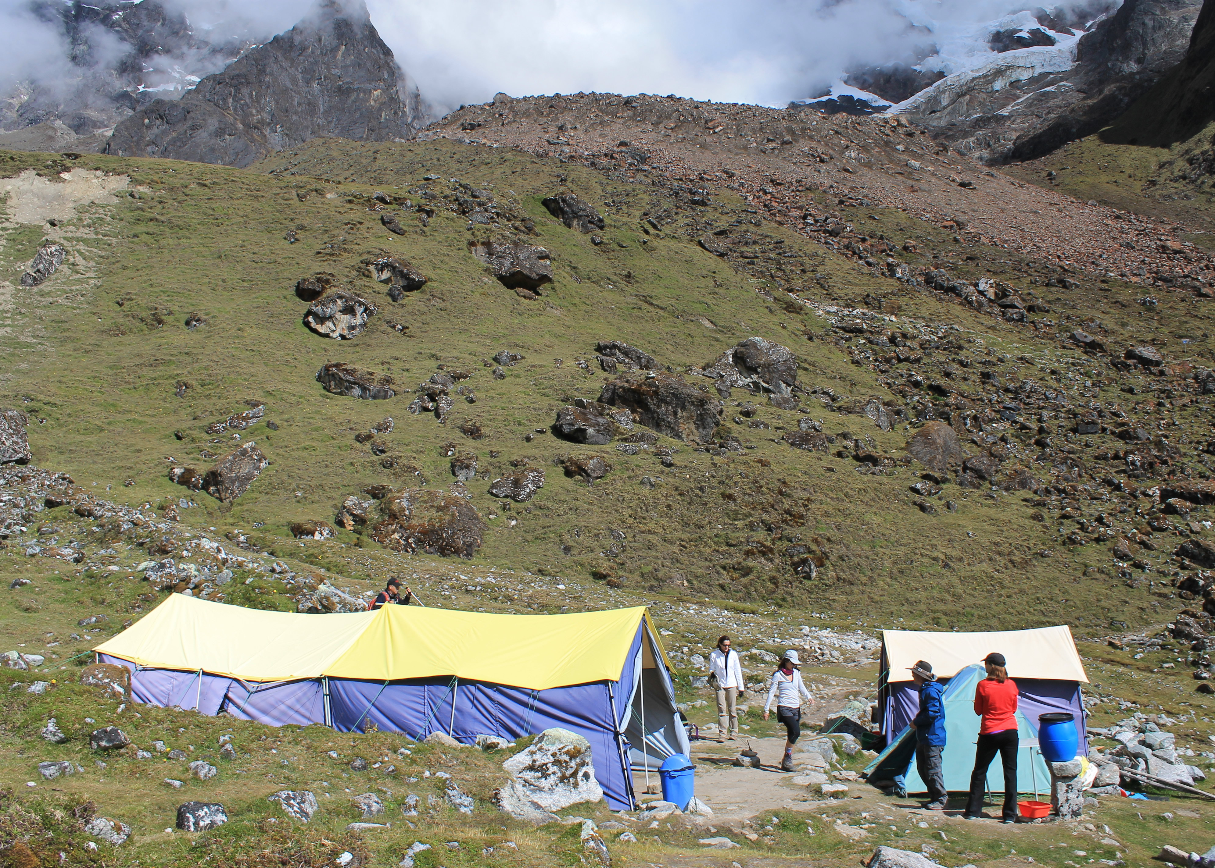 Tent at our lunch spot
Lunch was excellent, as all the meals were. We took our time. Everyone was in good spirits after crossing the pass. As usual today, Sandy and I were the first done and were ready to go. We were anxious to cover the last miles, to get down to the lodge so that we could really relax and celebrate. We had spotted the lodge far down the valley from quite a way above the lunch spot, so there wasn't any route finding to do. Sandy and I started off and the group spread out more than usual since it would have been hard for anyone to get lost without climbing a mountain.
Although we could see the lodge it was a long way off. We just kept slogging along. And slogging. And slogging. Finally we were there.
This was a smaller lodge, with only six rooms for a single group instead of the twelve rooms at the previous lodge. We got to our room and found our duffel bags already waiting for us. It had been a long day so the hot tub was already open. We changed into swimming suits and headed for the hot tub. Two other couples joined us there.
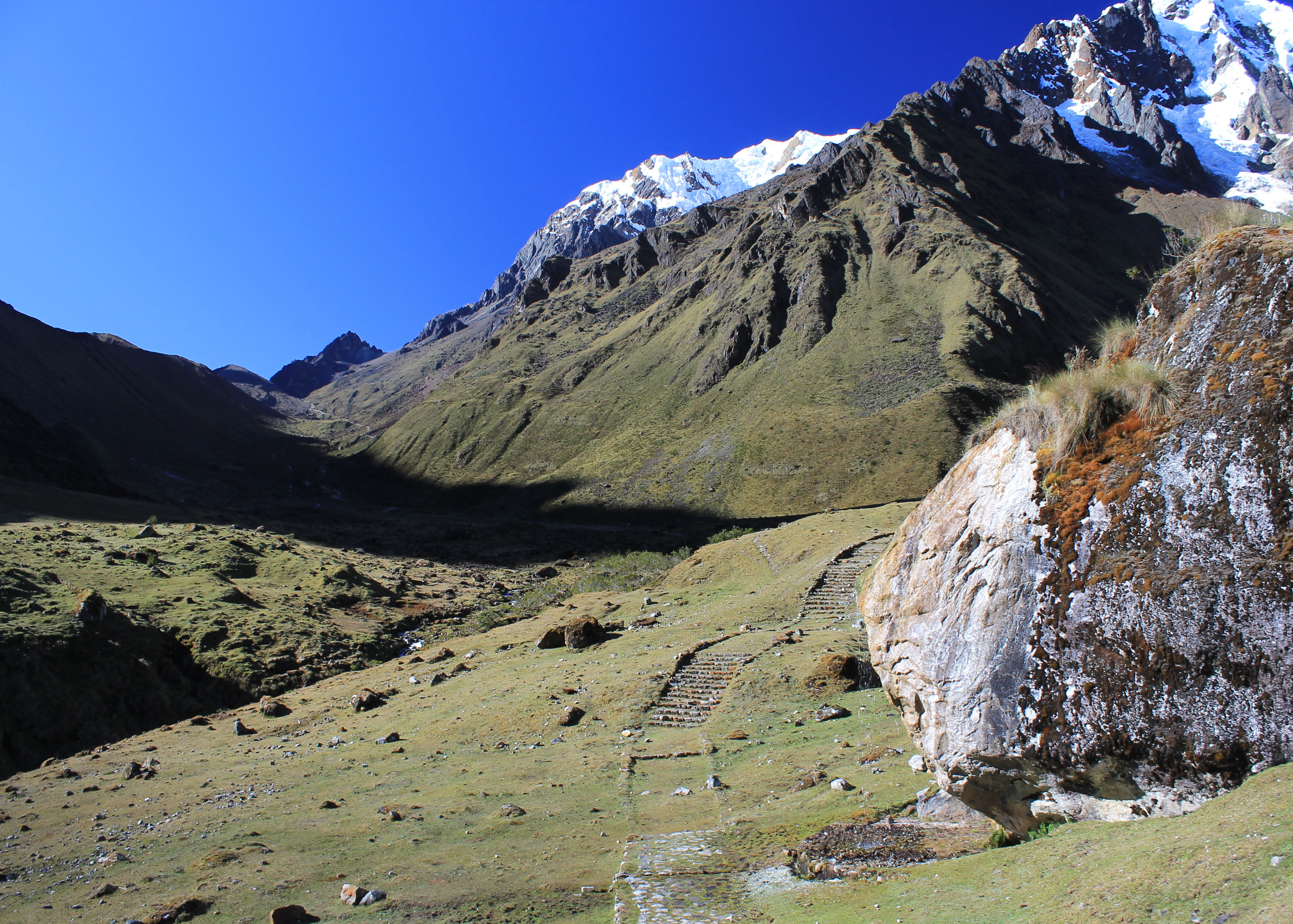 Inca trail in foreground, trail from the pass in background
Soaking in the hot water was wonderful after a long, hard day. We were tired but we felt good. Sandy had set a personal altitude record. I was always excited to get higher than I could in the continental US. Neither of us had been troubled by the altitude. We had been slow but there were no headaches and no nausea. Our acclimatization in Cusco and at Salkantay Lodge had been successful. We had enjoyed a fantastic day in the high Andes, one of the great mountain ranges of the world. Afterwards, to cap it off, we had what I thought was the best dinner of the entire trip that night.
