Utah Trip - Horseshoe Canyon Rock Art
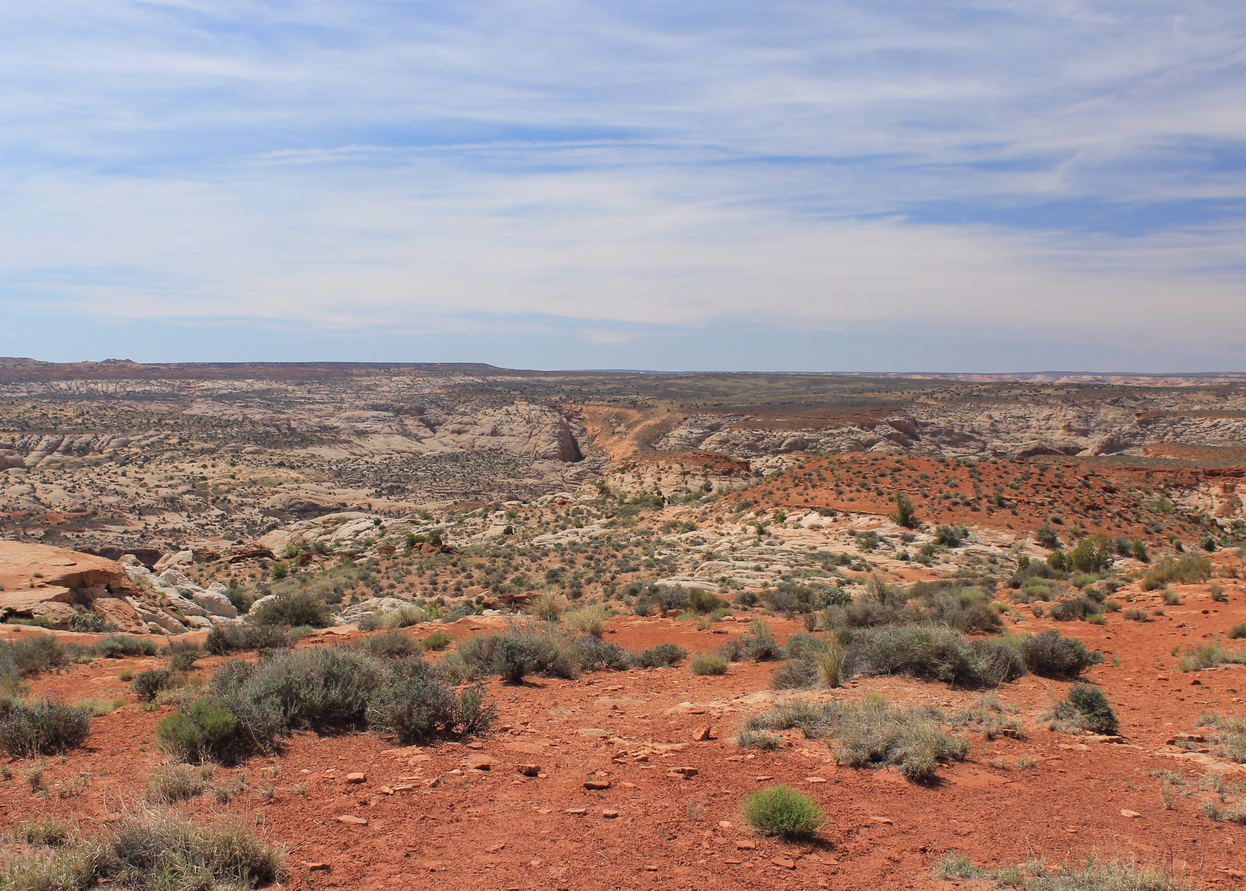 At the trailhead - there's a canyon out there somewhere
It was going to be hard to follow up the first day of this trip - a hike/scramble through two slot canyons, dinner in Moab and a hike to photograph the sunset at Delicate Arch. But I was going to try. I already had my hike for the second day picked out. Last year, Sandy and I had spent our spring break vacation hiking in canyon country. At the end of the trip we were staying in Hanksville, Utah and were planning to do one last hike. But several things added up to change our minds. The weather started to turn and it looked like we might get rain, or at least cloudy skies which meant we wouldn't get good photos. The access road for the hike we wanted to do was very long and rough. And Sandy often gets anxious to start home towards the end of a trip. We ended up skipping the last hike and going home. So it was still on my list as unfinished business and I was really anxious to do it. The hike was in the isolated Horseshoe Canyon unit of Canyonlands National Park. Since the trailhead is about midway between Hanksville, where we were last year, and Green River, where I was staying this trip, I was about as well postioned as I could be to do the hike.
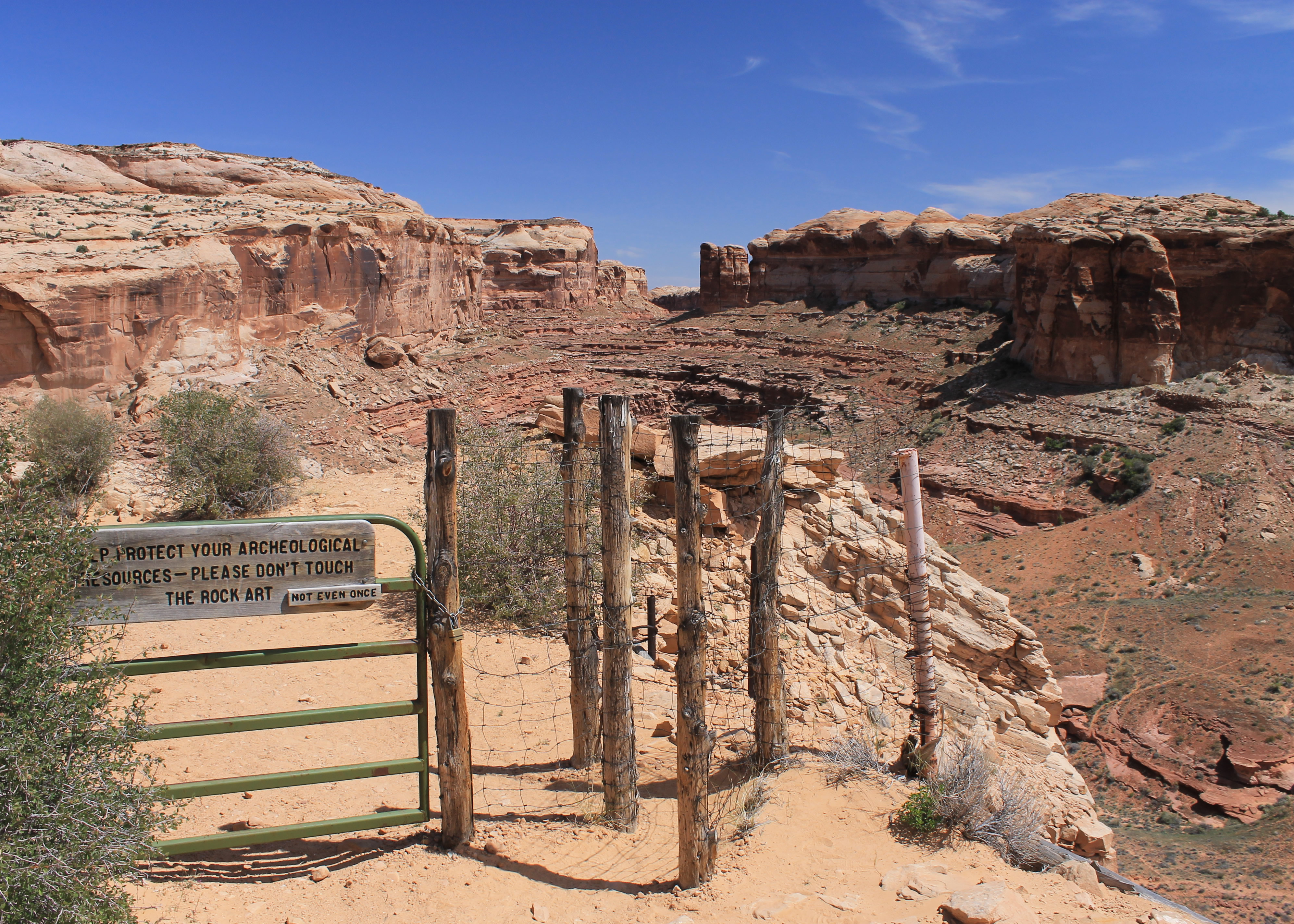 Hiker's maze to keep cattle out of the canyon
Still, Horseshoe Canyon is quite remote. To reach the trailhead I had to start by retracing my route from the day before. I drove along I70 and then Utah higway 24 for a total of 37 miles to the spot where I had turned off to the west towards Goblin Valley State Park and the Little Wildhorse and Bell Canyon trailhead. This time I took the dirt road on the opposite side of the highway that headed east toward - nothing. At least there was nothing as far as I could see. And I could see a long way.
The dirt road went off a long way into the desert. Eventually it climbed to a saddle between two buttes. It passed a ranch house that could make a case for being one of the most isolated places to live that I have ever seen. It passed through an area of drifting sand with dunes that were encroaching on the road. Fortunately it wasn't too windy. This explained the warnings that I had seen on some descriptions of the trail that access could be cut off due to high winds. Rain storms can often make dirt roads impassable because of mud but this road can be completely covered and obliterated by blowing sand. That was a new one for me. But today the weather was benign and I had no problems with mud or with sand dunes covering the highway. The road was just long, slow, dusty and monotonous. Finally after thirty one miles and over an hour after leaving the highway, I reached the trailhead.
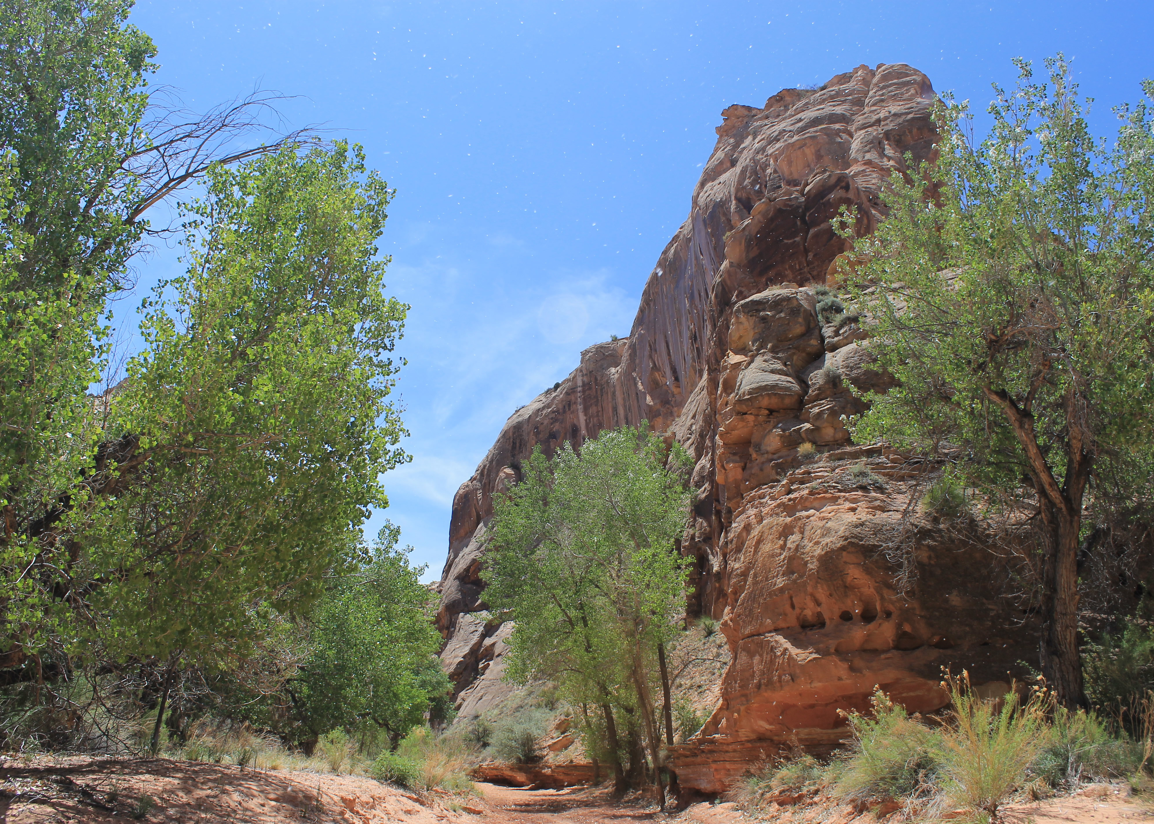
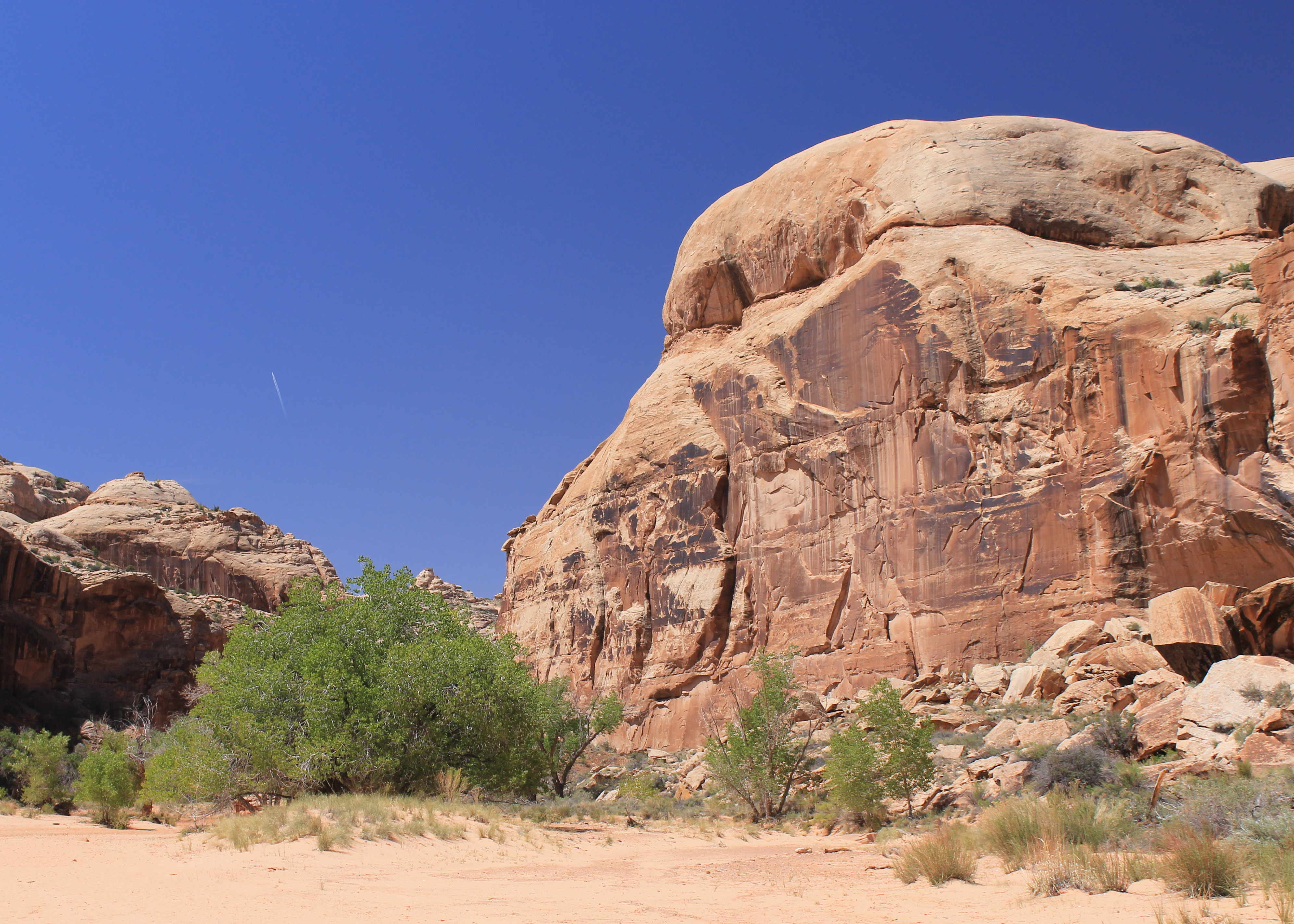 At the bottom of Horseshoe Canyon
There were eight or ten cars at the trailhead. My guidebook suggested camping at the trailhead because of the effort required to reach it. Beyond the end of the road the boring desert that I had been driving through was replaced with slickrock sloping downward and an obvious large gap, but I couldn't see down into it. Nothing too exciting, but it certainly looked like there could be a canyon hidden out there. I put on my boots, grabbed my pack and started down the trail.
The trail descended gradually into an area of slickrock. At least that was more interesting than the sand and scrub brush that I had been driving through for so long. After about fifteen minutes of hiking I reached the rim of the main canyon. It had sheer walls that dropped about eight hundred feet to a broad, sandy floor. I went through a "hiker's maze", designed to keep cattle out of the inner canyon. I turned a corner which revealed a steep dirt ramp that allowed access through the cliffs, the secret to reaching the bottom of the canyon. The trail followed it and made a steep descent to the canyon floor.
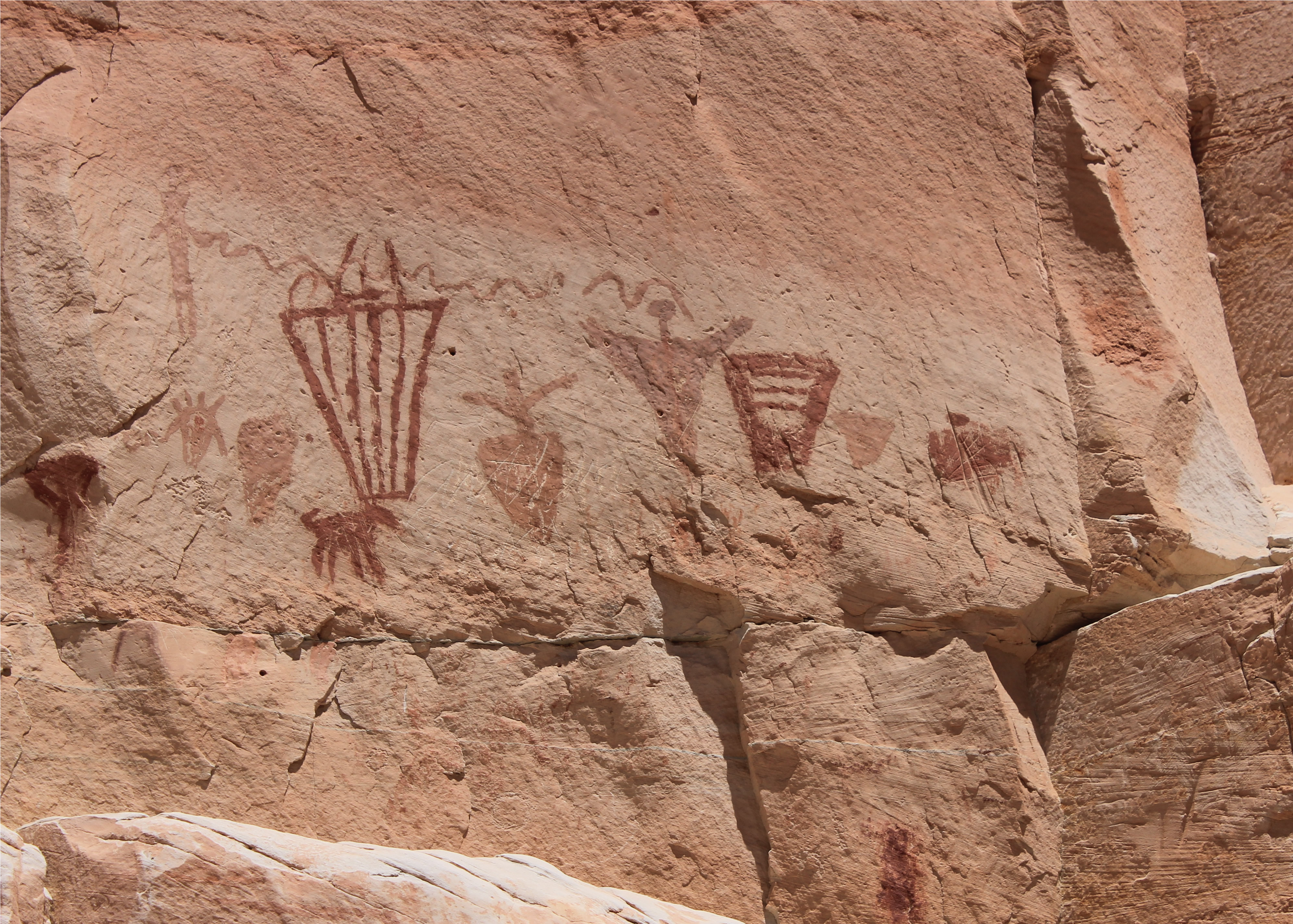
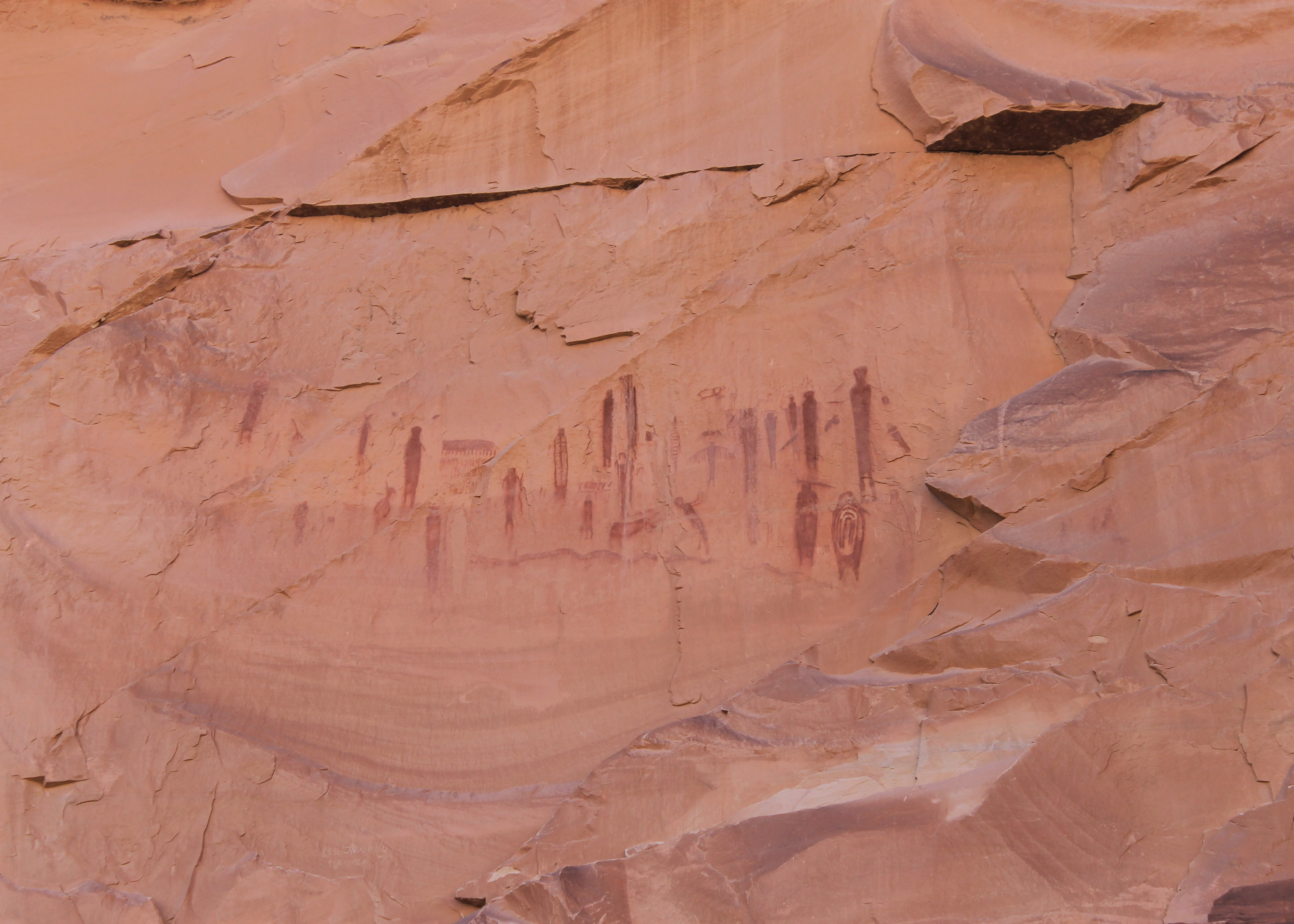 First rock art at High Gallery
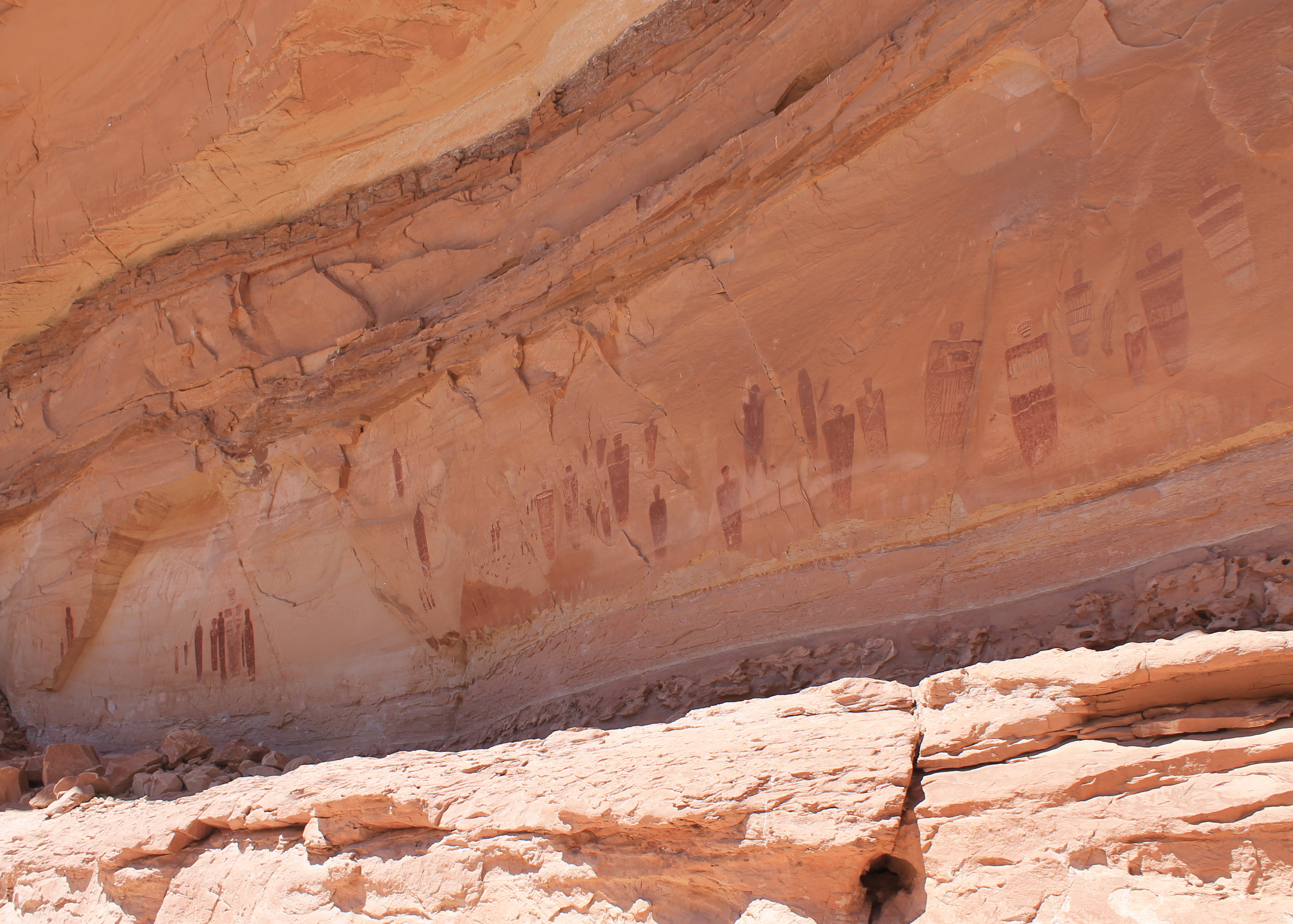
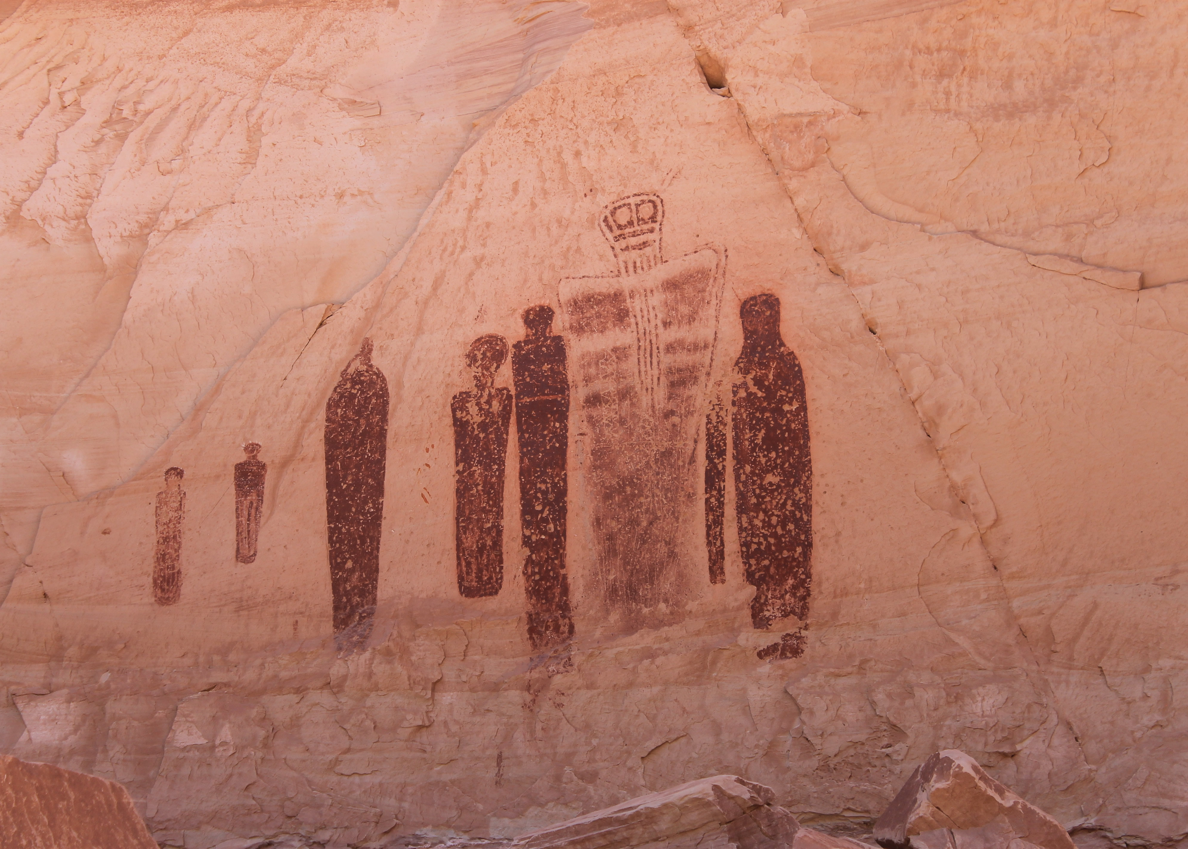
Although the canyon is beautiful, the real fame of the Horseshoe Canyon hike is the a series of ancient rock art panels, culmionating in the Great Gallery. According to my guidebook, "The Great Gallery is the single greatest display of rock art in North America." The rock art is done in what is known as Barrier Canyon style. The previous year when Sandy and I had been hiking in canyon country, we had explored several ruins of buildings inhabited by the Anasazi people. They dated from about 1400 CE, give or take one or two hundred years. These people were farmers who built permanent settlements. But the Barrier Canyon rock art was created by hunter gatherer people from the Archaic Period, who inhabitated the area long before the Anasazi. They didn't have fixed settlements, build permanent structures, or make complex artifacts like pottery. They lived in caves and brush shelters and left few artifacts. So not much is known about them. What they did leave was beautiful and intriguing rock art for us to admire and wonder about.
 Drawings at Horseshoe Shelter
Even dating the rock art is very difficult. The art was produced using mineral-based paint created from red ochre or hematite (iron oxide). Since the pigments are not made from organic materials, carbon dating cannot be used to determine the age of the paintings. The time period of the Barrier Canyon style paintings stretches all the way back to 7000 BCE and ends sometime between 500 and 700 CE. The dating at some sites is based on the recovery of small clay figurines or fragments, which just indicate a time period that the site was frequented and not the date the paintings were actually created. Even these are scarce since the rock art galleries are not at locations that were inhabited. Instead they seem to be placed at important spots that were passed during seasonal migrations. That means that there are no burial grounds or garbage dumps near the rock art, the two favorite places for archeologists to explore looking for artifacts. The best estimates for the rock art in Horseshoe Canyon is that it was created between 2000 BCE and 500 CE. That's quite a range of time!
 The "snow storm" at Water Canyon
There are four major galleries along the hike in Horseshoe Canyon. I was looking around admiring the beautiful cliffs and canyon walls and not really looking for rock art. I have to admit that I walked right by the first site. About half a mile from where I reached the floor of the canyon there were two hikers who had stopped in the shade to rest. When I said hello they asked if I had seen the rock art. I said no and they pointed out that it was about a hundred meters back. I quickly backtracked and found it. It was fortunate that I had run into them. Once again it proves the old maxim - it's better to be lucky than good.
The High Gallery gets its name because it's...well..high. The figures are above a steep dirt slope about fifteen feet above the ground. Most likely they are so high not because the ancient peoples were very tall, but because the floor of the canyon probably dropped through erosion since the figures were painted. At least by being so high up they were safe from vanadalism, something which had occurred at one of the other galleries in the canyon.
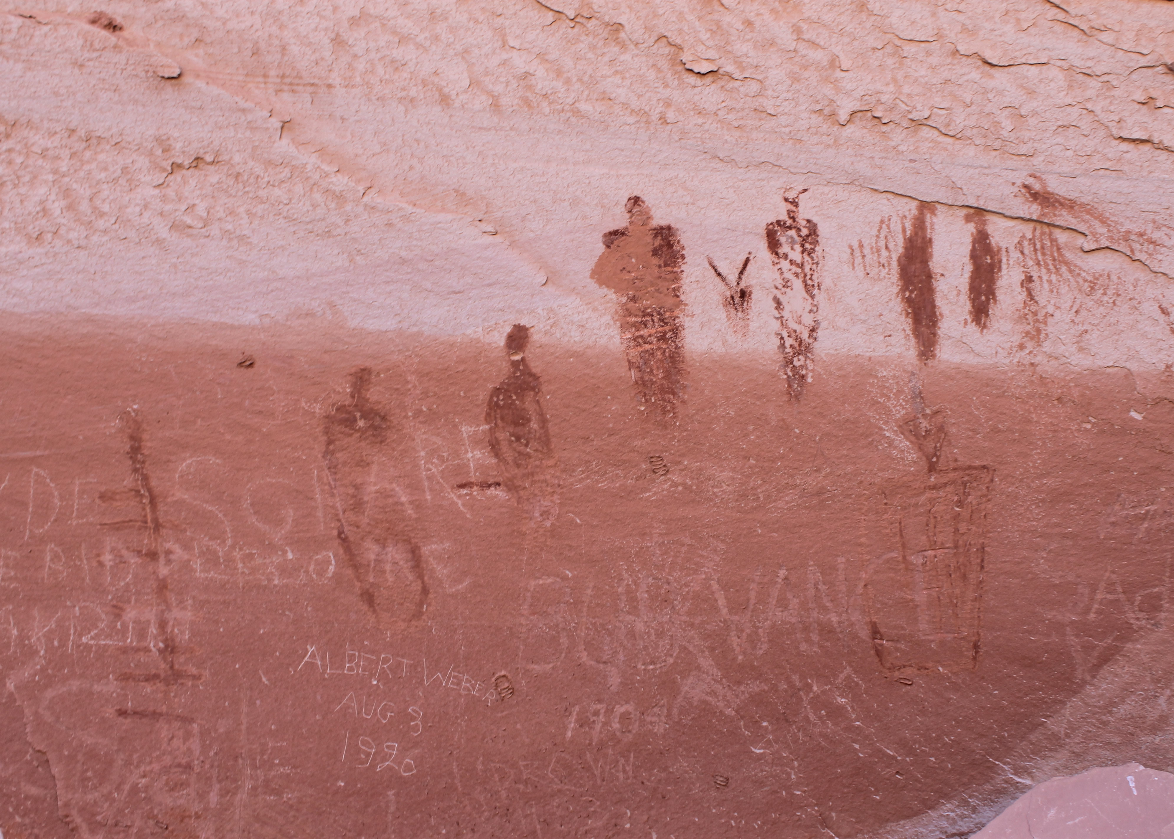 Vandalism at Alcove Gallery - shame on you Albert Weber
After (finally) finding the first gallery I was alert for the second. It was supposed to be very close by on the opposite side of the canyon. This time I spotted a track leading toward the cliffs and followed it to Horseshoe Shelter. These pictures were lower and therefore more accessible, as it would be possible to scramble on some broken rocks to reach them. The way was roped off which hopefully people will respect and just admire the pictures from a few feet away. The gallery was in an incredible spot, at the base of a sheer, overhanging cliff that was hundreds of feet high.
There was another pair of hikers here that were admiring the rock art. They offered to take a picture of me in front of it. Unfortunately in spite of the spectacular natural, historic and artistic surroundings, I still managed to look like a total dork. That's why I always take Sandy's picture on the hikes that we do together. If I had to make my living as a model I would starve.
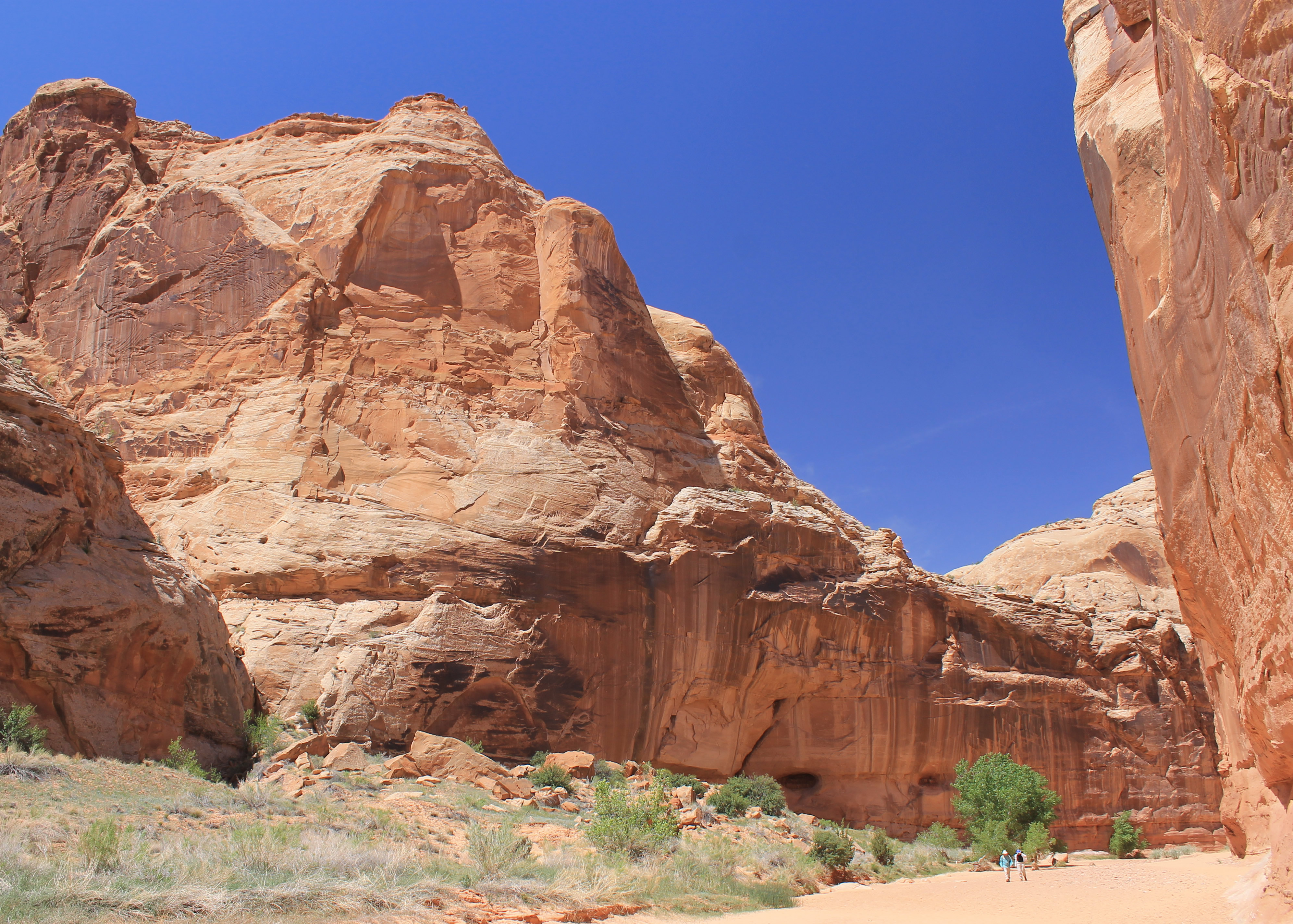 Hikers dwarfed by the cliffs in Horseshoe Canyon
I continued on. Just past Horseshoe Shelter was the junction with Water Canyon, a large and impressive side canyon coming in on the left side of the main canyon. At this point the wind was blowing the cottonwoods which had some kind of seed on them. So many seeds were blowing in the wind that looking up Water Canyon it looked like I was in the middle of a snowstorm. That was hardly the case as it was hot and sunny and getting hotter. It was promising to be a hot climb out of the canyon to the trailhead at the end of the hike.
Another half mile down the canyon I saw a rock cairn marking a path up to a rock shelf above the canyon floor. I followed it and found Alcove Gallery. It was in a sheltered alcove where the canyon took a wide bend. The view from it was beautiful looking up and down the canyon. Sadly here the rock art had been vandalized. Someone named Albert Weber, who I intensely dislike, thought that it would be a good thing back in 1920 to scratch his name over the rock art that had been there for 2000 years. So did lots of others. It was very sad.
 The High Gallery
In 2003 most people heard the story of Aron Ralston, who was doing a solo canyoneering trip when his arm was trapped by a falling boulder. He escaped only by amputating his own arm. The accident occured in Blue John Canyon which is just south of Horseshoe Canyon. After he escaped he hiked into Horseshoe Canyon where he met other hikers who contacted the National Park Service. He was rescued by helicopter from Alcove Gallery.
After Alcove Gallery I continued on. Not quite four miles from the trailhead I reached the Great Gallery. It is truly spectacular. After all I had read about it, the reality did not disappoint. The panel is roughly 200 feet long and fifteen feet high and contains over twenty larger than life size figures. Some of them, like the Holy Ghost, are quite famous. It was like visiting the Louvre. But it had the added element of awe for the age of the rock art, and the mystery of the people who created it about whom we know almost nothing. The Park Service had installed a bench where I sat and stared at the Great Gallery for about fifteen minutes. I didn't even bother with the snack in my pack. There was a booklet that I thumbed through that had a number of articles on what is known from the archaelogical studies of the area. For those interested, I found it on the Canyonlands National Park website uploaded it to my website. It is a fascinating read.
 The Holy Ghost panel at High Gallery
Eventually it was time to go. The canyon on the hike back was just as pretty. One thing that I did miss was the dinosaur prints. Apparently there are some dinosaur tracks preserved in rock along the river near the Great Gallery. It would have been really cool to see them but I didn't find them. Reading other hiker's stories on the web some people were able to find them.
By the time I started to climb out of the canyon the temperature felt like it had reached the mid-eighties as forecast. But it wasn't too bad. There was a breeze. I just took it slowly. When I reached the trailhead and took off my boots, I poured about a cup of sand out of each of them. That wasn't too surprising as the canyon floor had been very sandy. But when I took my socks off I poured another cup of sand out of each of them. That was a little too much! Then it was time to pile in the car. It was another (boring) hour on the dirt road to get back to the highway. Then I started for home. Although it was only Saturday, I had checked out of the motel in Green River. It was quite expensive for central Utah. I didn't think it was worth it to pay for another night just so I could do a short hike Sunday morning, although it does mean I have to make another trip to hike in Goblin Valley State Park. But I really didn't want to face eating dinner in Green River again. So I had a long drive home, arriving in Boise about 2 am.
It had been a great trip with some awesome hikes.
