Peru - A Distant View
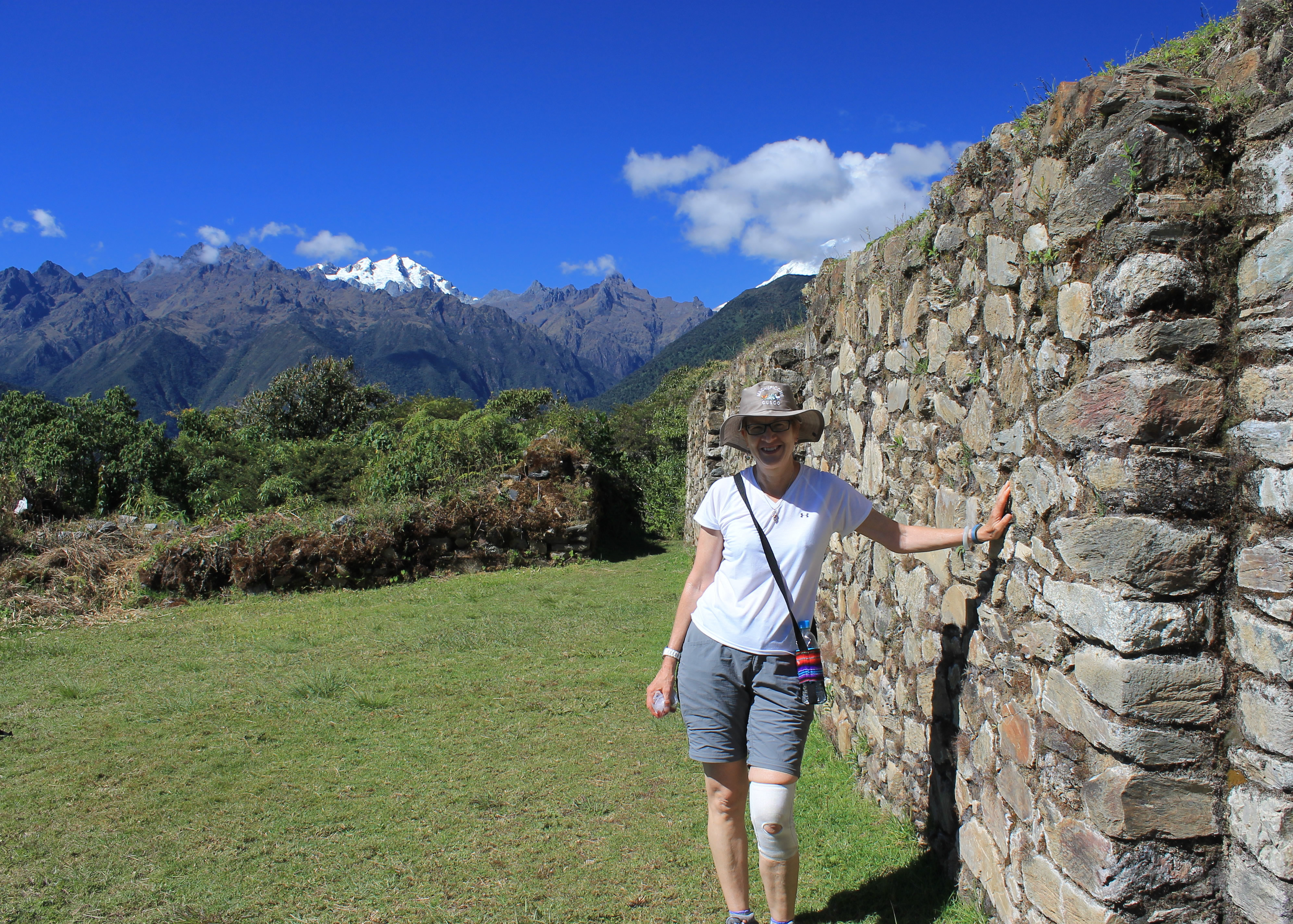 Chuyunko and Salkantay from the ruins at Llancapata
It was time for the group to regroup.
Last night we had been at Colpa Lodge. We thought the hardest part of the hike was behind us. We would just cruise for the last two days, then it would be on to Machu Picchu for an easy day of sightseeing. But it hadn't worked out that way. Several people weren't feeling well on the hike today. Not everyone showed up to eat dinner tonight. I was there but just to be sociable. I didn't feel like eating anything myself. I wasn't worried though. I had enough bodily reserves to keep me going for a while.
For the last day of the Salkantay Trek there are two alternatives from La Playa, which is where most groups camp on their last night. The low route continues down the valley to the town of Santa Theresa. From there it continues to descend to the hydroelectric plant at the bottom of the Urubamba Valley, far below Machu Picchu. From there it is possible to catch a train for a short ride to town of Aquas Calientes, although low-cost trekkers walk the train tracks instead.
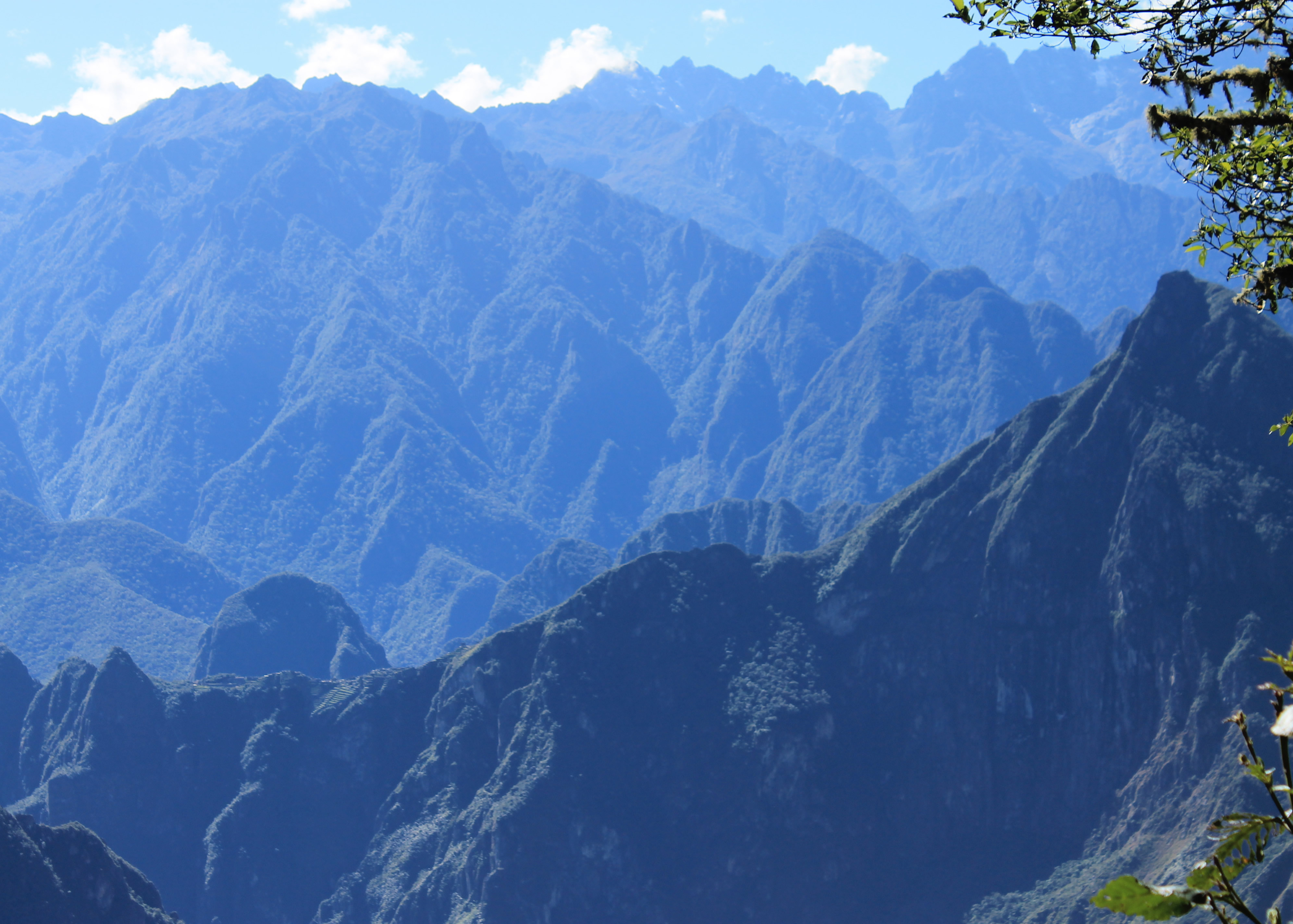 Zoomed in view of Machu Picchu from Llactapata
Our group was planning to take the high route instead. From La Playa it passes the Lucma Lodge at 7,000 feet. We were already staying there for the night so we had a head start for the next morning. From the lodge it climbs another 2,000 feet to Llactapata Pass. Shortly beyond the pass are the ruins of Llactapata and a spectacular view of Machu Picchu in the distance. Then it drops 3,500 feet in a very short distance to end at the train station near the hydroelectric plant at 5,570 feet. It's a spectacular way to end the trek but it meant a tough day of hiking.
Since several people in our group were unwell, Juan proposed a third alternative. In the morning he would hike down with a group to the road from La Playa. It was only a short distance downhill. There they would meet a van and ride to the hydroelectric station. Meanwhile Jairo would lead anyone who wanted to do the planned hike via Llactapata.
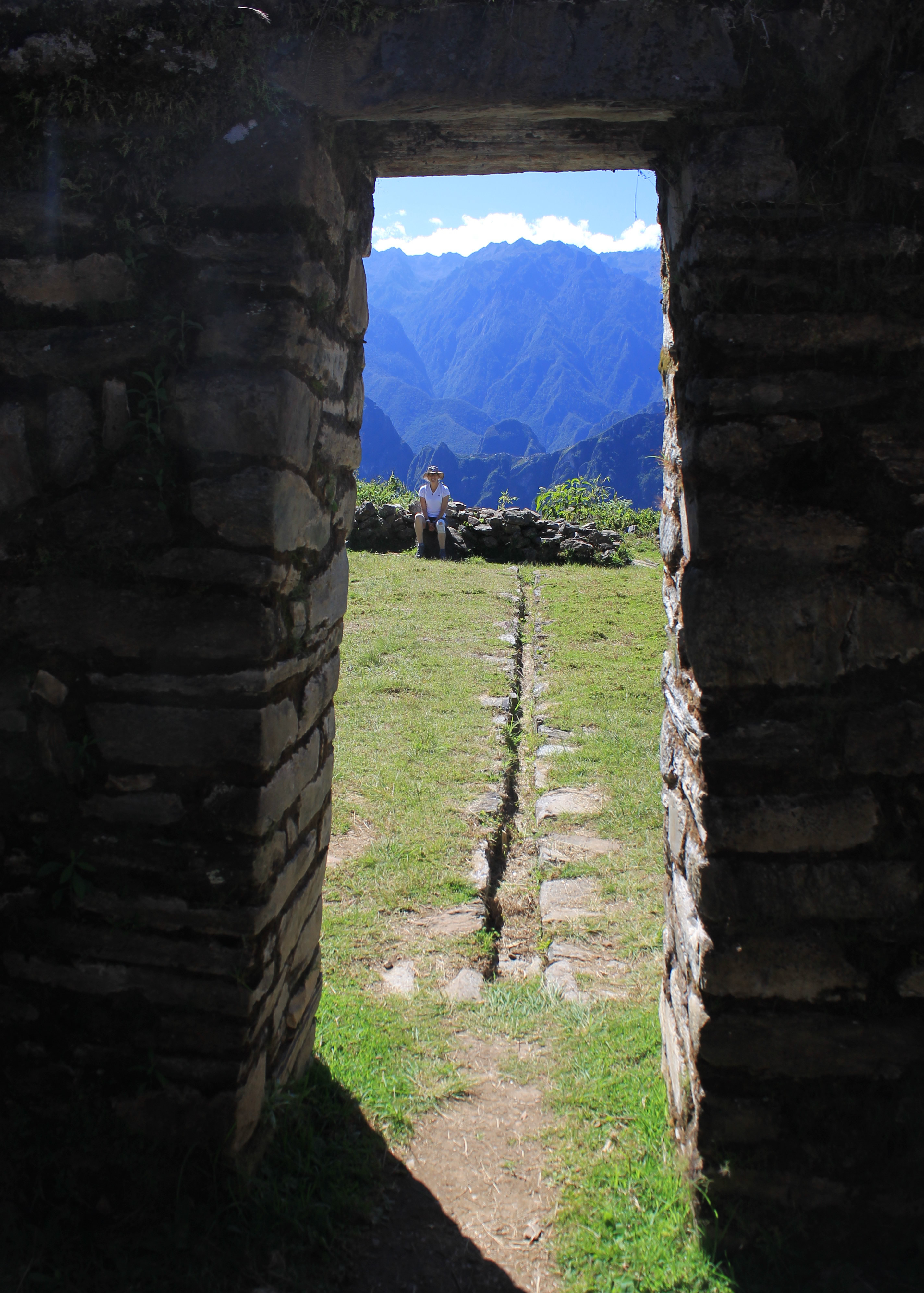 View through the framed doorway - Machu Picchu is just over Sandy's left shoulder
Next morning, people weren't sure until the last minute who was going in which group. Several people ended up taking the van. Cari was feeling better but thought she it would be better and Kelly went along with her. Mike thought the steep descent might be too much for his knees so he and Gayla chose to ride. Derek and Tamara had also come down with stomach troubles overnight. Derek ended up taking the van while Tamara decided to give the hike a go. Mary, Suzanne, Blair, Tim and I were all going to hike. Sandy picked the van option to be safe, but she came down at the last minute and joined the hikers. She said that if Mary was the oldest and was going to hike, she was inspired and would hike too. So our group ended up just about evenly split, with five people riding and seven hiking on the last day.
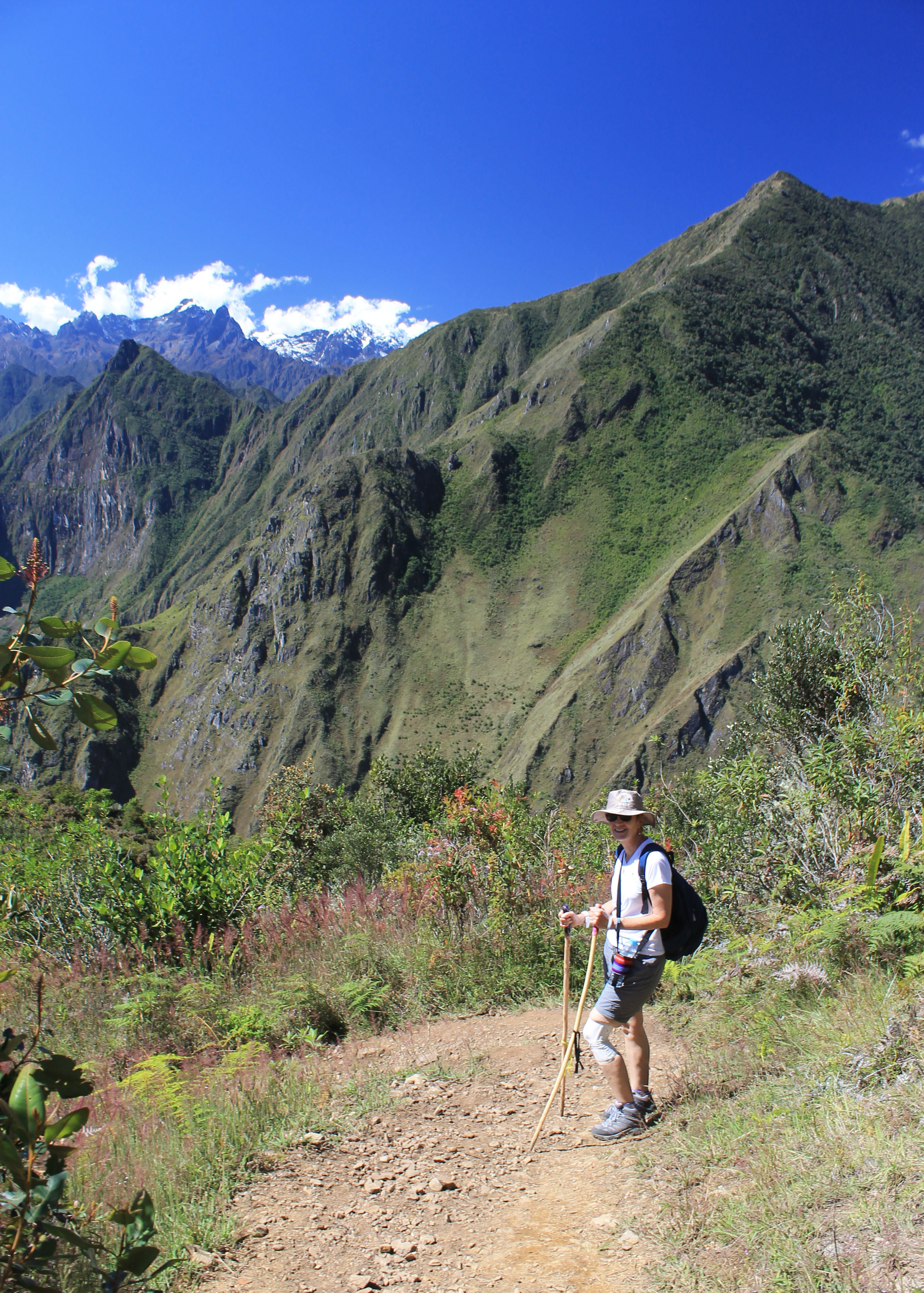
It was another perfect morning as we started off. We began in the shade but very quickly came out onto open slopes. Today we would be in the sun for the entire uphill section. The trail contoured along the ridgeline, climbing gradually but steadily. Or maybe a better word to use would be relentlessly. The trail was never very steep but it was always going uphill. It didn't take me long to figure out that today I wasn't at 100%. What ordinarily would have been nice hiking with great views, although hard work, turned out to just very hard work. I was just plodding along. After about an hour and a half we came to a small snack stand and toilet (the two most important things along the trail) that an enterprising local had set up. We took a long break, enjoying the extensive views and cool breeze. We were about half way to the pass.
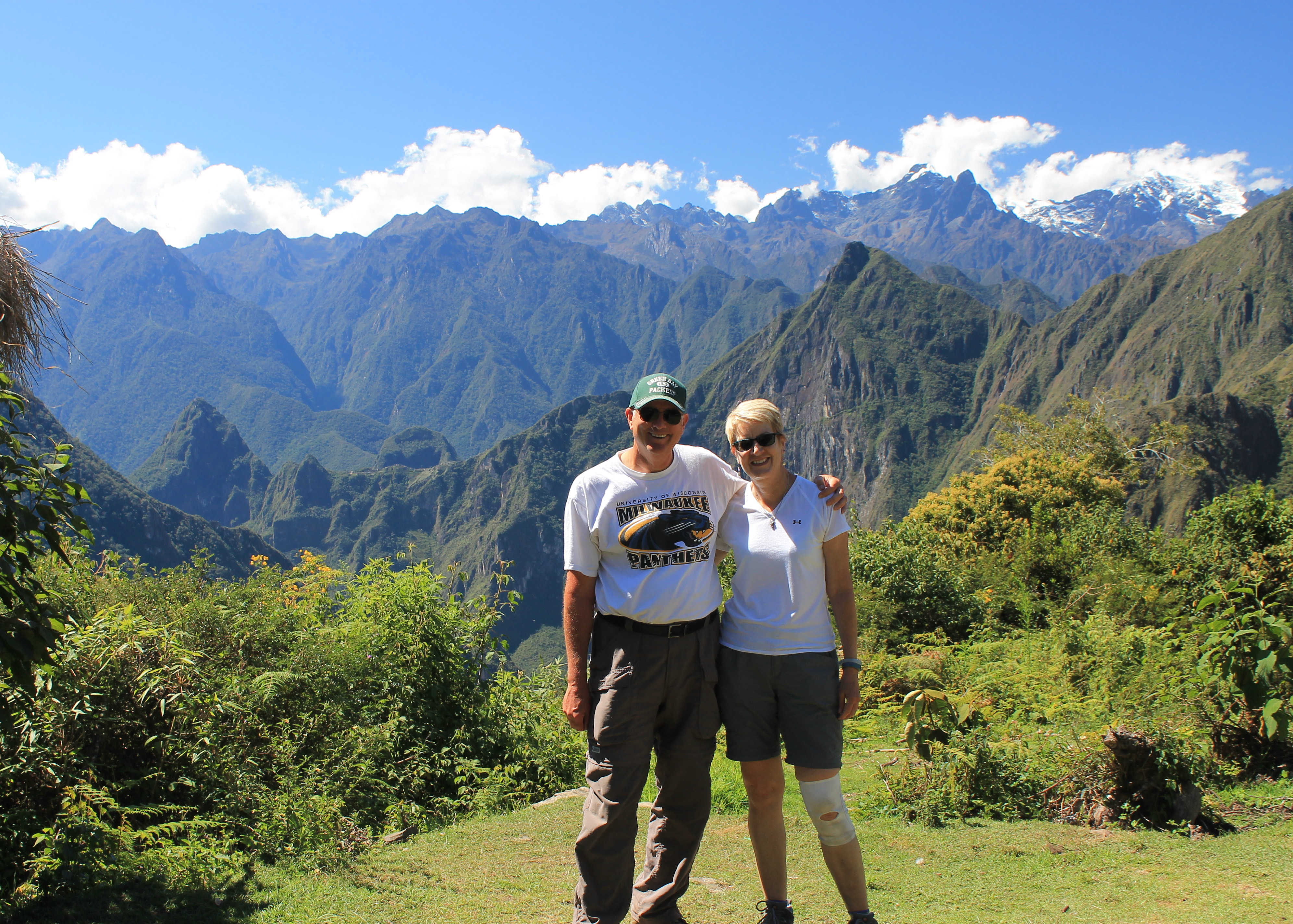 I'm feeling better after lunch
After the break I really struggled. Jairo always set a moderate pace for us so even though Sandy and I are slow hikers we were usually right with him at the front. Today Sandy was up front again but I was bringing up the rear. It wasn't long before I started to lag behind the group. Fortunately Jairo would stop often to point out and describe something of interest so I was usually able to catch up. I have to admit that this part wasn't fun. For all the great times that I have hiking in the mountains, there are also times like this when you just put your head down and keep slogging, wishing that you were already there. I was hoping that when we reached the pass and started down it would be easier. Actually, I don't think I put that much thought into it. I just wanted to stop going up. Every so often I would look up toward the pass, hoping it would look like I was almost there. Sadly it would look just as far as it had the last time I looked, which usually was two steps back.
 We have a long way to go...down
After another hour the slope lessened, we entered the shade of the forest, and after a short distance we stopped at a trail junction. There was a small sign that said we were at Llactapata Pass. As passes go it wasn't much of a viewpoint. We probably couldn't see fifty feet in any direction. But I was certainly excited to have made it there.
From the pass we descended gradually through the forest for about a half an hour until we reached a small clearing and the Inca ruins of Llactapata. The thing that immediatly grabbed everyone's attention though was the view across the Urubabamba Valley. Perched on the spine of a long, narrow mountain ridge, about 3 miles away across an extremely deep valley, Machu Picchu was clearly visible. Everyone was pointing, taking pictures, or just plain staring. The view of Machu Picchu was incredible. The thing that really struck me about it from this view was what an incredibly unlikely place for it to be built. It is right on the crest of a narrow ridge, with steep dropoffs on both sides. I coul imagine the royal engineer standing next to the Inca King when he points to the summit of the ridge and says "We are going to build our city there!". The engineer probably cursed to all of the gods the Incas had and replied "Yes Sire. A brilliant idea." I've had days like that myself during my own engineering career, just on a much smaller scale.
The other strong impression from the view was how remote Machu Picchu is. As far as we could see all around were rugged mountains covered with jungle, with no sign of people anywhere. Well, don't look too closely or way up the ridge you'll spot some electric power lines from the nearby (but thankfully out of sight) hydroelectric plant. But the impression of remoteness was still very strong.
 Sandy crossing the Urubamba River
The name Llactapata, like so many other things in Peru, is confusing. Usually it refers to the ruins we were currently at. But sometimes it is used to refer to ruins in the Urubamba valley along the main Inca trail. That site is more properly called Patallacta and is on the main Inca Trail. The site we were at is the correct Llactapata. Accept no substitutes.
Llactapata is an interesting Inca site in its own right. It was rediscovered by Hiram Bingham in 1912, a year after he found Machu Picchu. Since then it was largely ignored until 2003 when a group of archaeologists surveyed the ruins and determined that they were much more extensive than previously thought. Since then a small section has been excavated and restored. In the process a small clearing was created and that was where we were enjoying the view over to Machu Picchu. The location of Llactapata had been chosen carefully by the Incas. In the restored ruins there was a long corridor leading to a doorway that from the far end, perfectly framed the distant view of Machu Picchu. The alignment of the corridor is such that on the winter solstice, the sun rises directly over Machu Picchu. The sun was the most important god to the Incas, and the chief Inca himself was said to be descended from the sun. A lot of their religious rites apparently were oriented around the sun. Hence the position and orientation of their buildings with respect to the movements of the sun was important. Not bad for ancient people - I have friends who don't know which way is north when they are in their own house.
 Waterfall at the hydroelectric project
From Llactapata we had a short hike to our lunch stop. It was another farm house with a dining area next to it. It was enclosed but most of the wall facing Machu Picchu was glass windows, so we had a fantastic view while we ate. Ever since the pass I had been feeling better and now I was really hungry. I had hardly eaten anything the day before but now I ate a big lunch. That was a good sign. I had not one, but two Coke Zeros as well. I was feeling much better.
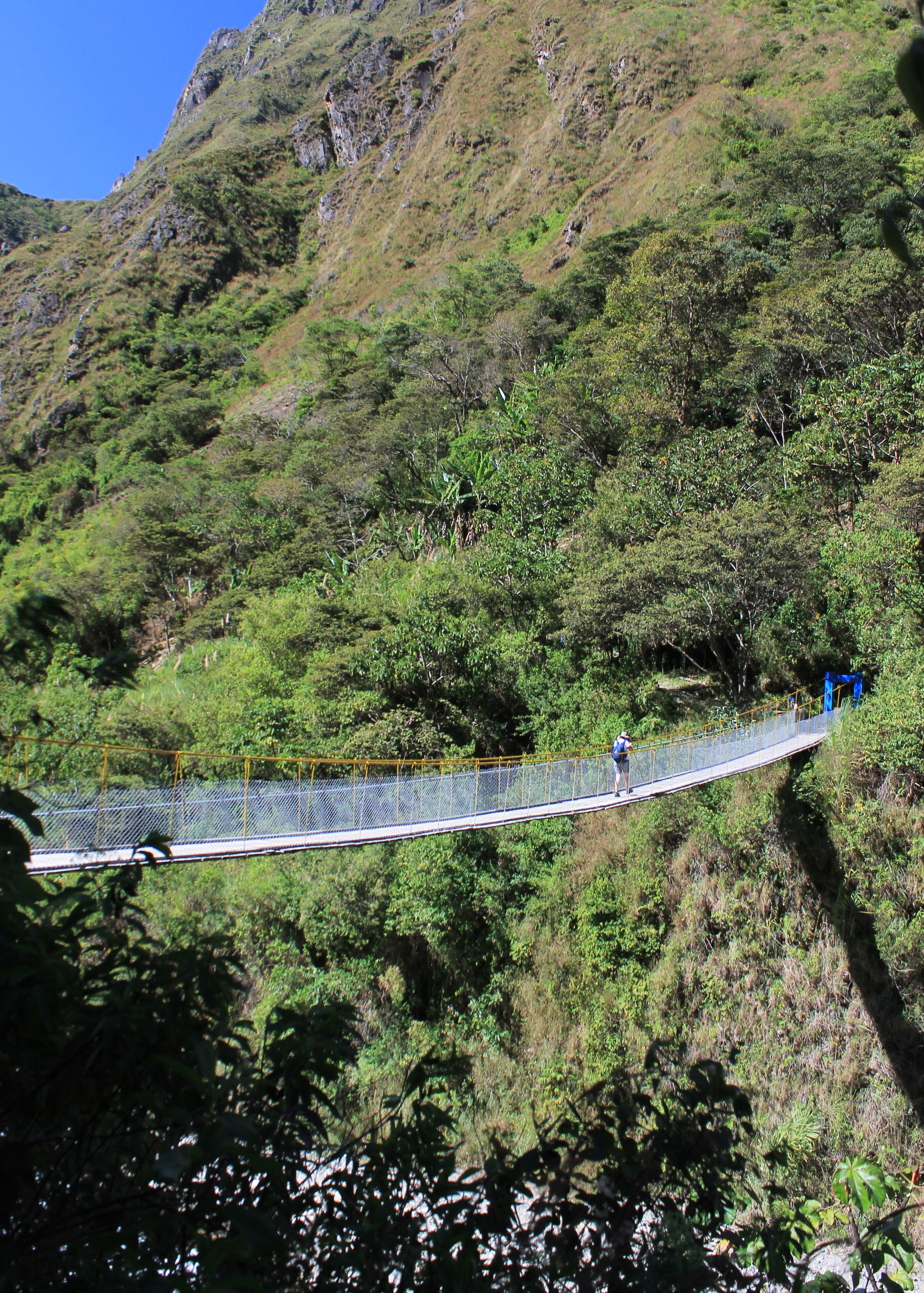
Our view of Machu Picchu was dramatic, across a valley that was so deep and so steep that we couldn't even see the bottom of it. Now to finish the trek we had to hike all the way down to the bottom and cross to the other side of the valley. It would be our last tough section and just about the end of the trek. Over the next two hours it proved to be just as deep and just as steep as it had looked from above. Fortunately most of the way was in the shade. Even more surprising, the trail was mostly dry and not slippery. So it was hard work but not too unpleasant. Most of the way we had impressive views. We also knew that we with each step we were getting closer to the end. Eventually we reached the bottom of the long slope. There was a suspension bridge high over the Urubamba River that we had to cross to reach the other side. It bounced and swayed as we crossed it one at a time. Fortunately we didn't have anyone who was acrophobic and soon we were all across.
 Final stretch to the train station
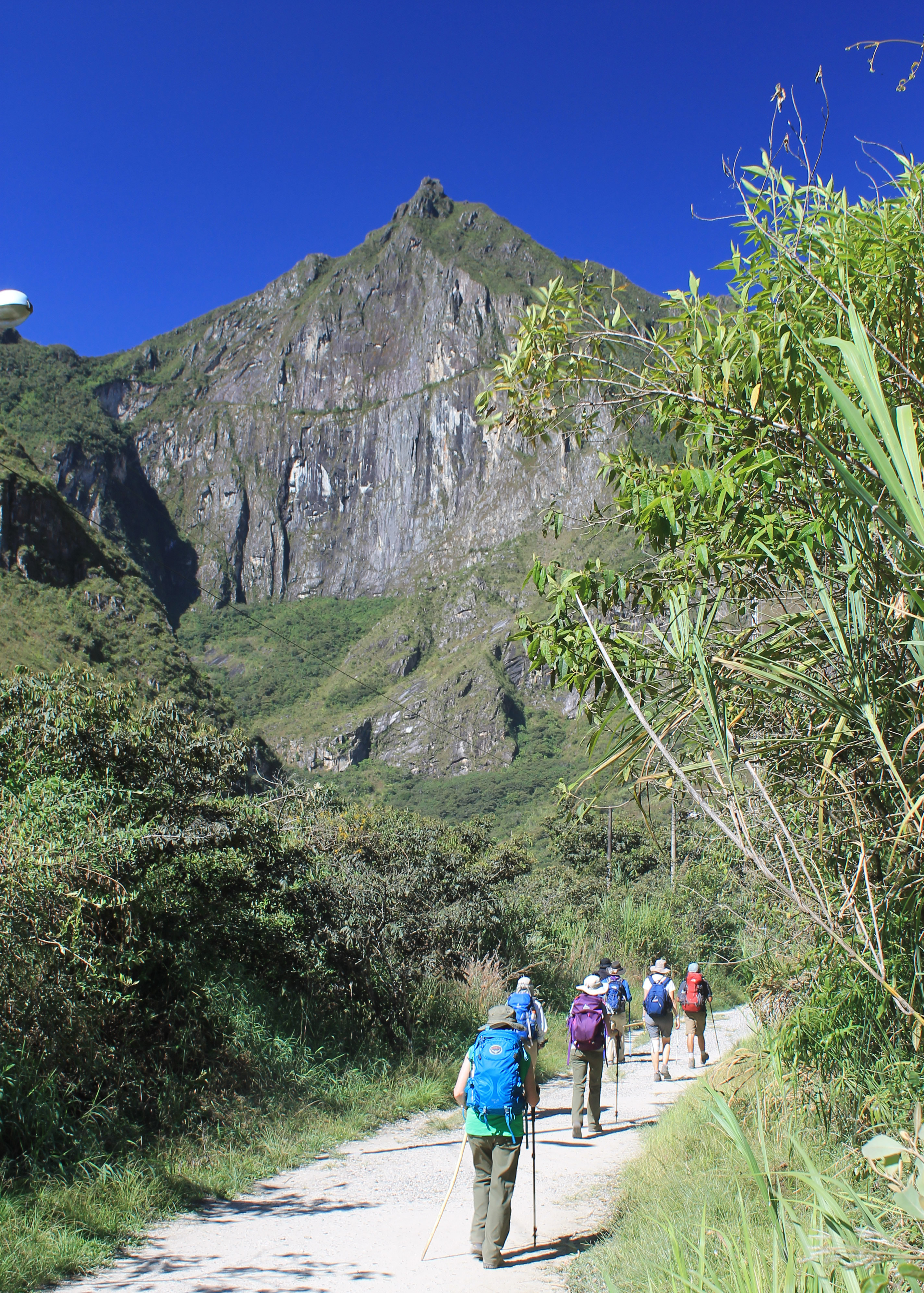
We were on the home stretch. We walked along the river in the sun. We passed right below the artificial waterfall that was spilling down the mountainside. It was part of the hydroelectric project so we knew that we were very close. Then we reached the project itself and had an unpleasant walk along the road, dodging vehicles and choking on their dust. Finally we passed it and were approaching the train station. There was a market place selling souvenirs, food and drinks. There were restaurants and bars and crowds of people. Over all the noise and commotion we heard someone holler out to us. It was Juan, calling from the balcony of a restaurant next to the train tracks. The rest of our group was already there and had saved two tables for us. We climbed up to them and were happy to take our packs off for the last time. We sat down while they poured us a beer. We spent the next hour while we waited for the train trading stories about the last day of hiking and the van trip to the station. Everybody was laughing and having a great time.
We had done the Salkantay Trek.
