Alps1 - Getting Into The Mountains
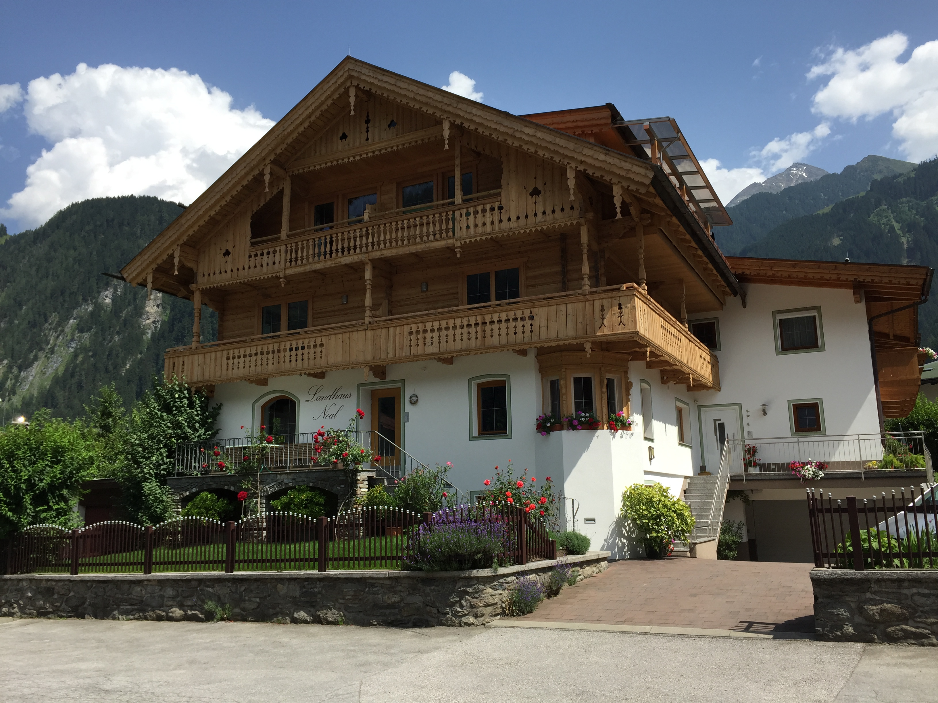 Typical Tyrolean house in Mayrhofen
This past winter, as Sandy and I tried to figure out where to go for our big trip this summer, it didn't take us long to decide to go back to Europe to hike in the Alps. Sandy suggested that we sign up for the CustomWalks hiking trip to the Dolomites. That sounded good to me. I have been to a lot of places in the Alps but somehow had never made it to the Dolomites. One advantage of this trip was that once you signed up and paid your deposit, CustomWalks would run the trip, even if there were only the two of us. There might be a surcharge but the trip would go. That was important for us because we had a lot of trouble with Mountain Travel Sobek last year. We put down a deposit for a South American trip with them which they later cancelled because they didn't get enough people to sign up. Even though they cancelled the trip, we had a very hard time getting our deposit back. They kept trying to get us to accept a credit on another trip. With CustomWalks guarantee that out trip would run, we didn't have to worry about those kind of problems. We had done several trips with CustomWalks before: Tuscan Hilltowns, Cinque Terre, Puglia and Provence, so we knew that they did a good job.
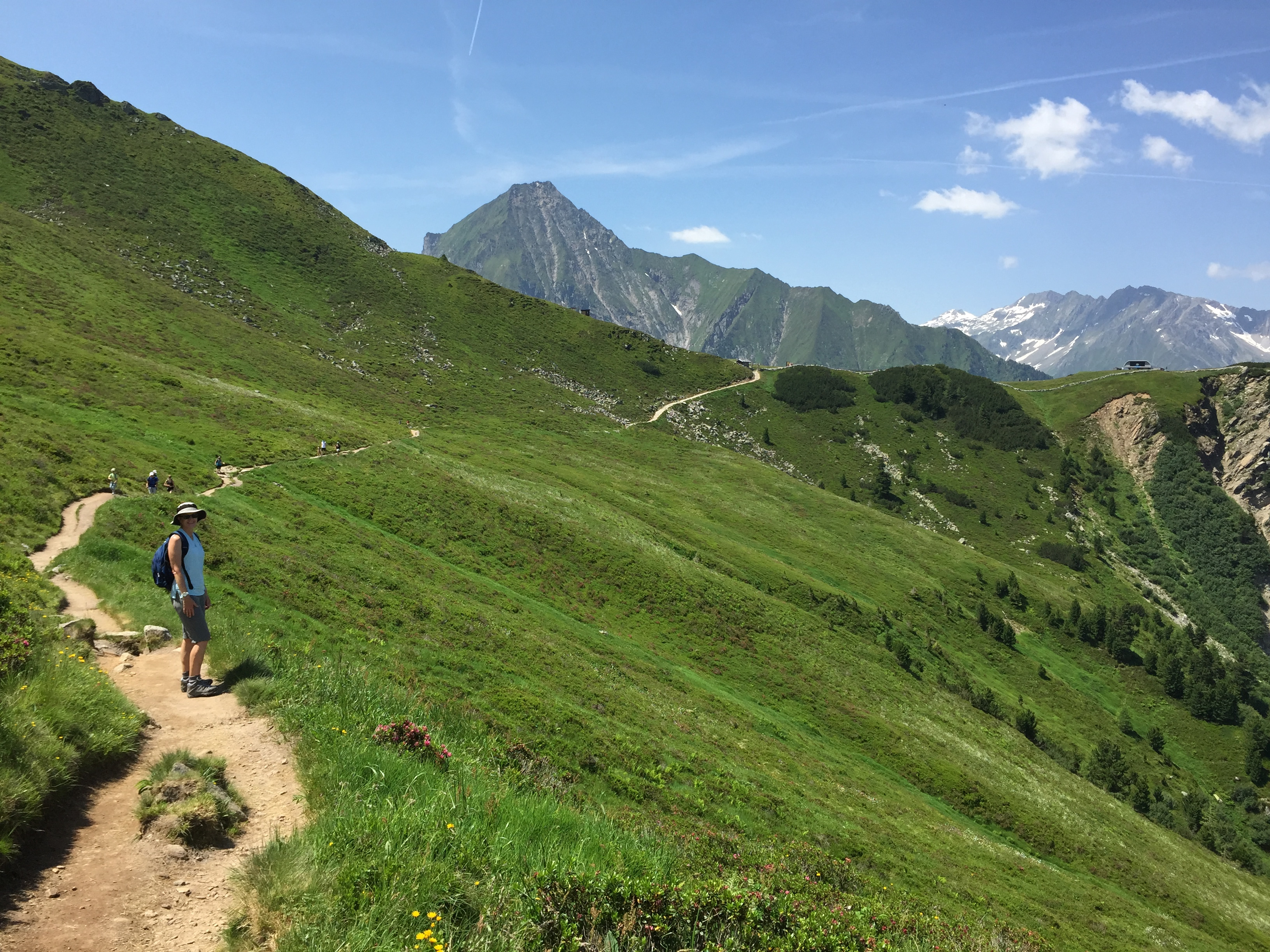
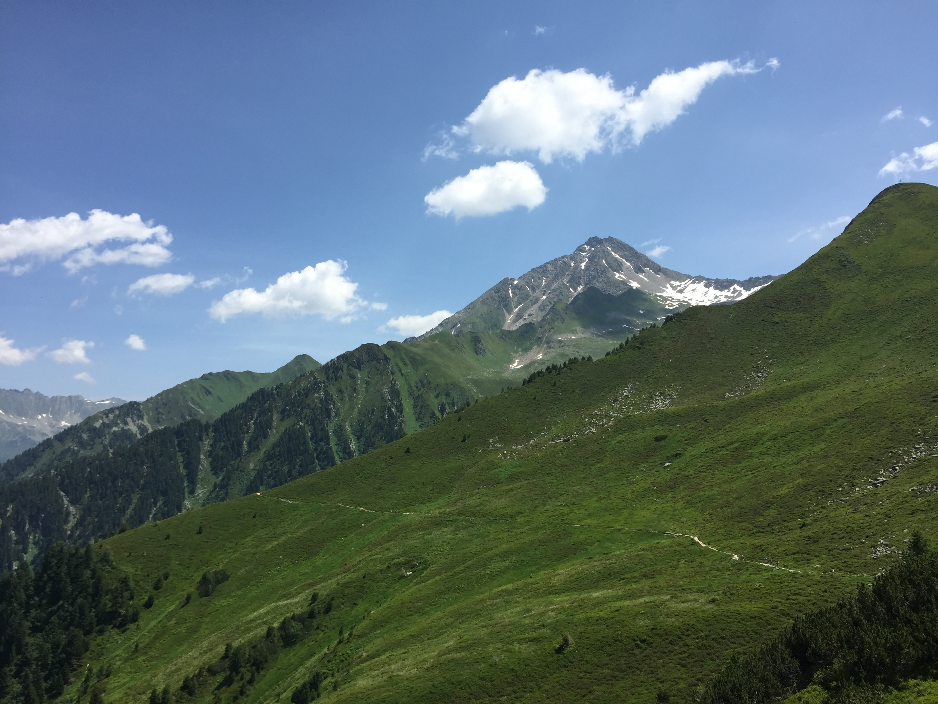 Our trail and the Ahornspitze from the top of the lift
Besides a week of organized hiking in the Dolomites, we decided to add a week of hiking on our own in Austria at the beginning and a few days in Venice at the end. That would be two and a half weeks in Europe. We felt like we had a good trip planned and were excited to go.
Of course we had a six am flight out of Boise to start what would be a long travel day. We had a cab pick us up very early for the ride to the airport. On the way I got bad news. My dad had been ill for several months. I had been to visit him several times and we all knew that he had very little time left. On the ride to the airport I got a call from my sister that he had died in the early hours that morning. Although I knew that it was coming it was still very sad.
It might seem strange to be leaving on a trip under the circumstances, but for me it was the best thing to do. Some people go to church to seek comfort, or want to be with other people. I have always found comfort and solice in the mountains. For me, the best thing was to go to the mountains to think and to deal with my emotions.
 First glimpse of the hut as we turn the corner
For a change United Airlines got everything right and we got to Munich the next day without incident.
I did have concerns about the last leg of the trip. From Munich, we had to drive to Mayrhofen in Austria. We were starting out on the wrong side of the city and I was nervous about going through and/or around it. I had a map but it was not very detailed. And we had been traveling all day and night so we were very tired.
Sure enough, the difficulties started in the Munich airport. It took us a long time to find and walk to the rental car garage. Then we couldn't find the stall with our car. That took a while. Once we were in the car it turned out to be a keyless ignition. It had a pushbutton start - that took us a long time to figure out too. And the car was an "environmentally designed" diesel engine, so if you idled in place for more than ten seconds the engine would turn itself off. THAT proved to be a real nuisance for the next week. The car did have a GPS but I don't always trust them so I wanted to get a detailed map of the area around the airport and the city. As we drove out I asked the attendant if they had maps of the area. He rolled his eyes and gave me one of those "are you for real?" looks. "No maps anymore. Car has GPS." Ok, ok. Cut me some slack. I can't help it if I'm a visitor from a backward counrty.
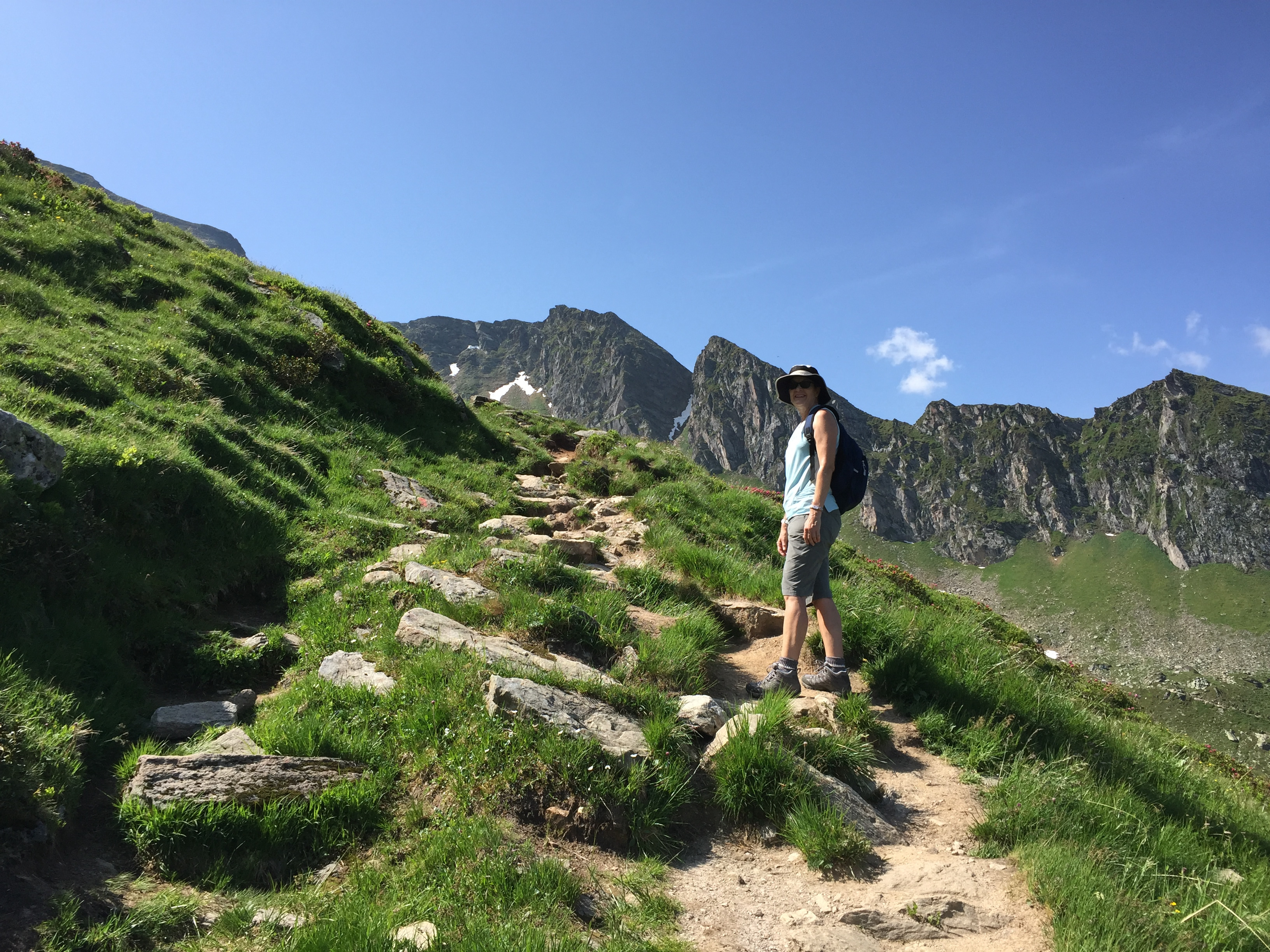 Sandy climbing a steep section of the trail
He asked us where we were going and we told him Austria. He said something about getting a sticker for the toll roads there, and that we had to get it at a petrol station before we crossed the border into Austria. I don't know why we couldn't get a sticker for Austrian toll roads in Austria but the guy made it seem like it was really important. We didn't quite get the details but hoped that we would figure it out when we got close to the border. First we had to get through Munich and on the right autobahn heading to Austria.
It turned out that the route around the city was quite complex, but I have to admit that the GPS performed flawlessly. Sometimes the GPS unit was a little hard to understand because of its accent. We set the language to English but it was like getting directions from Arnold Schwarzenegger talking in a female voice. "Achtung! At the next intersection, you VILL turn right!" After a while though we got used to it and could understand it pretty well.
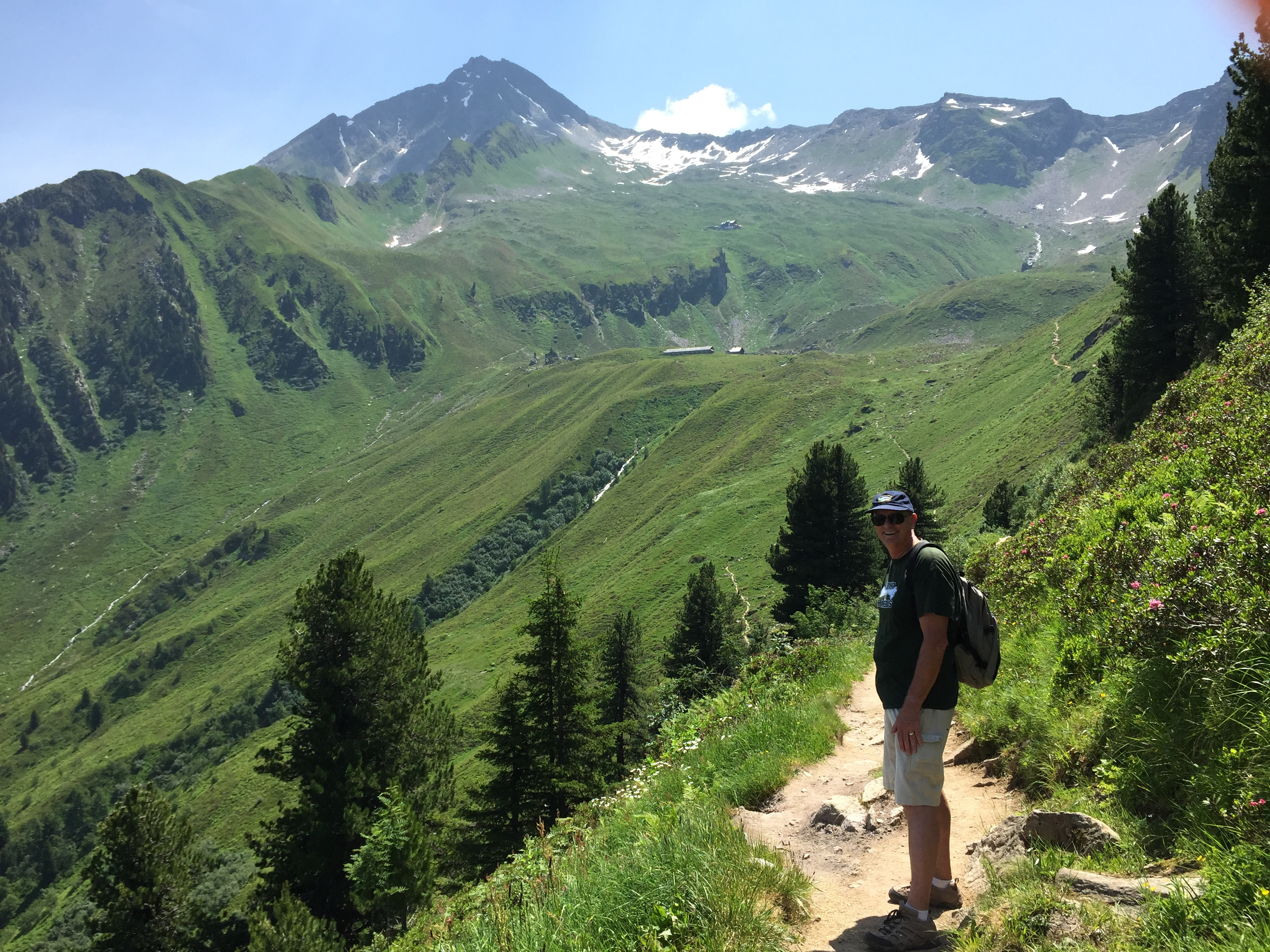
 Making progress but there is still a ways to go to the hut
It was Saturday morning so traffic wasn't bad getting through Munich. Once we were heading for the mountains though the traffic really picked up. The weather across Europe had been very hot so far this summer and that trend was continuing. Everyone seemed to be leaving Munich to go to the mountains for the weekend. It took us longer than we expected but there were no problems. Soon we were getting close to the Austrian border.
We stopped at the "last petrol stop before border" to get gas and to find out about the toll sticker. It was a total zoo. There was a gas station, restaurants and shops. Cars and buses were parked everywhere and the place was packed with people. We went into the mini mart and while Sandy went to the ladies room, I stood in the (long) line for the cashier. I was not looking forward to being the dumb foreign tourist trying to ask about the toll stickers with lots of people around and me not even really knowing what I was talking about. But as I got close to the front of the line I saw a sign for "Austria tolls" right next to the cash register. They listed amounts for various amounts of time. I just stepped up, pointed at the sticker that was good for one week (it was seven euros and change) and handed the lady a ten. By the time Sandy came out of the ladies room I had my sticker and was waving it proudly. "See. I told you this would be easy!" We were ready to roll.
 Official hut dog - obviously in charge of the operation
When we were almost to Mayrhofen the GPS finally failed us. We got off the autobahn to get on the local highway. At the junction it told us to go left. After a while it was clear that was wrong. We went back to the junction several times. Each time we did what we were told. Each time we ended up going the wrong way. So we finally stopped and pulled out the map. It was clear we were supposed to go right. As soon as we did that we were back on track. I guess it was too soon to completely abandon old fashioned ways of navigating.
Since I wasn't totally certain we were going the right direction, I pulled off at the first town to check the map again. There was a gas station and a McDonalds and of course lots of cars and people. When I was convinced that we were on course I went to pull out onto the highway again. But to reach it I had to get around the McDonalds, so I took a driveway that went around the building - right to a car facing the other way. I was going the wrong way through the drive through. So I had to back up on a very narrow, very curvy drive, with people all around looking at me like I was nuts, although none of them were laughing as hard as Sandy. I think I only drove up over the curb two or three times but at least I didn't run anyone over. Eventually I got back on the highway and sped away as fast as I could.
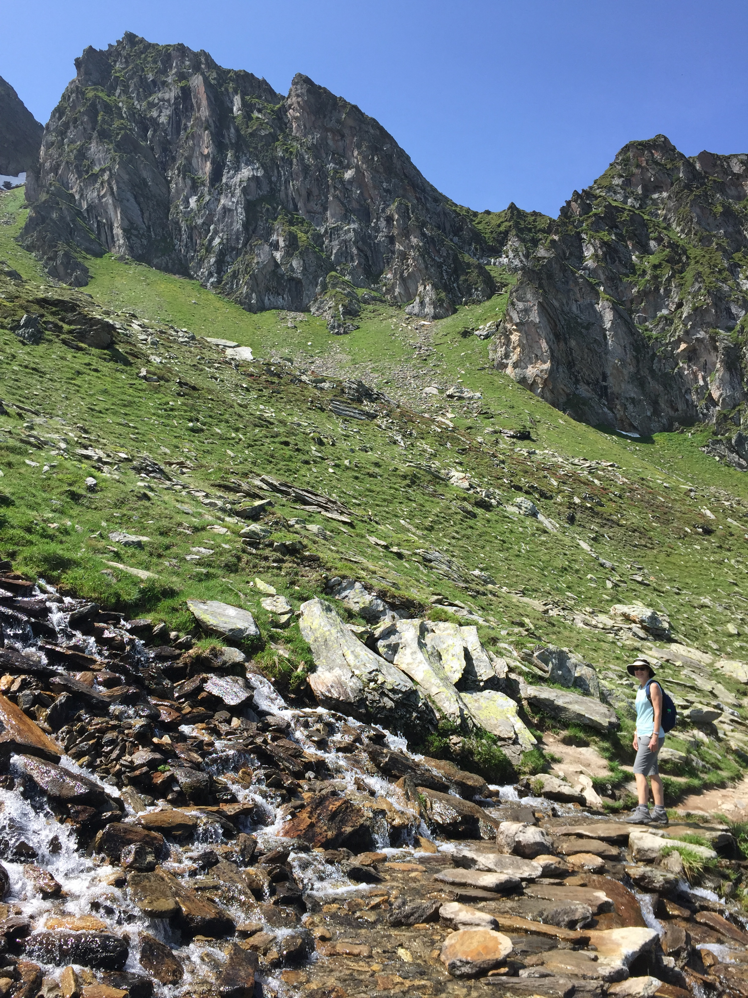 Hiking through a mountain cascade
I have always said that the key to traveling in a foreign country is not worrying about looking stupid. I kept having to remind myself of that on this trip.
We finally got to Mayrhofen in the middle of the afternoon. The GPS directed us to our hotel with no problem. We had expected it to take about two hours from the airport. It actually took us about four hours. But we had made it. We would stay in Mayrhofen for three nights. I was happy to park the car, wait ten seconds for the engine to turn itself off, and then not have to worry about driving anywhere for the next few days.
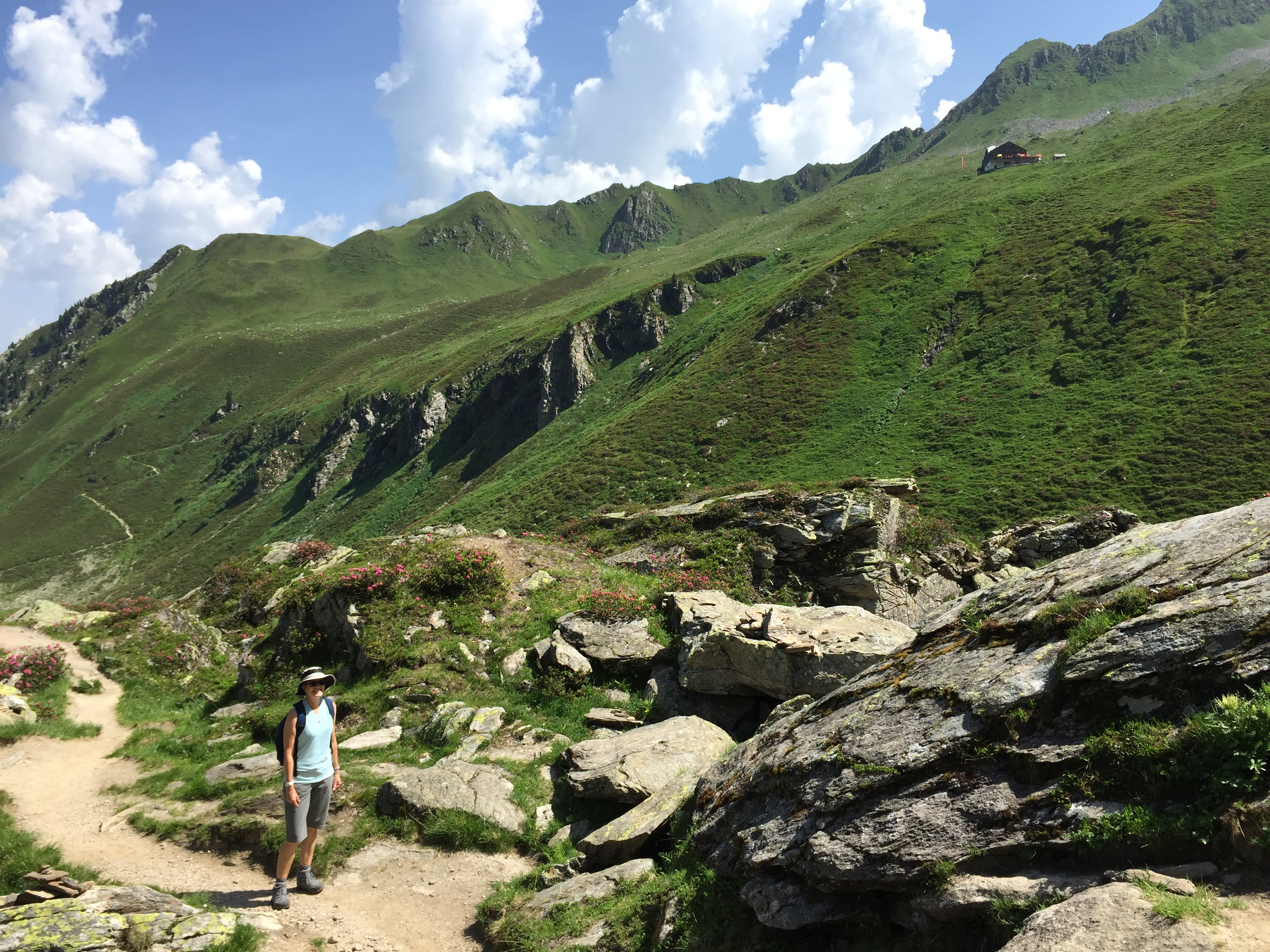
Our hotel was only a short walk from the lower station of the Ahorn Bergbahnen, a cable car that provided easy access to the high country right from the center of town. Since the weather the next day was supposed to be clear but very hot again, we wanted to get an early start so we could hike in the cool of the morning. We were up early and waiting in line to get on the very first cable car when the lift started running. The cable car took us from Mayrhofen at an elevation of 630 meters to a high plateau at 1960 meters on a shoulder of the Filzenkogel, a 2227 meter peak directly above Mayrhofen. From the upper terminus we had a spectacular view of the Zillertal Alps. Around the lift there were a number of attractions for people who just took the lift up but didn't hike, but we didn't hang around long. Our objective was the Edelhutte, which was about 4-5 miles away and 273 meters higher. As soon as we started walking we learned it would be more work than those numbers indicated, as the trail dropped quite a bit before rounding a corner into a high basin. It's the gross elevation gain that counts, not the net gain.
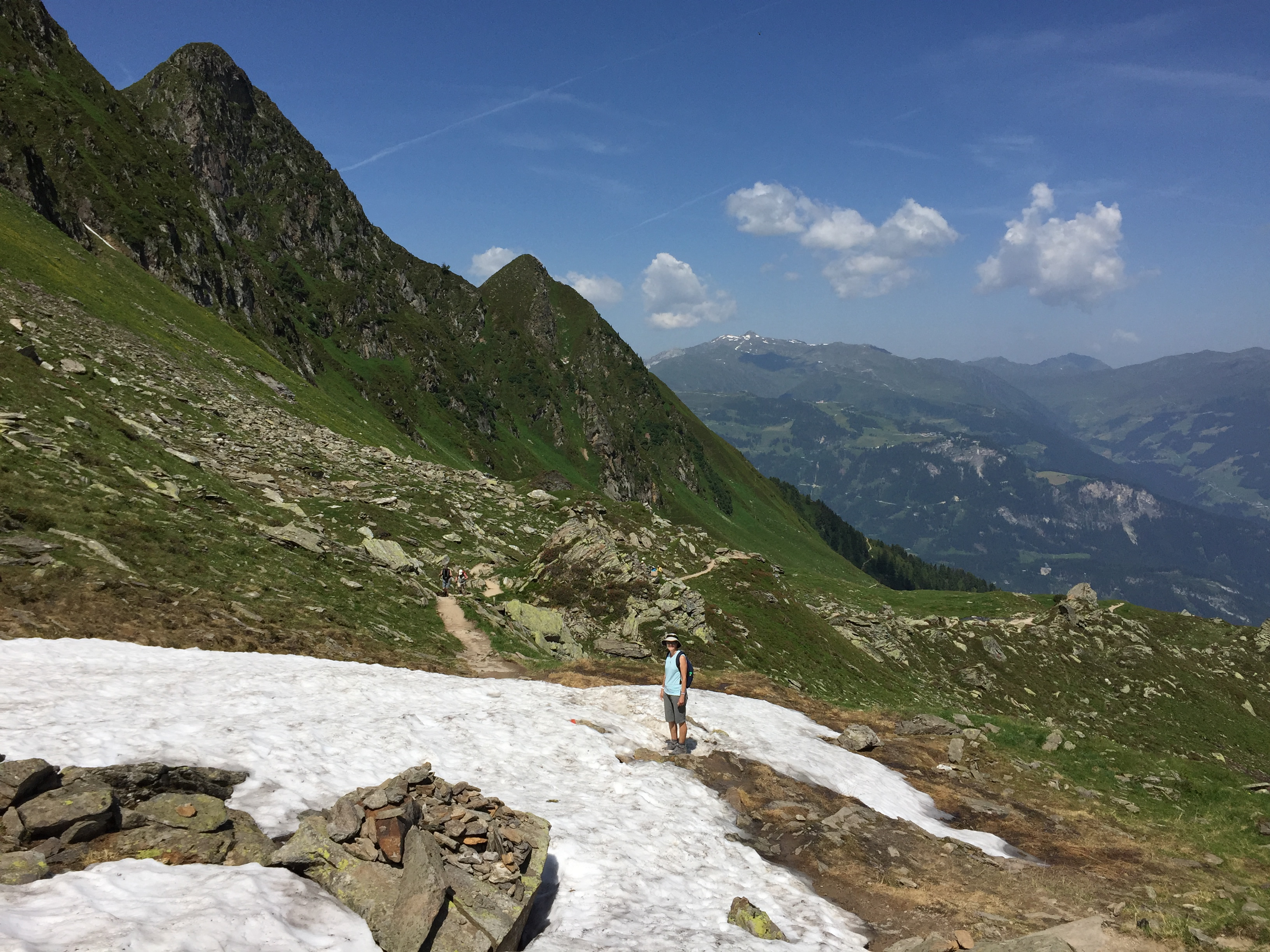 Crossing a snowfield that had survived the heat somehow
When we got around the corner we could see the hut, a long way off and a long way up. Soon the trail split and there was no trail sign to indicate which way to go. It was pretty obvious that both trails went to the hut. One crossed the floor of the high, hanging valley that we were in and went up the other side to the hut. The other continued up the floor of the valley and eventually crossed over and climbed to the hut. Most people were taking the second route but it looked like it might involve more up and down in the section that we couldn't see. To paraphrase the great American Zen philosopher, Yogi Berra, "when you come to a fork in the trail, take it". We opted for the trail that we could see, even though it did appear to be less used.
The trail passed a small farm building, which was closed up. A trail dropped about 500 vertical feet to a rough dirt road that looked like it went all the way to Mayrhofen. And I complain that it's tough hauling our groceries into the kitchen from our garage. It would be a tough, isolated life in a place like that. And although it is nice in the summer, the winters are undoubtedly long and harsh.
 Climbing the last stretch to the cable car station
Soon we reached the uphill stretch - and it was steep. Not just steep, but Really Steep. We took it very slowly but it wasn't long before we were both sweating profusely. This was definitely a good hike to get us warmed up. Now we could see the entire other section of trail. It climbed steadily, and much more gradually, to the hut. No wonder everyone had taken the other way. Although now that we looked, some people had followed us on the steeper route. We decided to get going before they could catch up to us. We didn't want to hear their opinions of our routefinding.
At least we knew now which way we were going to go down.
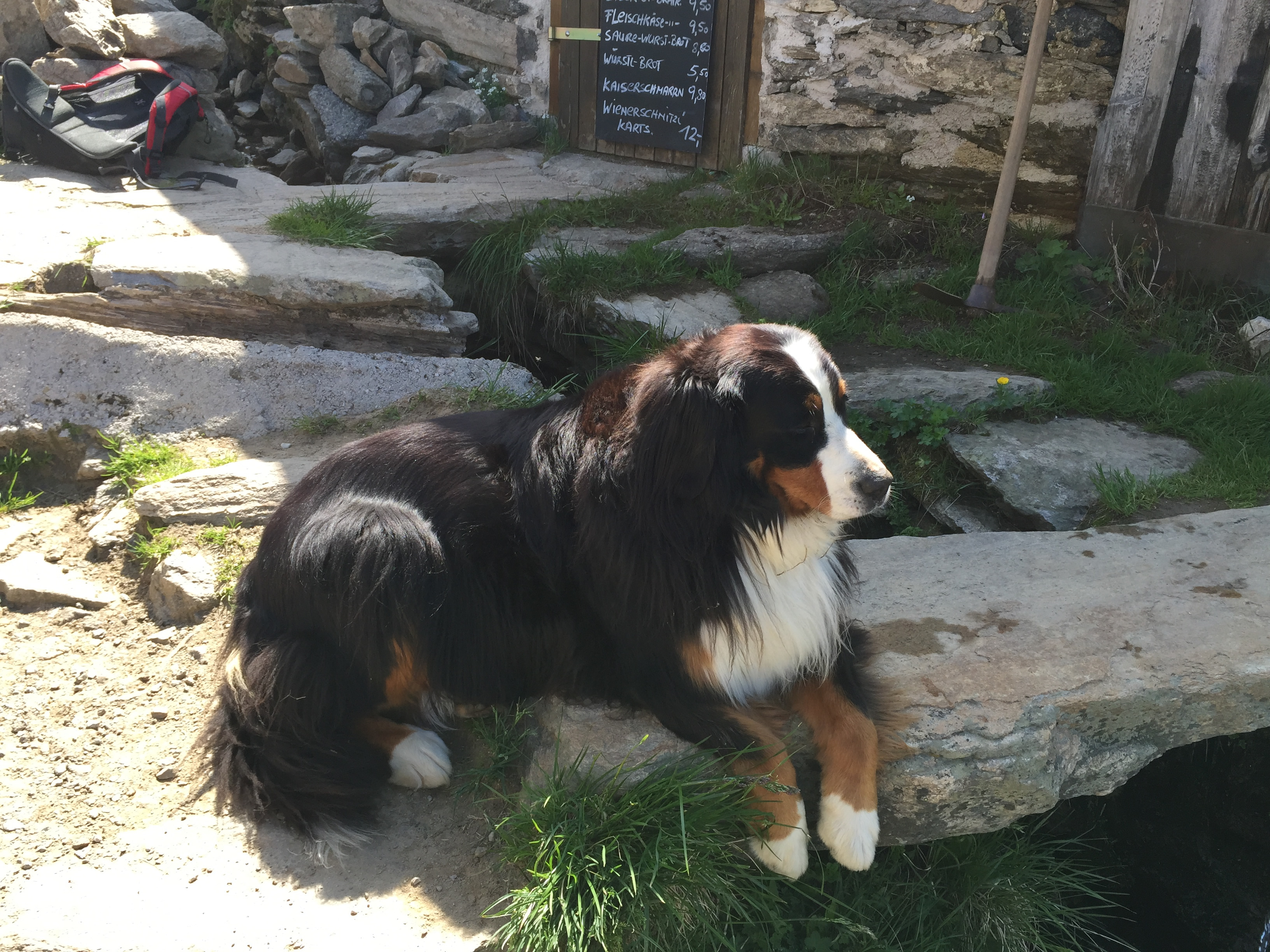
After a long, hard climb we finally reached the hut. Waiting for us was the official hut dog, some kind of mix of collie or sheltie and who knows what else. It definitely had a long coat and looked like it would do quite well during cold winters at the hut. He was just sitting in the sun, taking it easy, looking very regal and scoping out all the hikers who were coming up the trail to visit his hut.
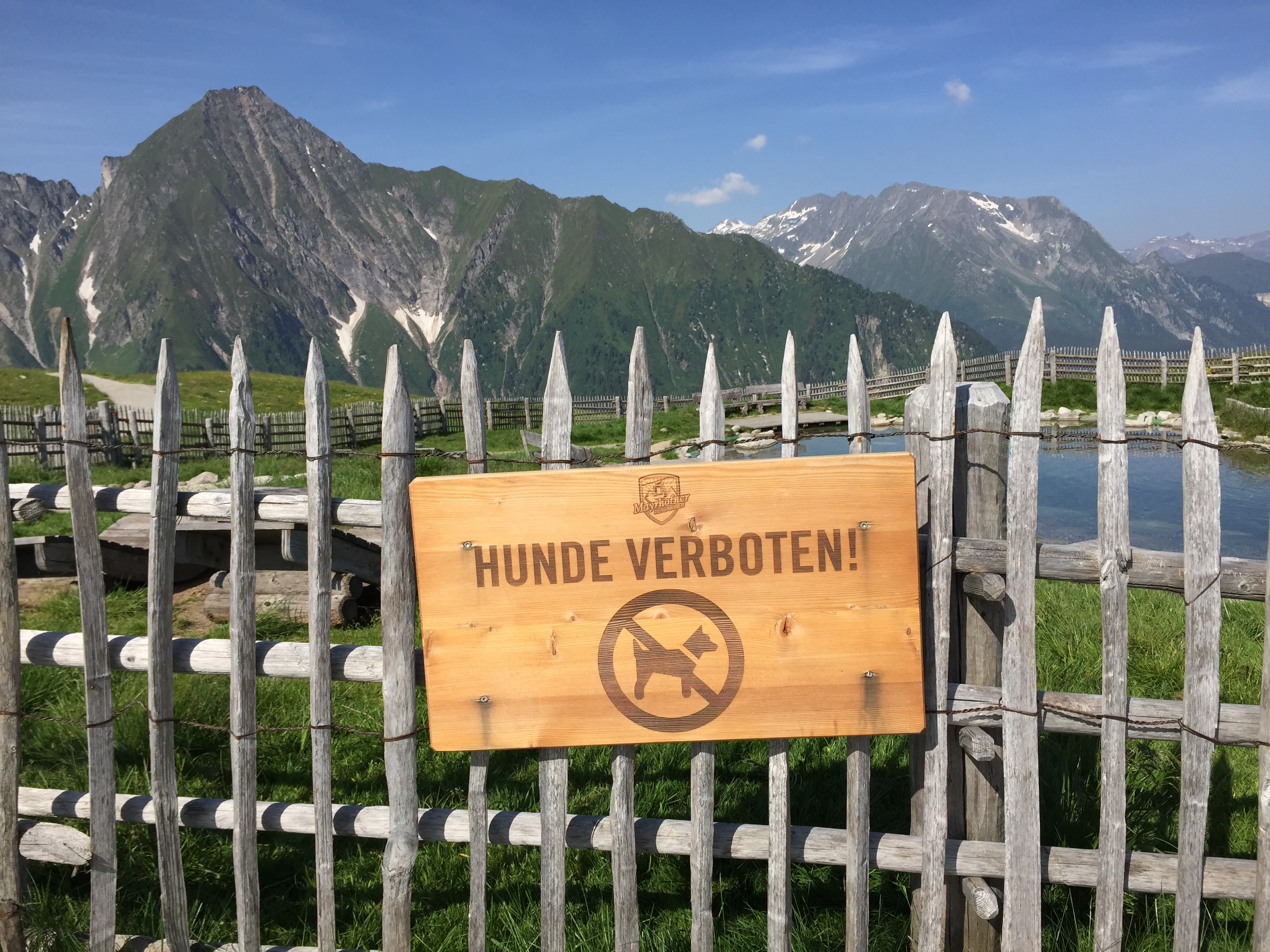 Sorry Abby - no dogs allowed
It was only about 10 am and still too early for lunch, so I went into the hut and bought cold drinks for us. We found a bench on the patio that was in the shade where there was a cool breeze and we had a beautiful view looking down the way we had come. There were crowds of hikers following us - very few people had gotten an early start. We were feeling very smug and superior to all of them since we had already finished the climb and were enjoying our cold drinks while they were still working hard to get up the steep hillside.
Beyond the Edelhutte the trail continued to the Kasselerhutte, a long and difficult route that was supposed to take about ten hours. From there hikers continue on, often for as long as a week, on the Berlin Trail, one of the famous hut-to-hut routes of the Zillertal Alps, comparable to the Tour de Mont Blanc or Haute Route. There was also a trail that led to a scramble route up the Ahornspitze, the beautiful peak at the head of the valley behind the hut. I might have been tempted to give it a try, but it still looked like there was a long way to go and a lot of climbing to do past the hut. It would be a lot to take on for the first hike of our trip. So after we finished our drinks we grabbed our packs and headed back to the lift terminal.
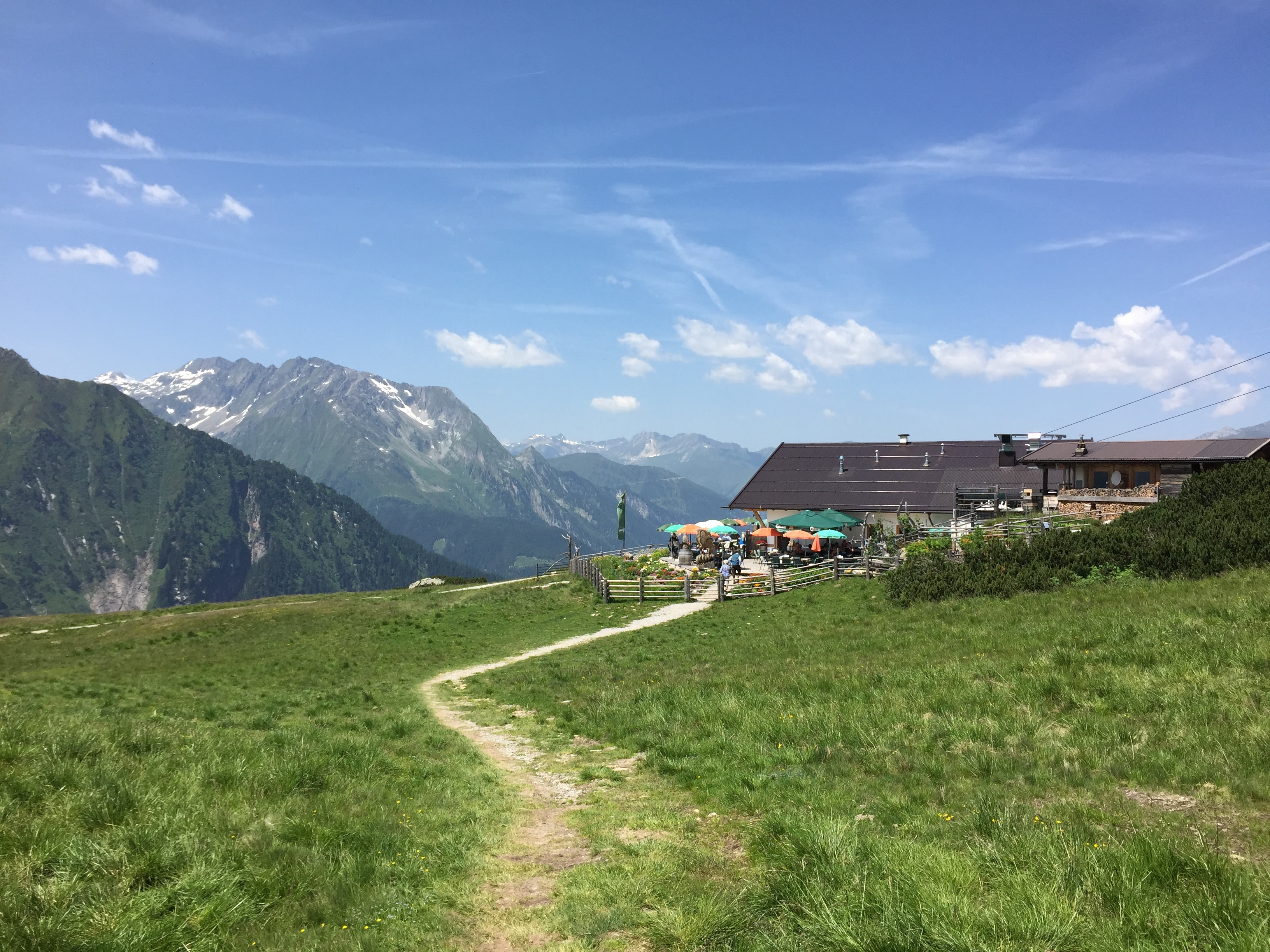 After our hike we had lunch with a view
Going down the less steep trail was longer but much more pleasant hiking. We took our time and were back by about noon. Since we knew it would be hot in the valley, we decided to have lunch up here, rather than heading back down to town right away. There was a nice breeze and we could look at the mountains while we relaxed and ate our lunch.
There was a restaurant right next to the cable car station. It was very crowded since it was lunch time now and a lot of people had ridden up on the lift. Fortunately we were able to find a place to sit. I had noodle soup and a Diet Coke, with spectacular mountain views on the side. It was delicious after our morning hike. With so many people the service was really slow but we didn't mind. It was a wonderful place to be so we were in no hurry.
Then it was time to ride back down to the valley. It had been a good hike on a beautiful day. After the bad news that I had received as we left Boise, it seemed more important than ever to live as intensely as possible and not to waste a single day. We each only get a precious few.
