Alps3 - Drive By Hiking
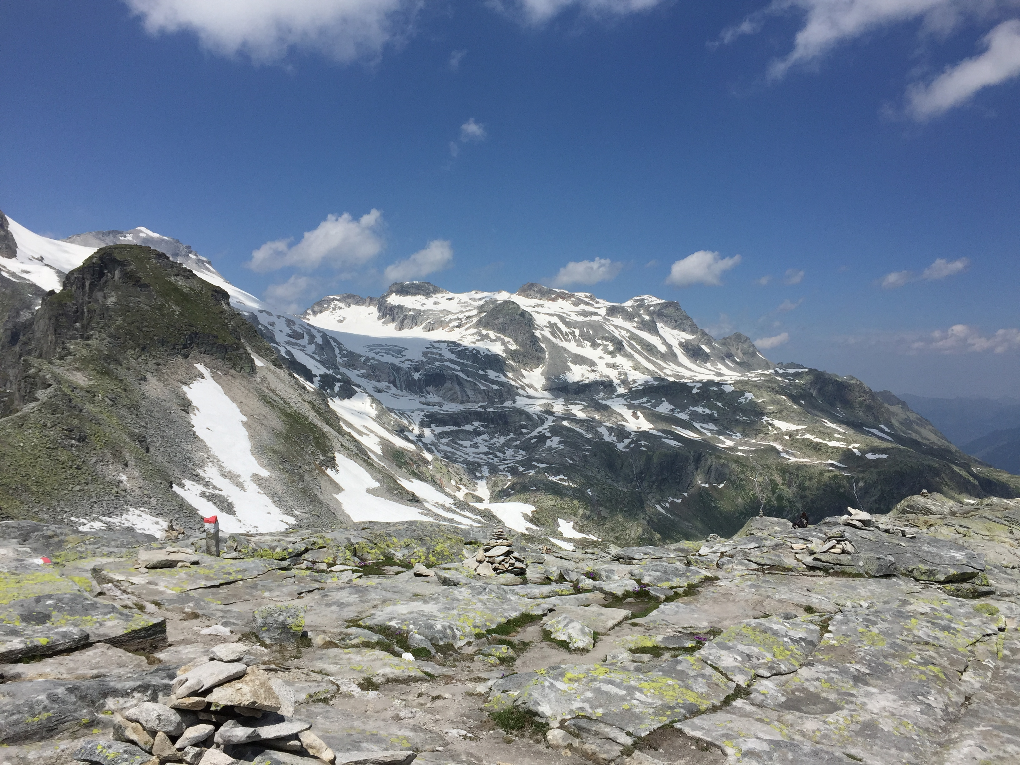
 View of high peaks from our high point above the chairlift
We had spent several nights in the Austrian resort village of Mayrhofen and had done two good hikes. Now it was time to move on to our next base, the town of Lienz in South Tyrol. Google claimed that it would take two hours and fifteen minutes for the drive. Our experience so far on the trip was that the Google time estimates were very optimistic. Since the weather forecast was good we didn't want to completely miss out on a day of hiking. I spent a lot of time the evening before we left doing research to try to find a good hike for us to do along the way. There were several candidates but they were all up side valleys that had long approach roads. It wasn't clear exactly how much time we would have for hiking. For the one I picked, we would take a cable car to a high lake. It is mainly a tourist attraction for nonhikers, a way for them to get very high in the mountains without doing any work. But there were some hikes from the cable car station, some short, some medium, even a longer climb to the summit of a peak, so depending on our timing we would have several options. It seemed like a good choice for our travel day.
 Summit of Madelz Kogel - so near and yet so far
I have to admit that after my experiences on the day that we arrived I wasn't excited about driving long distance again. This time though the route was mostly mountain roads rather than the autobahn on a summer weekend. The drive turned out to be easy and I was even beginning to trust the GPS with its Lady Terminator voice for directions.
At about the half way point of the trip, at the town of Mittersill, instead of taking the turn to Lienz we continued an extra seven kilometers along the highway and then turned onto a spur road that climbed high up into a side valley. Now the drive became more of an adventure. There were lots of sharp curves and switchbacks and several long stretches of one lane road which required driving very slowly and carefully. Fortunately there wasn't much traffic. At the end of the road we reached Enzigerboden at 1482 meters, which was just the name for the lower station for the cable car that we would ride up to the high country.
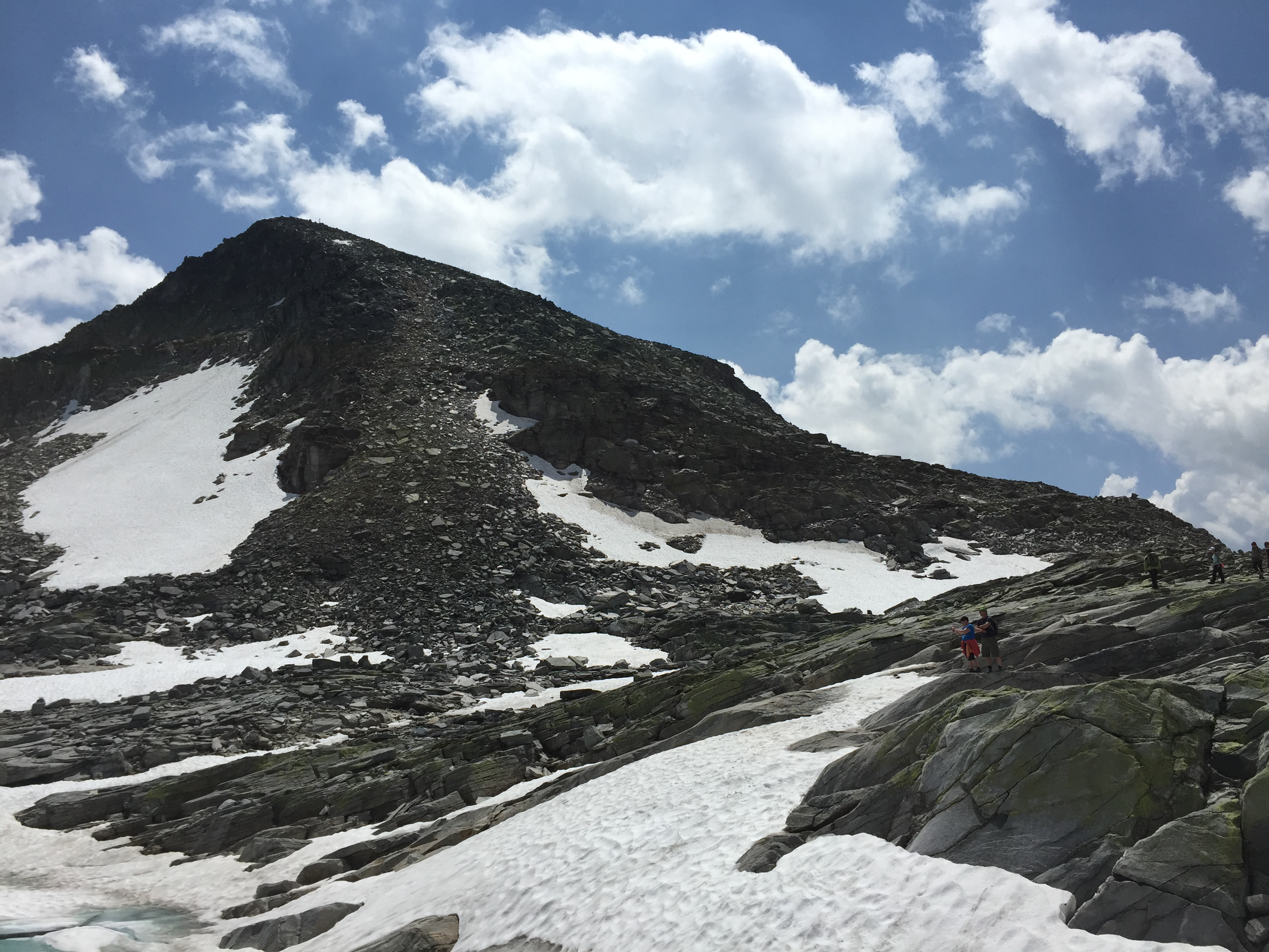
 There was lots of snow left this high up
Although my guidebook highly recommended walking up to WeissSee (White Lake), a reservoir very high up in the mountains, we opted to ride. It was an 800 meter climb up to the lake and it was already noon. We had more money than we had time. Or energy and ambition for that matter but we won't say any more about that.
We rode up in two stages, with a middle station at 1742 meters. Even riding the cable car it took us a half hour to reach the top station and the Rudolphshutte, a large mountain hotel at 2315 meters. Nope, hiking wouldn't have worked.
The hotel had a view overlooking the WeissSee. At 2250 meters above sea level it was quite high for a large mountain lake. It was less than 200 feet below, and an easy walk from the hotel. Like our previous hike, it turned out to be an artificial reservoir, and just like our last hike, it had an ugly low-water ring around it. It was too bad as the mountains around it were spectacular and otherwise the view would have been awesome. But the ugly bathtub ring spoiled the view for me again.
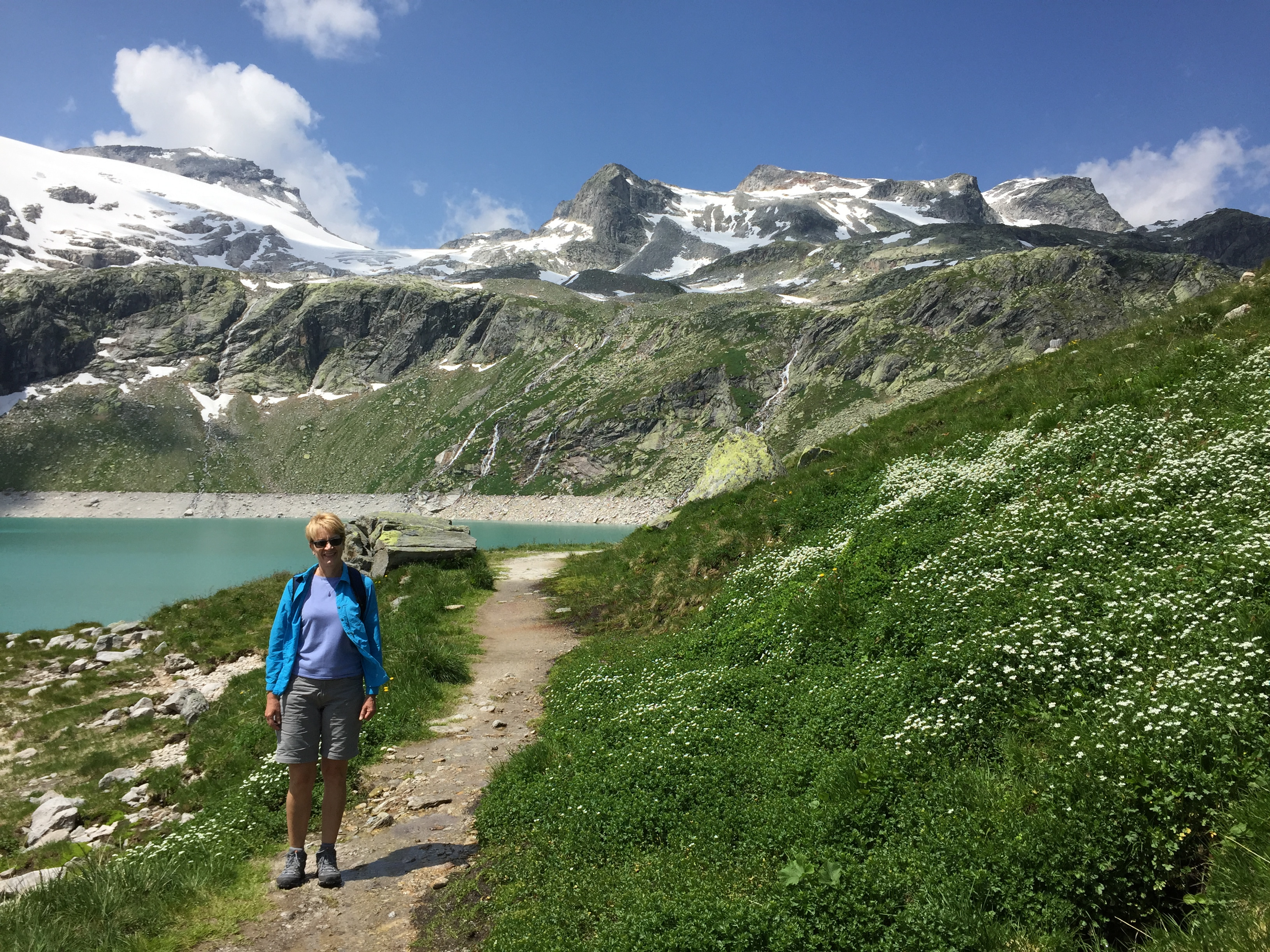 It's warmer and greener back down at the lake
The whole area is a ski resort in the winter. In the summer the lake and its surrounding high basin is marketed as Gletcher Welt (Glacier World), a chance for tourists to get up into the high mountain glacier terrain without any effort, other than getting out their wallet. And lots of them did ride up, walk down to the lake, take pictures, eat at the hotel, and then ride back down. There were a lot of people there. To me it felt more like being in an amusement park then being in a remote, big mountain wilderness.
There was a longer hike that went all the way around the lake. Because of cliffs and rock bands it had to climb up quite high on the other side of the lake to get all of the way around. The guidebook said that it took four hours and that parts of it were difficult and protected by cables. It sounded like it would have been a challenging hike. We were tempted but after we thought about it we picked another option.
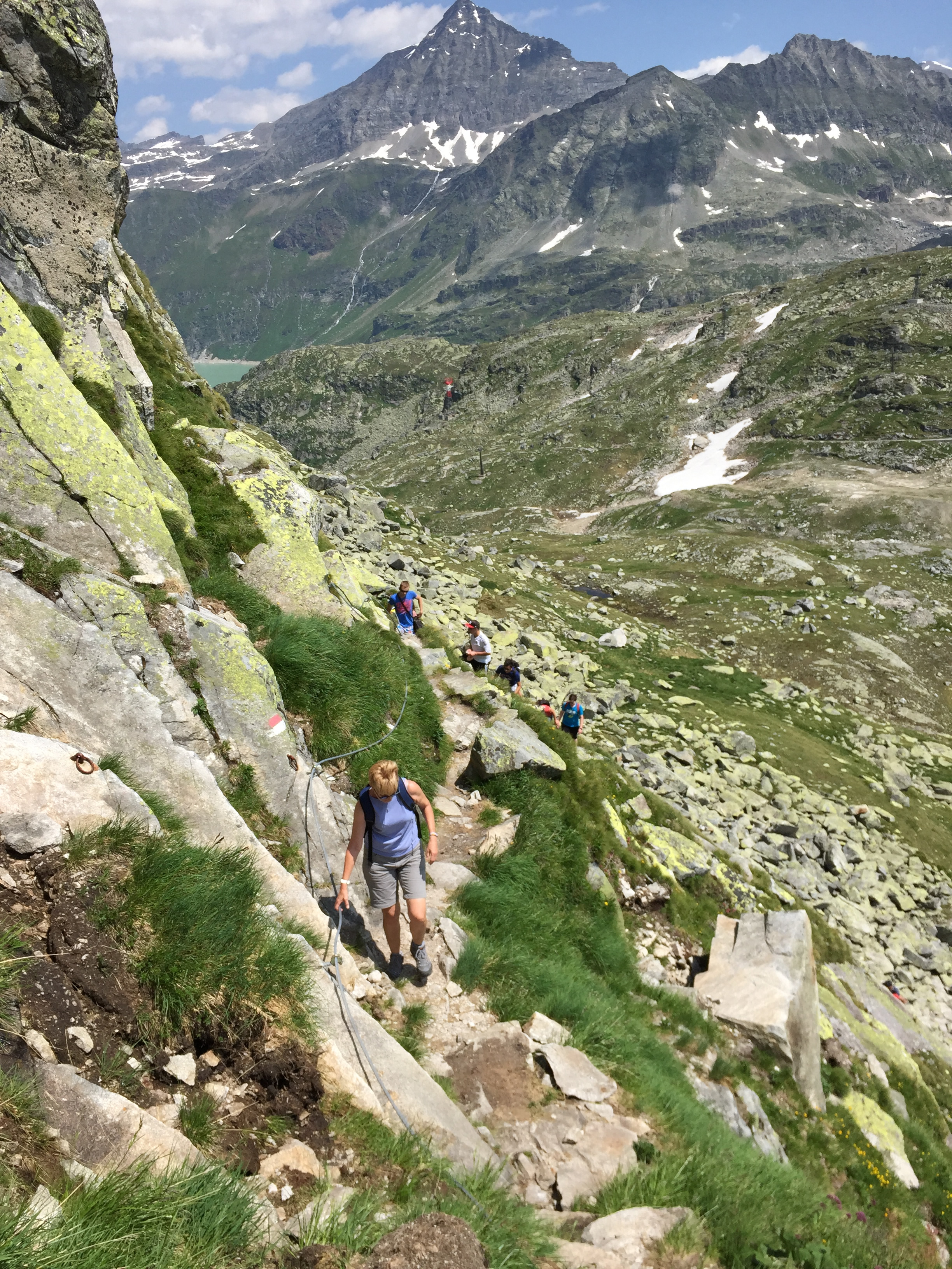 Sandy on an exposed section of the trail
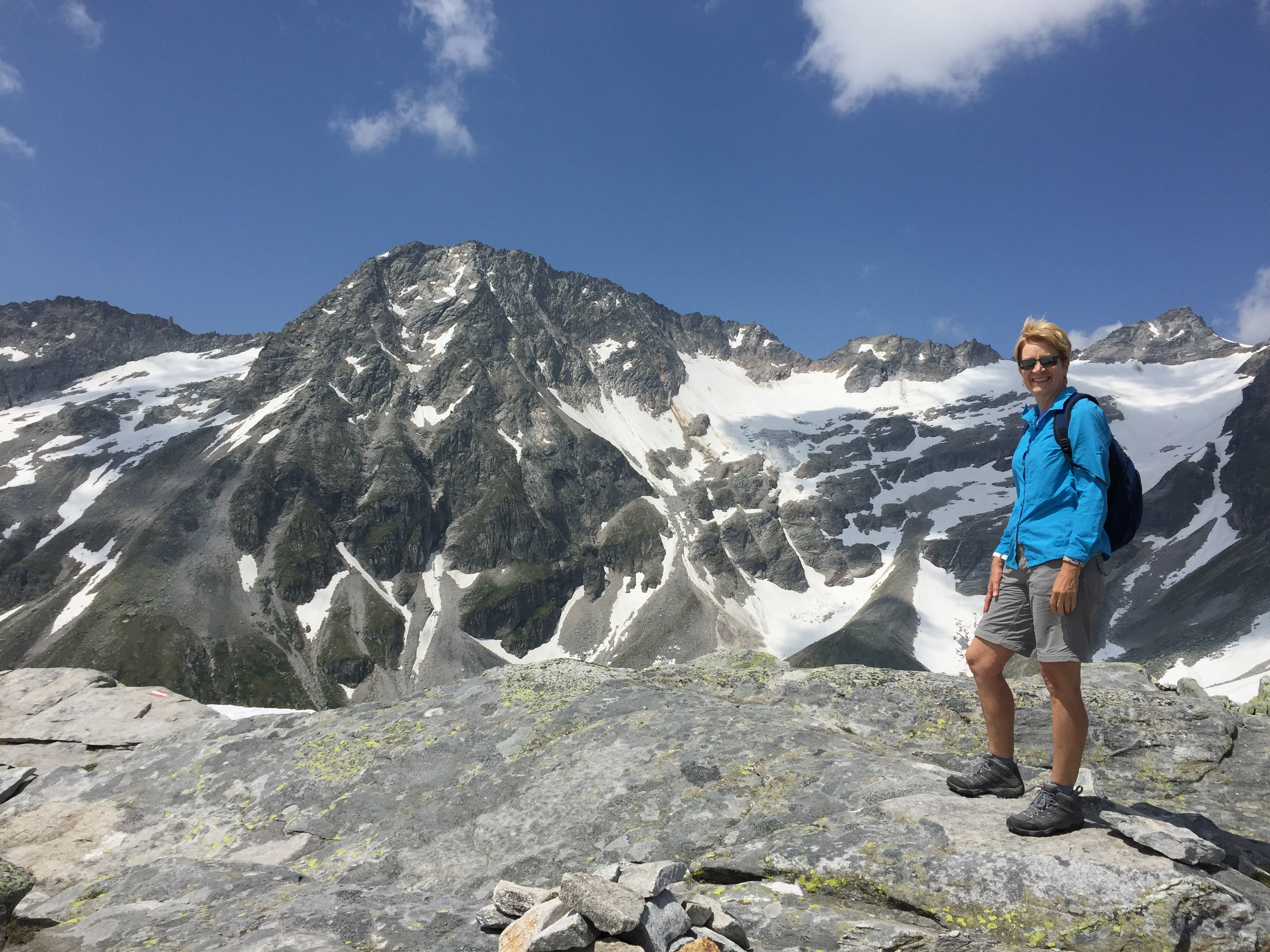
In the winter there are multiple chair lifts that operate all around the lake basin and one of them still runs in the summer. It goes up to the base of the summit pyramid of the Medelz Kopf, a mountain on the crest of the range behind the WeissSee. It's 2760 meters high, not big compared to nearby giants like the GrossGlockner, which is almost 3800 meters high. But it is on the crest and looked like it would command an incredible view. The chairlift literally turned the mountain into a mole hill, since the summit was less than a thousand feet from the upper endpoint of the lift. We decided to take the chairlift up as high as we could go. Of course I was hoping that we would have time to go up to the summit of the peak. Yes, I'll admit it. I'm a shameless peakbagger.
We were the only ones getting on the chairlift so we didn't have anyone else to watch. We're also not skiers so we don't have experience from riding chairlifts at ski resorts. So we made the noob mistake of getting on but not pulling the safety bar down. As we started to ride up the operator began yelling and waving his arms at us. I didn't know what the heck he wanted but Sandy got the message and pulled the bar down. I had been thinking that it seemed rather precarious riding way up there on such a tiny seat!
As soon as we were on the chairlift we were exposed to a strong, cold wind. We were just wearing tshirts. We didn't bring a lot of warm clothes because the past few days we had been quite warm on our hikes even high up in the mountains. But we were higher than we had been and we were facing right into the wind. On the long, slow ride up we both pretty much decided that we weren't going to try for the peak. The correctness of this decision was confirmed when we reached the top of the lift. Even though we put on our long sleeve shirts it was still a bit chilly. But the clincher was that there were quite a few snowbanks left this high up, and we didn't have ice axes. The route went around the ridge of the peak and we couldn't see how much snow there would be.
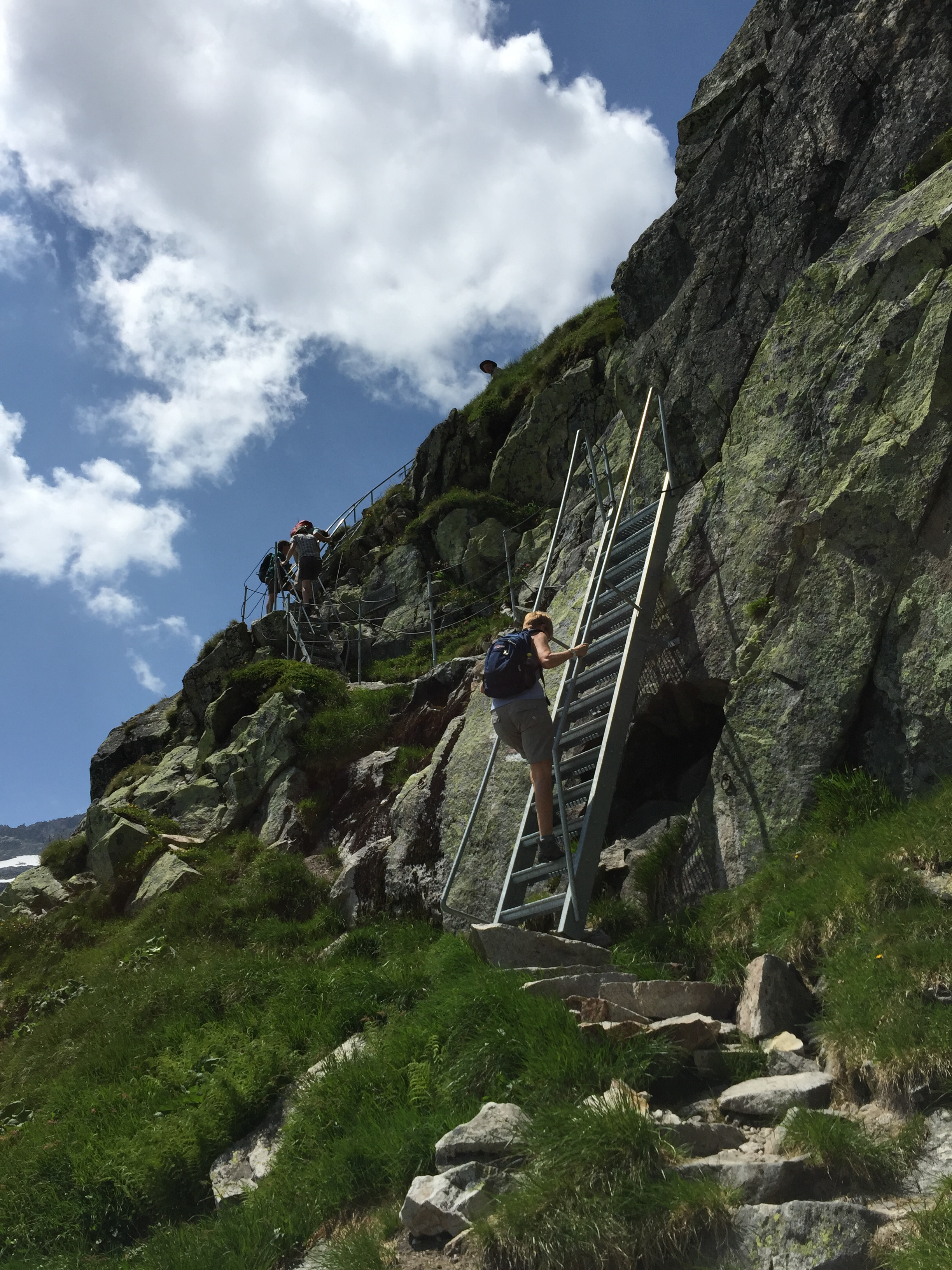 Climbing metal ladders up the cliff
We also had to worry about time. We had to get up and back, then down the chairlift, then ride down on the cable car, which closed at 5 pm. Since the guidebook listed it as a two hour round trip, time would have been tight. We didn't want to spend the night marooned high on the mountain. So we settled for a short walk to a nearby viewpoint. Even getting there was tough work crossing over several snowfields. The right thing to do was to go back down and do a walk around the lake. Still, it was tough to turn back when the summit of the mountain was so close.
"But look! It's right there!" my brain kept saying when I looked at how close the summit was.
Back down at the lake we were out of the wind, and in the sun it was much warmer. We started the trail around the lake in a counterclockwise direction. We crossed the dam at the outlet and began to climb steeply up through breaks in the cliffs on the other side of the lake. Soon the trail had some exposure as the slope on our left fell away steeply to the lake far below. Then it became rougher, as it crossed fields of boulders. At some points there were cables for secruity when the exposure increased, and toward the top of the cliffs there were some large metal stairway/ladders to get through rock bands that would otherwise have required technical climbing. We went to the top of the ladders and decided it was far enough.
It had taken us about an hour and was a good hike. We were above the lake and the hotel and had a great view. We weren't sure how long the full circuit of the lake would take and we were conscious of time. So after enjoying the view and taking pictures and eating some candy bars we headed back down again.
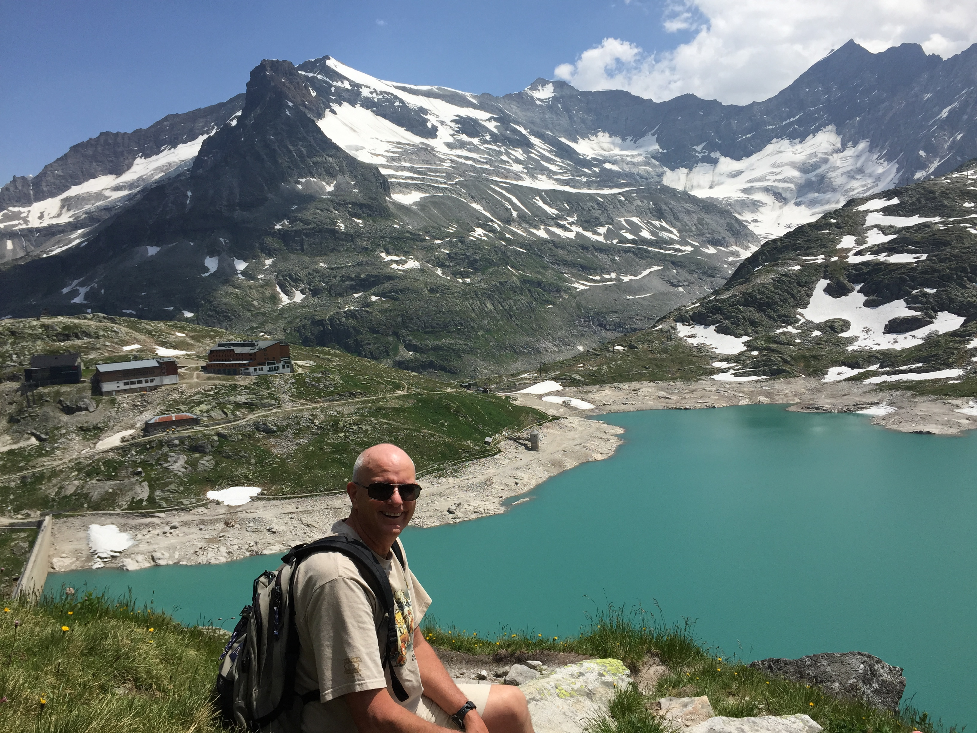 Sunshine and mountain views - I'm happy
When we got back to the berghotel, we thought about lunch. But it was crowded, the menu was limited and the prices were high. We decided to ride down and eat at the restaurant that we had seen next to the parking lot. But when we got down, it turned out that we were wrong. It was a lodge and only guests who were staying there could get food. We had no choice but to head for Lienz. The candy bars we had eaten on the hike would have to last us till we got there. The drive only took about two hours but it seemed longer than that.
When we finally reached Lienz we were already thinking about what we were going to order for dinner as soon as we got checked into our hotel and could find a restaurant. Unfortunately the GPS wouldn't accept the address of our hotel. Great time for a navigation problem. We finally just put in the name of the street. We figured that we could cruise up and down till we found the hotel. Sure enough, that worked. It turned out that our hotel was actually just outside the city limits of Lienz and was in the next village instead. So the GPS didn't accept it as a valid Lienz address. But we finally found the hotel, got checked in, and as quickly as we could we were headed for the city center to find a place to have dinner. The first restaurant we came to was Leonardo's. Highly rated on Trip Advisor and it served pizza. Worked for us.
