Thousand Island Lake
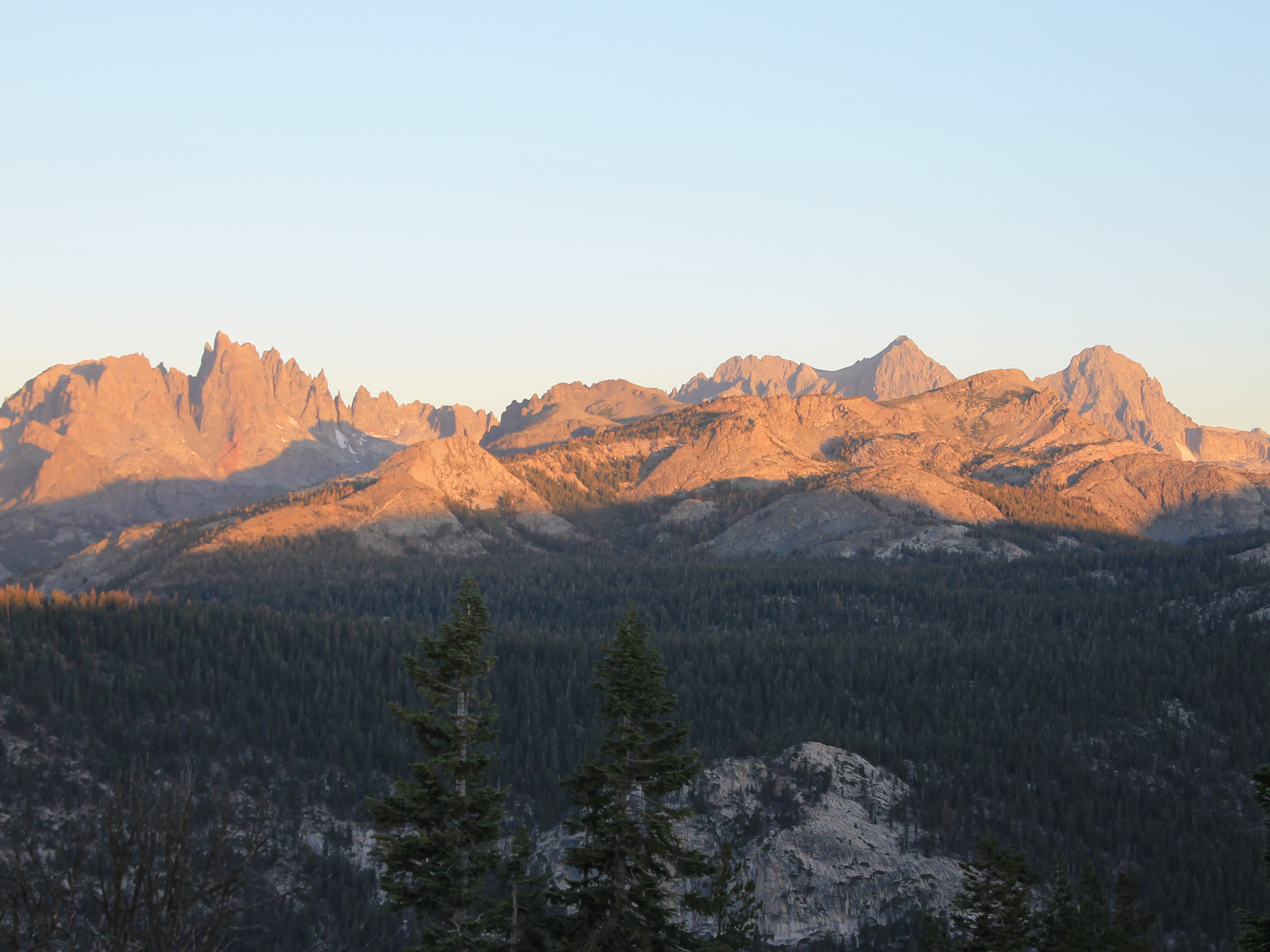 Sunrise on the Minarets - that's where I'm going hiking
My first hike to Cathedral Lakes in Yosemite National Park had been moderate. It was a good start to the trip but now I was ready for more of a workout. I wanted to do a hike that let me get good views of the Minarets. This is a group of mountains in the Sierra Nevada south of Yosemite National Park that is quite famous, both for scenery and for mountaineering. It was one of John Muir's favorite mountain areas - a high recommendation indeed. I had seen many pictures of these mountains and had read about them for years. Now I wanted to see them first hand.
A major reason that I had chosen Mammoth Lakes as a base for this trip is that it is close to the Minarets and provides the best access to trailheads on their east side. Of course it isn't straightforward though. The road from Mammoth Lakes that led to the trailhead continues on to Devil's Postpile National Monument. The road is narrow and winding and has very limited parking. Because so many people visit Devil's Postpile, private cars are (mostly) banned from the access road. You have to take a shuttle. Just as in Zion National Park, where I am only too familiar with the shuttle system, I know that it is the best solution for handling the crowds of people. It's still a nuisance though.
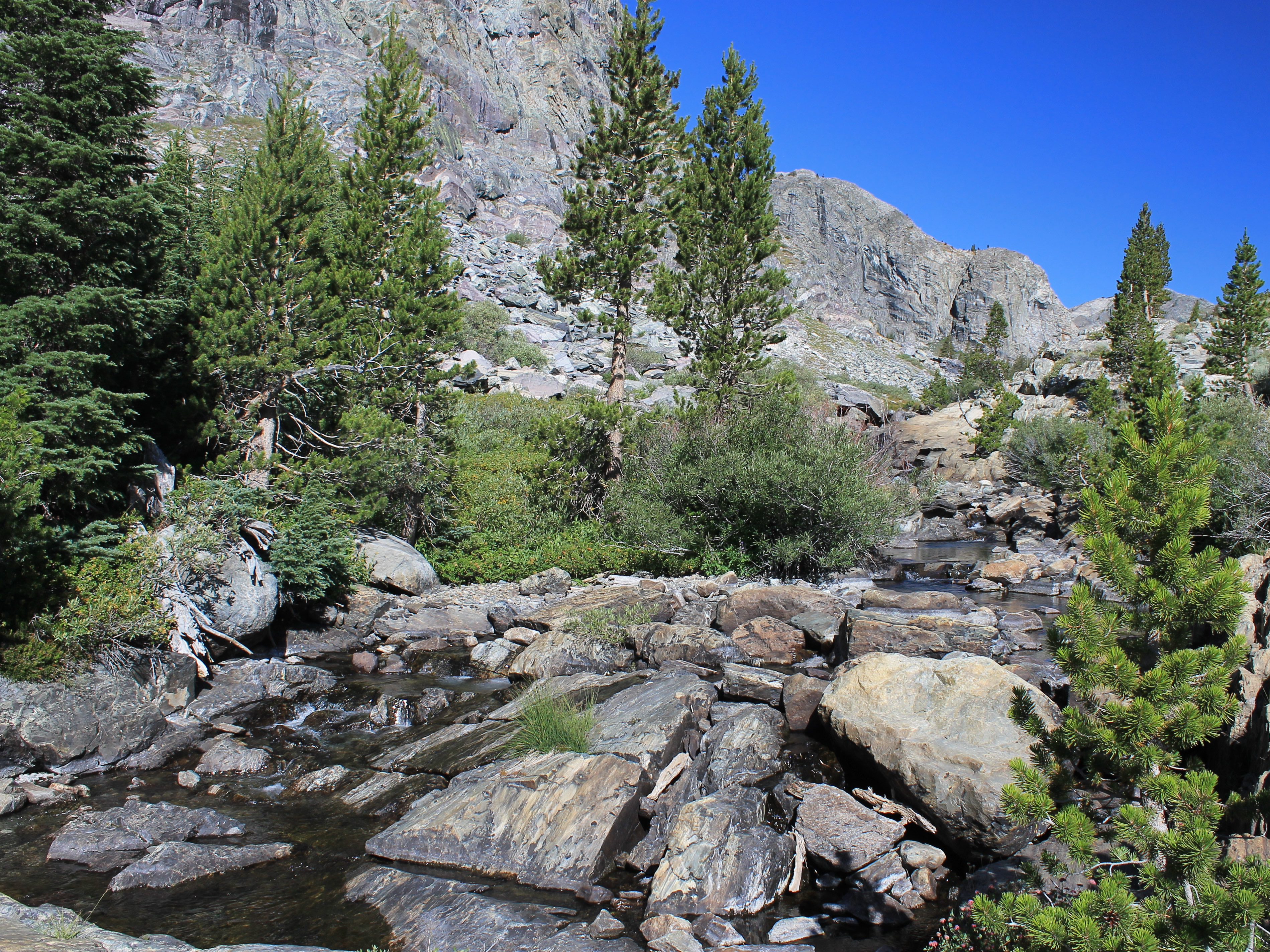 Upper San Joaquin River canyon
Fortunately I was able to find a loophole. If you came very early or very late, when the entrance station was closed (and the shuttle bus wasn't running either), you could drive your own car on the road. The hours of operation were 7 am to 7 pm. It's kind of weird to think of a wilderness area having "normal business hours" but hey, this is California. I wasn't adverse to taking the shuttle but I wanted to get as early a start as possible. So I was planning to drive.
To make sure that I knew what I was doing, I drove up to check the day before. After my hike (and cleanup, and shopping, and lunch - good thing I had an early start that day too) I drove as far as you could go during the day. The road went to the base of the gondala for Mammoth Mountain Ski Resort. There was a huge parking lot filled with cars and about a zillion people. I found the shuttle bus office and the lady there gave me the specifics. Yes, I could drive my own car before 7 am. Yes, I could park at the trailhead. Yes, there were bear-proof food storage lockers at the trailhead (which I needed since I was switching hotels that day). So everything sounded like it would work.
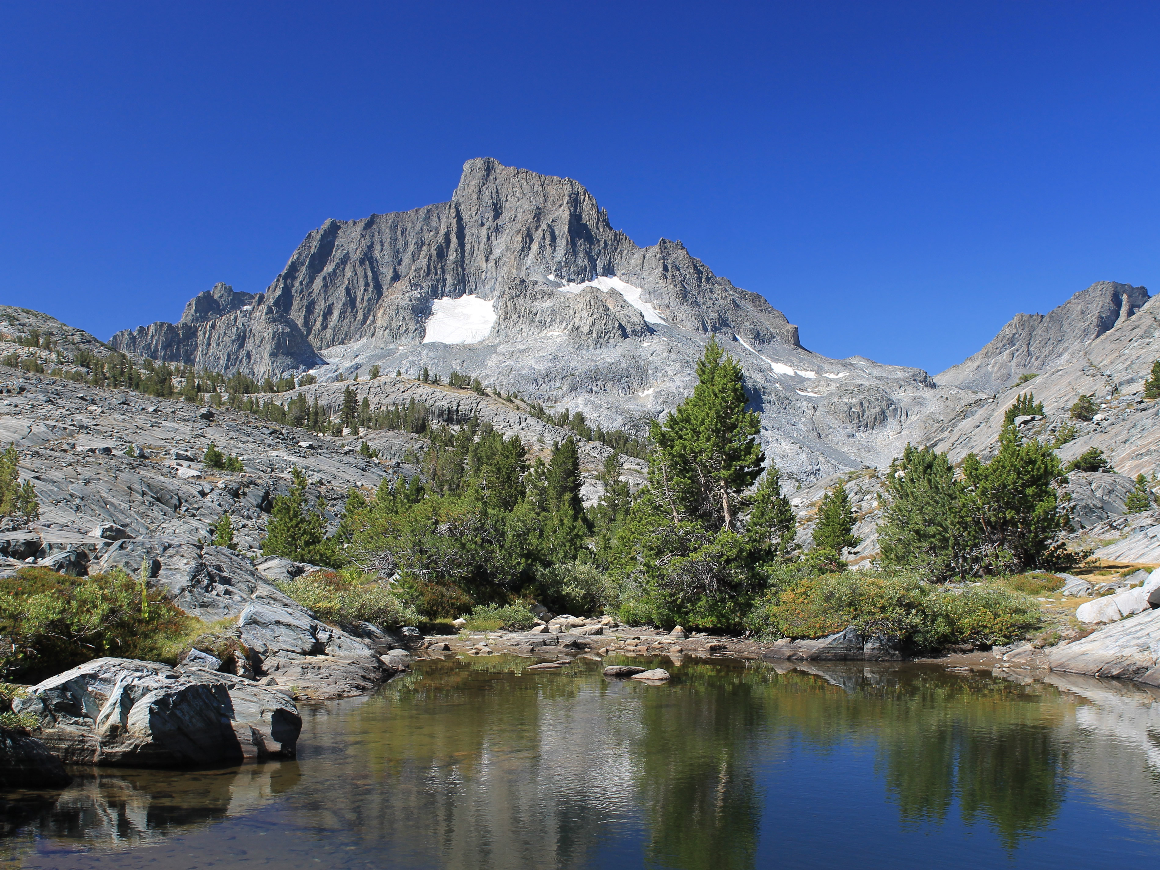 View of Banner Peak and Mt. Ritter from tarn along the trail
I was up even earlier the next morning. This time it was 4:30 am. I'm not sure what was wrong with me, but I was waking up early every morning. But for hiking that was a good thing. Still, I was slow getting going. And just as I got to the entrance station that marked the end of daytime private car access, I saw a side road with a sign to "Minarets viewpoint". I had to check that out. I got an excellent distant view of the Ritter Range just as it caught the first light from the rising sun. Beautiful. That was where I was going so now I was really anxious to start hiking. Finally I went past the entrance station and drove to the trailhead. I stashed my extra food in the bear locker (I didn't want a bear opening my car like it was a can of sardines) and hit the trail. It was 6:30 am, a good early start on what looked like it would be a perfect day. Like the day before, it was very cool, but a warm hat and gloves and a long sleeve shirt provided enough warmth for the first hour of hiking.
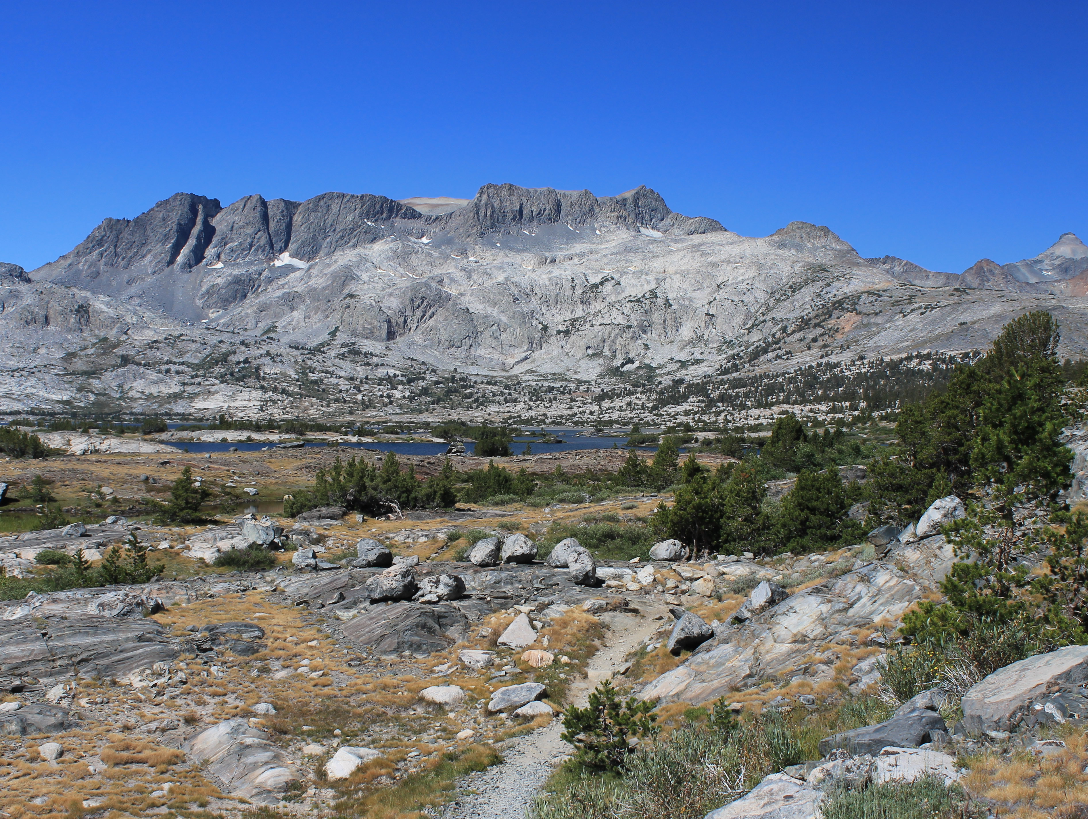 Finally - approaching Thousand Island Lake
I had looked at a lot of options and the hike I chose was to Thousand Island Lake. It was supposed to feature excellent views of Mt. Ritter and Banner Peak, the two highest mountains in the Ritter Range. There were two trails that went there from the trailhead at Agnew Meadows, and the loop combining the two was listed in the guidebook as eighteen miles long. Even though I was looking for a good workout that was long enough to give me pause. So I opted to start with the shorter half of the loop, the River Trail, even though the guidebook recommended it for the return trip. It followed the San Joaquin River (hence the name) for most of the way. Like the day before, I hardly saw anyone for the first several hours. About a half hour after starting, I came across a guy on the trail with his camera and tripod set up, taking extra effort to get a special photo. I paused behind him and all I could see was a tree with a funny crick in in the trunk. I guess he thought that it was artsy. I coughed to get his attention and excused myself as I went through, leaving him behind to take photos of his crooked tree trunk.
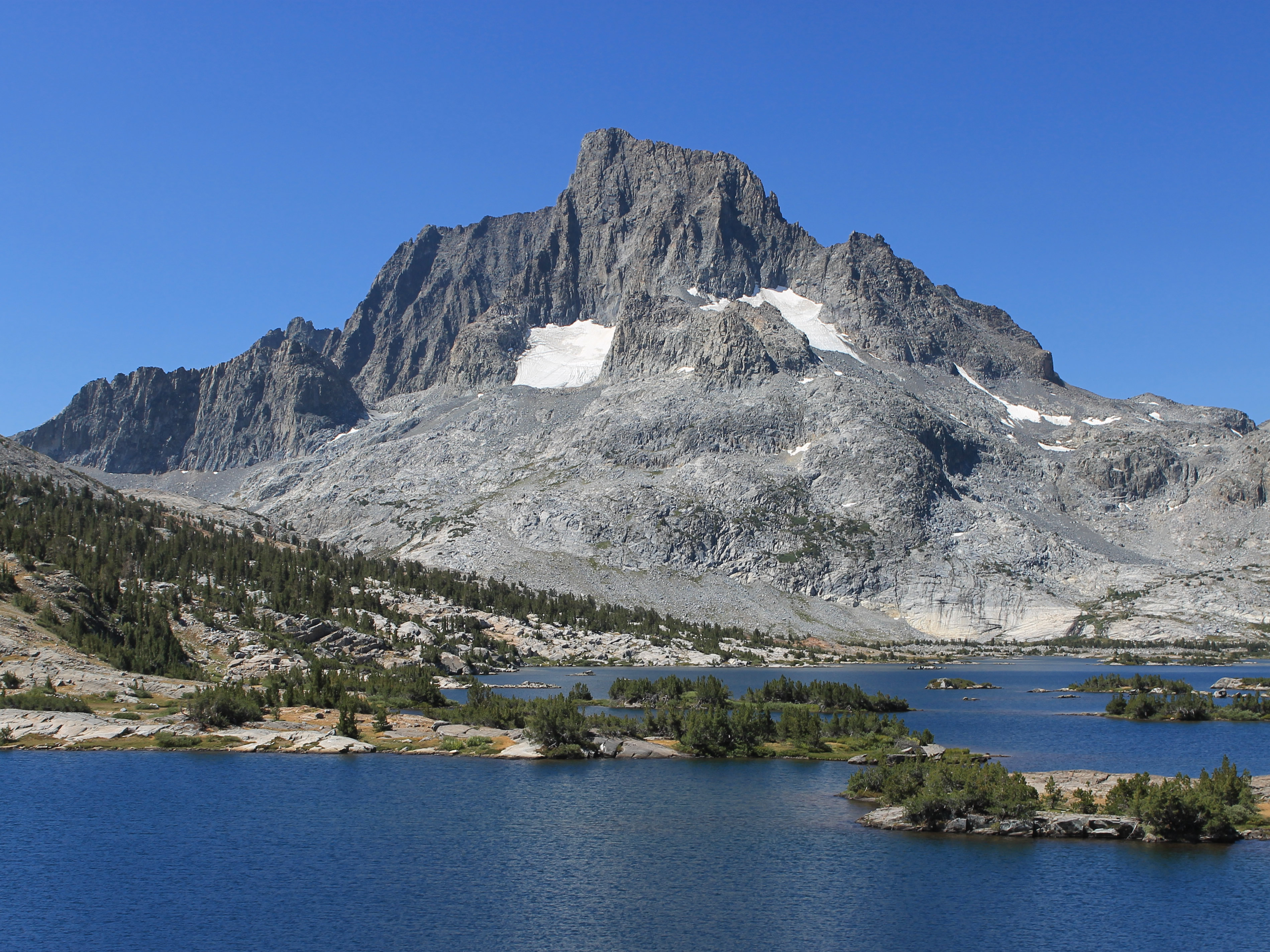 Banner Peak with Mt. Ritter behind from Thousand Island Lake
Whatever.
The hike along the river wasn't especially interesting but it was easy enough. The grade of the trail was reasonable. I gained elevation slowly but consistently. But there wasn't much scenery. The canyon was pretty but not spectacular, although at the upper end it did open up. The trail came out of the woods and followed the river, now just a small stream, through numerous cascades and short waterfalls. I just went slowly and kept making progress. Finally after a little over three hours I had reached the end of the valley and was climbing over a ridge towards the Minarets. On the other side was a large basin and I could finally see the Ritter Range on the far side. It still took another half hour to get to Thousand Island Lake, with continuously improving views of Banner Peak and Mt. Ritter the closer I got to the lake. I finally reached it after a little less than four hours of hiking.
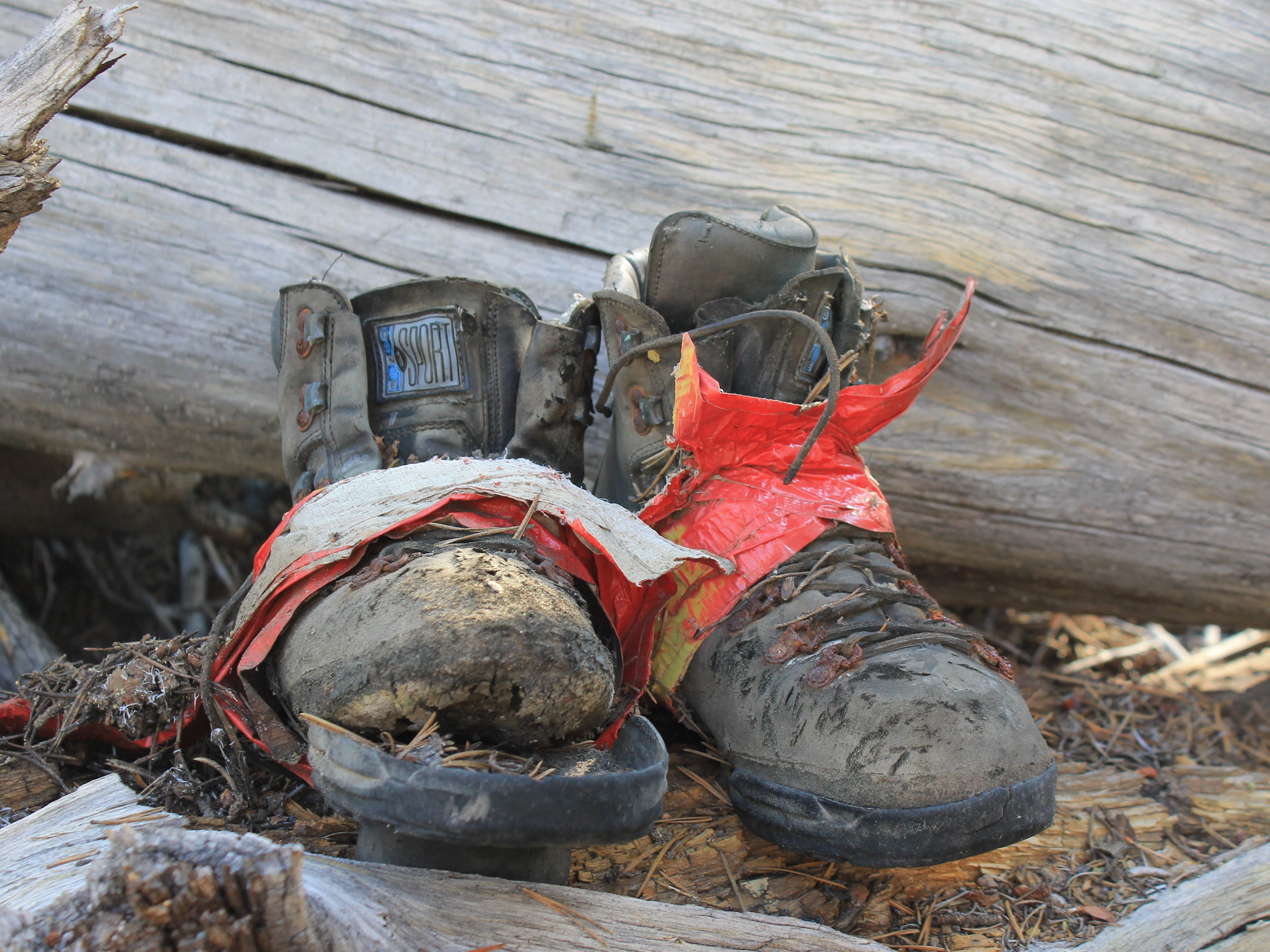 A well worn pair of boots abandoned on the trail
Until the lake, I had only seen one other hiker the entire morning, other than the photographer of strange trees (or was it the strange photographer of trees?). Here at the lake there were several parties. A few were day hikers like me but most of the people were backpackers. It's a spectacular spot and since the John Muir Trail passes right along the lake shore, which is broad and flat with lots of room for tent sites, it's a major backpacking destination. The view was amazing, with Mt. Ritter and Banner Peak providing a beautiful backdrop for the lake. The lake was large enough that even though there were other hikers around I was able to find my own private section of shoreline. I sat down on a rock right at waters edge, took off my boots, and put my feet in the lake. Ahh!!! The water was pleasantly cold after my feet had been trapped in hot boots for hours. The weather was perfect and I had an awesome view. It was one of those spots where you wanted to sit for hours.
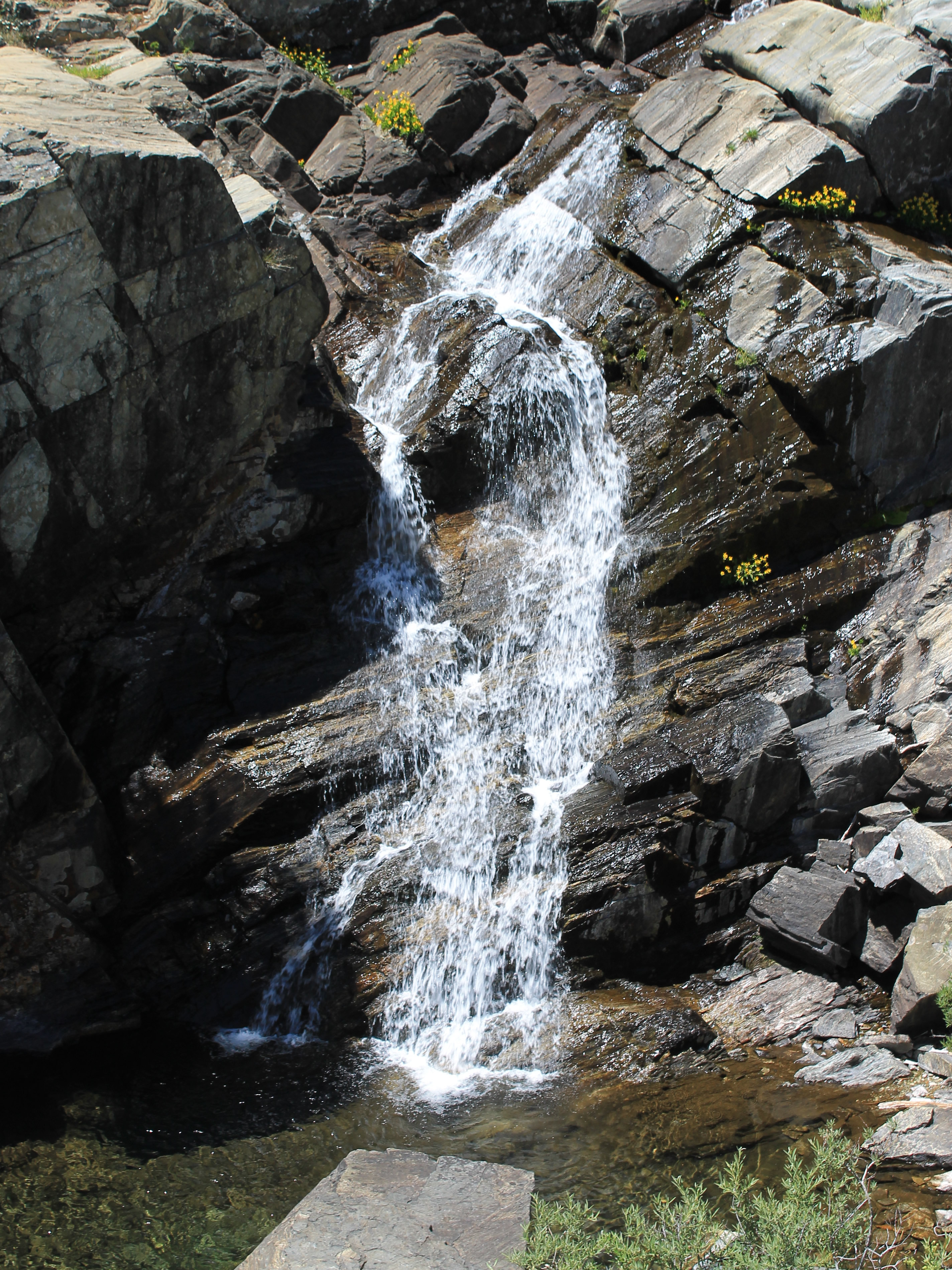 Waterfall in San Joaquin Canyon
Eventually I put my boots back on, grabbed my pack, and started back along the lakeshore. I stopped to chat for a while with a guy who seemed to be about my age. He lived in Bishop, the largest town in the Owens Valley on the east side of the Sierra Nevada, and it sounded like he did a lot of hiking in the Sierras. Since I was going to be staying in Bishop the next two nights I asked him about the best place to get pizza there. He gave me a long and elaborate answer and it took me a while to realize that he was talking about Mammoth Lakes, not Bishop. When I mentioned this he said "Oh, yeah. That isn't Bishop. You're right." Now that's weird. A guy who can't remember what town he lives in. My memory may be going as I get older but I'm not that bad.
It was time to start the long hike back to the car. According to the GPS app on my phone it had been 7.65 miles to the lake, less than all the guidebooks said. That might just reflect the fact that the GPS only has so much resolution. But I preferred to think that I didn't have that far to go. The hike back was straightforward and took about three and a half hours. There was a long stretch in the middle where it was quite hot. There were also quite a few bugs during the afternoon, although they didn't bother me as long as I kept moving. Whenever I tried to stop it would only be a few seconds until the bugs showed up and I had to start hiking again. It reminded me of my trip to the Olympics last year. But since it was all downhill and I was feeling good, I didn't need to stop. Just as the day before, there were lots of hikers now, most of them backpackers heading in. It didn't look like fun hauling a heavy pack uphill in the heat.
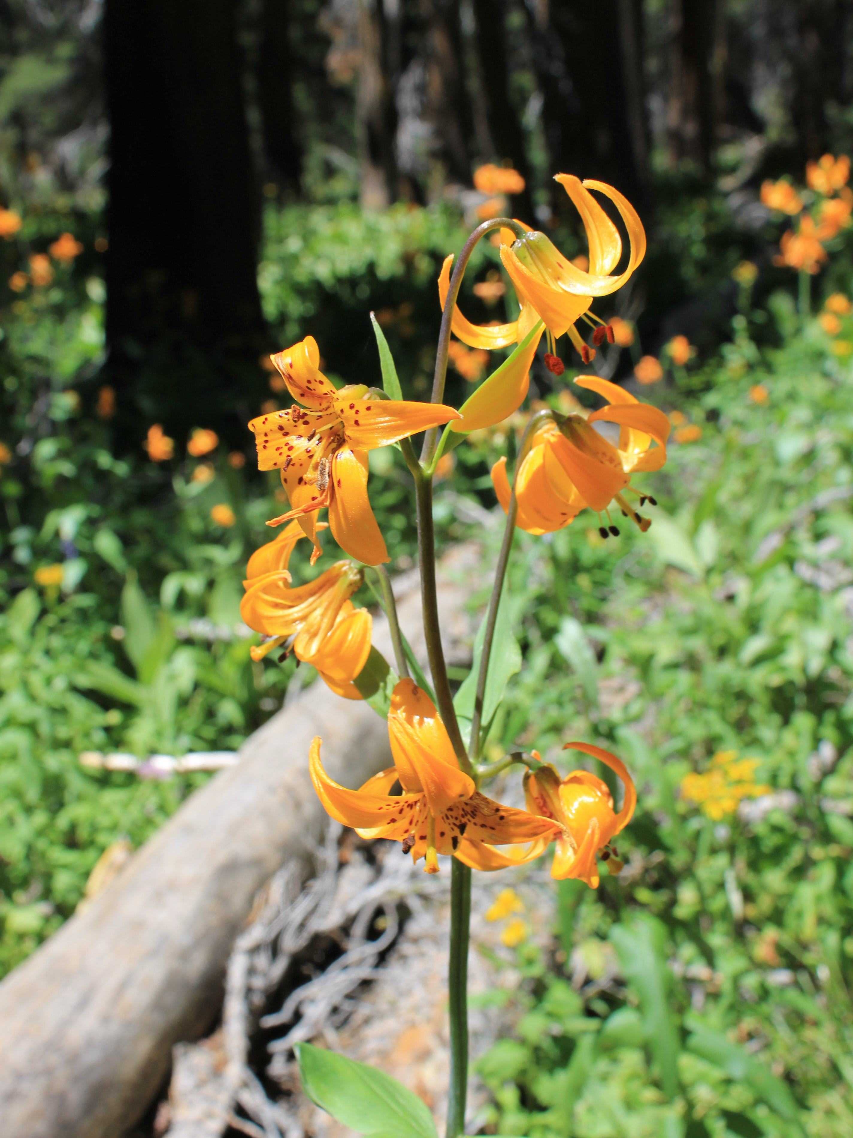 Tiger Lillies along the trail - rare in the Sierras
There was one big uphill near the end, climbing up from the San Joaquin River. I was passed by a group of younger hikers on this stretch. That's not too surprising. I'm a slow hiker. But then I caught up to them again. They were talking to an older couple. Apparently the guy had a heavy pack and was having a lot of trouble, especially with his neck. He was in a lot of pain. One of the young guys volunteered to take his pack for him, a true Good Samaritan. It really must have been heavy because the guy with the pack was soon left far behind while I walked up and chatted with the rest of his group. They were dayhikers too, but had just gone to Shadow Lake, only three miles each way. Considering the hike that I had done I was feeling pretty smug then.
I finally made it to the car. It had been eight hours total time, seven hours spent hiking. The GPS said it was over fifteen miles but that was still less than the guidebooks claimed. That distance, with 2265 feet of elevation gain, was a significant accomplishment. Driving out I stopped at the viewpoint again and was surprised that most of the view was obscured by smoke that was blowing in from the south. Just like the day before, the smoke rolled in about 3 pm. But I had blue skies and clear views while I was hiking, so I was happy.
It took less than an hour to drive to Bishop. I checked in at the Motel 6 and went across the street to the Pizza Factory for dinner, my only real meal of the day. They had a good salad bar, and a salad and pizza sure tasted good.
