Dave's Lake
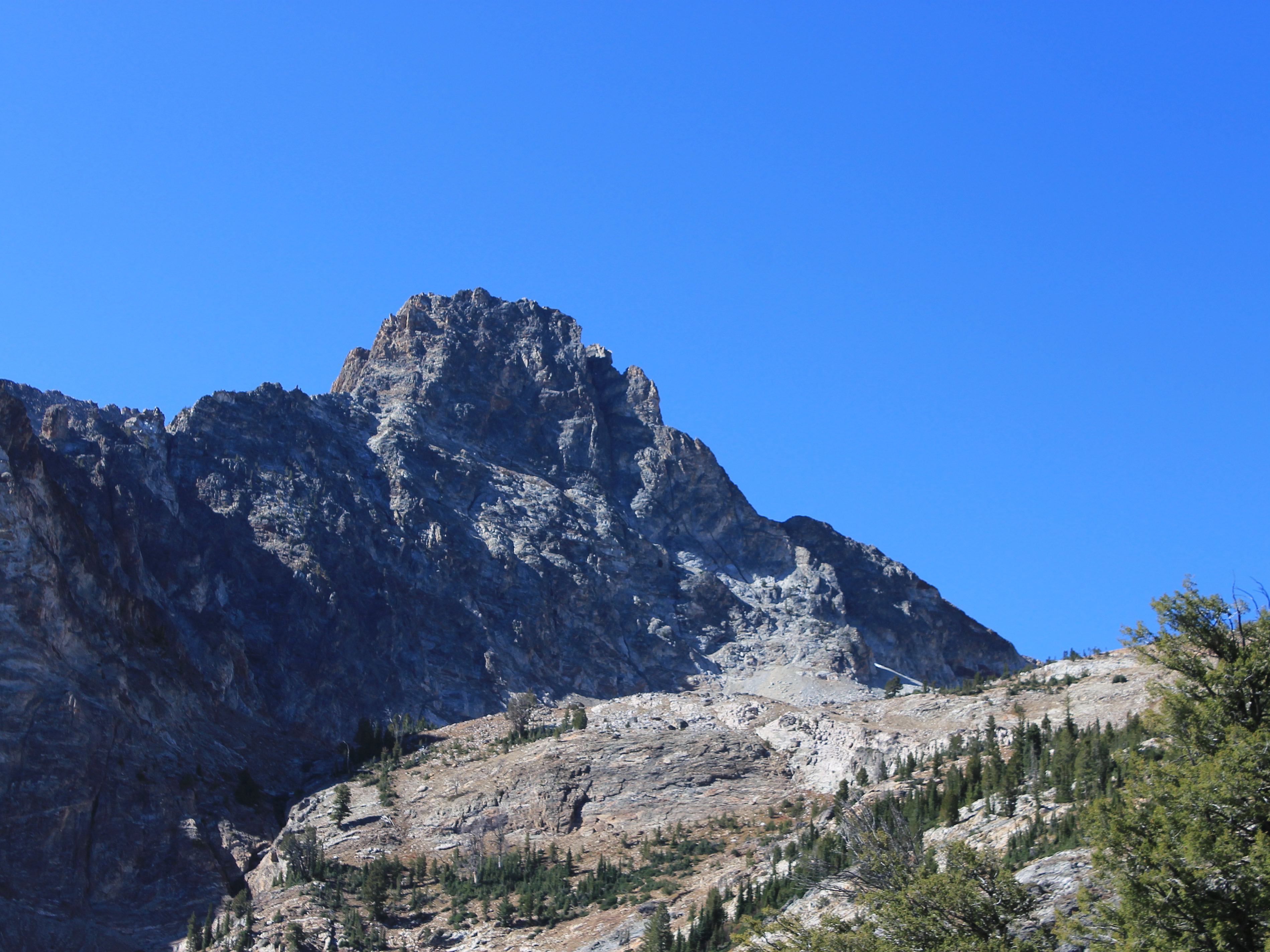
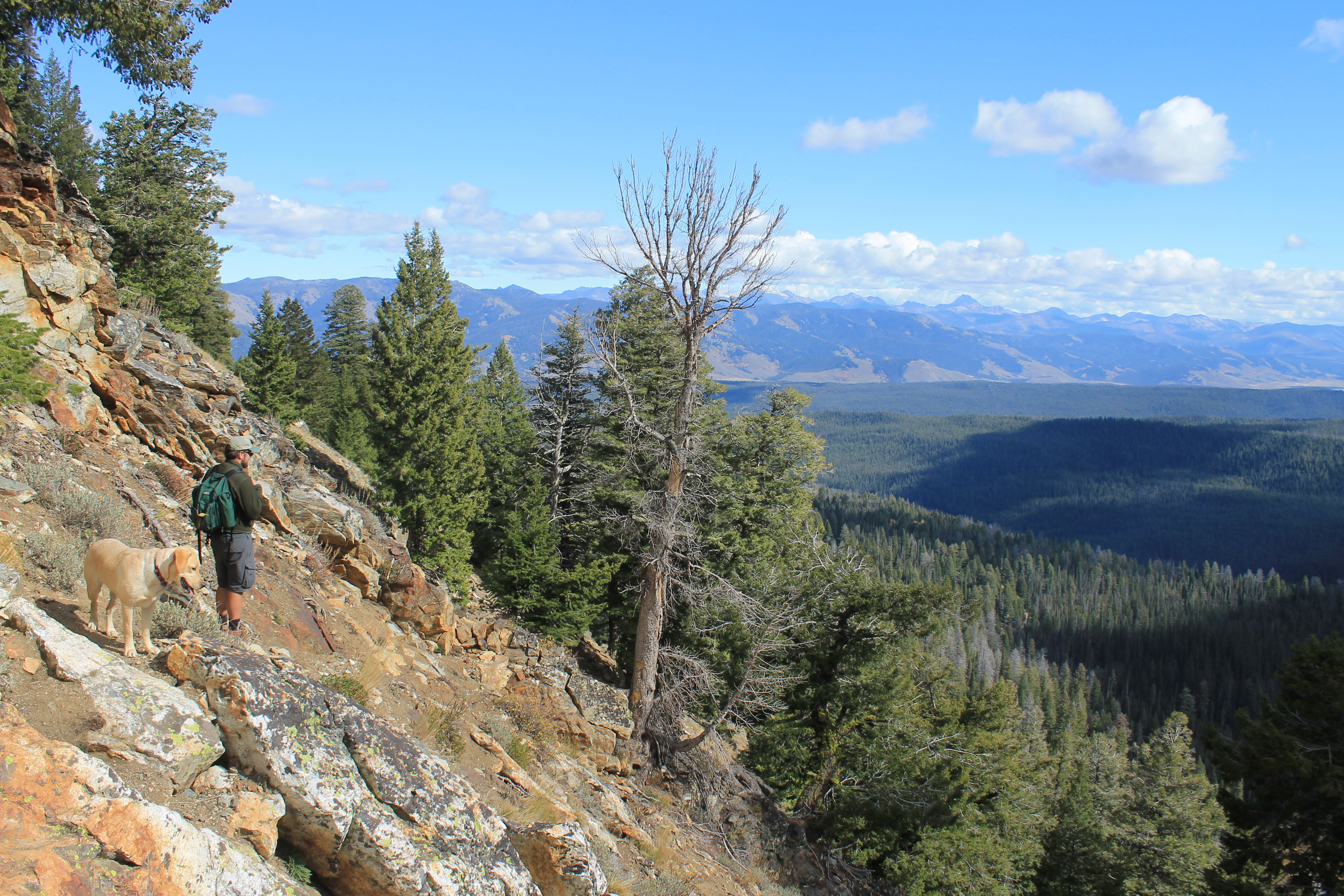
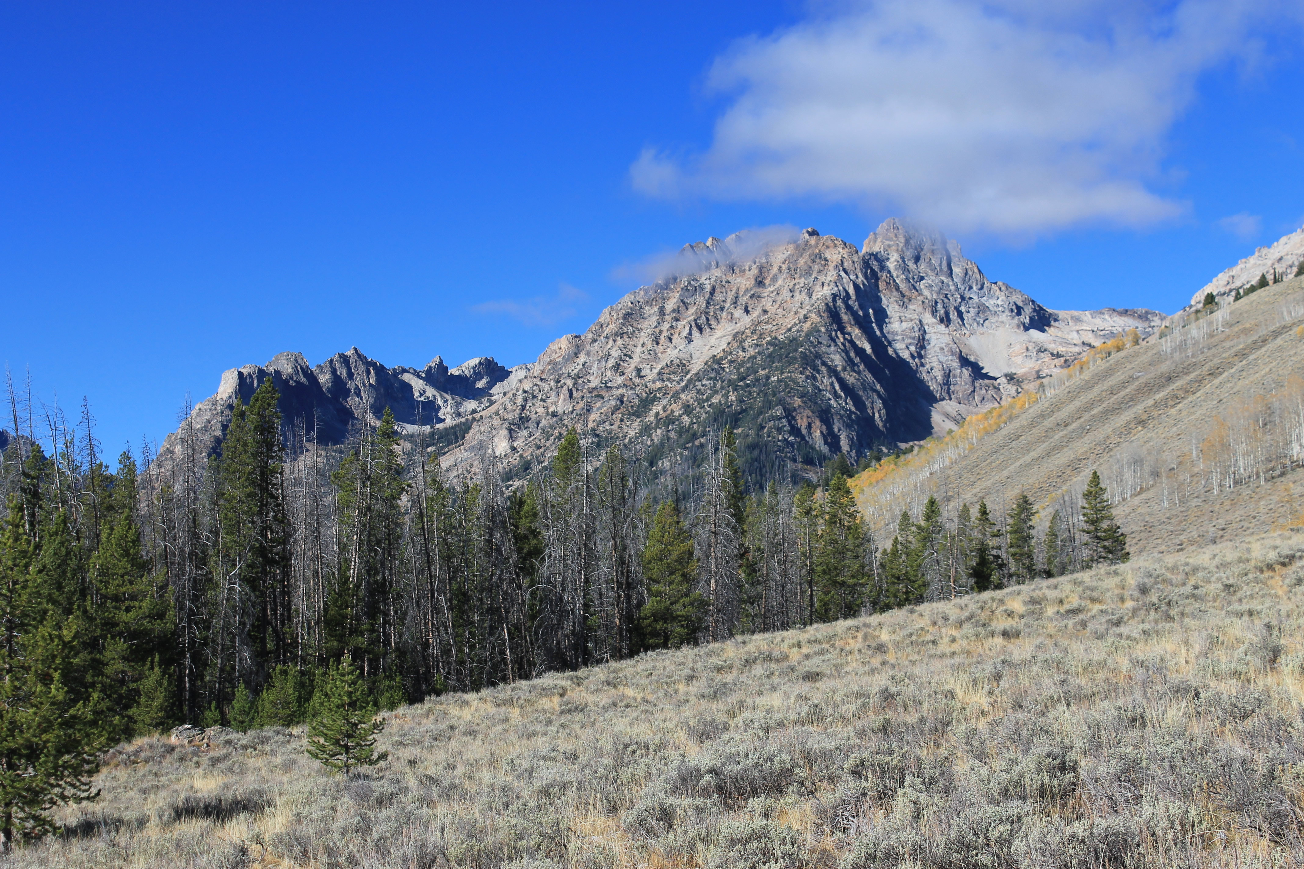 Looking towards Thompson Peak from near the start
Abby and I did some excellent hikes in September. I was finally able to take her hiking in real Idaho wilderness. First we did an old standard, Sawtooth Lake. Then we hiked to the summit of Horton Peak. The good fall weather continued into October. Another weekend was coming up and the forecast was excellent. Abby of course was anxious to go hiking again. This time I also invited along two friends from work, Ivan and Bryan. I had done hikes with each of them last year, for both of them their first time ever in the Sawtooths, and they had expressed interest in going again.
Unfortunately Ivan had to bow out at the last minute because he got tied up with homework. Besides working, he also is studying for an electrical engineering degree at Boise State University. That's why when we are at work, even though we are at the University of Idaho, he will often jump to his feet suddenly, pump his fist in the air and shout out "Go Broncos!".
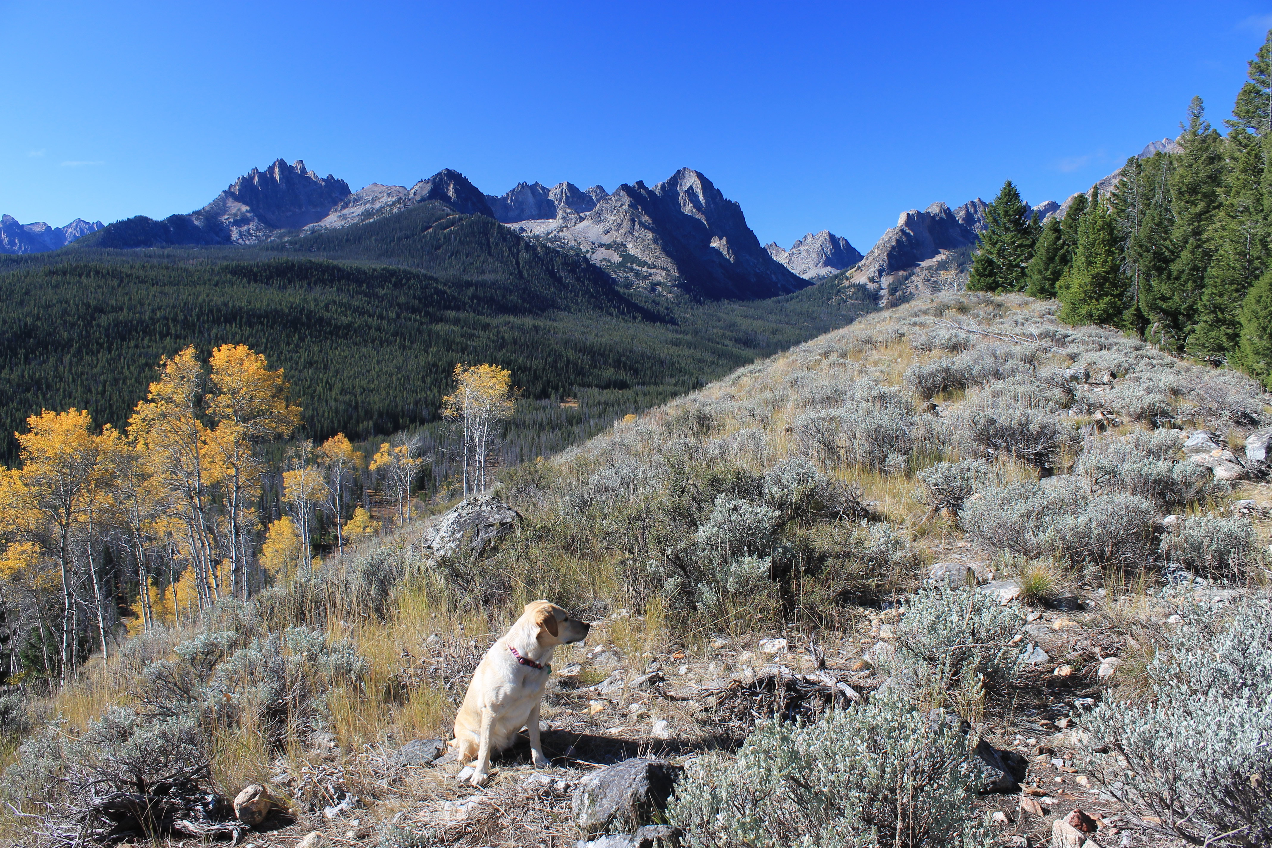 Abby on the ridge above Fishhook Creek
Bryan on the other hand was able to get clear for a day, so he was on for the hike. Now all I had to do was pick out where we were going to go.
The only hike that Bryan had done in the Sawtooths was Alice Lake, which we did together last fall. Probably the next obvious hike for Bryan to do was Sawtooth Lake but Abby and I had just done it a few weeks before. But there was another hike that I wanted to do that I thought he would really like and that was Dave's Lake.
At 10,751 feet, Thompson Peak is the highest mountain in the Sawtooths. It's visible from the highway in the Stanley valley, rising above a large cirque on the east side of the mountain. There isn't a trail that goes into the cirque but there is a game trail/climber's track used by mountaineers to gain access to Thompson to climb it. Since it is the highest peak in the Sawtooths it is one of the few peaks in the range that is climbed fairly often.
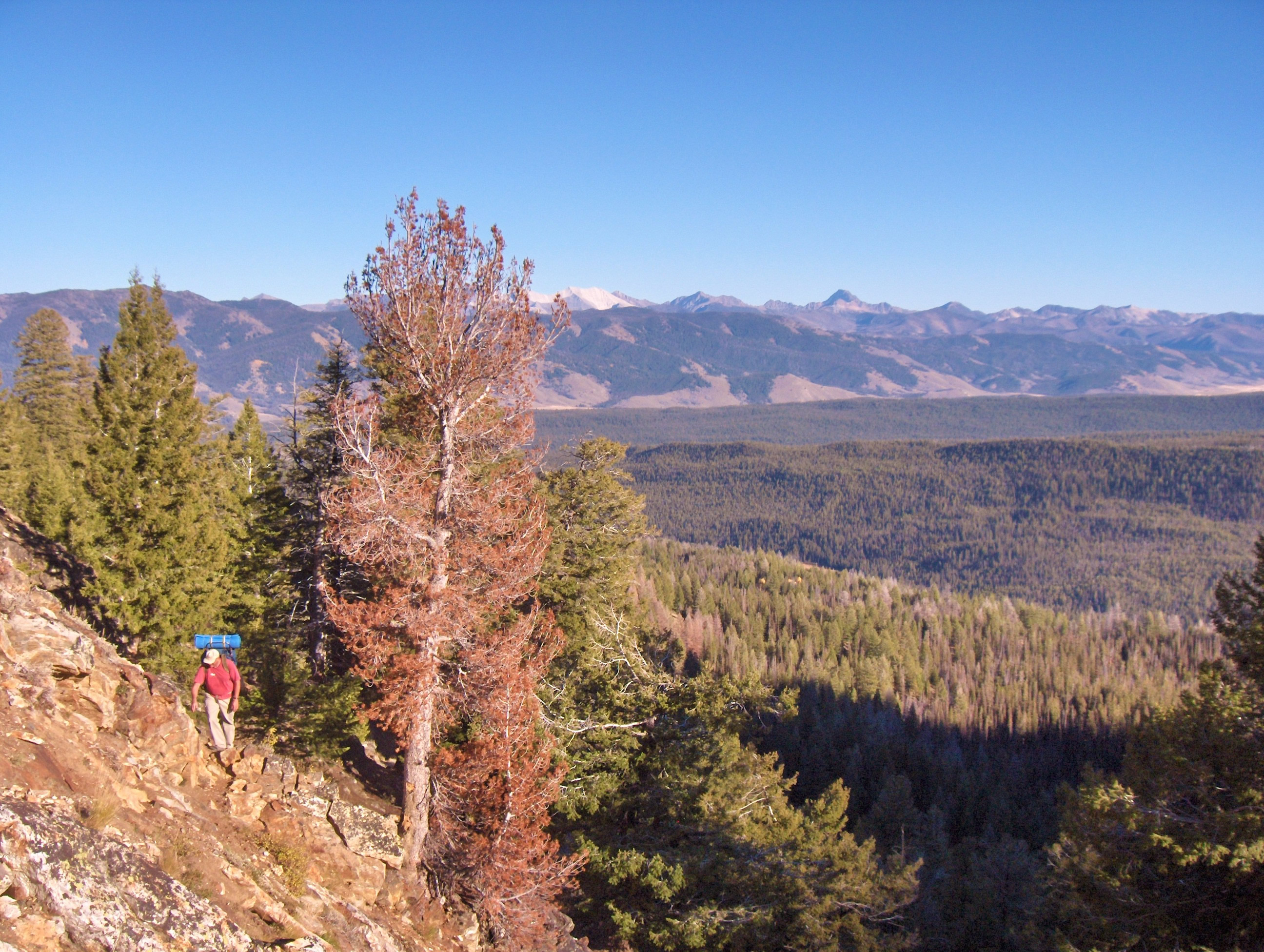
 Bryan looks happy - he doesn't know how far we have to go
There is a large, unnamed lake in that cirque, lying at the base of Thompson's sheer east face. An old hiking buddy of mine, Dave Thiel, really likes the spot. It's his default destination in the Sawtooths and he usually hikes there every year, the way I do with Sawtooth Lake. So we have taken to calling it "Dave's Lake" instead of "that big unnamed, off-trail lake in the cirque just below the east face of Thompson Peak that Dave hikes to every summer". Saves a lot of time.
Many years ago I backpacked into the basin a couple of times. I used it as a base camp, once to climb Williams Peak and once to climb Thompson Peak. That was way back in the 1980's, when I was a much more serious and ambitious mountaineer.
I've been up there twice more recently. In 2010 Dave Thiel and I backpacked in and attempted to climb Thompson Peak again. We didn't make it to the top on that trip and if you want to know the whole, sad story you'll just have to follow the link. Turning back on a climb doesn't sit well with me, so even though I had climbed Thompson Peak once before, now I was determined to try it again and get up it a second time. I went back the following year, many pounds lighter and in much better shape, and did get to the summit. I made it from the trailhead to the top and back in a single (very, very long) day. It's one of the tougher climbs from a length and endurance standpoint that I've done in my later years.
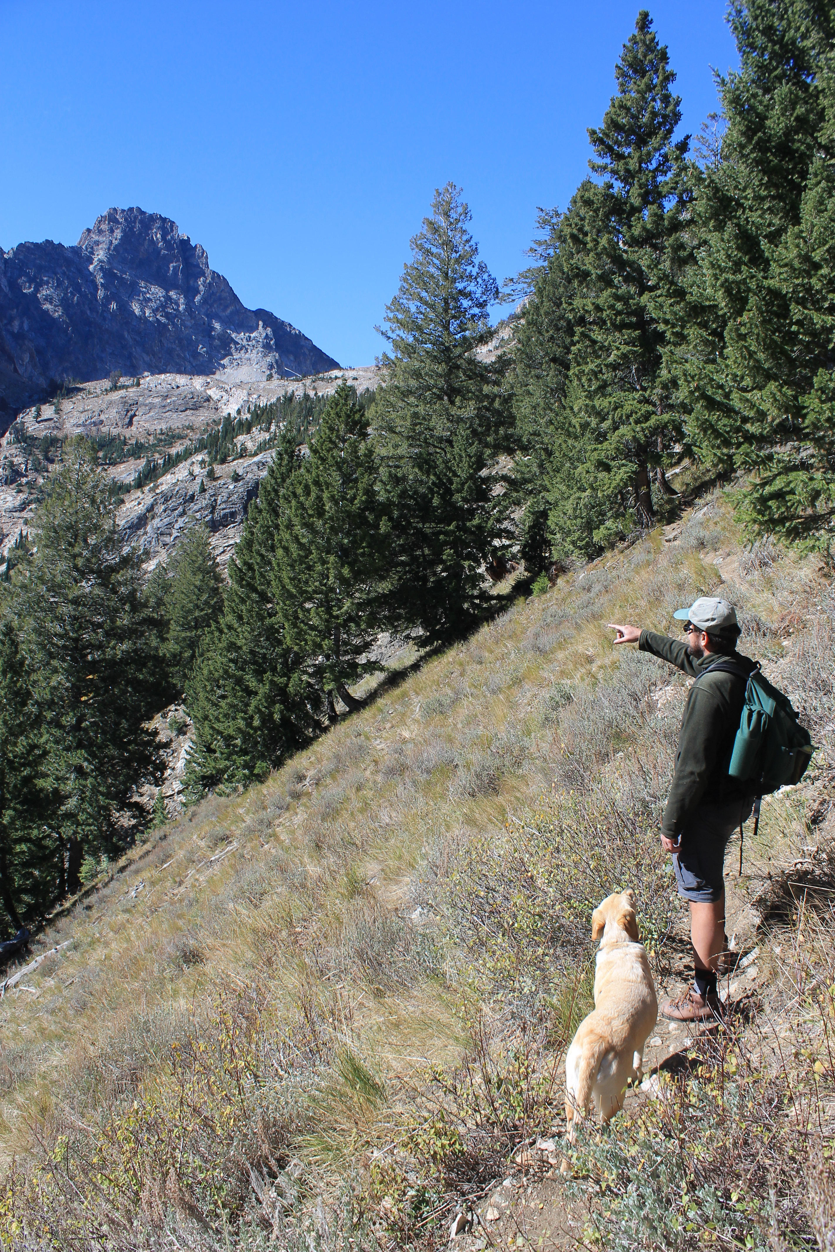 Bryan points out the route to Abby
Even though I made it up Thompson in 2011, I've been thinking of going back some time to try to climb Thompson or Williams again. Or maybe I would try Mickey's Spire. Although it's not a prominent peak it's a challenging climb, and because of the name I could tout it to my son, Mickey.
Since it's been a few years again since I was up there and the route is partially off trail, I thought a scouting hike into the basin would be a good idea to refresh my memory of the area. Dave's Lake is a beautiful spot so I thought Bryan would enjoy going there too. Since it isn't in any hiking guide that I know of (although it is listed as an approach route in the Idaho climbers bible, Idaho - A Climbing Guide by Tom Lopez), it's not easy to find out about it. Even though local hikers and climbers travel into the basin it doesn't get nearly as much traffic as more well known places like Sawtooth Lake. When I asked Bryan if he was up for a harder hike to a place that not many people knew about, he was all for it.
Since Abby was going along I volunteered to drive. Otherwise Bryan would be finding yellow dog hair in his car for years to come. He was over at my house early (although not quite as early as he said he would be) and we were off to the mountains. Our only excitement on the drive up came in Garden Valley when the "low tire pressure" light came on. Fortunately we were only about two miles from Garden Valley when it happened so in two minutes we were at the Chevron station where we could put air in the tires. Hey, it's better to be lucky than good.
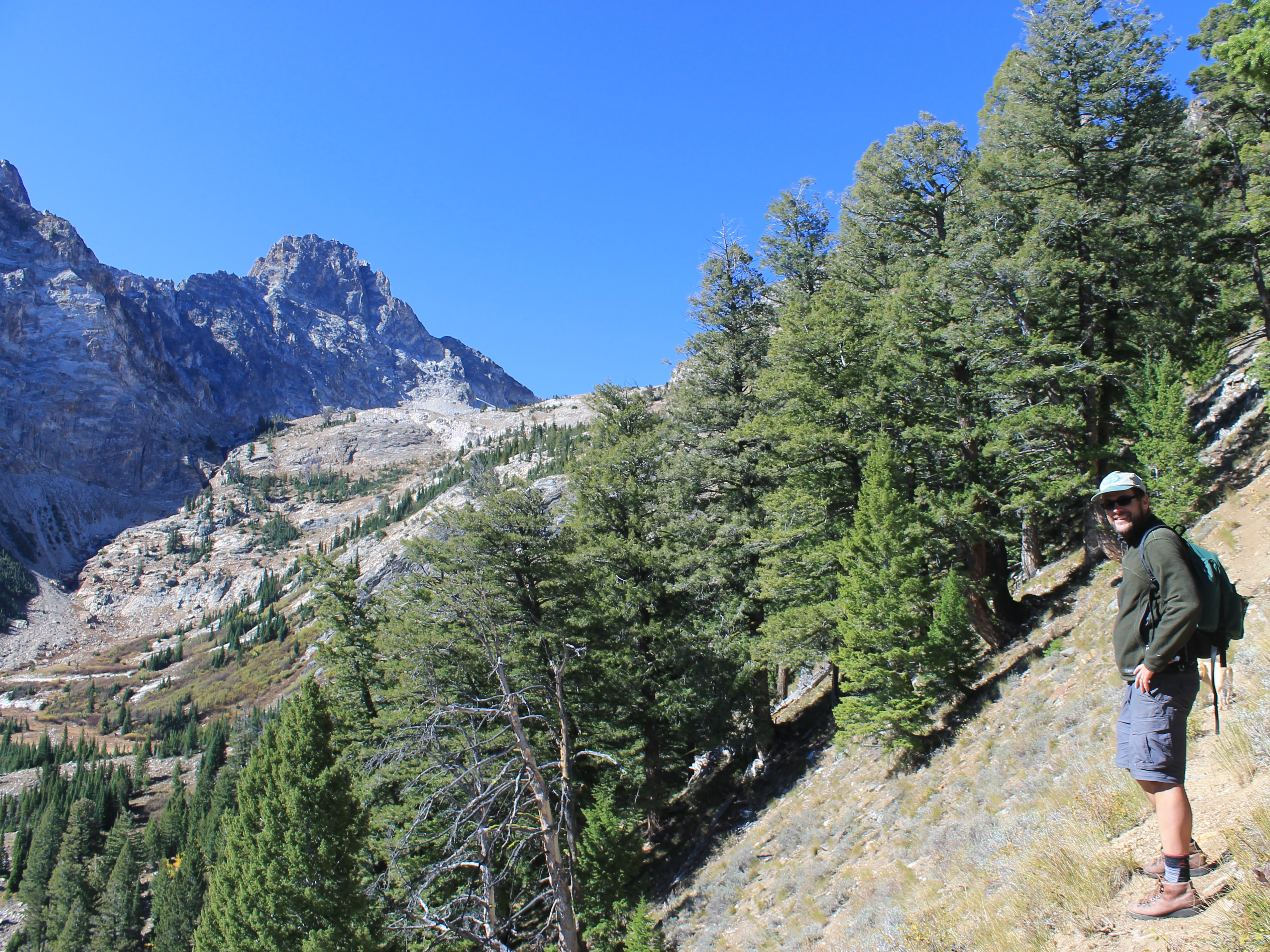
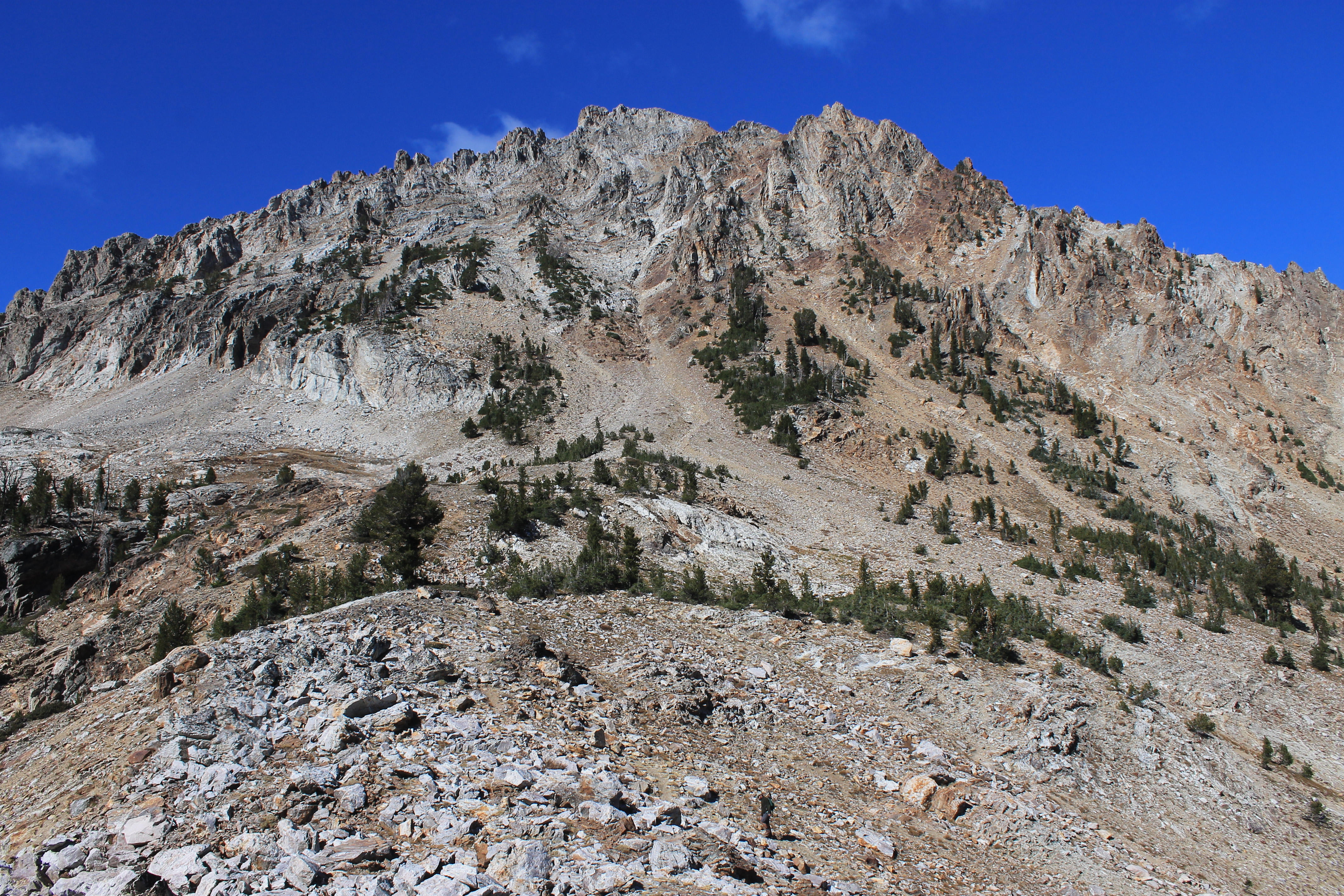
 East Face of Thompson Peak
We parked at the Redfish Lake backpackers lot. We started out on the Fishhook Creek Trail with an easy, level mile along the creek to a trail junction. Here we turned right onto the Marshall Lake Trail, where we got our first good view of Thompson Peak and the cirque that was our destination, still several miles away.
We began a long climb up onto the ridge that led to Williams Peak. I took it slowly while Bryan, and of course Abby, soon pulled way ahead. But they were waiting for me at the crest of the ridge, enjoying the excellent view. The aspen on the lower slopes of the ridge were a bright golden color. To the east the White Clouds were visible across the valley. To the west we could look up Fishhook Creek to Horstman Peak, a mountain that has always fascinated me. Although it is on the more accessible west side of the Sawtooths, there are no trails that go anywhere near it. I have tried to approach it several times. Once I tried to go cross country up Fishhook Creek but gave up about a mile past the end of the trail, far short of the mountain. Another time I spent two days trying to cross over from the Bench Lakes basin, but when I reached the saddle above the fifth and highest Bench Lake I saw I was still very far away. So Horstman Peak is still on my To Do List. One of these days.....
 Bryan climbs the vast rocky slope below Williams Peak
From our vantage point we could see our destination. The east face of Thompson towered over a bowl where we knew the lake was, even though we couldn't see the lake itself. It was a long way off so after taking some pictures we got back to work hiking up the crest of the ridge, which climbed through forest until it eventually becomes the rocky east ridge of Williams Peak. About two hours from the trailhead we reached a point where the trail took a sharp right turn and descended from the crest of the ridge towards Marshall Lake. This was where we left the trail. For all the times that I have been up here, I have never taken the trail all the way to Marshall Lake. Maybe someday...
Now we were following a game trail/climber's track. And it was steep. We contoured to the left off of the crest, making a rising traverse along the steep side of the ridge, climbing all the time. We were half way to the lake but now the real work started.
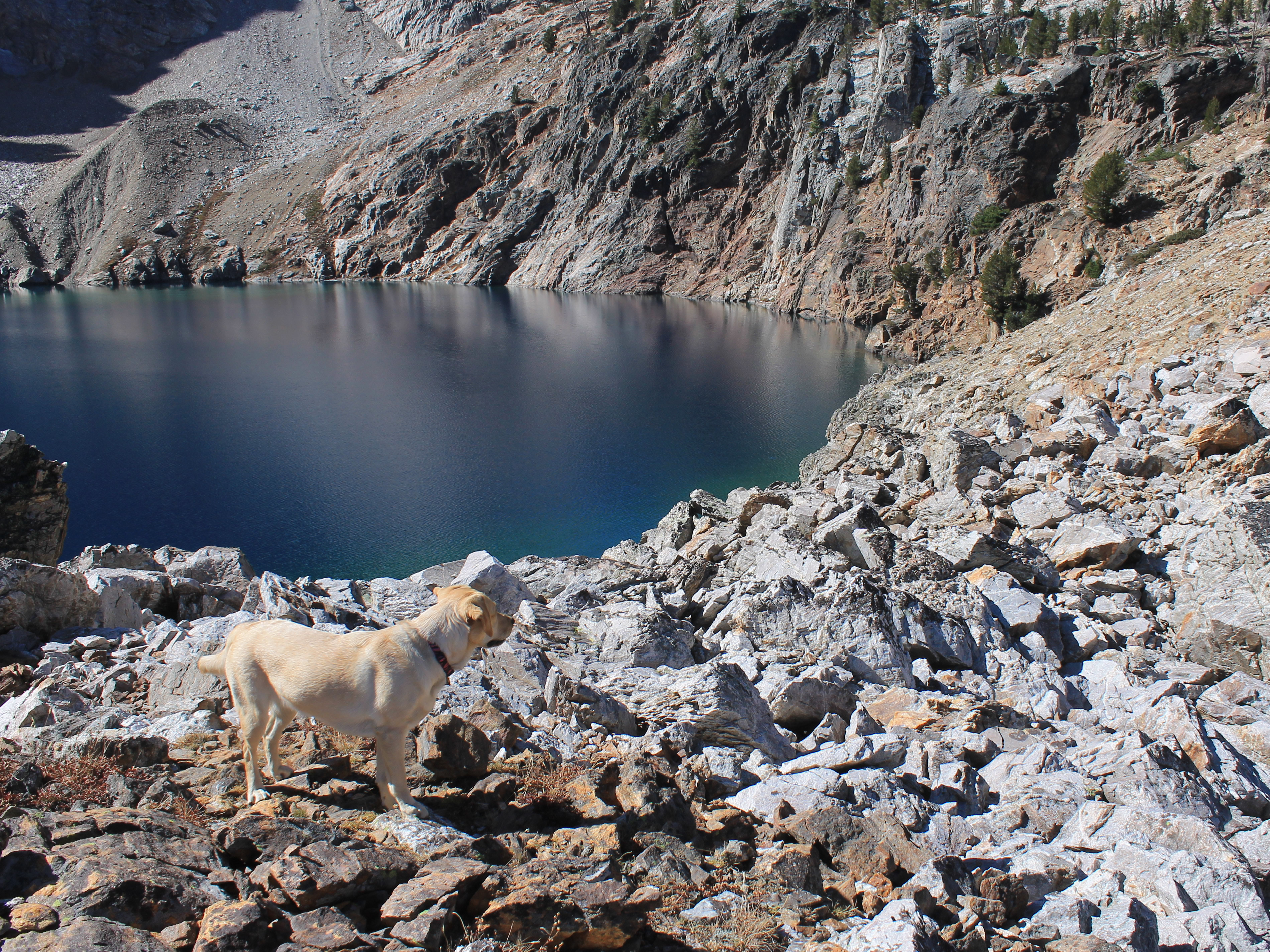 Abby watches for Bryan at Dave's Lake
And I made it harder than it needed to be. The track we were following started to dwindle and just about disappeared. Since I had been up here before, I knew that it went all the way to the lake. So I must have gotten off track (literally) somehow. I couldn't see the track below so it had to be above us. I explained the problem to Bryan and started straight up slope. The track we were following hadn't been much, but it made a big difference. Without it, the slope was really steep. Even Abby looked at me like I was nuts, and she has four feet. Fortunately we only had to climb about a hundred feet before we came across the real track again. On the way back we found that I had missed a sharp 270 degree switchback. In my defense, since there was a light trail that went straight ahead, so had a lot of mountain goats. Hey, theres a reason I'm not a professional mountain guide. I apologized to Bryan and we continued on up.
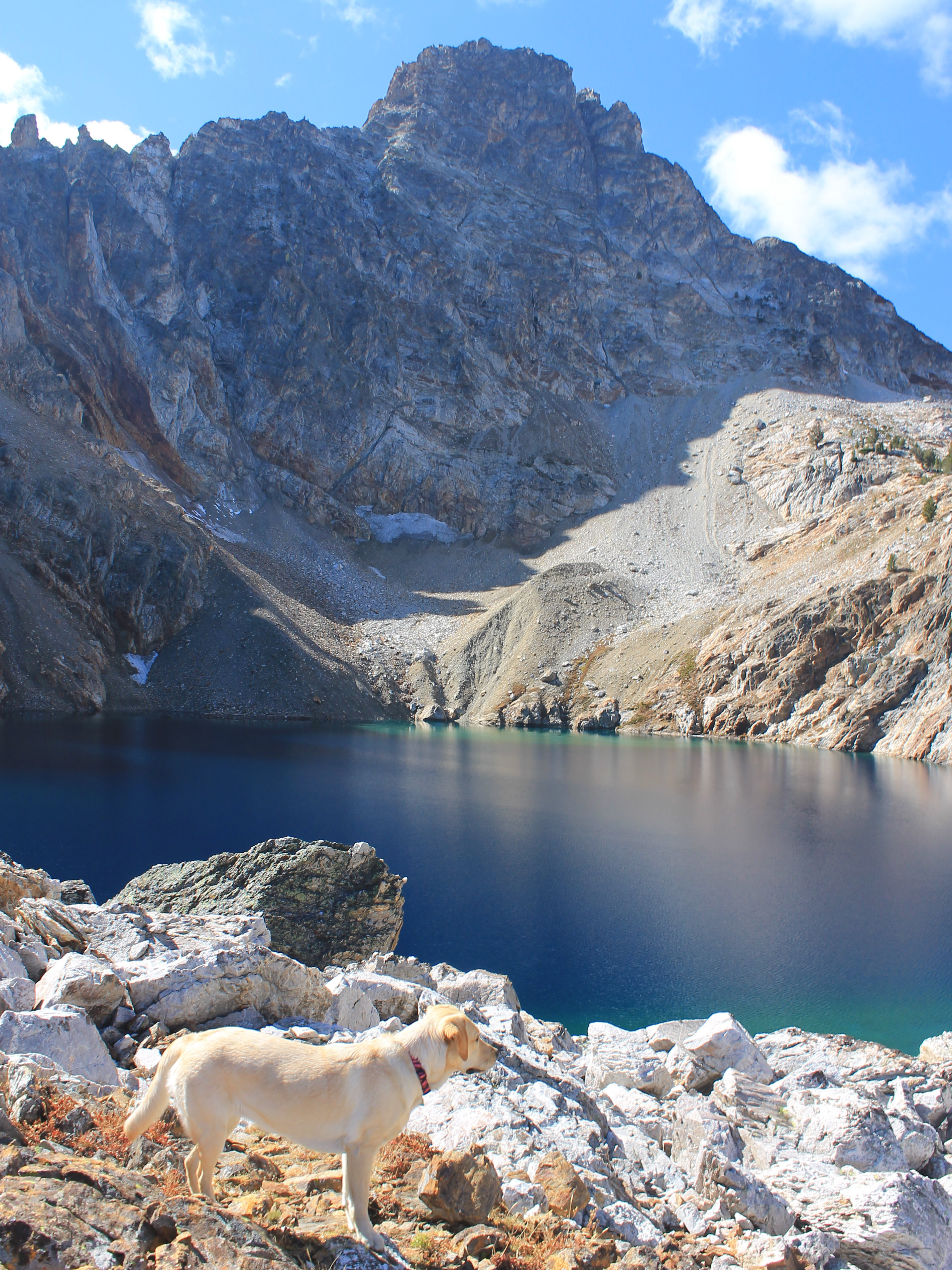 Dave's Lake and Thompson Peak
Our next challenge came when we reached a boulder field. Abby didn't like crossing the large rocks. She balked and started to complain. For a Tough Mountain Dog, she suddenly sounded like a real sissy. I eventually found the shortest way across and managed to coax her over the boulders. Then we went up beside the boulder field, not the easiest way but the one that Abby preferred. Bryan stayed on the rocks and met us above.
I couldn't be too hard on Abby. Laney didn't like crossing large boulders either.
Soon we reached the meadow where Dave and I had camped five years before on our unsuccessful attempt on Thompson. We stopped for a short rest. This was where we left the last of the trees in the basin. There was only one more slope up to the lake and it didn't look far.
But we were wrong. The scale of things in the mountains is deceptive, and it was a long slope and a long climb. Bryan went up one side of the slope and Abby and I went up the other. When I looked across I could barely pick Bryan out among all the big rocks. It took longer than we thought to climb the slope, but then it always does. Finally we did make it to the lake.
And it was worth it. The lake rested in a granite bowl with the sheer 1700 foot high east face of Thompson Peak on the other side. Bryan, Abby and I found spots to stretch out and rest in the warm sun. After hiking so far off trail the spot felt very remote, as if we had it all to ourselves. We had passed only one other hiker all day. He was coming down as we climbed the last slope leading up to the lake.
 Abby and Bryan descending the steep slopes below the meadow
Bryan was already talking about coming back next year to try to climb Thompson Peak. I was ready to sign up for that.
We had a spectacular view of the White Clouds in front of us on our return as we headed down from the lake and out of the basin. Going down was easier and faster, but on the way back I was even more impressed by how steep the slopes were that we were traversing. And last time I had done it with a full pack. Without the faint track we were following it would be really hard to make it to the lake. As always, it was a relief when we finally got back to the real trail, even though it meant that we were in the woods now and didn't have the great view. But now the going was easy down the crest of the ridge and we made good time.
At one point along the ridge Abby started to growl and bark, looking down the slope into the dense woods. Her shackles were up and she was really upset. Bryan and I joked about it but we both looked intently into the woods trying to see what had caused her to get so excited. We couldn't see anything but I had to admit it was a little spooky. A big bear? A moose? Wolves? Sasquatch? It was probably just a rambucntious chipmonk.
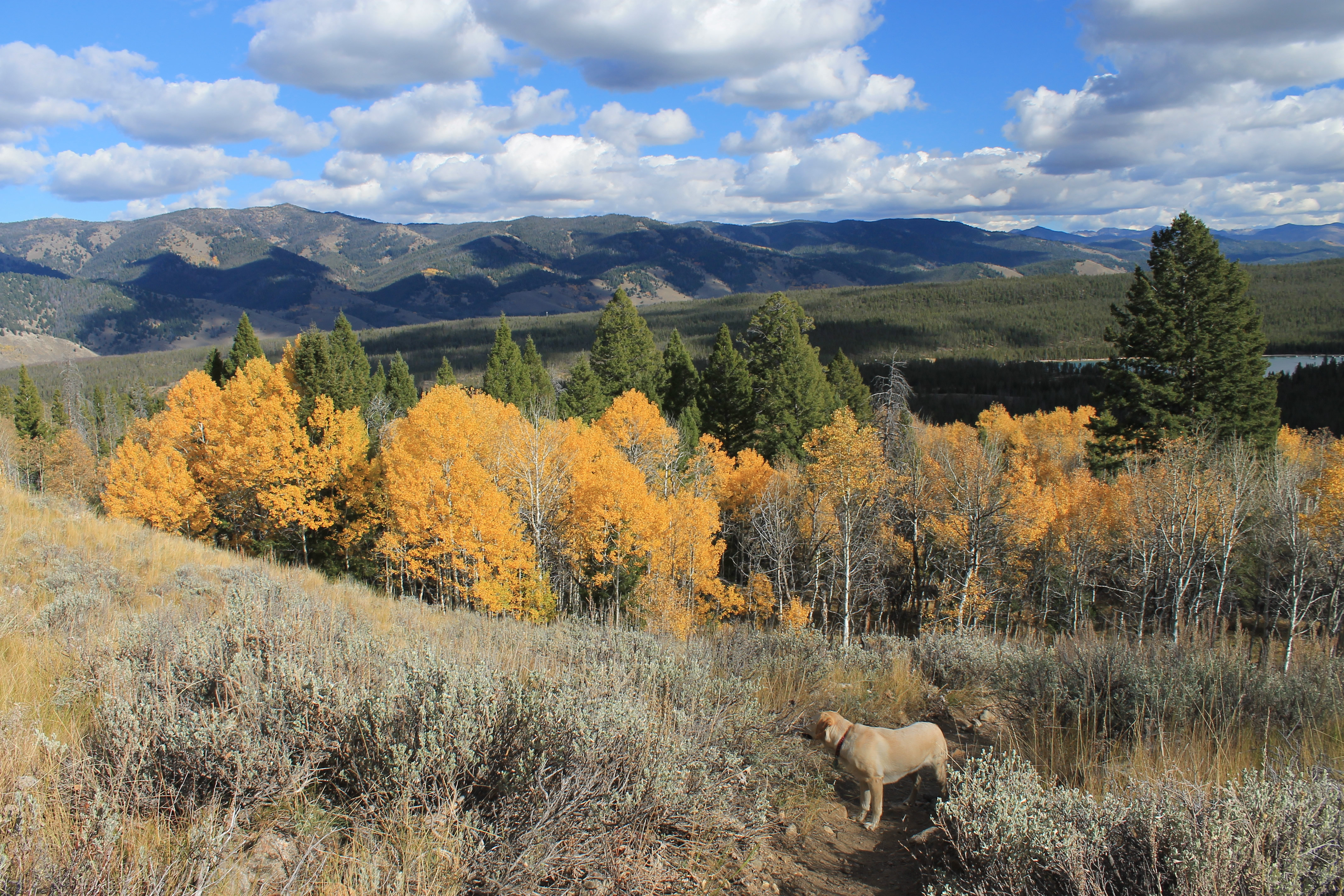 Golden aspen on the lower slopes of the ridge
I was glad to reach the car, tired after a long but rewarding hike. My GPS said that it had been ten miles and 2400 feet of elevation gain, a good days work especially with all the off trail travel. Abby still had energy though and she showed it when she spotted a chipmonk near the car. Although she likes to chase squirrels and chipmonks on our hikes, she is a city dog and doesn't do very well. If she had to catch her food in the wild she would probably starve. But this time she spotted a chipmonk sitting on a log next to our car and was on it in a flash. There were a series of large logs lined up to form a barrier all along the parking lot. When the chipmonk noticed Abby it ran along the top of the log as fast as it could, jumping from log to log. Abby was right behind it, jaws snapping shut on air where the chipmonk had been a split second earlier, just like in one of those cartoons where a dog or wolf is chasing and almost catching a small animal. The chipmonk was screeching loudly the whole time. I didn't need a translator. I'm sure it was screaming "Oh shit! Oh shit! Oh shit! Oh shit!" in chipmonk. It looked like Abby would get it. But the chipmonk made it to the end of the logs and dived off into the tall grass. Whew! That was close. After a few futile sniffs in the grass Abby was willing to concede the chase and get in the car with us.
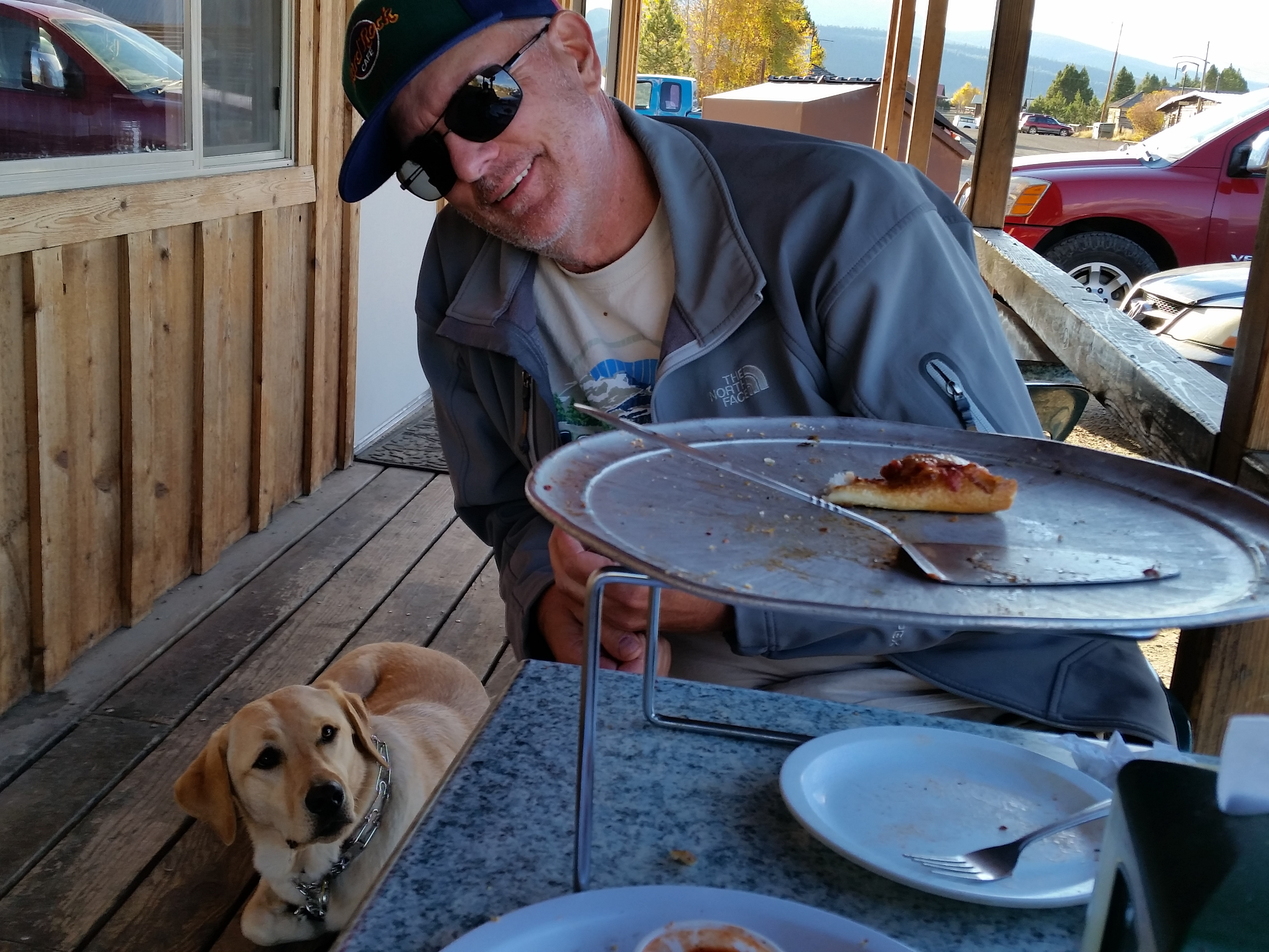 Abby has her eye on the last piece of pizza
Usually I just drive straight home after finishing a hike in the Sawtooths but Bryan suggested we stop in Stanley for dinner. I didn't have any food along for Abby so we needed to find a place where all three of us could eat. First we tried the restaurant in the Mountain Village Resort, the easiest place to stop since it is right along the highway. I asked the guy at the counter about Abby. He didn't seem too enthusiastic about the fact that we had a dog with us, even if we stayed outside on the patio. He suggested that maybe we should try Papa Brunee's Pizza, which is in downtown Stanley (or what passes for a downtown in Stanley, population 69 ). It turned out to be a great idea. The people there were friendly and they were happy to let Abby sit with us if we ate on the patio. Since I drove Bryan was kind enough to buy dinner. We ordered a large pizza and some garlic cheese breadsticks. We shared among the three of us and it was delicious. Even Abby was full. She slept all the way home in the car.
An excellent hike. I hope that Bryan and I do get a chance to climb Thompson Peak next summer.
