Black Canyon of the Gunnison
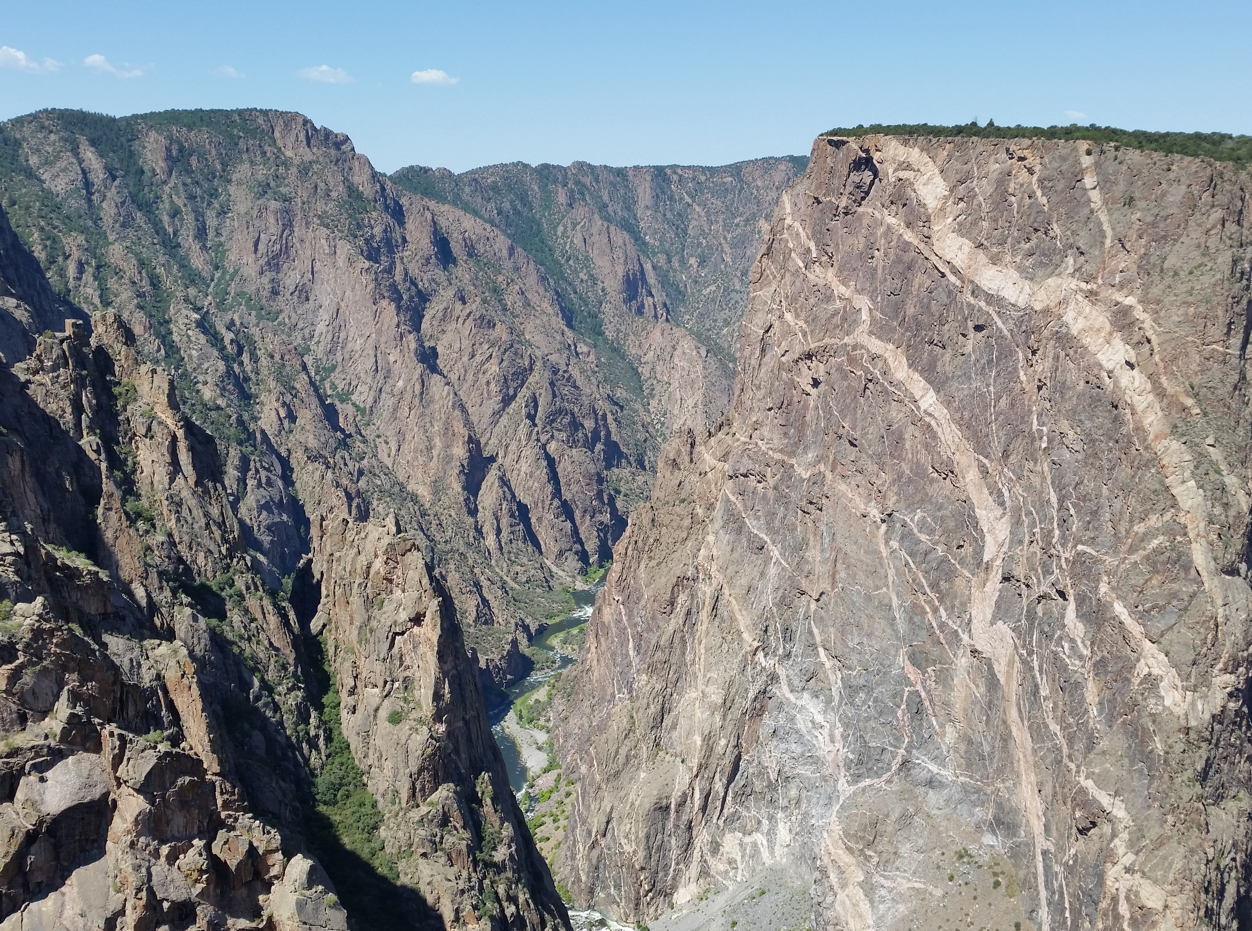 Painted Wall (on right)
It was a travel day. Time to leave Ouray and head for South Fork, where Sandy would be taking a quilting class for the next two days. It's probably only about thirty five miles as the crow flies but that is straight through the most rugged part of the San Juan mountains. There are several jeep roads that connect Ouray to Lake City, about midway. From there it's paved highway the rest of the way to South Fork. The most direct route is over Engineer Pass and is twenty seven miles. It's rated moderate to difficult, depending on how you define difficulty. Since you drive it in first gear it takes over four hours. Some people think that's a lot of fun. Personally I think rough roads are a pain and I hate driving them. The more conventional options involve going around the mountains, either to the north or south. The day before we had driven the Million Dollar Highway to Silverton, so we had seen the most scenic part of the southern route.
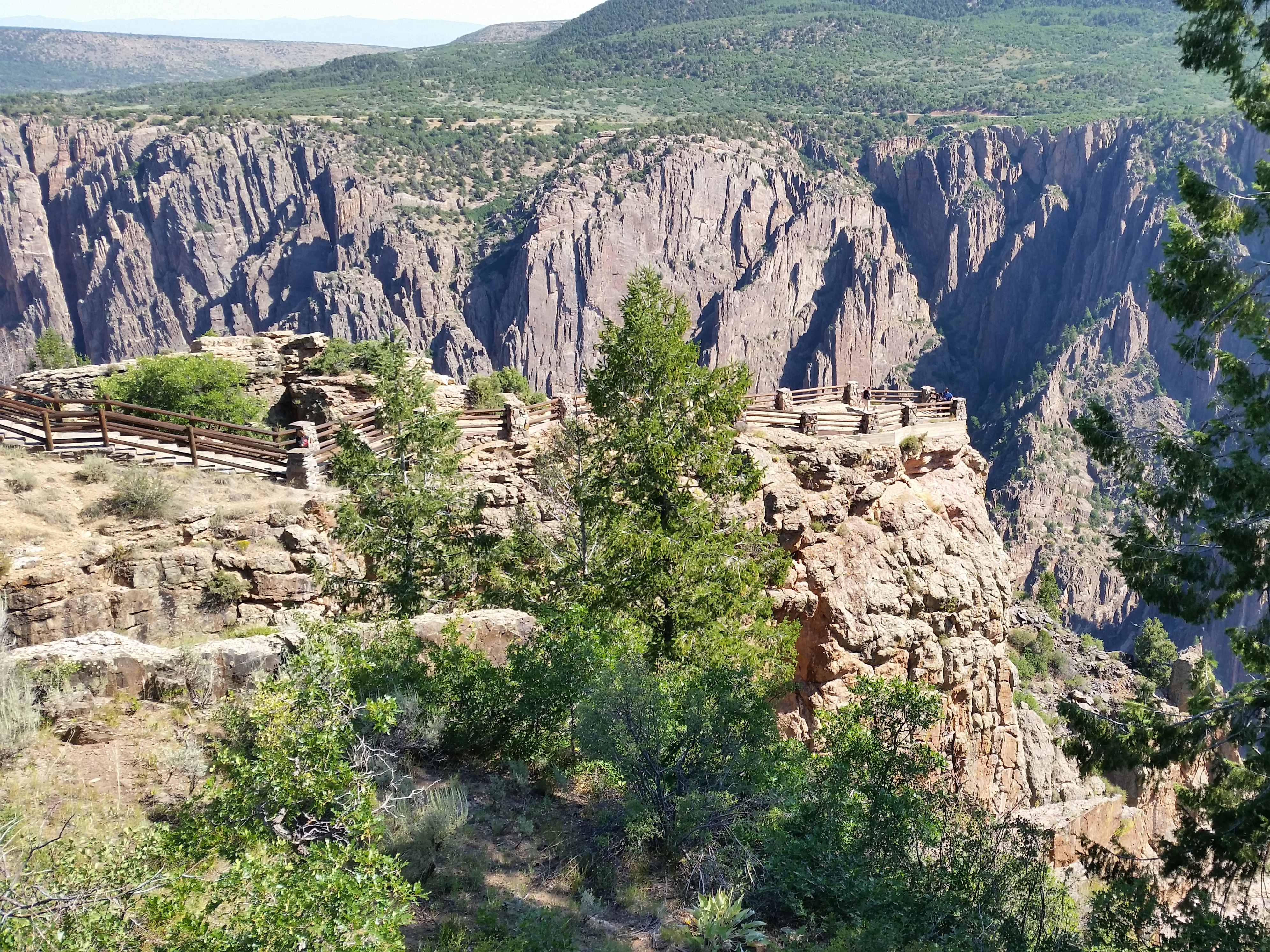 Viewing platform at Gunnison Point
The other option, to the north, offered something that looked interesting. Near the town of Montrose the highway passed very close to Black Canyon of the Gunnison National Park. Neither Sandy nor I had ever been there. Since the drive to South Fork would only take about four hours we had time to spare. We could spend a few hours checking out the national park.
We were in no particular rush to get going so we slept in, took our time packing up the car, and had breakfast at the Roast and Toast again. It only took us an hour to drive to Montrose, although getting through town was slow. Then it was fifteen miles to the park. At the entrance station I took the opportunity to buy myself a Senior Pass. If you are sixty two or older, for $10 you get a lifetime pass to all US National Parks. That's a heck of a deal and I don't know how I missed getting it last year. Getting old sure sucks but at least there are a few fringe benefits.
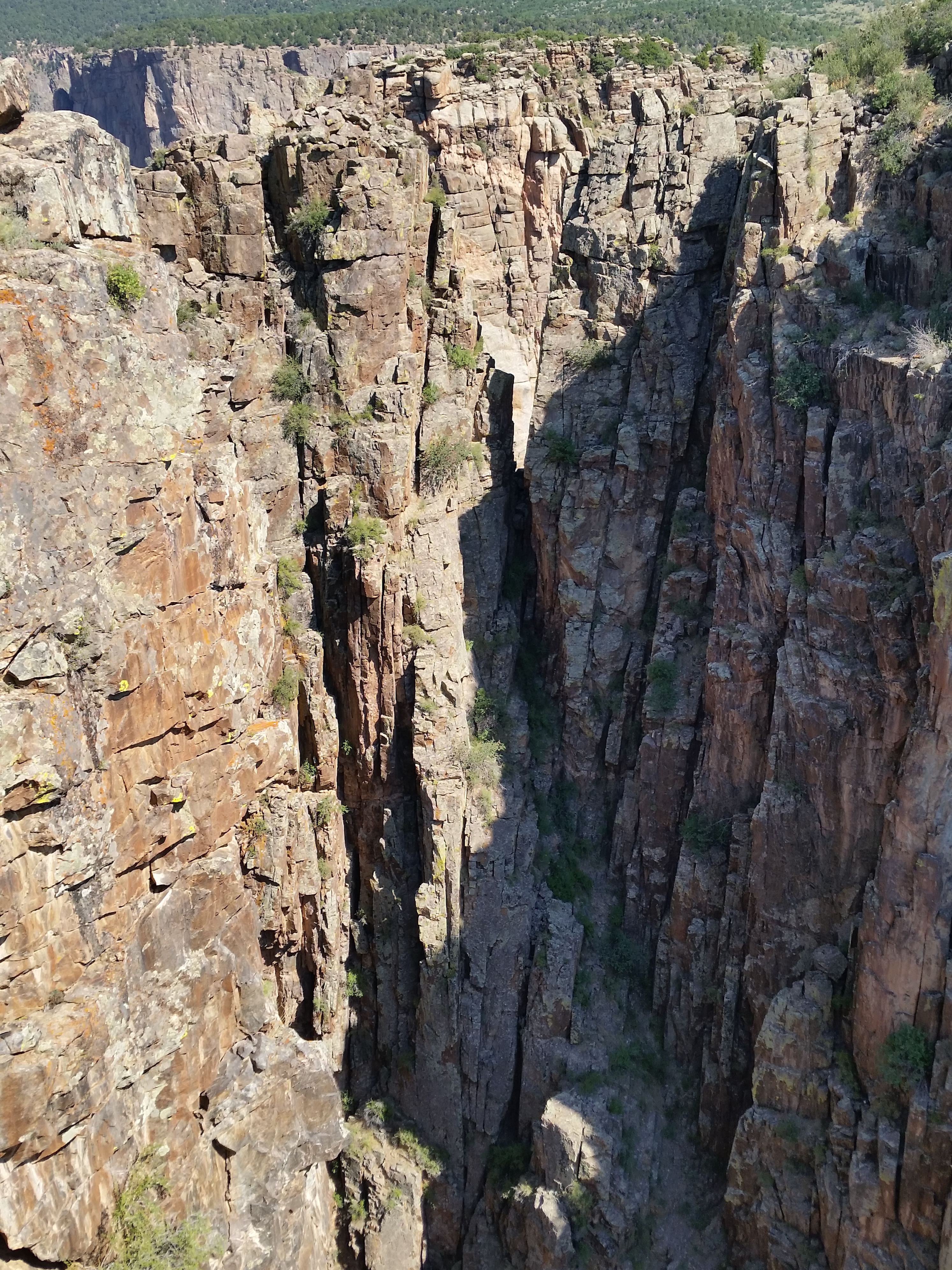 The Narrows of the Black Canyon
The Black Canyon of the Gunnison isn't the deepest canyon in the US, nor is it the steepest. But the combination of steepness and depth are truly amazing. At The Narrows, it's only forty feet wide at the bottom and eleven hundred feet wide at the rim, eighteen hundred feet higher. In other places it's over twenty five hundred feet deep and half a mile across.
The canyon is forty eight miles long although to the east of the park part of it is beneath Morrow Point Reservoir. Only fourteen miles of it are preserved in the national park but it's the deepest, steepest, most scenic section of the canyon.
Activities are somewhat limited at the park. The dead end South Rim Road is seven miles long and provides access to several spectacular viewpoints of the canyon. Most of them require a short walk to reach from the road, from a hundred yards up to a quarter of a mile. The longest trail is only a two mile loop on the rim near the visitor center. There really isn't much opportunity for hiking in the park. So we played tourist, took the scenic drive, and stopped at several view points to admire the canyon and take pictures. Although I prefer hiking to car touring, the canyon was so impressive that it was still well worth while.
We ended up at the Visitor Center. I bought an obscure book about travel through the bottom of the canyon, called Deep Black. It told about the first successful trip along the bottom of the entire canyon in 1901 as well as about the author's contemporary (well, 1996) attempt. And yes, I got a tshirt, although surprisingly it was gray. So it was a Black Canyon of the Gunnison tshirt but not a black Black Canyon of the Gunnison tshirt.
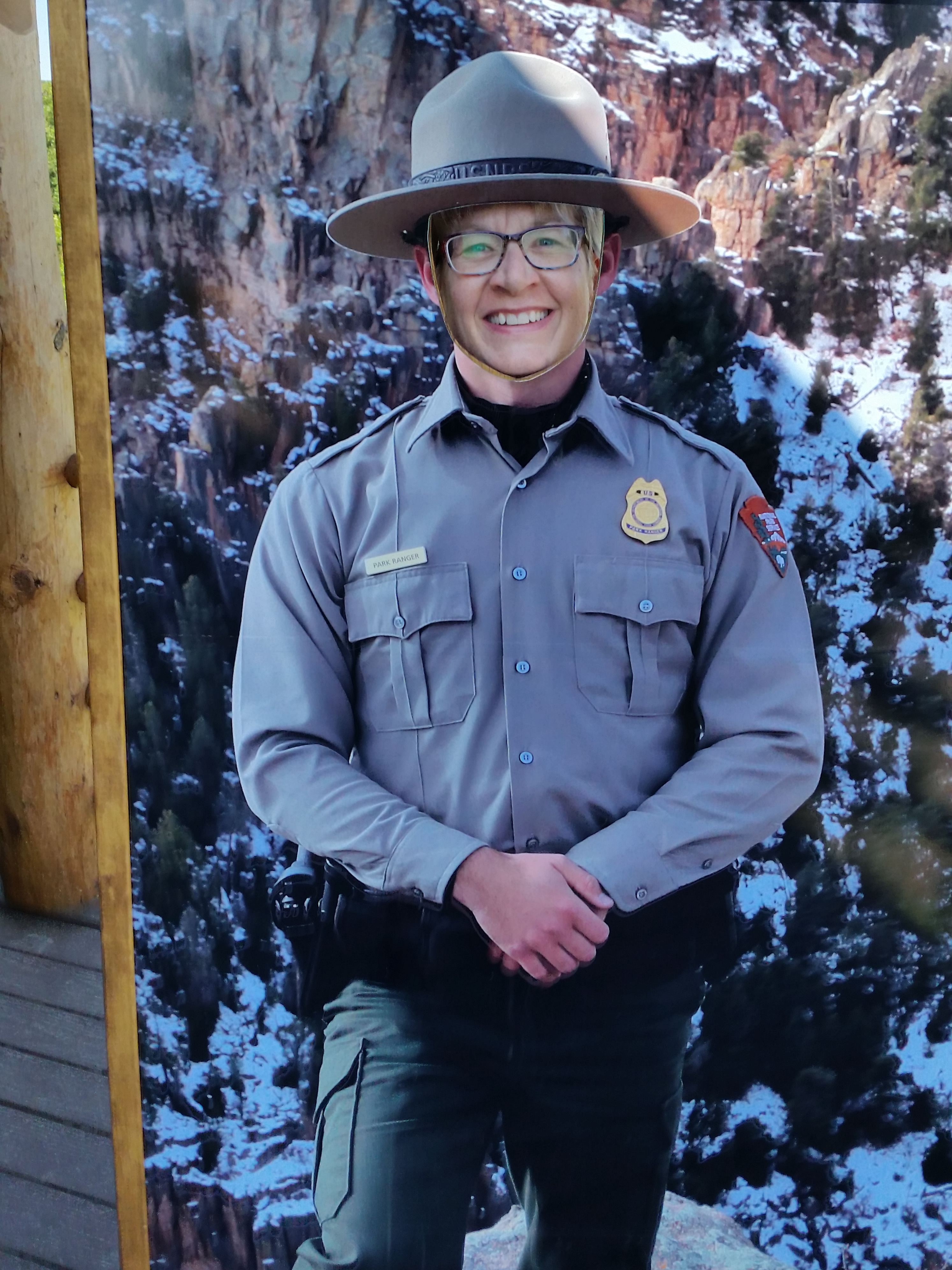 Ranger Sandy - I think she missed her calling
It is possible to hike from the rim to the river in the park. There are no maintained trails but there are six routes, three from each side, that take side canyons and reach from the rim to the river. They are all exceptionally steep and are serious hikes. The easiest is the Gunnison Route which is near the visitor center. It drops eighteen hundred feet in only a mile, and the first third of a mile is mostly level along the rim. The other routes are even longer, steeper and more difficult. The hike to the river sounded like fun but not on this trip. It would take all day and be a serious effort. I'll have to come back and do it another time.
We ended up spending about two and a half hours in the park. By the time that we left we were pretty hungry so we stopped for lunch at the first opportunity. This was at Pleasant Valley Cabins and Campground, which had a small cafe and general store. Very small. It was definitely an old-fashioned, middle-of-nowhere kind of place.
When we parked we noticed that there were five or six hummingbird feeders hanging from the roof of the porch along the front of the cafe and there were about a dozen hummingbirds zooming around them. We consider ourselves lucky when we see one hummingbird by the feeder that we have in our back yard. I guess we need to add some more feeders!
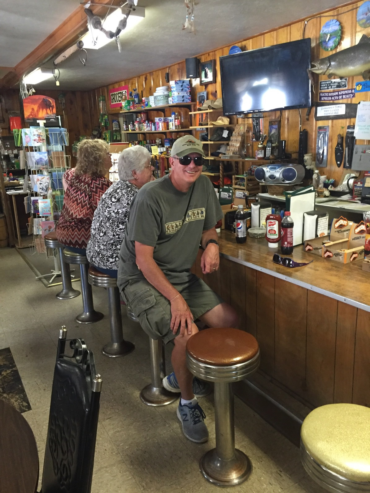 Lunch at cafe in Pleasant Valley
The cafe claimed that home made pie was it's specialty. They had a whiteboard behind the counter with the types of pie and number of pieces of each that they had today. When the two ladies sitting next to us ordered a piece of pie, sure enough the white board was updated in real time. Our burgers turned out to be good and very filling, so we didn't have room for any pie. I would have been more bummed but they didn't have cherry pie that day anyway.
The rest of the trip was uneventful, although it took a lot longer than the four hours that Google maps had predicted. We were stopped for construction not long after our lunch. We were stopped again after we passed Lake City, on the way up to Slumgullion Pass. (I love that name.) The pass is 11,361 feet high and has the steepest grade of any paved road in Colorado on it's north side approach.
We arrived in South Fork around five. First we located the local church where Sandy's class was going to be held. We wanted to know where Sandy needed to be the next morning. Then we checked into our hotel and unloaded the car before heading out to get dinner. We had a good pizza at The Old Firehouse, the number one rated restaurant in town on TripAdvisor. They had a nice patio and we could eat our meal while we sat outside and enjoyed the nice weather. Hopefully it would hold for the next day so that I could do a hike while Sandy went to her class.
