Upper Cascade Falls Trail
 Pizza in the mountains - what could be better?
Our trip to the Colorado mountains this summer actually came about because of Sandy's interest in quilting. Since her retirement at the beginning of the year, Sandy has been able to spend more time sewing. This spring Sandy's friend Laura, who owns the Quilt Crossing here in Boise, helped me pick out a nice sewing kit as an anniversary present for Sandy. It was from Quiltworx, a company that offers a whole line of patterns designed by a woman named Judy Niemeyer. They feature very complex geometric designs that require very specialized sewing techniques to make. Sandy got very interested in them as did her friend Laura,. Sandy decided that she would like to learn more, and maybe even become an instructor in the techniques at Laura's shop. To do that, she has to become a certified instructor, taking several classes and producing a number of quilts based on Quiltworx patterns. When she looked around for a class that she could take, she found one in South Fork, Colorado and signed up. The town is in the San Juan mountains, probably Colorado's prettiest mountain range. It's also on the edge of the Weminuche Wilderness. It protects half a million acres which makes it Colorado's largest wilderness area. Sandy asked if I was interested in coming along so I could hike while she was taking the class. That was a no brainer - it took me about ten nanoseconds to agree to go along. Since it was a long drive to get there, we decided to extend beyond the two days of the class and make it a week-long mountain holiday. Than way Sandy could do some hiking too.
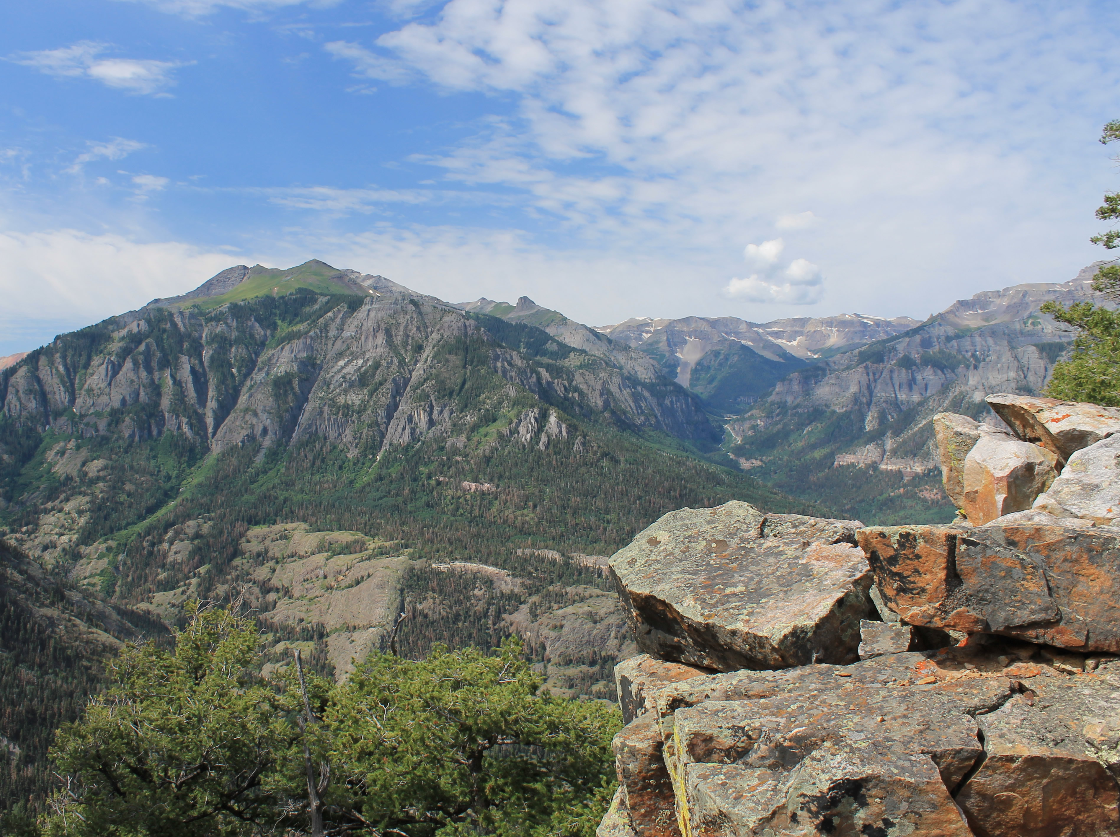
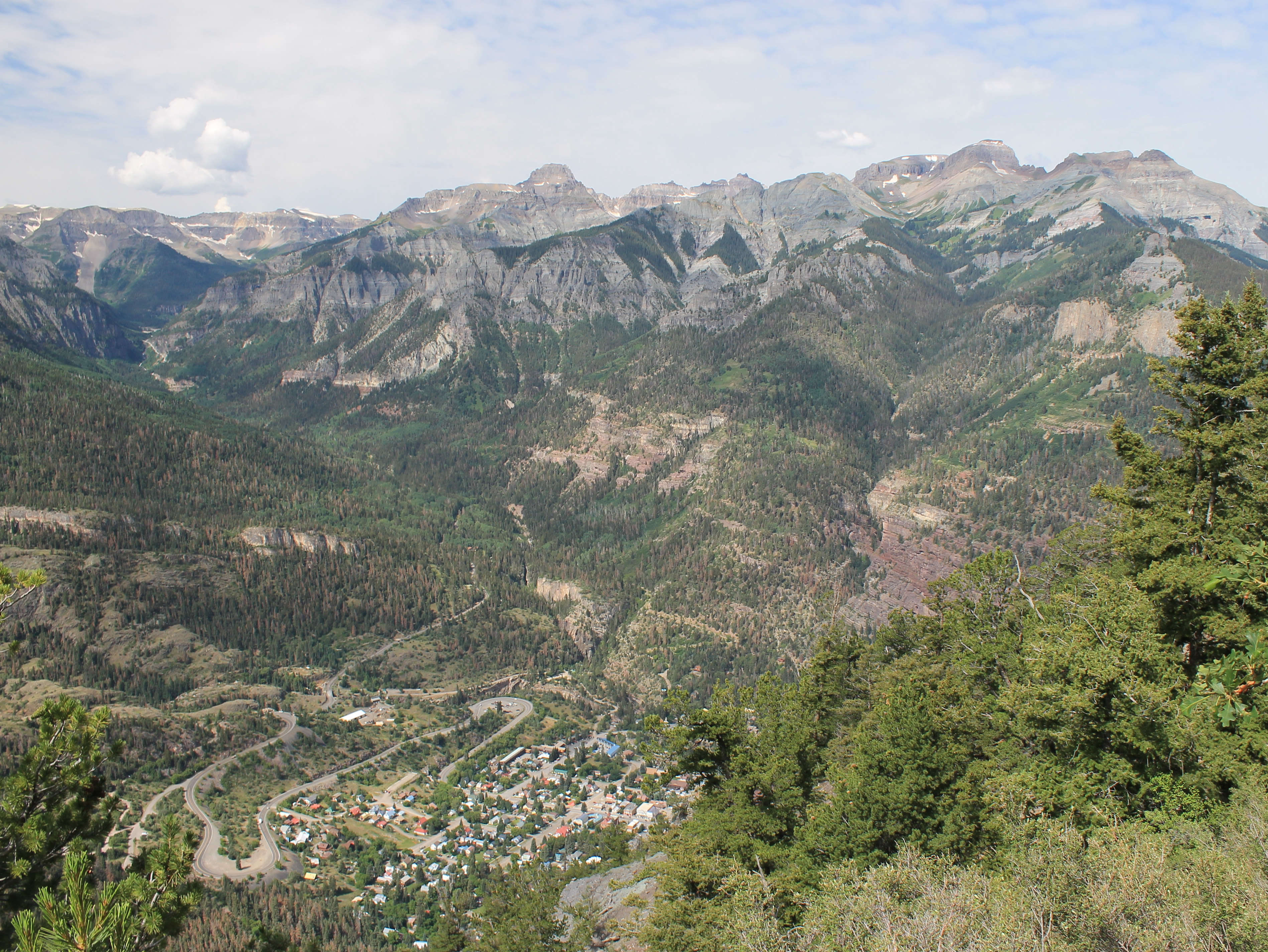 Ouray far below with the Sneffels Range in the distance
And that is the very long-winded explanation of how we decided on a trip to the Colorado mountains this summer.
We decided to spend the first couple of days in the town of Ouray. It's on the west side of the San Juans so it's a little closer to home and easier to reach. We had been there many years ago on a previous trip but certainly hadn't exhausted the possibilites for exploring the area.
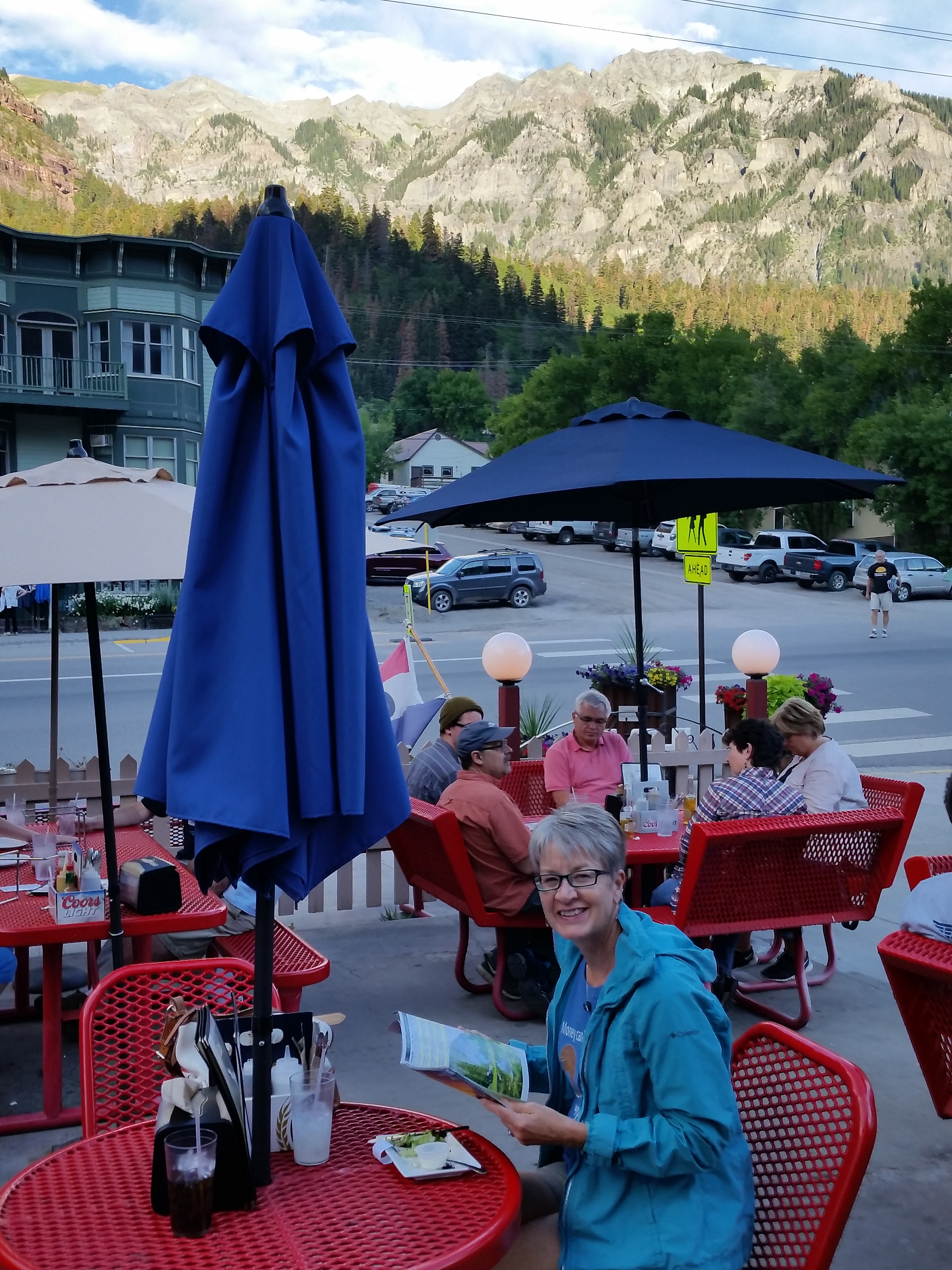
We got an early start leaving Boise, on the road at 7 am. We arrived in Ouray at 6 pm, almost right on the eleven hour time that Google maps had predicted. Although there were some lingering afternoon thunderstorms over the mountains it was sunny and warm in town. We had driven straight through without stopping for lunch, so when the first place we came across was Goldbelt Pizza, it sounded good to us. They had a large patio and we enjoyed a nice view of the surrounding mountains with our pizza. Maybe it was the scenery or maybe it was just because we were hungry, but it sure tasted good. Definitely a pleasant start to the trip.
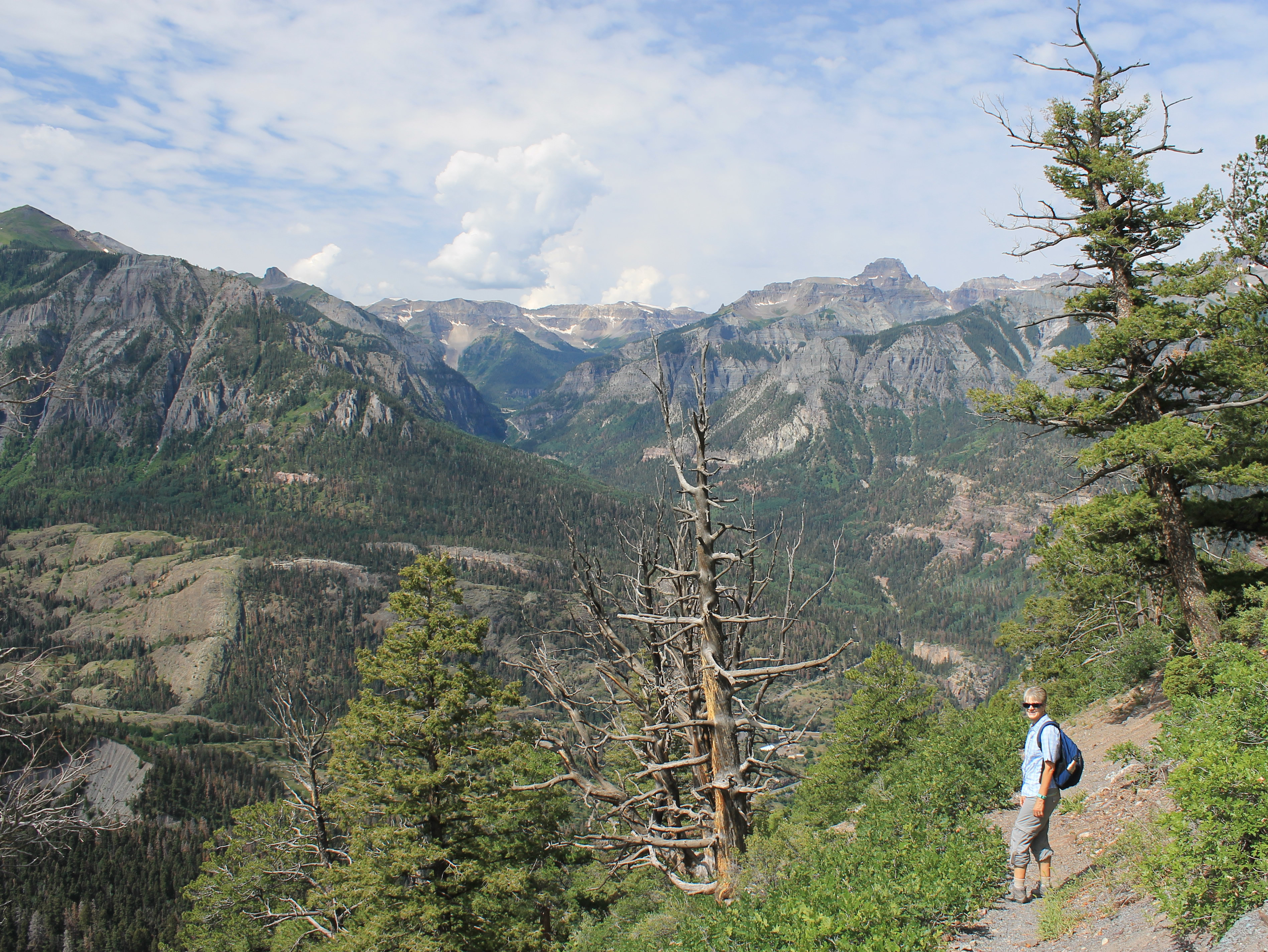
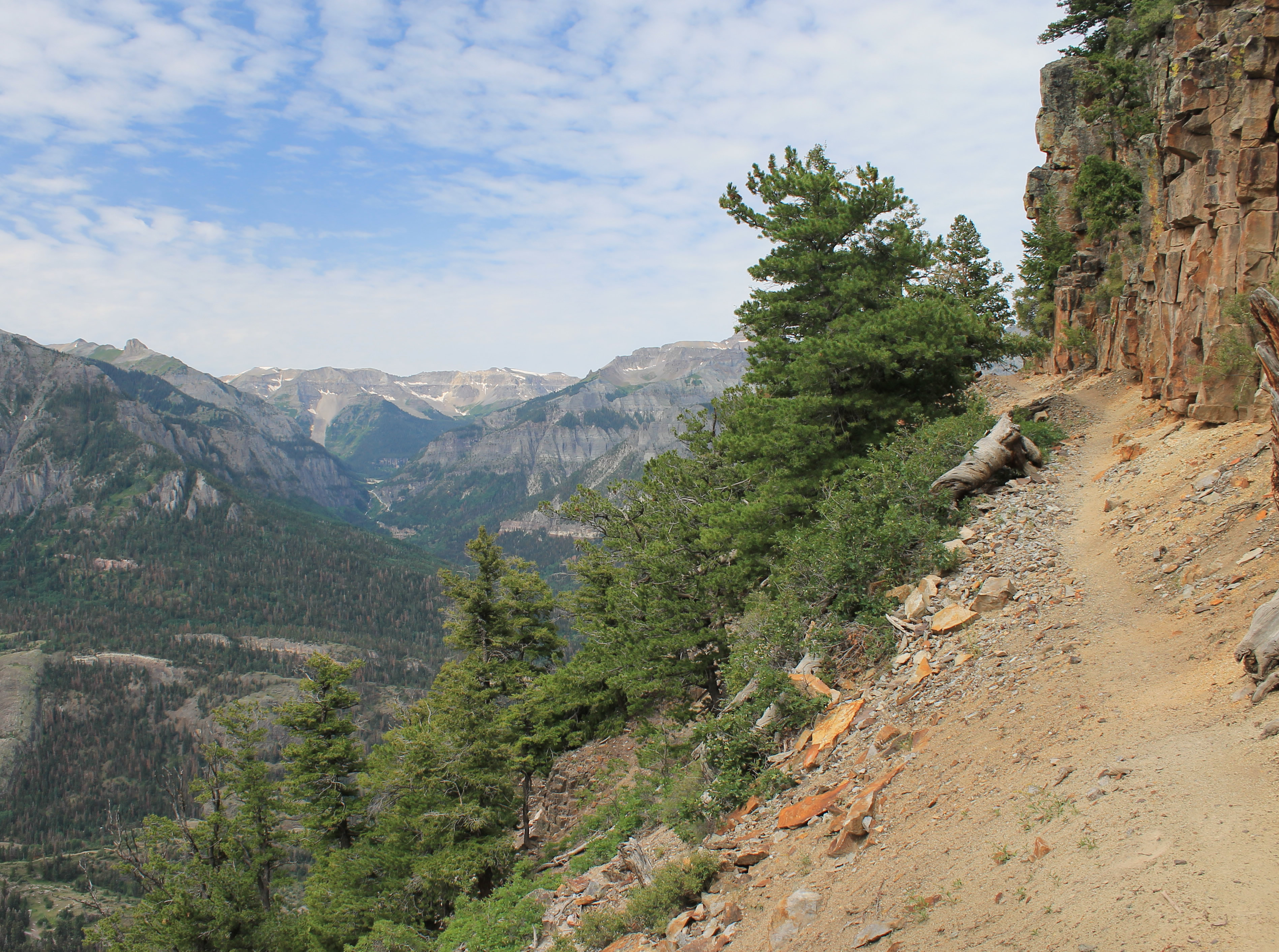 The scenic traverse below the cliff band
There were numerous hiking possibilities nearby so I spent a lot of time that evening studying the guidebook, Best Hiking in Southwest Colorado around Ouray, Telluride and Silverton. I had purchased it on Amazon in Kindle format. I was nervous buying the electronic version of a hiking guide. Several history books that I had bought previously in electronic form didn't have maps or illustrations that were as good as the print version. Those are critical for a hiking guide. But since this book only came in electronic form (and it wasn't very expensive), I decided to give it a try. It turned out to be quite well done. Besides getting it right away, it had the extra benefit that since I have the Kindle app on my phone, we had the guidebook along with us on our hikes. That proved useful a couple of times. Now I am probably spoiled and will want all my hiking guides in electronic form so I can always have them with me on the trail. Definitely high tech hiking. It's not like the old days when I always carried seven and a half minute USGS maps on my hikes.
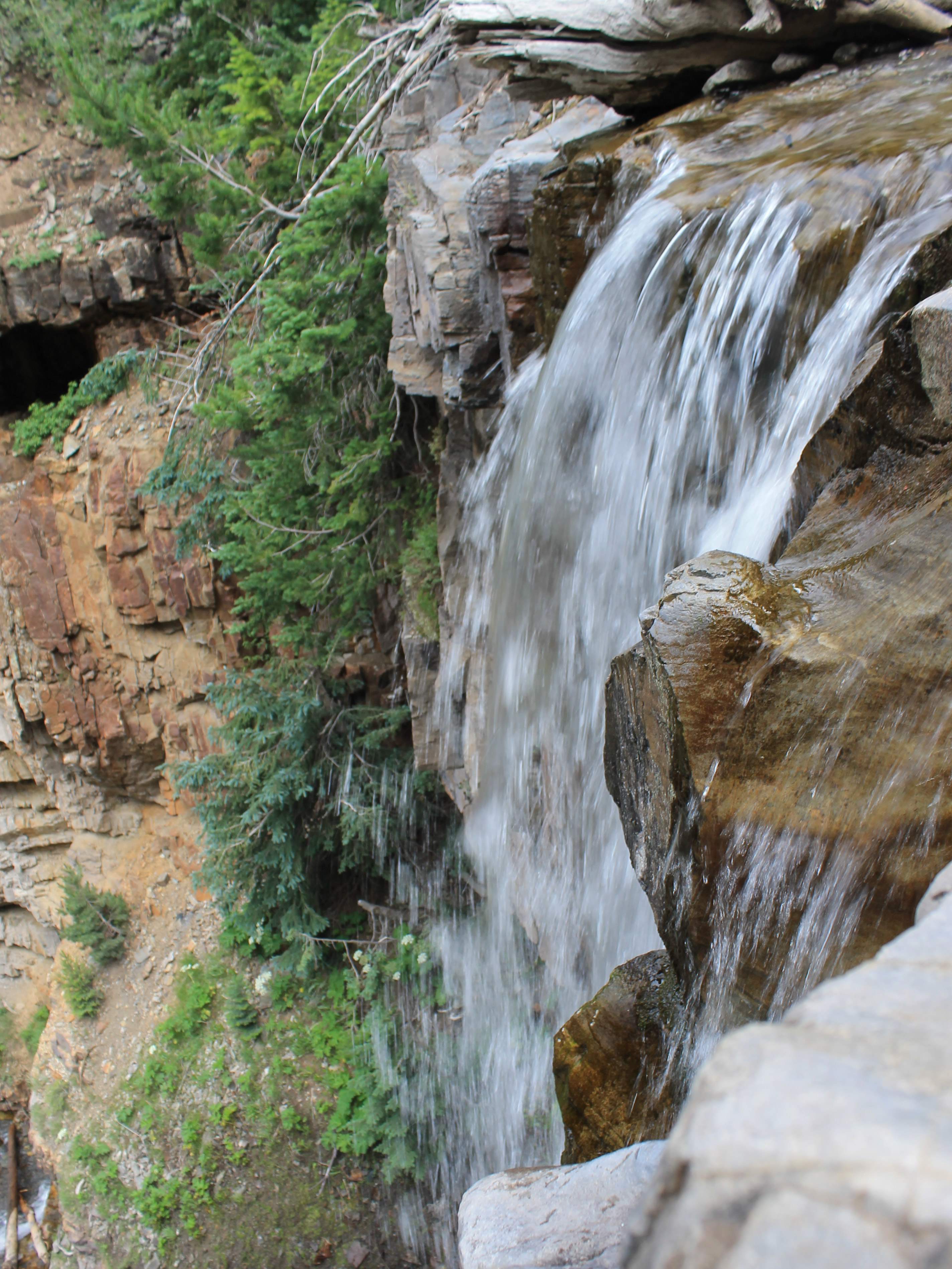
 Upper Falls and cascades above the trail
For our first hike I chose the Upper Cascade Falls Trail. It had several advantages. The trailhead was close, just a ten minute drive from town. It was one of the shorter hikes in the book, only about six miles for a loop trip. Normally we would consider that a pretty short hike for a full day, but it had fifteen hundred feet of elevation gain so it was a good amount of work. The shorter hike seemed like a good idea for our first day. We were at high altitude. Ouray is at 7800 feet and the trailhead was at 8500. This would be a good acclimatization hike. Another factor was that the weather forecast called for a good chance of afternoon showers. When we are hiking in a new area we like to be cautious for the first few days till we get an idea of the weather patterns. All mountain areas are different and mountains have a tendency to make their own weather, especially mountains as big as the San Juans. We wanted to be back from our hike by early afternoon before any bad weather had a chance to develop.
We were at the Roast and Toast shortly after they opened at 6:30 am for a quick breakfast. Then it was on to the trailhead. It was a six mile loop but a lot of the distance was on the longer return part of the loop. It was only 2.2 miles to the falls, which was the high point of the hike. The trail climbed gradually for the first quarter mile, then got down to serious business, gaining the rest of the elevation in the next mile and a half. It was definitely steep and we were working hard. Although it was a good trail, we had to be careful as it was steep enough that it would be easy to slip on the loose dirt. We climbed very slowly with the steepness of the trail and the high altitude (and a lot of extra weight that I was carrying after a long sedentary winter). Still, it wasn't long before we were up high and the trees started to thin out to give us good views.
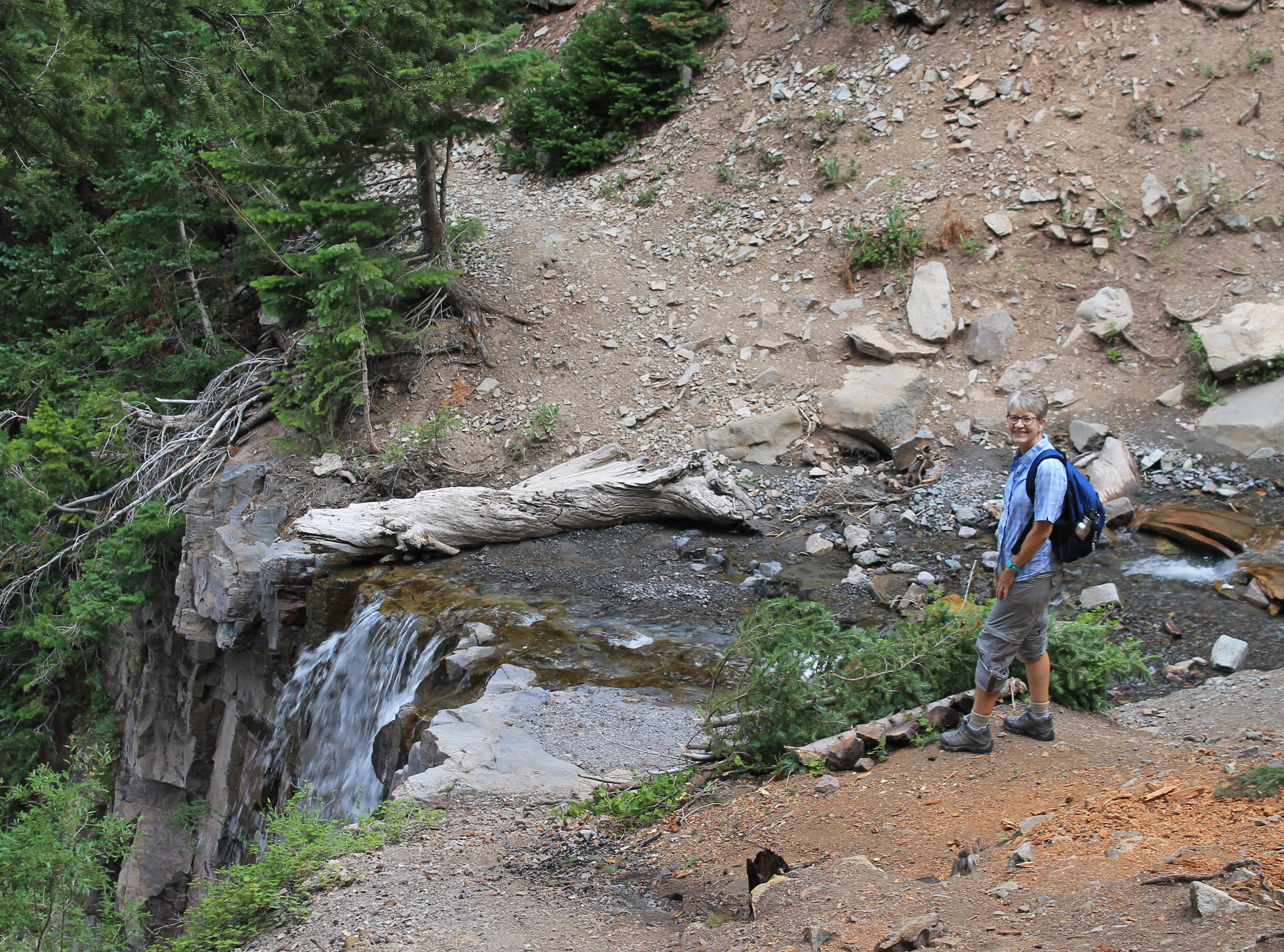 The trail crossed right above the dropoff for the lower falls
At first there was about a three quarter cloud cover, but as the morning progressed some of the clouds burned off and there was a lot more blue sky. To the south we had a beautiful view of Mt. Abrams, the mountain that dominates the view from town. To the west we could see Ouray far below with the Sneffels Range towering over it.
Finally the climb let up and we did a long traverse at the base of a cliff band and then turned a corner into the next drainage. For the last half mile to the falls the trail was level or slightly descending, a welcome change after our steep climb.
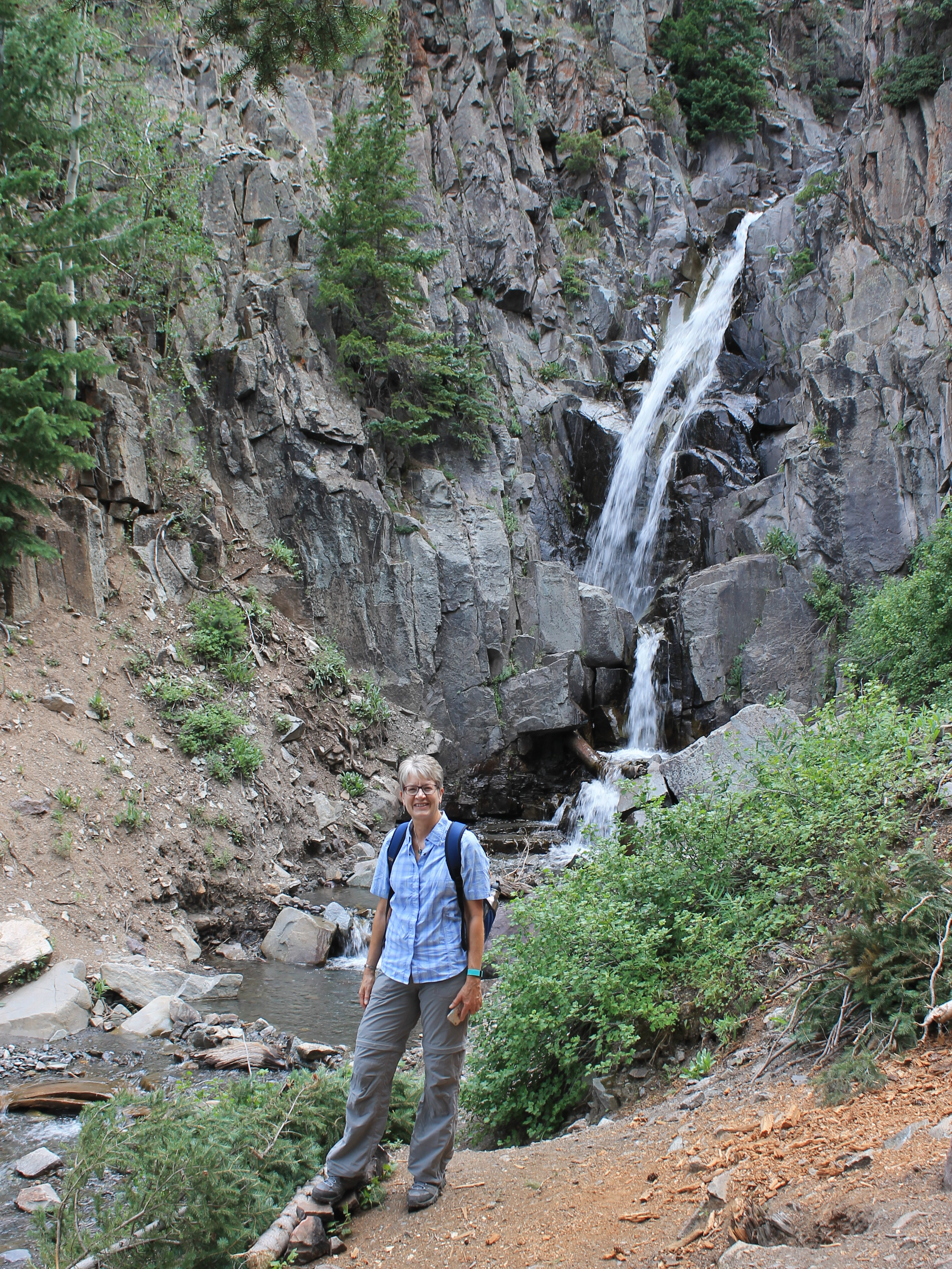
We stopped when we reached Cascade Creek and the waterfall. The trail continued for another quarter of a mile to the abandoned Chief Ouray Mine. Sandy was game to continue but I didn't see much point in looking at trashed old buildings. The falls were very nice though so we took a break there. There were actually two waterfalls, one above the trail and one below. They're both considered Upper Cascade Falls. Lower Cascade Falls is quite a ways downstream, much lower and near town, accessible by a different trail.
 Mt. Abrams from high on the Cascade Falls Trail
The falls above the trail was in a pretty alcove with wildflowers along the side of the stream, cool shade under the trees and a view out to the Sneffels Range across the valley. A very quiet, peaceful and beautiful spot. Just a few feet from where the trail crossed the creek the water plunged over a cliff edge. I crawled and looked over the edge and could see that the water fell vertically for quite a ways. I couldn't even see the bottom of the falls, at least not without being braver (or more foolish).
When we finally started back down, the sky had cleared a little more and the views on the traverse were even better. Then came the steep descent back into the forest. It was faster than climbing up but still hard work. We had to be very careful not to slip on the steep dirt. When we reached the trail junction for the loop, we chose to continue back on the Portland Trail. It added a mile and a half but we figured that was actually an advantage, being a lot less steep.
 Afternoon buildup starting as we head down the mountain
It actually turned out that the loop wasn't such a good idea. Soon there was a climb of about two hundred feet to get over a small ridge. The guidebook hadn't mentioned this! It wasn't that much elevation gain, but uphill is never welcome on the way back when you think that you have already done all the hard work. Then, even worse, near the bottom we reached several confusing trail junctions. Twice we decided that we had gone the wrong way and had to backtrack several hundred yards. Since that meant going back uphill it was doubly frustrating. Still none of the paths looked familiar and we couldn't figure out where we could have missed the junction that closed the loop. We finally just settled for going downhill. We figured the worst that could happen was that we would end up back in Ouray and someone would have to go get the car. It turned out that we didn't have to go all the way back to town but we did come out on the road and not at the trailhead parking lot.
 Looking over the edge of the lower falls
At first we weren't sure whether it was the highway or the spur road to the trailhead which meant that we didn't know if we had to go left or right to reach the car. Then I remembered that I was using Map My Hike, a GPS app on my phone, to plot our hike. I haven't been using it for that long so I don't rely on it to navigate. Sure enough, when I checked it showed our position, the road, and where we had hiked on the way up. More importantly, it showed where we had left the car. At first I thought that rock/paper/scissors would be a good way to determine who had to go get the car, but then decided that it would probably be smarter for me to volunteer. Sandy stayed behind while I walked up the road. It took me twenty minutes to reach the car and drive back to get her. She was just starting to get anxious, as it had clouded up and started to sprinkle a minute or two before I showed up. I rescued her just in time.
By the time we cleaned up and headed back into town, we were well overdue for lunch. We decided to try the Ouray Brewery, which had a rooftop patio (which was under cover in case of an afternoon shower) where we could have lunch, try the local brew, and admire the mountains. It turned out that our lunch was ok but not great and the patio was overcrowded. It wasn't a total loss though. At least I got a cool Ouray Brewery tshirt. Overall it had been a good first day of hiking.
