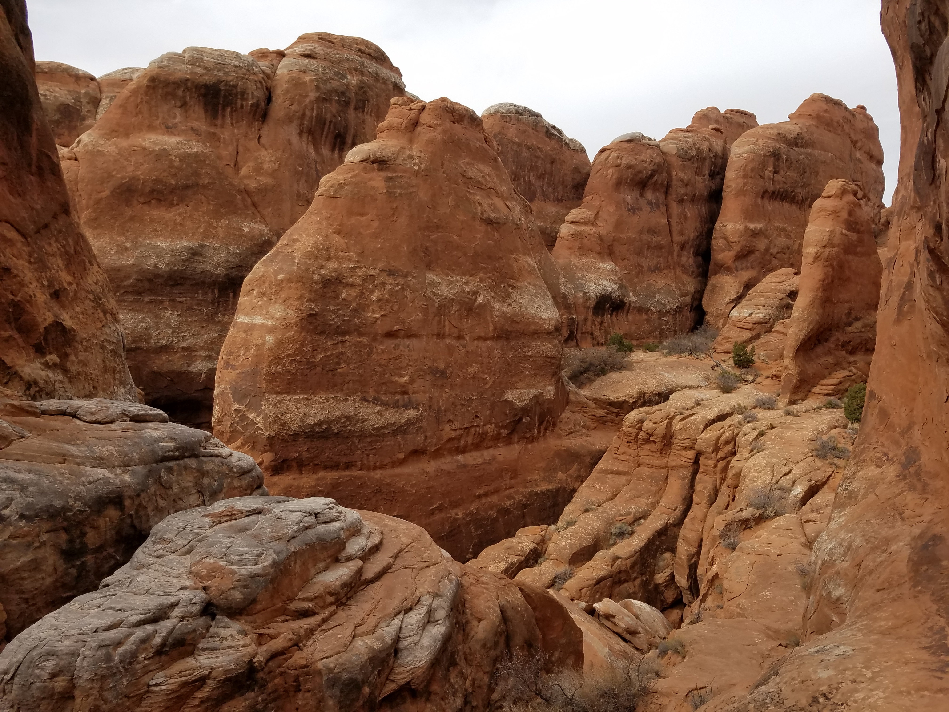
Fiery Furnace
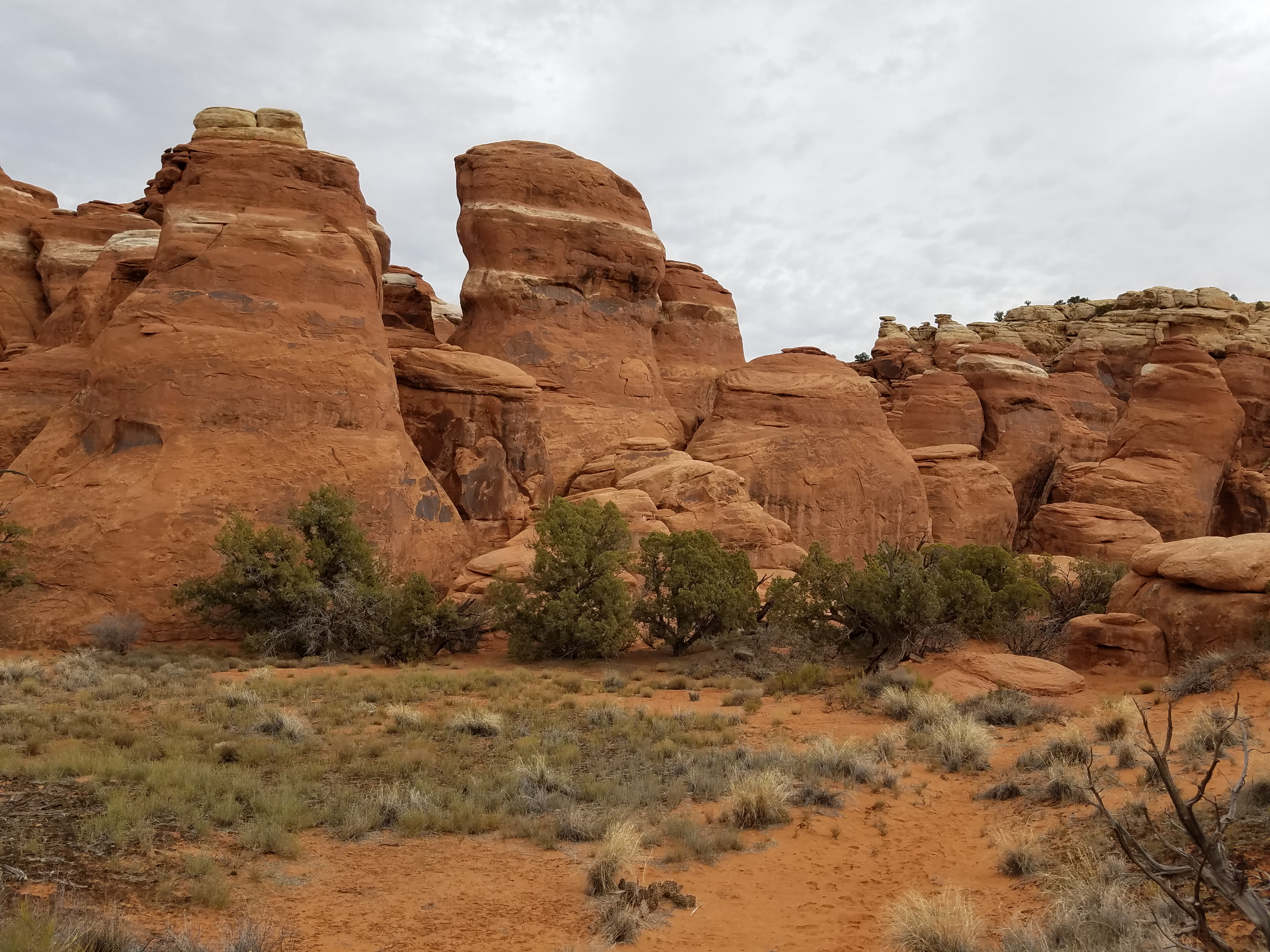 Approaching the Fiery Furnce
I was excited about my second day in Moab. I had a permit to hike in the Fiery Furnace, an extremely rugged area in Arches National Park, a dense maze of rock fins and canyons. The terrain is too rugged for hiking trails. There is a ranger led tour through the Furnace which I did once before. It was so long ago that I don't remember much about it. All I have is a vague recollection of a confusing trip through a rocky labyrinth that required hiking on slickrock, scrambling up and down obstacles, and squeezing through narrow passages. In other words, it was great fun.
I was hoping to do the Fiery Furnace again. The problem is that the ranger led tour has very limited spots. The tickets are sold seven days in advance and go quickly. Unless you are spending more than a week in Moab, you don't usually have a chance to get one. But since this was off season I was hoping that I might get lucky. My first day in Moab, I was at the visitor center right after it opened hoping that I could snag a spot on a Fiery Furnace tour.
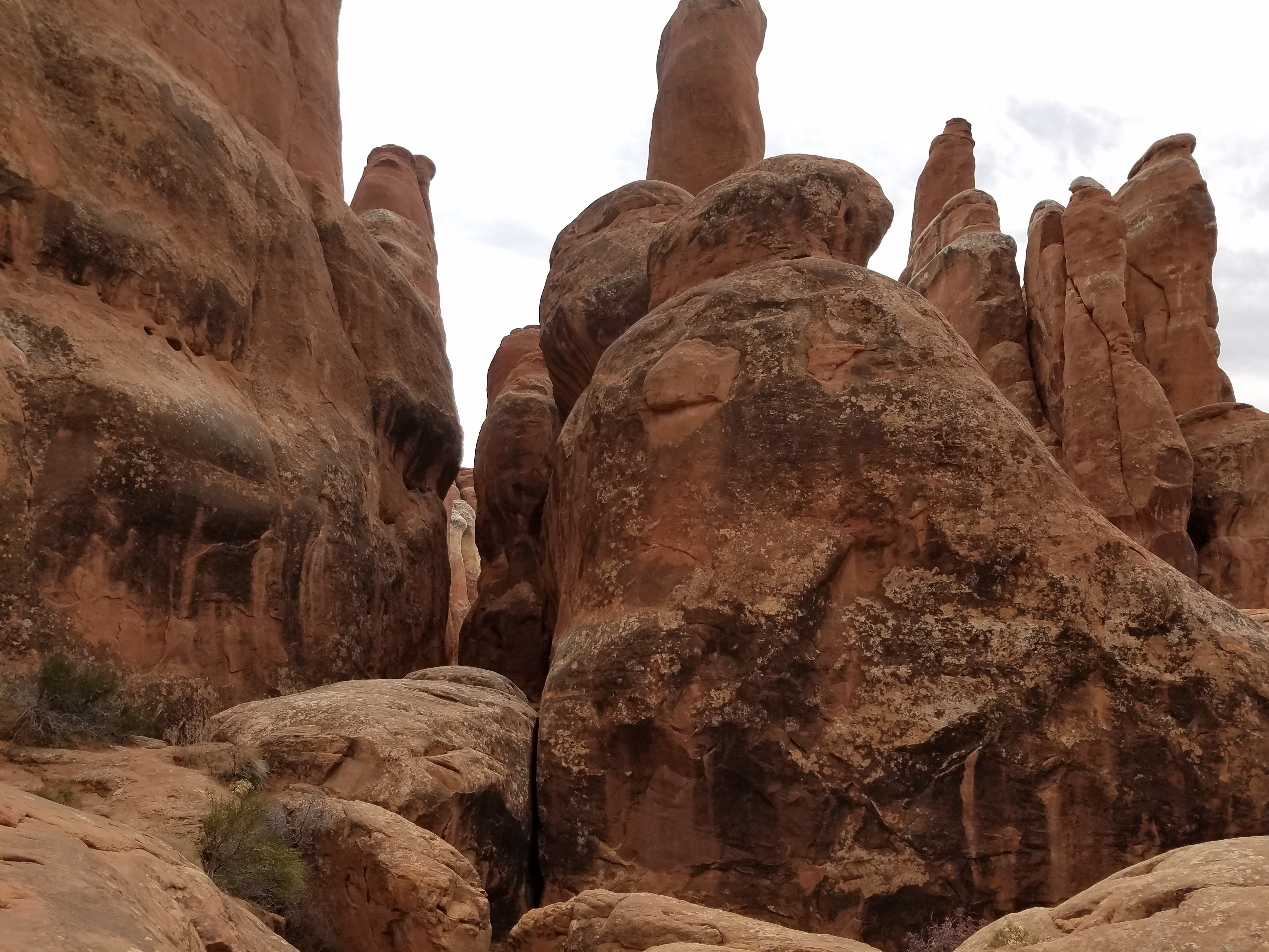
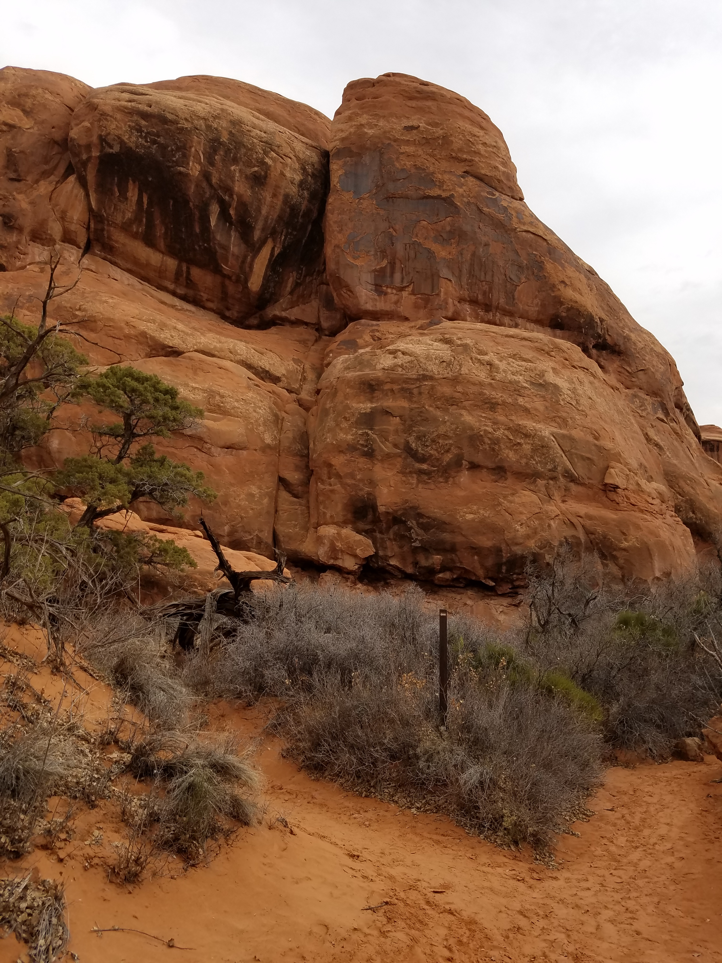 One of the more conspicuous route markers
When I asked at the visitor center I found out that the guided trips weren't starting until later in the spring. The only option was to get one of the small number of permits that they give out each day for private hikes. They were already gone for that day but tomorrow was open. I told the ranger to sign me up.
It turns out that there is a fairly extensive process to go through to get the permit. First they asked if I had done the hike before with a ranger. Check. Then I had to watch an instructional video. It covered important information for hiking in the area. Don't step on crytpbiotic soils. Don't mark your path in the Furnace in any way. Keep quiet because sounds reverberate through the narrow canyons. Don't latch on to other groups, especially a ranger guided one. If you can't do the hike yourself you shouldn't attempt it. Most important, always be prepared to backtrack to get out. The video emphasized that it was easy to get lost so you always needed to be able to retrace your steps to find your way back to the trailhead.
There were two other people who watched the video with me but when it was over they bailed out. They suddenly remembered that they had planned to do something else tomorrow. Then a ranger came in and gave a follow up talk. At the end, I had to pass an oral test on what had been covered in the video and the talk. Obviously the Park Service was serious. But I passed and got my permit. I always was good at taking tests.
 Walk Through Arch
The ranger did say that the standard route through the Fiery Furnace was "lightly marked". He showed me a small arrow sign that was about about one inch by three inches. He said that they were located at key spots along the route. But he made it clear that they could be very hard to spot and difficult to follow. He emphasized that it was ok to get stuck and have to backtrack.
That night I spent a lot of time on the web researching the Fiery Furnace. Everything that I read indicated that it was quite difficult to find your way through. I found one article that listed major points along the route, complete with photographs, and gave the rough distances between them. It also listed GPS coordinates but many of the articles that I read indicated that GPS readings in the narrow canyons were very undependable. Since I didn't have a printer I copied the description of waypoints down on a sheet of paper to take with me the next day. I figured that it would be better than nothing.
Next morning I went into Moab to see if I could find a good map of the Fiery Furnace. First I went to Back of Beyond Books, an excellent small bookstore in downtown Moab. They had an extensive selection of guidebooks and maps for hiking near Moab and elsewhere but there was nothing with any detail on the Fiery Furnace. Next I tried Gearheads, an outdoor equipment store. They also had a good selection of hiking guides and maps. They even carried USGS 7.5 minute maps and had the one that covered the Fiery Furnace. Unfortunately even that was useless. The Fiery Furnace is such a compact area that the detail that would be needed to navigate through it doesn't show up on the topo map.
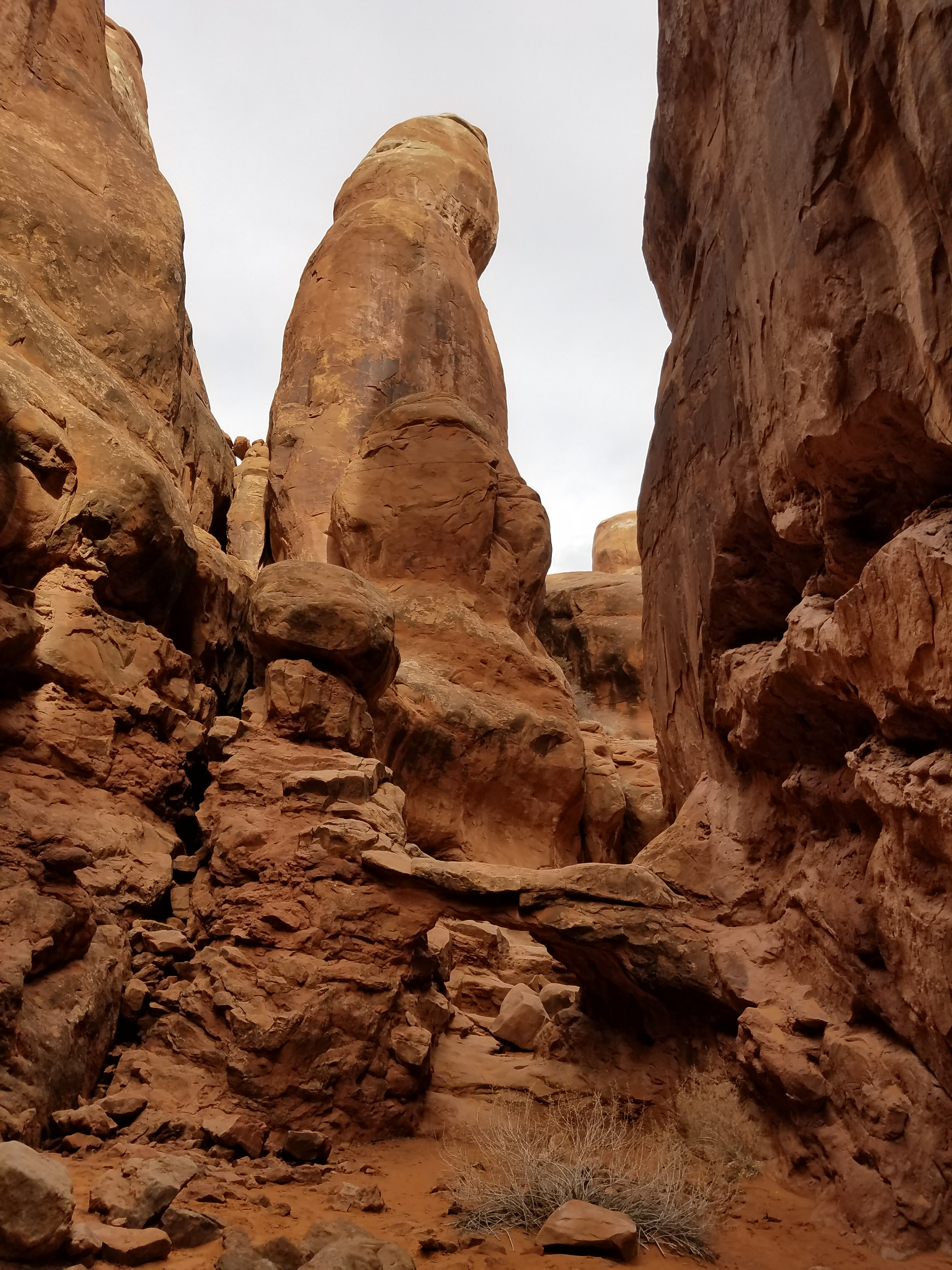
 No trail - the route climbs up slickrock
When I got to the trailhead I figured that I would head into the Fiery Furnace and just poke around for a while. I would just make sure that I knew how to retrace my steps to get out when I was done. I wouldn't go into the Furnace any further than I felt comfortable.
There were just a couple of cars at the trailhead. The NPS only gives out a handful of permits each day. I grabbed my pack and started down the trail that left the parking lot. It wasn't long before the trail faded and then disappeared, well before I even reached the rocks. I headed down the slope towards the Furnace and eventually picked up a faint tread that trended east. I followed it for a while but then realized that it was just going around the Fiery Furnace, not into it. Time to backtrack. Great. It wasn't that I was lost in the maze. I couldn't even find my way into it!
Eventually I found a way downhill and reached a large wash. There were lots of tracks in it and they looked like they were headed the right way. Even better, there was a pole with one of the small arrows on it. Finally! I was on track.
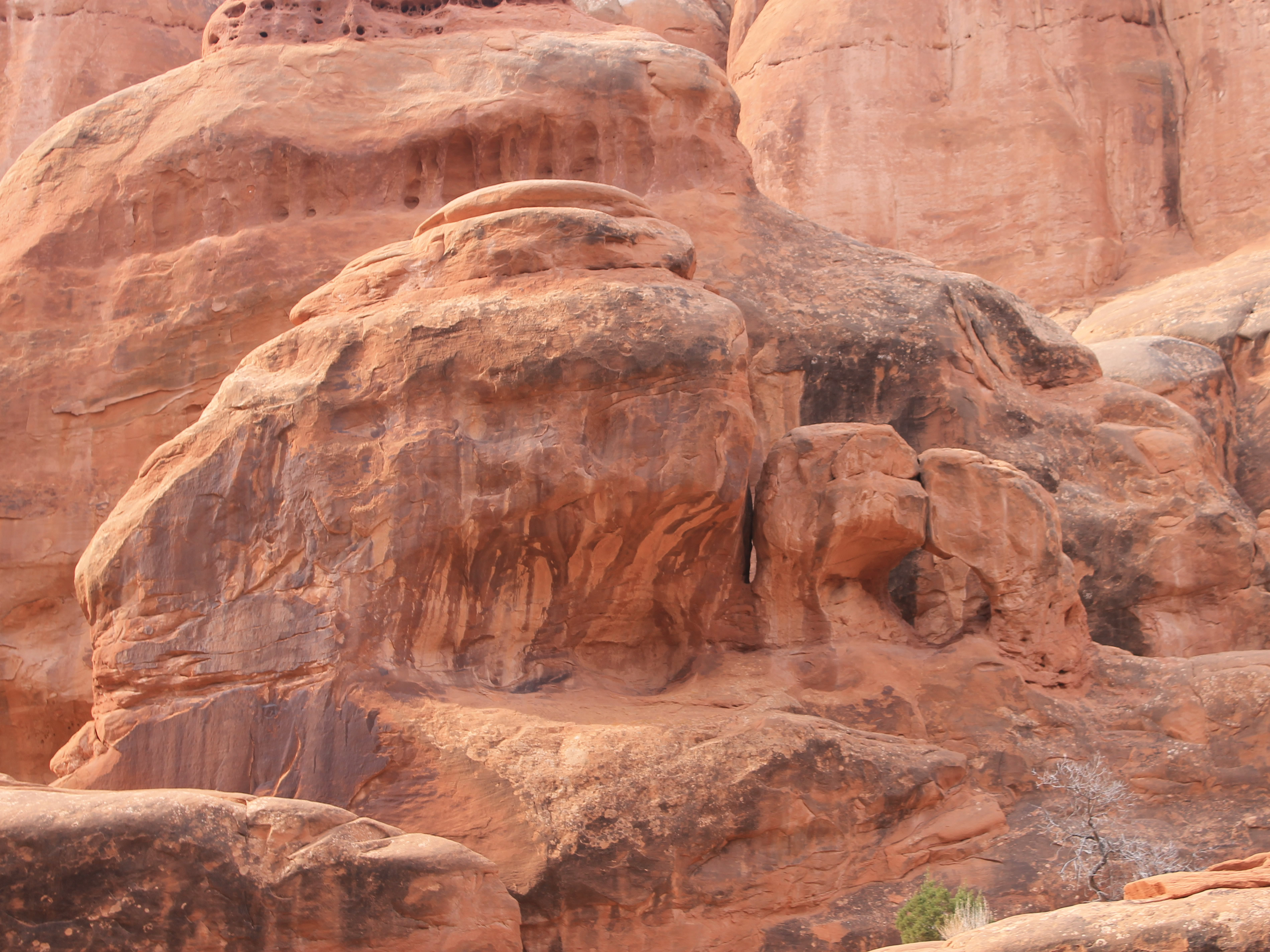
I remembered from my reading the night before that there were several notable landmarks near the start that were up short dead ends, mostly to the left of an early junction. Sure enough, shortly after the first route marker was a small sign that read "Dead End Ahead". I checked out a couple of the short canyons. Up one I found Walk Through Arch, which I recognized from pictures. I did walk under it without ducking, barely. Crawl Through Arch was supposed to be nearby but I didn't find it.
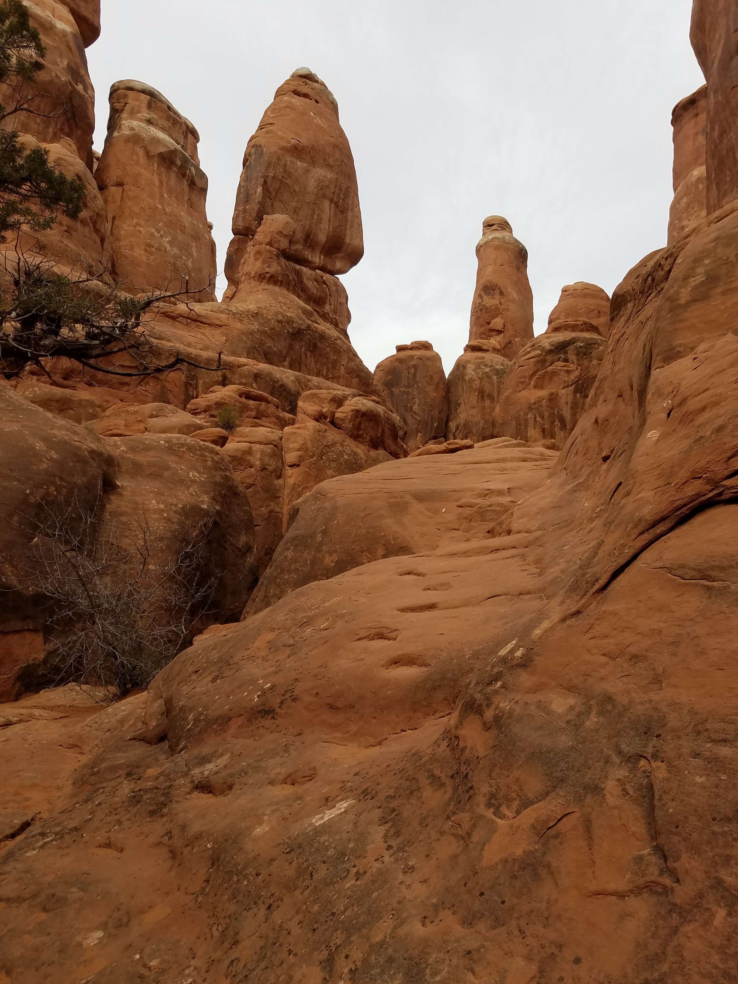
 A tight squeeze - good thing I'm skinny
After exploring several dead ends I began to wonder where the through route was. Eventually I went back to the trail marker. From there to the Dead End Ahead sign was only about a hundred feet. The correct route had to be somewhere in that short stretch. I remembered from some crude maps that I had seen the night before on the web that there was a sharp right bend in the route near here. I looked and looked and finally spotted a narrow, rising slot that was just big enough for a person to fit through going off to the right. And there, next to it, was a route marker. Eureka! After climbing a short distance through the slot I emerged in a higher wash with lots of tracks. It was slow but I was making progress.
Some way down the wash there was another route marker on a post pointing off to the side. I decided to explore further down the wash before following the sign. I was looking for Skull Arch. I didn't have a good idea of what it looked like but I figured with a name like that it would have to be cool. I didn't find it, although I didn't look up every possible side canyon. There were just too many to try all of them. On my way back down I ran into two hikers, a man and a woman, and stopped to talk to them. They were looking for Skull Arch too, so I told them where I had looked unsuccessfully. They were the first people that I had run into since entering the main part of Fiery Furnace.
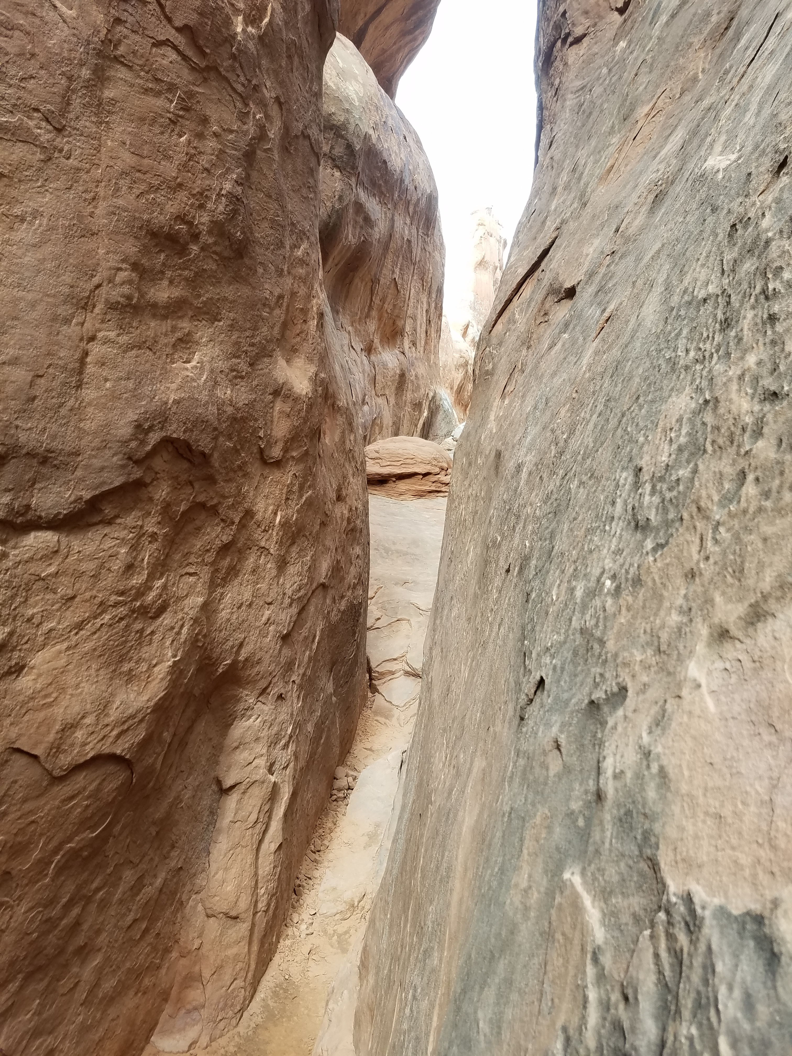
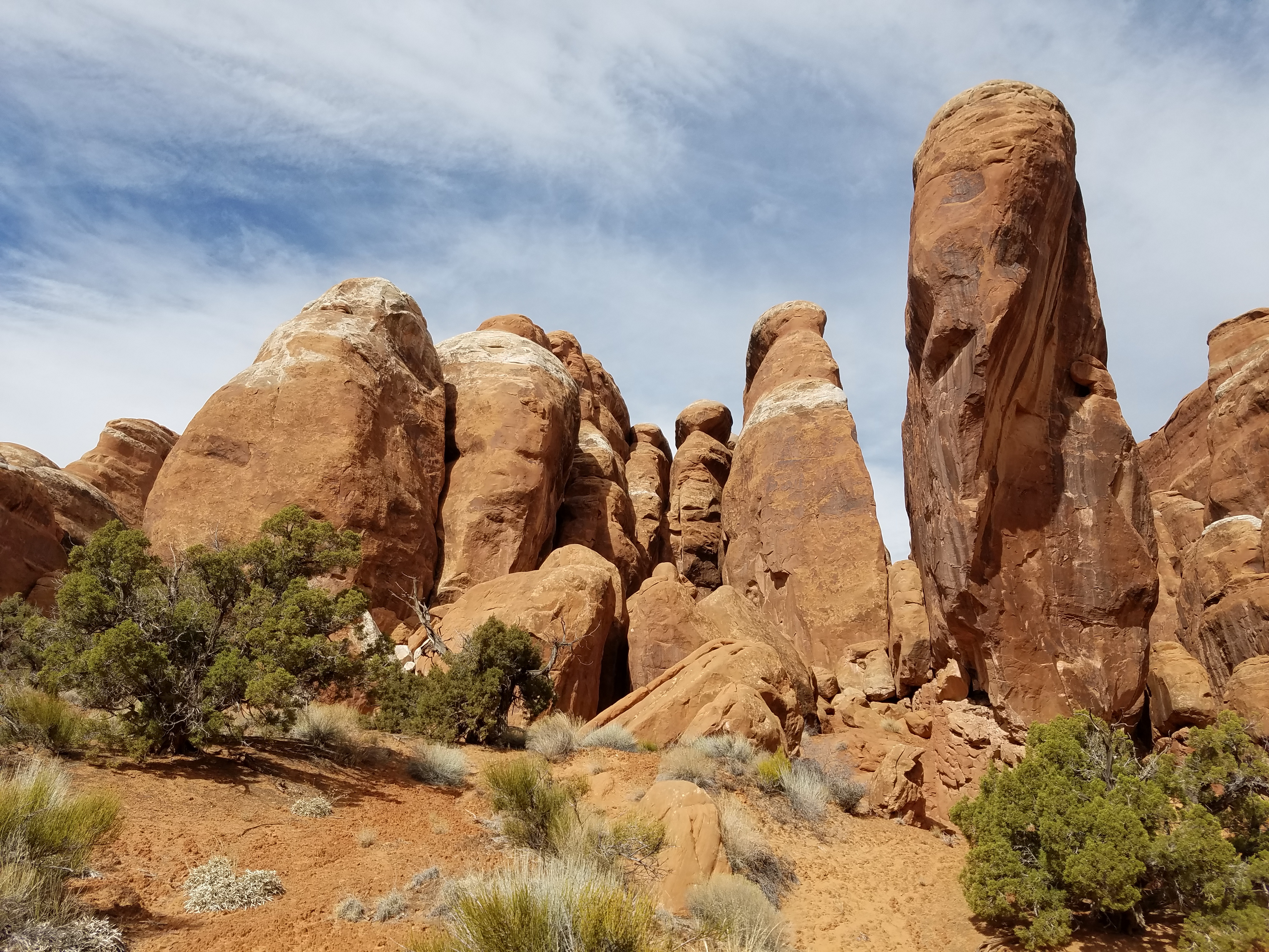
I went back to the turnoff where the route left the wash and climbed straight up a rock slab. No more following footprints in the sand. From here on the route was mainly on slickrock. For quite a while it was easy to follow though. It went through deep slot canyons or along slickrock shelves, usually above dropoffs. Sometimes it was easy walking. Sometimes it was scrambling. I kept getting deeper into the maze but wasn't too worried about reversing my way to get out. There really wasn't much choice about where to go.
 Narrow slots, rock ledges and drop offs
At one point I was in a narrow canyon which was blocked by a rock bulge in the center. On the right it narrowed to a tiny crack. Too deep and narrow to walk in, it would have required stemming, a rock climbing technique, to get past. The left side looked more promising, where I was able to climb up an easy ramp...right to where it ended in a twelve foot dropoff. I could see an ampitheater beyond and right in the middle of it was a trail marker. It was where I needed to go I just didn't know how to reach it. I was reminded of the old expression "you can't get there from here".
I looked to see if I could climb down or jump. But I remembered something the ranger had mentioned the day before in the orientation. He said that the most common reason for people to need rescue from the Fiery Furnace was because they broke a leg or an ankle jumping down a dropoff. I decided to go back and look for another way.
I tried going directly over the rock bulge. I tried cutting over in the middle. Nothing worked. Finally I just went back and did the stemming move. Once I tried it I found out that it wasn't that hard, but it was more than I expected would be on the guided tour.
 Kissing Turtles Arch
Finally I was in the ampitheater. When I looked to the right I recognized Kissing Turtle Arch. Now I was excited. From the notes that I had in my back pocket, it was half way or more along the ranger route. Up till now I was thinking that I would just go in for a way to explore and then go out the way that I had come in. But now I was well along the route. I had gotten this far so I should be able to follow it the rest of the way. Now it was the whole route or nothing!
And pretty quickly it looked like nothing. The trail marker in the ampitheater pointed to the left but there were a lot of ways leading out. I tried the most obvious one. That was blocked after a few hundred yards. I tried the next one. Same thing. Every way I tried came up with a dead end. I just kept returning to the ampitheater. There was a trail marker there so the route had to go on from that point but I had to admit that I was getting pretty frustrated.
About this time the two hikers that I had met earlier showed up. I explained that I was having trouble finding where the route went from this point. We decided to combine efforts. The Park Service orientation had said not to "tag along" with other groups to preserve the wilderness experience, but we were the only people we had seen since we entered the Fiery Furnace. It seemed plenty wildernessy to me.
 The broad ledge that was so hard to find
They picked one way to try and I took another. Five minutes later we were back at the ampitheater. We tried again. Still no luck. I did find one more marker slightly past the first which narrowed things down a little, but there were still a lot of ways to go. Finally I decided to look very carefully, just like I had at the point I had been stuck near the beginning. There was an opening in the rock, like a giant window that looked over a deep chasm. That wouldn't work because there was no way we could climb down but I thought maybe I could see some indication of where the route could be. I climbed up into the window. As I did I noticed a route marker on the ground pointing through the window! As soon as I climbed up, I could see that on the other side there was a broad ledge that had been out of sight around the corner. And there was another route marker pointing along it. Wahoo! I waved to the other two hikers to follow and took off along the ledge.
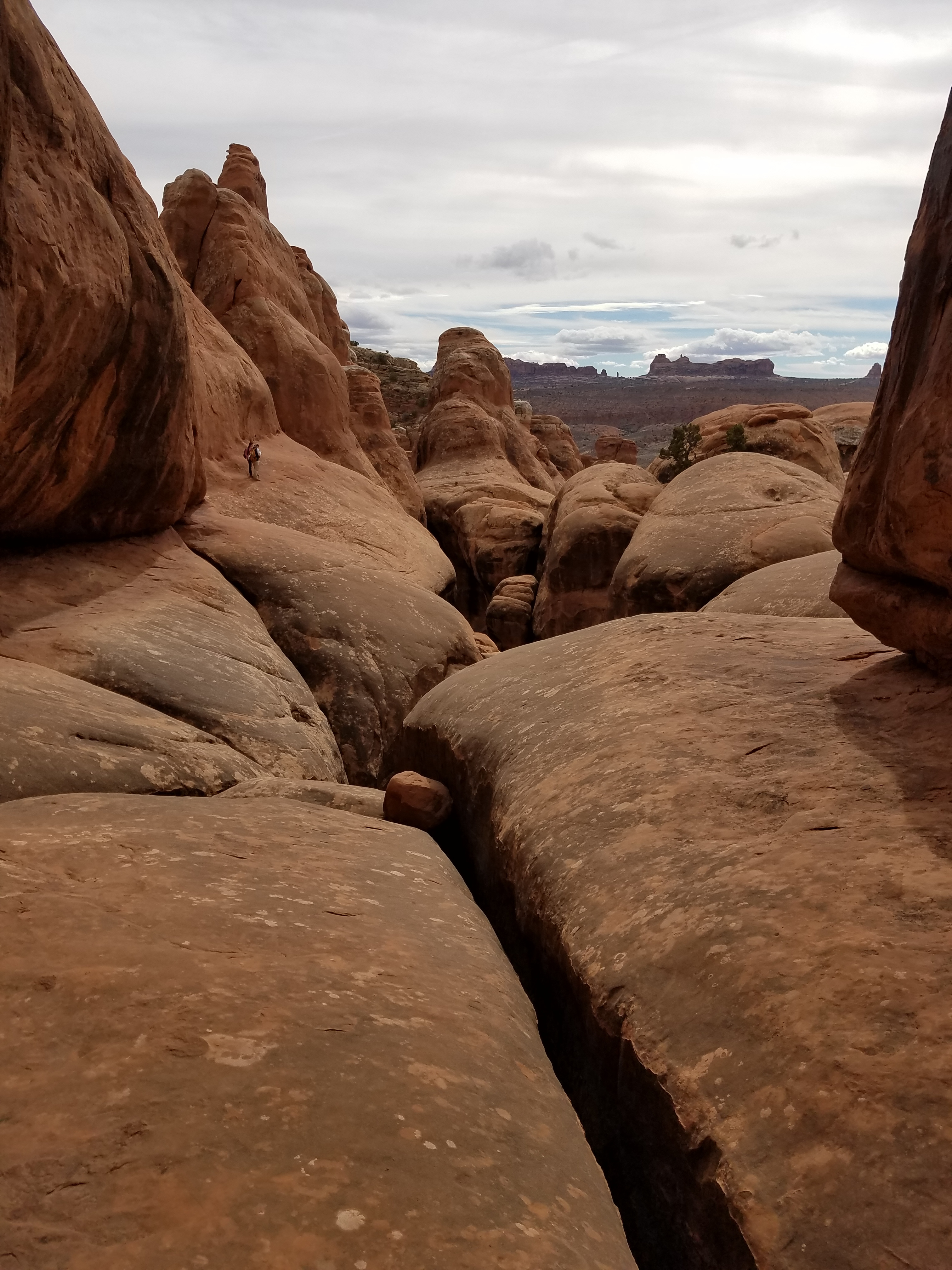
Now the route was pretty easy to follow again for a while. There was usually only one way to go. Eventually I came out in another broad wash. Checking my notes I seemed to be on track. Now I should be near Surprise Arch. It wasn't much farther to the exit. It was easy traveling and I headed down the wash.
Except that it was too easy. Surprise Arch was supposed to appear suddenly directly overhead in a narrow section. Where I was the wash was quite broad and no arch was going to be able to sneak up and surprise anyone. So once again I turned around and went back to my last known good position, where I had entered the wash.
 Deep in the Fiery Furnace
Just then the other two hikers emerged into the wash. They seemed to have a knack for showing up when I was stuck. I told them I thought the wash was the wrong way to go but they said they wanted to check it out. Meanwhile I tried some less obvious ways. On about my third try I spotted a route marker that pointed behind a rock fin. Behind it was a narrow squeeze which led to a wider canyon, and around another corner was a set of stairs carved into the rock. Now I knew that I had just about made it. The stairs were supposed to be near the exit.
At the bottom of the stairs was a wash which looked like it led down and out of the rocky area. It took a while to descend, and there was a little bit of scrambling in spots, but I could see that I was heading out of the maze. Eventually I was out of the rocks and back in the desert. I could see the parking area up the hill from where I was. It wasn't long and I was back at the car.
 Almost out and blue sky is starting to appear
The couple I had been hiking with was sitting on the back of their car eating their lunch. They said they had doubled back not long after I left them and gone down the steps. Somehow they had passed me and gotten back first. How they did was a mystery but there they were. I waved to them as I drove off.
I have to admit that I was pleased with the hike. I hadn't seen every feature described on the guided tour but I had managed to follow the route all the way through. The guidebooks say that it's only two miles. The guided tour takes about two hours with all the side trips. My GPS said I had gone four miles. I'm not sure how valid that is since it rarely gave me good position information while I was in the middle of all the rocks. And it took me two hours and forty five minutes. But it had been a blast.
It had been cloudy all morning but it hadn't mattered on this hike. I was almost always in shadow and half of the time I could barely see the sky anyway. But now the clouds were breaking up and blue sky was showing. And there was still time to do some more hiking today.
