Excelsior Mountain
 There's still a lot of snow at Artist Point in late July
For a few years now, I've been wanting to go to a wargame convention in Seattle sometime during the summer months. I figured that as long as I was making the drive out there, I could combine some wargaming with a couple of days of hiking in the Cascades or Olympics. For the past few years though there has always been a conflict with Dragonflight, which is in August, and I have never been able to make it. Fortunately this year GameOn, which is always in February, had a special summer session in July that I could attend.
I played some fun wargames the first two and a half days but the game that I had arranged for the last day fell through. My opponent was sick and couldn't make it to the con. (At least that was what he said. I suspect it could have been that he was just too intimidated to play me.) That was ok though. I was fine with starting the mountain portion of the trip a day early.
 A guy and his dog sliding down the snow
The forecast was for cloudy skies in the morning that would clear in the afternoon, followed by sunny weather lasting for several days. That was perfect. I even liked the cloudy morning because it gave me an excuse for sleeping in. Otherwise I might have felt compelled to get up super early and race to a trailhead so that I could do a hike the very first day. This way I could catch up on my beauty rest and use the day to travel to the mountains, I wanted to scout out some of the hikes that I was considering.
I didn't really have a much of a plan. I had booked Monday night at a hotel in the small town of Marblemount, near North Cascades National Park, but I didn't have anything else locked in. I just had to be back in Boise on Wednesday to relieve Sandy since she was leaving for a week-long quilting retreat in Montana. I had to take over Abby duties from her. Someone has to be there to feed the dog, to walk the dog, and to play with the dog.
I decided to just start driving north and watch what the weather did. If it improved early in the afternoon maybe I could get in a short hike along the way. I thought that the Mt. Pilchuk Trail was a good possibility. I did it once before and knew that even though it was just a short hike (it's only a little over five miles round trip), it was steep enough to be a good workout. Unfortunately the weather over the mountains didn't clear up early in the afternoon as the forecast had promised so I just kept on going north.
 The classic view of Mt Shuksan from Picture Lake
I decided to go all the way to Bellingham and then drive up to the ski area near Mt. Baker. If I didn't get any views there I would have wasted some time and some gas but at least I wouldn't have put in a lot of hard work on a trail. It would also give me a chance to scout out the trailheads for some of the hikes that I was considering doing the next day. North Cascade trails often have snow late into the summer. Since a lot of the mountains in the western US had unusually heavy snowpack the previous winter, it was possible that some high trails would still be blocked by snow.
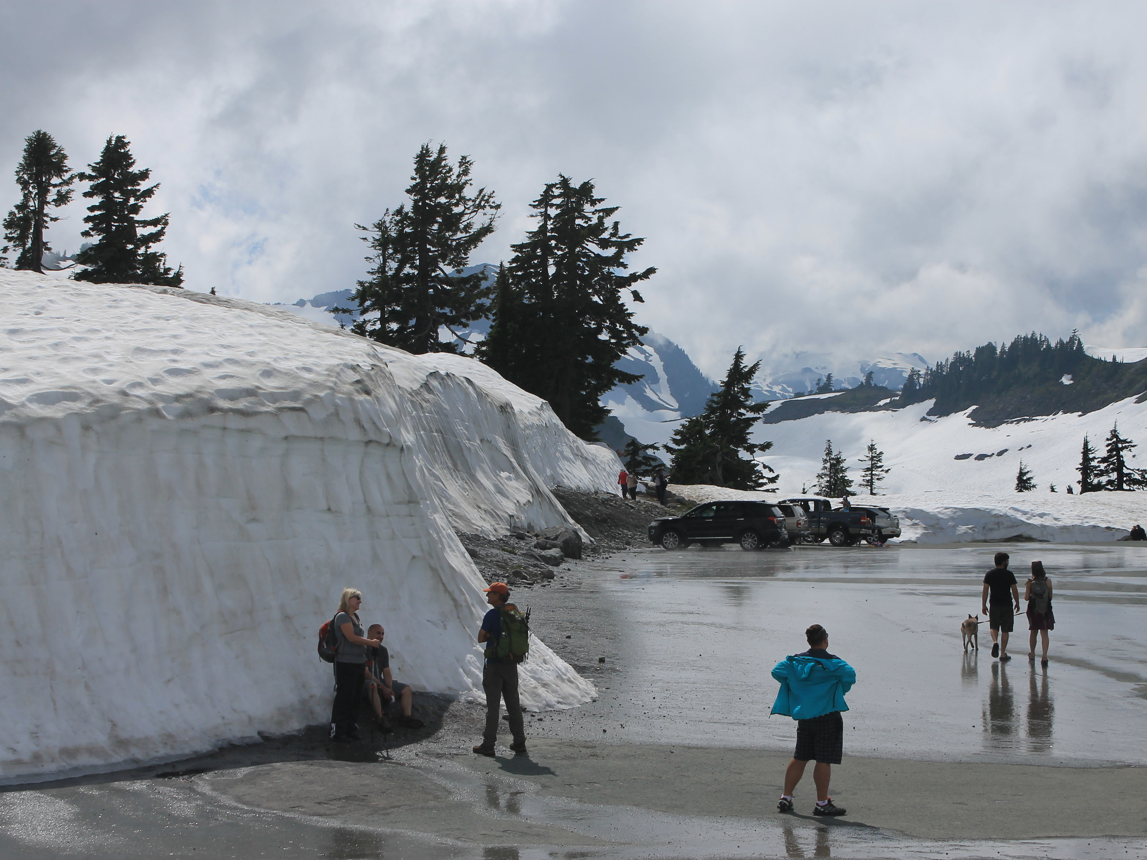
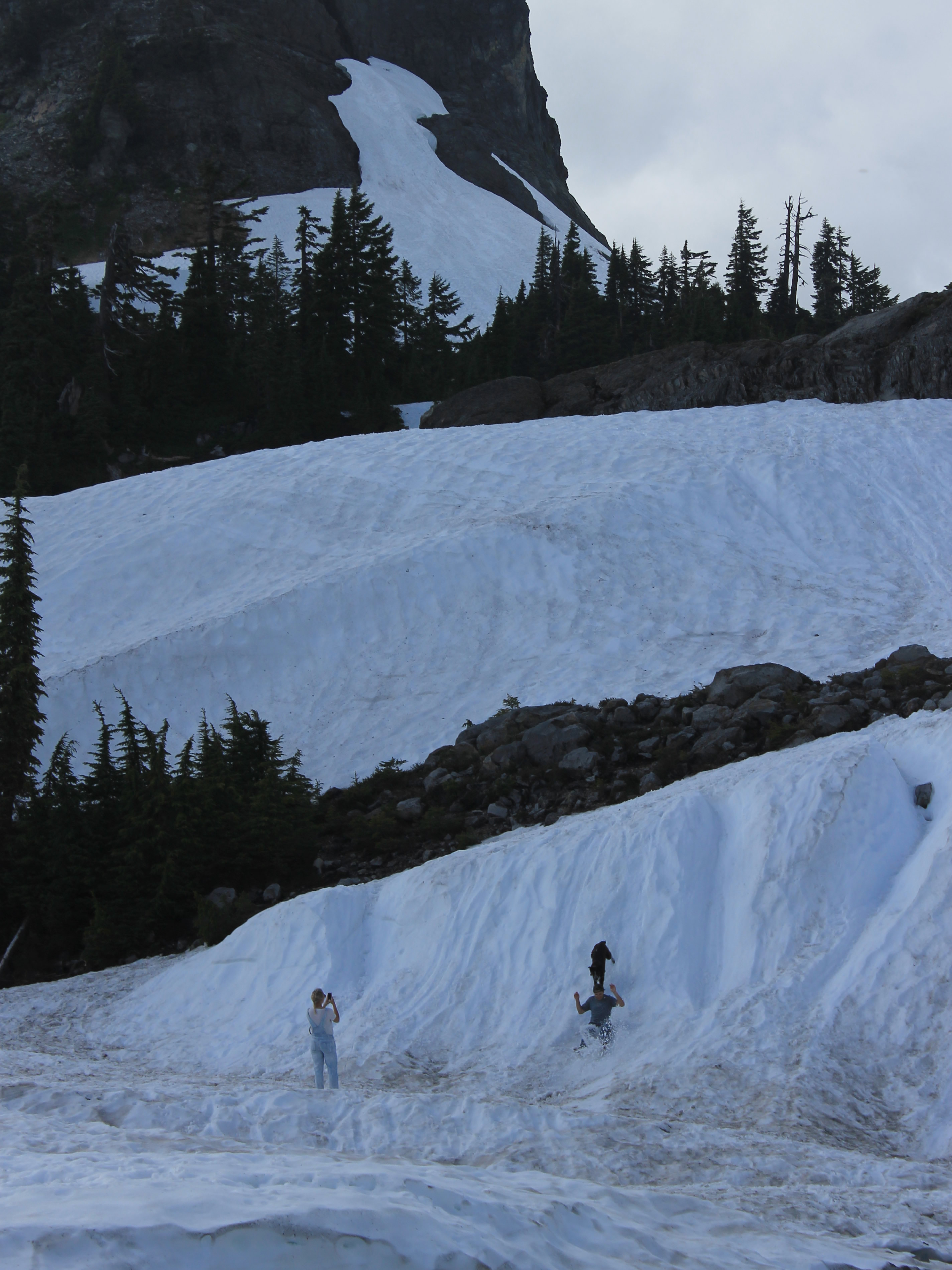
When I reached the Mt Baker ski area late in the afternoon, the clouds were starting to clear so I could finally get some views of the mountains. I drove all the way to the end of the road, to Artist Point, and there was a lot of snow there. Like six to eight feet of snow. There were a lot of people there and some of them were playing in the snow. I saw one guy who would call his dog and then run and slide down a steep snow bank, his dog following right behind him. It was pretty funny.
 Entering the Mt Baker Wilderness
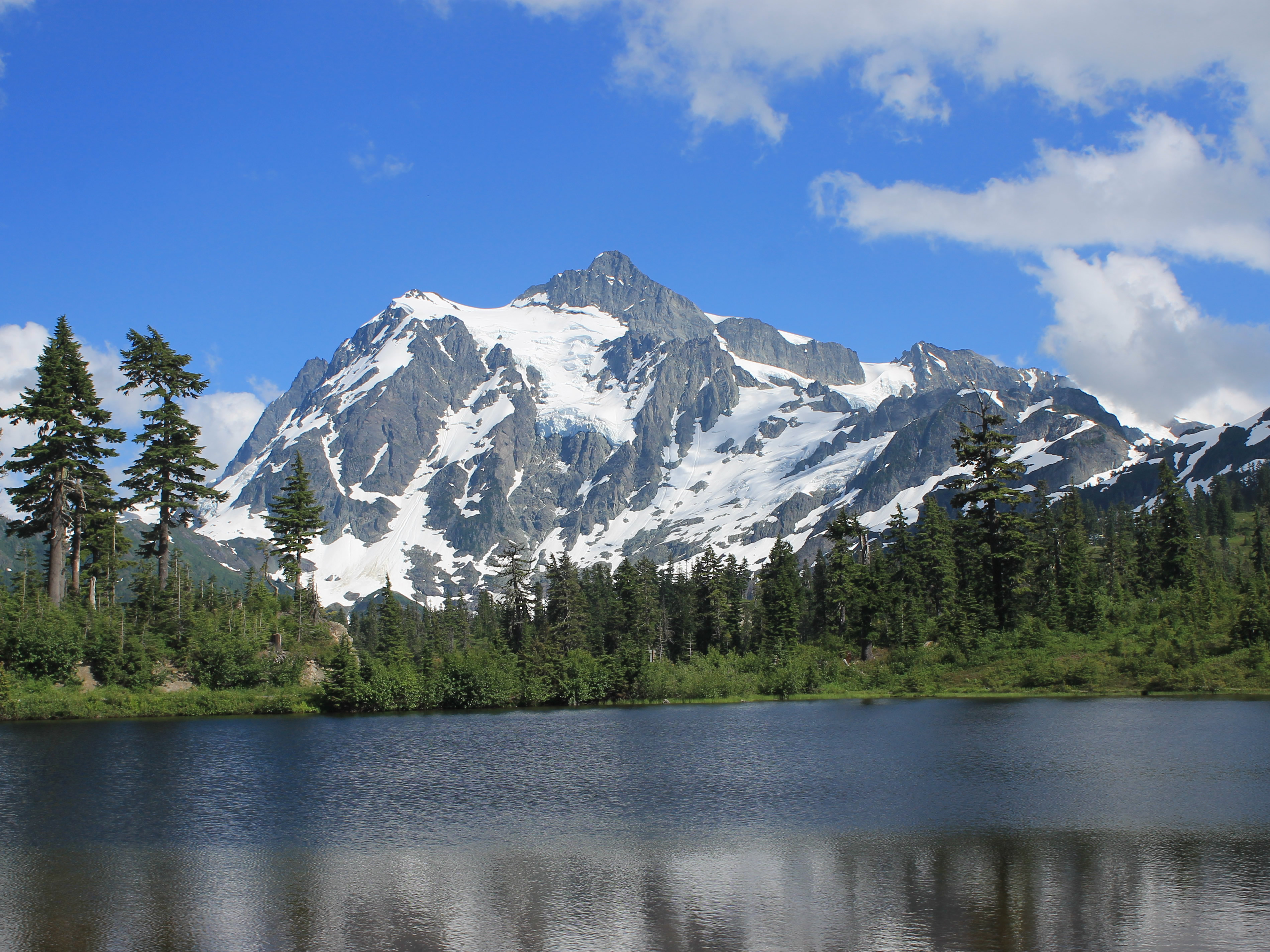
I stopped at the trailhead for Lake Ann, one of the hikes I was thinking about doing the next day. The snow was so deep I couldn't even tell where the trail started. So much for that plan. It was clear that I had to pick something lower down and/or with a southern exposure. So my recon was useful. Plus by the time I was on my way down Mt Shuksan had come completely out of the clouds and I got a fantastic view of it from Picture Lake.
As I was driving back to Bellingham I passed a trailhead for Excelsior Pass. It was much lower than the ski area. It was one of the trails I had considered doing and it fit the bill of starting at a lower elevation and having southern exposure. I decided that I would give it a try the next day.
The standard hike to Excelsior Pass usually starts higher up from a trailhead reached after driving a long dirt road. But my guidebook, 100 Hikes in Washington's North Cascades National Park Region, listed this trailhead along the highway as a good early season variation. Although it was a lot more elevation gain, 3500 feet to reach the pass from the road, it seemed like the perfect choice when there was so much snow left higher up. I figured I would start out and just hike as far as I could until I hit snow. If I was lucky I would be able to reach the pass and get good a view of Mt Baker. If I was really lucky, I could continue all the way to the top of Excelsior Mountain for even better views.
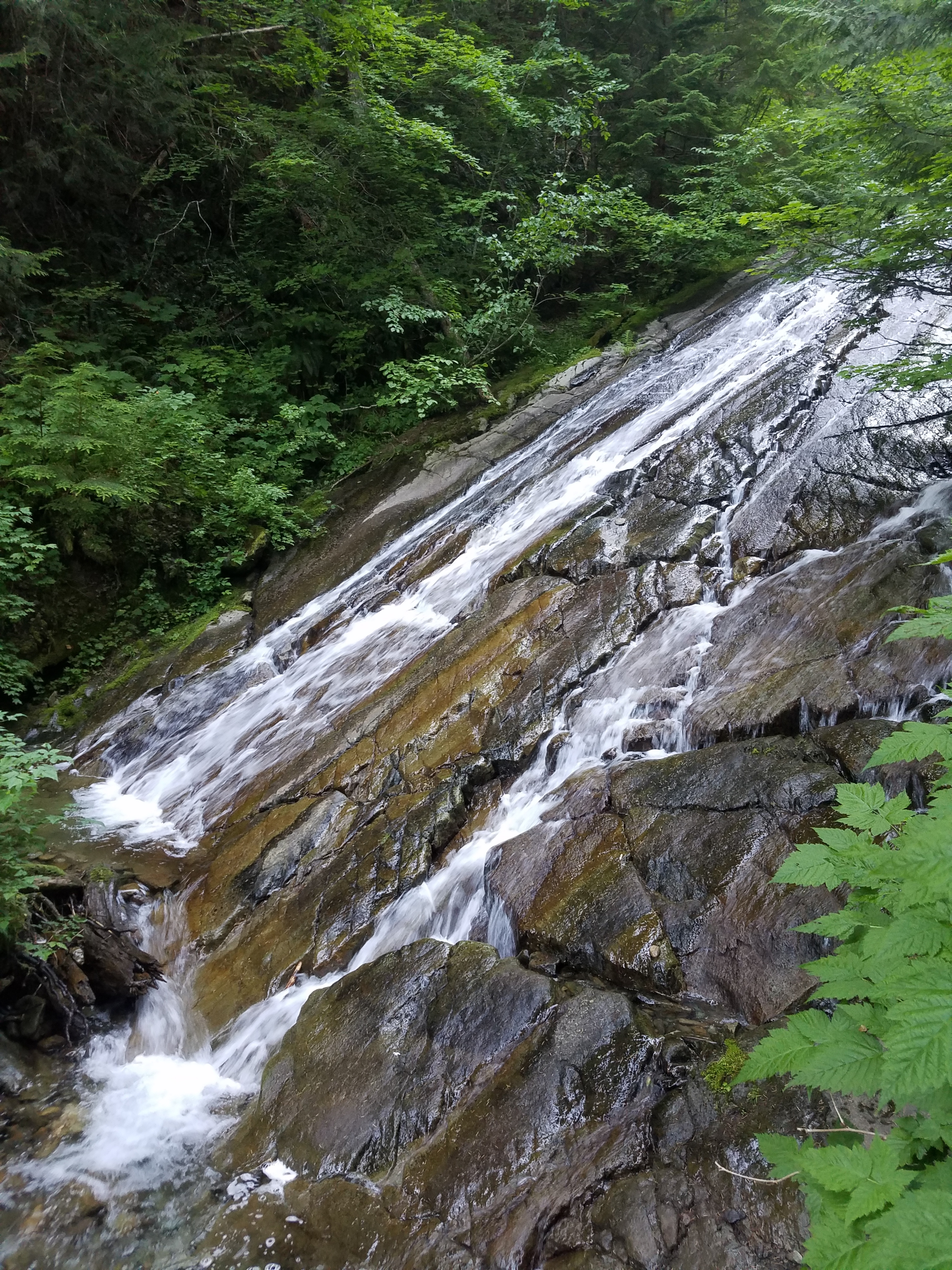 A cascade along the Excelsior Pass trail
That night I found a great place to stay in Bellingham. The Coachman Inn motel was only $65 bucks a night for a room. It wasn't fantastic but it was clean. It was a great price though, especially for the summer season.
For dinner I went to the Pizza Hut just down the street from the motel. This wasn't an ordinary Pizza Hut. This was an "Italian Bistro". It also wasn't very good. Plus the service was terrible. After the one couple that was there when I arrived left, I was the only person in the restaurant. Even with three people working, I had to get up to ask for service. They aren't getting a rave review from me on TripAdvisor.
Next morning I was up and ready to leave a little before 6 am. When I went to the motel office to drop off the key, I was impressed that they already had breakfast set up. I didn't want to take the time to sit down and eat but at least I could grab a muffin to take with me.
It took me about an hour to get to the trailhead. There were two cars parked there already. That early in the morning they had to belong to backpackers who had hiked in the day before and stayed overnight. That was a good sign that I wouldn't hit snow right away and have to abandon the hike. Given how much snow I had seen the day before I didn't expect to get to the top of the mountain, or even to the pass, but I was hoping that I would at least get high enough to get a good view of Mt Baker and maybe Mt Shuksan.
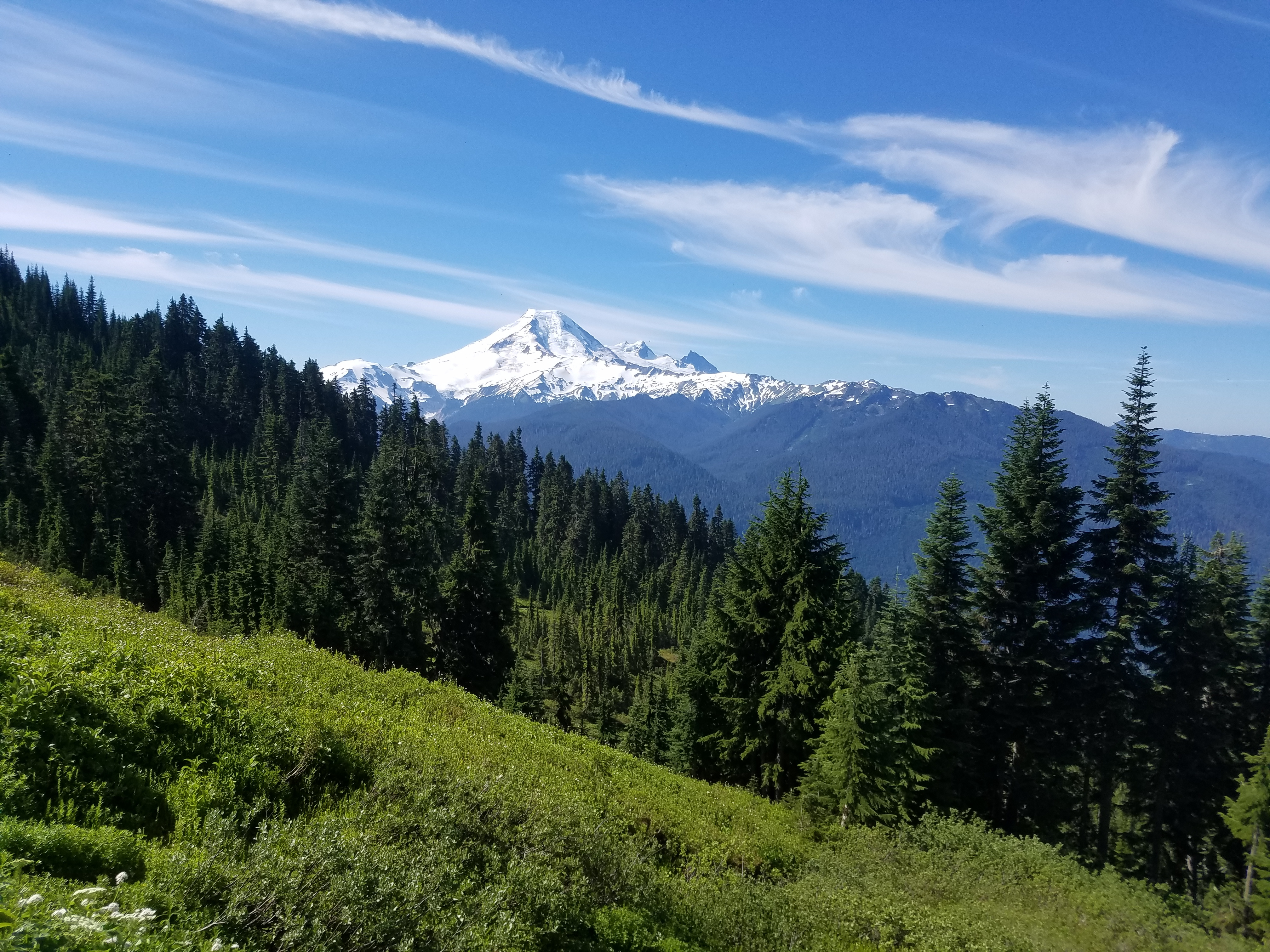 Mt Baker comes into view below Excelsior Pass
By 7:15 I was hiking.
The trail started off in heavy forest. It reminded me of hiking in the redwoods a few weeks ago. The forest canopy high above completely cut off the sunlight so that ground level was completely in shade, only soft light filtering down to the forest floor. The shade kept down the undergrowth so that at ground level the forest was quite open. Forests like that always give me the impression of being in a large building. Because the North Cascades are very wet, everything is covered with moss - rocks, trees, even the ground. The moss is a good sound absorber so the forest was very quiet, especially so early in the morning. It's very calming to hike in such a peaceful place.
I passed a sign marking the boundary of the Mt Baker Wilderness. For some reason the area around Mt Baker and Mt Shuksan were not included in North Cascades National Park, even though I think the mountains there are as spectacular as any in the continental US. At least they have been protected (mostly) by wilderness designation. Sometimes that is even better because national park status can attract a lot of visitors and tourist development.
 Flower fields below Excelsior Pass
There was a lot of forest to climb through but it was on a good trail, uphill all the way but at a nice, steady grade. It was pleasant hiking but pretty much all the same. There weren't any distant views. At one point the trail did pass next to a small stream that was cascading down a series of rock slabs. I guess there's a reason that they call these mountains the Cascades. I hiked slowly but felt good. It was cool and shady and too early for any bugs to be out yet. I steadily gained altitude and fortunately didn't run into any snow.
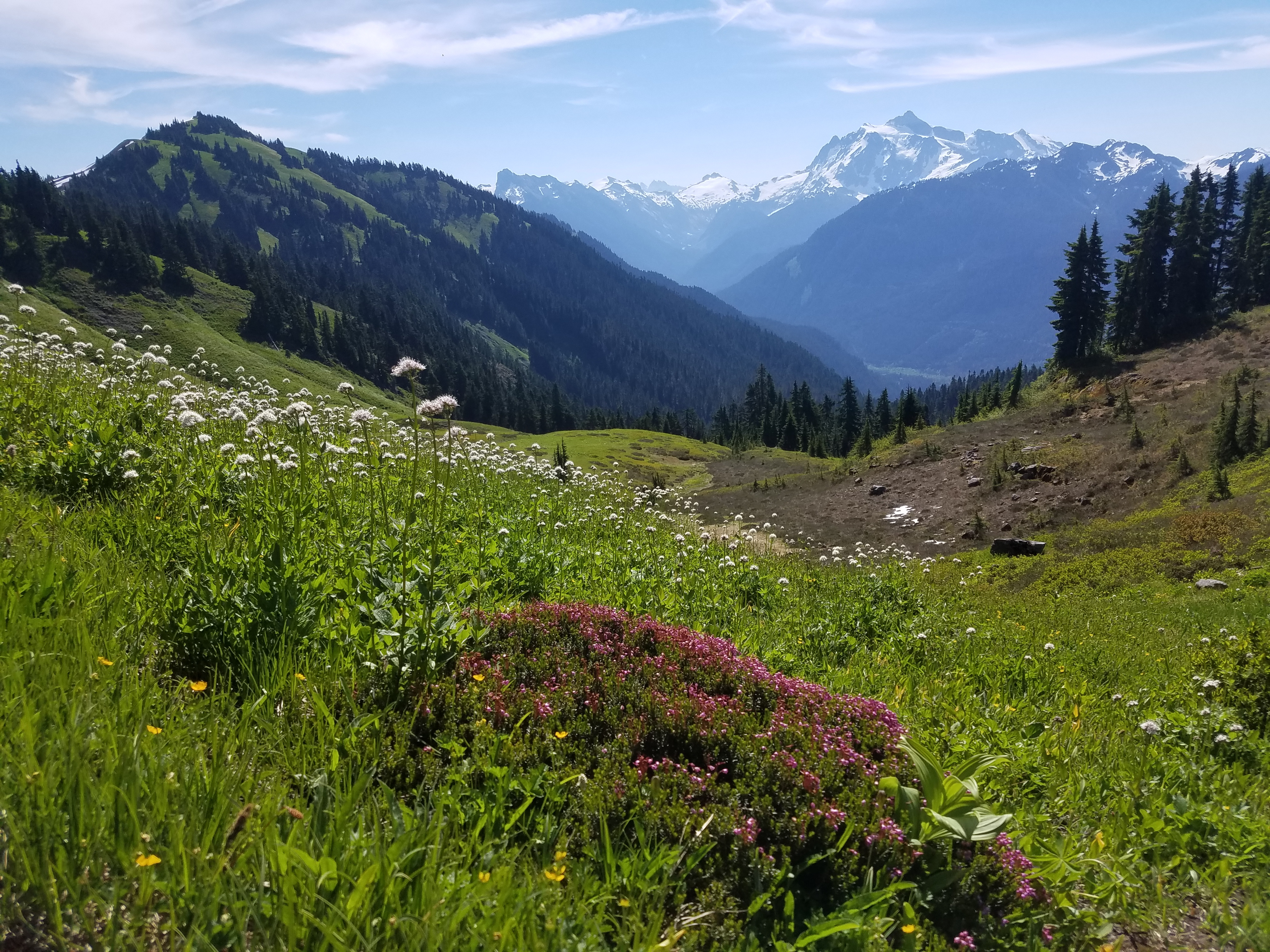
Eventually the trees started to thin out as I got close to treeline. The trail came out of the forest and made a rising traverse across a large, grassy hillside that was covered with flowers. There was arrowleaf balsamroot, which is common in the Boise foothills in spring, although these were smaller than the ones that I see in Idaho. There were purple flowers like penstemoand moss campion. There were lots of others. Most of all, there was a white flower that I didn't recognize. Against the bright blue sky and the deep green grass it was a beautiful meadow, although set on its side at almost 45 degrees.
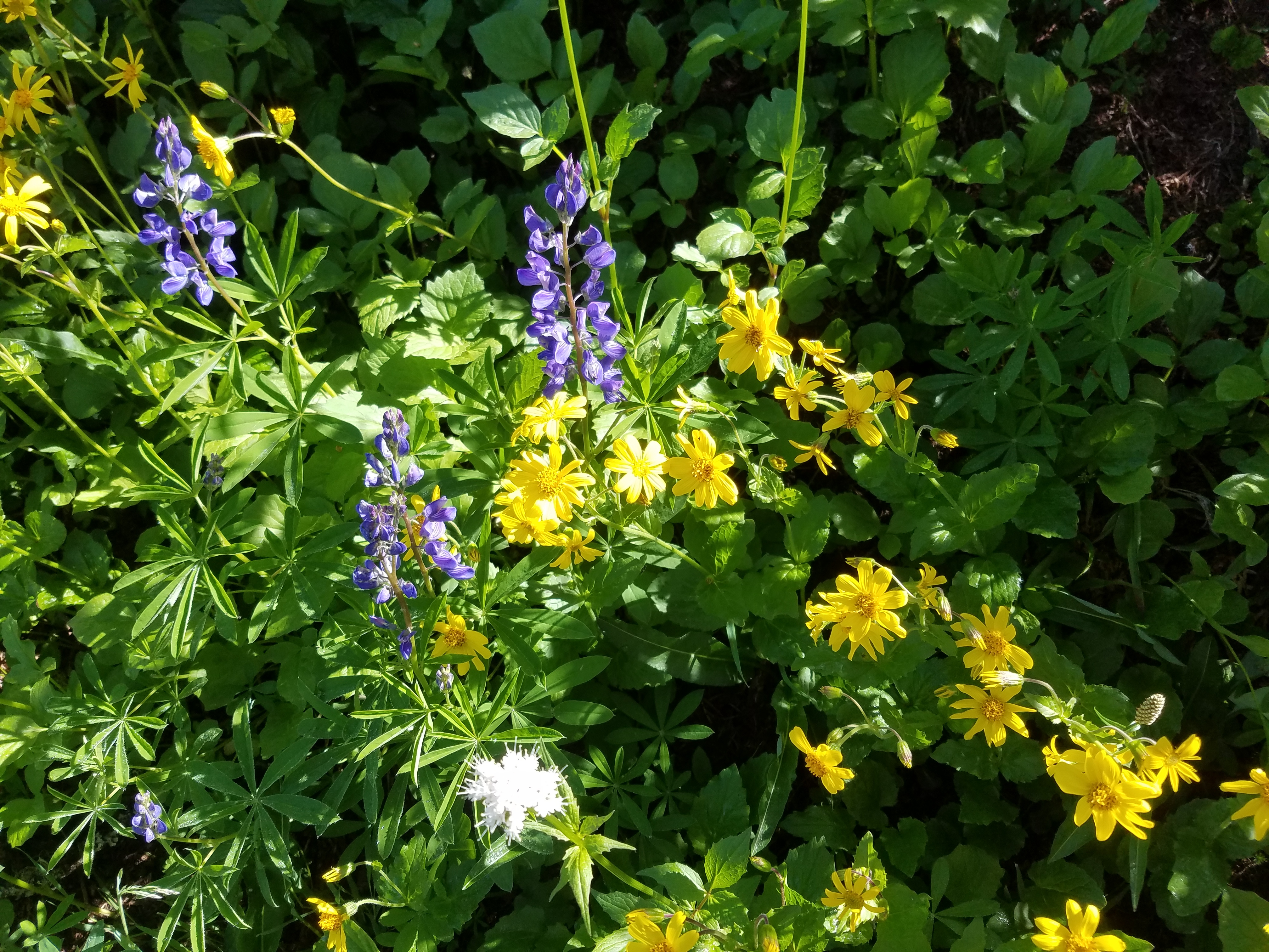 A mixture of purple, yellow and white flowers
I didn't have to go far before I could look back and see Mt. Baker rising in the distance. Each of the Cascade volcanos is unique and Mt. Baker is one of my favorites. At 10,781 feet, it's not high compared to Mt. Rainier or Mt. Adams, but it still rises above and dominates its surroundings. It's one of the few volcanos in the Cascades that I haven't climbed, although I still hope I will get a chance some day.
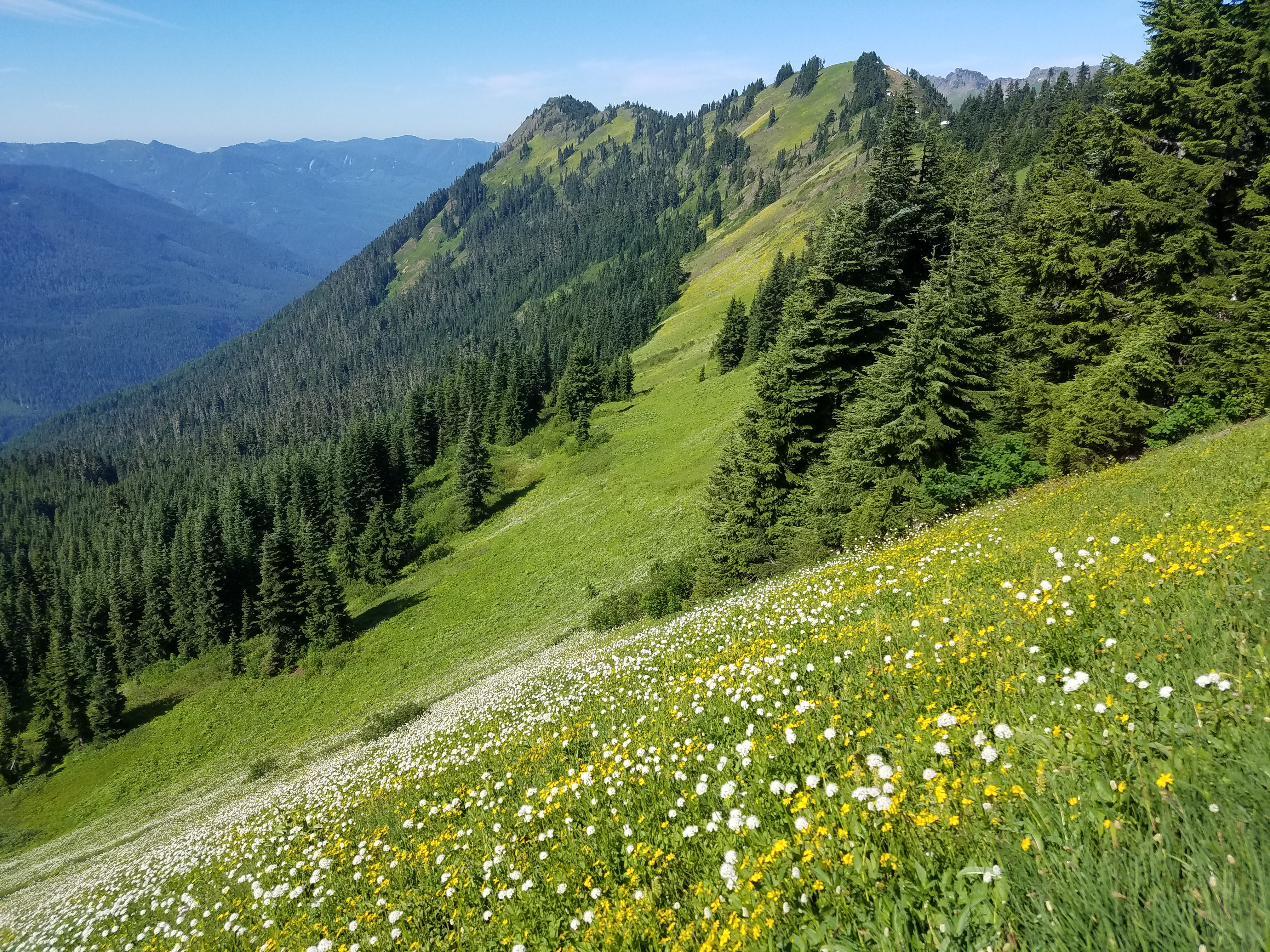
Eventually the trail reached another small group of trees. When I came out on the other side I found myself on Excelsior Pass with a view to the north of mountains reaching far into British Columbia. The pass was at a broad, gentle saddle. There were two tents pitched not far away and several people there were just grabbing their packs and heading out for a day hike. They were the first people I had seen today. To the west the Canyon Ridge Trail dropped down to the north to the standard trailhead. To the east, the High Divide Trail did a gradually rising traverse to the crest and then followed Excelsior Ridge for several miles to Welcome Pass and beyond.
 Mt Shuksan dominates the view to the east
Although I had started from the lower, south-facing trailhead to avoid snow, I didn't see any looking down the north slopes either. Although only about ten miles from the Mt Baker ski area, obviously a lot less snow fell here. I didn't mind the extra 2000 feet of climbing. I was just glad that I had been able to get high enough to get these great views and still keep going. It looked like I should be able to reach the top of Excelsior Mountain.
It's not much of a mountain. It's nothing but a bump on the ridge, less than four hundred feet higher than the pass. But it is higher than anything around it and the top is clear of trees so it is a fantastic viewpoint. Although I could have climbed straight up from the pass there were some trees and some rock bands on the most direct route. It was easiest to follow the trail, which wrapped 180 degrees around the mountain and climbed to a shoulder just below the top. From there the main trail continued along the ridge but a short spur trail climbed to the top of Excelsior Mountain. Here I finally hit my first and only snow patch, but it wasn't steep and I just walked up it.
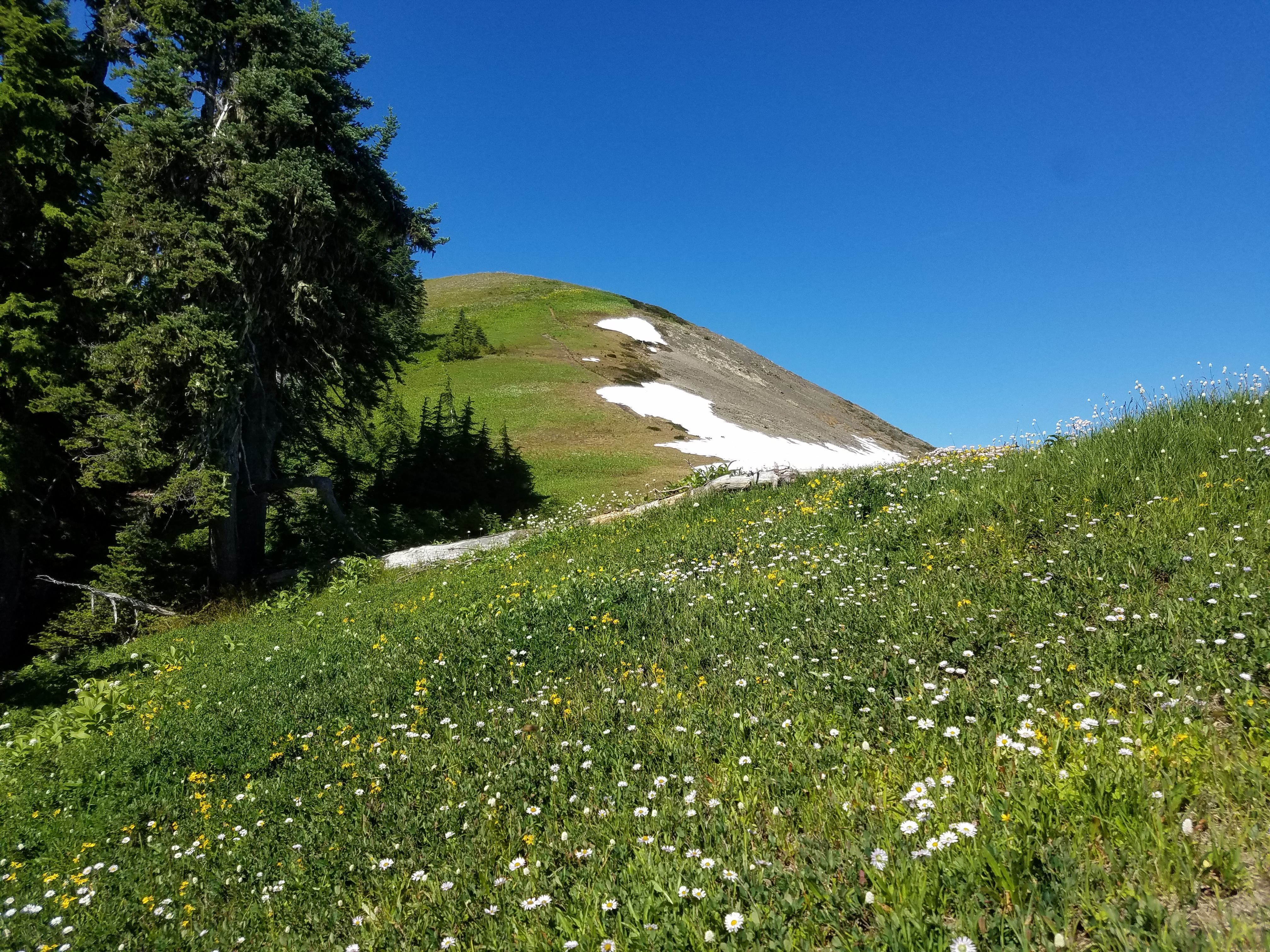 The final slope to the top
The top was just a rounded hump but I had an unobstructed 360 degree view. Mt Baker, a giant snow-covered peak was joined by Mt Shuksan, a rocky, glaciated peak that was almost as high. Together they completely dominated all the peaks around them. In the far distance to the south I could see the next volcano in line, Glacier Peak. North I could see snowy peaks in the far distance in Canada. To the west were the jagged summits of the Picket Range, in the wilderness heart of North Cascades National Park. It was now late morning and it had warmed up quite a bit so lots of bugs were out and buzzing around the flowers that surrounded the summit. Surprisingly none of them were interested in me and they left me alone, so I sat on the summit for a long time enjoying the view in peace. Then it was time to head down.
On the way up the only people I saw were the ones who were camped at Excelsior Pass. On the way down I passed quite a few hikers coming up. It was a nice day but I was glad that I had done the hard work of gaining all that elevation in the cool of the morning. It was a lot easier going down although it still took quite a while to reach my car.
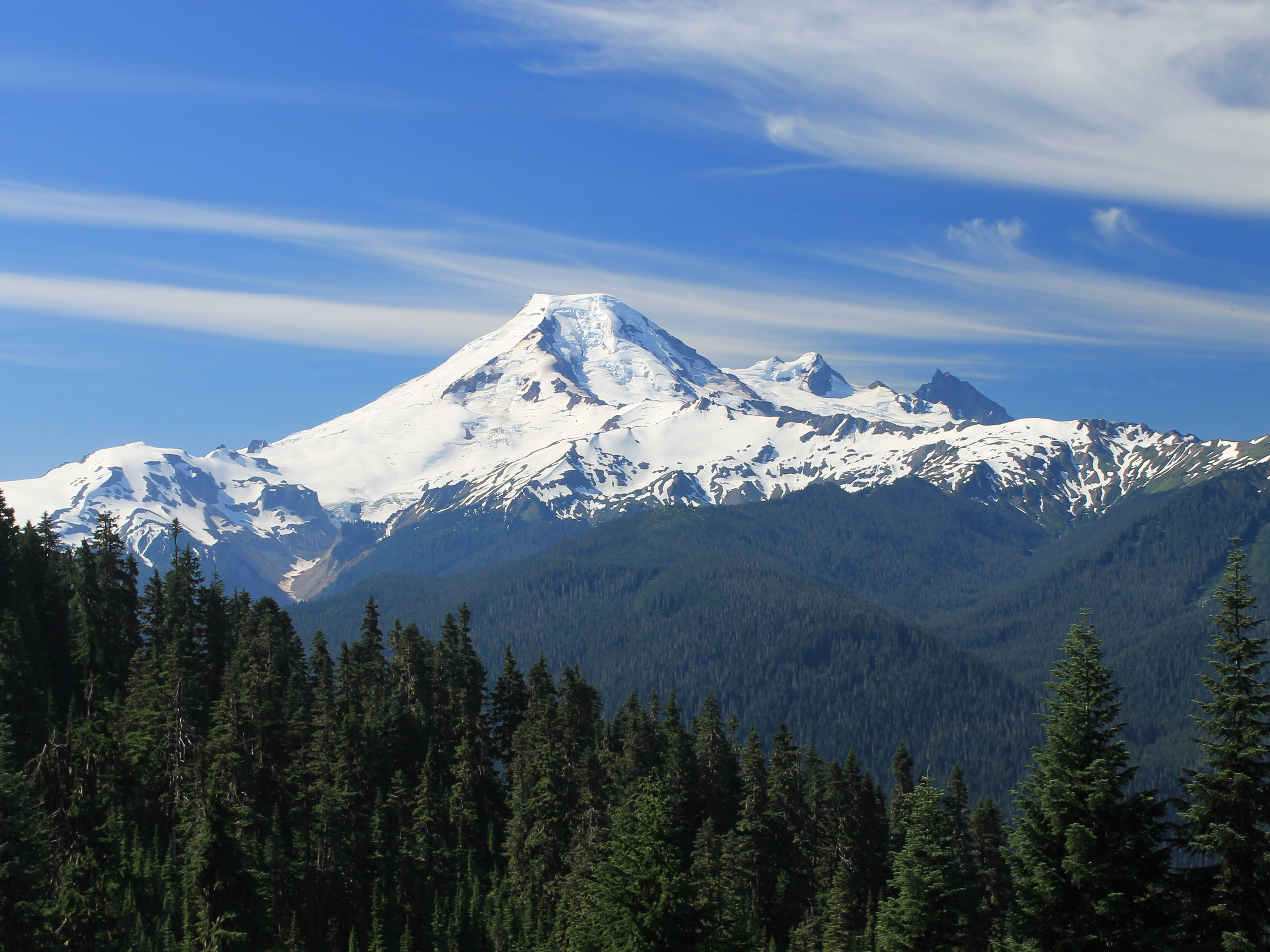 Mt Baker from Excelsior Mountain
Not far from the trailhead I stopped at the USFS ranger station in the small town of Glacier. There was a display of a cross section from a gigantic Douglas fir tree, over eight feet in diameter. Not as big as a redwood but still a very big tree.
While I was looking at the small gift shop inside I talked to the lady at the information desk. It was a slow day and I was the only person there. When I told her about my hike she asked how the flower fields were. I explained that there had been lots, but I hadn't recognized the most common white flower. I showed her a picture on my phone and she looked it up in her field guide. Turns out that it was American Bistort. I don't know my wildflowers as well as Sandy but at least I learned a new one on this hike.
Instead of driving all the way west to the interstate before I turned south, I drove down state highway 9 that went through a valley in the western foothills of the Cascades. Since I had time I thought I would explore a little and take a route that I hadn't driven before. On the east side of the valley, southwest of Mt Baker was the Twin Sisters Range. It was an interesting looking group of peaks that I had not known of before. From the coast along I5 they are hidden by foothills to the west. From north of Mt Baker, where I was hiking earlier in the day, the giant volcano itself blocks them from view. Maybe sometime I will go back and explore the hiking and climbing there.
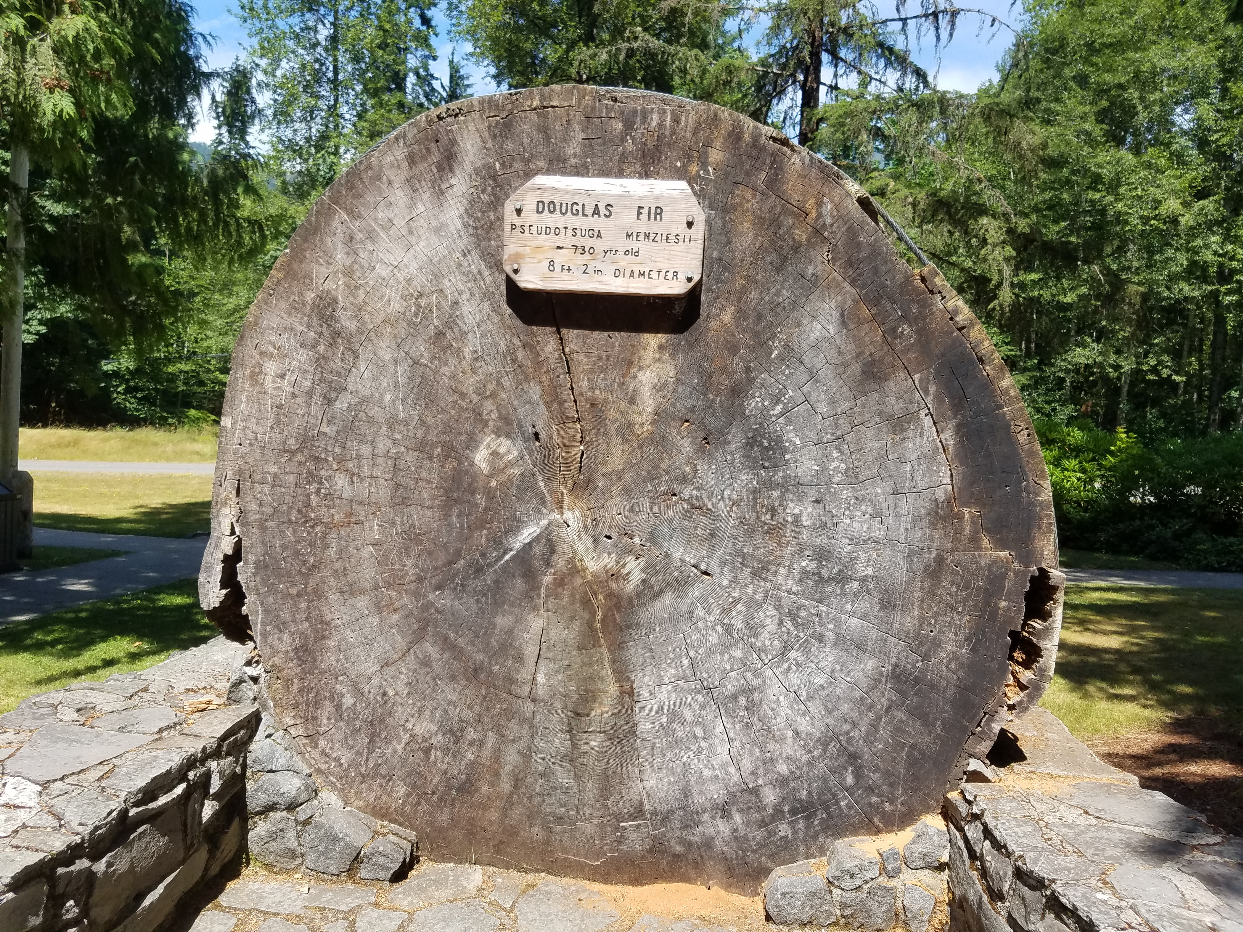 That's a big Douglas Fir tree
By now it was about three in the afternoon. Since I hadn't eaten anything since before six in the morning I was pretty hungry. When I passed the Blue Mountain Grill along the highway I stopped for a late lunch/early dinner. It was a small family-run restaurant in the middle of nowhere but the food was sure good. Maybe I was just really hungry.
I hadn't been in cell coverage all day so when I hit the first real town, Sedro Woolley, I called Sandy to let her know that I had survived my first hike. Then I made a quick stop for gas which wasn't so quick. Turned out that the card readers on their pumps didn't work so you had to go inside, have them charge your card for a high amount like $50, then pump the gas. Then you had to go back inside so they could refund the difference from what you really pumped. What a pain.
The good news was that the gas station was right next to the headquarters for Mt Baker National Forest. I figured I would go in and get maps for my next hike but when I got to the door a sign said that they closed at four pm. I was two minutes too late. Oh well. A miss is as good as a mile.
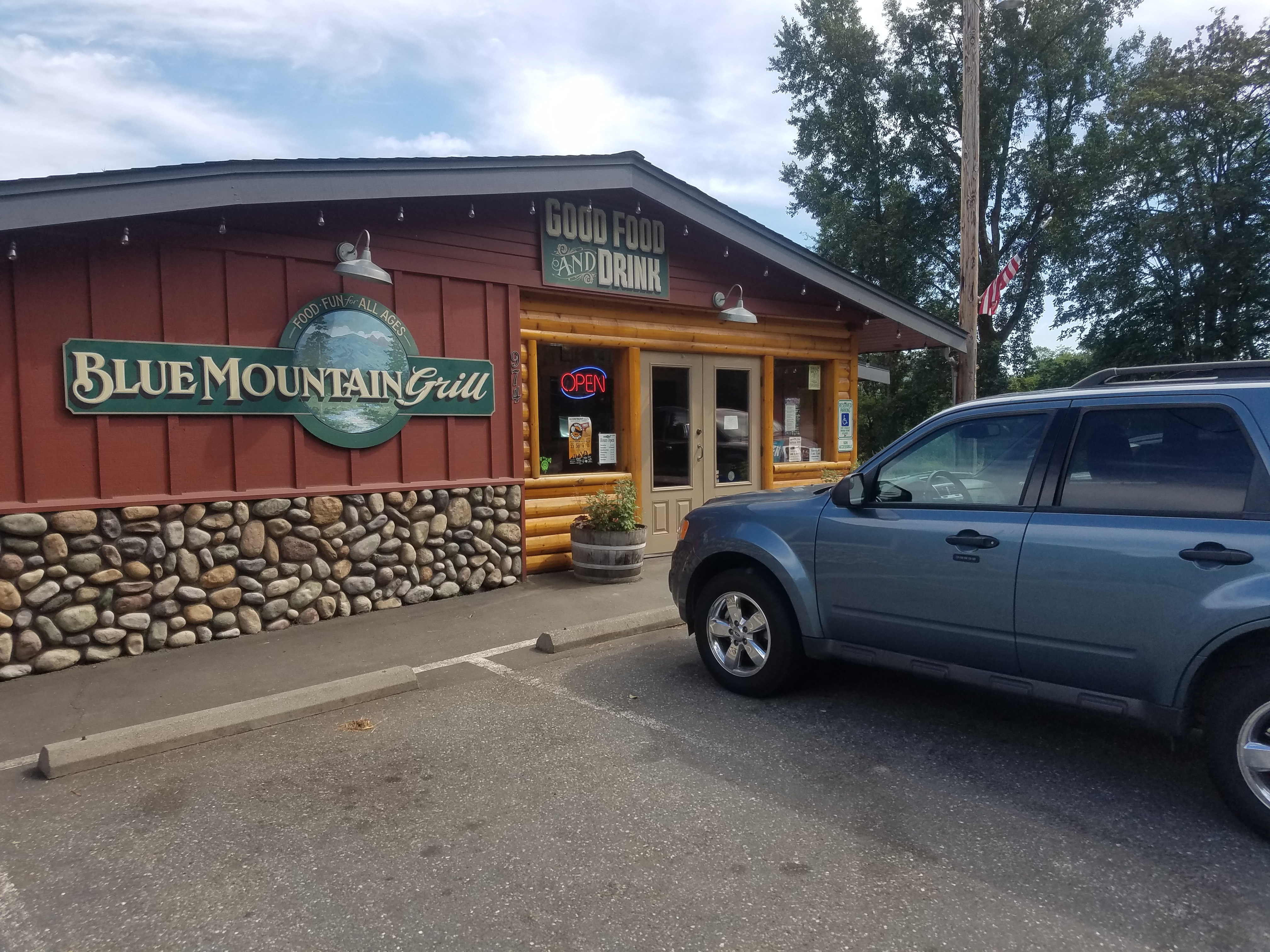 I finally get to eat at the Blue Mountain Grill
I headed east on the North Cascades Highway towards the national park to get in position for my next hike. Just as I was leaving Sedro Woolleey I saw a car approaching from the other direction start to drift over the center line. As he got closer the car was dead center on the yellow line. I swerved onto the shoulder and laid on the horn and the car veered back into its own lane. I looked in my rear view mirror as I drove away and the car was drifting over again. The next car behind me was doing the same thing I did, moving onto the shoulder and honking his horn. I don't know what was wrong with the driver of the one car but it sure looked like they wanted to cause a very bad accident. It was kind of scary.
After all that I have to admit that I was glad to leave Sedro-Woolleey behind. It's probably a fine town but I just wasn't having good luck there on this day. Fortunately I didn't have any more difficulties and in another hour I reached the tiny town of Marblemount, where I would be staying the night. The next day I planned to do the Cascade Pass Trail, probably the best known hike in North Cascades National Park.
