Wheeler Peak
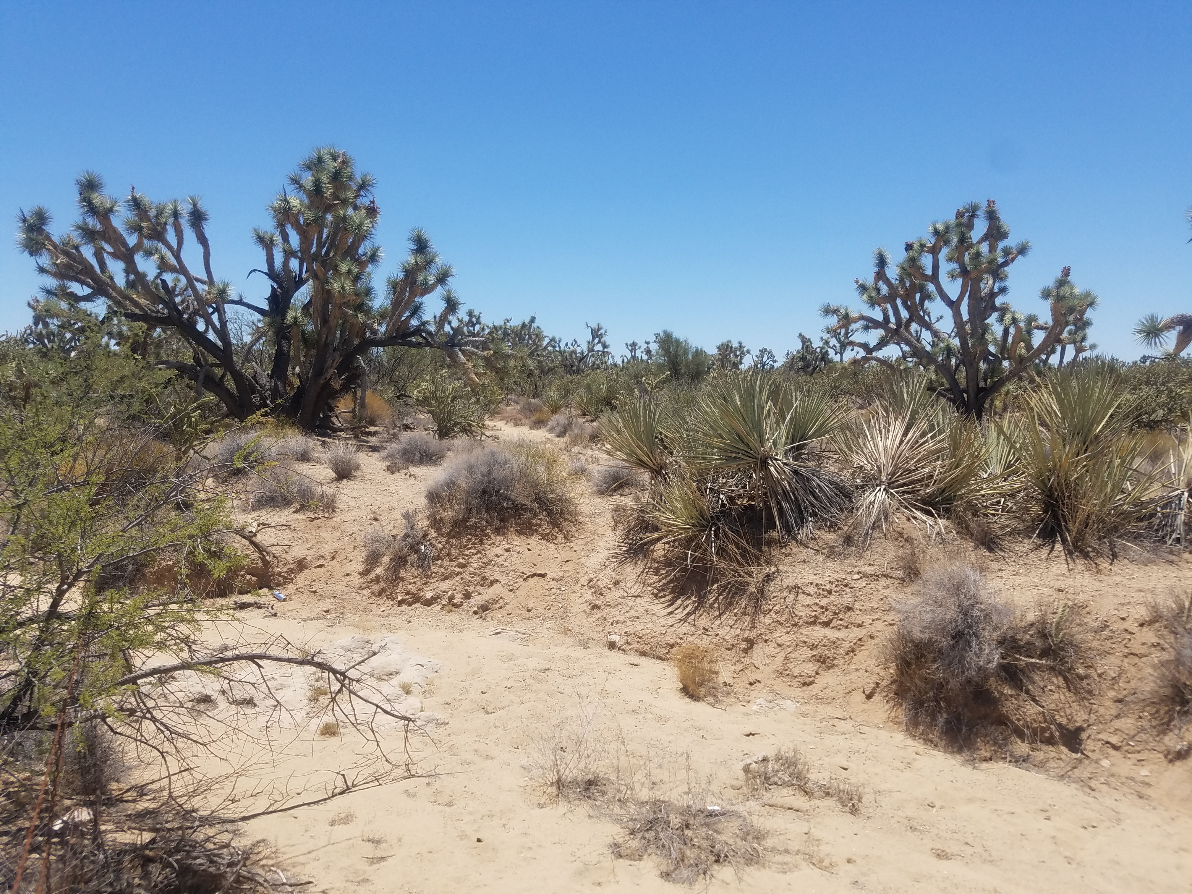 Joshua Tree forest in the desert near Wickenburg Arizona
I had a long drive home after Consimworld Expo in Tempe - about a thousand miles. I usually like to break it into two days and get at least a half day of hiking in. On the way down, coming through Utah, it was way too hot to try any hikes. On the way back, I decided to take the route through Nevada. By stopping overnight in Ely Nevada, I could pay a visit to Great Basin National Park. There are some good hiking trails there and since they are quite high, I thought that temperatures would be bearable.
Although the route through Nevada is shorter and faster than the one through Utah, I don't like it as well. Getting out of the Phoenix area involves driving on regular streets. It takes a long time and can be a pain. Two years ago I hit construction and lost over an hour finding my way through it. This time google maps gave me an alternative route out of Phoenix, going all the way out of the city on I10 and then cutting north up to US93, the highway that I would follow most of the way home. That seemed promising.
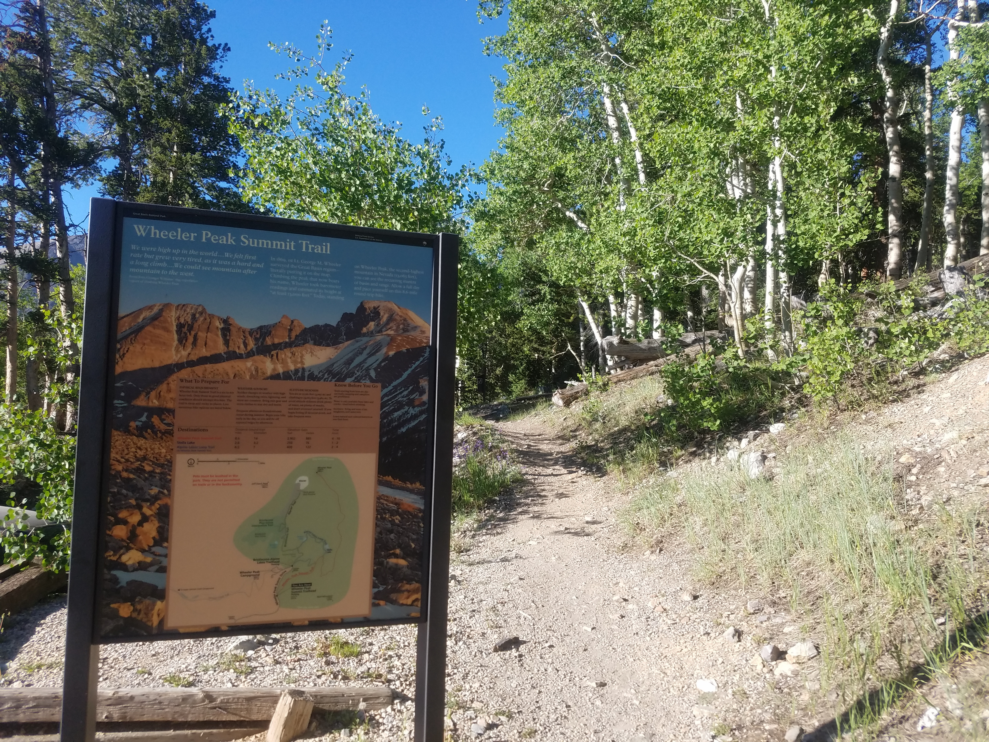 Start of the trail to the summit of Wheeler Peak
I don't like to use my phone, even for the GPS app, while I am driving so I wrote down simple directions on a piece of paper. I just had to take I10 west and get off at exit 104 onto highway 303. Easy. When the mileage markers had ticked down to nearly 104, I could see an exit in the distance. It turned out to be exit 103, for Hassayampa Road. There was no exit 104. Google lied to me! I was going to lose a lot of time again.
When I got off the interstate and checked Google maps, it wasn't so bad. It showed a fairly easy route north to Wickenburg where I would pick up US93. So although the signs didn't match the original route everything was ok. The drive turned out to be pretty easy. I was out in the middle of nowhere and there was no traffic, just dry desert all around with nothing growing but the occasional saguaro cactus.
At one point, when I had almost reached the town of Wickenburg, I came over a hill and instead of bone-dry desert there was green grass all around. Instantly my brain said "golf course" and sure enough, that's what it was. It was an amazing contrast to what I had been driving through for the past hour.
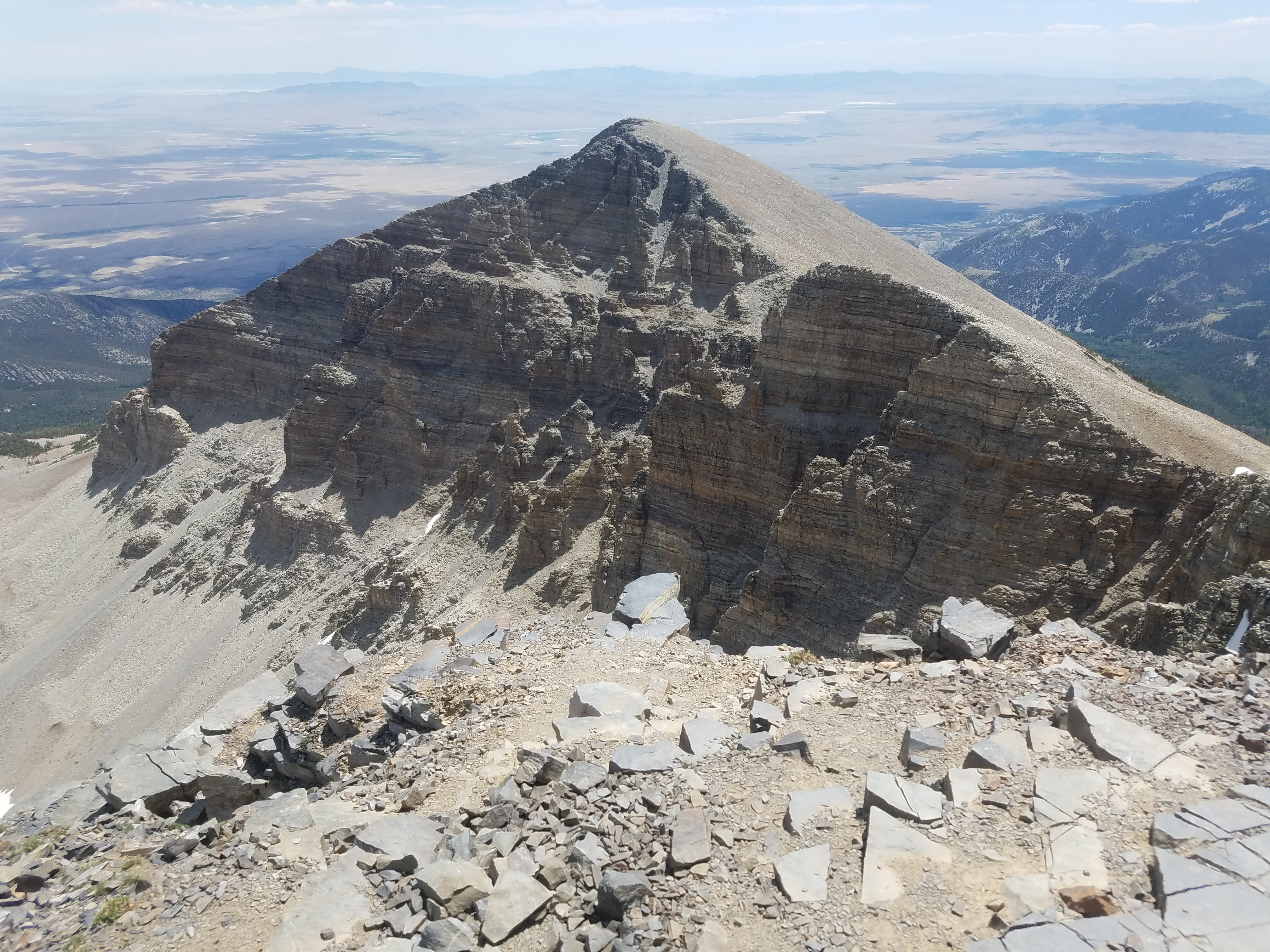
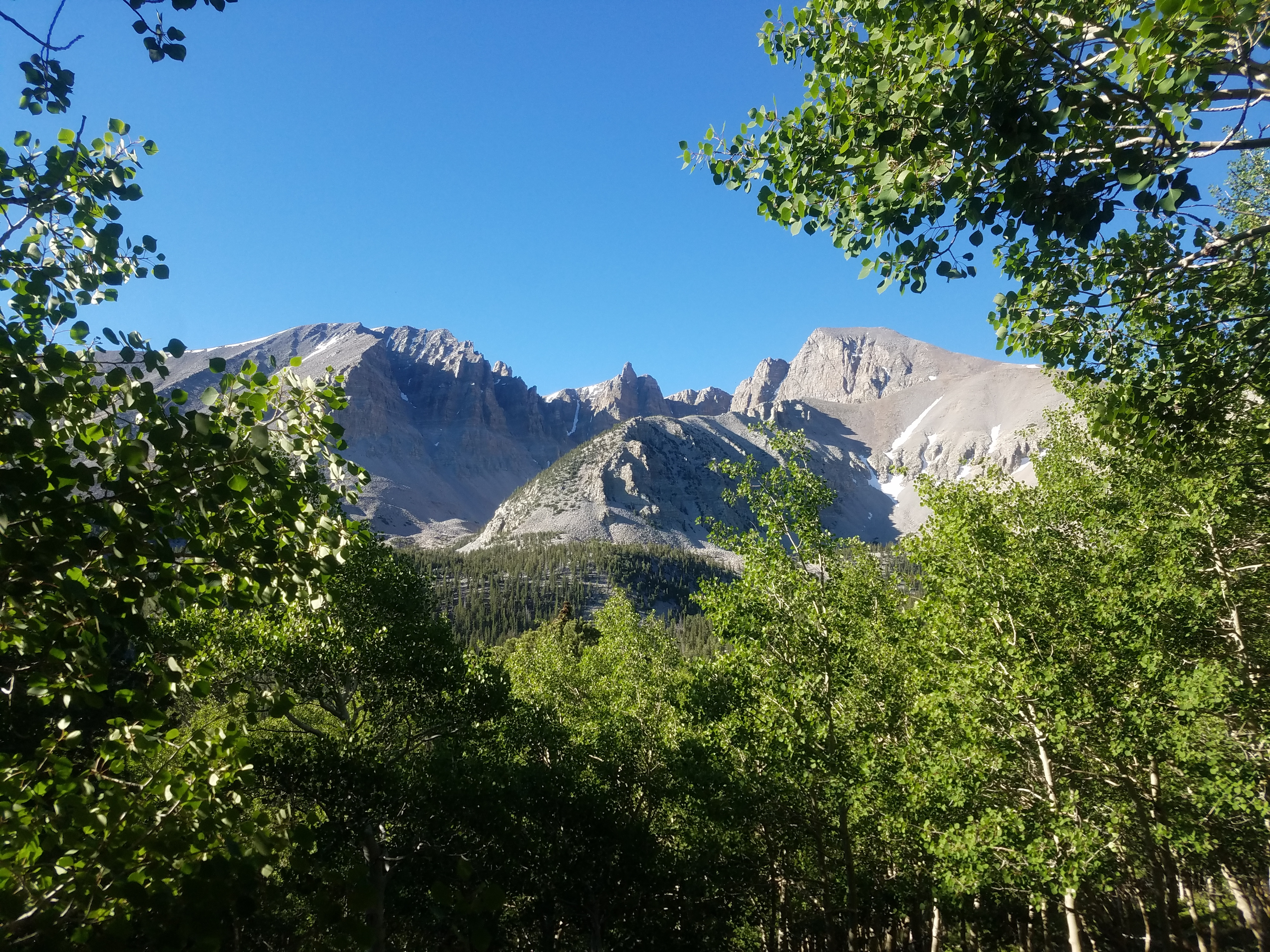 View of Wheeler Peak cirque from near the start of the trail
After I reached US93 I was on better highway, with more traffic, but still in desolate country. At one point there was a pullout, with nothing there except a large sign, which said "NOTHING". Quite appropriate. The story behind the sign is that there used to be a town there named Nothing, Arizona. There was just a gas station and the population was only four people. It was abandoned about twenty years ago and the building has collapsed, so now there really is nothing in Nothing.
There is a stretch of US93 that is known as the Joshua Tree Forest Parkway. There are quite a few Joshua trees, although only in Arizona would they be called a forest. Somehow I have trouble thinking of a place with absolutely no shade as a forest. I have to admit that the Joshua trees are unusual though.
That night I stayed at the Bristlecone Motel in Ely Nevada. I got a really nice room for seventy dollars. Not super cheap but not bad. The evening was very nice. At about five thousand feet, the temperature was in the eighties, a pleasant change from the hundred and ten degree temperatures every day in Tempe.
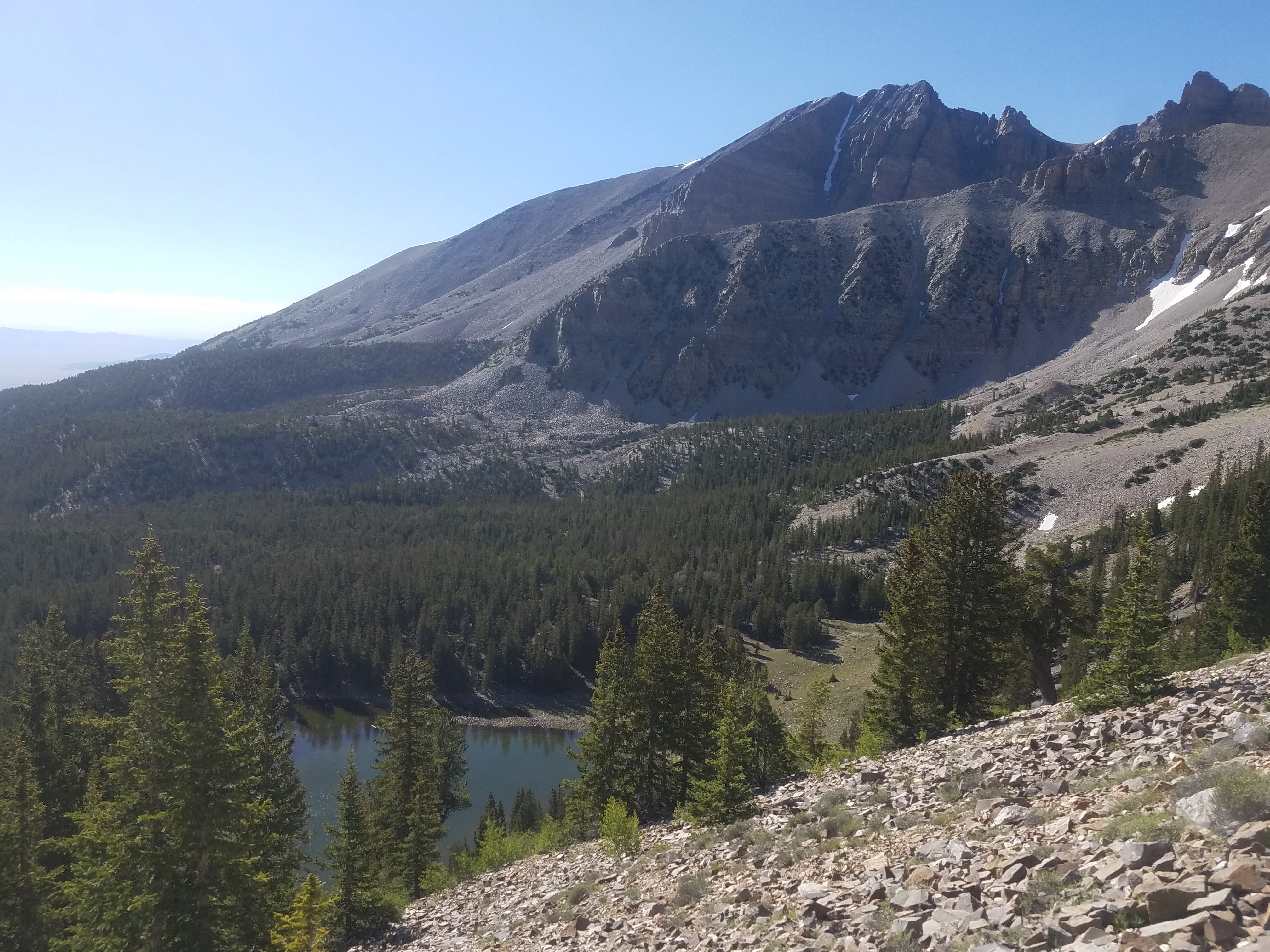 Gaining height - looking down on Stella Lake
I got up before 5 am the next morning, packed up and was on the road at 5:30. I was surprised that the motel office was open when I left and that other people were packing their cars and leaving as well. It took me about an hour to drive to the park. Just outside is the tiny town of Baker, Nevada. It had a campground but no hotels. There were also a couple of restaurants that TripAdvisor said were pretty good. I figured that I might give one of them a try after doing my hike.
Great Basin National Park is located in one of the most sparsely populated areas in the continental United States. It's centered on Wheeler Peak. At 13,065 feet it's the second highest mountain in Nevada and with it's spectacular east face, it's certainly the most impressive mountain in the state. Because it rises so high above the desert valleys, much of the park is forested. There are even a few small alpine lakes. There is a nice trail network including a trail to the summit of Wheeler Peak. I had climbed it thirty years ago but had not been back since. I was way overdue to return.
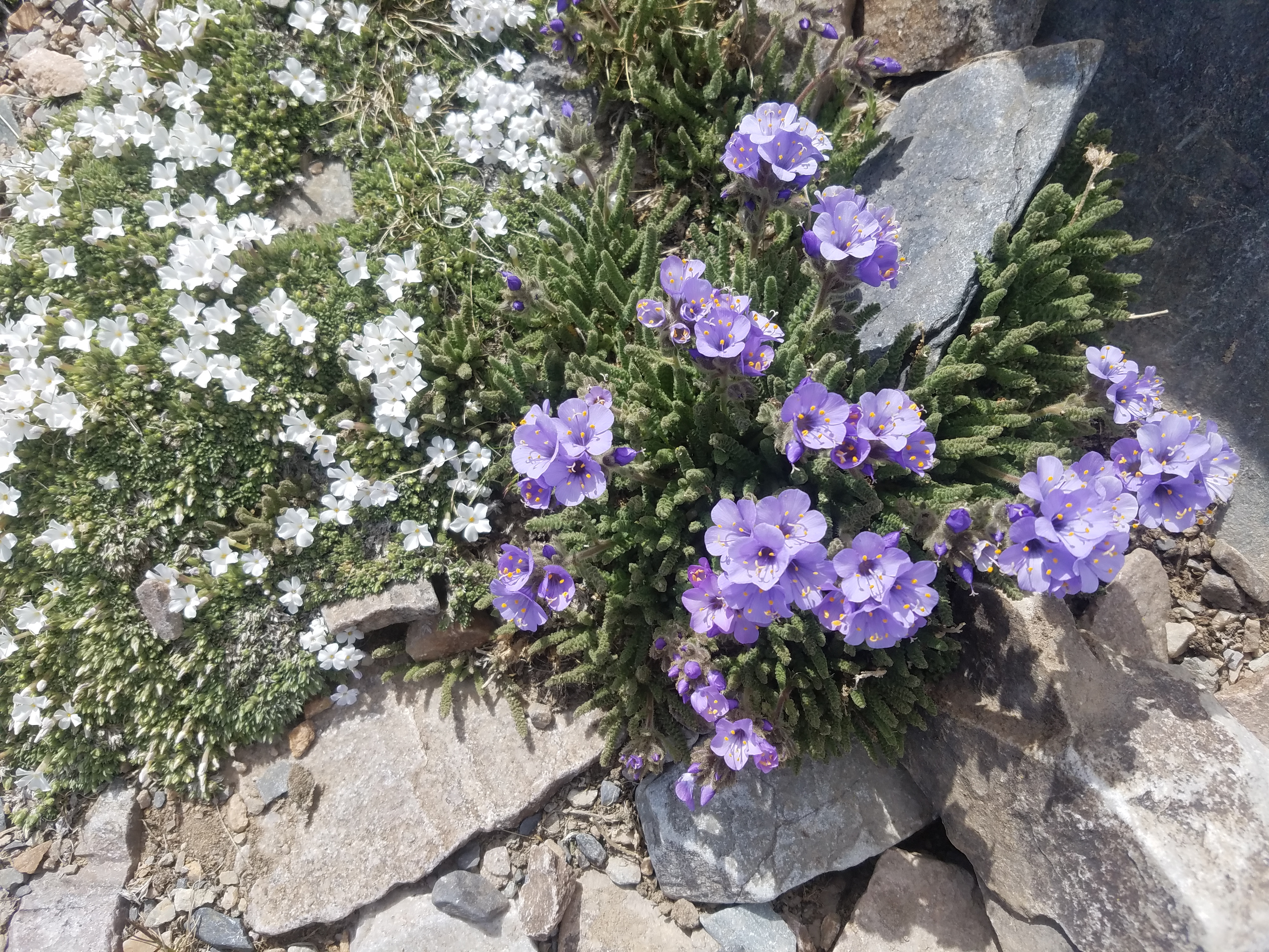 There were lots of flowers in the rocks well above timberline
After reaching the park I still had to drive to the trailhead. It was quite a long way including twelve miles of steep winding road on the Wheeler Peak Scenic Drive. When I reached the trailhead there were four cars parked there. I didn't have the mountain all to myself but it wasn't exactly crowded either, especially for a national park two days before the fourth of July. It was 7:15 am when I started out on the trail. There wasn't a cloud in the sky and it was pleasant tshirt weather.
I had several options. I could do a short loop hike that went past two alpine lakes. It was less than three miles and only a few hundred feet of elevation gain. That seemed too quick and too easy. I could also do the summit trail. That was over eight miles round trip (pretty easy) but three thousand feet of elevation gain (pretty hard), especially since I started at 10,000 feet and went up to 13,000 feet without much acclimatization (really hard). So I figured that I would go part way, maybe up to the saddle between Wheeler Peak and Bald Mountain, and see how I felt. When I told Sandy later that this had been my plan she said "Oh come on. You know that you were going to go for the summit." Yeah, she was probably right. I guess I can fool myself but not her.
 Flowers line the route even near the summit
After an easy, level mile to get me started the trail started to climb in earnest. The whole route was visible from near the start, climbing to a saddle and then following the long north ridge of Wheeler Peak to the summit. The sheer northeast face of Wheeler Peak dominates a massive glacial cirque, an unusual alpine feature in the mountains of Nevada. It was a beautiful sight, one that was inspiring me to go for the top of such a magnificent peak.
Unfortunately Wheeler Peak is only the second highest mountain in the state. Boundary Peak, just east of the state line, is less than a hundred feet higher. But Boundary is overshadowed by nearby Montgomery Peak in California, and is really just considered a subsidiary peak of Montgomery. There is nothing higher than Wheeler Peak for over two hundred miles in any direction. It's the twelfth most prominent summit in the continental United States. In my opinion it's the most impressive mountain in Nevada.
 Looking down on 12,771 ft Jeff Davis Peak
I climbed Wheeler Peak about thirty years ago with an old hiking buddy, Jack Smith. But I was a lot younger back then. This was the day after my sixty fifth birthday. I had acclimatized before my first climb by spending the night at the campground at the end of the road, at 10,000 feet. This time I had much less acclimatization after spending the night in Ely at 5,000 feet. So I expected it to be a challenge.
My one vivid memory from my first climb so long ago was the wind. At the saddle it was ferocious, and I remember being knocked over more than once going up the long ridge. The winds that day were probably the strongest that I had ever experienced either before or since. Today was a warm sunny day but when I got to the saddle the wind was blowing strongly. Not quite as bad as the first time I had been there but still pretty windy. I was definitely holding on to my hat. I have to say that the Wheeler/Bald Mountain saddle is the windiest place I have ever been. And I have been to a lot of mountain areas around the world.
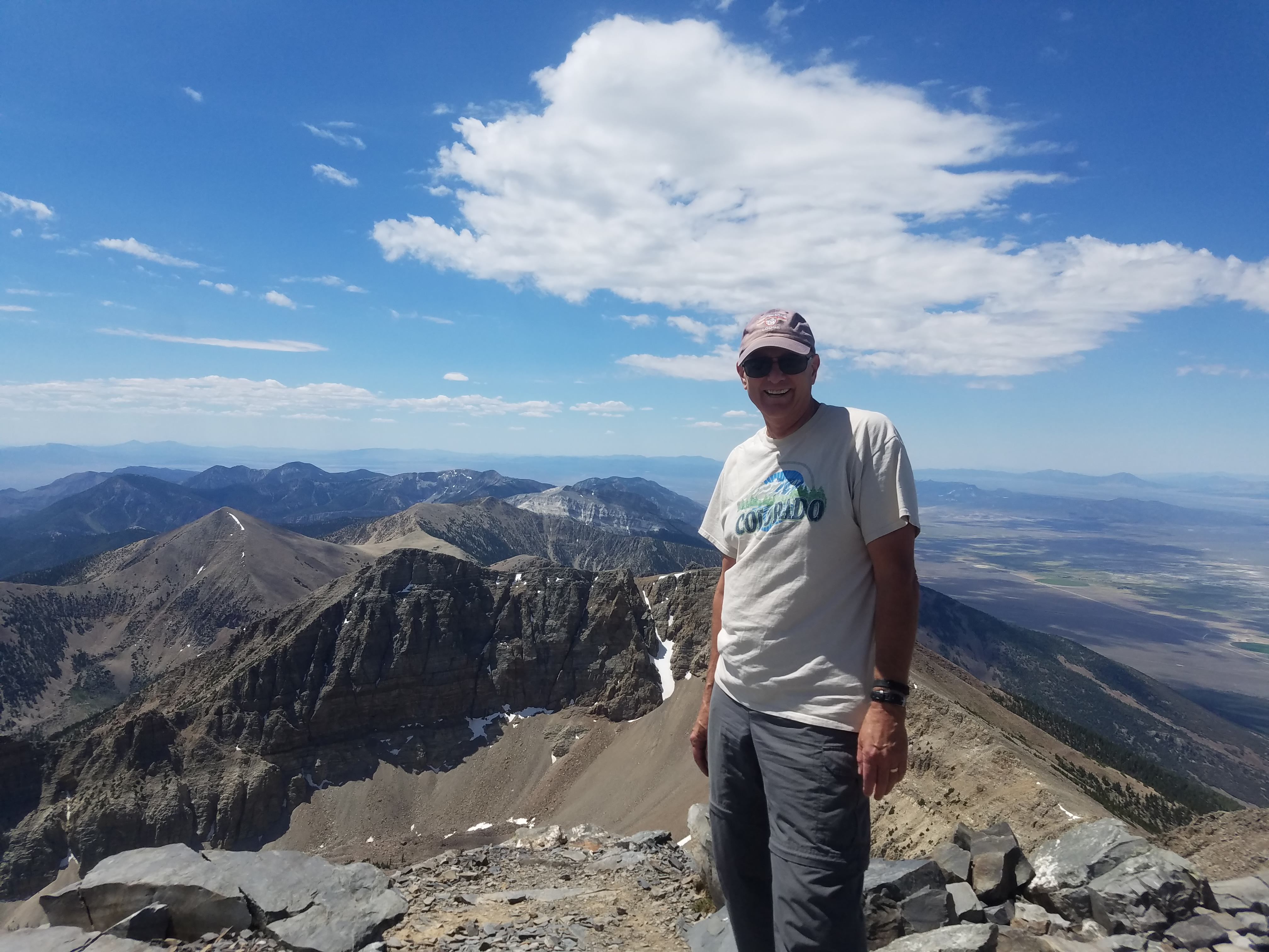 I'm on top of the world
Above the saddle the route climbed a long, talus-covered ridge. Once I was on it, the ridge seemed to go on forever. I was pleasantly surprised by the number and variety of flowers that were blooming in the rocks. I don't remember ever seeing so many flowers in a similar rocky environment on any other mountain I have climbed. The splashes of color were very pretty in such a stark and hostile place.
At one point I met two hikers coming down. When I asked if they had made it to the top they said no. They pointed to a snow patch just above and said that the trail ended there and it was rough going boulder hopping up the ridge. That didn't sound good. When I reached the snow patch the trail did indeed disappear under the snow, but when I climbed a short way around it I picked up the trail again. They had given up way too easily. From there it was quite straightforward.
I felt pretty good so I went all the way to the summit. I slowed down quite a bit on the last thousand feet. I was really feeling the altitude but I just kept plugging along. It was 11 am when I made it to the top - three hours and forty five minutes to get there. It wasn't a fast time but considering the altitude and lack of acclimatization I was happy with it. It wasn't a race.
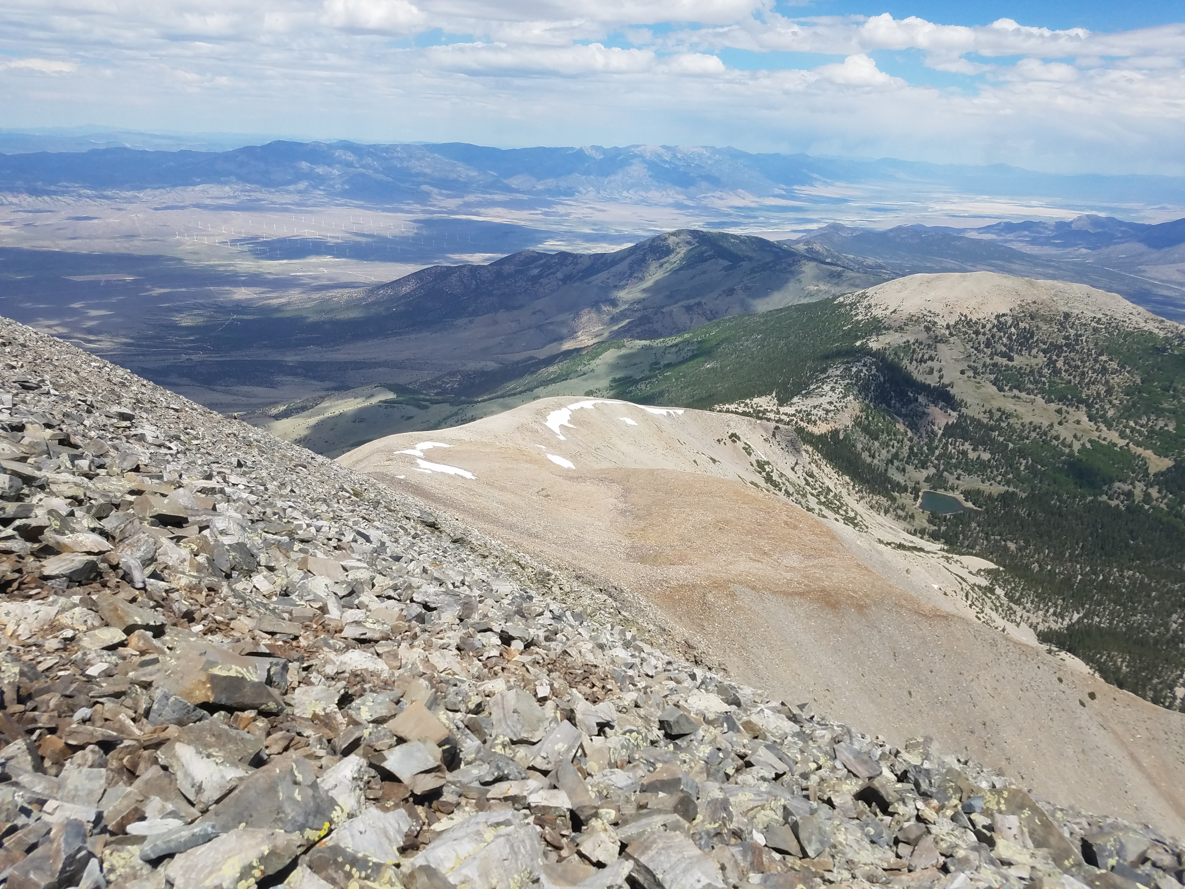 Looking down the route as I start back
The summit view was amazing. As I mentioned earlier, Wheeler Peak is higher than any other mountain for hundreds of miles. It was like I was on top of the world. That's the feeling that I climb mountains to get and I never get tired of it. Surprisingly I had one bar on my cell phone. I was able to send a text message to Sandy. I even sent her a photo of me (shown above) taken by one of the other three hikers who were on the summit. Life was good.
Going down was faster than going up but still hard work. The footing was unsure because of the loose rock all the way down the ridge. When I finally reached good old dirt trail at the saddle I could relax and just cruise the last two miles. From there back to the car it was easy.
Besides Wheeler Peak, the other attraction at Great Basin National Park is Lehman Caves. The park service runs guided tours through the caves but I wasn't up for it today. I had done it on my last visit here long ago. It was already late in the afternoon and I still had a seven hour drive back to Boise. It went pretty quickly though. It had been a great day and I was feeling pretty good about my climb. Not a bad day for an Old Man!
