Mores Mountain - Three Hikes
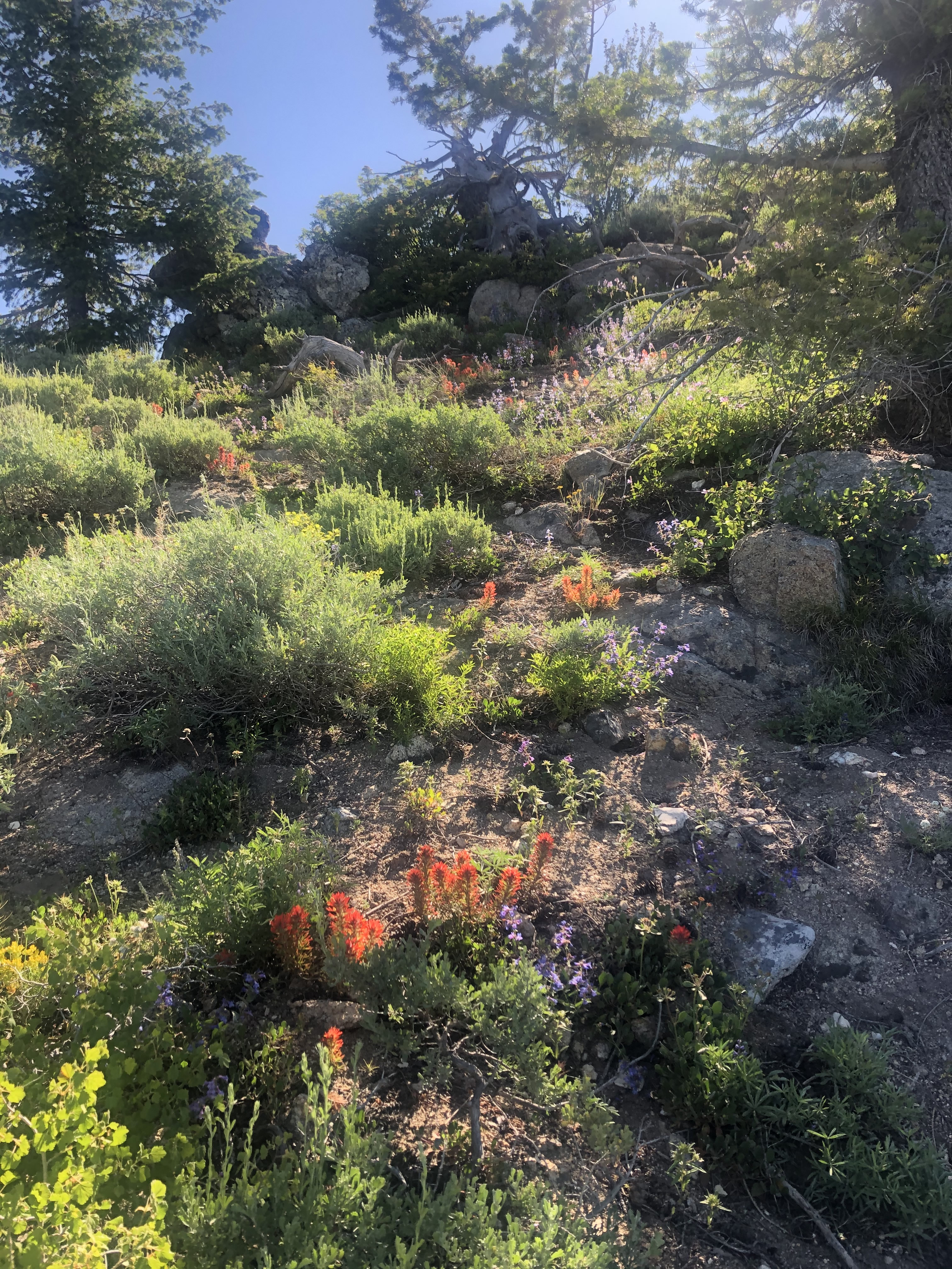 Flowers covered the mountainside
Abby loves to go to the mountains and I really enjoy hiking with her. Unfortunately after our first three outings of the season, she had developed a problem. She has a habit, even when we go on our daily walks in the park near our house, of eating grass. Usually it isn't that big a deal, but on our hikes this year she was eating a LOT of grass. And not just grass, but weeds with long, stiff stalks. After each of our hikes, the next morning we would find a big clump of grass/weeds on the floor that she had thrown up. Each one was at least as big as my fist and both Sandy and I were worried. We were afraid that it would get stuck in her system and plug her up. Surgery to remove it would not be fun (or cheap - Abby doesn't have health insurance). Or we thought she could choke when she tried to throw it up.
We spent every day the next week working hard with her while we were out for walks to try to break her of the habit of eating grass. Next time I went for a hike though I decided to do it solo. She didn't like it but I left her at home. Just like a parent I had to tell her "It's for your own good!"
The hike I did was on Mores Mountain. It's near Bogus Basin Ski Area, just north of Shafer Butte and about 300 feet lower. The top of the mountain can just barely be seen from near our house, poking up over an intervening ridge. I'd hiked there before but it was many years ago. All I remembered was that the trail went around the mountain, passing very close to but not quite going to the top.
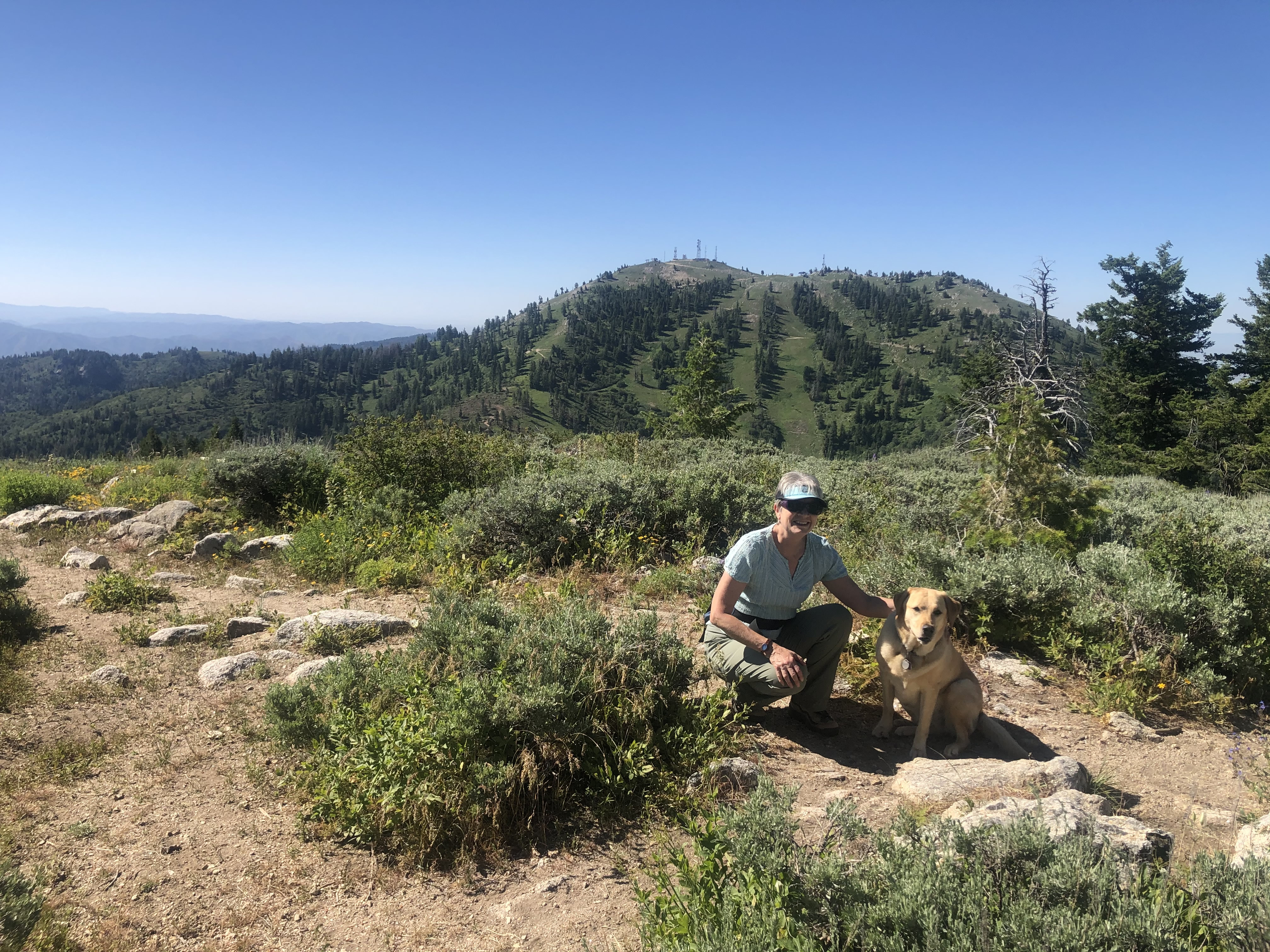
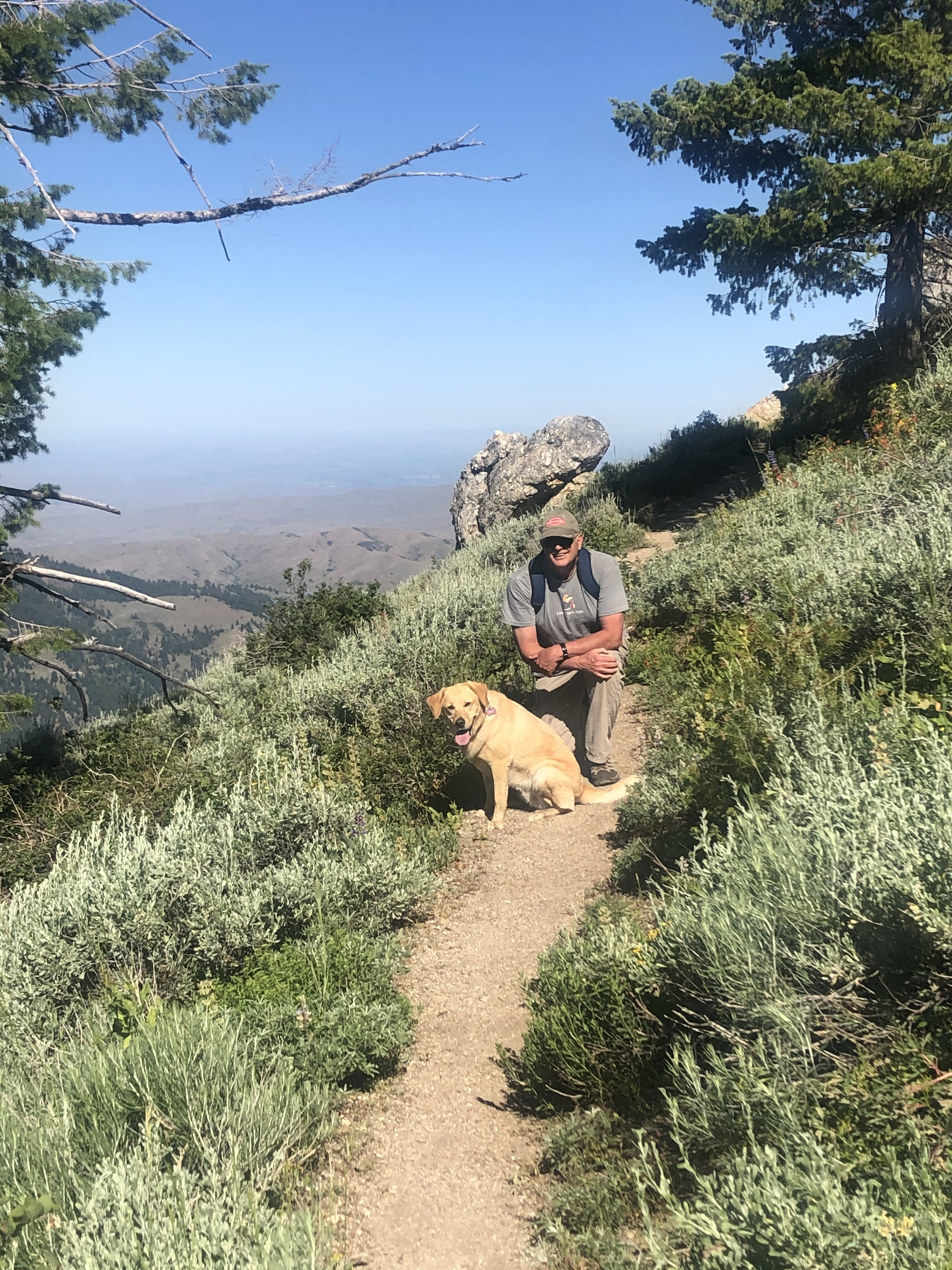 Abby and Steve pause on the trail
The hike is very accessible from Boise. From our house it's an hour to Bogus Basin, then another fifteen minutes on a good dirt road to Shafer Butte Campground where the trailhead is located. I wondered why the campground is named that since it is on the south slopes of Mores Mountain and not on Shafer Butte. But stay tuned - that wasn't the only strange thing about this hike.
There's a parking area at the trailhead with room for a half a dozen cars. Since it is part of the Forest Service campground there is five dollar day use fee. It was an honor system but I didn't mind paying since the money goes to maintaining the campground and trails. It's a good cause and I was willing to contribute.
The trail loops clockwise around the mountain and is only two and a half miles long. With less than five hundred feet of elevation gain it was pretty easy. As you do the loop there are two places where there are shortcuts that cut across to the return trail for people who want an even shorter hike, but I figured I could manage the whole thing. It was quite a nice trail. It started out climbing up through the woods. The shade was very pleasant on the initial uphill section. There were a lot of wildflowers beside the trail, especially a pretty yellow flower which I think was a some variety of buttercup. It was everywhere, and often red or blue flowers were mixed in for a very nice effect. Very colorful.
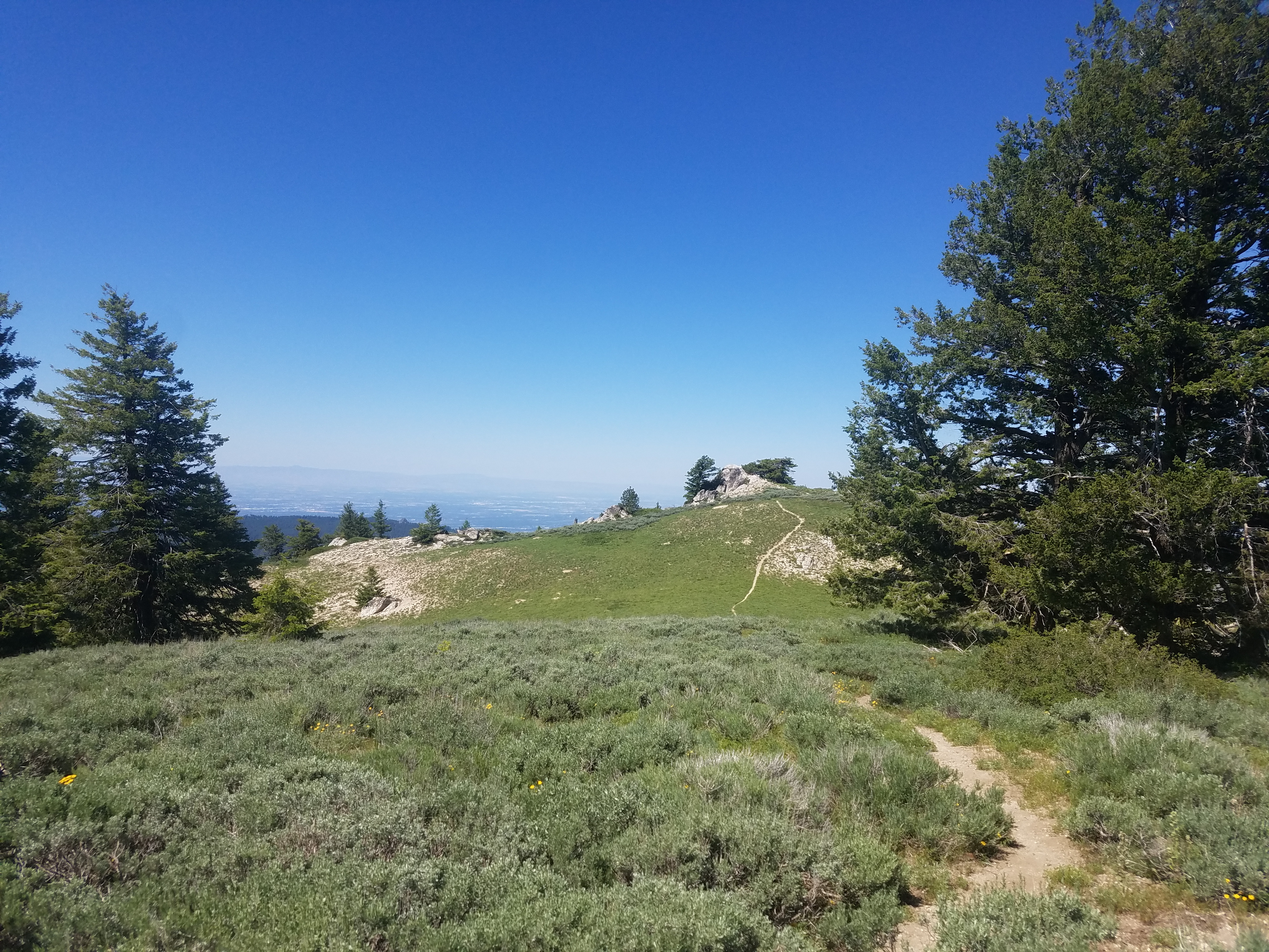 The rock outcropping west of the summit - is it higher?
After passing a number of rock outcroppings the trail came out into the open on the west side of the mountain. The view extended far to the west. The trail kept climbing gradually, eventually circling around to the north and west sides of the mountain. Here there were a few trees and deep green grass - the whole upper part of the mountain was one giant meadow. The view extended over the mountains near Idaho City to the north and Steele Mountain in the west, with the Sawtooths barely visible in the far distance.
When my GPS showed that I was close to the top I cut off the trail and headed straight up. It was only about a hundred yards to the high point. (I checked when I got home in "Idaho: A Climbing Guide", which is the ultimate reference for mountaineers in Idaho. It says that the offtrail section is .08 miles. I was pretty close.) Even on the top there were lots of flowers and a nice view looking across the saddle to the north side of Shafer Butte. The height of the mountain is usally given as 7237 (more on that later). A good size mountain - not bad for an easy to reach trailhead and a moderate hike. Certainly a scenic viewpoint.
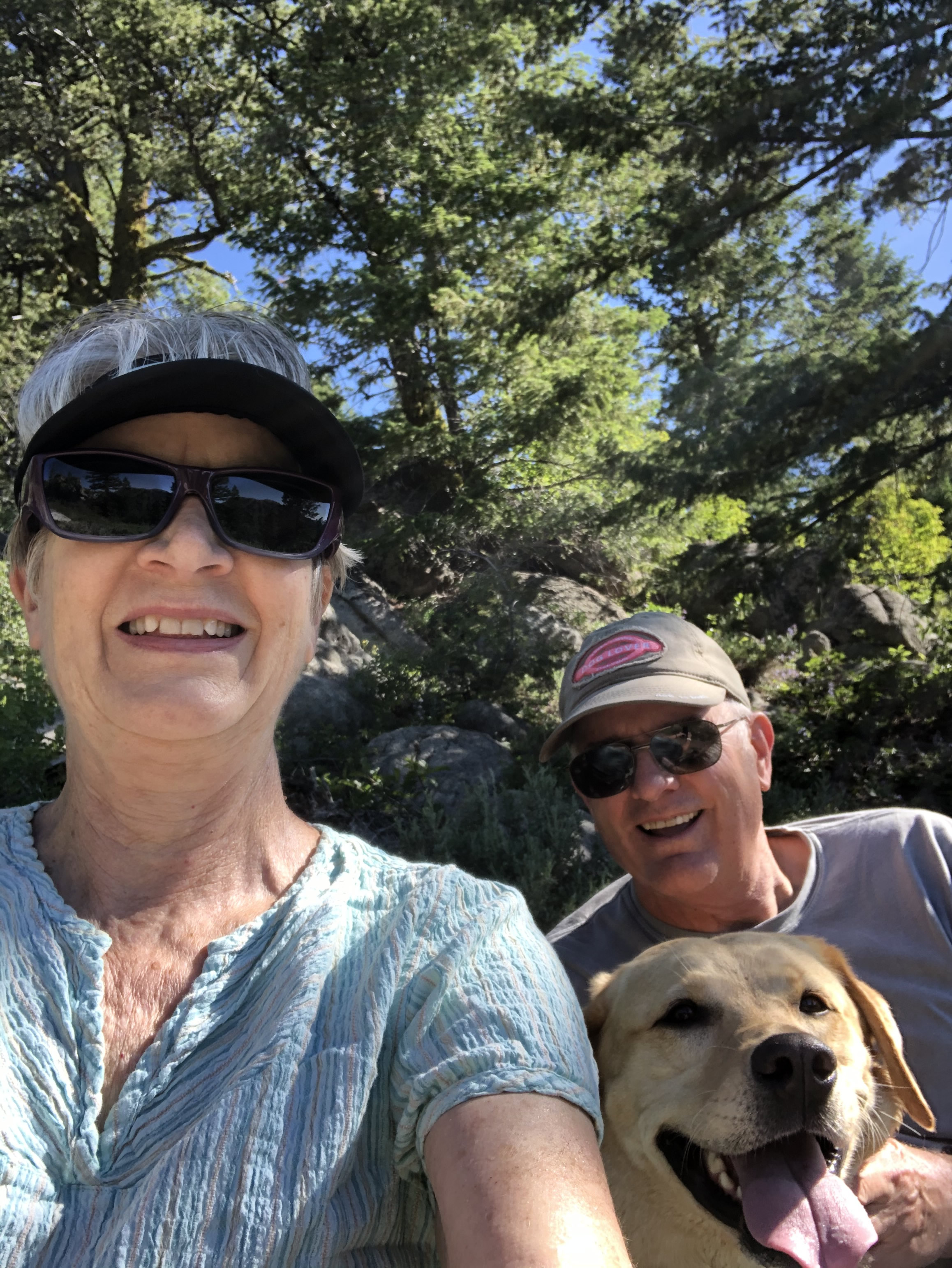 Group selfie on our second hike
There were some strange things though. My GPS map (using the "Map My Hike" app on my phone) labeled the the mountain as "Pico de Mores". I have always known it as Mores Mountain. Later at home I found out that Google maps also calls it Pico de Mores, but even googling that name just returns references to Mores Mountain. So it's not clear what the correct name is.
The summit area is quite large and relatively flat. The map with my GPS app indicated that the highest point was at the east end of the mountain but about two or three hundred yards to the west there was a rock outcropping that looked like it might be higher than where I was standing. Being an incorrigible peak bagger, I had to walk over and climb up on the rocks to be sure that I had been on the actual summit. Looking from one to the other they were very close. I couldn't tell for sure which one was higher so I decided to concede the point to the app. Since I had been to both I figured that either way I was covered.
My confidence in the GPS map was slightly eroded though because when I stood on what I thought was the highest point on the east side, the map actually showed me about fifty feet away. Walking northeast to the exact spot, I was clearly about ten feet below the highest point. So the map was at least a little off.
 Sandy and Abby on Mores Mountain - July 2020
Later at home I went old school and dug out my USGS fifteen minute map of the area. At first glance it agreed with my GPS app because the top of the mountain was marked at the eastern end of the summit area. Instead of Pico de Mores though it was labelled Mores Mountain, 7237 feet. But what was weird was that looking at the contour lines, there was clearly another high point, which was not labelled, at the west end of the mountain. The contour lines were at 40 foot intervals and there was clearly a 7240 foot contour line. I've never seen that before, where a point is identified for height and labelled with the name of a mountain, but isn't actually the true summit according to the elevation contours. And it wasn't labelled as a benchmark either. Weird.
I finally found a source that I trusted that verified this - the website for Idaho: A Climbing Guide. In the book it is called Mores Peak and the height is given as 7237. The website corrects that and states that the official name is Mores Mountain. It also says the west summit is the high point at 7260 feet. So I am going with that.
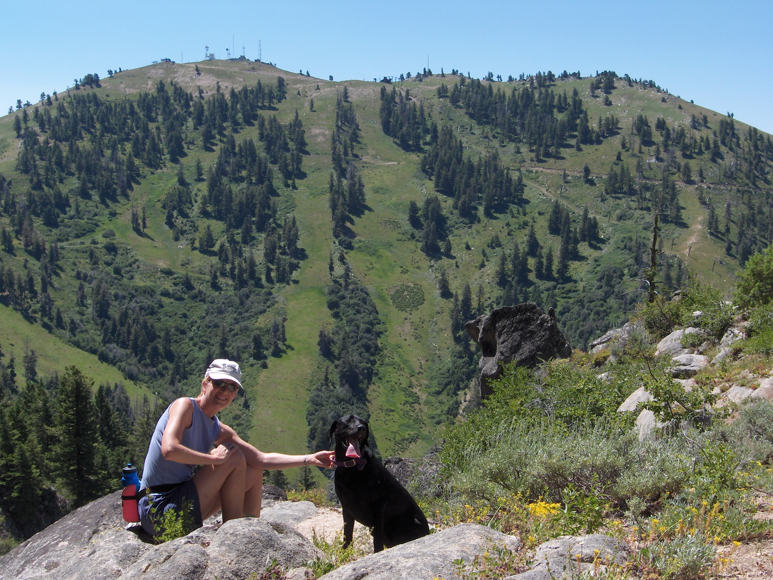 Sandy and Laney on Mores Mountain - July 2005
Meanwhile I was still on top of the mountain and had to get down.
The hike back was easy. There were lots of flowers and the whole time I was walking with a view of the north side of Shafer Butte right in front of me. I was back at the car in less than two hours total. The hike was only about three miles and five hundred feet of elevation gain even with my diversion to both summits.
It was a nice hike. Not a long drive to the trailhead. Scenic. Not too much work. I only encountered about half a dozen people, and one dog. In fact, when I told Sandy about it and showed her my pictures, she wanted to try it too. So two days later, I was back at the trailhead with her. This time Abby got to come along too.
It was another beautiful day and we all enjoyed the hike. This time we only went to the east summit. Sandy noticed a summit register in a pile of rocks that I had missed last time, so even the person who left the register was fooled by the map. We all signed in anyway. There were a few more people on the trail, probably because it was a Friday, but it was still a good hike. Abby, as always, loved running free in the mountains and giving the business to the local squirrels.
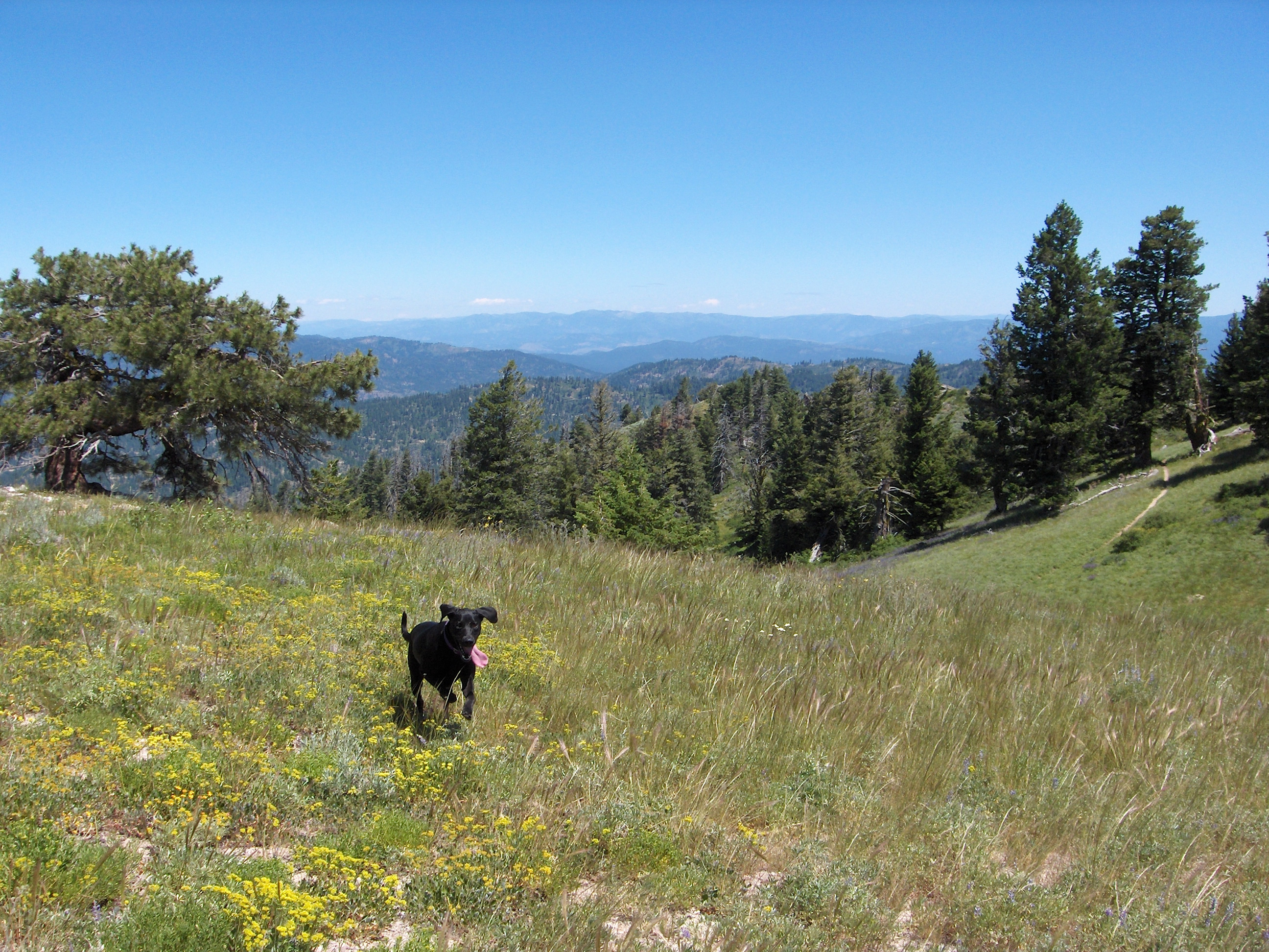 Laney runs through the summit meadows
When I mentioned to Sandy that we had done the hike years before with Laney she didn't recall it. I distinctly remembered a picture of her and Laney on Mores Mountain with Bogus Basin in the background so when I got home I checked the Darth Dog website. I couldn't find it. I started going through old pictures (on my PC, of course). It took me quite a while but eventually I found what I was looking for. Sandy and Laney and I had done the hike on July 16, 2005, before we moved to Singapore. It was almost fifteen years earlier to the day. Just like Abby, Laney also loved to be in the hills. When we did the Mores Mountain hike with her she was still a young dog. I had to smile when I saw the picture of her running through the meadow with her ears flapping and her tongue hanging out, but I was a little sad too. We lost her in 2013 and I still miss her.
Life is short. Play with your dog.
