Blackmon Peak
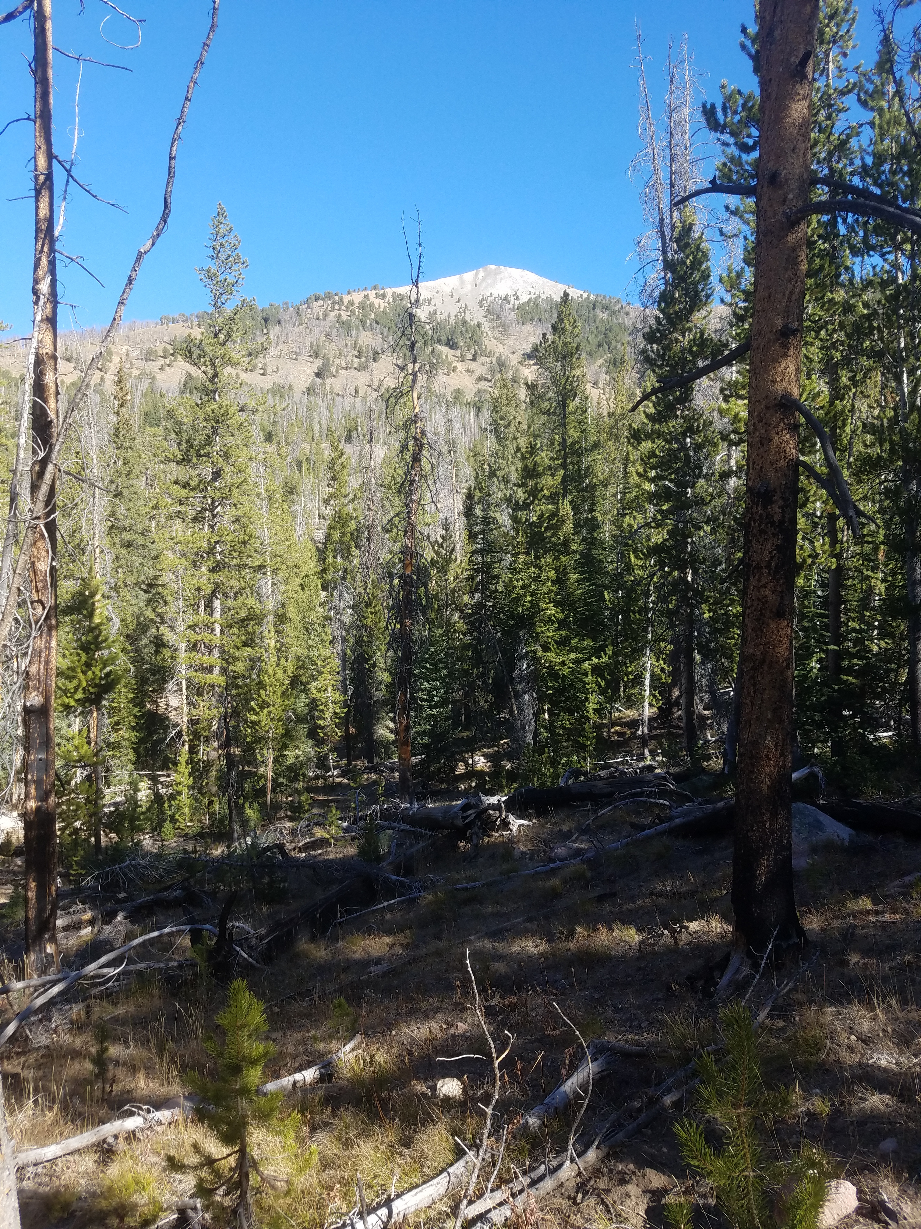 View of Blackmon Peak from near trailhead
It's been almost three years since I climbed a significant mountain. In 2019 I had knee problems and did very little hiking. 2020 was Covid which really restricted traveling. This year the fire season started at the beginning of July and the smoke was bad enough to discourage trips to the mountains. Finally this fall the smoke cleared in Idaho and I was able to get out and do some hiking. Abby and I did our first real hike in late September. It was one of my standard, well-known hikes in the Sawtooths, to Hell Roaring Lake. It was a good trip and now I was psyched to do more.
Unfortunately, by now the hiking season was just about over. There were complications too. Abby got sick after our Hell Roaring Trip. The vet thought it was either from eating plants (she threw up a big wad of plant matter after we got home) or from drinking bad water (she drinks a lot while hiking and doesn't worry about the source). Abby did get better after a few days but now she was grounded from hiking. Sandy was traveling a lot as well this fall so I didn't have many opportunities to get away on my own. I couldn't leave Abby for a whole day to go hiking. Sandy was teaching at Quiltworx University in Arizona for a whole week. She also had trips back to Wisconsin to help her parents move into assisted living. When I overlaid her schedule with the weather in the mountains, which is not always good in the fall, it looked like I had one day which was my last chance to get out for a hike before her next trip.
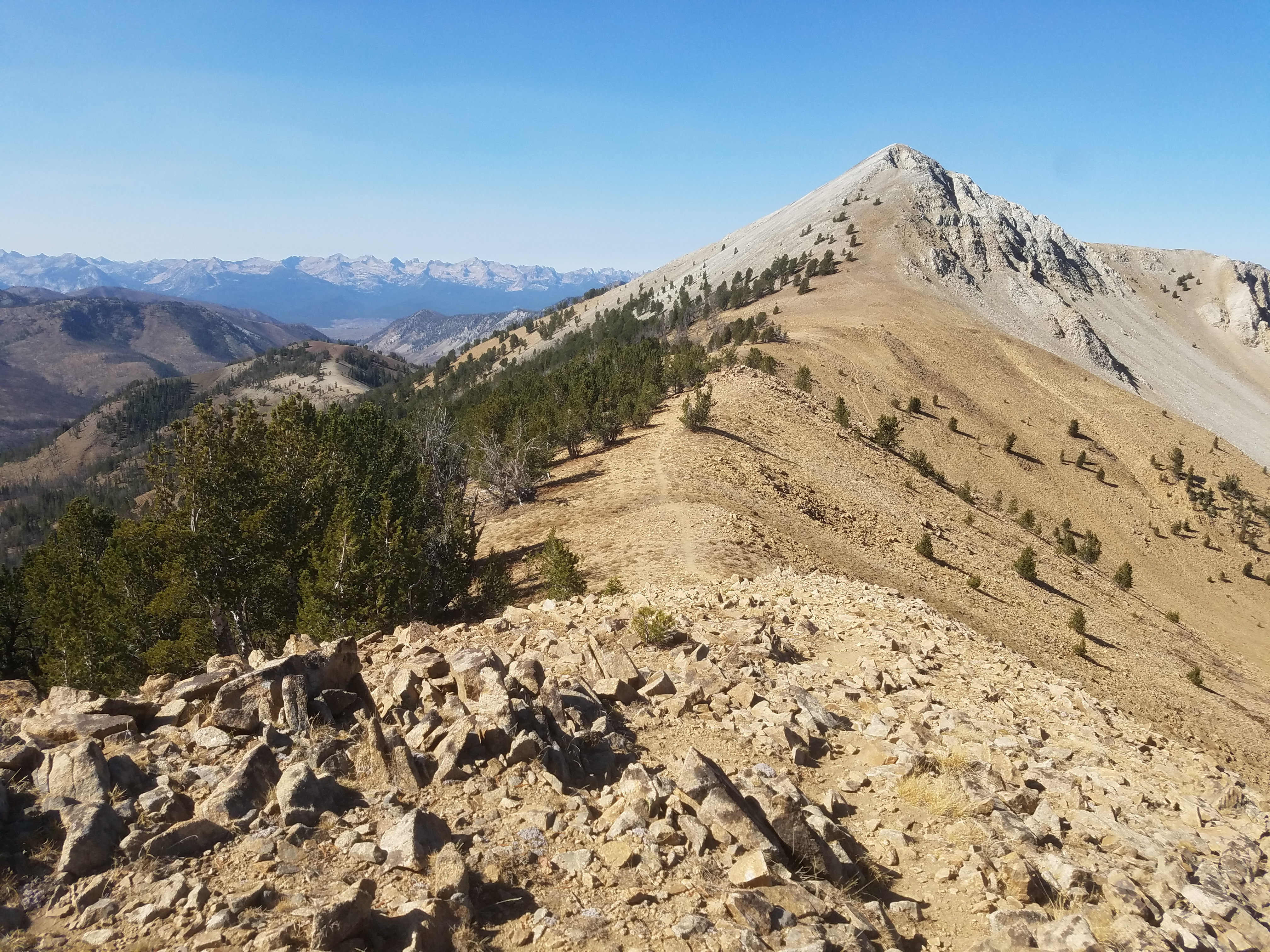
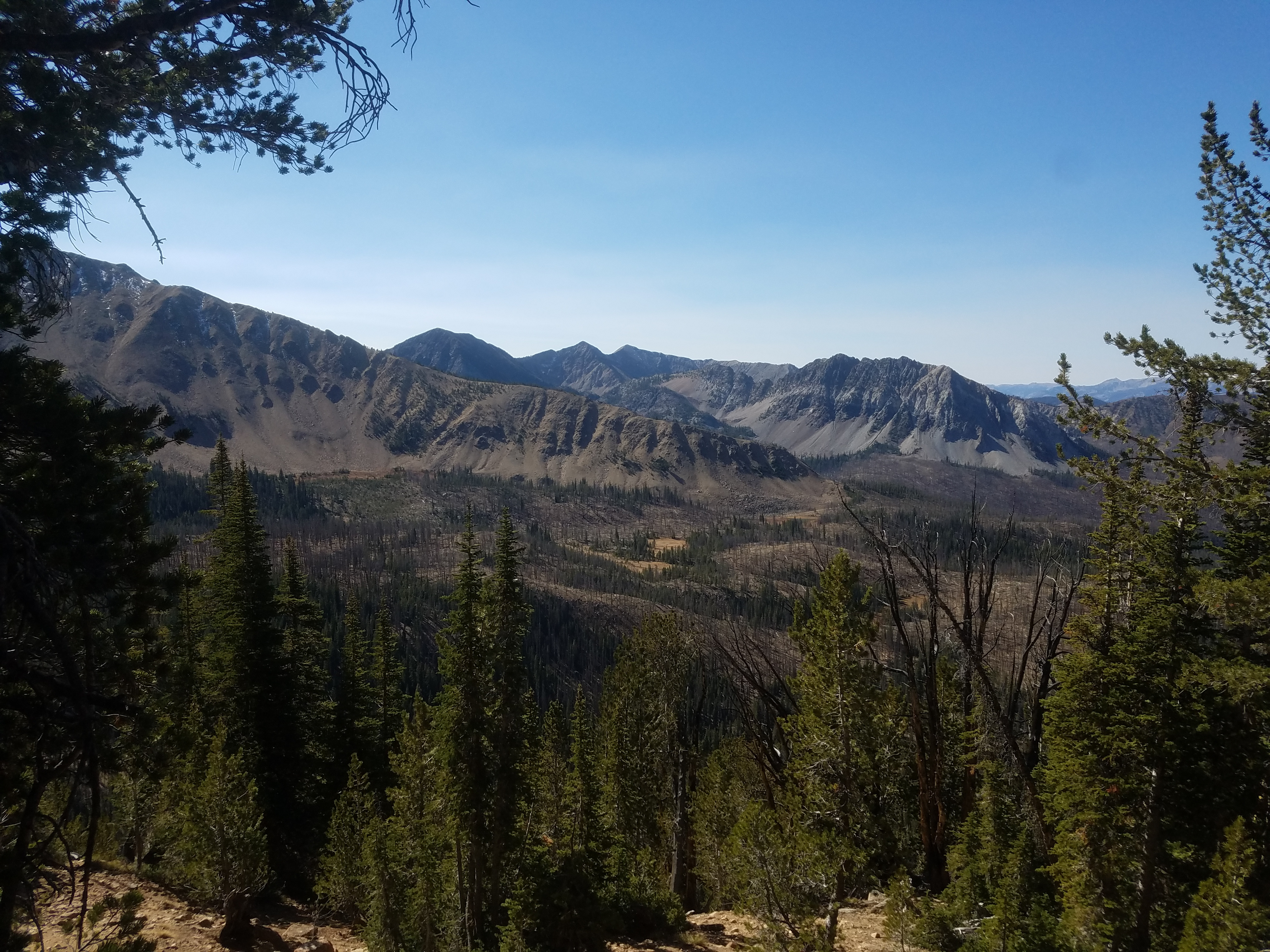 Climbing up the ridge and looking down on Fourth of July Creek
My first thought was to go to Sawtooth Lake. It's probably my all time favorite hike. I must have done it over twenty times. I used to make a point of doing it every year. It was one of the few hikes I did in 2020. But then I decided that instead of something familiar, I wanted to do something different instead. Because I did so little hiking the past two years, I hadn't done much exploring. I hadn't done a summit either, except for Shafer Butte and Mores Mountain at Bogus Basin. For both, you drive to within an hours walk from the top - they're pretty tame. They hardly count as mountaineering.
After doing some research I decided that I wanted to try to go up Blackmon Peak. I had never done it before. It's in the White Clouds, near the Fourth of July trailhead. Because of a long, rough access road, I hadn't climbed or hiked in that area since the early 1980's. I would be exploring again, and I would climb a real mountain.
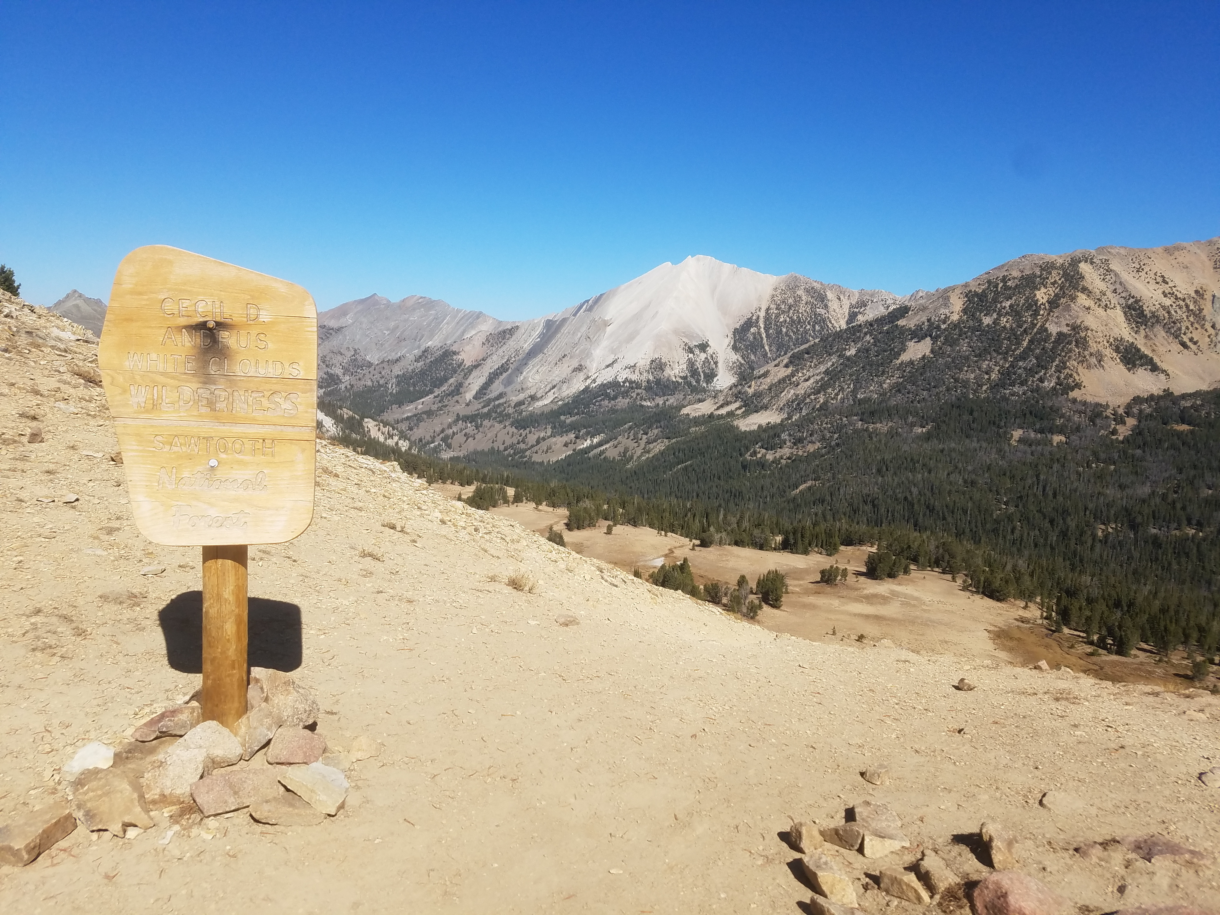 D.O. Lee Peak from the Wilderness boundary
I'm not a fan of driving on rough, dirt roads. Four-wheeling has no appeal for me. Idaho: A Climbing Guide recommended a 4WD for the access road. It's the definitive guide book for mountains in Idaho and I've always found the info in it to be excellent. That made me nervous since it's ten miles from the highway to the trailhead. I have a Suburu with good clearance but it's no Jeep. But when I checked on the web I found recent comments from people who said the road was driveable with a regular car. The only way to find out for sure was to go there and see for myself.
It turned out it wasn't too bad. Parts of the road were just dirt, parts were gravel and parts were rocky but nothing that came close to being a real problem. The ten miles only took me thirty minutes to drive, about half what I expected. And the trailhead was at 10.0 miles from the highway by my odometer, so that information was spot on. After that long on a dirt road though my car was completely covered in dust. I couldn't see out the back window and when I got out it wasn't even easy to tell that my car was red.
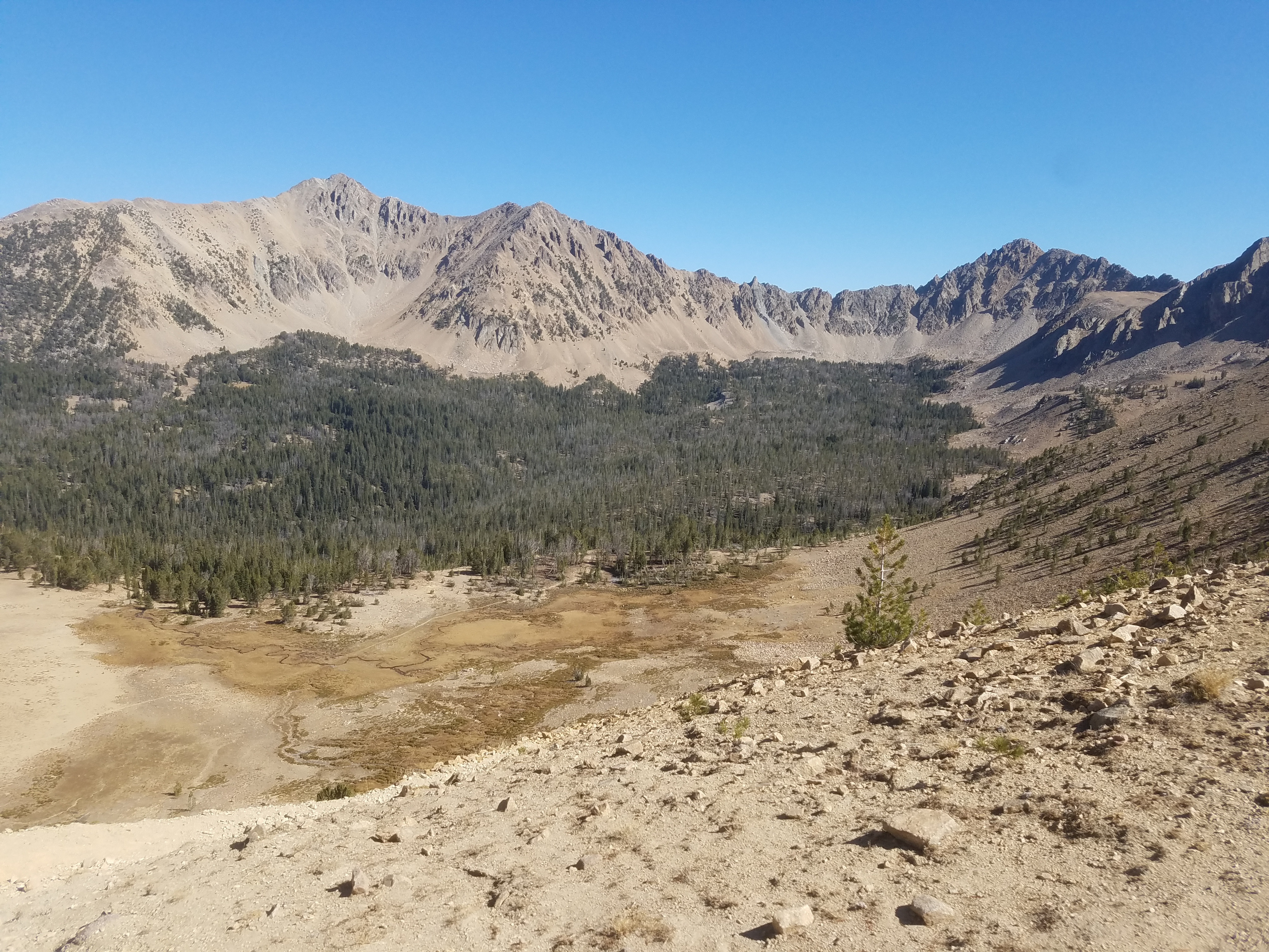 Lonesome Peak (left) and Mount Frank (right) above Antz Basin
Although Fourth of July trailhead is very popular, when I got there only three other cars were parked there, probably because it was so late in the season. As I parked two other hikers were just starting out, but by the time I put my boots on and was ready to go they were long gone. When I started out it was just me on the trail.
I got a good view of Blackmon Peak as I was driving up the access road. The trailhead was right below the peak but instead of going directly cross country I was taking a more roundabout approach via the Fourth of July Lake trail. It started out in the woods but soon it passed through some burned sections where I had a good view of the mountain I was planning to ascend. There was definitely a lot of altitude that I needed to gain but the peak actually wasn't that far away. There were trails I could use to approach the mountain, although it would be a lot longer. Still it would be easier overall.
 The final section of ridge leading to the summit block
First was a hike to Fourth of July Lake. It's less than two miles so it's a popular hike to an easily accessible alpine lake (once you've driven the long access road). It's a pleasant hike that climbs gradually through the woods. Fourth of July Creek runs alongside the trail for much of the way. Just before the lake was a trail junction where I turned off to head to Born Lakes. According to the map Fourth of July Lake was only a short distance further but I decided to save my energy for now. I'd stop there on the way back. Of course on the way down I'm usually too tired to do any side trips.
After the junction the trail started to climb up the ridge that stretched between Blackmon Peak and Patterson Peak. Part way up it passed a small tarn. It would probably be pretty most of the time but after such a hot summer it was almost completely dried up, just a mud puddle now. Then there was more hiking through the woods. At one point the trail dropped suddenly, heading down for as far as I could see. That's the wrong way. I want to go up! When you are climbing there is nothing worse than having to give up elevation. There was a fainter trail that split off and went straight up towards the ridge crest. It had a large branch partially across it, usually done to indicate people shouldn't take a trail. This one was hard to tell for sure. Studying the topo map, it looked like there might be a short stretch of downhill so I stuck with the main trail. That was the right decision. Soon the trail turned upward again and eventually topped out at the lowest point of the ridgecrest.
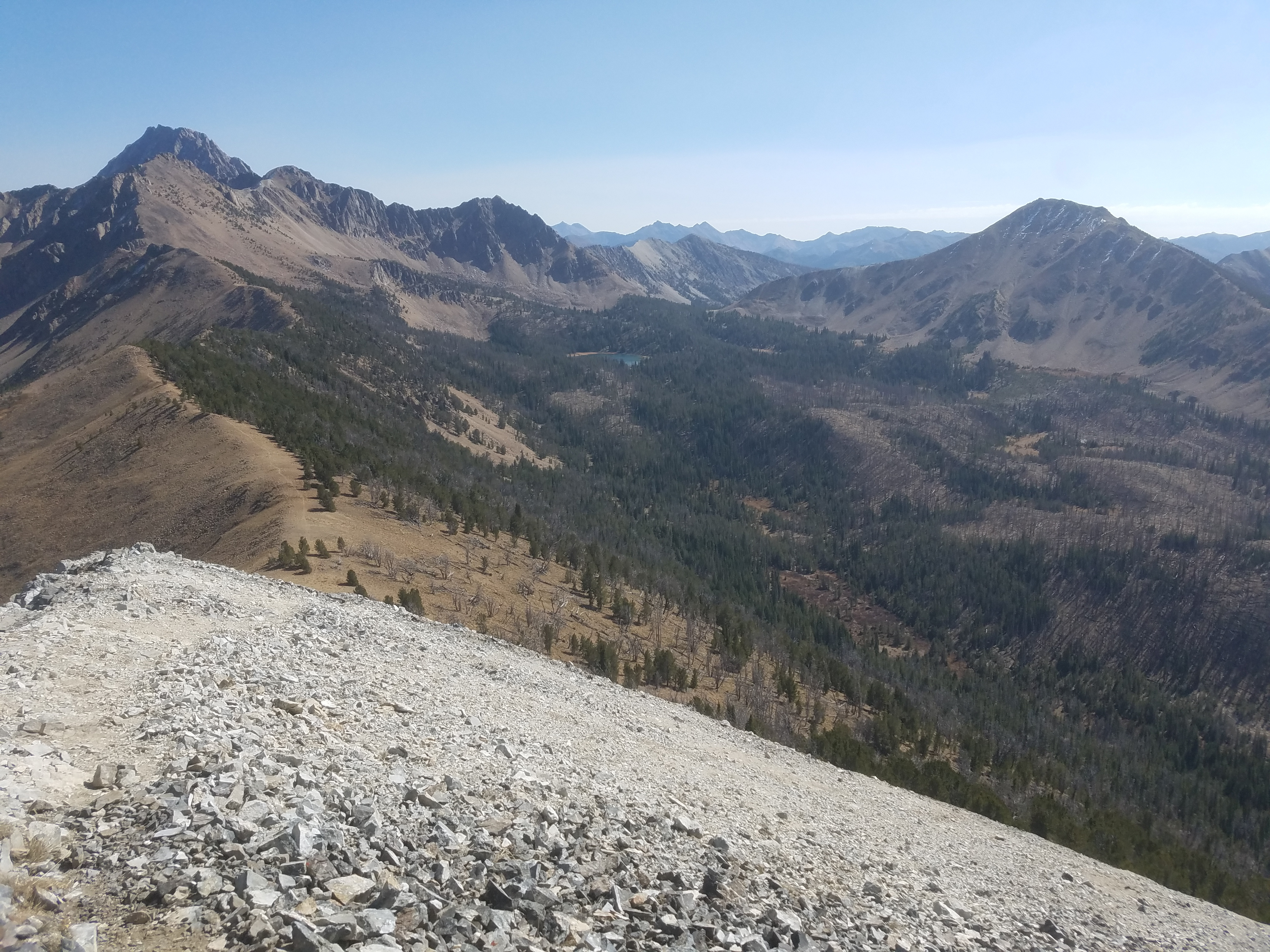 Summit view looking down the ridge I ascended
Although the hike to this point was through woods, the trees ended just below the crest so there was an impressive view from the top of the ridge. To the right, the ridge continued up to Patterson Peak, which is also supposed to be a class 2 route. There were some rock bands that looked a little tricky so I was content to save that climb for another day. To the north, across Antz Basin were Lonesome Peak and D.O. Lee Peak, the latter composed of the bright white quartzite rock that gives the White Cloud Peaks their name. To the left the ridge extended to Blackmon Peak. Although it was actually a lot farther away than when I had started from the trailhead, the ridgeline looked like it provided a straightforward way to the top.
After following the trail a short distance to the west along the crest of the ridge, I reached a sign marking the boundary of the Cecil Andrus White Clouds Wilderness. At that point the maintained trail turned north and headed down steeply into Antz Basin, where the Born Lakes are a popular destination for backpackers. A light climbers track continued along the ridgecrest to the west and I followed that towards Blackmon Peak. At one point there was a rocky bump in the ridge. I made a rookie mistake by going around rather than over the bump. Traversing on a slippery scree slope was hard work even if it was level. Climbing up and over would have been faster and less work. But I made it around the hump and continued along the ridge. Eventually I reached the base of the summit slopes of Blackmon. Here there was no choice but to go up steep scree. Being above 10,000 feet didn't make it any easier. I just took it slowly and carefully and eventually made it to the top.
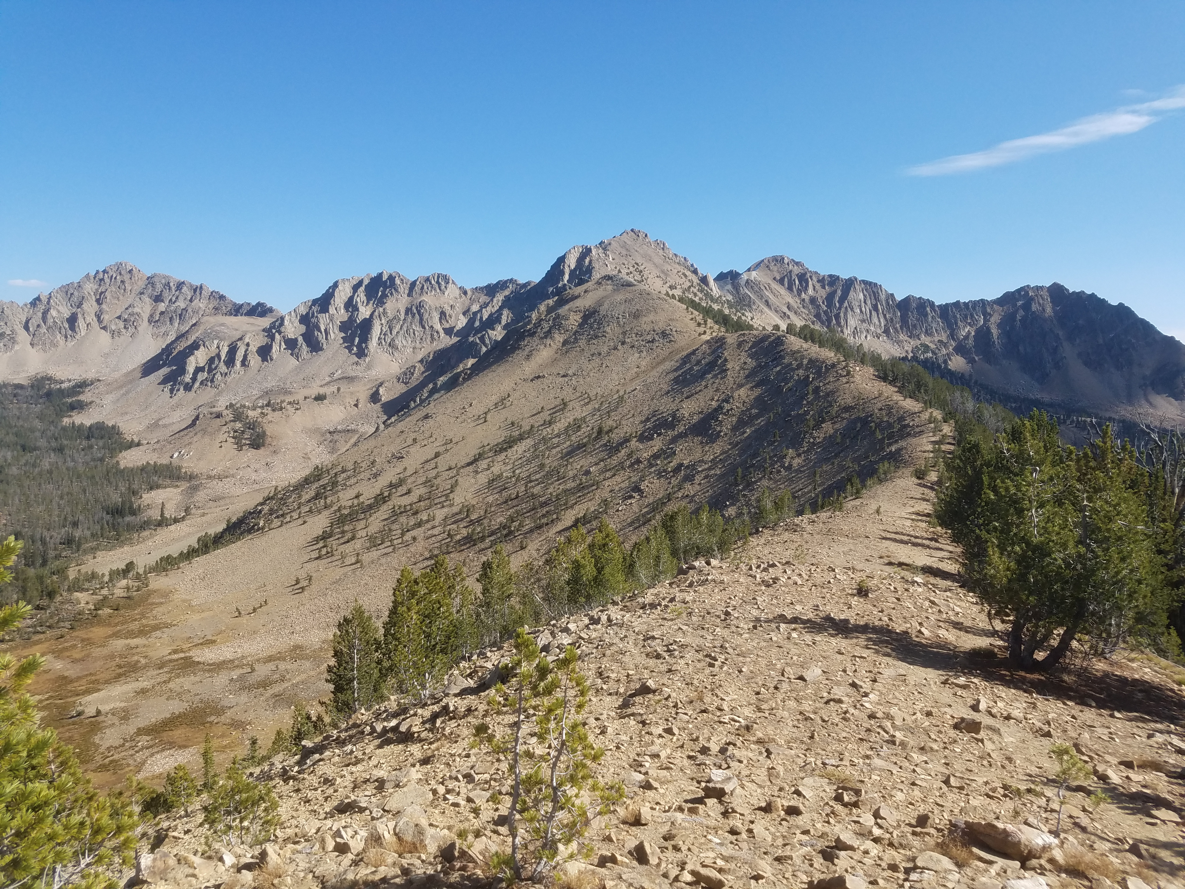 The route to Patterson Peak along the ridge looks tougher
The view from the top was spectacular. To the east, Castle Peak dominated the White Clouds, rising behind Patterson Peak. To the west, the Sawtooth range rose on the other side of the valley. Although it wasn't cold it was quite breezy on top. I wore my windshell as I sat and admired the view.
Almost straight down from the summit was the trailhead and I even thought I could see a speck of red (my car) through the trees. According to what I had read, the southwest ridge of Blackmon was class 2 descending to a saddle. From there an old mining road was supposed to go straight to the trailhead. The idea of a traverse was appealing and the trailhead was right there, straight down the mountain. It looked like I could be down at the car in half an hour. But...
I had not seen the mining road from the trailhead or on the early part of the trail, and I had looked for it. From above, I still couldn't see it, although there were some trees on the lower slopes that might be hiding it from view. Not that many though. It should have been visible. And the scree slope leading down the the southwest ridge was fairly steep. It was certainly doable but since I hadn't done a peak since my knee problems started I wasn't sure how my knee would hold up. I debated internally for a while and then decided to go back the way that I had come. Still when I got up and left the summit it was hard to head for Fourth of July Lake. I could see it quite a distance away, and knew I would have to walk all that way just to turn around and walk all the way back down the valley. Oh well. It wasn't that far and it was a good trail. Better to be conservative.
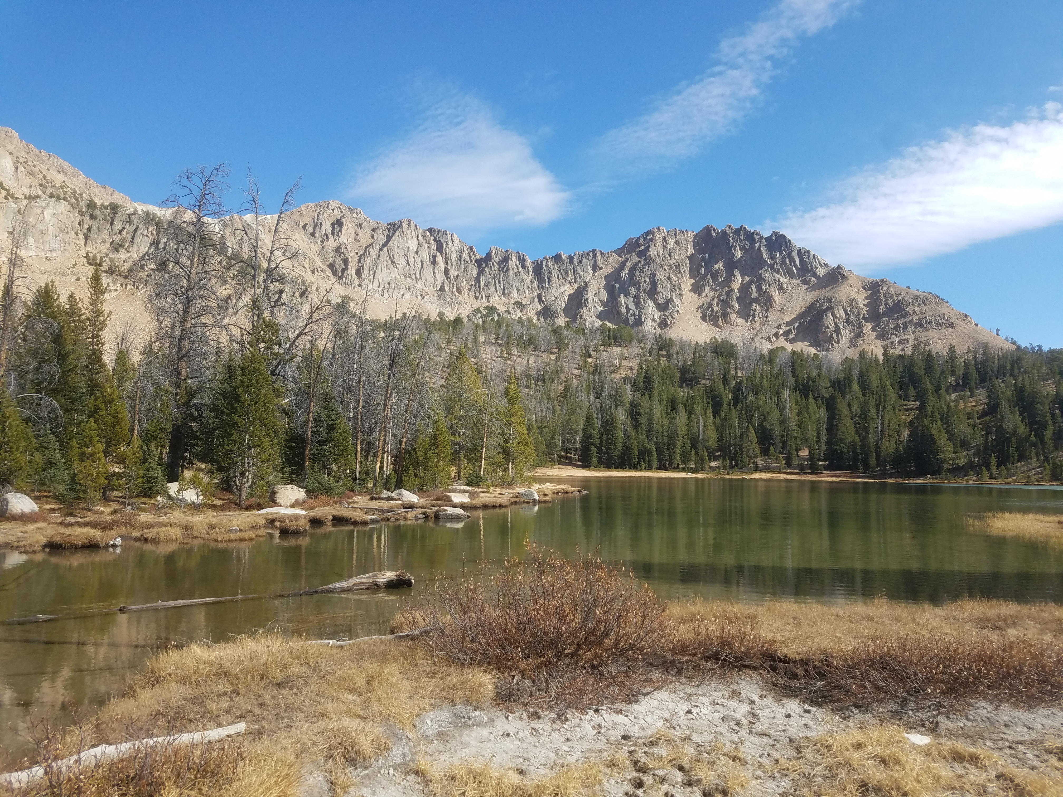 Fourth of July Lake
The steep scree coming down from the summit took some effort but once back down on the main ridge the going was easy. This time I knew enough to go over the bumps on the ridge rather than around. The downhill section of the trail that descended from the ridge went well too. I felt pretty good. When I reached the trail junction I even went the extra distance to check out the lake. It was well worth it, still waters surrounded by trees with a backdrop of steep peaks. There were two other hikers there taking a selfie on a rock. They were the only people that I had seen since leaving the trailhead.
After the lake I was on the home stretch. I felt good but took my time. Eventually the lady I had seen at the lake caught up and passed me. I mentioned that she was moving at a good pace and she said she wanted to get down for happy hour. Hey, a hiker after my own heart. A little while later her husband caught up and passed me too, but I just took my time. Then just before the trailhead two other hikers came the other way. Except for those four people, I hadn't seen anyone else the entire hike. That was pretty cool. I had my own personal mountain to climb.
When I reached the car my GPS said I had hiked seven and a half miles. With sixteen hundred feet of elevation gain, it was a good workout but not too difficult. I took my time. It was two and a half hours up and less than two hours and fifteen minutes down. I felt really good and the hike had been great. The weather was perfect and the hiking along the ridge crest and up to the summit was like walking in sky. It was an awesome day in the mountains and it felt good to climb a mountain again.
