Elk Meadows
 An early morning start on Brewster's Byway Trail
I have done a lot of hiking at Bogus Basin. I've gone to the top of Shafer Butte more times than I can count. I know the trails pretty well. The cat track goes up the north side. The Tempest trail climbs the west ridge. And the Face trail makes a long traverse high on the southern face. It's my favorite way to come down because of the view of the Treasure Valley that's in front of you the whole way.
I was surprised when I saw some photos in a Facebook post by my friend Michael Kroth. He said it was from a hike at Bogus. It definitely looked like Bogus but I couldn't identify any of the spots. I asked him where he took the photos and he told me they were from the Elk Meadows Trail. Hmm. It sounded familiar but I had to admit I didn't know where that trail was. Fortunately there are good resources for hiking in the Boise area. I checked the trail map on the Ridge to Rivers website. It's a local organization that does maintenance and management of trails near Boise. I found the Elk Meadows trail - it circled around Shafer Butte on the east side. That's one part of the mountain I had never been on. I decided to go and check it out.
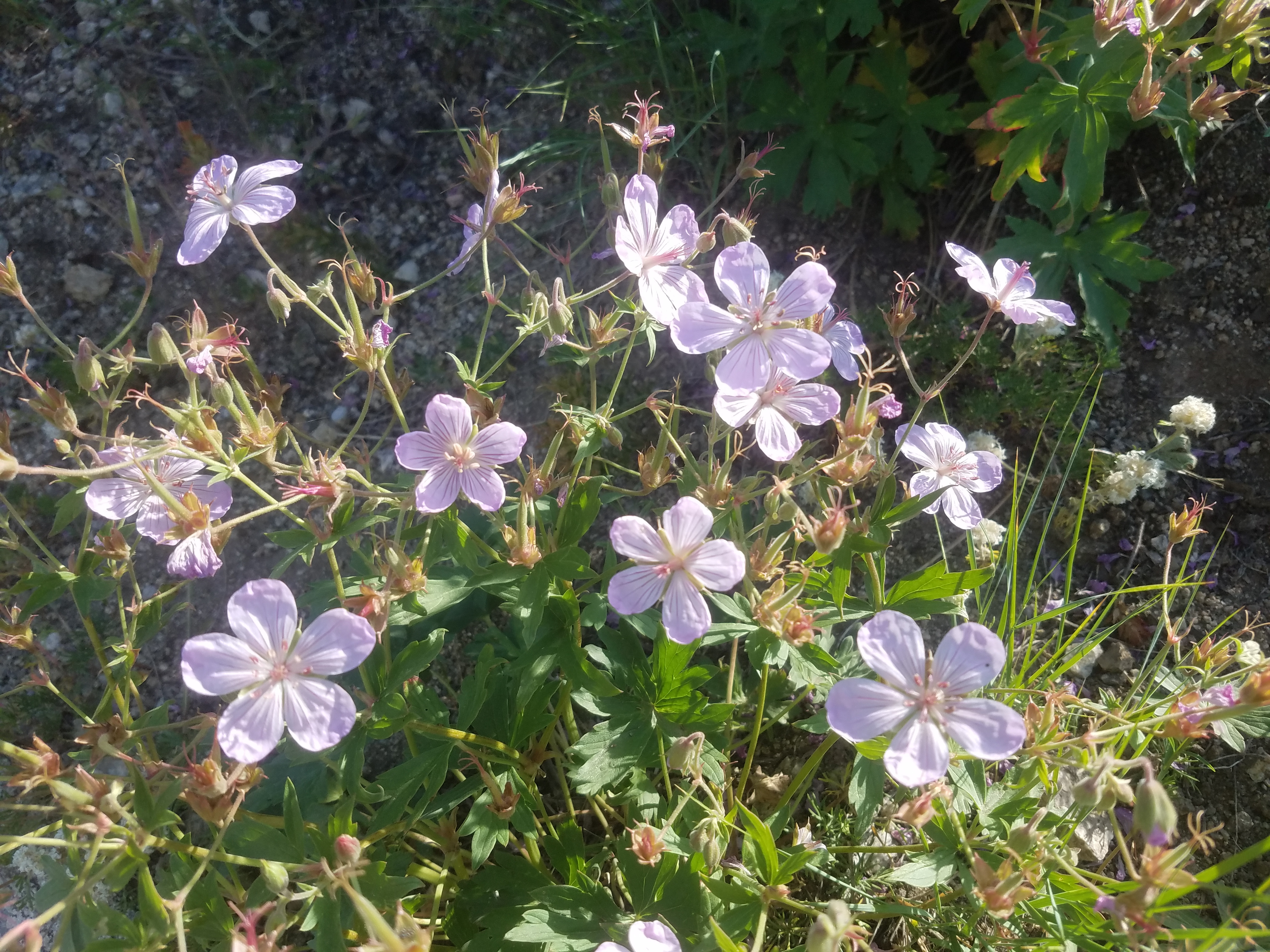 There were wild geraniums everywhere along the trail
A couple of days later I was on my way up to Bogus Basin, early in the morning to avoid the heat. It's always cooler up at Bogus than it is down in the valley, but we had been having one hundred degree plus days in Boise for a couple of weeks already. I figured it would still get pretty hot, even at 7,000 feet, so I wanted an early start. Of course when I got my hiking boots and pack out, Abby wanted to come along too.
I parked at the upper lodge, the starting point for our usual routes up the mountain. From there we took Brewster's Byway, another trail that I had never hiked before. It starts near the upper lodge and makes a mostly level traverse across the lower part of the south face of Shafer Butte. It ends on the saddle between Deer Point and Shafer Butte. I had never taken it because I didn't really think it went anywhere. I thought that it was just one of those connector trails that join two parts of the ski area.
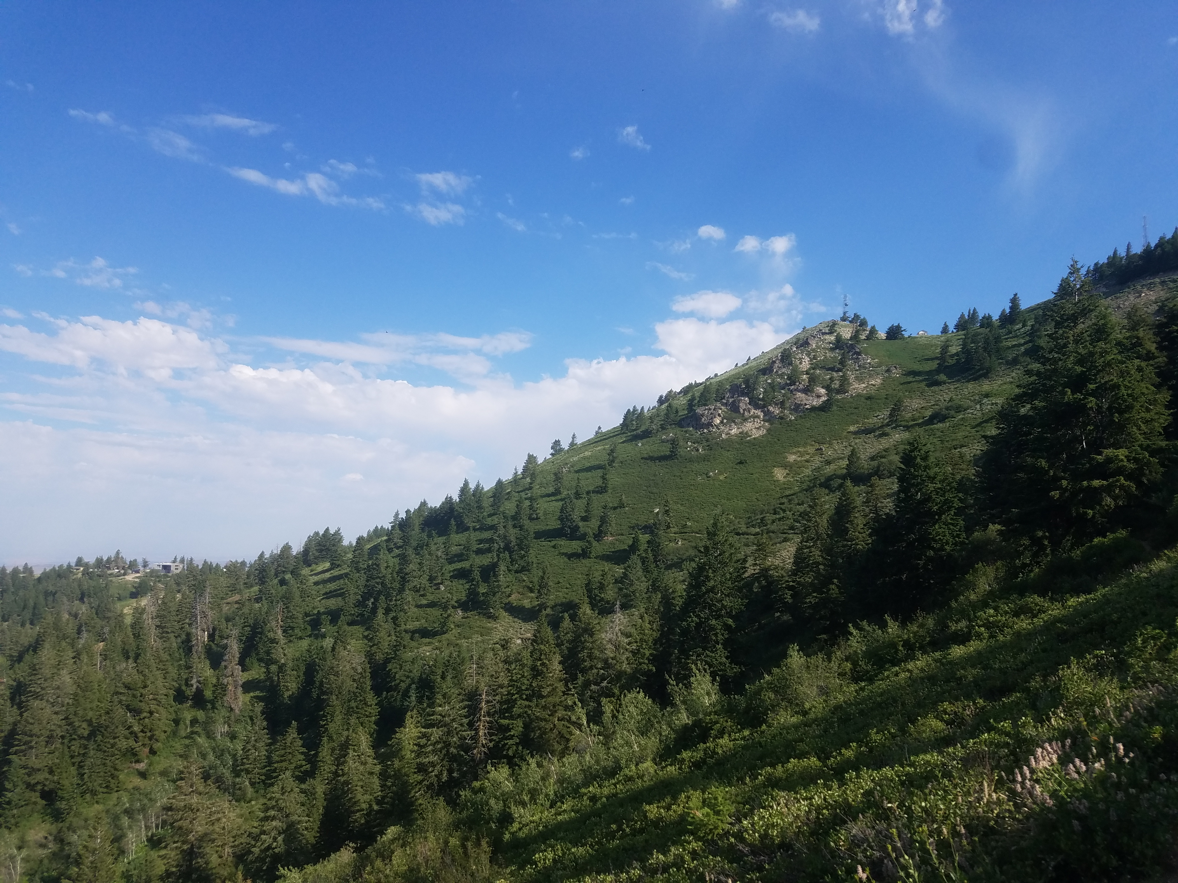 Looking back at Brewster's Byway trail from the saddle
Once we started out I was pleasantly surprised. The trail started out by heading into some woods, so even though we had just left the lodge it had a feeling of remoteness. The trail made a level traverse across the mountain so it was easy going. Soon the trees thinned out and we had views across the slopes of the mountain over to Deer Point. The air was cool and the early morning light made the mountain a deep green color. I usually think of Bogus Basin as quite dry so it was a different view of the mountain for me.
The only other people we saw on this section were three women hikers. They were moving fast, coming up behind us and zooming by. Abby and I were content to take our time. Nothing to do with being old and not having hiked much this season. No, we were just going slowly and enjoying the morning and the beautiful surroundings. At least that's my story and I'm sticking to it.
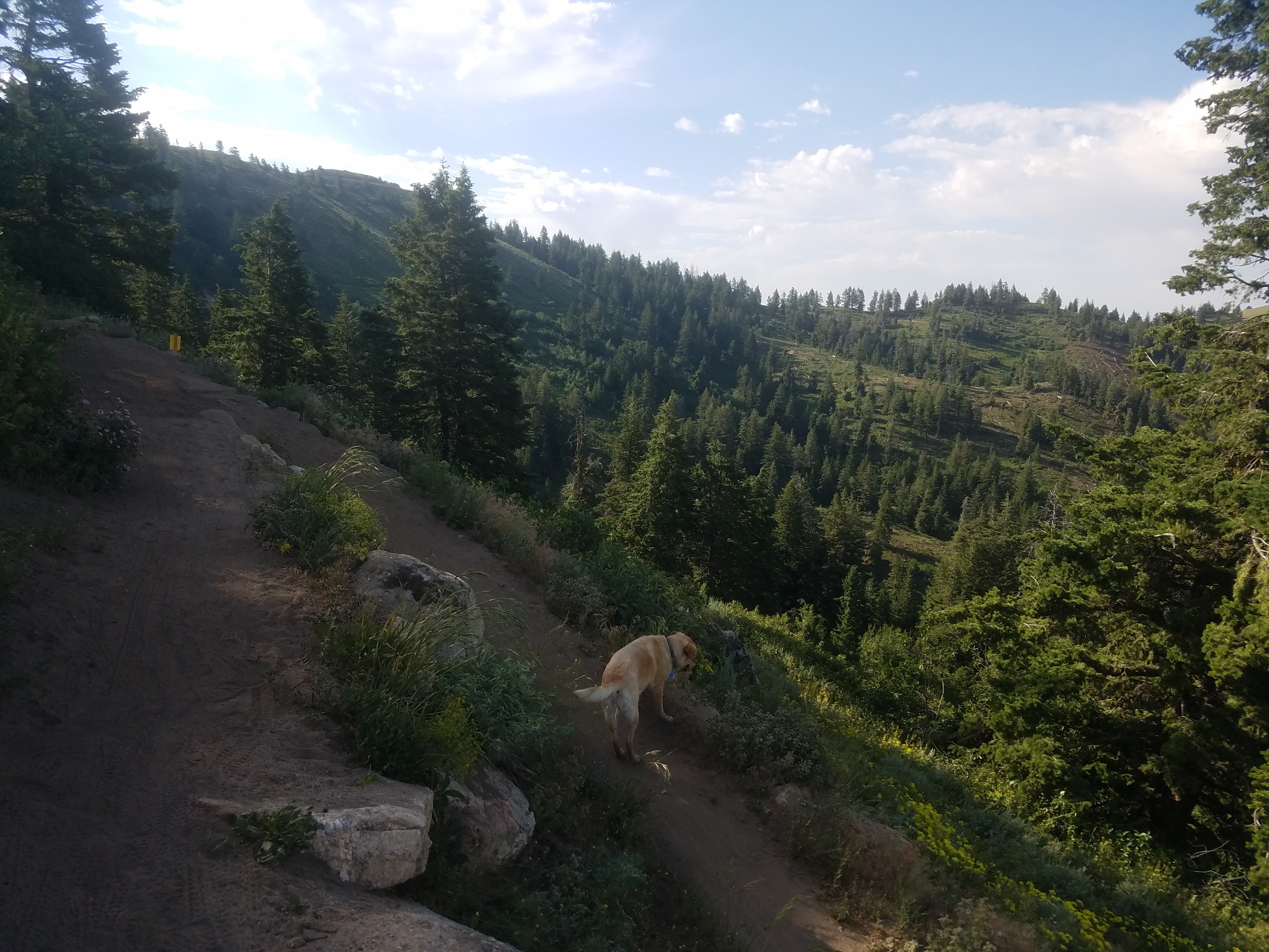
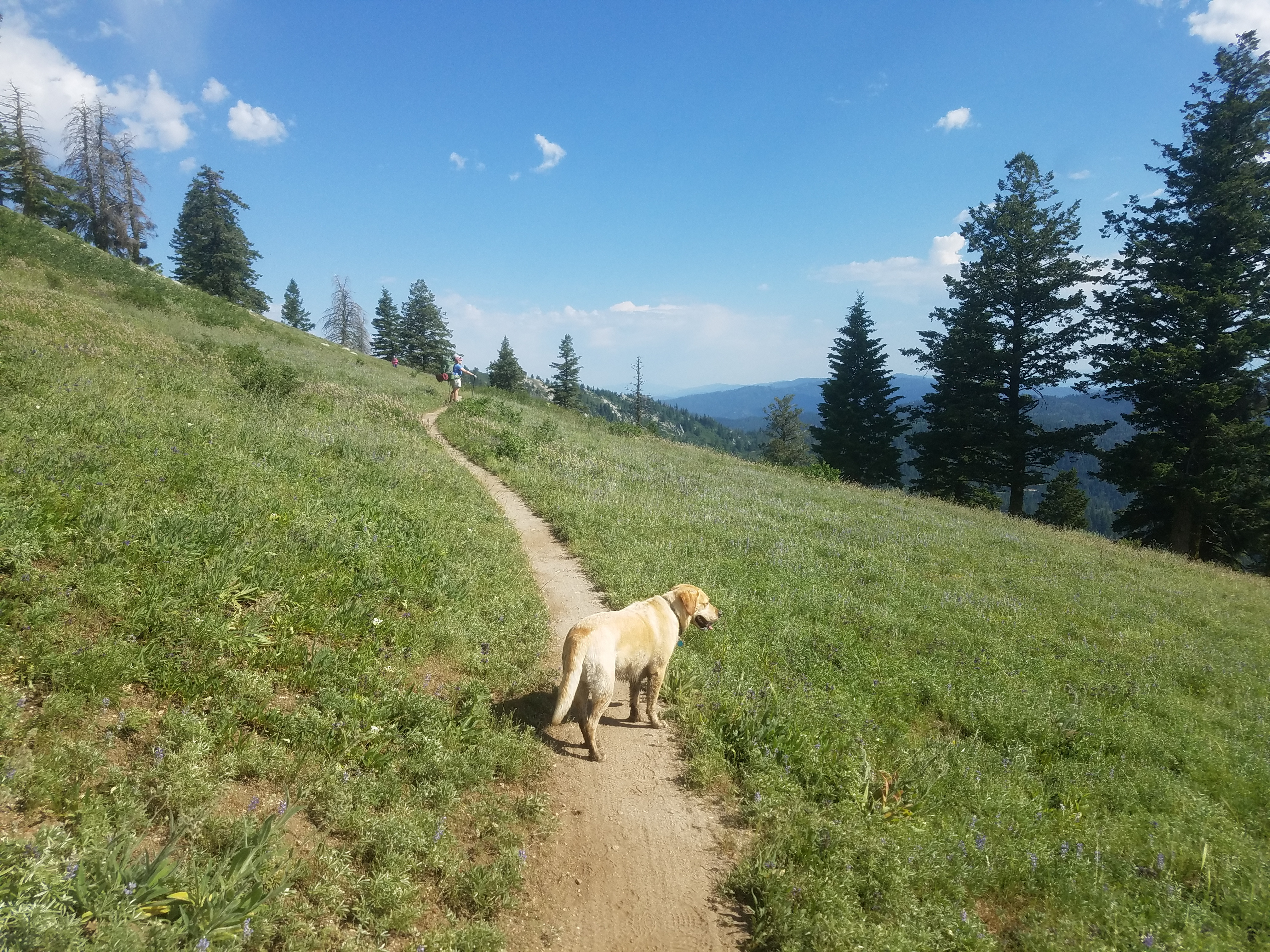
 Abby explores one of the meadows along the Elk Meadows Trail
Another pleasant surprise was how many wild flowers there were. I'm used to seeing them here earlier in the year. Bogus is pretty dry though and I would have expected them to be gone by early July, especially with the heat wave we had been experiencing this summer. Instead the slope was covered with wild geraniums. There were also lilies, lupine, penstemon and the arrowleaf balsamroot that is ubiquitous in the hills around Boise. There were other flowers that I couldn't identify - Sandy is the expert on flora and she wasn't along. All of them were really pretty though.
It only took us forty minutes to reach the end of Brewster's Byway, where it connected to the service road coming down from the summit of Shafer Butte. By then the sun was fully up and now the sky was a bright blue. We had a nice view looking back across the south face at the traverse we had just done from the lodge. It looked very close but the mountain is big and appearances were deceiving. It was well over a mile away.
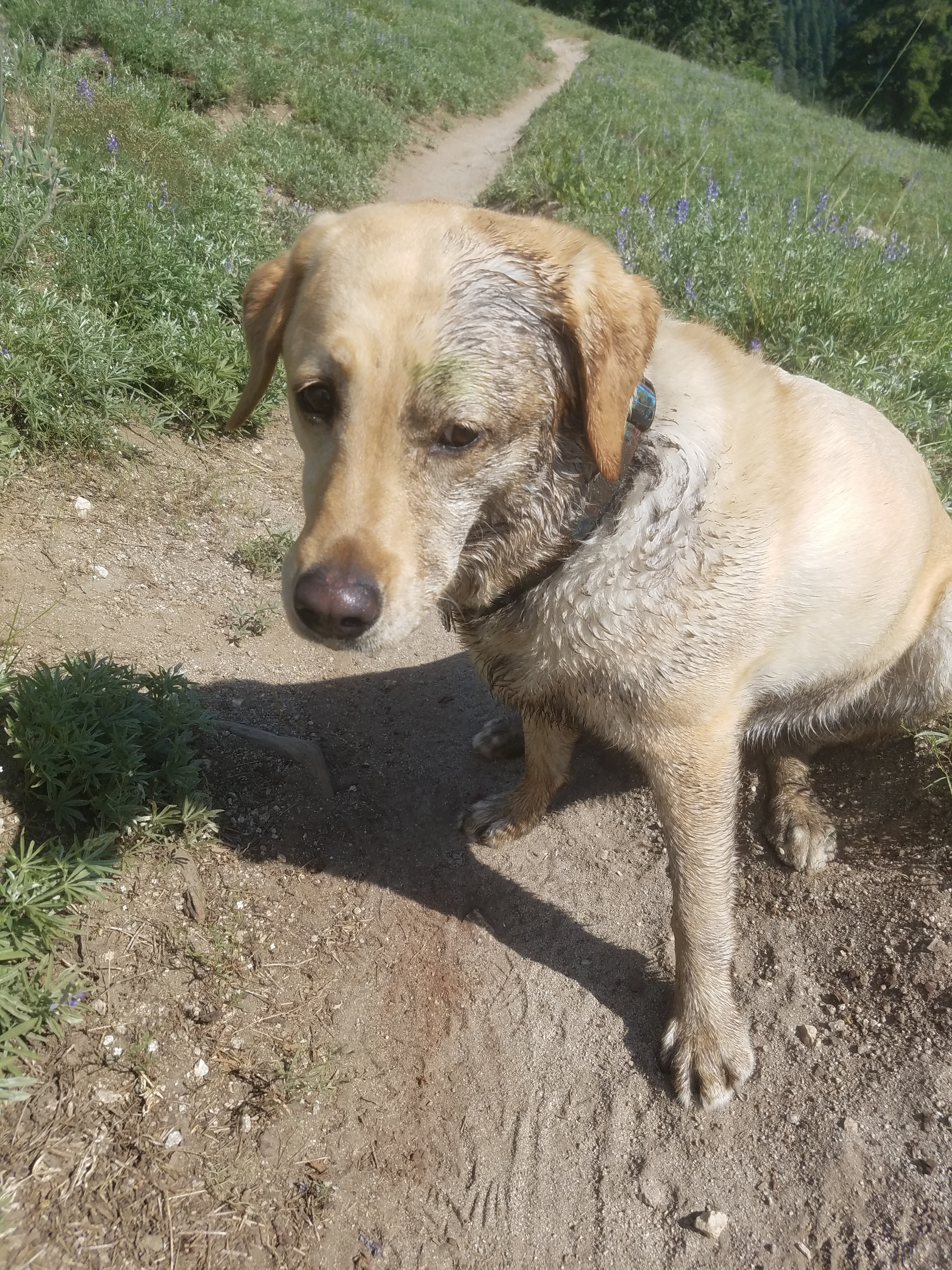 Dirty dogs have more fun
I'd been to this spot, the saddle between Shafer Butte and Deer Point, a number of times. Sometimes coming down from the top of the mountain I would take the service road down to connect with the Face Trail to go back to the upper lodge. Sometimes I took the Shindig Trail if I was ambitious and had started from the lower lodge. I had never paid attention to the trail that went off on the other side of the road. It was the Elk Meadows Trail, and sure enough, there was a big trail sign there. No wonder the name had sounded familiar. I'd walked right past it multiple times. Now it was time to check it out.
It started out climbing slowly, paralleling the service road at first. Eventually the road veered off to the left and the trail turned right. It leveled off and started a long, winding traverse of the east side of the mountain. Since this side is behind Boise Ridge it is hidden from the valley. There are only remote forest roads in the valleys below so I had never really seen the east side except from very far away.
The terrain on this side was quite varied. For a while it leveled off and there were in fact large meadows. Hence the name of the trail, although I didn't see any elk. I did see a Blond Wolf though. When Abby heard some small animals in the trees she took off at full speed across the largest meadow. She never came close to catching anything but she did burn off a lot of energy.
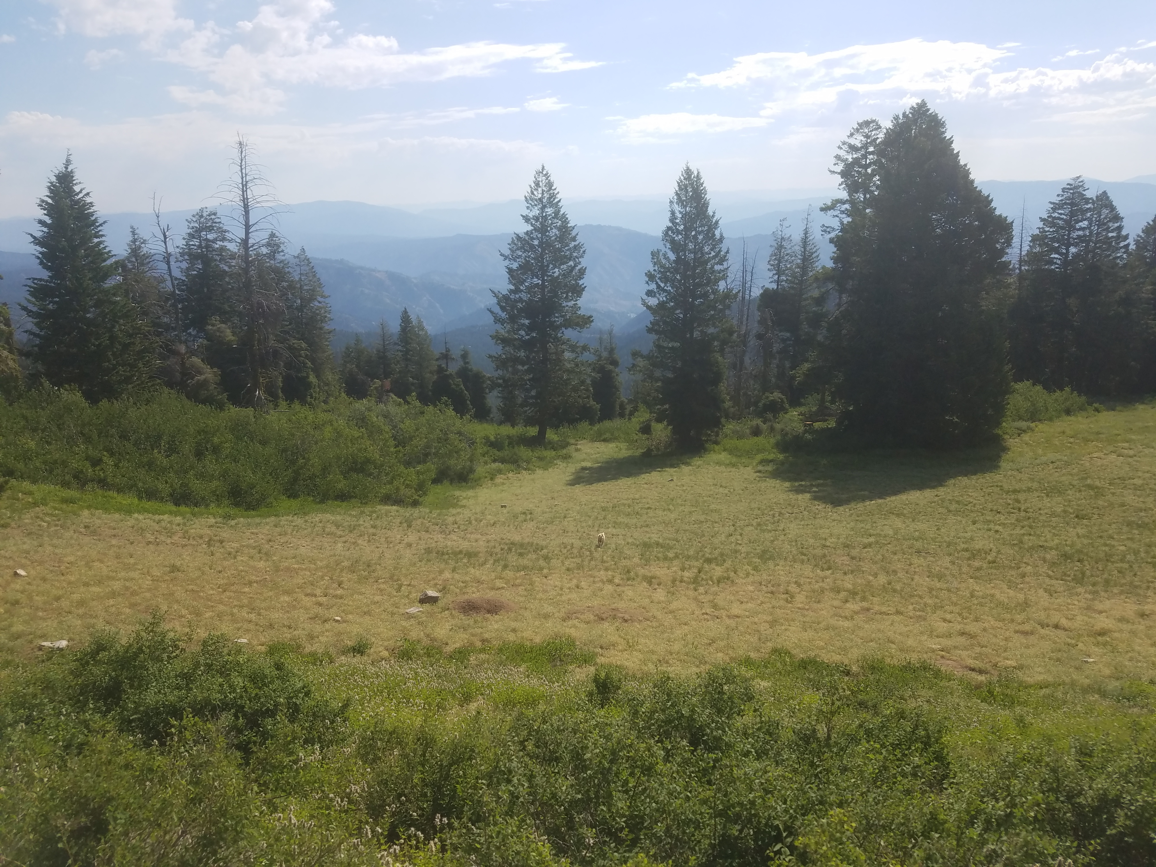
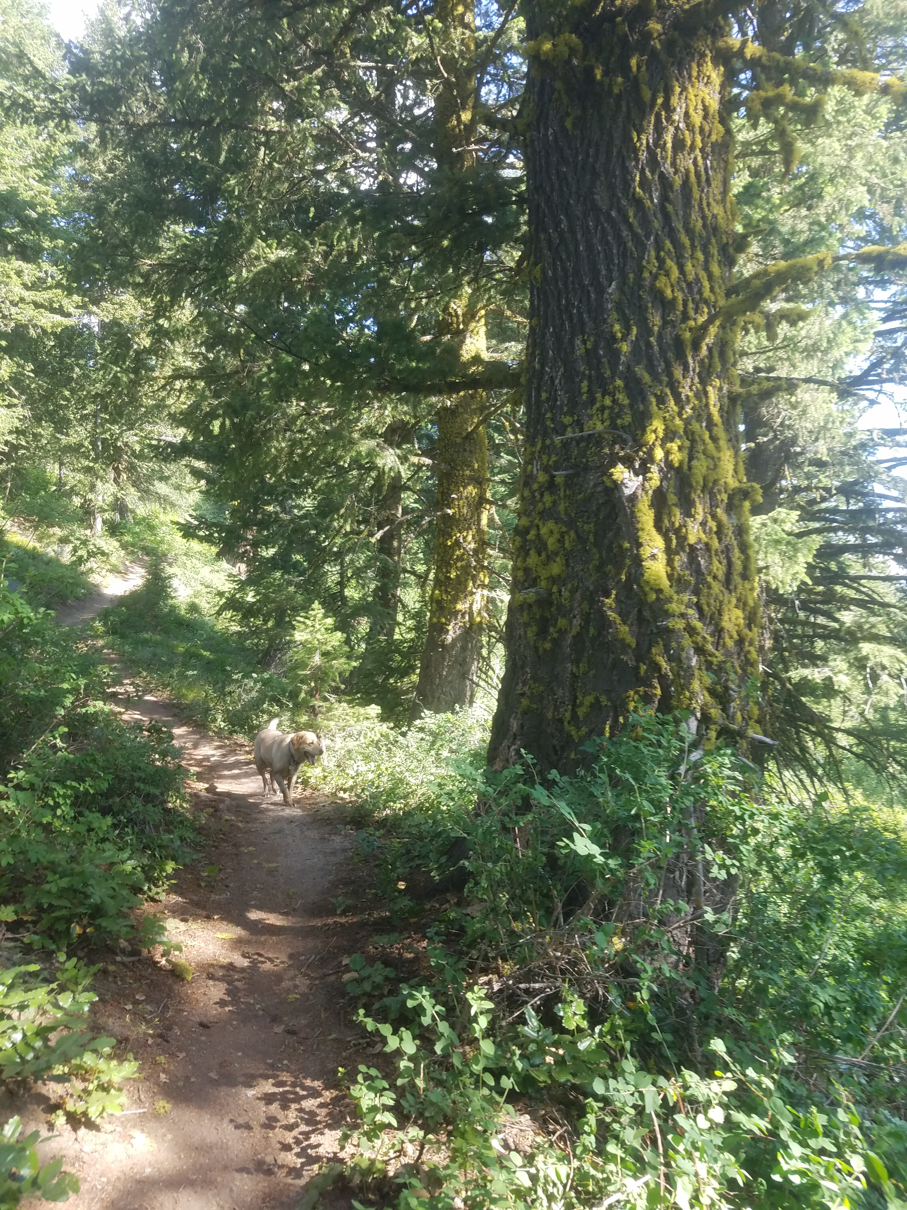 Back in the forest again
What she did find in the brush was some water, or at least some mud. When she finally came back to the trail she was one dirty dog. But the wetter and muddier she can get, the happier she seems to be. And right now, she was really happy.
Next the trail passed through another wooded section and we were actually in the shade for a while. But soon the trees opened up again to a view of the Boise Mountains to the east. I could make out prominent peaks like Steel Mountain near Featherville and Smokey Dome near Fairfield. In the far distance was the southern end of the Sawtooth range, over fifty miles away.
At this point we caught up to two women hikers. They were moving slowly because they had full backpacks, very unusual on a trail at Bogus Basin that was so close to the road. I passed them quickly. Abby was her usual friendly self and I didn't think the other hikers would enjoy the attention of a wet, muddy dog. Later when we had reached the north side of the mountain, I noticed that they turned off onto the connecting ridge with Mores Mountain. There is a campground there which was probably their destination. Most people drive there to camp but I guess it wasn't a bad idea to hike there if you wanted a very tame backpack trip that was close to Boise.
 Catching up to the backpackers on the ne side of the mountain
Once we reached the north side of the mountain we were on familiar ground. The Elk Meadows Trail ended at the cat track that runs across the back and around to the west side of the mountain. I've hiked it many times on my way to the top of Shafer Butte. We followed it all the way to the Upper Lodge where we had parked the car.
We sat down in the shade and enjoyed a cold drink before driving home. There aren't any streams or ponds at Bogus for Abby to drink from while hiking so she was very thirsty. She could barely sit still while I poured water into her bowl and I had to refill it several times. I had a cold Diet Coke from the cooler I had in the car. It was a pleasant end to our hike.
Circling the mountain turned out to be a really enjoyable hike. It was a nice surprise to find a new trail so close to home in an area that I thought that I knew really well.
