Cervidae Peak
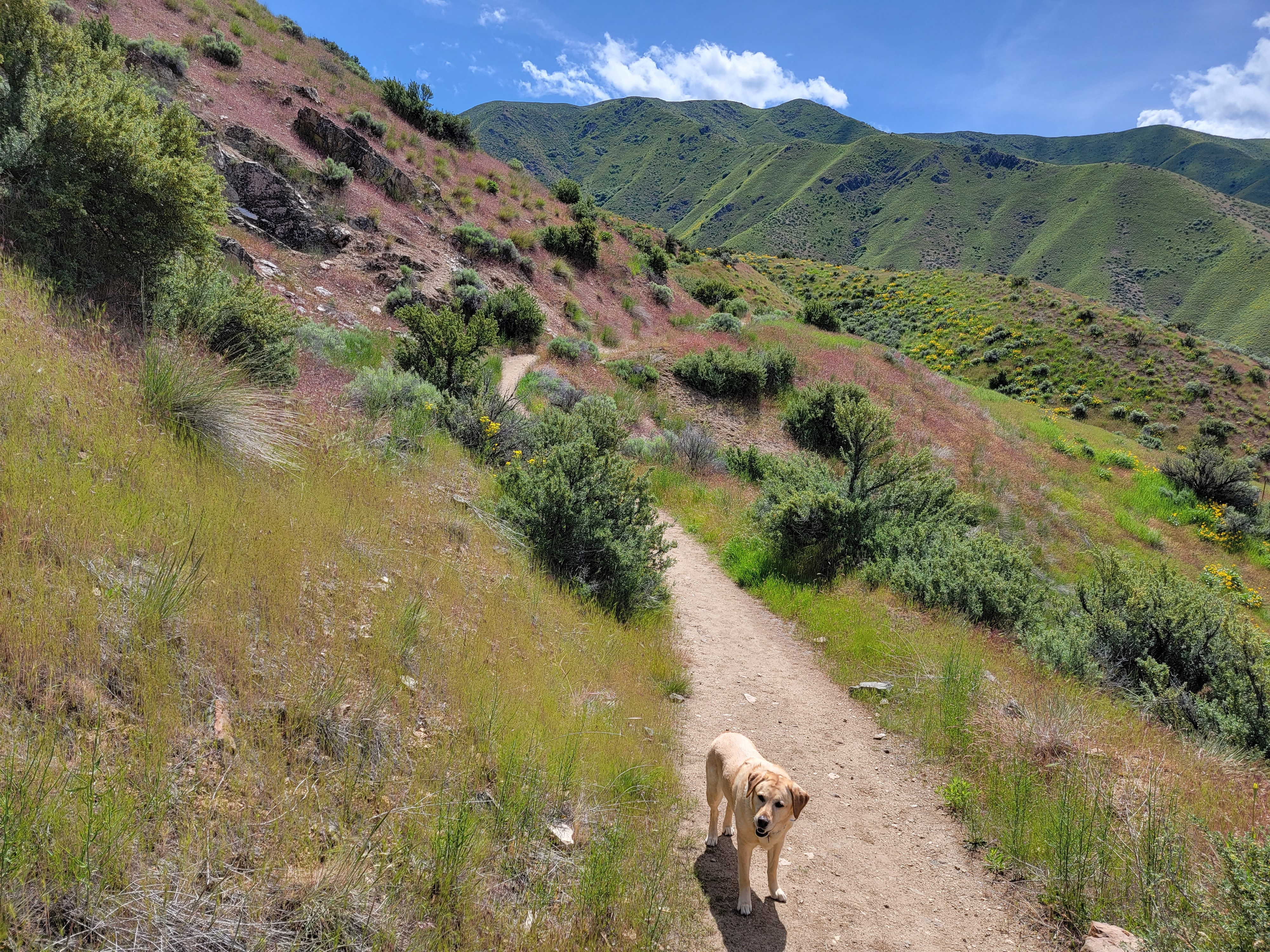 Near the start - Abby has to wait for me to catch up
The Grand Slam Peaks are four mountains near Boise: Cervidae Peak (4,987 ft), Kepros Mountain (5,428 ft), Shaw Mountain aka Lucky Peak (5,904 ft) and Mount Heinen (6,336 ft). The name Grand Slam Peaks was coined by Tom Lopez, the author of "Idaho: A Climbing Guide", the definitive guidebook on mountaineering in the state of Idaho. The Grand Slam Peaks are all close to Boise and since they are not very high, they are usually snow free early in the year. Tom Lopez used them as training peaks for many years and according to his website, has done them seventeen times. Eventually "doing the Grand Slam" became a thing for local hikers and climbers. Some even take it to the extreme and do them all in one day, even competing for the record for the fastest times. The current record is 12 hours and 58 minutes, completed on May 23,2022 (less than two weeks ago!). The most fanatical do the Grand Slam totally on foot - not driving from one mountain to the other. The record for that is just over twenty hours by foot, or 13 hours and 53 minutes paddling a canoe to cross Arrowrock Resevoir.
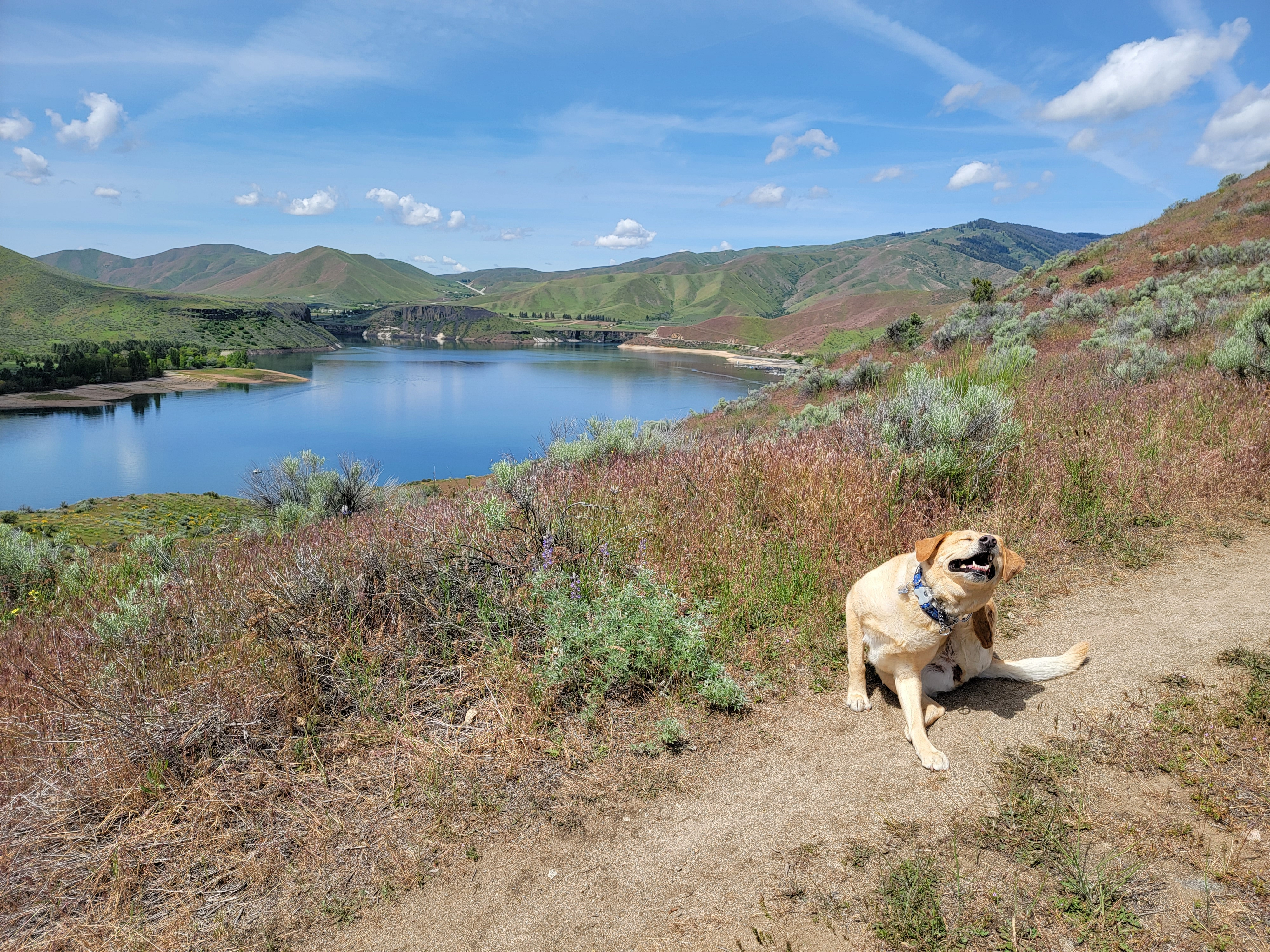 Sometimes ya just gotta stop and scratch that itch
That's a little extreme for me. But I figured it was time that Abby and I tried to do the Grand Slam. We had already made a start. Abby and I hiked up Shaw Mountain several years ago. It's the most accessible of the four peaks. We started from a subdivision in east Boise and followed various dirt roads all the way to the summit. Easy hiking but it was a lot of elevation gain.
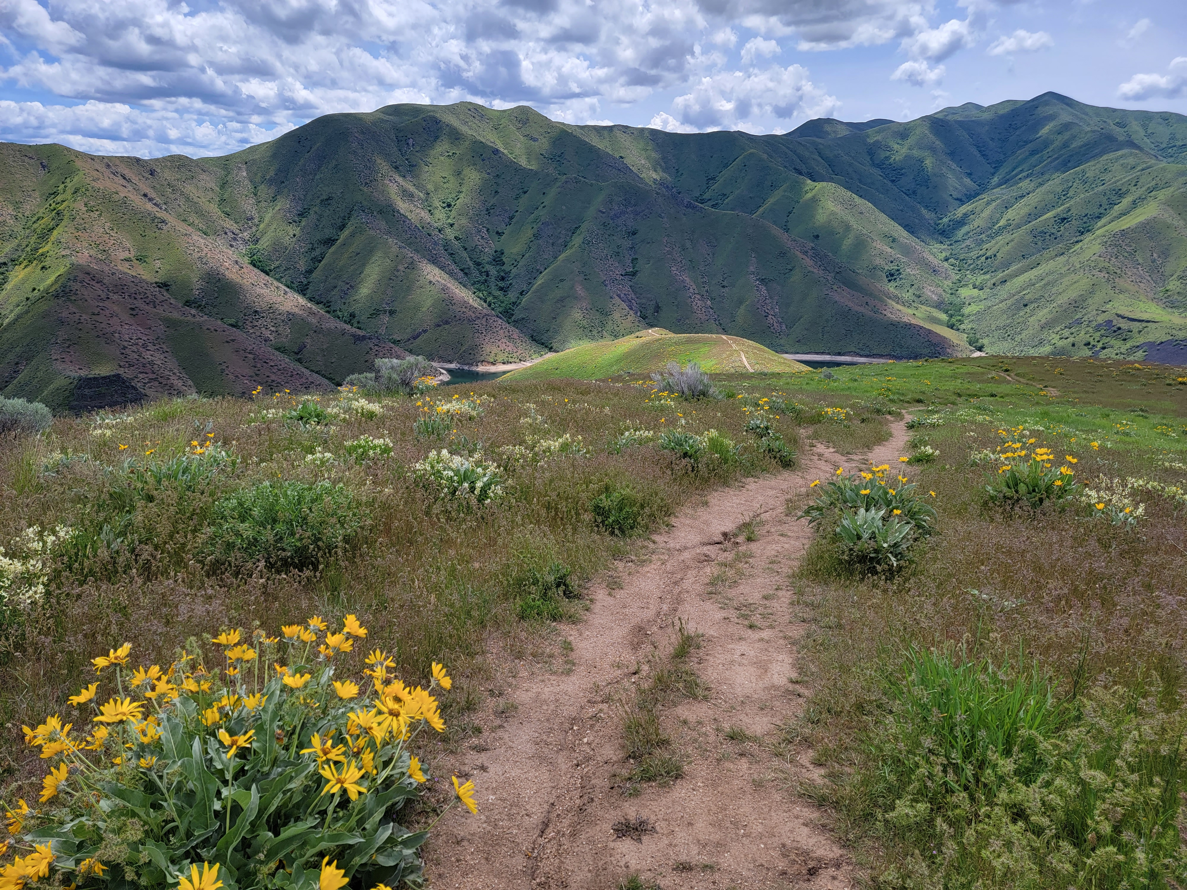
Today we were going to try Cervidae Peak, probably the next most accessible of the group. We drove fifteen miles east of Boise on Idaho 21, turned off on Arrow Rock Road and then went a mile or two past Spring Shores Marina. We parked in a pull off overlooking Lucky Peak Reservoir. There were only two other cars there so it looked like we wouldn't see many other hikers. Across the road was a gate leading to a large bulldozed area (what it was bulldozed for I have no idea). There we found a rough trail that led off to the right. It made a steadily rising traverse across the slope until it eventually reached the southeast ridge, which it followed all the way to the top.
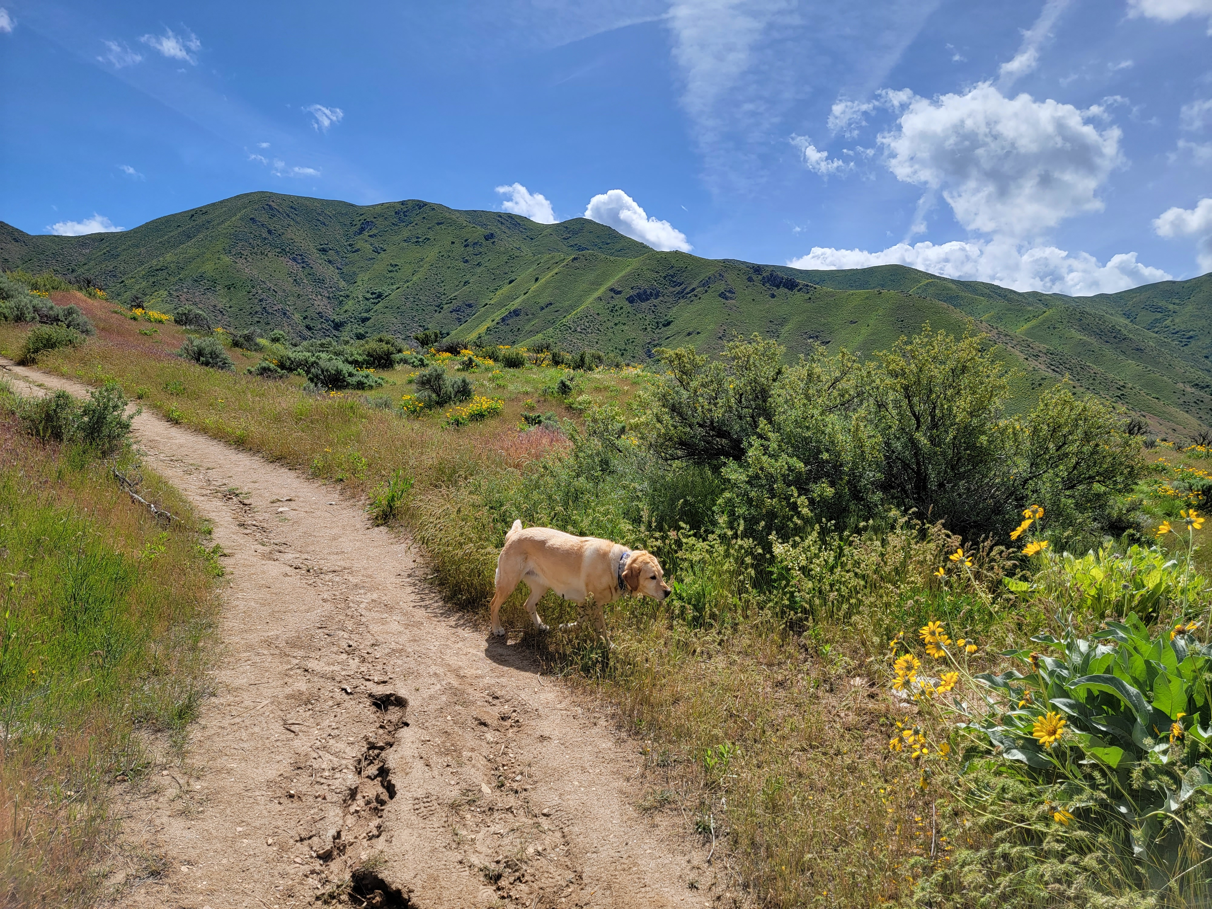 The Blond Wolf is on the prowl
I had Abby on a leash to cross the road but let her off as soon as we got about a hundred yards down the trail. She was excited to be free and able to roam. She raced from place to place, sniffing intensely. Although we walk in the park every day, this was her first hike in the hills this year. It was a beautiful day, sunny with a few puffy white clouds. The temperature was in the low seventies as we started out, with a slight breeze. It was pleasant hiking weather. I was excited to be out in the mountains too.
Most of the year the hills around Boise are dry and brown. This spring has been cooler and wetter than normal so the hills were surprisingly green. There were wildflowers everywhere too. Typical for the Boise foothills, there was a LOT of arrowleaf balsamroot. Sometimes the entire hillside was covered in it. I recognized other flowers common in the foothills in spring, such as purple phlox and both blue and yellow lupine. Sandy is the family expert on flora, not me so there were a lot of flowers that I couldn't name, even though they were familiar. They were still pretty to look at. There was one flower that I don't think I had ever seen before. It took a long time searching on the web when I got home but I finally figured out that it was threadleaf phacelia.
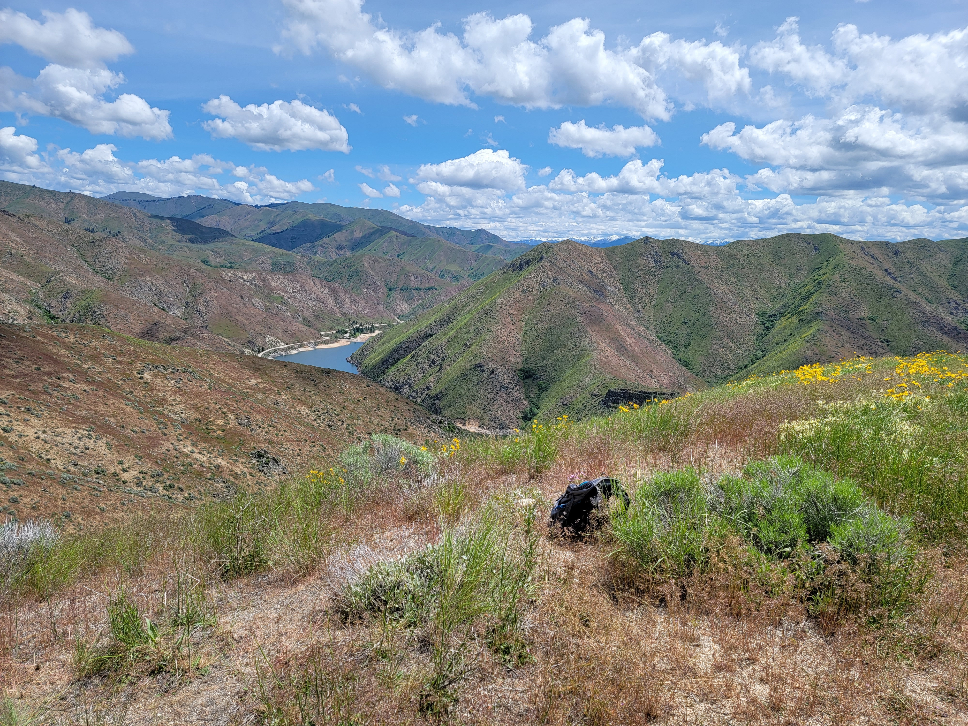 The mysterious pack found beside the trail
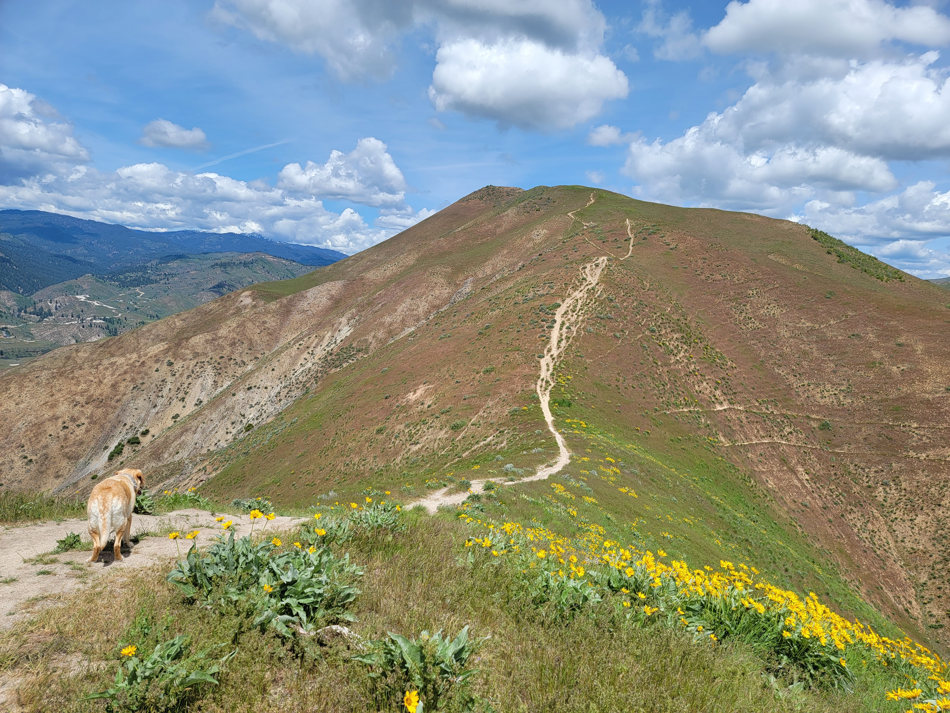
Not long after starting we passed two hikers who were going down. Since there had only been two cars at the trailhead, that meant that we could expect to have the mountain mostly to ourselves the rest of the day. Soon the trail reached the southeast ridge and from there on followed the crest. Once on the ridge we could see most of the route, following the undulations of the ridge ever upward to the summit.
The hike wasn't long. Various descriptions I found on the web gave values from 2 to 2.5 miles for the length from base to summit. The elevation gain was listed as anything from 1,700 feet to slightly over 2,000 feet, although I think that may have been the difference between the net and the gross elevation gain. There was some up and down along the ridge. Since the trail gained so much elevation in such a short distance it had only two grades, steep and really steep. It was not a designed or maintained trail, just a track worn by many hikers, so there were no switchbacks or traverses. It went straight up the ridge by the most direct route. Abby ranged all over but I went up the trail slowly and deliberately. Very slowly and very deliberately.
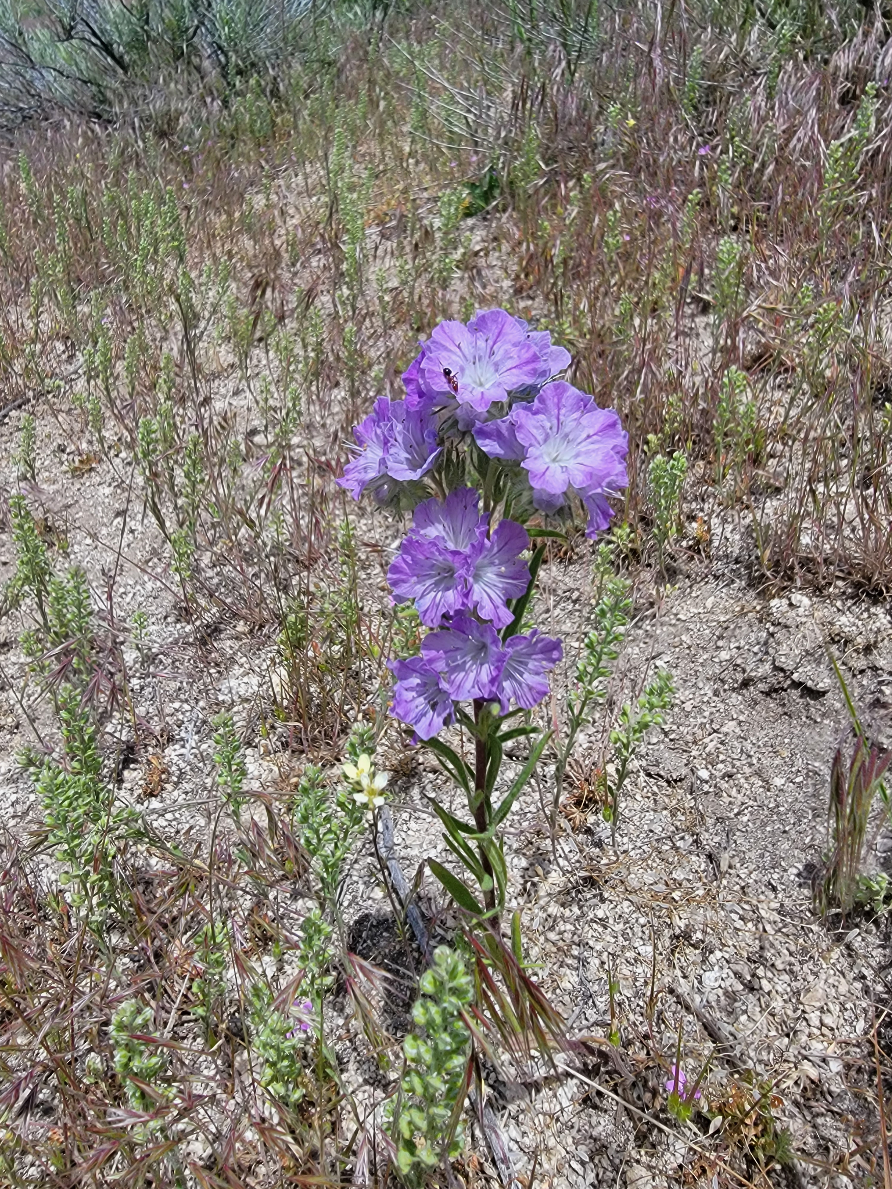 A new flower for me - Threadleaf Phacelia
It was a bright, sunny day and there was no shade at all anywhere on the route. As we climbed higher it started to get a little warmer. For a while, there were a few flies buzzing around, which was mildly annoying. But as we continued to climb the breeze picked up, which kept it from getting too hot and also chased the bugs away.
A mile from the trailhead I came across a backpack sitting next to the trail. That was a bit strange since the pack looked to be brand new. I looked around, thinking that maybe someone had left it and wandered off the trail (bathroom break?) but the only place to go was down the steep sides of the ridge. I couldn't see anyone anywhere. My only theory was that someone had stopped for a break, taken their pack off, and then continued on without it. That seemed pretty unlikely though.
In another half mile we reached a false summit that is mentioned in all of the route descriptions. I didn't think of it as a false summit. To me, a false summit is a local high point that you think is the real summit as you approach it but when you reach it, you find that you still have further to go but it was hidden from below. It's all about anticipation of being done when you reach a certain point and then disappointment when you actually get there. But from lower on the route it was easy to see that the ridge continued beyond this local high point. I guess the descriptions called it a false summit because there was a significant drop to a saddle after it but I didn't think of it as a "true" false summit. (Maybe I should be careful. I'm getting pretty meta there.)
 Abby heads down to the saddle from the false summit
At the false summit we met two other hikers coming down. I asked (hopefully) if it was about another half mile to go to the top. That would be at the shorter side of the various estimates in the route descriptions. They both hemmed and hawed at that, which wasn't encouraging. One of them said it was still a long hard climb, and that she had dropped her pack lower down because of that. Darn. But at least that conversation solved the mystery of the abandoned pack.
I was expecting that dropping to the saddle would provide a welcome relief from the hard work of going up the ridge. Instead it turned out to be extremely hard work. The track was super steep and the surface was loose dirt covered with fine gravel. It was extremely slippery and it was all I could do to make it down without slipping. I was actually glad to reach the saddle and start uphill again. It was a preview of things to come though since we had a long way to go down on the return trip. Abby, of course, had no trouble going down the steep slope. Sometimes having four feet is a big advantage.
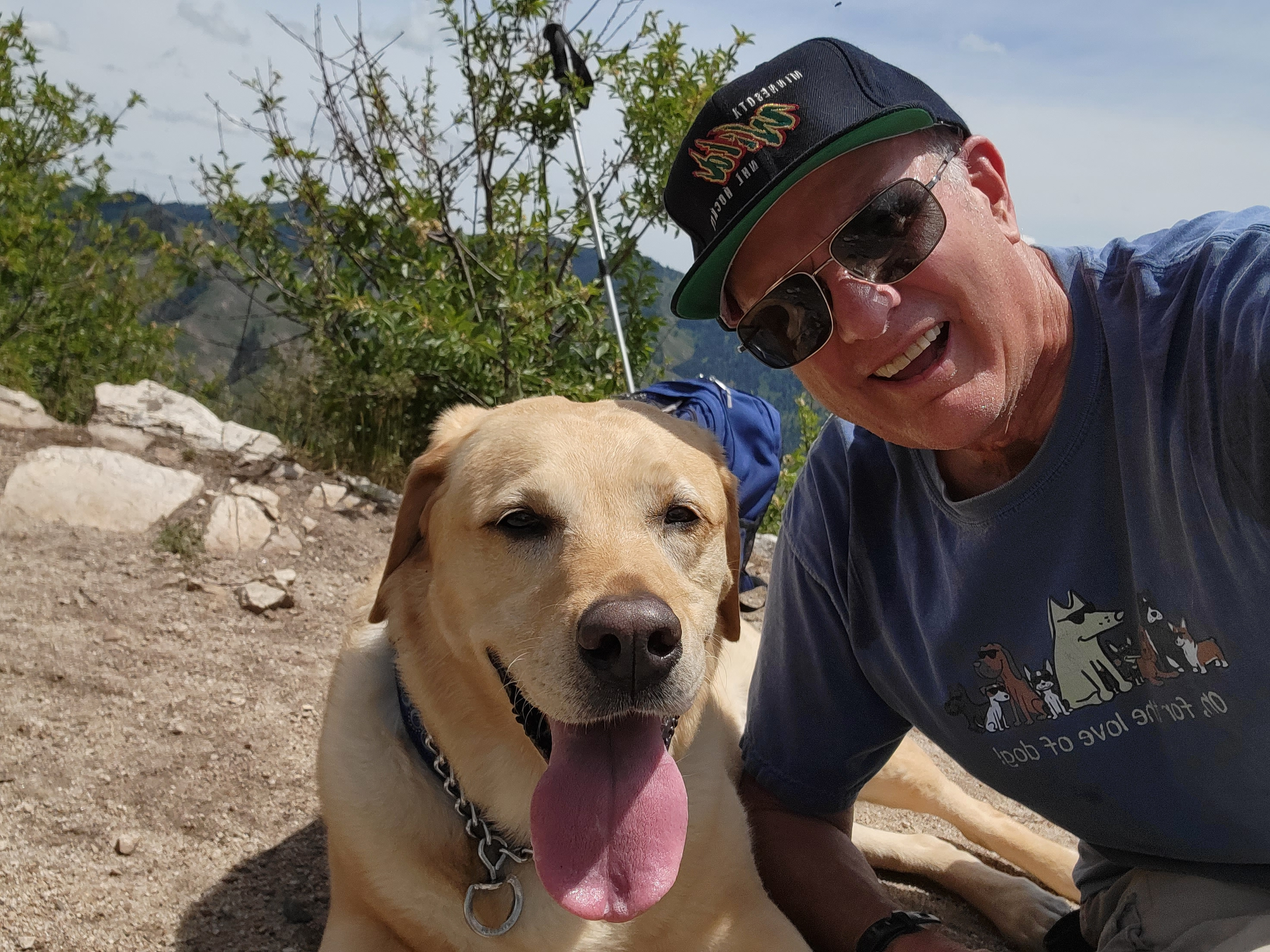 Summit selfie - Abby has a better smile than I do
Finally we reached the top. I sat down to enjoy the impressive view and to have a drink of water. I took three sips and then gave the rest to Abby. She gulped it down and was looking for more. I told her that if it wasn't enough, next time she would have to carry her own water and not just mooch off of me.
After a ten minute rest we were ready to start back. Just as I suspected after the short descent to the saddle, going down was very hard work. I had to be extremely careful. It would be easy to slip and fall or to blow out a knee. In my old age my knees are a lot gimpier than they were in my youth. That meant taking a lot of the load on my leg muscles instead of just locking my knees as I stepped down. The only good thing was that it was a lot faster than coming up had been.
On the descent we passed two hikers going up. They had a dog with them, a border collie, with a coat much heavier than Abby's. That dog looked hot. When I commented on it, the lady said "they say that a heavy coat keeps them cooler". Nope, not when they are working that hard and generating a lot of body heat. That would violate the laws of physics. But the dog seemed to be enjoying itself, just like Abby, even though it was panting quite a bit.
 Heading back - it's a long down
The lady was wearing a Nepal tshirt and I asked her about it. Turns out she hadn't been there, but the man with her (younger - her son?) had. He had done the Annapurna circuit. That's one trek that I haven't done. Maybe on my next trip to Nepal.
On the way up, whenever I paused and looked down, I would be impressed at how high up we had climbed. I would figure that we were almost to the top. On the way down, when I stopped at the same places, I would look and think how close we were to being down already. Wishful thinking in action.
But we did make it back to the car eventually. It only took an hour and fifteen minutes going down. The GPS app on my phone said that we had hiked just over four and a half miles and done 1736 feet of elevation gain (which was certainly net gain). Our time of two hours to go up was slow for only two and a quarter miles. But it wasn't bad considering the elevation gain, which was probably about two thousand feet considering the ups and down. I still felt really good when we finished so I was happy. The scenery was great and the wild flowers were beautiful.
When we reached the car I opened the hatchback so Abby and I could jump in the back and sit in the shade. I had been smart enough to bring a cooler so we both had our fill of cold drinks while we looked up at the peak we had just climbed. It was a good day in the mountains.
