Polecat Gulch
 The trail begins to climb not long after leaving the trailhead
This spring I was trying to explore. After many years I had fallen into a pattern of just doing the same local trails that I knew over and over again, like Stack Rock or some of the trails at Bogus Basin. This year I wanted to try something new so I picked Polecat Gulch, a trail in the foothills just outside of Boise that I had never hiked before.
Usually I would take Abby with me on a hike but this time I went by myself. For the past week or so she hadn't really been herself. All through the winter and spring she would get three walks a day. Sandy would take her in the early morning. I would take her in the late morning. Then one or both of us would take her in the afternoon. She was always excited to go for a walk. But the past week or two she had only been doing one walk each day. When I would try to take her for her second walk, she would just sit down after going one or two houses down our block. We thought maybe she had hurt herself when we were playing fetch with her two weeks ago. Maybe it was getting too warm for her. She does have a heavy fur coat, after all. Or maybe she is just getting older and doesn't have as much energy. Perhaps it was for the best. Polecat Gulch is a high use area and dogs need to be on a leash. Abby really likes to run free when she goes into the hills so this might not have been the best trail for her.
The trailhead was easy to reach. It's right at the end of Collister Road. It only took me fifteen minutes to drive there from my house. That's a lot quicker than the two and a half to three hours to reach the Sawtooths, or even the hour to drive up to Bogus Basin. I thought that I could definitely get used to this.
Apparently a lot of other people could too. The parking area had spaces for about a dozen cars and they were all taken. Other cars had parked on the side of the road behind the official parking spots and I squeezed my car into the last of these spaces. (Not really the very last. When I got back at the end of my hike, cars were parked along the side of the access road for quite a way down.) Even though it was a Monday there were obviously a lot of people using the trail.
There were several possible hikes in the Polecat Reserve. I was planing to do the main Polecat Loop Trail. After walking up the trail for a few minutes I reached a junction. It was the two ends of the loop trail. Because of heavy use, all traffic is supposed to go clockwise around the loop. People seemed to be pretty good about following this rule. All day I only saw two people who were hiking against the grain.
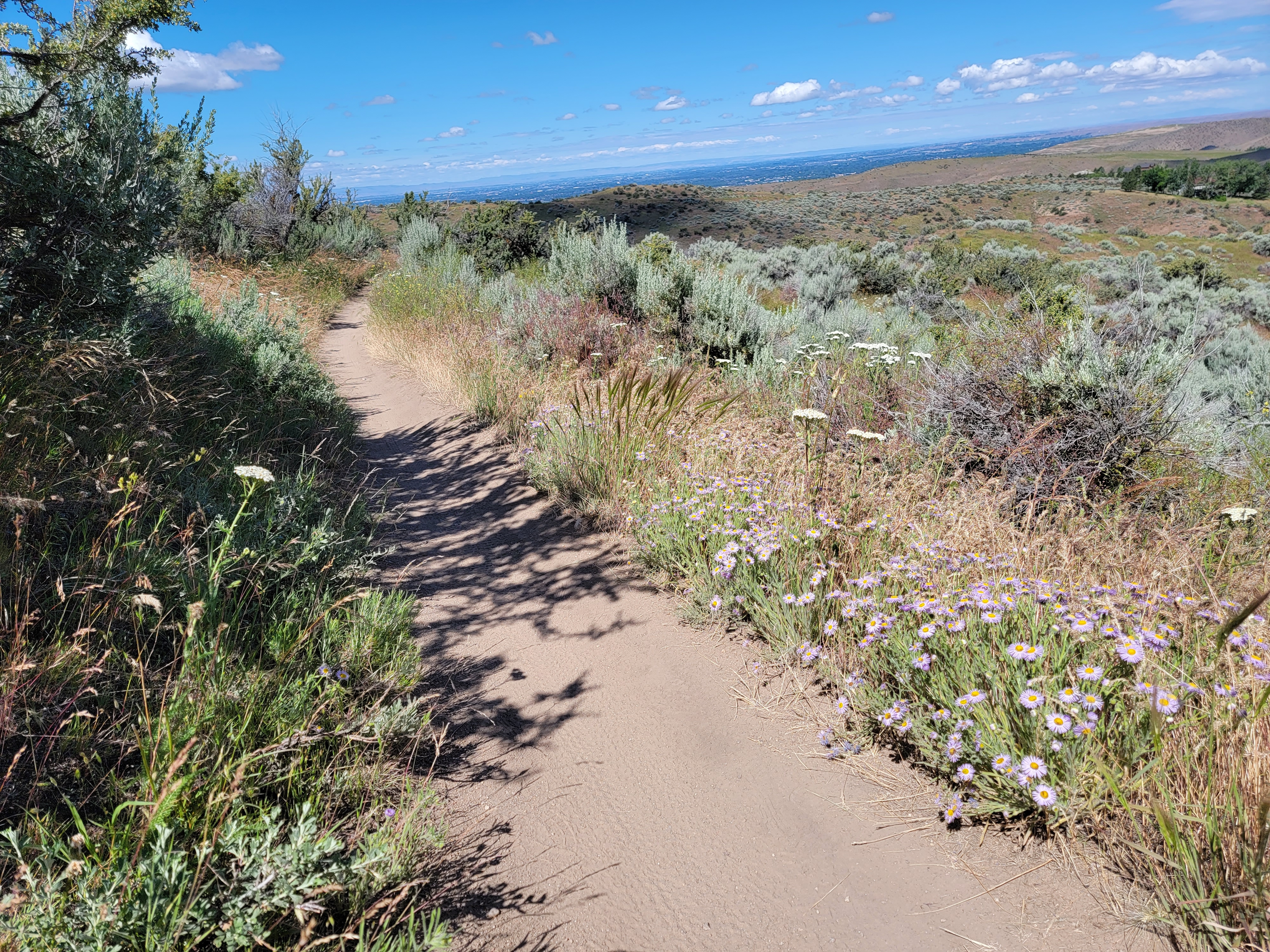 Purple aster lined the trail for much of the hike
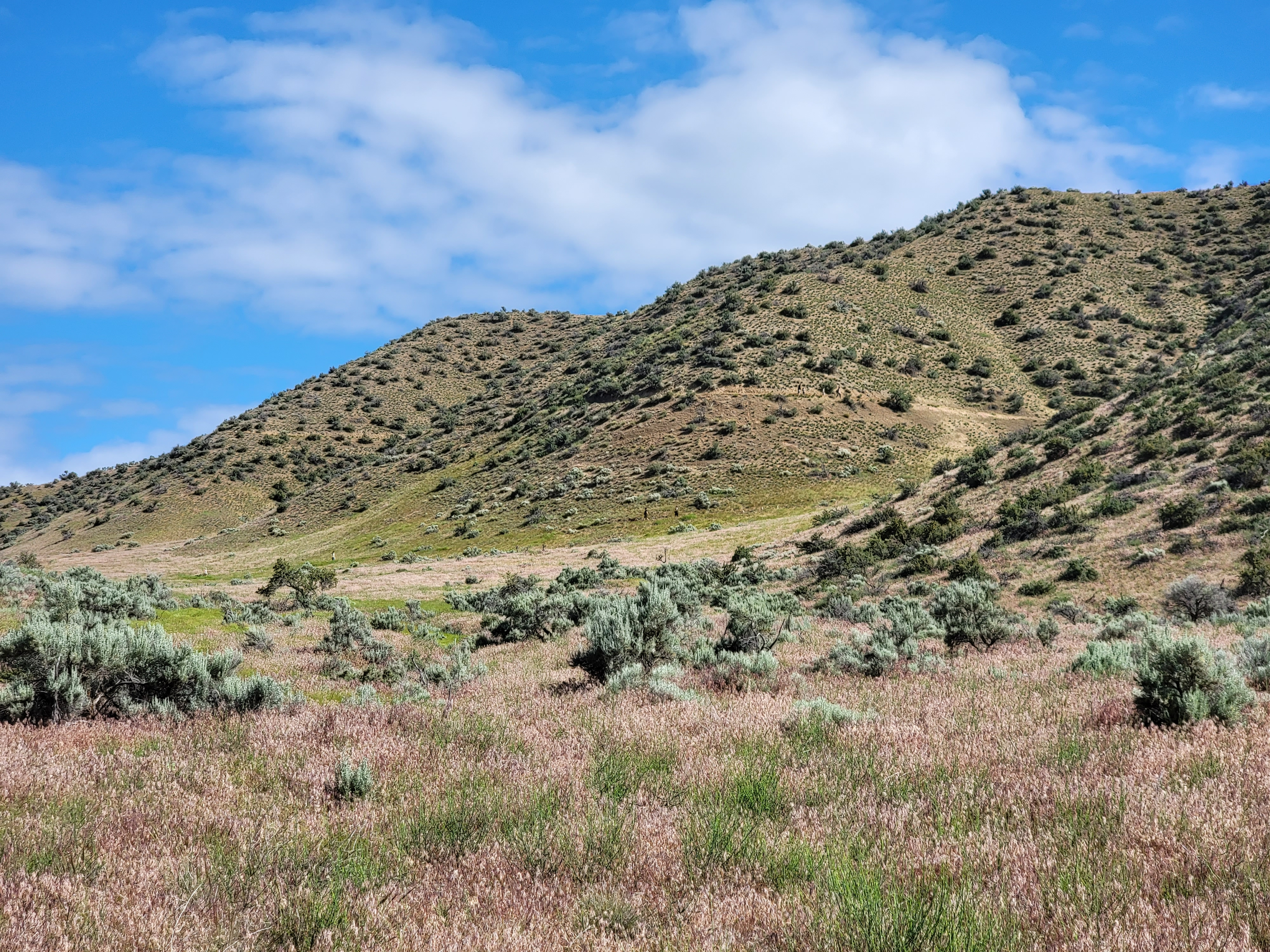
Shortly after starting the loop, the trail started to climb. I could see quite a way ahead and there were a number of hikers on the trail. It was definitely busy. Before long a couple of mountain bikers came up behind me. They were the first of many. For the entire hike I would say I was passed by a mountain biker every five minutes. They were all very polite. They didn't go fast. I didn't feel like I was going to be run down. And they always said thank you when I stepped aside to let them go by. Still, after a while it got to be annoying to have to constantly be getting off the trail to let mountain bikes go by.
Other than the minor nuisance posed by all the mountain bikes, the trail was very nice. It climbed gradually but steadily, traversing the steep hillsides. The trail was narrow and although there were no cliffs, the steep dirt hillside made it difficult to step off the path when a bike passed. It was also clear why one way traffic was important. Bikes coming from two different directions that would have to pass each other would have a difficult time.
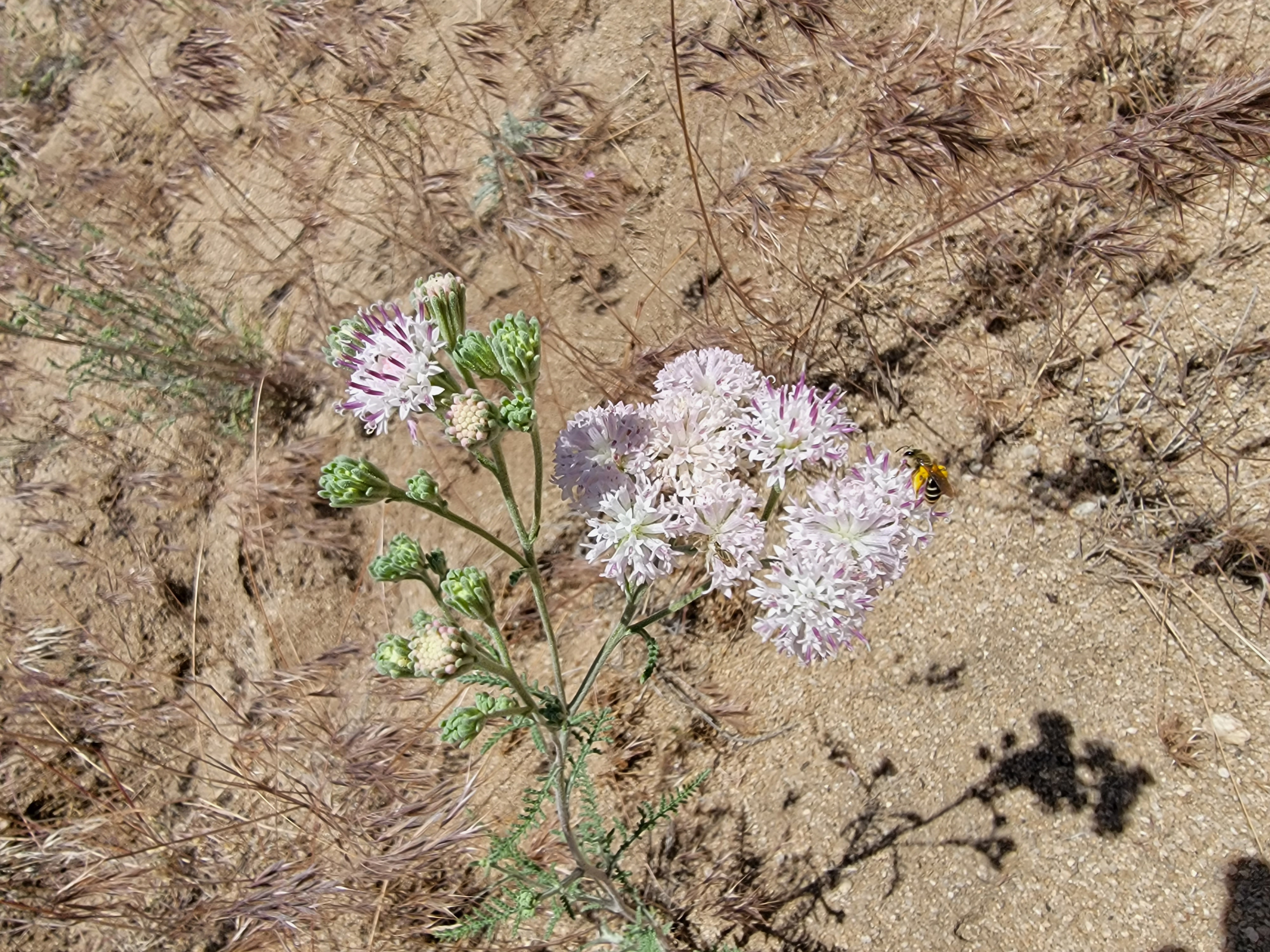 Some of the flowers beside the trail I had never seen before
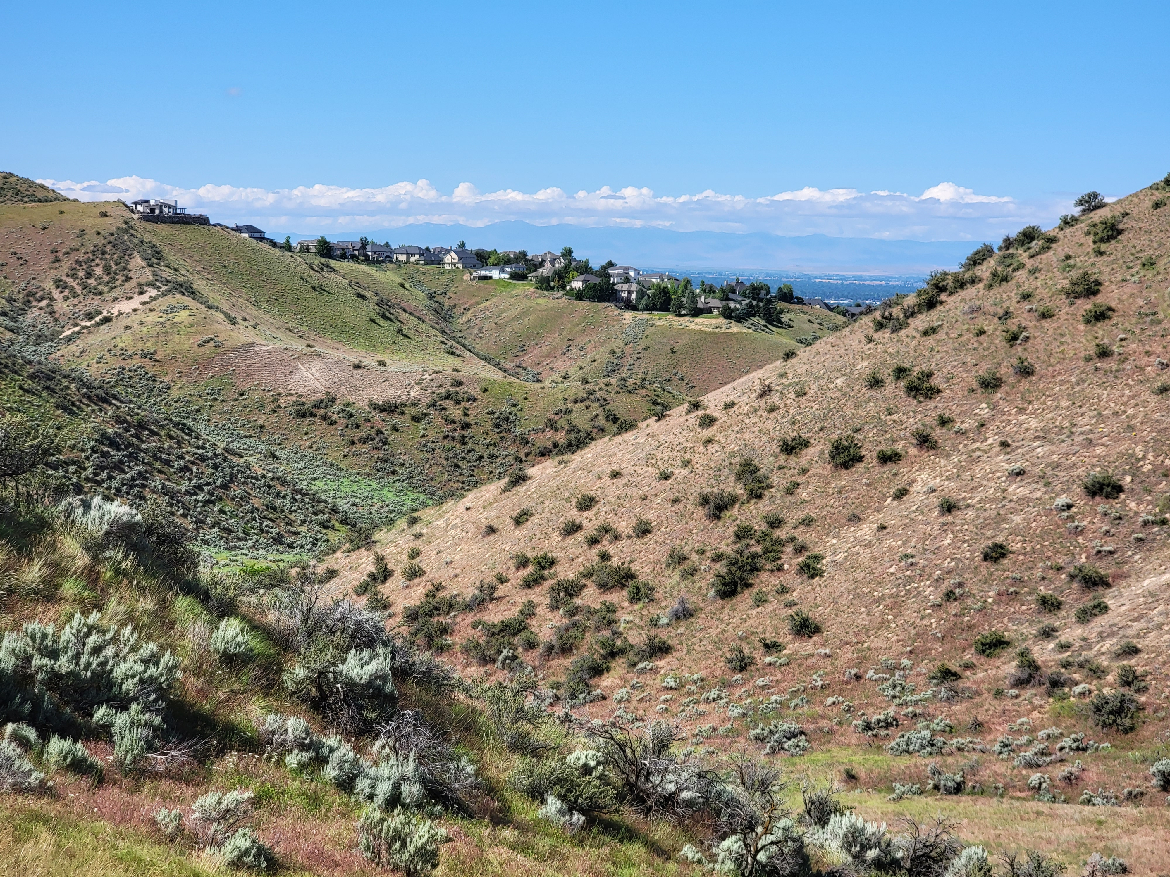
After climbing to the top of the ridge, the trail continued along the crest with great views in all directions. To the south was Boise and the Treasure Valley, with the Owhyhee mountains in the distance. To the east and west were the ridges and canyons of the Boise foothills. To the north the foothills rose up and up, culminating in Shafer Butte and Bogus Basin. Because the spring had been cool and wet the foothills were unusually green. Very pretty. And even though it was late in the season for this elevation, there were still a lot of wildflowers.
I could identify some of the flowers (I've been working on learning them) while there were others that I couldn't. The one I found most interesting was a purple aster. There was a lot of it, but it always grew right next to the trail and nowhere else on the hillside. On the whole hike I saw only two plants that were maybe a foot from the trail. The effect was so pronounced that it almost looked like someone had planted them on purpose. There is obviously a reason for it. Asters often appear after fires or other soil disturbances. Maybe there had been trail maintenance in the past year that created favorable conditions for the flowers. They certainly looked pretty, lining the trail for much of the way.
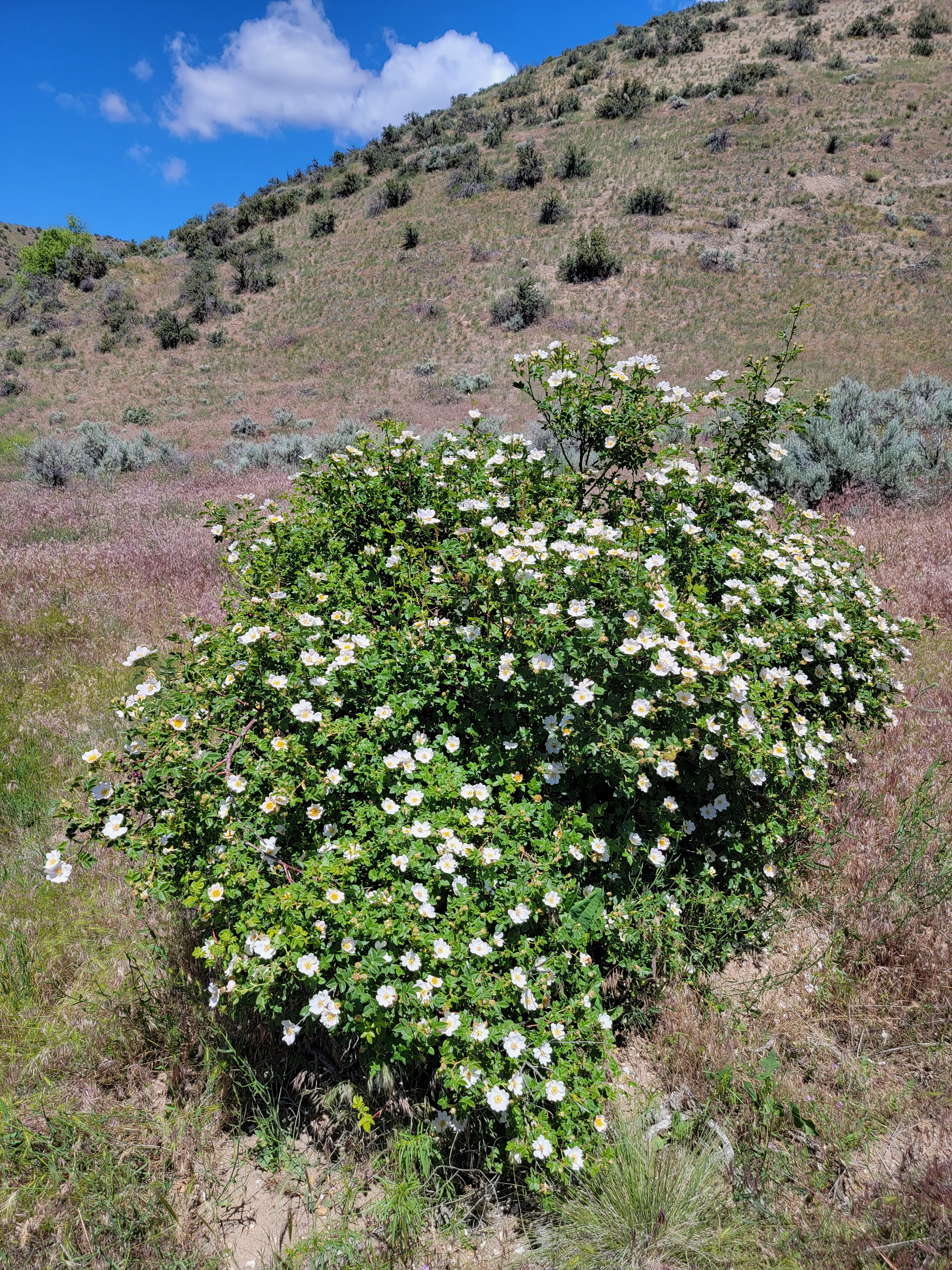 The lone syringa
At about the midway point of the loop the trail dropped down off the ridge. Cartwright Road loops behind the first line of foothills and there is another trailhead off of it which accesses the far side of the Polecat Loop. I passed a junction where a short spur led off a few hundred yards to the other trailhead. Then the main trail started to climb up onto the ridge again. It paralleled Cartwright Road for a while, making a swing way to the east before going up and over to drop back into the drainage that led back to the trailhead. There were views all the way to Table Rock and Lucky Peak far to the east. After going over the ridgecrest, I was on the home stretch. Along the way I saw a single large Syringa bush, totally covered in blossoms. Usually they're very common in the lower foothills but this was the only one that I had seen all day.
By the time I was close to the trailhead it was getting warm so I was glad when I finally got back to the car. According to the GPS app on my phone, I had done 6.48 miles with 871 feet of elevation gain. I had taken my time but figured that I would do the loop in three hours or less. The app on my phone gave my time as 3:00:09. Seriously?! I missed three hours by nine seconds? I guess that's what I get for stopping to take a leak when I passed those bushes.
It was a nice hike. The distance and elevation gain made for a good workout without being too much. The trail was very well maintained and well marked. The views were great and the flowers in the spring were pretty. The short drive to the trailhead was a major plus. The mountain bikes were a drawback but weren't that bad. The leash requirement for dogs would be a bigger deal if I took Abby with me. Still, overall it was a really good hike. I'll be back to do it again.
