Big Sur
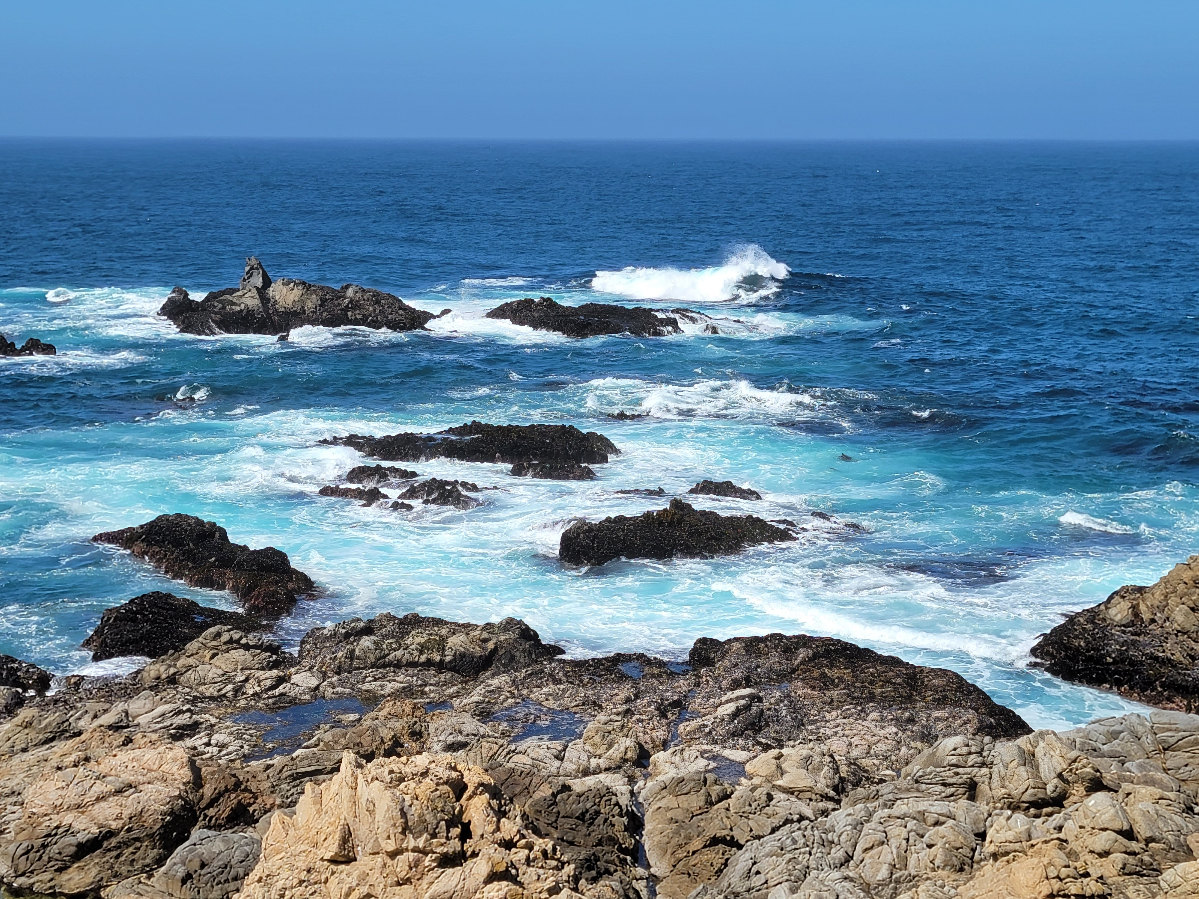 Blue water and big waves at China Point Lookout
Our three nights at the Monterey Tides were up. The location on the ocean was spectacular, right on the water, with big surf crashing onto the beach and a view of the cities of Monterey and Pacific Grove across the bay. Our next three nights would be in Los Osos, near San Luis Obispo. It was only a hundred and fifty miles to the south but we would be taking the scenic route, driving the Pacific Coast Highway through Big Sur. Although it wasn't that far, we planned to take most of the day for the drive with lots of stops along the way.
We made one stop before we even left the Monterey peninsula. Sandy had been to Robin's Jewelry in Carmel each of the past two days. The owner of the shop was making some earrings to go with the pendant that she had bought. The day before she said that she would have them finished by the time she opened today at ten. She even called Sandy about nine to say that she had the earrings done and was at the shop already if we wanted to stop by early. We still got there about ten but we appreciated that she remembered we were leaving right after we stopped by. Sandy was pleased when she saw how the earrings turned out so we were happy as we headed south for the next part of our trip.
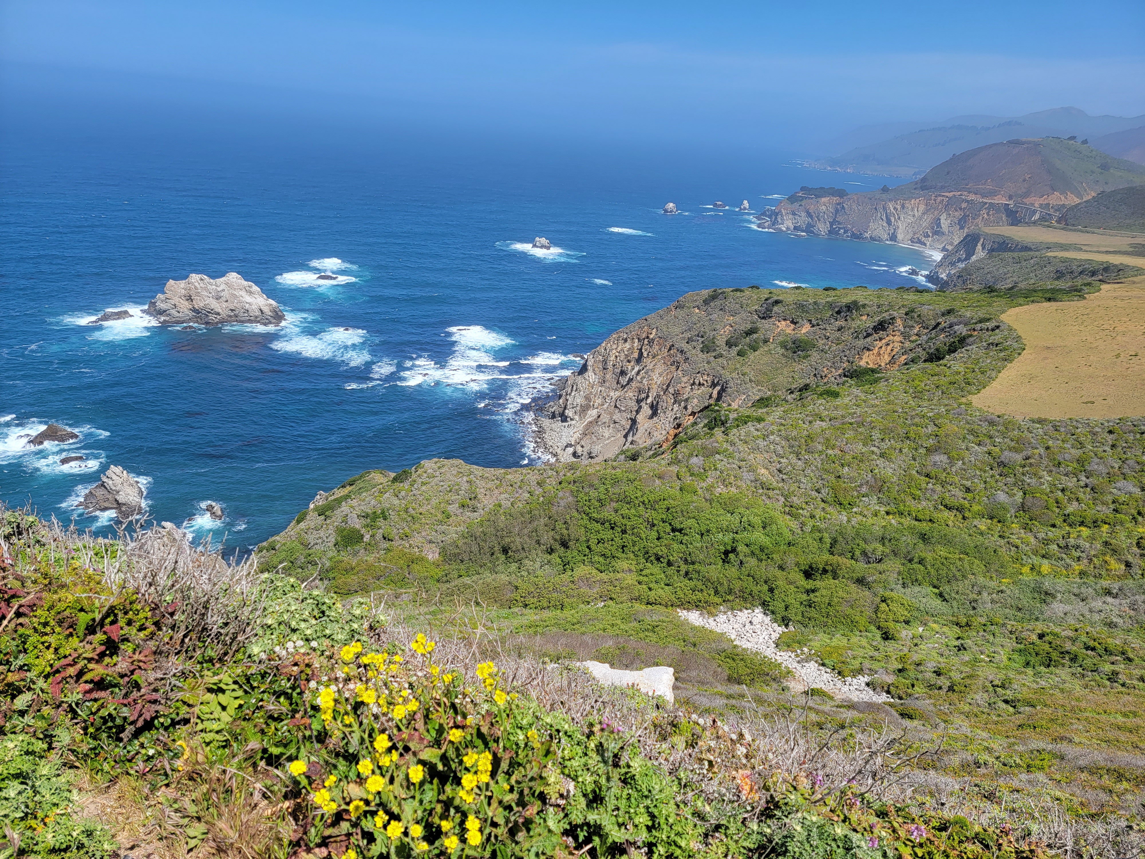 Rugged cliffs along Big Sur coast - Bixby Bridge in the distance
Big Sur is a ninety mile stretch of coast, between Carmel and San Simeon, where the Santa Lucia mountains come right down to the sea. Extremely scenic, the ruggedness of the terrain discouraged development for many years. Now most of Big Sur is protected, either in national forests or state parks. California Highway 1, the Pacific Coast Highway, follows the coast most of the way, often traversing steep mountainsides or hanging on sheer cliffs above the ocean. One of the worlds great scenic drives, it provides access to many viewpoints, beaches and trailheads. Inland from the coast, many of the mountains are in two national forest Wilderness areas, accessible only on foot. Big Sur is rightfully one of the most famous stretches of coastline in the world.
Our first planned stop was at Point Lobos State Reserve, just south of Carmel. That didn't work out. When we reached the turnoff for the park, the road was closed. We kept going but stopped a few miles down the road at China Point Lookout. It was a perfect day, warm and sunny, with bright blue skies and deep blue water. Big waves crashed into the many offshore rocks and shoreline cliffs, the rough water boiling with white foam. It was quite spectacular. The water was definitely not inviting.
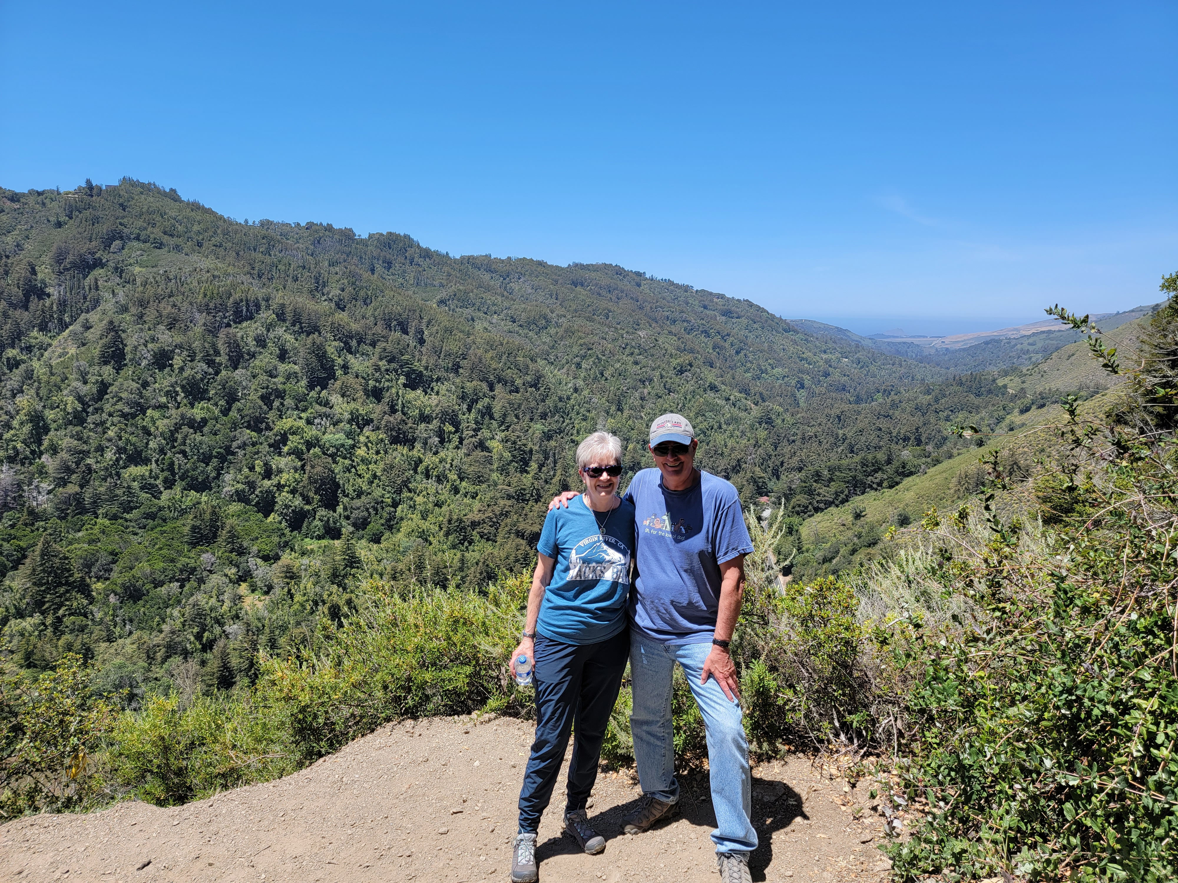 At the end of the Valley View Trail
It did not look like a good place for people to swim. But others were not intimidated. In a sheltered cove just below the cliffs, we spotted several sea otters. They seemed to be relaxing, just floating on their backs and taking it easy. If I am ever reincarnated I wouldn't mind coming back as an otter. Whenever I spot one, they always seem to be having a good time.
Our next planned stop was the Bixby Bridge, a photogenic bridge over a side canyon that is featured in many movies and commercials. That didn't work out either as the parking area near the bridge was completely filled. We stopped at a pullout two or three miles further down the road where there was a nice view of the coast and we could see the bridge in the distance. It didn't really matter. The coastline was pretty spectacular everywhere. No matter where you stopped the view was amazing. And we made several stops as we continued heading south. The trick was to keep your eyes on the road as you drove. With spectacular scenery all along the route, it was easy to be distracted as you drove along. I suspect alot of cars end up driving off the road. With the steep cliffs above the ocean, that would not be a pleasant experience.
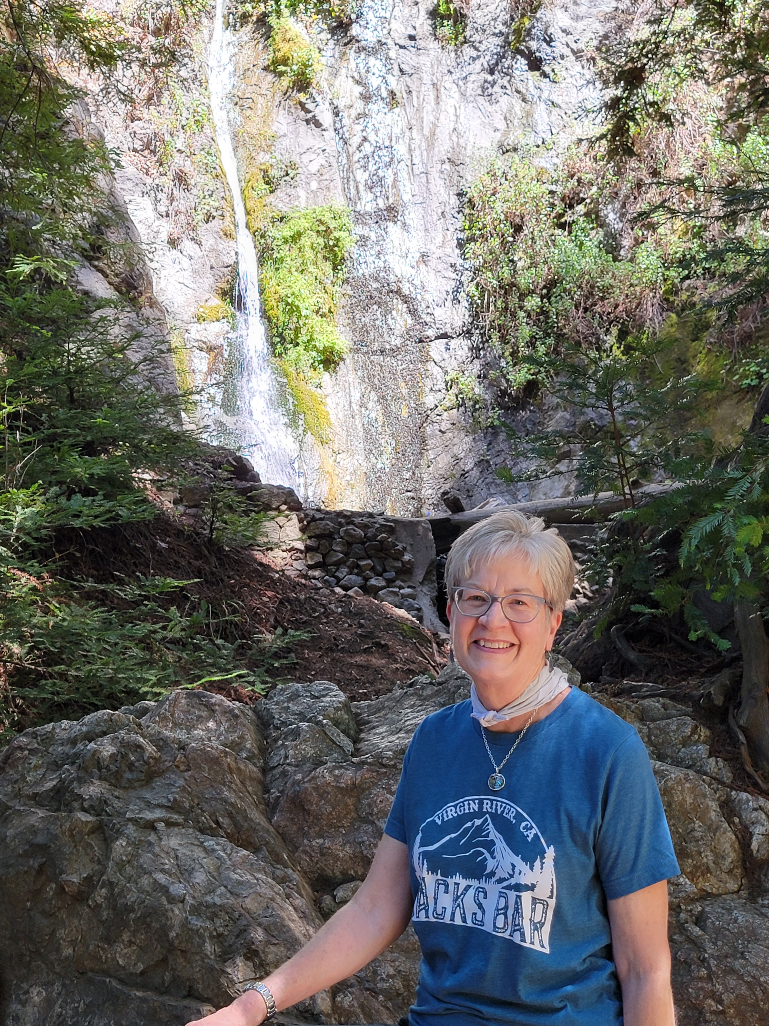 Sandy at Pfeiffer Falls
At Pfeifer State Park the road turned away from the coast and headed up an inland valley. Here there were a few signs of civilization: a gas station, a camp ground, even a lodge. Not much thoug. We turned off the main highway toward the state park. Our first stop was at the Big Sur Lodge, where it was necessary for me to check out the tshirts. They had some cool ones and I ended up buying two. Then we paid our ten dollar park entrance fee. In return we got a trail map, and a parking sticker for the trailhaed to put on our dashboard.
We had been enjoying views of the rugged Big Sur coastline so far, but Pfeiffer State Park has no beach or ocean access. It is a mountain park and the Santa Lucia mountains are impressive mountains. The trails in the park provide access to the 236,000 acre Ventana Wilderness, which is about the same size as the Sawtooth Wilderness in Idaho. With almost 200 miles of trails and a mild climate, it's an excellent hiking and backpacking area. I did one of my very first backpacking trips ever there, back in 1976 when I was a graduate student at Stanford. A friend and I took three days to hike up Double Ventana Cone. I have to admit that I don't remember much about that trip other than that there was a fantastic view from the summit, with rugged mountains all around and the ocean far off in the distance.
Sandy and I weren't nearly so ambitious this time. We decided to try a couple of short trails that would provide a good sample of the hiking in the park. The Valley View Trail climbs 550 feet in a little under a mile to a viewpoint over the Big Sur Valley. The Pfeiffer Falls Trail climbs 400 feet in three quarters of a mile to a waterfall on Pfeiffer Creek. It's possible to combine the two in a loop that is two and a half miles long with 660 feet of elevation gain. That was perfect for us to get some exercise and get a break from riding in the car all day.
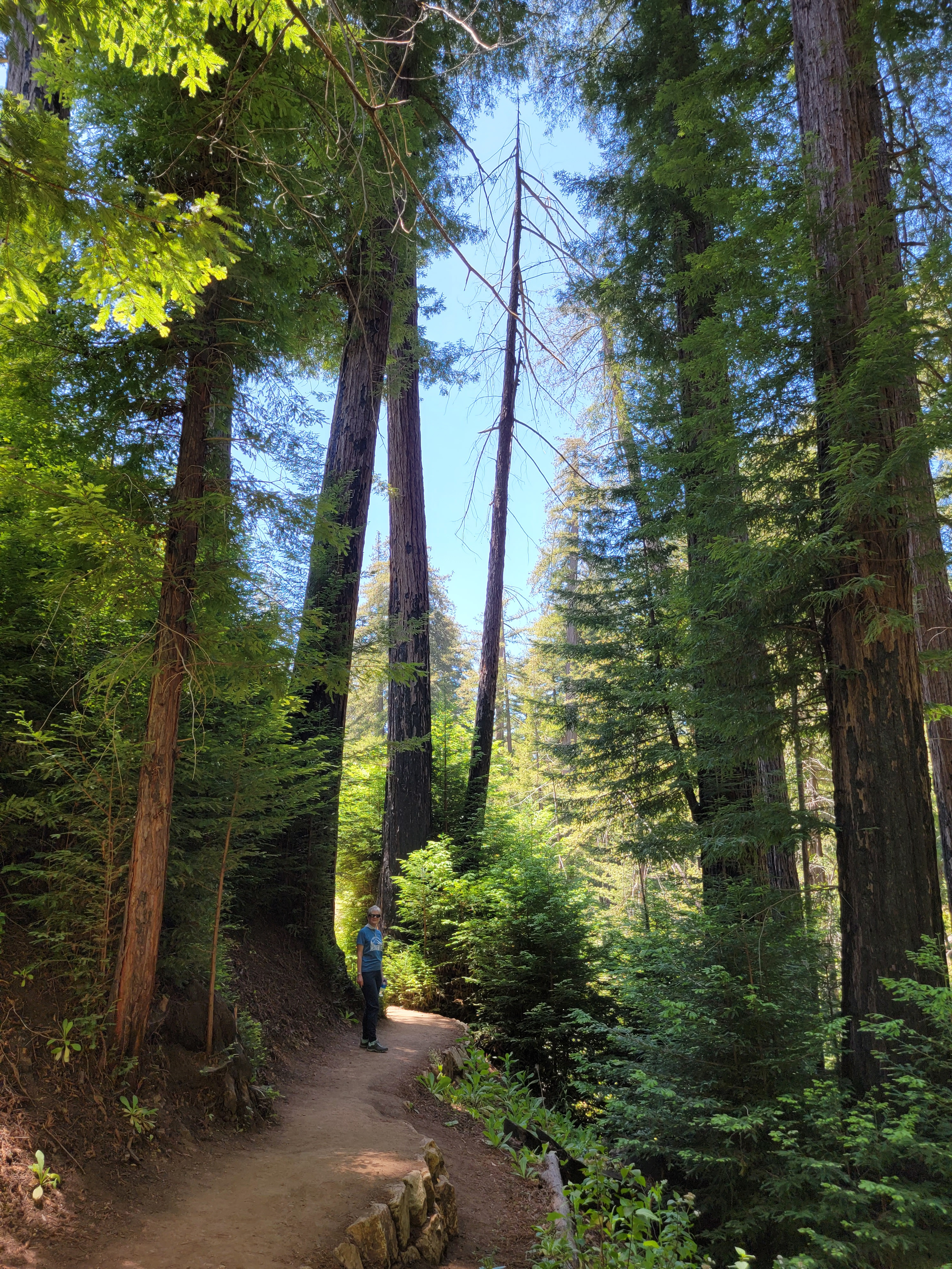 Hiking among the redwoods
The trail left the parking lot and followed a river back to the lodge. There it crossed the road and turned uphill and started to follow Pfeiffer Creek as it rose up into the mountains. We crossed a bridge and then continued to climb high above the creek. It was a nice trail but since we were a few miles in from the coast the temperature was definitely a lot higher than we had experienced the past few days. There were some flies as well, not bad but at least mildly annoying. When we reached a trail junction we went left toward the Valley Viewpoint. The trail continued to climb up a hot hillside through light forest. Eventually it reached a spot where the trees opened up to provide a view up and down the Big Sur Valley.
Far in the distance we could see the ocean. We hadn't seen many hikers but now two other people got there just as we did. While I was taking pictures they volunteered to take a picture of Sandy and I together, so we got a rare picture of both of us. We didn't stay long since the flies were bothersome while we were stopped, standing around in the hot sun.
Not long after starting down from the viewpoint I passed a hiker going up. He stopped to ask how much farther to the end. When I told him it was only a few minutes, he asked if I would share that with the people who were following behind him. Apparently the others in his group were not very enthusiastic hikers and he was concerned that they might give up and turn around. I assured him that I would mention it to them when I saw them.
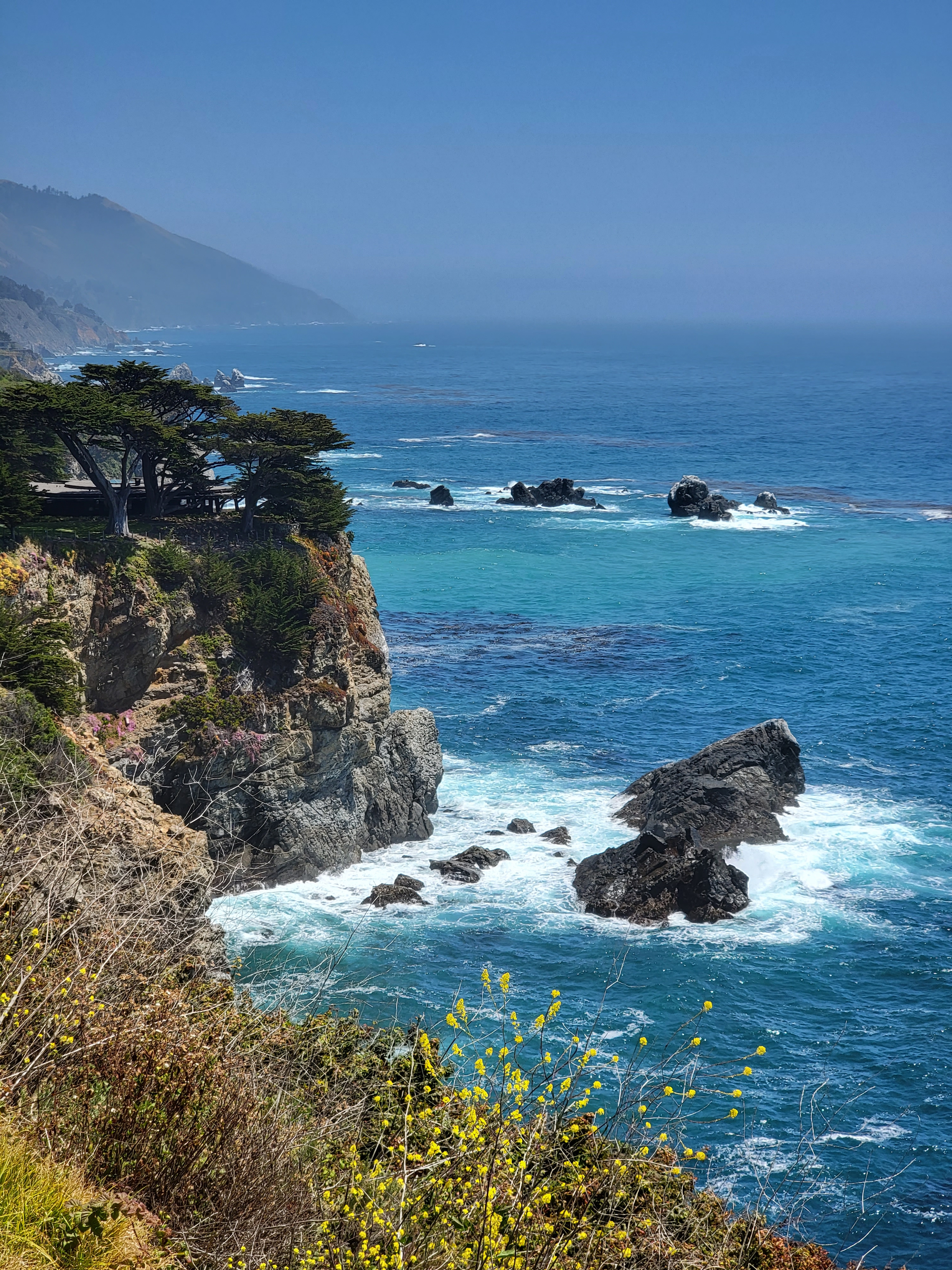 Back on the coast road - more dramatic views
Sure enough, five minutes later I met another three hikers on their way up. They looked hot and tired and didn't seem to be enjoying themselves. I figured that they had to be with the hiker I had just talked to. I stopped and told them "Some guy I just passed gave me ten bucks to tell all of you that it wasn't very much farther."
They looked at me strangely for a second. Then a woman laughed and said "That would be my husband". They kept on going.
Back at the junction, we went the other way this time. The trail descended into the steep valley of Pfeiffer Creek. Now we were in the shade and it was much cooler, and more pleasant. It was easier going down too. The forest got heavier and the trail got darker. We entered a grove of redwood trees. This was just about the southern limit of the range of the redwoods, the southernmost extent being only another fifteen miles further south at Salmon Creek. They weren't as big or as tall as the trees we had seen in Northern California on a previous trip to the heart of redwood country. They were still very impressive though. It's always cool and dark and quiet (and less buggy) hiking through a redwood forest and this one was no exception. Much more pleasant than the trail we had been on up above.
Eventually we could hear Pfeiffer Creek Falls ahead. When we reached them there were quite a few people there. There wasn't much flow but it did fall about sixty feet down a rocky cliff. There were good spots for photos both below the falls and beside the falls. After taking pictures it was an easy downhill walk to the lodge. We stopped there to get cold drinks and snacks. I got a rice crispy bar and Sandy got a jar of Pringles. We figured that we had earned them. Then it was back to our car to continue the journey south.
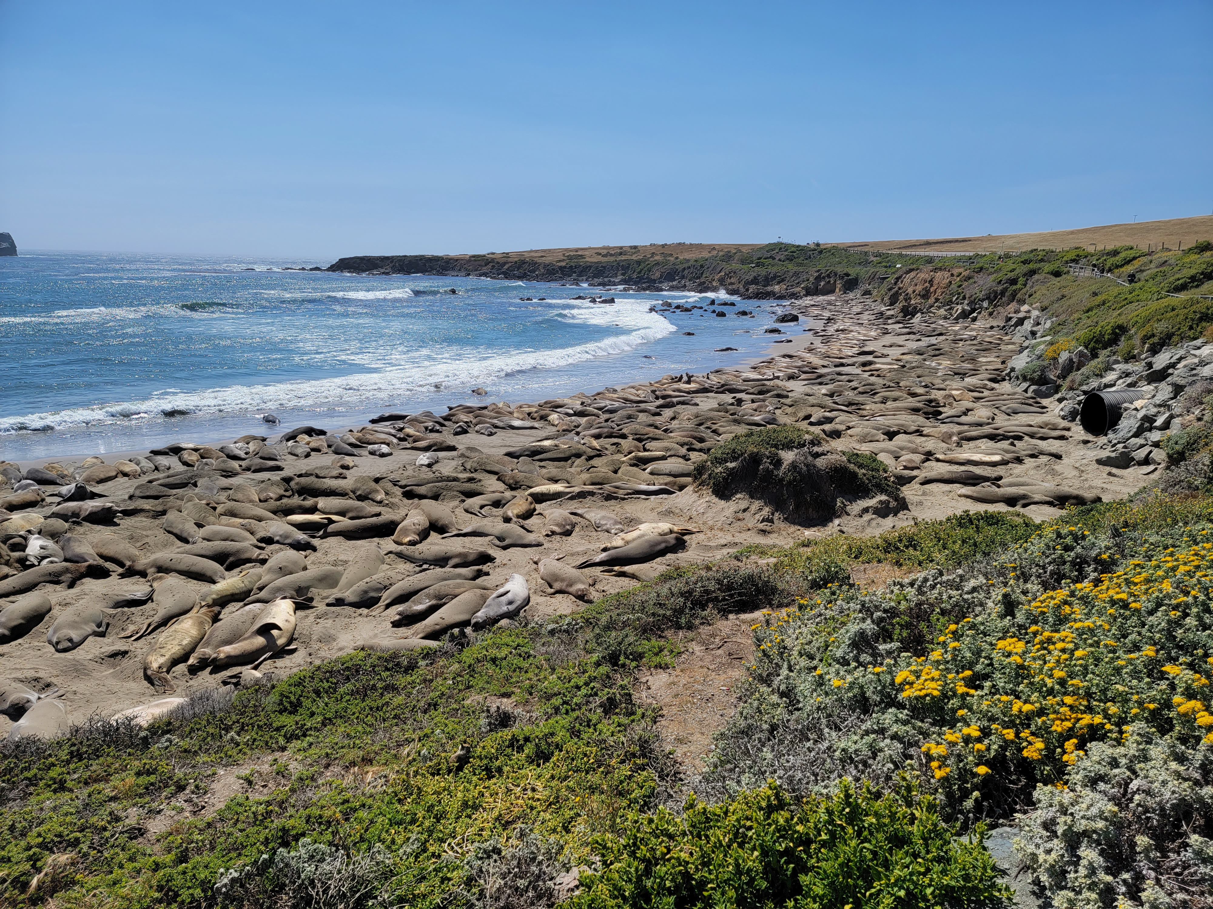 Hundreds, maybe even thousands of elephant seals on the beach
Not long after leaving the park the highway returned to the coast again, with more outstanding views. I had hoped to do another hike, the one to Salmon Creek Falls, which is near the southern end of Big Sur. It didn't look like we had time for that though. By now it was well past noon and we still had quite a ways to go. But the trip had been really good so far and we were still able to make stops at a few more viewpoints along the way.
When we reached San Simeon the land leveled out and the mountains were set back a little distance from the ocean. It's usually considered the end of the Big Sur region. We could see Hearst Castle in the distance, up on a ridge. It looked impressive but neither of us really had much interest in going to see it. At this point we were thinking that our sight seeing was done for the day and we just had to cover the distance to get to our destination. It turned out that we were wrong.
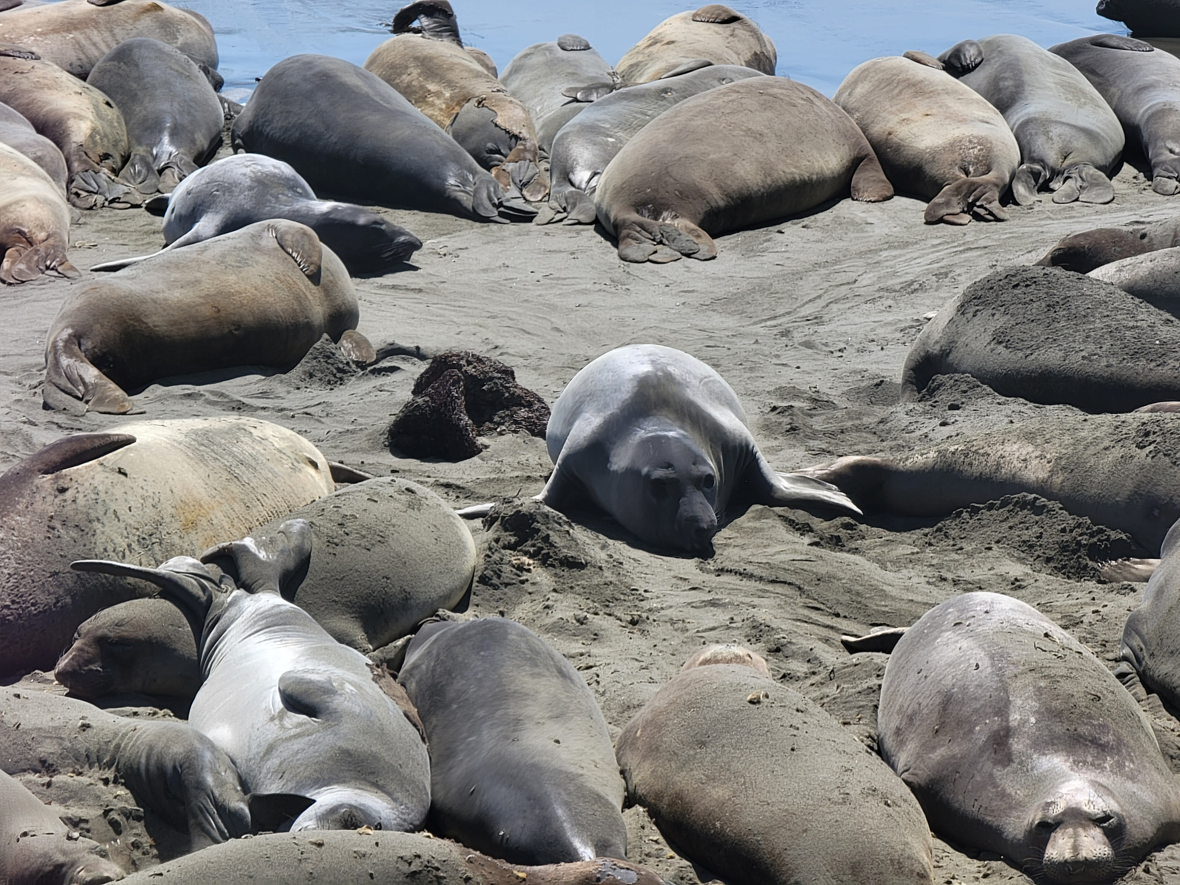 Those seals make me feel really skinny
As we drove along we could see a huge parking area for an ocean viewpoint ahead that was filled with cars. We pulled in to see what was attracting all of the attention. There was a long beach that was covered, literally covered, with elephant seals. There had to be hundreds of them. Most of them were just lying there but a few were moving around. While the seals were lying there they would use their flippers to toss sand in the air and over themselves. I read later that covering themselves with sand protects them from the sun. There was a lot of honking, pushing, shoving and biting. The seals certainly weren't quiet. And the whole area had a strong smell. It wasn't surprising with so many big animals packed tightly together, likely without much toilet discipline. I've seen seals on the shore before but never anything like this. It was pretty amazing.
If you want to see the seals in action, you can watch this video.
After seeing the seals we were finally in the home stretch. We did miss our exit from the freeway (again) but managed to get turned around and eventually found our hotel in Los Osos, the Back Bay Inn. Like our hotel in Monterey, they had a happy hour with complimentary wine which we didn't want to miss. Fortunately we made it in time. Now we started the last part of our vacation.
