Hiking in the North Cascades
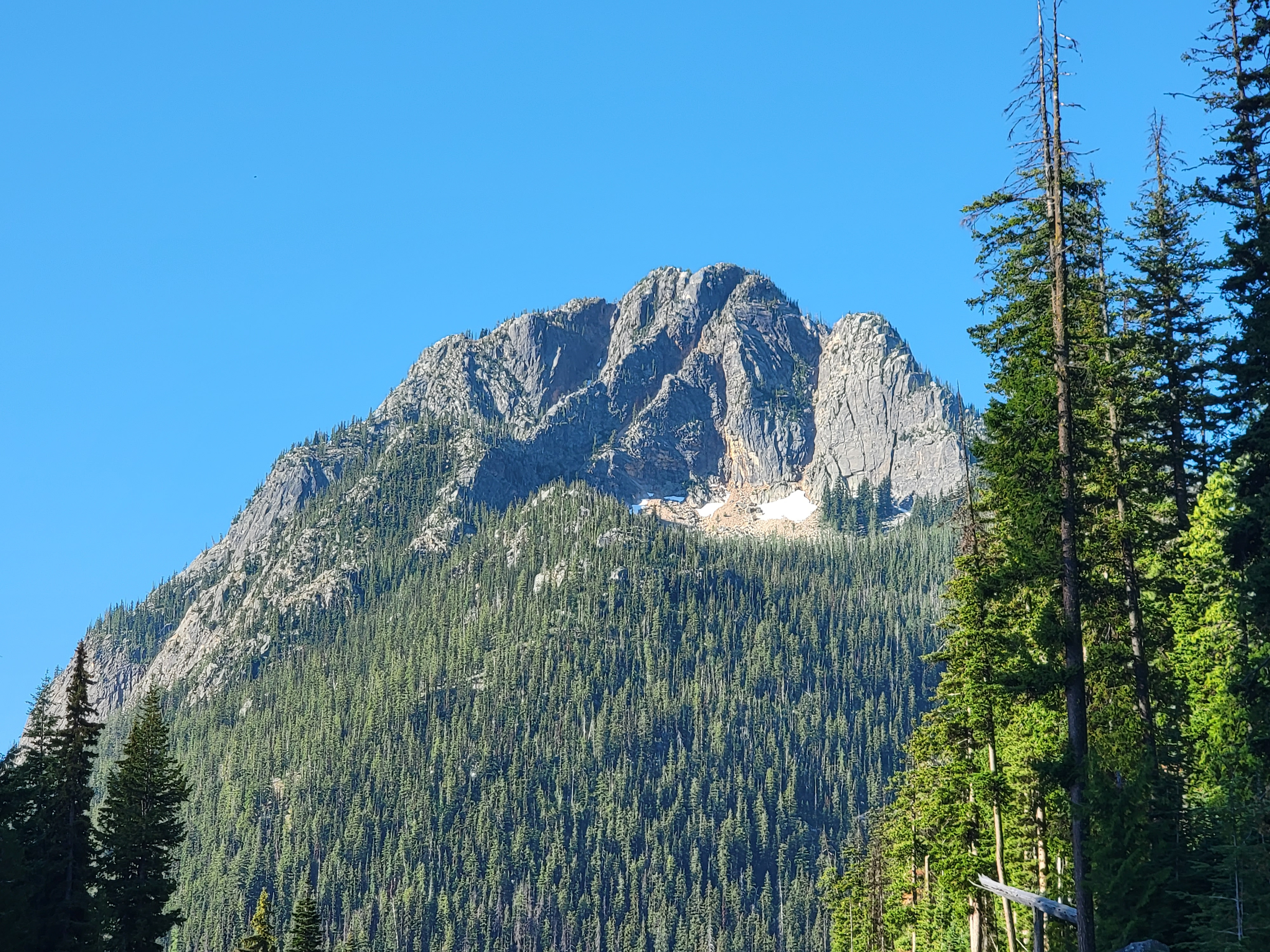 View of Silver Star Mountain on the drive to the trailhead
Our vacation wasn't over after the overnight trip to Stehekin. Next we were going to continue further north and spend three nights in Mazama. Then we would return to Chelan and spend one more night there before heading home. Splitting our time in Chelan wasn't the original plan. We were going to spend two nights there before going to Stehekin. We had to change that when we delayed our trip so Sandy could go back to the Midwest to attend the funeral service for her dad. The hotel in Chelan wouldn't let us cancel our two prepaid nights but would let us change the dates. Since we couldn't change the arrangements for Stehekin, the best we could do was split our stay in Chelan. There actually was an advantage to that. Originally we were returning home right after our stay in Stehekin. Since we couldn't start driving until the ferry brought us back mid afternoon, it meant it would be very late when we got to Boise. That wasn't ideal for our friend who was dogsitting for Abby. This new itinerary would be much better because we could start our drive home first thing in the morning and get back to Boise at a reasonable hour. It also meant that the afternoon that we got off the ferry, all we had was an easy drive to Mazama. It was only about an hour and a half from Chelan, so we would be there by dinner time.
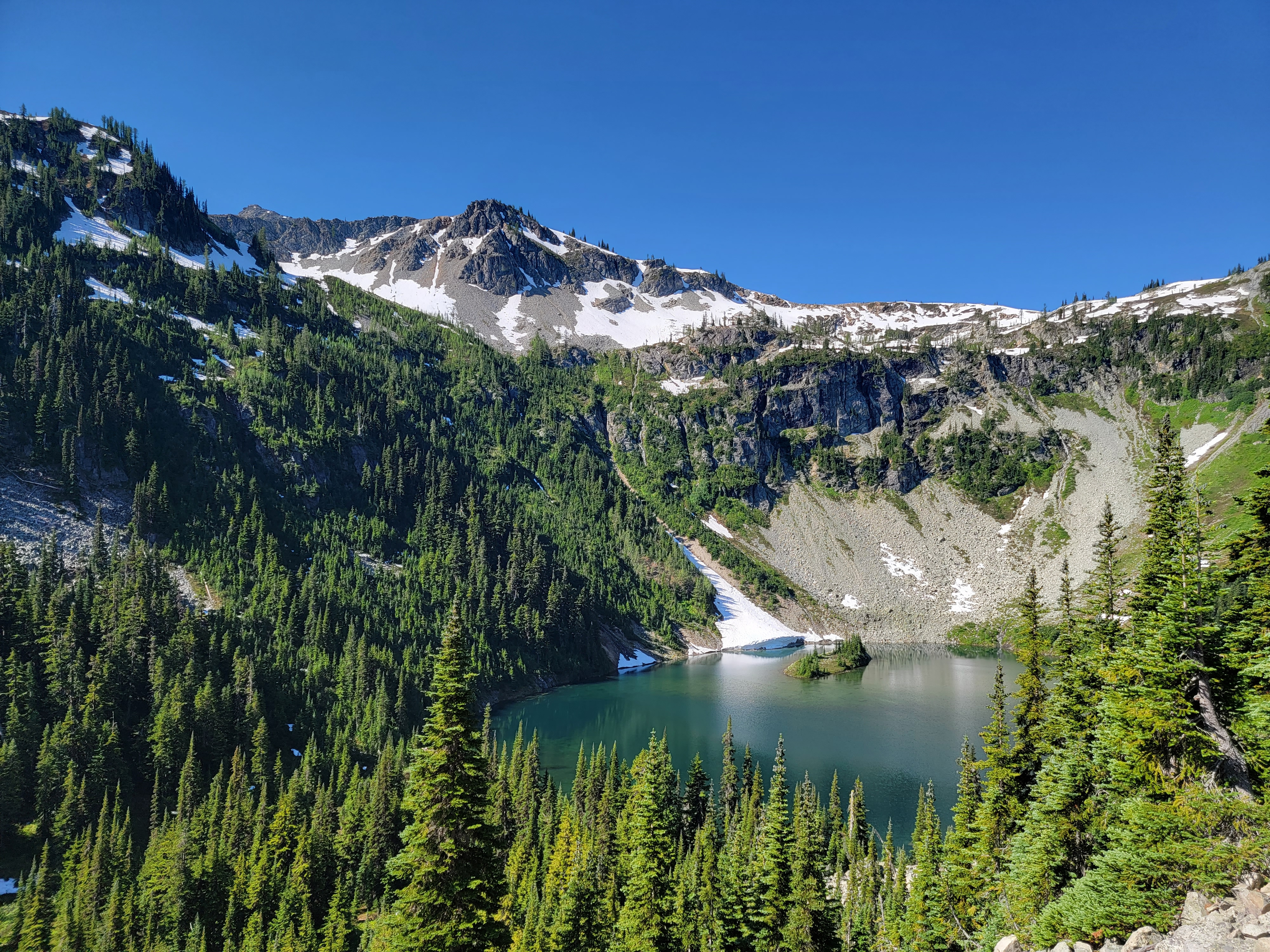 Lake Ann from Maple Pass Trail
We were staying in Mazama because it is the closest town to the North Cascades on the east side. State Highway 20, aka the North Cascades Highway, is the only road that crosses the mountains in the eighty mile stretch between US Highway 2 and the Canadian border. Most of the area is within the North Cascades National Park complex or various National Forest Wilderness areas. There are three dams which predate the creation of the park and two small company towns, Newhalem and Diablo, where the only residents are employees of Seattle Power and Light. Other than that, there are no improvements. Almost no roads penetrate the area. There are no concessions - no gas stations, lodges, restaurants or shops. There isn't even a gateway town. Many parks have tourist-oriented towns just outside of their boundaries. Springdale near Zion NP and Estes Park near Rocky Mountain NP come to mind. There isn't anything like that for the North Cascades. Mazama is the closest we could get to the mountains if we wanted to do "hotel camping". The name appears on Google maps, but when you zoom in it just shows a lodge and a general store on a side road a short way off the main highway.
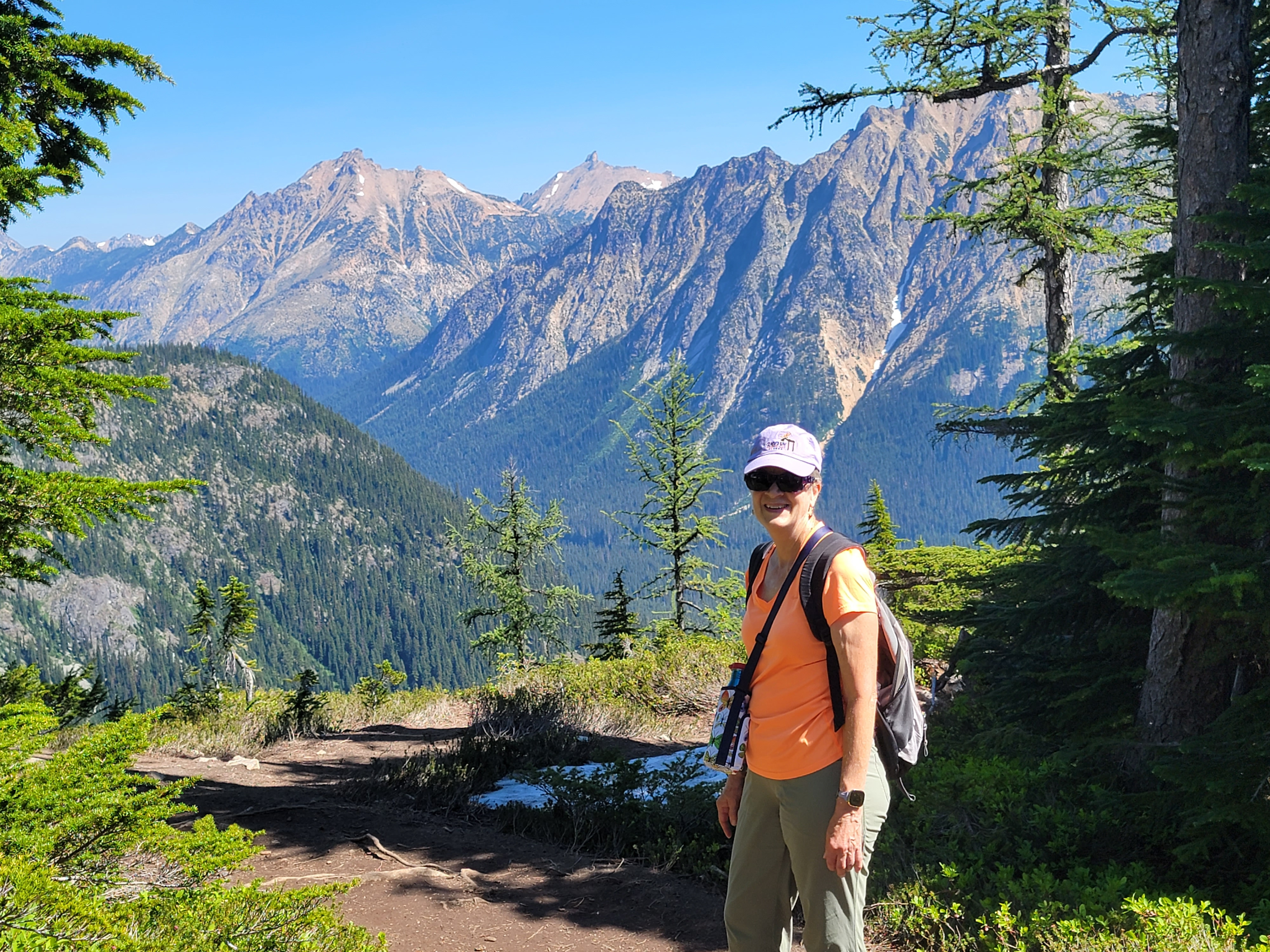
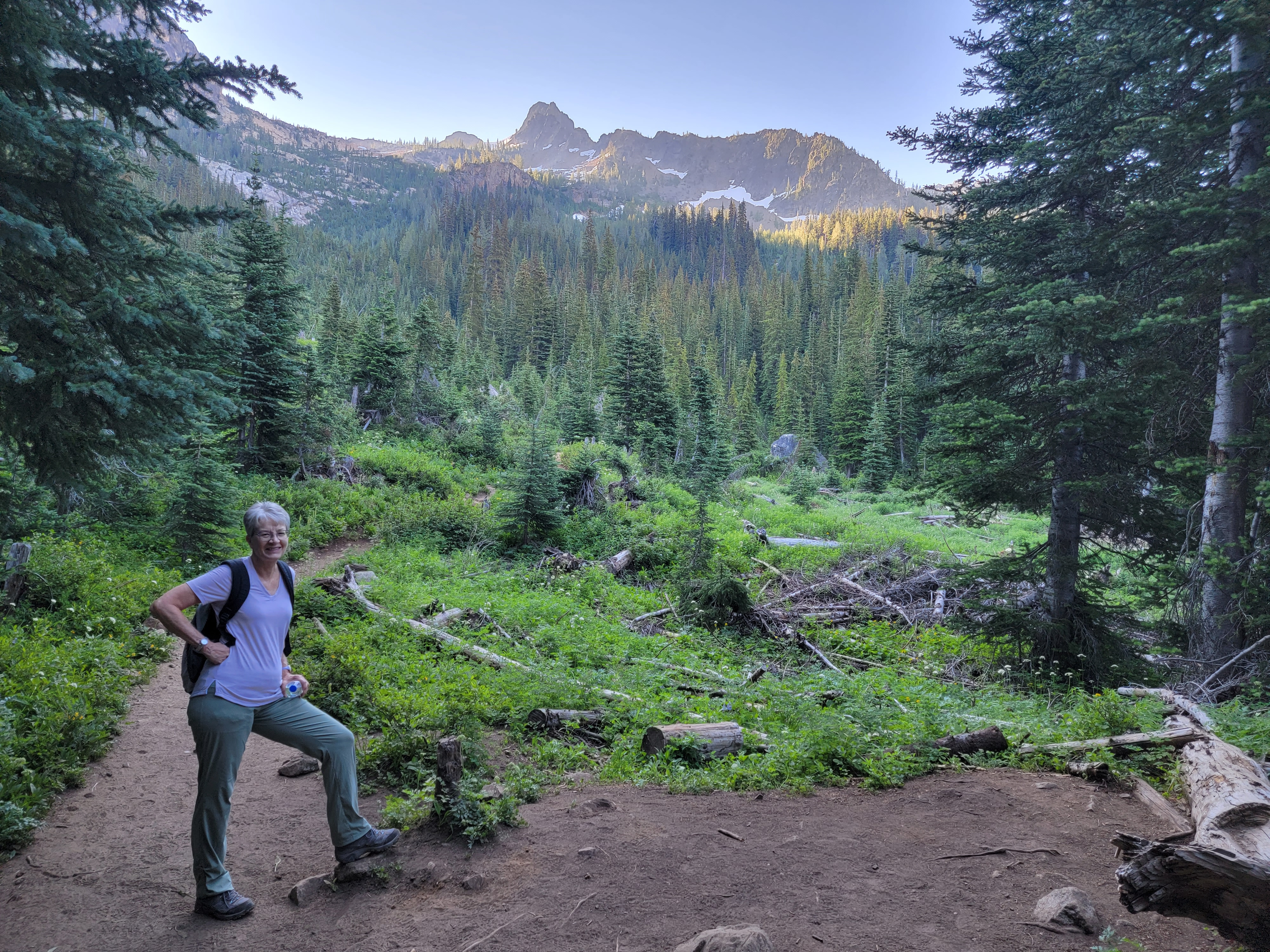
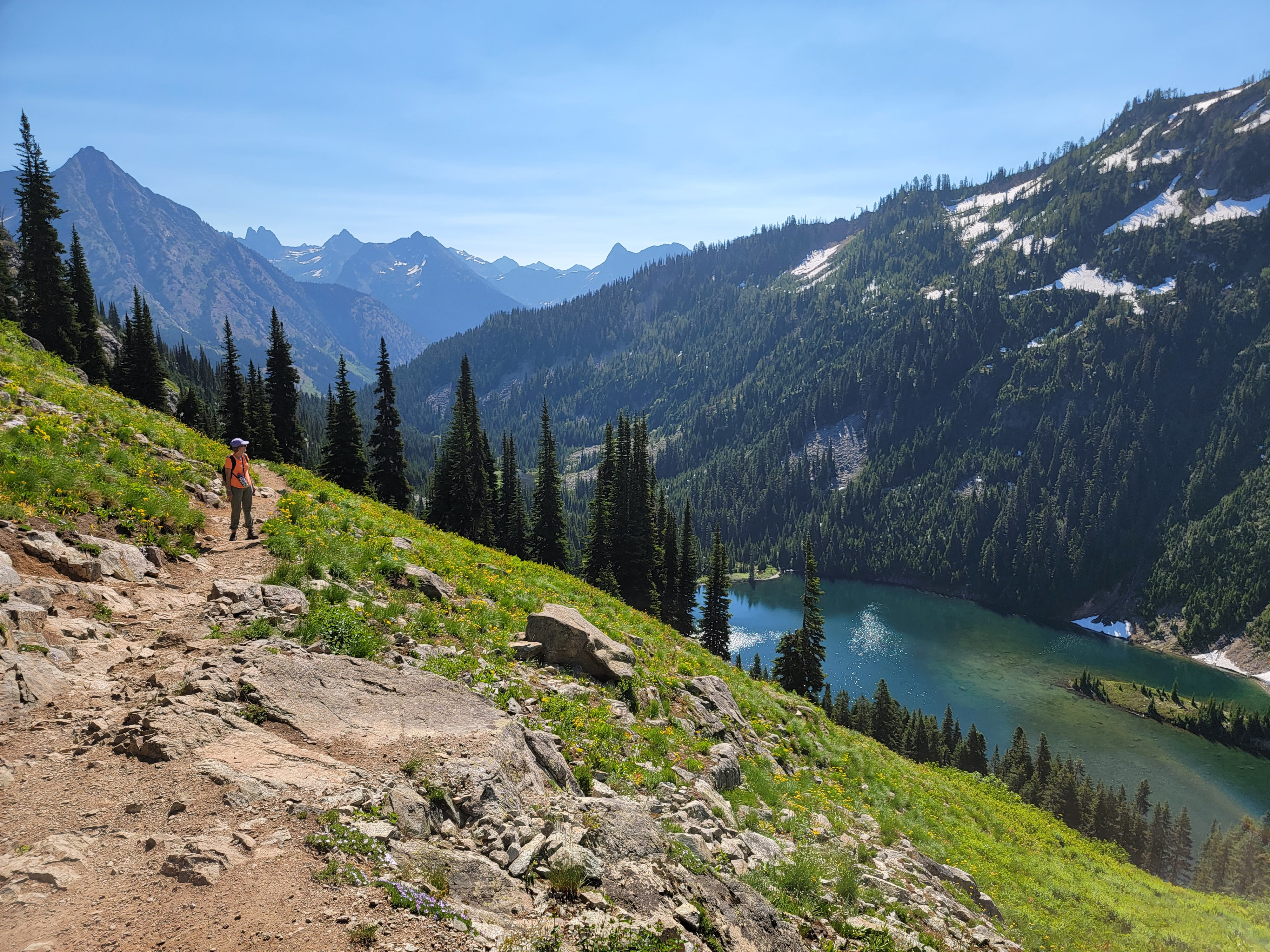 Sandy admires the view from the Maple Pass Trail
I was thinking ahead about driving to Mazama. We didn't have internet while we were in Stehekin so I couldn't check out the route. But while we were on the ferry I got out my phone as soon as we were close enough to Chelan to get cell service. I brought up Google maps and made sure I knew how to get out of Chelan headed in the right direction and where to go from there. It wasn't that complicated so I was able to commit the whole route to memory. No checking my phone for directions while driving for me. I even looked up restaurants and found a pizza place just a few miles east of Mazama.
My preparation paid off and I navigated there flawlessly - for 99.99% of the way there. I turned off at the sign for Mazama. In about half a mile the road intersected another road that ran parallel to the main highway. There was the general store and a dirt road leading off with a sign that said "Mazama Lodge". We were staying at "The Inn at Mazama" so that wasn't our hotel, but we were obviously close. We drove up the road a few miles. There was nothing.
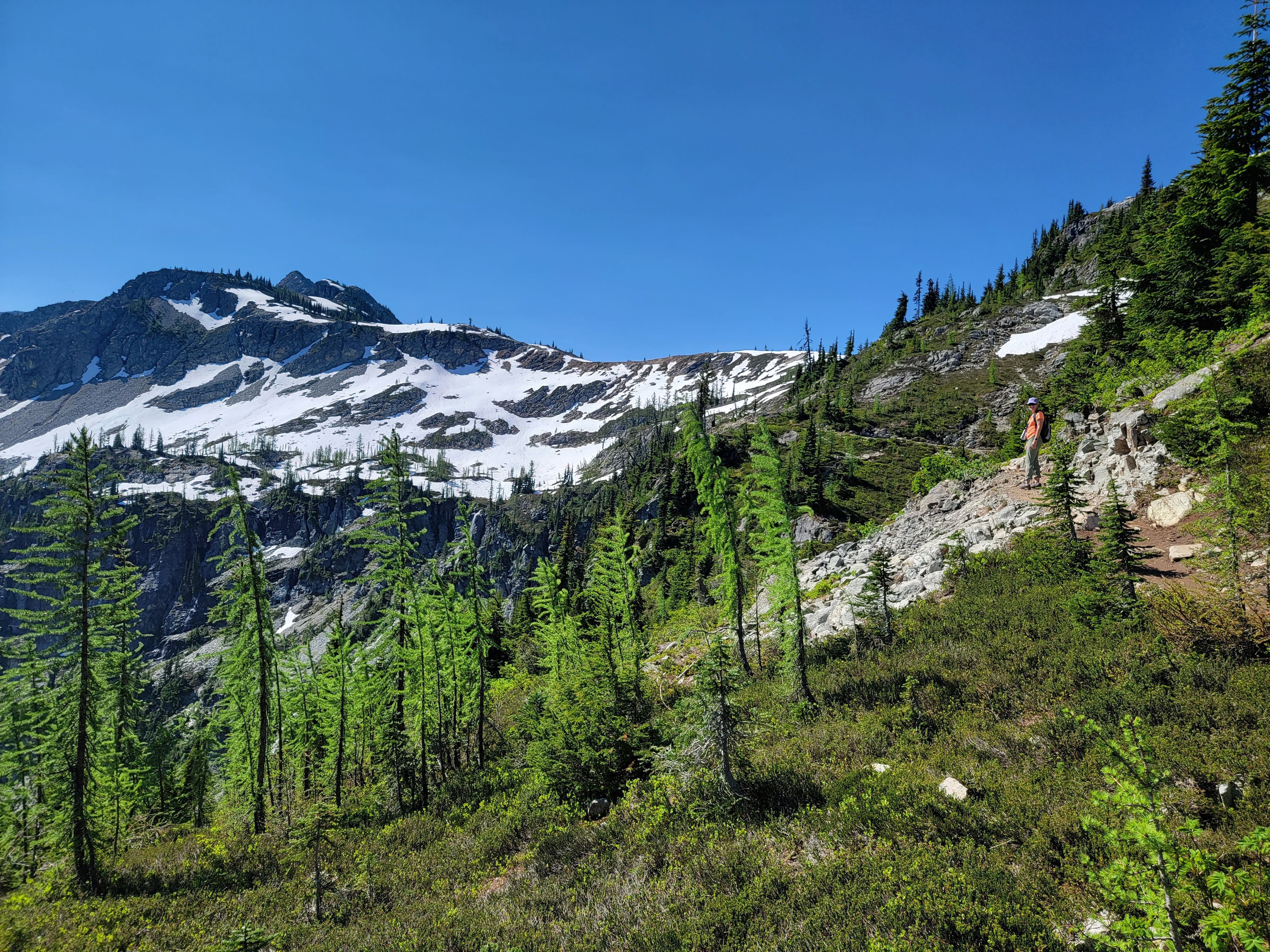
 Looking ahead - we turned around at the big snowfield (center)
I pulled off the road and took out my phone to check Google maps. Oh oh. No cell service. Do people actually live in real towns in the twenty first century without cell phones? Checking later, it turns out the answer is no. But we had switched to T-Mobile at the begining of the year. When you check their coverage map for the country, the one that looks like it is covered by so much pink, there is a big hole over a lot of northeastern Washington. It was AT&T or nothing where we were in the upper Methow Valley.
We drove back towards the general store. I was getting desperate, thinking that I might actually have to resort to stopping there and asking directions. Fortunately when we got back to the junction, we noticed a small sign nailed to a tree that said "Inn at Mazama" which pointed down the dirt road. Originally we had passed it by because the big, obvious sign had the name of a different hotel. We only had to drive about a hundred yards down the road and there was the hotel. Whew! That was hard.
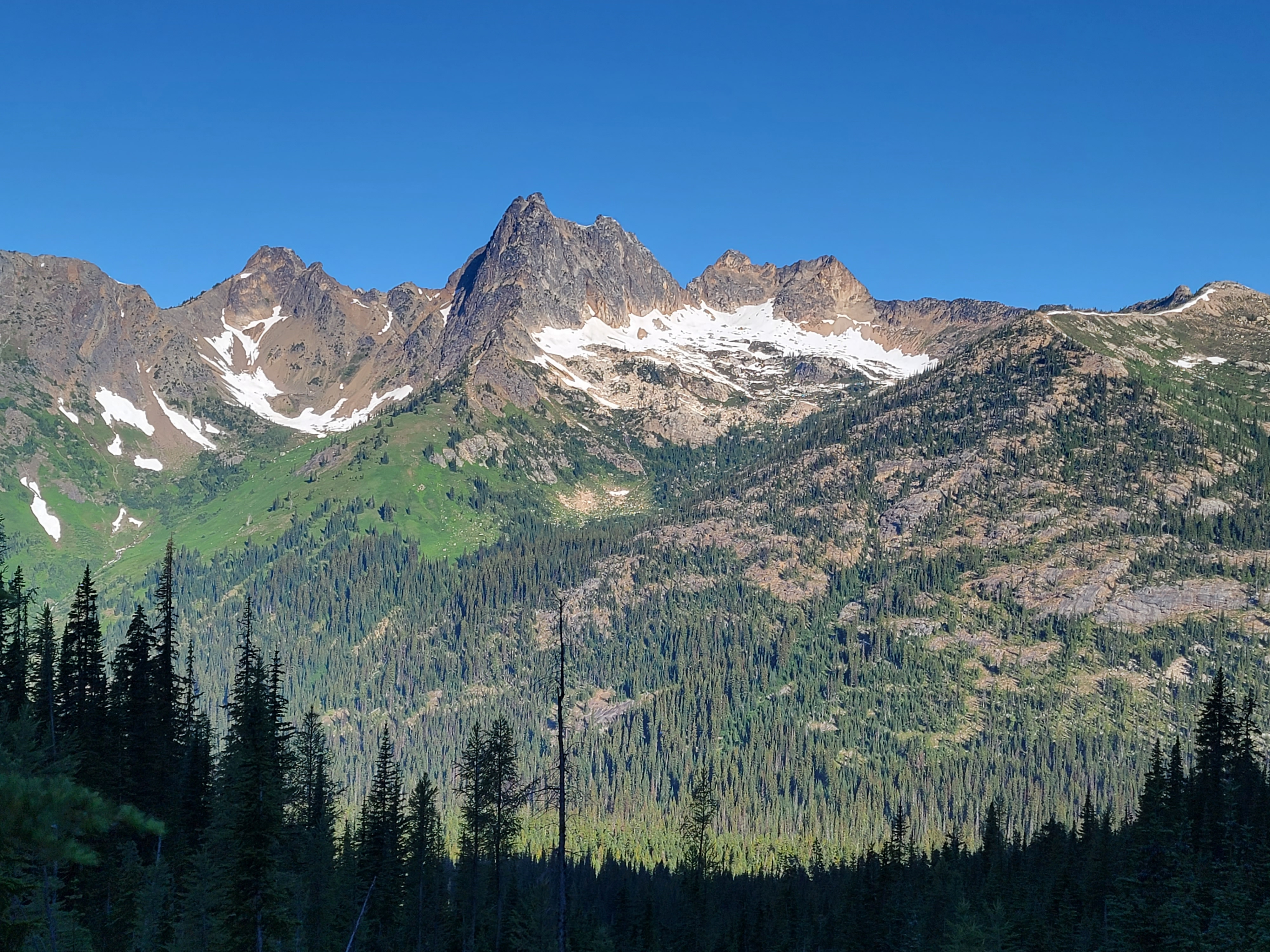
 Black Peak from Heather Pass
Later we solved the mystery. The hotel used to be the Mazama Lodge. A few years ago it got a new owner, who changed the name to Inn at Mazama. But they didn't bother to change the name on the big sign by the road. Well, it gave me something to say when they sent me an email after our stay asking for feedback.
Once we found the place everything was fine. They had a similar system to the hotel in Chelan. All the rooms had electronic combination locks. It seems to be standard for small hotels in this area that aren't big enough to be able to staff a front desk 24/7. It worked well for this hotel. I had received an email earlier in the day and had the combination. Plus they did have a front desk that was staffed during the day. The lady was still there when we arrived and would have been able to help us if we needed it. That was an improvement over the place where we had stayed in Chelan.
 View from above Heather Pass
The lodge was quite nice. There were two small hotel buildings and a few cabins scattered around. It was in the woods and felt like you were in a remote spot, although it was possible to cut through the back of the property and walk to the general store in about two minutes. The room was nice but it was very small. Even though we each had only one small suitcase we were barely able to fit our stuff in the room.
Once we were settled in as best we could, we drove back to the pizza place for dinner. Like a lot of businesses, they had trouble getting seasonal staff and were closed several days during the week. We were lucky because this was the only night they were open during our stay. The pizza was good although the service was slow. It was a little surprising because when we got there we were the only party inside, and there were only two groups outside, maybe another six people. The server was rushing around a lot but didn't seem to be very efficient. She apologized to us for being slow and explained that she had just started working there. It didn't matter to us. We didn't have anywhere to go.
 Sandy near our high point on the Maple Pass Trail
Her job didn't get easier when another party came in - a man and two women. One of the ladies must not have wanted to come. She just sat with her arms folded and refused to order or even look at a menu. She was doing a good imitation of a petulant five year old. The waitress was getting pretty exasperated. We made sure to leave her a good tip when we left.
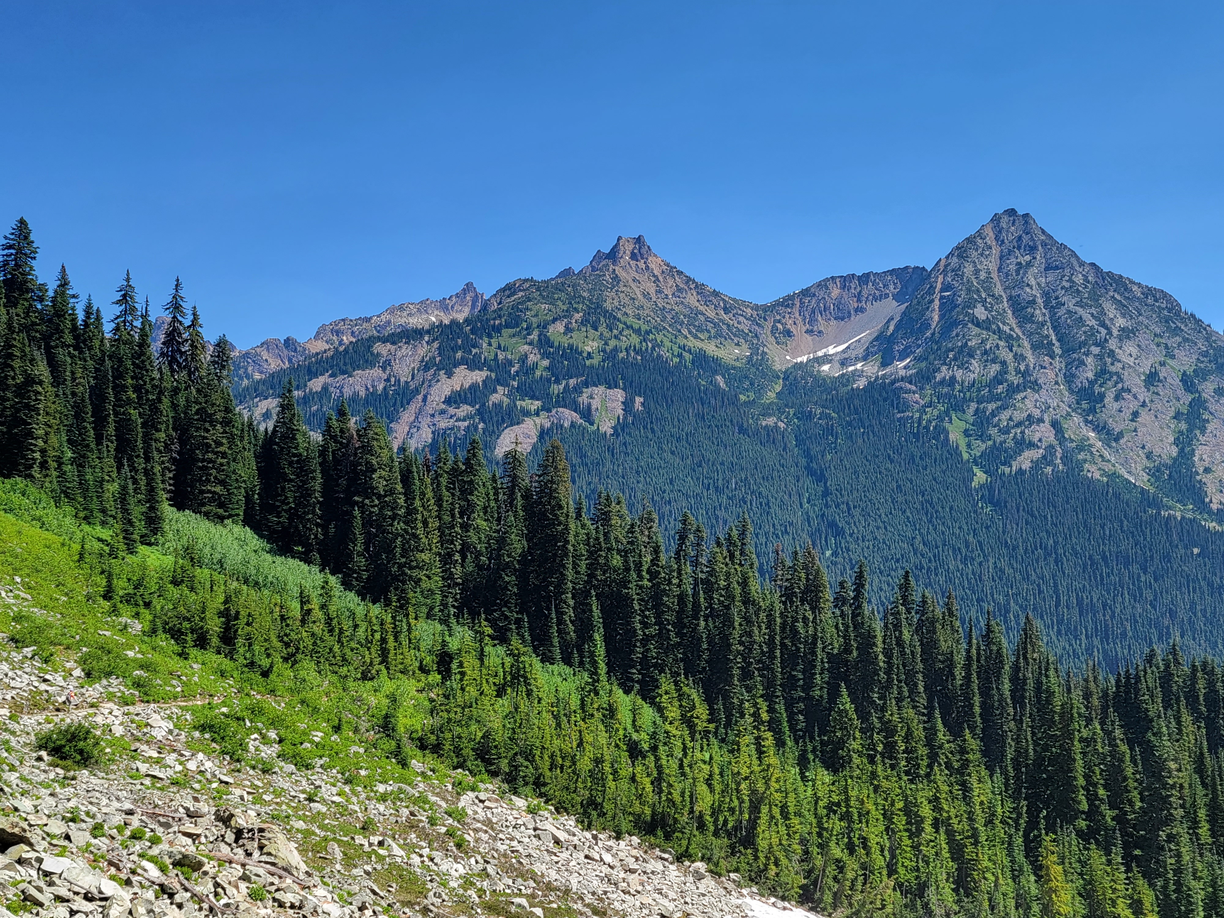
I had a hike picked out for the next day - the Heather/Maple Pass Loop. I had been studying my copy of 100 Hikes in the North Cascades. Although they are long out of print, the old Harvey Manning/Ira Spring "100 hikes" series are still my go to hiking guides. When they recommend a hike I know that it's a good one. I also found descriptions online. The Washington Trails Association website was especially useful because they had a lot of comments about the hike, several added in just the past few days. It was nice, although unusual, to get such up to date information about hiking conditions. There were a couple of common themes in the comments.
 Sandy is way ahead on the way back - she must want lunch
1) Everyone raved about the hike. That was good. It looked like I had picked out a good one.
2) Everyone complained about the bugs. Based on that, we decided to wear long pants, even though it would probably be very warm. I always wear long hiking pants whenever there is any chance of bugs but it was a big deal for Sandy. She gets paranoid about overheating on hikes and prefers to wear shorts when it's hot. I also had brought bug spray along. I even brought head nets in case it was really bad, although I was really hoping that we didn't have to use them.
3) Everyone said that there was still a lot of snow on the highest section of the loop and several posters recommended having trekking poles and spikes. Others without equipment turned back part way. We didn't have our crampons or Yaktrax with us, so we figured that we would turn around as well if we hit steep snow. It would be nice to do the full loop but if not, it would still be a good hike.
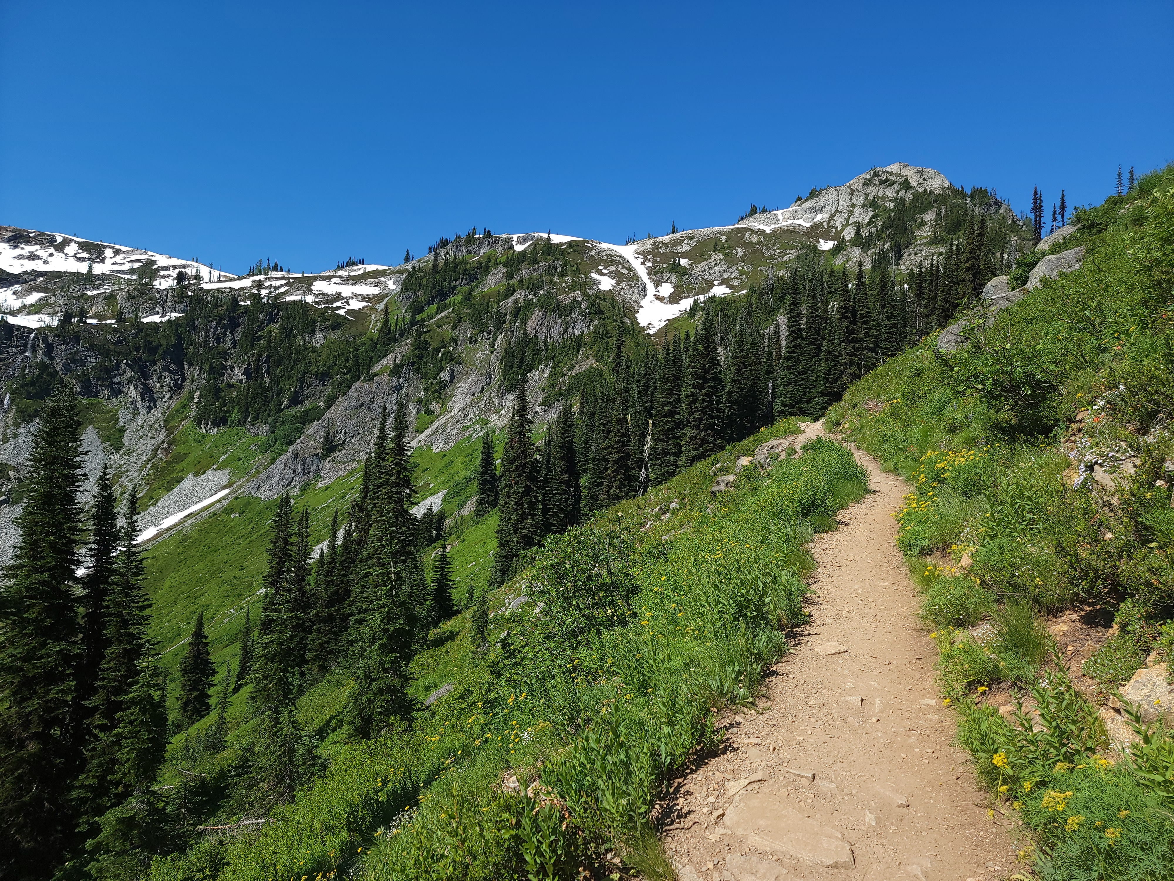
 An early morning start on the Blue Lake Trail
We wanted an early start so we would be hiking during the coolest part of the day. The North Cascades are impressive mountains but they aren't that high. That meant it would be warm. I'm not a morning person but even I was motivated enough to get up early. We had an easy half hour drive to the trailhead, which was just off the North Cascades Highway. No rough approach on a dirt road was required. It was a perfectly clear morning with a bright blue sky. On the way to the trailhead we got fantastic views of Silver Star Mountain, Liberty Bell, Early Winter Spire and many other peaks.
We went by a sign for the Rainy Pass Trailhead, where there were already overflow cars parked on the highway. Since the Maple Pass Trailhead would be just a few more miles, I stopped gawking at the scenery and kept a sharp eye out for the sign for our trailhead as we kept going. And kept going. And kept going.
 Cutthroat Peak rises across the valley
Something was wrong. With a very strong feeling of deja vu, I pulled over to check. Turns out that the trailhead we had passed was the one we wanted. By this time, Sandy was begining to get a little irritated with my navigation. And when I say "a little", I mean "really a lot". In my defense, there were several trails that left from that trailhead, the Maple Pass Trail being one and the Rainy Pass Trail being another. And on Google Maps, it is marked as the Maple Pass Trailhead. But that isn't what the sign said, so I drove right past.
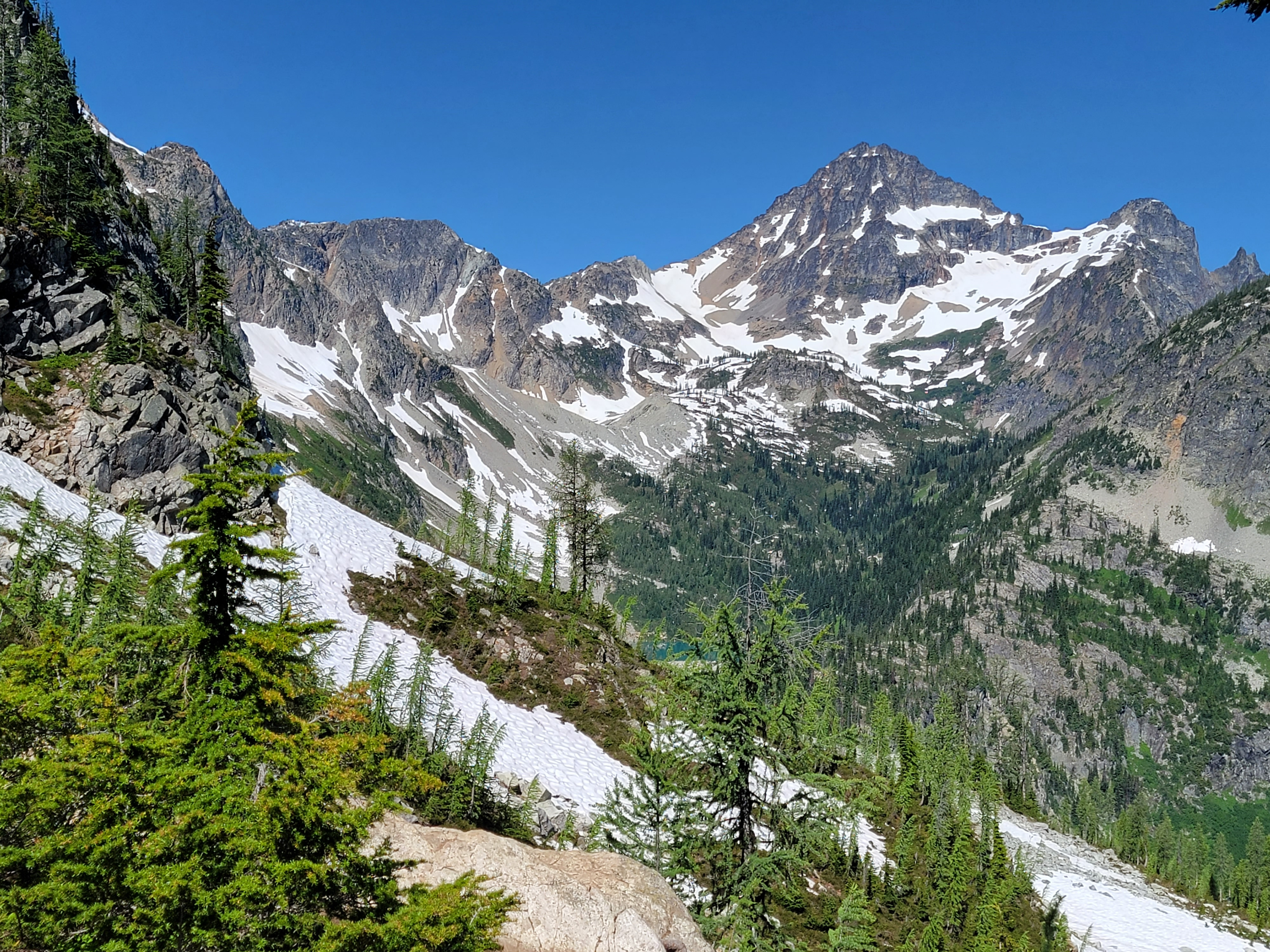
The good news was that there were a lot of spots avaialbe when we pulled into the parking lot. The cars on the highway must have been backpackers who had arrived late the day before. We found the right trail from the lot and started off. The trail began climbing right away, but it was in the woods, which meant in the shade. It was a good trail and quite pleasant. After 1.25 miles we reached a junction. A short, flat trail led to Lake Ann. We thought that wouldn't be enough to count as a days work, so we continued on the trail to Maple Pass. That trail climbed and eventually came out of the forest onto open slopes.
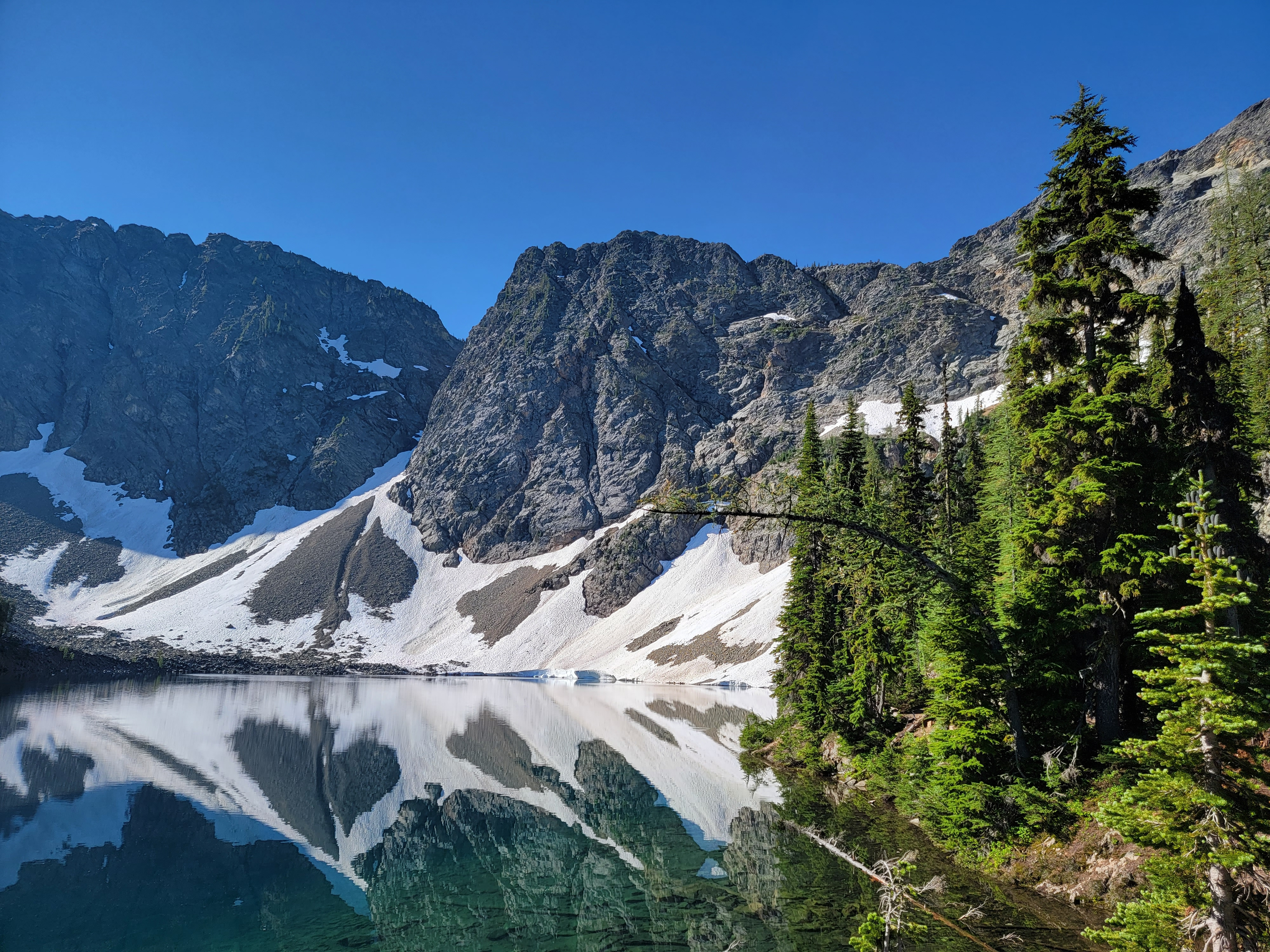 Blue Lake
We had a great view of the cirque that held Lake Ann, which was now far below us. We could see the trail continuing upward as it made a loop around the cirque. Far ahead we could barely make out hikers where the trail crossed a large snowfield. They were moving very slowly so we figured that might be where the going became difficult.
Eventually we reached Heather Pass. A climbers track branches off and we followed it about two hundred yards to a viewpoint. We were right on the border of North Cascades National Park. Up till then we had been in a narrow corridor which lines the highway that is part of the Ross Lake National Recreation Area. Now we could see over the ridge to a drainage dominated by Black Peak, which towered over several alpine lakes. The mountains were extremely rugged but what really impressed me was how green everything was. The North Cascades get a lot of rain and snow throughout the year. It's a great place to live if you're a plant. I'm used to hiking in the Sawtooths in Idaho. They're spectacular mountains but a lot drier and so not nearly as green. The grey rock, the green forest, the white snow and the blue sky certainly made for dramatic scenery.
 Cutthroat Peak from Blue Lake Trail
When we finally reached the big snowfield it wasn't that bad. The snow was a little steep and the runout onto the rocks wasn't good, but the snow was pretty soft so the footing was secure. It seemed like we could get across ok. But we couldn't see the trail very far ahead because it crossed to the other side of the ridge and disappeared from sight. Since some comments online mentioned difficult snow and exposure on the later part of the hike, we decided this was far enough. According to my GPS we had come three miles and we had gained a lot of elevation. We were ok with turning around.
The hike back to the car was easy. When we finished, the GPS app on my phone said we had done 5.77 miles and 1380 feet of elevation gain. It seemed to me like we had done more climbing but I'm ok to go with that. Not a monster hike but a reasonable workout for a couple of oldies. We had seen some great views. The weather was excellent, although it was getting pretty warm by the time we finished. I wouldn't have wanted to be one of the people that we saw just starting out as we finished. The bugs weren't bad at all either, except at the very end where the mosquitoes were waiting to ambush us. We had to hurry getting into the car.
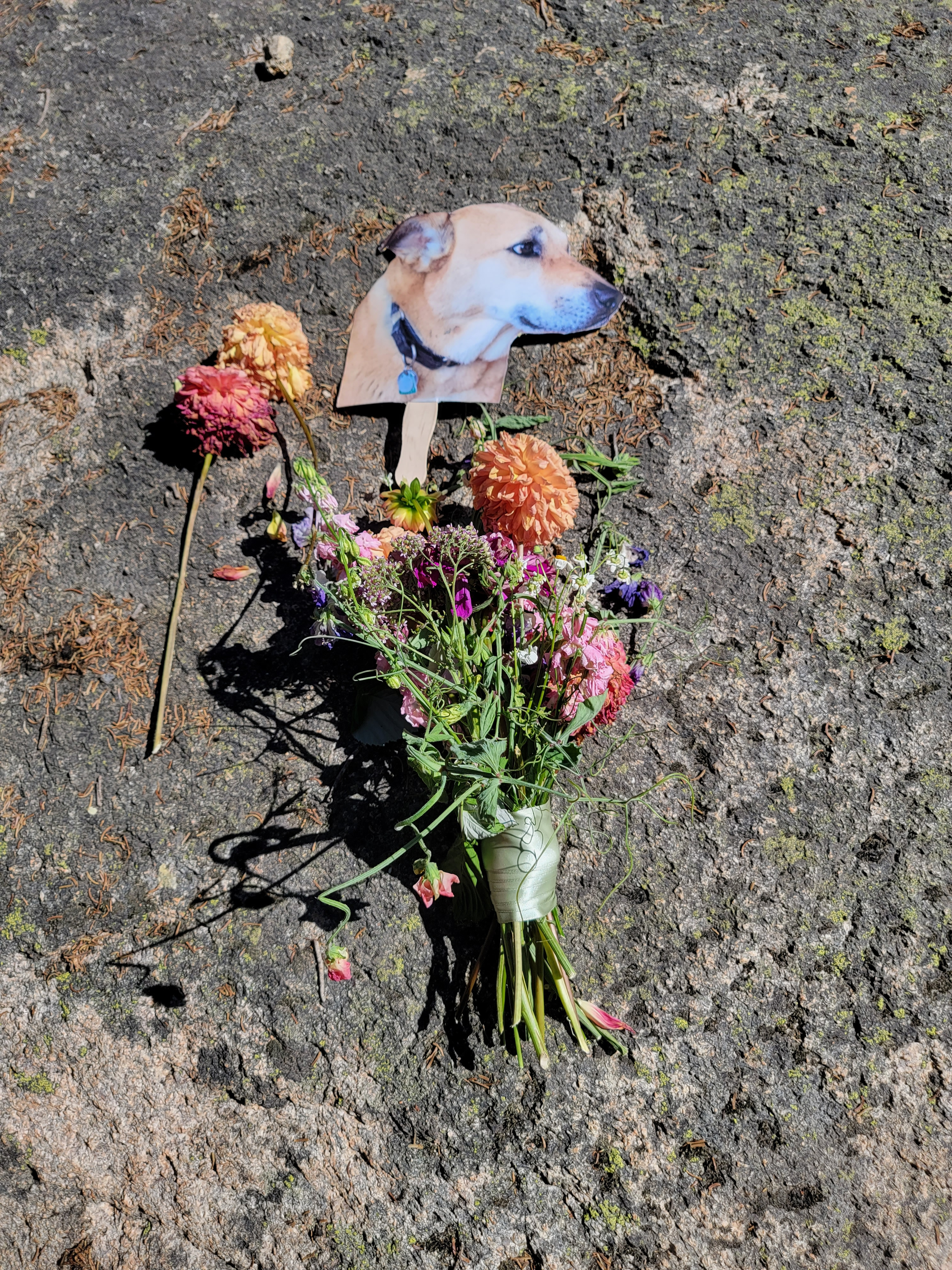 Memorial for hiker dog beside the trail
After cleaning up we drove away from the mountains about fifteen miles to the town of Winthrop. Compared to Mazama (population 158) Winthrop (population 340) is a big city. It's a picturesque town, with a Western-themed downtown that has old style wooden buildings and even wooden sidewalks. We spent about an hour checking it out. There was a bookstore where I bought a hiking map. There was a tshirt store where I bought a North Cascades cap. There was a general store where I bought some Diet Cokes and snacks for later. There were a few other shops where, amazingly, I didn't buy anything, but I did do my best to help support the local economy.
The most important place in Winthrop was Sheri's Sweet Shoppe. There was a small store where they sold all kinds of candies. But they also had a huge patio and an outdoor counter that served ice cream. That place was mobbed. We were lucky when we got there and only had one person ahead of us. While we were eating our waffle cones, the line grew. Even with multiple people working the counter, they couldn't keep up with all the people. Between this and the shop in Chelan, I've come to the conclusion that ice cream is the business to be in, at least when it's summer and hot outside. It certainly helped that Sheri's ice cream was very good.
By now it was really hot, at least a hundred degrees. There weren't many choices for dinner and it was so warm that we didn't really feel that hungry. We went back to the hotel and made a quick stop at the Mazama General Store to buy a large baguette, cheese, some more snacks and a bottle of wine. Then we munched while we watched the Brewer game on Sandy's iPad. They beat the Twins 7-6.
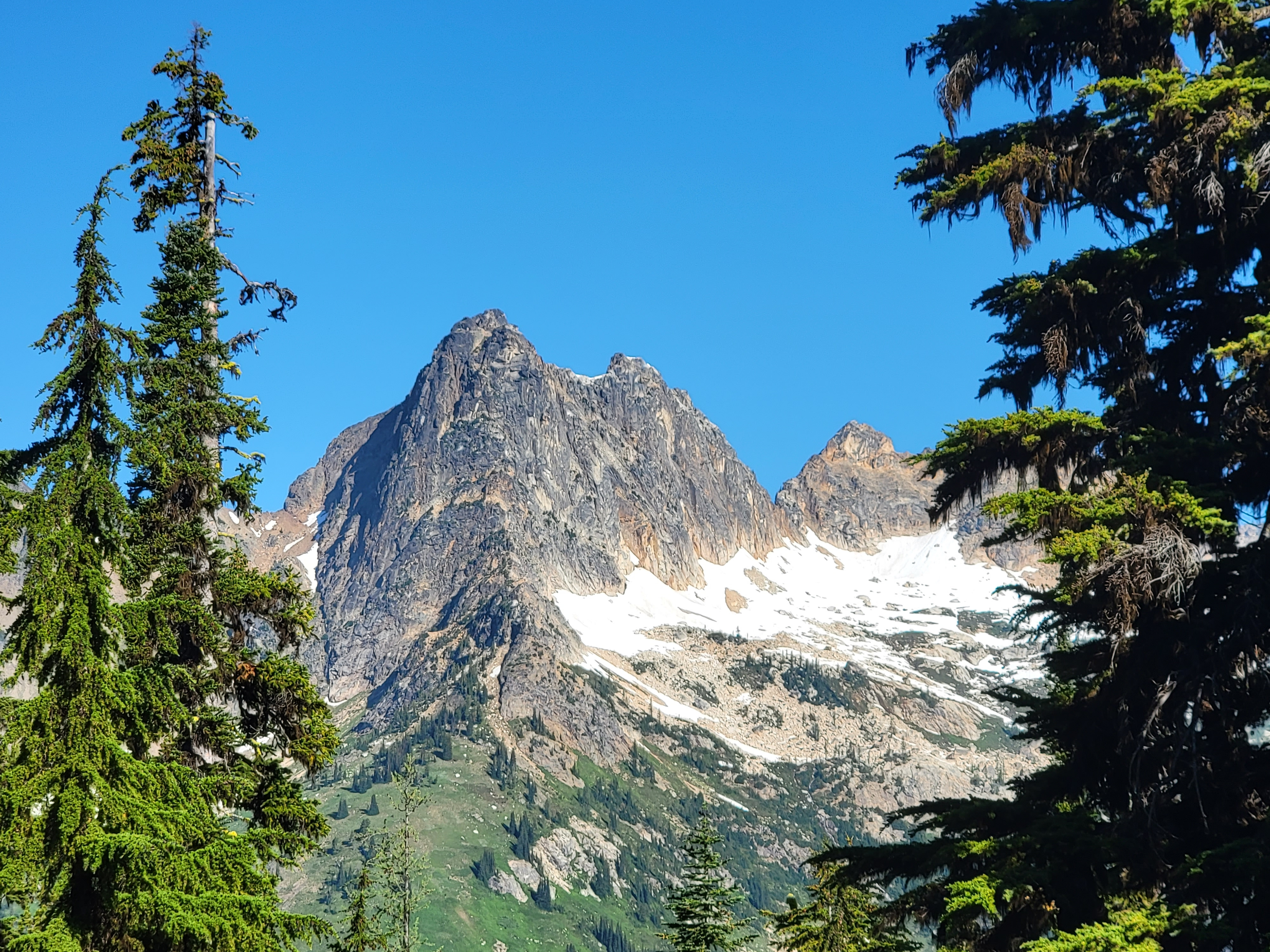
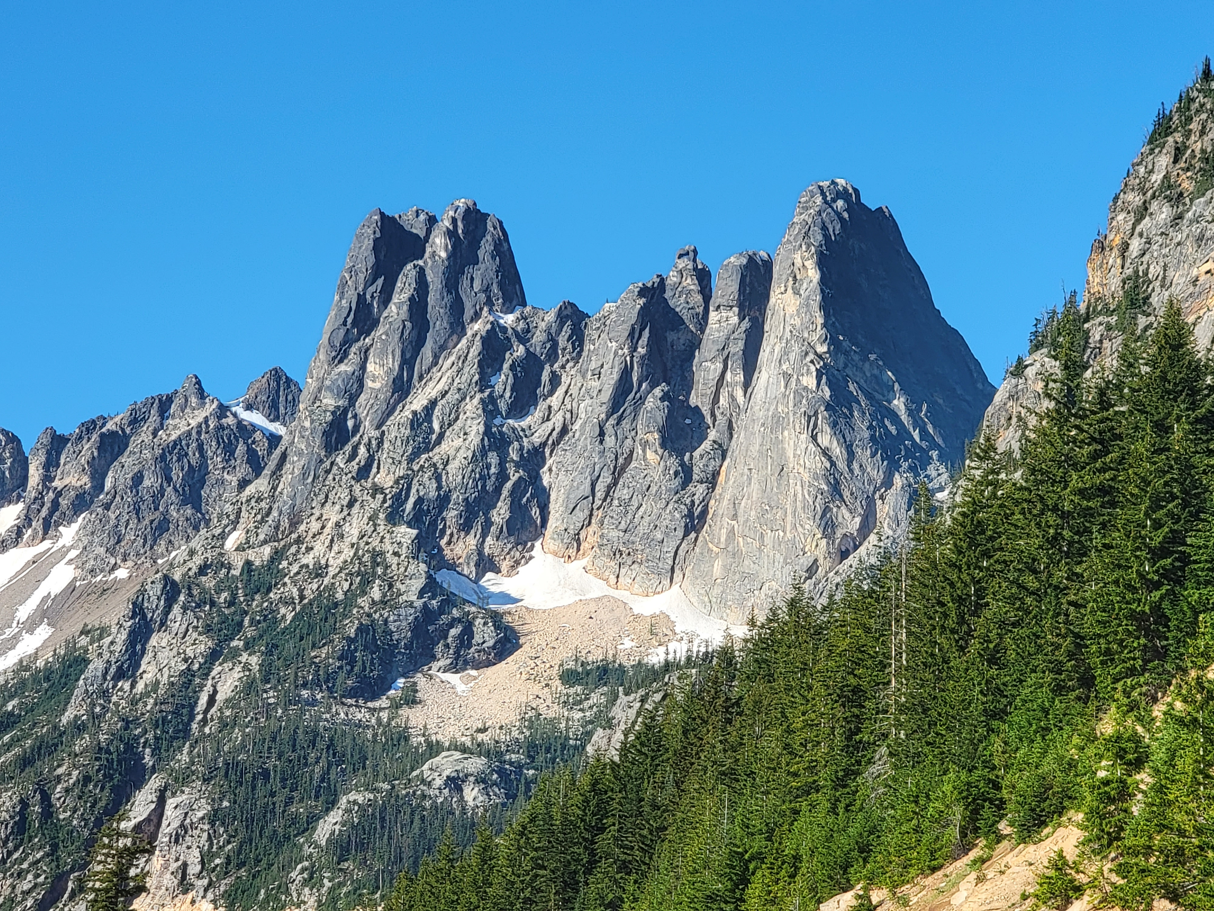 Early Winter Spire and Liberty Bell Mountain
The next day we decided to do the Blue Lake Trail. The forecast was for higher temps than the day before so we started even earlier. It helped that the trailhead was a little closer. It helped even more that this time I made sure that I knew where I was going.
We pretty much had the trail to ourselves that early in the morning. Most of the hike was in the forest (and therefore in the shade) and was very pleasant. Higher up and closer to the lake there were some openings in the trees, which gave us good views of Cutthroat Peak and Whistler Mountain, far across the valley on the other side of the highway. We had seen them the day before while hiking the Maple Pass Trail but it was from the opposite side. This was a completely different view and Cutthroat Peak looked especially impressive.
Blue Lake was very pretty, with huge cliffs providing a backdrop for the lake. We found some nice rocks to sit on and enjoy the view. There was another couple there and we chatted for a while. They were from Virginia and were on a grand tour of the west. Turns out that they had stopped in Boise just the week before. We stayed at the lake for quite a while because once again, inspite of online warnings about bugs, they weren't too bad.
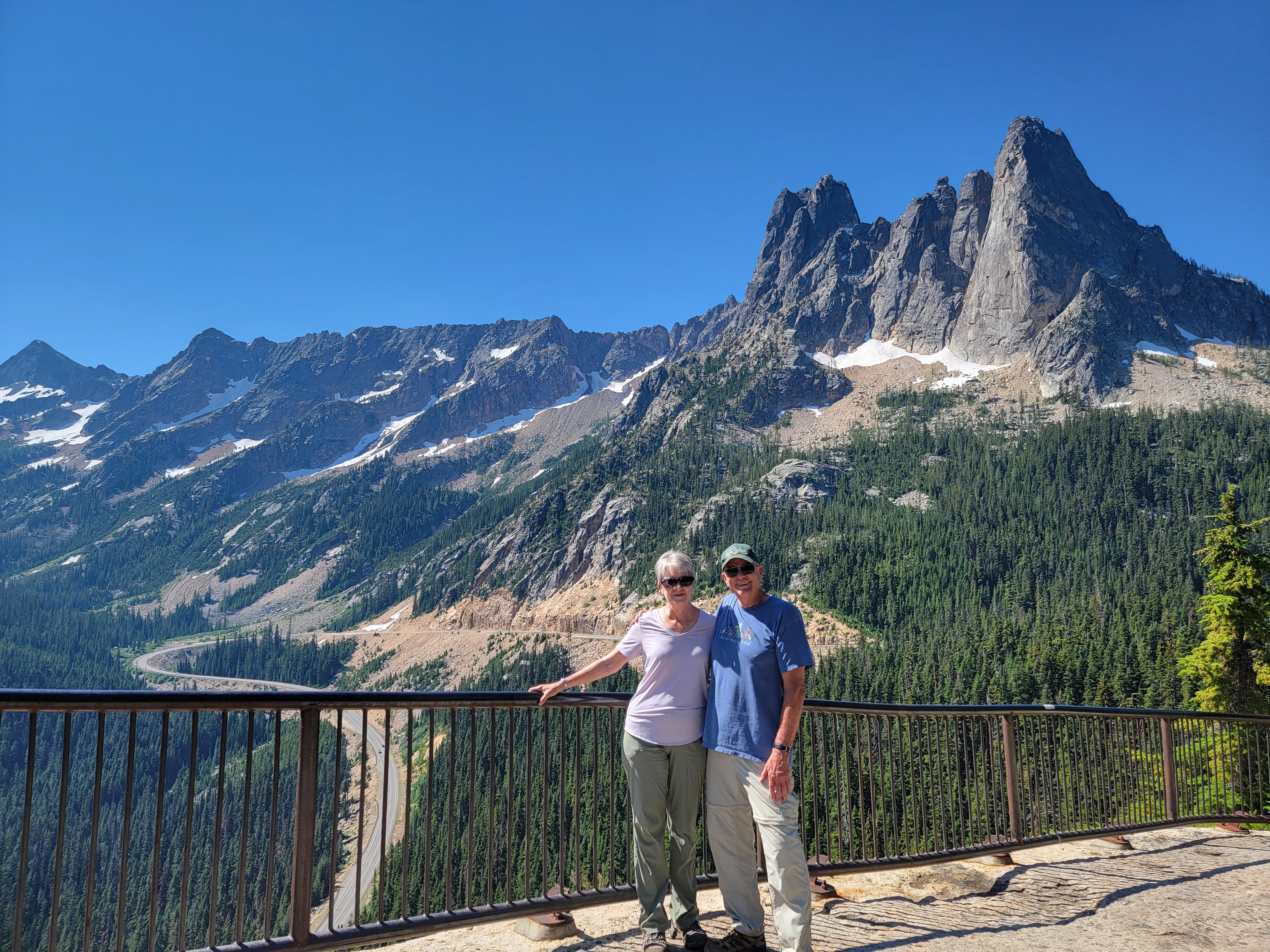 Sandy and Steve at the Washington Pass Overlook
On the way down we passed lots of people going up. I didn't envy them considering the heat they were going to be hiking in later in the day. We were finished before it got too hot and the lake wasn't crowded while we were there. It wouldn't be that way later on. Starting early was certainly a good idea.
After the hike we visited the Washington Pass Overlook. It's a three minute drive from the highway on a side rode and then a five minute walk from the parking area. The view was amazing, although somehow it's more enjoyable when you have to work harder to achieve it.
Someone had left a memorial to their dog beside the trail. It made me think of Laney. She was a tough little dog who never got tired, no matter how far we hiked. And it made me appreciate Abby, who is still always ready to go when I want to head into the mountains. It's sad when you lose a dog who is your hiking partner.
 Sharing a Cinamon Twisp in Twisp
After the hike we cleaned up and went back to Winthrop. We had lunch at the Methow Valley Ciderhouse. Since it was one of the few places in town serving food, it was pretty crowded. Afterwards we went to Lost River Winery. Unlike a lot of wineries, they didn't have any vinyards. They bought their grapes from various locations around the state to make their wine. We really liked their Rainshadow wine, a blend of Semillion and Sauvignon Blanc. We bought a couple of bottles to take home with us. After that we made another stop at Sheri's for more ice cream. By then it was mid afternoon and really hot. We went back to our hotel and drank one of the bottles of wine we had just picked up at Lost River while we watched the Brewers beat the Twins again, 10-4.
The next day we were due to go back to Chelan. We were going to visit some of the wineries around the lake and then stay overnight before heading home the next day. But as hot as it was, that didn't sound like much fun. We decided to forfeit our room and just go home a day early.
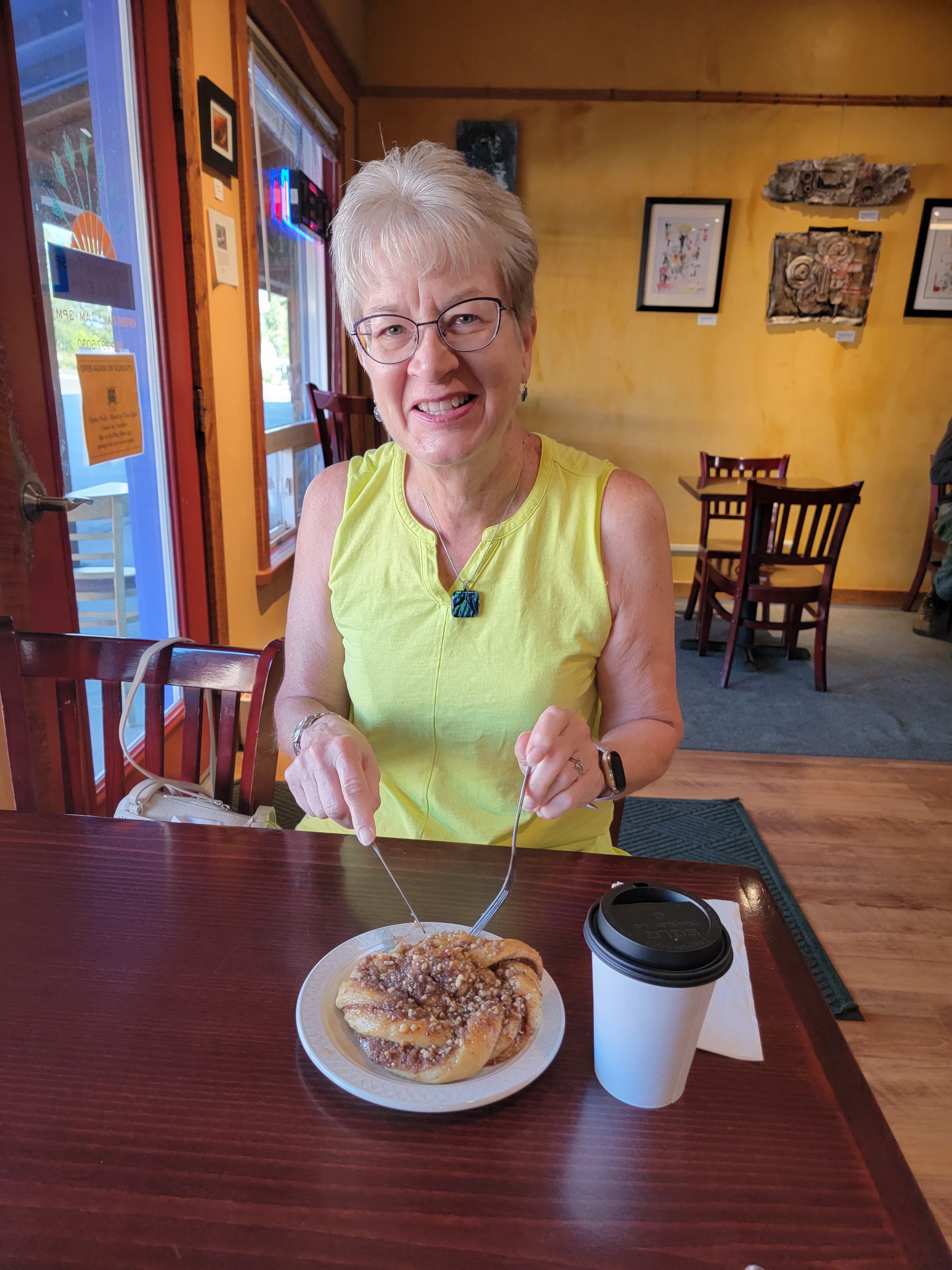
We got an early start again the next day. Heading out, we stopped at the Cinamon Twisp Bakery in Twisp for a breakfast treat. We tried their namesake Cinamon Twisp, which was really good. We also stopped on the way home in Prosser, Washington at one of our favorite wineries, Thurston-Wolfe. Their tasting room wasn't open on weekdays but their website said that you could call for pickups. Sandy did just that, and we were able to get a mixed case of PGV (Pinot Gris - Viognier blend) and Albarino.
We made it home about dinner time. Abby was really excited to see us.
