Moab In The Winter - Day 1
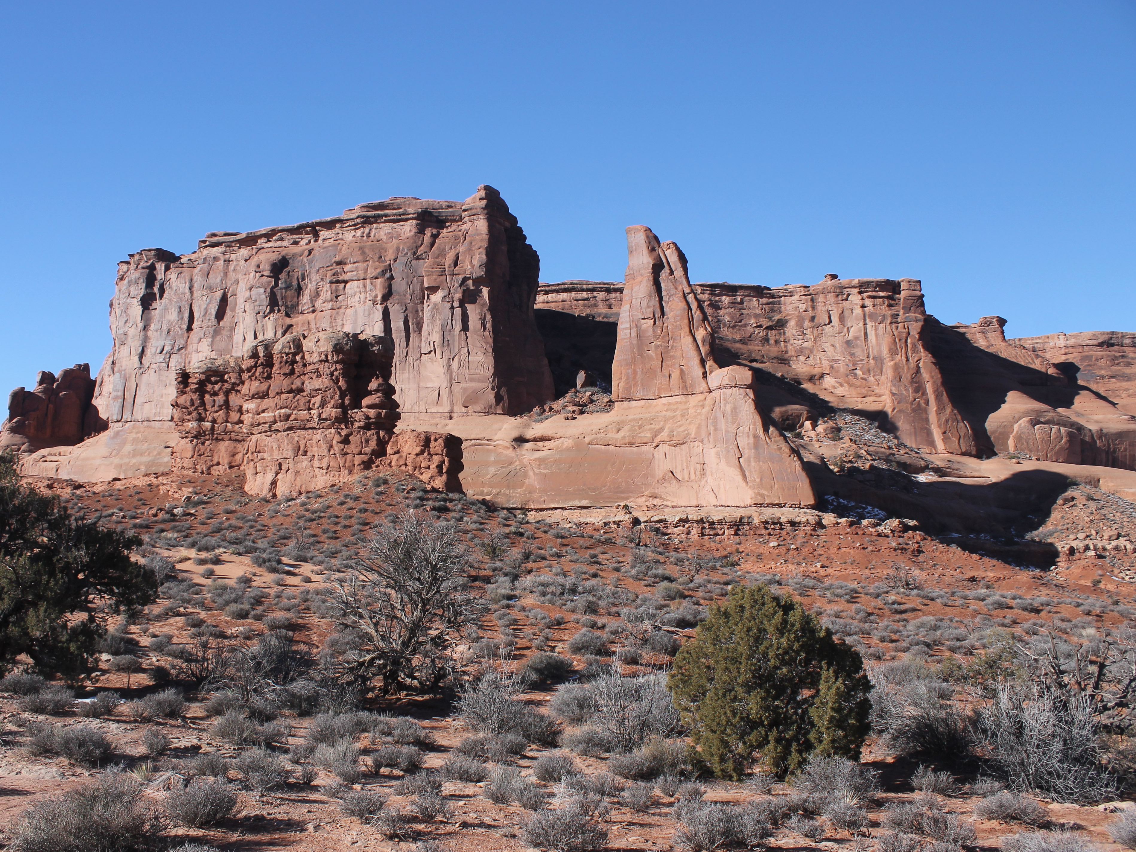
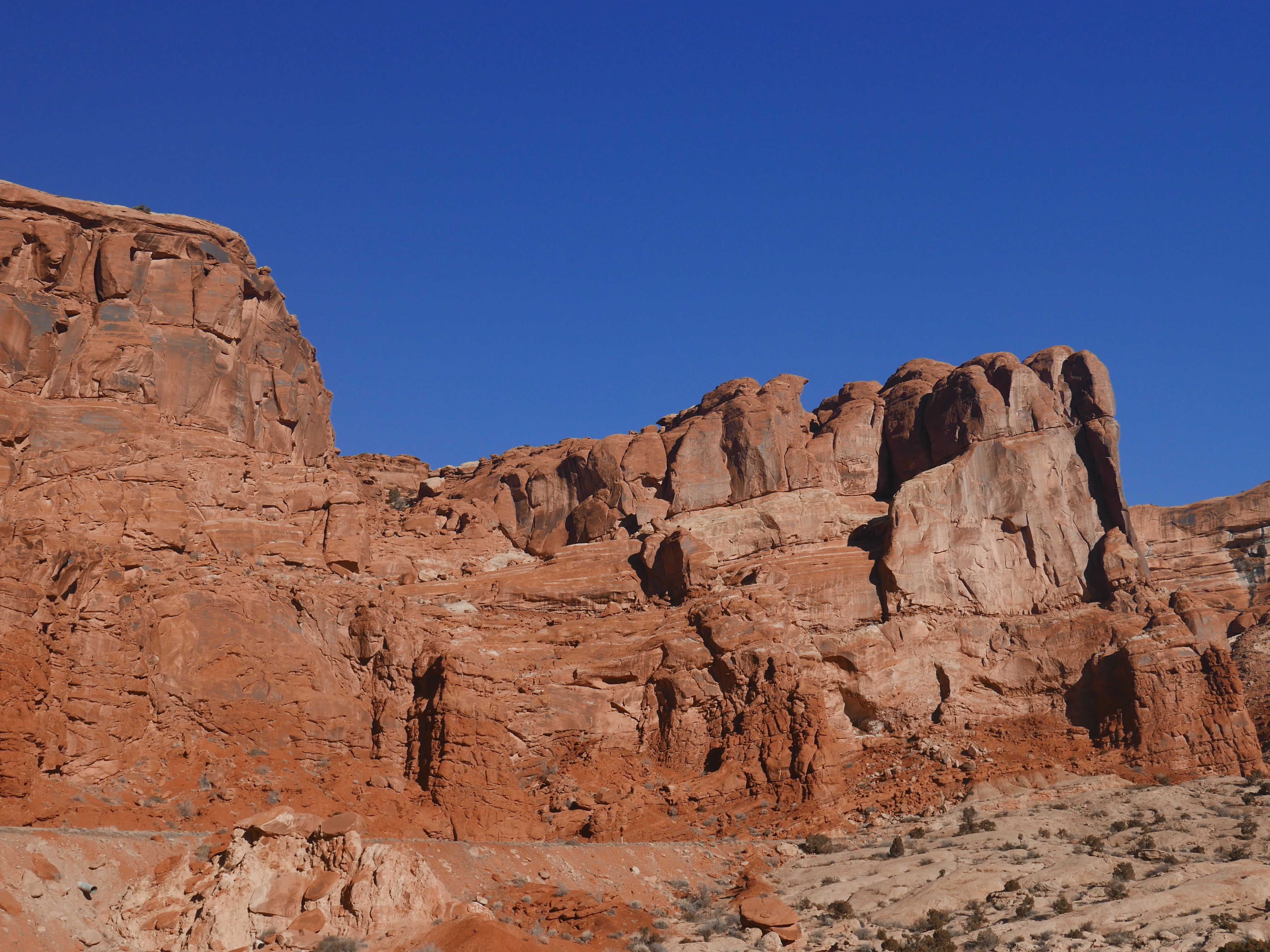 Cliffs rising behind the Arches National Park Visitor Center (L)
I haven't taken a hiking trip since the pandemic started. I've done a day hike here and there, but no real trips. I was anxious to get out. I had been working through the fall and winter to lose the weight I had gained during the pandemic. Our dive trip to Boniare in December was the initial incentive but after that I wanted to keep it up to get in better shape for hiking. Canyon country in Utah can provide good hiking even in the winter when the weather is right, so I kept a close eye on the forecast for Moab. In early February it looked like a window of good weather was opening up just before Sandy was taking a trip back to Wisconin. I talked to her about it and she was ok with me going. I made my reservations and headed to Moab for a couple of days of hiking.
I drove down on a Sunday. Traffic was light even through Salt Lake City, probably the only day of the week that will happen. With minimal stops I made it to Moab in eight and a half hours. I had reservations at the Inca Inn. It's slogan is "Budget done better" which I think is pretty accurate. It's my standard place to stay in Moab when I am traveling by myself. It's not fancy but it's clean and adequate as a place to crash between hikes. With offseason rates I was only paying $50 a night. Not bad for staying in Moab. Most of the year it costs three to five times that.
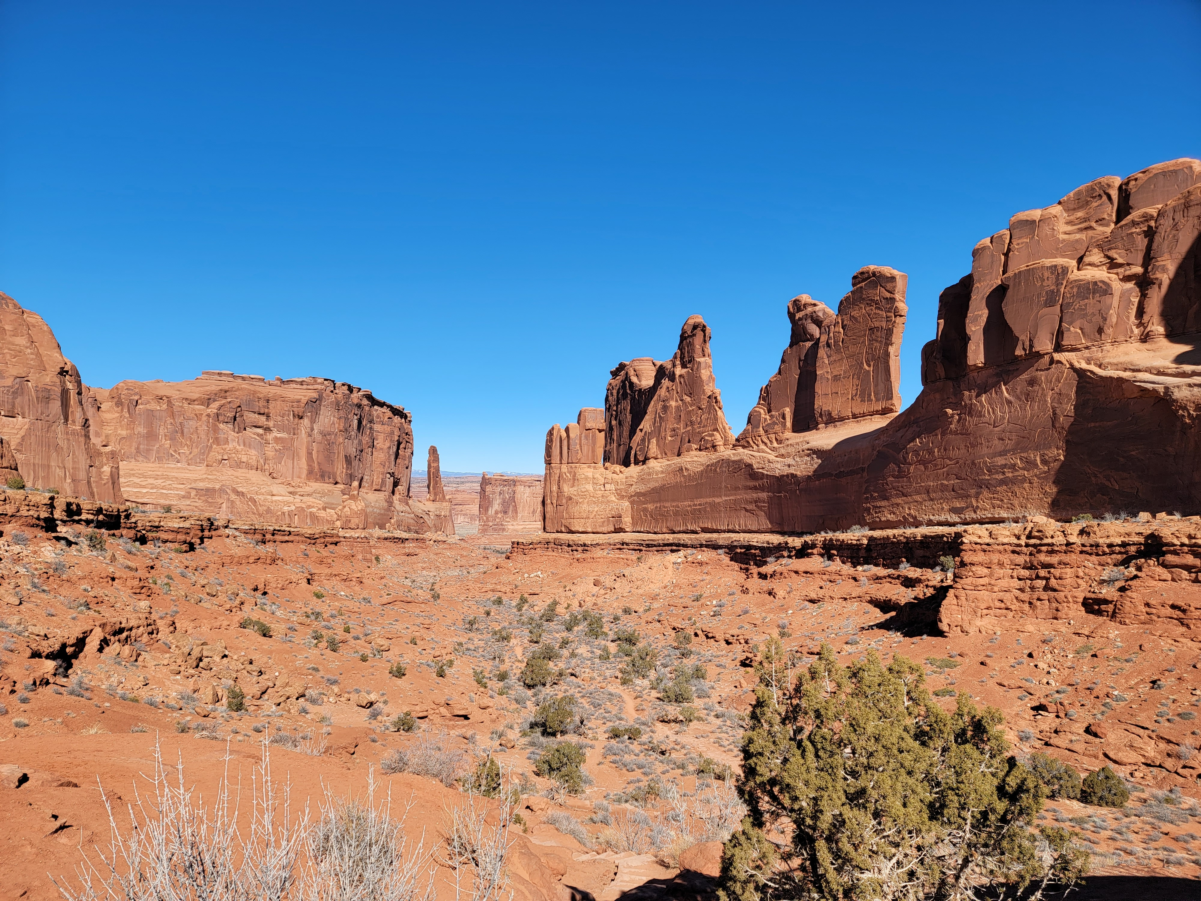
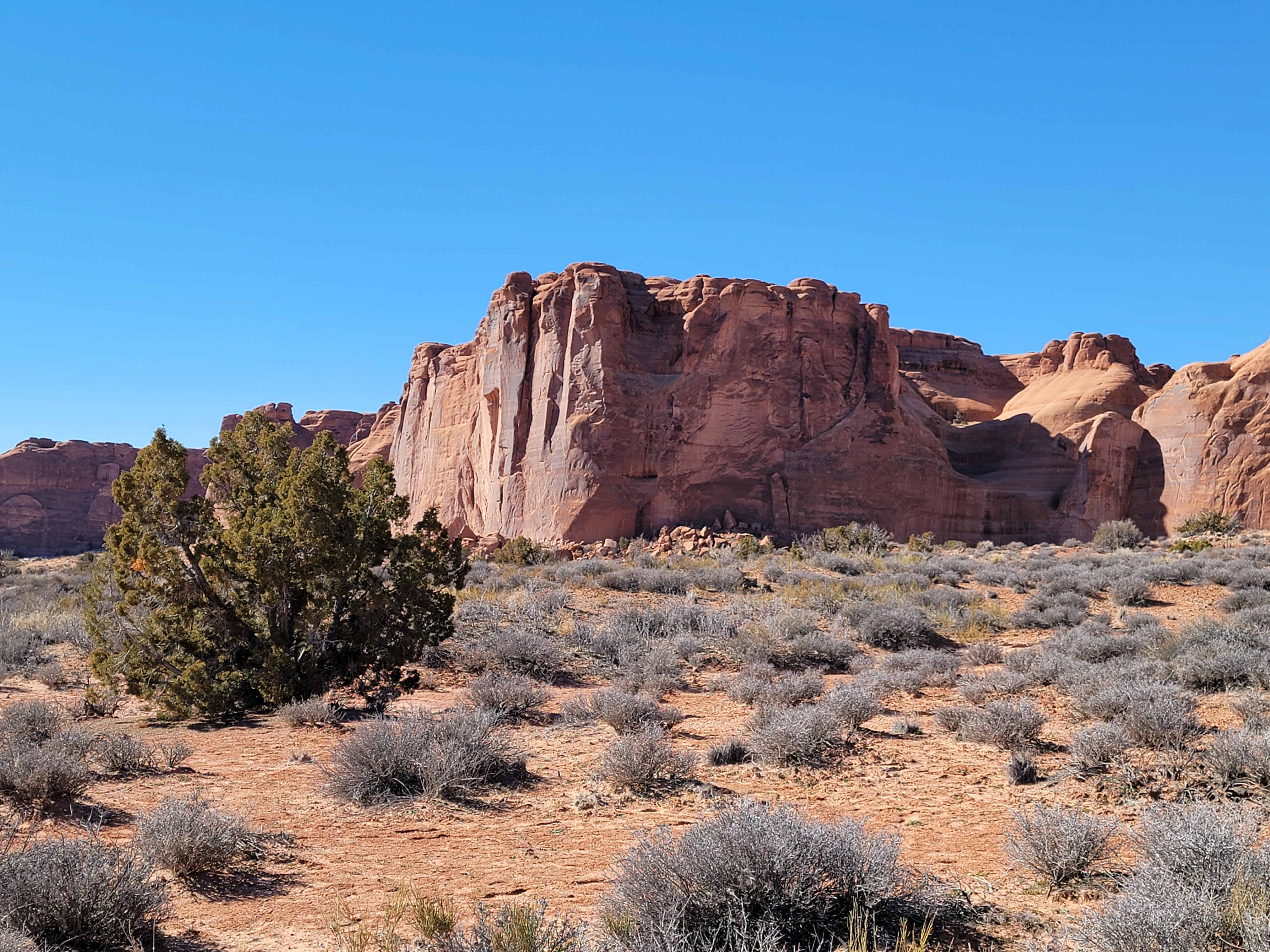 Early morning view towards the cliffs of Park Avenue (C)
After checking in at the hotel I made the short drive downtown. Most of the year Moab is a zoo. Now during the first week in February it was pretty dead. Every hotel had vacancy signs out. I checked out the tshirt shops but only about half of them were open. About half of the restaurants were closed for the season too, even Pizza Hut and Denny's. And here I thought that Denny's claim to fame was that it was always open. I guess you can't count on anything.
With our big trip to Fiji coming up in March I was being very cautious with regards to covid. The omicron surge had passed it's peak and numbers were declinging rapidly, but they were still higher than the previous fall. To play it safe I avoided eating out. My favorite restaurant in Moab is Pasta Jay's and I always eat there when I am in town. This time I settled for a takeout pizza that I ate in my hotel room. That was just fine though. It still tasted good.
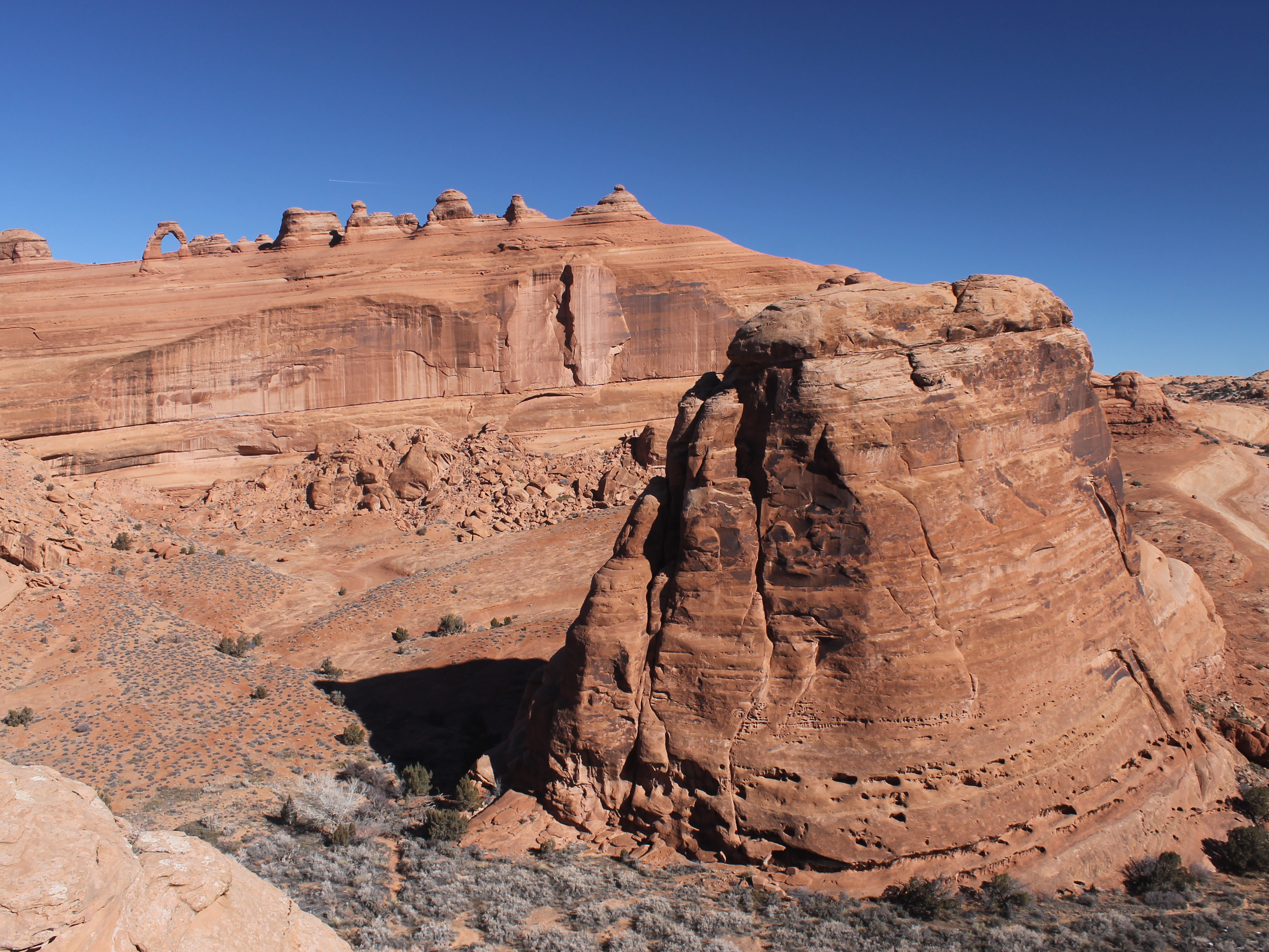 View from ridge beyond upper Delicate Arch viewpoint (C)
Next morning I was up and away around eight thirty. Later in the season it is important to get an early start, both to beat the heat and to beat the crowds. On this trip, with overnight temps below freezing, it was better to wait to let it warm up a bit before starting to hike. The afternoon highs would be in the mid forties. And at this time of year, crowds wouldn't be an issue.
One of my objectives for this trip was to evaluate all of my camera options. I had just got a new Galaxy S21 Ultra Plus smartphone a few weeks ago when we switched carriers. I was very happy with my old Galaxy S7 but after seven years it was probably time for a newer model. That's a long time for a smartphone. I suspected my new phone would be quite a bit better taking photos, but the engineer in me wanted to test it before I trusted it. I also have two older cameras, a Canon Rebel t3 DSLR and a Panasonic Lumix compact DSLR. I don't need three cameras. I certainly don't want to carry three when I am hiking. So on this trip I wanted to take some pictures of the same scenes with all three cameras and compare them to see which one(s) I wanted to use for future hikes and which one(s) I would retire. The scenery on hikes around Moab would be a good test.
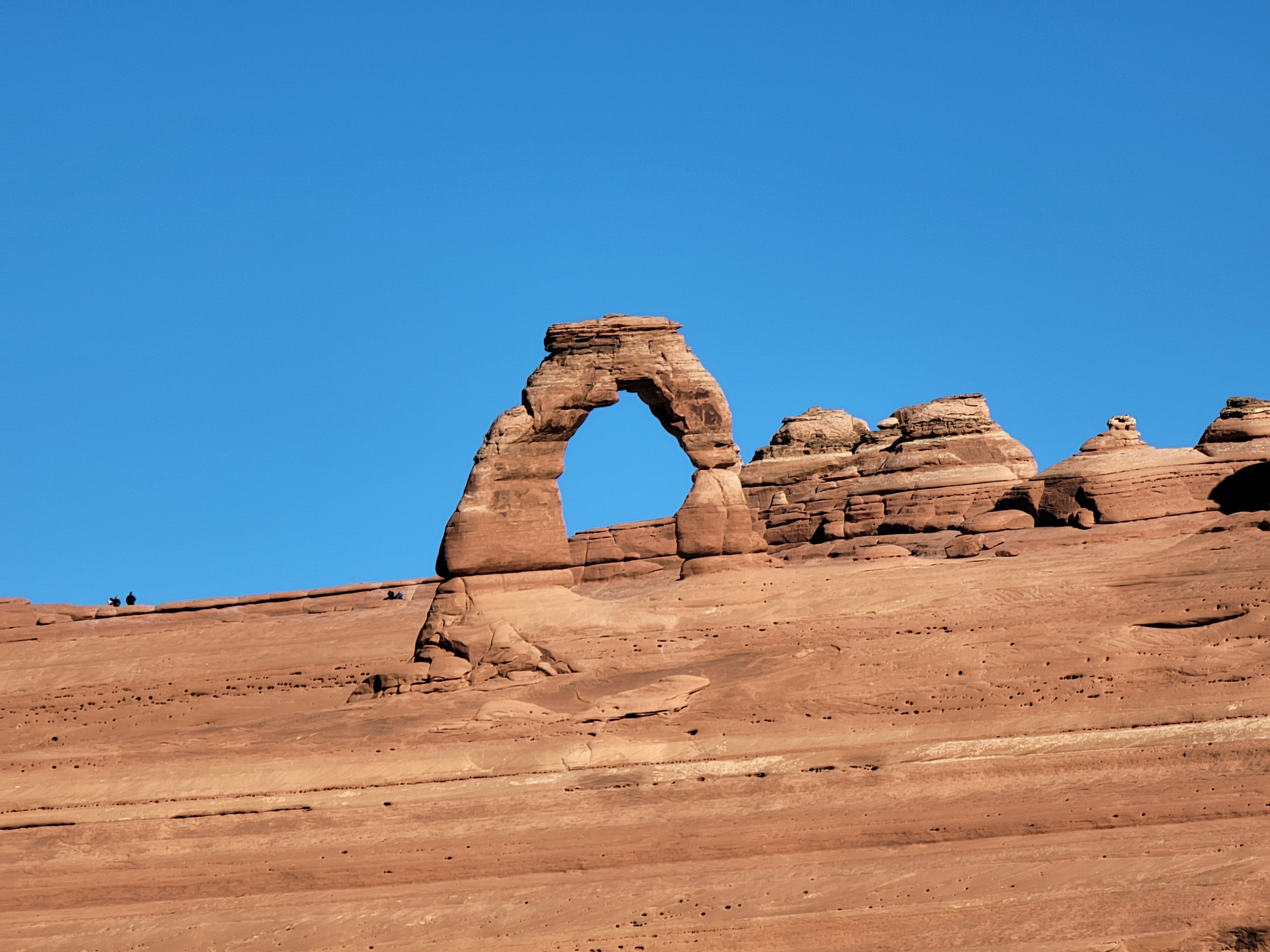 Maximum zoom view of Delicate Arch (G)
I started by going to Arches National Park. There are a number of impressive viewpoints on the initial drive into the park. It was a bright sunny day and the morning light was excellent. I stopped at a number of turnouts and dutifully pulled out each of my cameras. I took a number of pictures of the same scenes with each, varying the zoom and polarization on each shot. I've marked each of the photos in this post to indicate whether they were taken with my Galaxy S21 (G), Lumix (L) or Canon Rebel (C) so you can judge for yourself.
Another thing I wanted to do on this trip was try some different hikes. I've been to Moab a number of times over the years and have done the most popular hikes. I've hiked Devil's Garden and the Windows area. I've done Corona Arch three times and Delicate Arch so many times that I've lost count - at least half a dozen times. But I haven't done some of the shorter, easier hikes, so I decided to check out a few of them this morning. It would also give me a good chance to assess the hiking conditions. In Boise it had snowed about two weeks before and then stayed cold. There was still a lot of snow, and in some cases ice, in shaded spots. I wanted to see if the same was true of the hiking trails around Moab. There might be shaded, icy stretches of trail in a place called Canyonlands where I would be hiking, well, in canyons.
 Early morning view towards the cliffs of Park Avenue (C)
After stopping at a number of roadside viewpoints I drove to the Delicate Arch viewpoint. As many times as I have hiked to Delicate Arch, I had never been to "the viewpoint". It's about a mile down the road from the trailhead for the hike to the arch. The Lower Viewpoint is only a hundred feet from the parking lot. That made it easy to take all of my cameras and experiment some more with them. It's true that you could see Delicate Arch but it was a long way off. Next I went to the Upper Viewpoint, which is a short hike of about half a mile with two hundred feet of elevation gain. Getting closer was better, but when I reached the end of the trail there was an easy slickrock ridge that continued onward and upward. From the viewpoint, looking though Delicate Arch you could only see other rock formations behind it. By continuing up the ridge for another fiftenn minutes, I got a much better view. All that showed through the arch was sky. And it was a chance to hike on slickrock, which is always fun. Delicate Arch was still pretty far away so it gave me a chance to try out maximum zoom with all of my cameras.
 Looking down Park Avenue from near the trailhead (G)
When I started out it was quite cool. The temperature was around freezing but since it was sunny with no wind it was pretty comfortable for hiking. By the time I was back from the Delicate Arch viewpoint, it was warm enought that I took off my jacket and was fine in just a long-sleeve tshirt. When I started to drive back, I turned off the heat and even opened my window. It felt like a summer drive, except that here in the summer I'd drive with the windows up and the air conditioning blasting.
My next stop was at the Park Avenue Viewpoint near the entrance to the park. It's at the head of a valley between two sheer ridges so the wind was funneled between them and it was blowing pretty good there. I put my windbreaker back on but it was still quite pleasant for hiking. I took the trail through the valley to where it came out on the road again a mile away, then turned around and hiked back to the car. Out and back took me exactly an hour and I only saw four other people. It was a nice hike although the best views were actually from the viewpoint only a hundred feet from the upper trailhead.
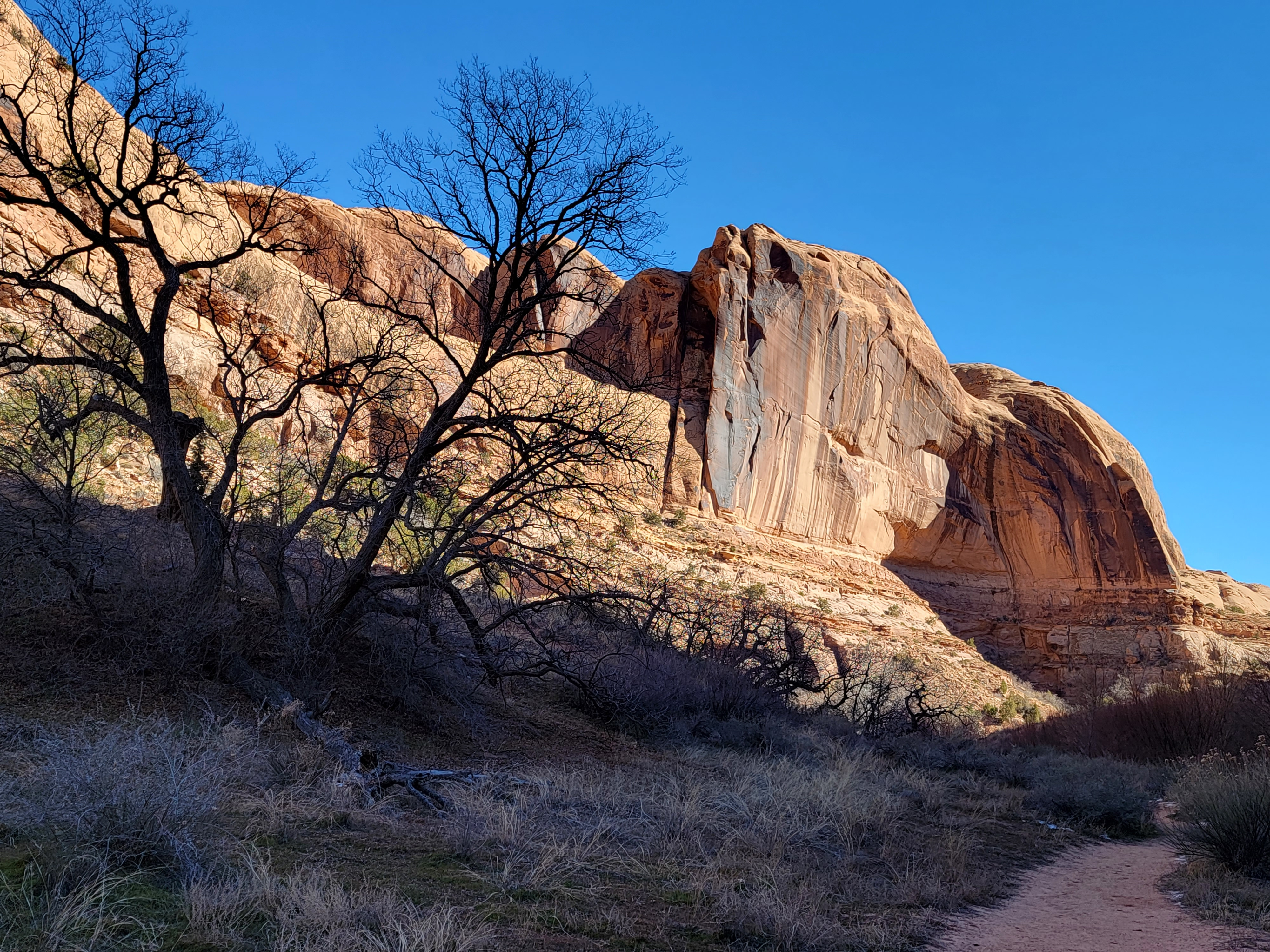 Hiking into Grandstaff Canyon (G)
By the time I was back to the car it was early afternoon. I figured that I had time for one more hike. The one I had in mind was Grandstaff Canyon, on BLM land south of the park. The trailhead is off Highway 191 which runs next to the Colorado River. It's named for William Grandstaff, a former slave who settled there in 1877. It was formerly known as Negro Bill Canyon and that's how it shows up on old maps and guidebooks. There is a hiker-only trail (no bikes or ATV's) through the canyon that follows (and frequently crosses) a year-round stream and eventually leads to Morning Glory Bridge.
Although it was a bright sunny day, from the trailhead I could see that the trail followed the bottom of the canyon and was in shadow even this late in the day. Unlike the open trails I had done earlier, snow or ice could be a problem on this hike. Just as I was locking the car and throwing my pack on my back, another hiker was finishing his hike. I asked him about conditions and he said only one short stretch of the trail was icy, very close to the trailhead. He said it was very short and not that difficult. If I was nervous, he said it was possible to climb around it but he had not. That was good enough for me and I started off.
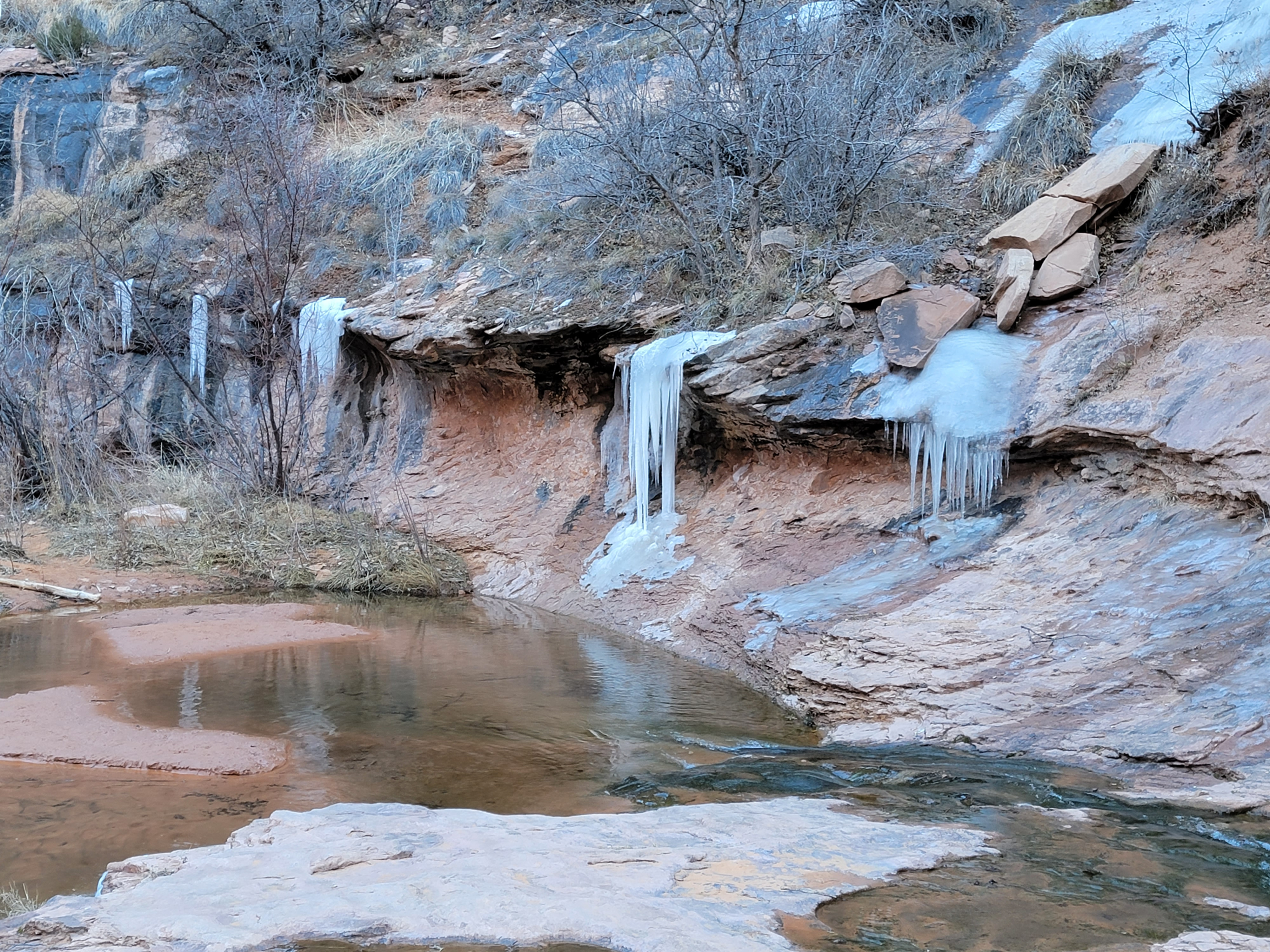 There was definitely still ice in the canyon (G)
Sure enough, within five minutes I reached a spot where the trail was covered in hard ice for about twenty feet. I played it safe and found a way to climb slightly above it and was past it no problem. The trail description mentioned that the trail crossed the creek a number of times, but when I reached a crossing there was good trail on both sides. No reason to cross back and forth as long I didn't have to. This was looking to be pretty easy.
That didn't last forever. Eventually I reached a place where I had to cross the stream. It wasn't that wide or that deep but it was tricky. Because it was at the bottom of the canyon in the shade, there was a lot of ice in and along the stream. Lunging or leaping from rock to rock was quite unnerving. I could never be sure if the rock was just wet or was covered with a thin layer of glare ice. Fortunately I made it across and could relax again, at least until I came to another crossing. And another. And another. I lost count of how many times I had to cross the stream. I did count carefully on the way back and there were nine separate stream crossings required. That was a lot of nervous energy!
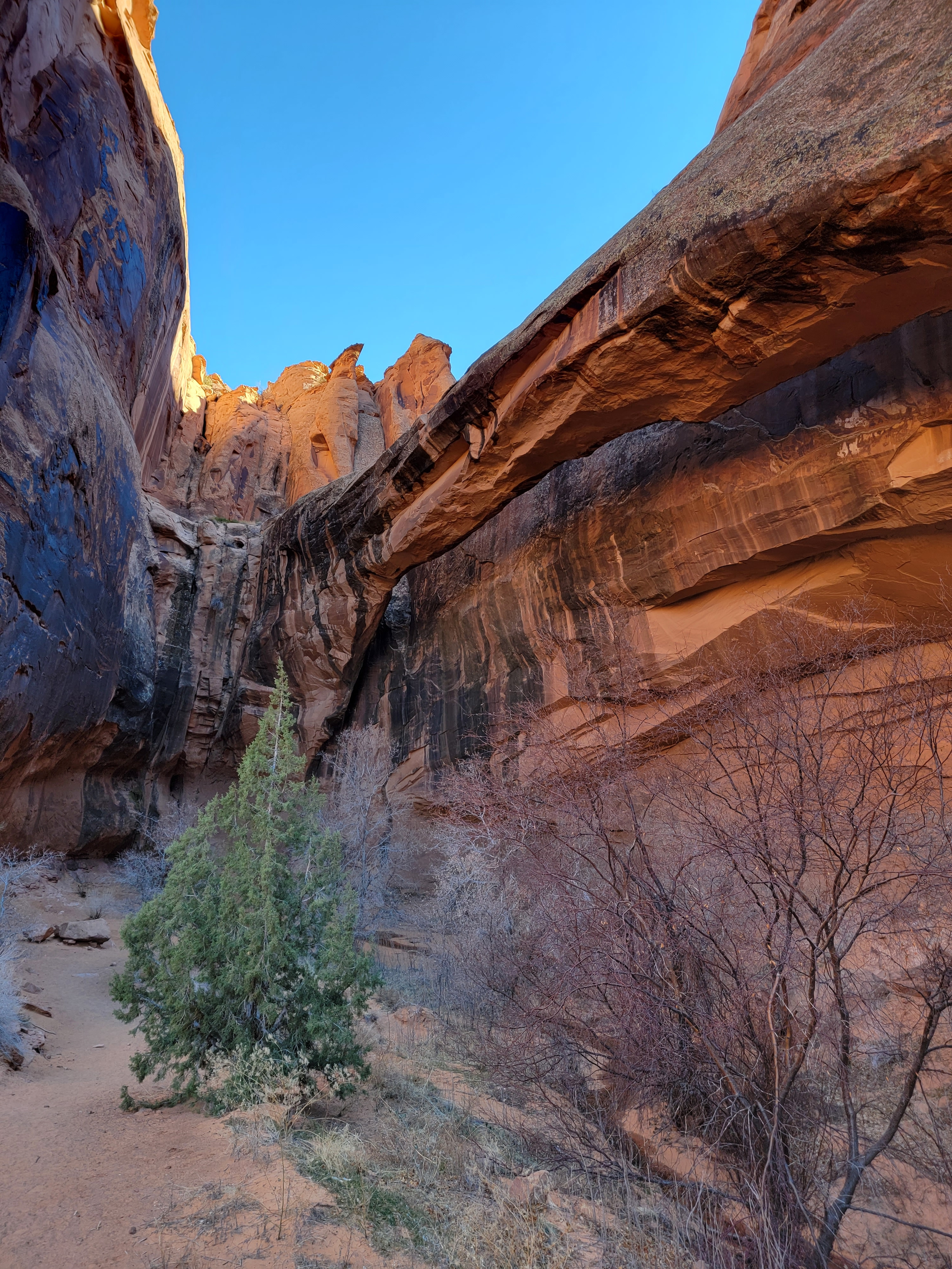 Morning Glory Natural Bridge (G)
The canyon was scenic and other than the stream crossings the trail was easy. A little less than two miles from the trailhead a spur trail led up a side canyon. In the side canyon I passed not one but two groups hiking with dogs. Don't tell Abby that she could have gone along or she will be very angry with me.
At the head of the side canyon was Morning Glory Bridge. At 245 feet it is the sixth largest natural bridge in America. It didn't look like much until I got close to it because it is separated from the cliff by only a few feet. From right below though it is very impressive indeed.
The hike back was a little easier. I trusted the stream crossings a little more the second time I did each of them. I was even bold enough to just walk right over the last icy section of the trail. Total for the hike was 4.65 miles and it took me three hours. Even with the ice it was a good time of year to do it as the trail is very busy most of the year. On this day I had it almost to myself.
By the time I was back to Moab it was dinner time. I stopped at the grocery store for some snacks and got a sandwich at Subway to take back to my room. I spent the evening looking at my pictures from the day, writing up notes for this post, and looking at trail descriptions for hikes I could do the next day. I had one more day to hike and the weather promised to be sunny and even warmer tomorrow.
