Anthony Lake Loop
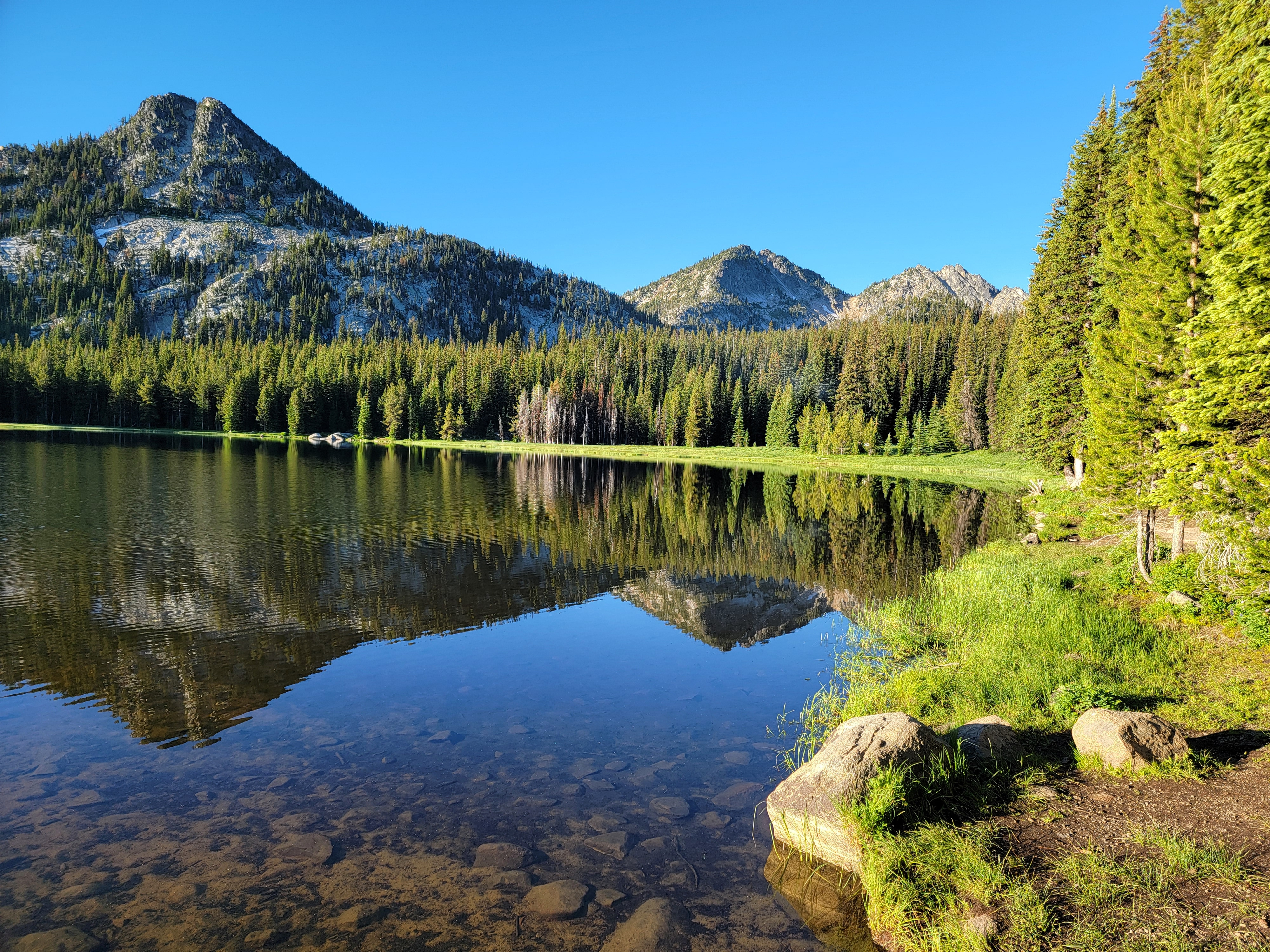 Gunsight Mtn, Lees Peak and Lake Lookout from Anthony Lake
I've passed by the Elkhorn Mountains countless times. Whenever I go anywhere in Oregon, Washington or British Columbia I drive by them on Interstate 84. The Elkhorns provide a dramatic backdrop to Baker City and every time I look at them I think to myself "I have to go hiking in those mountains some day". For some reason, I've never got around to it. Until today. I'd done my homework and picked out a hike, the Anthony Lake Loop. It started near the ski area of the same name so there was a paved road most of the way to the trailhead. (Don't ask me why there is a ski resort in the middle of nowhere so far from any sizable city.) I even managed to get to bed early for a change and woke up at 4:10 am. I resisted the urge to roll over and go back to sleep, and instead I climbed out of bed and got ready. I had packed the night before so I was pulling out of my driveway at 4:35 am. Even with stops to fill up with gas and to take pictures when I arrived at Anthony Lake, I was at the trailhead at 7:45 am.
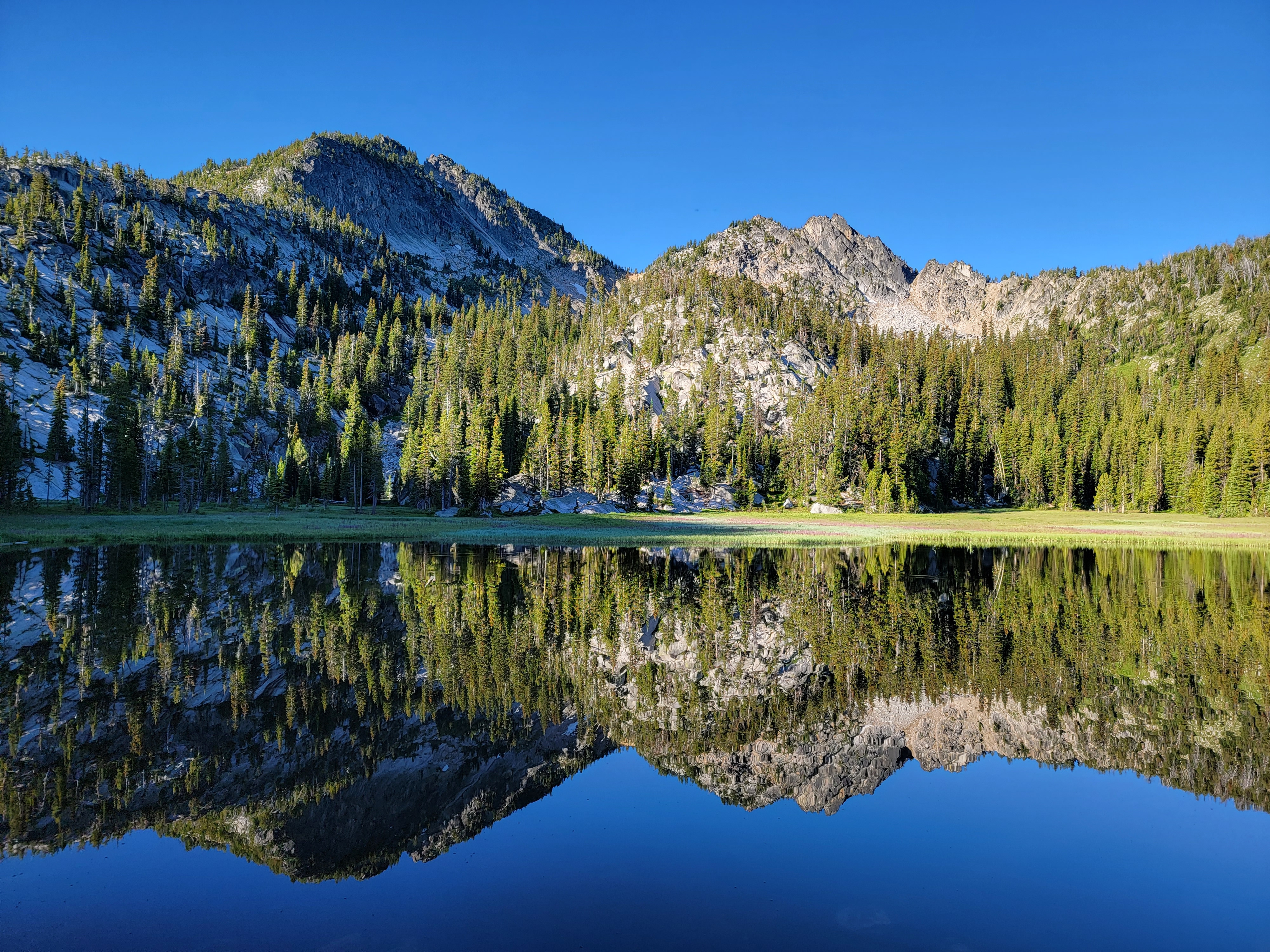 Lees Peak(L) and Lake Lookout(R) from Hoffler Lake
It was a beautiful morning. The sky was a bright blue without a single cloud. The lake was an idyllic spot, with the mountains reflected in the perfectly still water. The lake was at 7143 feet so the temperature was a bit cool, but without a breath of wind it was still very pleasant. I decided that just a long sleeve shirt was enough since it would undoubtably get quite warm later in the day. I left my jacket in the car so I had a light pack. I had picked a great day to be in the mountains.
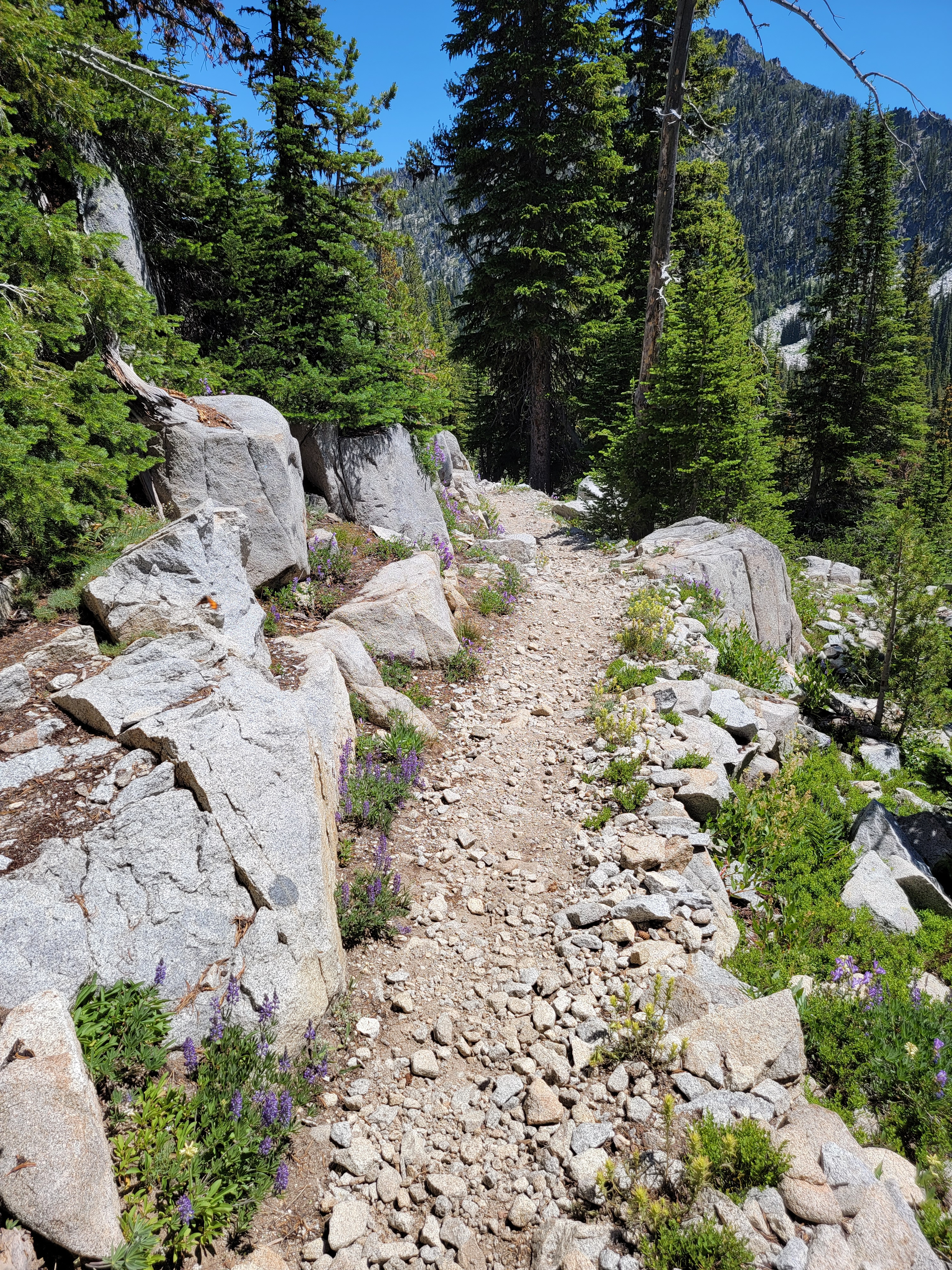
I started out on the trail around Anthony Lake. There was a USFS walk-in campground with sites dispersed in the woods all around the lake. It was a pretty location but there were hardly any people. I only passed one spot that had a tent. After an easy quarter mile, I turned onto the Hoffler Lake Trail and started uphill. The trail followed the outlet stream that descended from the lake. It was only a half mile and a little under 400 feet of elevation gain so it didn't take me long to reach Hoffler Lake, where I took a short spur trail right to the shoreline.
 Lake Lookout - I'm on my way to the top of that
The view at Hoffler Lake was even more spectacular than at Anthony Lake. The mountains were closer and their reflection was like a mirror image in the perfectly calm waters of the lake. There was a down side to such a still morning though. There were a LOT of mosquitoes at the lake. A pretty, bright green meadow at the south end of the lake was probably the cause. It looked like a perfect, swampy mosquito breeding ground. With absolutely no breeze, I could see a cloud of them hovering over the surface of the water. Fortunately they were slow and I had maybe a whole minute to snap pictures before they realized I was there and came for me. Then I had to hurry up the trail and make my escape. Away from the lake there were very few and as long as I was moving they didn't bother me. After I had gone a few hundred yards though, I did stop and spray Off liberally on my head and arms. It seemed to work well to discourage them. I barely noticed any for the rest of the hike and I finished the day without getting a single bite. Later in the day when it warmed up and the flies were out they didn't bother me much either.
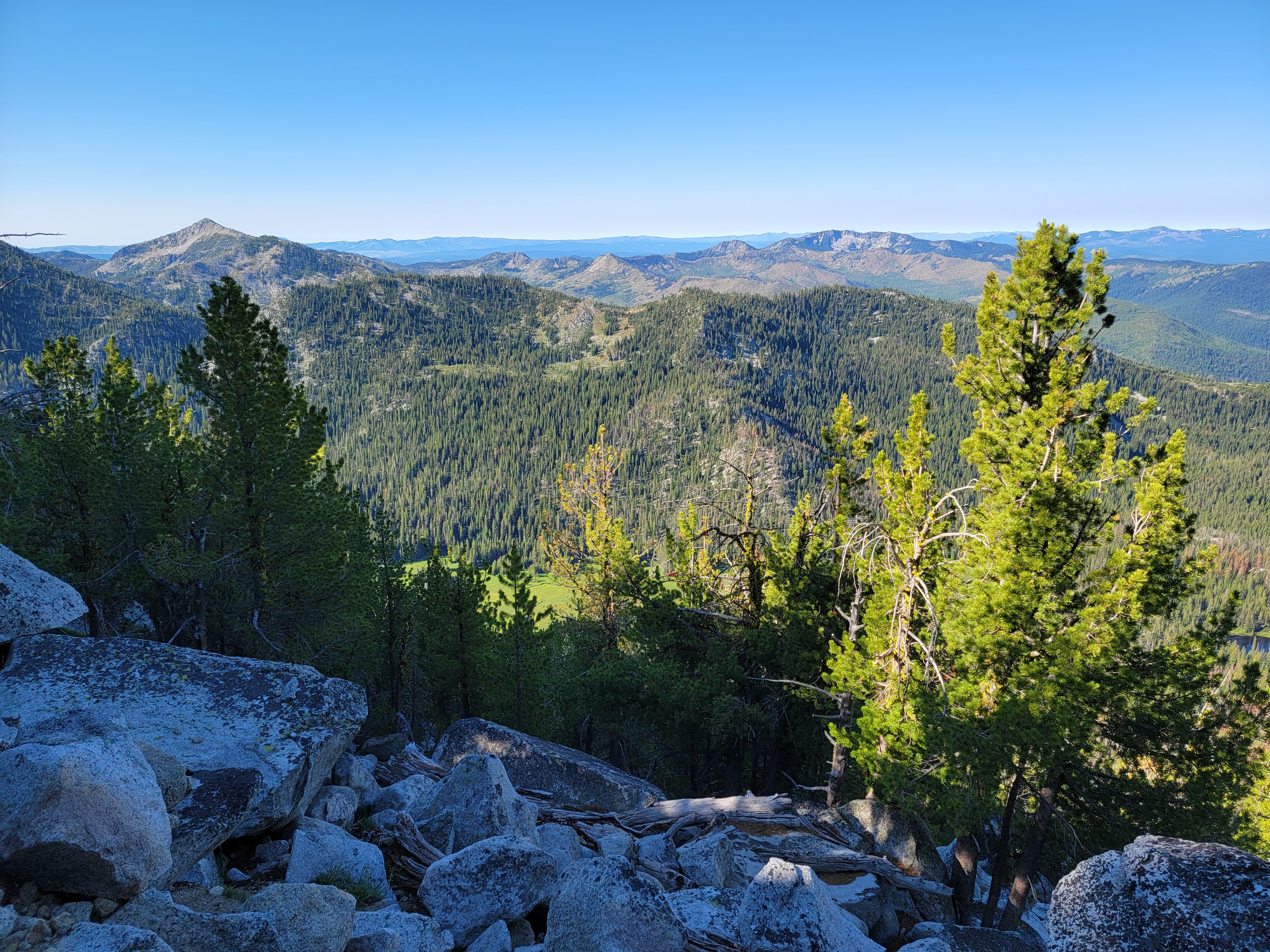 Elkhorn crest leading to Rock Creek Butte in the distance
After leaving the lake the trail climbed through the forest for a while before joining a service road coming up from the ski area. There was no signage so I noted carefully where the trail was in case I came back this way instead of doing the full loop. The road switchbacked upward through a more open area, eventually coming out on a ridge top which gave wide views of the Wallawas to the north and waves of wooded mountains extending off into the distance to the south. It looked exactly like you expect the Oregon Cascades to look, except that it was missing the giant volcano rising on the horizon that you always have in the Cascades. No Mt. Hood. No Mt. Jefferson. No Three Sisters. No Mt. McLaughlin. The road continued uphill but the grade was mild, the temperature was pleasant and it was wonderful hiking with expansive views to both sides. Then at two miles from the trailhead and after 700 feet of elevation gain, I reached a junction and had to make a decision.
 Anthony Lake Loop hike
The main trail (actually still a dirt road at this point) continued to contour along the slope to the east. I was now on the back side of the group of peaks that rose above Anthony Lake. The trail circled all the way around them before crossing back over the crest at Angell Pass and returning to the trailhead. The total loop was eight and a half miles with 1500 feet of elevation gain. It looked like it would be a good introduction for my first hike in the area. It would be a healthy workout but not too difficult.
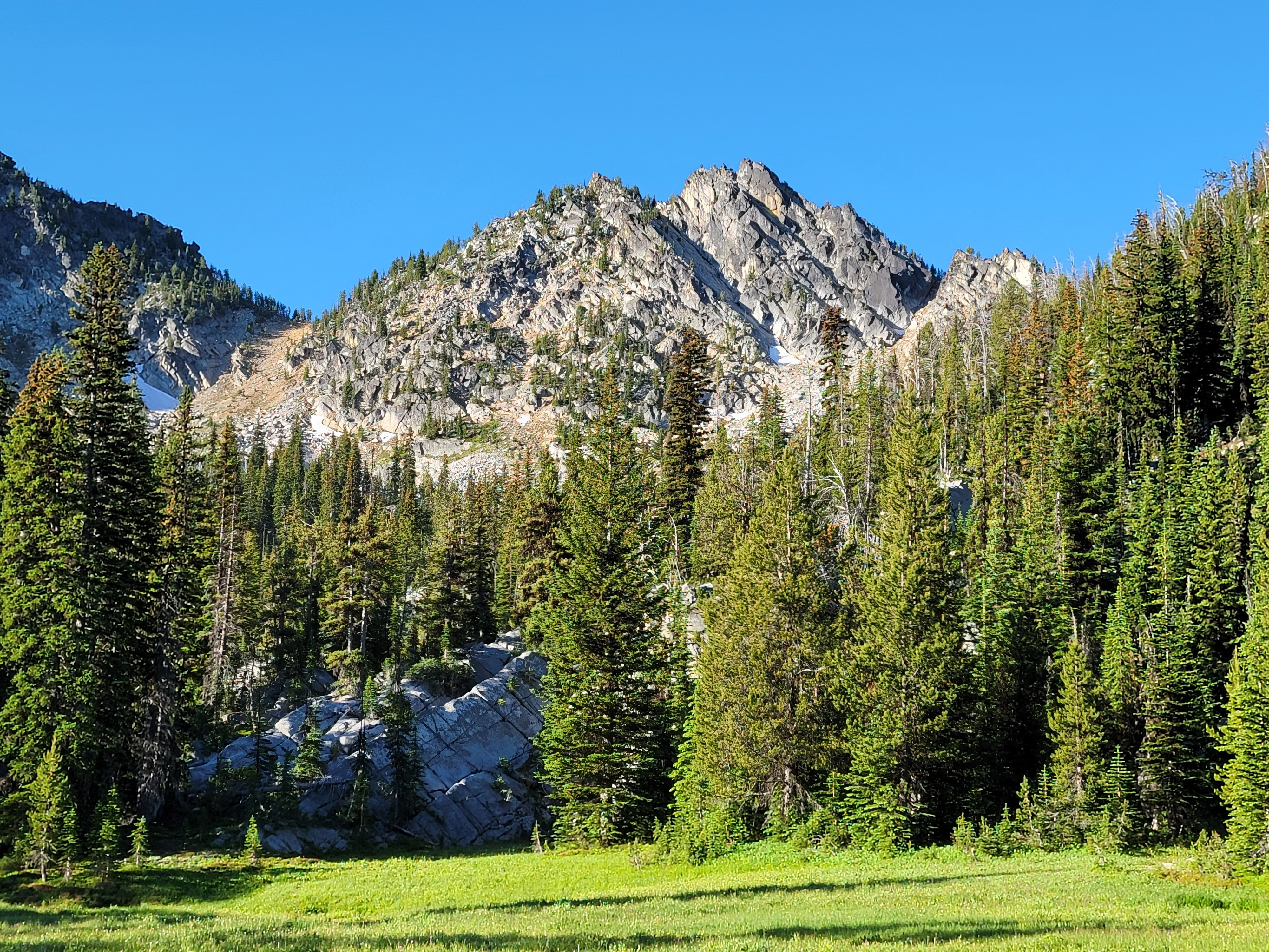
The other option was a spur trail that was signed "THE LAKES OBSERVATION PT 1". It led up a steep peak that had an impressive looking rocky summit block. The info I had on the trail was incomplete. It didn't say if the trail led to the actual summit (which looked steep, rocky and hard) or just up to a viewpoint high on the mountain. I admit to being a shameless peak bagger, so a chance for a summit was very appealing. That would likely mean that coming down I would just head back the way that I had come - a much shorter and more limited hike. Doing both the summit and the loop seemed aggressive since I had experienced trouble with my knee on the few hikes I had done so far this season. I have to admit I'm getting old. Not that long ago I would have done both without even thinking about it. At least I was still feeling feisty enough that I decided to go for the lookout instead of "just an ordinary hike" like the loop trail. Even if the trail didn't make it to the summit, it certainly had to lead to a good viewpoint.
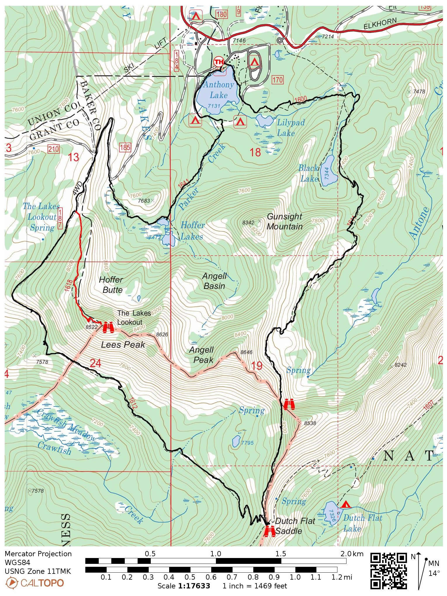
 Nearing the top - the pole marks the summit
The trail to the lookout was steep, climbing 700 feet in .8 mile (according to the GPS on my phone). The last hundred feet the mountain narrowed considerably and there were cliff bands on several sides with mild exposure. Now the view had opened up to the east along the crest of the range. I could see Rock Creek Butte (9106 feet), the highest mountain in the Elkhorns, and Elkhorn Peak (8931 feet), the second highest. They are the impressive mountains that provide the backdrop to Baker City when driving by on the interstate. As I was admiring the view I heard a loud crash nearby. I turned and saw a large mountain goat about twenty feet away, scrambling across a steep face and sending rocks tumbling down the mountain. In a few seconds he was gone. I've seen mountain goats before but never one so close, especially one so large. Apparently not many people go up to the lookout and disturb the local residents.
The trail continued, eventually vanishing at the base of steep rocks which led the last fifty feet to the summit. There was a metal cable extending down and at first I thought that maybe it was a poor man's via ferrata. But I looked around and to the side there was an easy scramble which didn't have too much exposure. The last fifteen feet was a pile of large blocks with a big pole standing on the summit. I managed to scramble up the last bit to the very top, where there was a bit of a depression where I could sit down. I had reached the top so I was pretty happy because the mountain had looked impossible from below. I climbed back down about fifteen feet to where there was a larger flat area where I could sit comfortably. I had some water and ate half my candy bar while I relaxed and enjoyed the view.
 Lots of lupine blooming everywhere
Coming down I was feeling pleased with myself for having done an impressive looking summit. I also felt pretty good physically and began thinking that maybe I should do the whole loop instead of just heading straight back to the car. It would only be six and a half more miles instead of just two, and since I was already high on the massif, how much more elevation gain could there be? (Quite a lot, it turned out.) So when I got back to the junction, I turned and continued along the loop instead of heading back. After all, it was still early, I had the whole day and the weather was perfect.
Soon after leaving the junction the dirt road turned into a trail. I had reached the boundary of the North Fork John Day Wilderness. At 110,000 acres, it's not very big for a legally protected Wilderness Area, and since it has four separate units spread across two different National Forests, each area is quite small. Still, I had never hiked in it before so it was fun to check off another name on the list of Wilderness Areas where I have gone hiking.
 Van Patten Butte from near Angell Pass
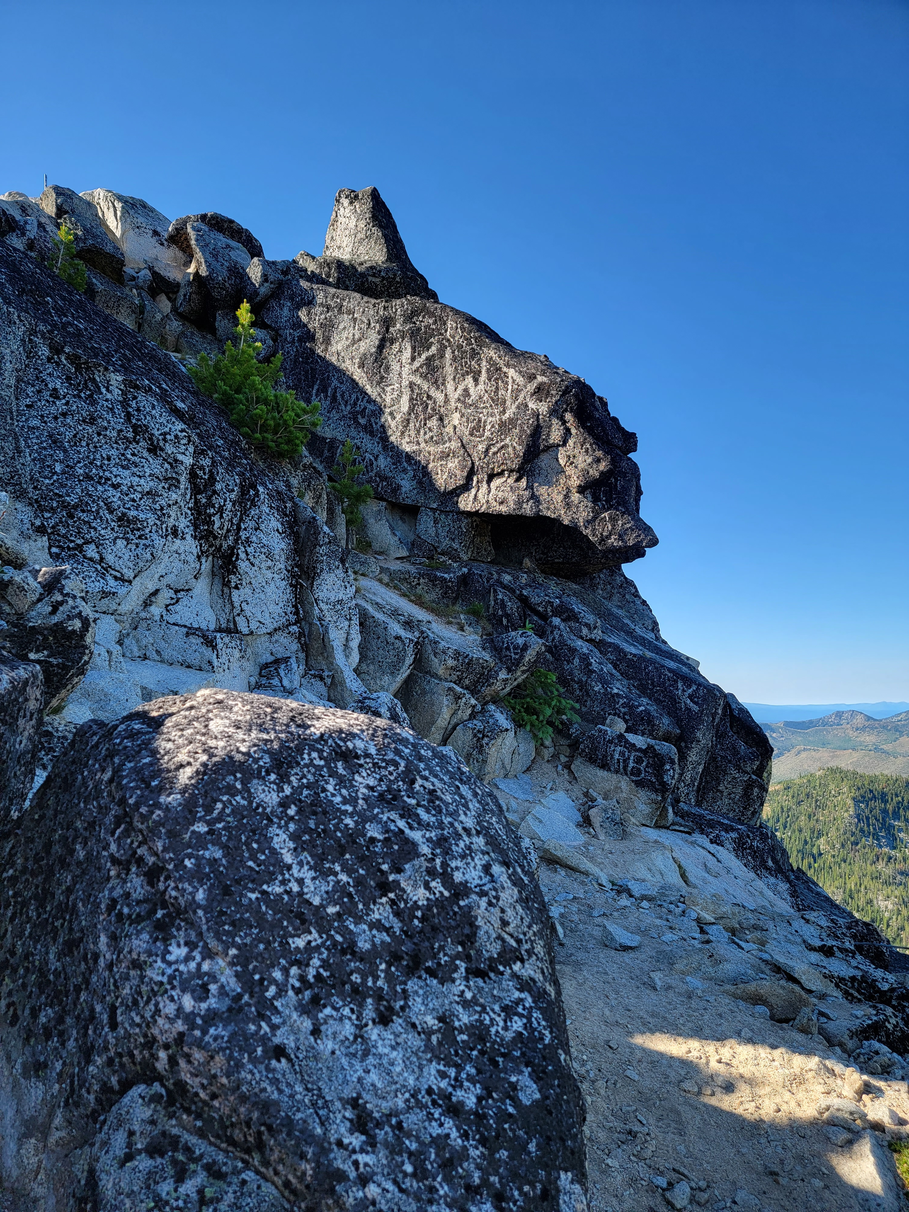
The next two and a half miles contoured along the back side of Lake Lookout, Lees Mountain and Angell Peak, mountains that I had admired from Anthony Lake when I started out in the morning. The trail did lose some elevation and then climb back up, and there were some local ups and downs, but mostly it was pretty easy. The trail went through broken forest so I had some good views off to the north. I passed through sunny areas that had lots of wildflowers: Indian paintbrush, lupine, columbine, penstemmon, purple aster and lots more that I couldn't identify. (Sandy is the flower expert in the family.) It was very pretty hiking. The shady stretches under the trees were welcome too - a chance to get out of the sun and keep cool as the day was warming up.
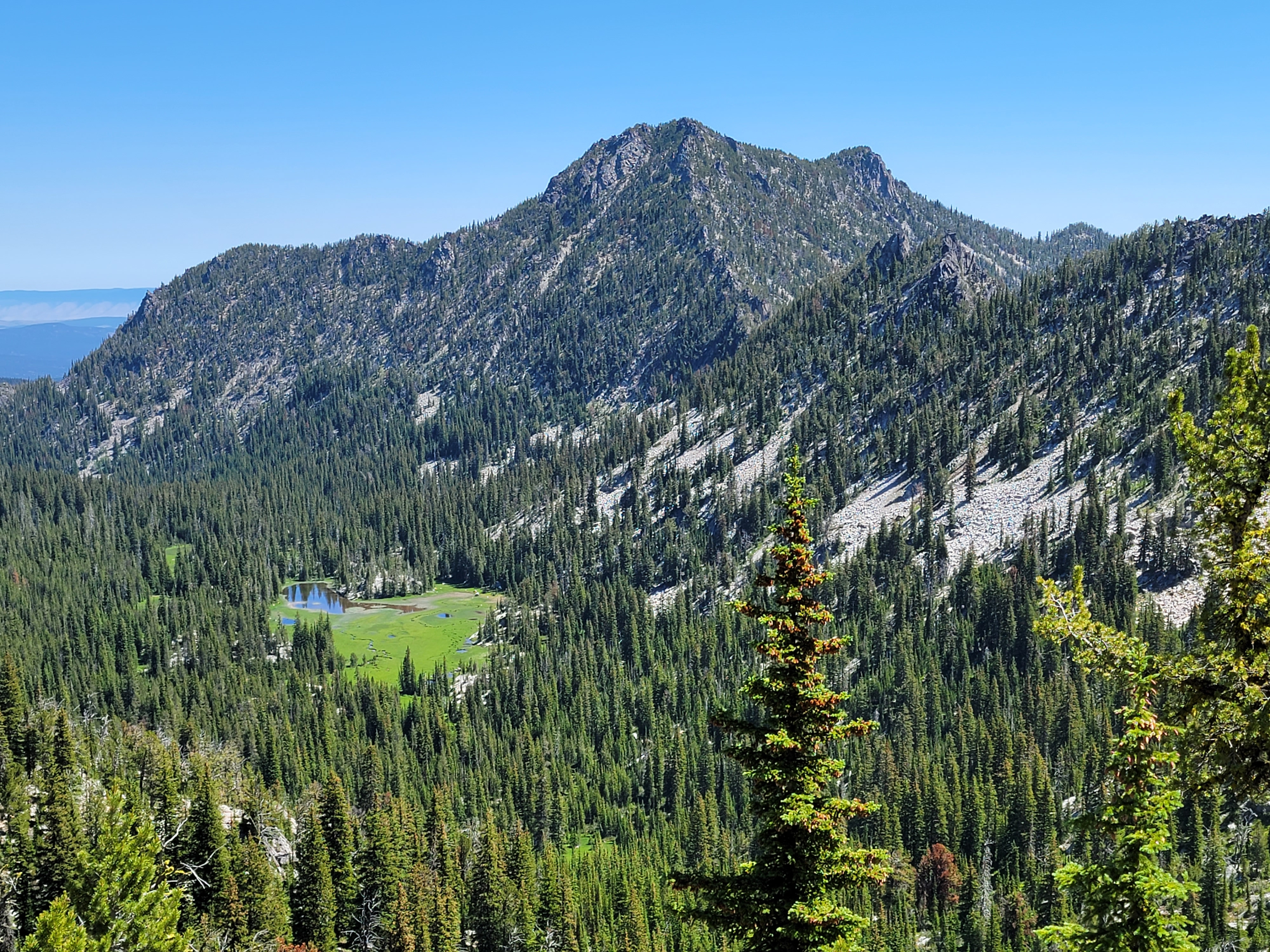
Eventually the trail began to climb seriously again, first to reach Dutch Flat Saddle and then to cross over the range at Angell Pass. It was quite a grind, about a thousand feet of elevation gain. I was moving very slowly uphill but when I finally reached Angell Pass there was a great view of Van Patten Butte to the northeast across the valley of Antone Creek.
 Flowers lined the trail below Angell Pass
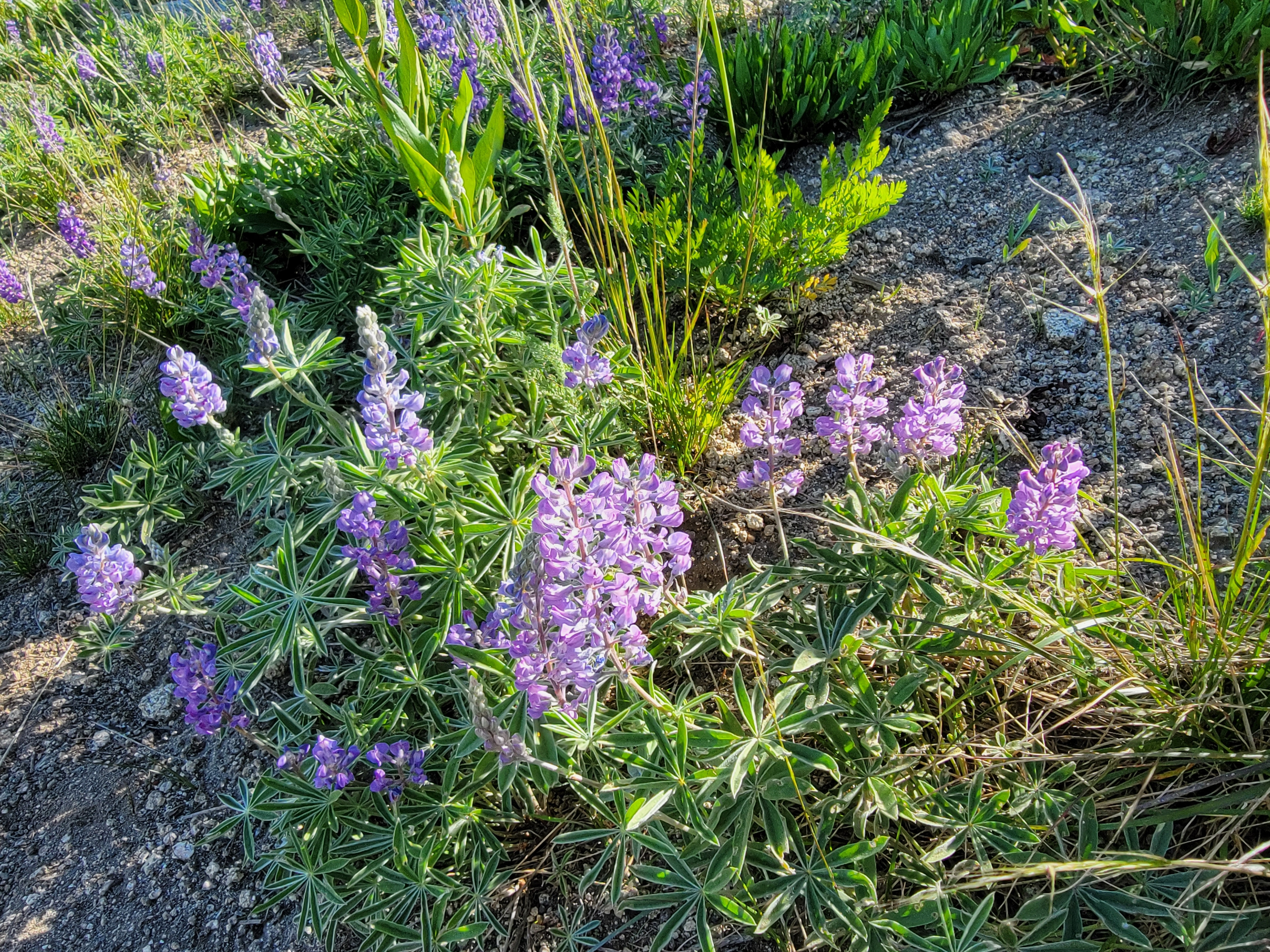
From the pass the trail descended steadily. It was entirely in the open now and it was starting to get hot hiking in the sun, but at least I was going downhill. I could enjoy the view and there were lots of pretty flowers lining the trail all along this section. Eventually it reached the woods although by now it was pretty warm even in the shade. At one point the trail passed within a hundred yards of Black Lake. Although what I could see through the trees looked enticing, I didn't have the energy at this point to take the side trail that descended to the lake. Now I was just grinding out the end of the hike. As I got close to Anthony Lake, there were several side trails that led to different campgrounds, parking areas and trailheads around the lake. Fortunately I had printed off a good map and was able to find my way to the trailhead where my car was parked. I even did it by the most efficient route. As tired as I was I was glad of that when I reached my car.
It was a really great hike. There were several beautiful lakes. The mountains were impressive. The route to the Lake Lookout summit was fun. There were also very few people. In six hours of hiking (I took my time), I encountered one backpacker at the Wilderness boundary, two more as I came down from Angell Pass, and two day hikers near Black Lake. For a mountain area that was easily accessible it had a real feeling of remoteness. Quite a change from the crowds I had experienced previously this summer at Redfish Lake or Mt. Rainier National Park. It reminded me of when I had first moved to Idaho and would study topo maps for hours to find places to go where there was never anyone else.
All in all, a great hike and a great day. Now that I have finally visited the Elkhorn Mountains I would like to go back and try hiking from the east end, perhaps even bagging one of the two major summits. Hopefully soon I'll be able to do a post about climbing Rock Creed Butte or Elkhorn Mountain.
