Clouds Rest
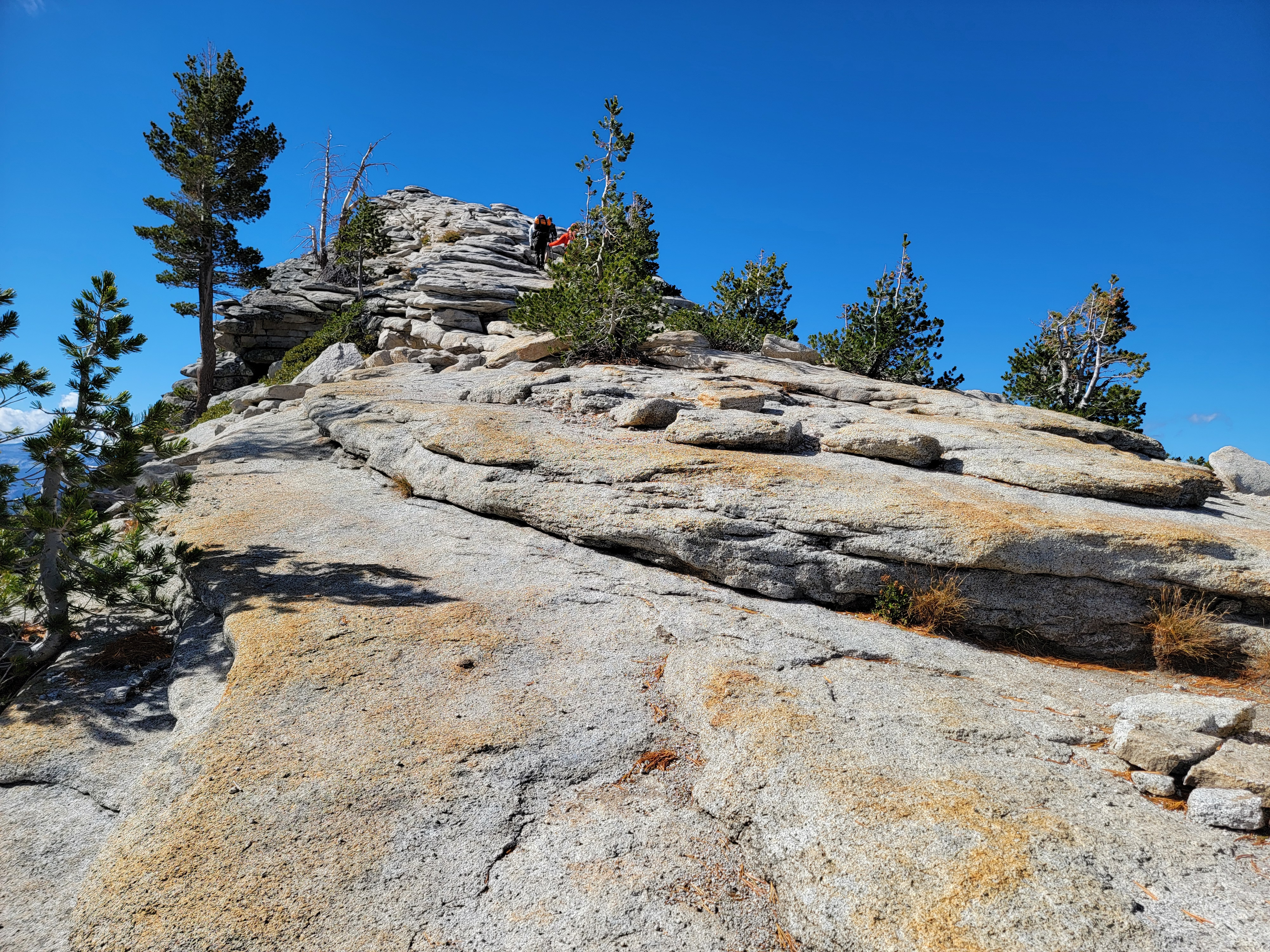
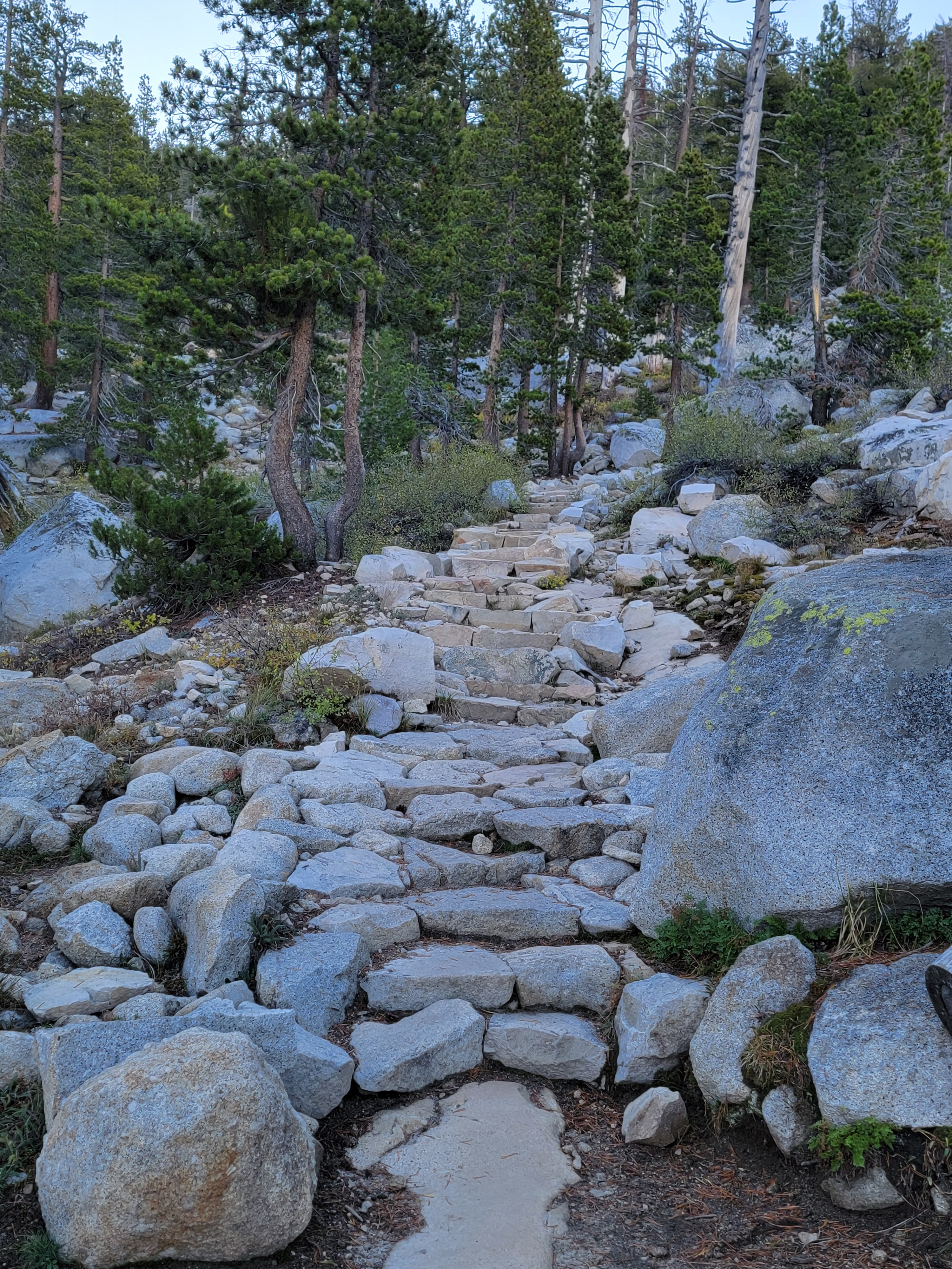 The steep climb up the first ridge
I did a lot of hiking in 2025. My climb of Half Dome was the high point, figuratively and almost but not quite physically. The view from the summit is spectacular. One thing that really stands out when you're there is Clouds Rest. It's the highest point around Yosemite Valley and one of the largest masses of exposed granite in the world. After seeing it from Half Dome I really wanted to climb it. I had done it once before, back in 2005. After twenty years I figured that it was time to do it again.
The summer was busy and went by quickly. Now it was October and the hiking season was almost over. Weather was a mix of beautiful days and rainy/snowy days and everything in between. Watching the forecast was critical. Permits were no longer needed to enter Yosemite National Park after Labor Day, so that made planning easier. Lodging was even available in Lee Vining, the closest town to the east entrance of the park. You're lucky if you can book that months ahead of time during the summer.
I was thinking of a three day trip. Day one would be to climb Clouds Rest. Day two would be to climb Mt. Hoffmann, which I had done a long time ago, back in 1999, with my two sons. Day three would be to climb Mt. Dana. It's the second highest mountain in the park, one that I have wanted to do for a long time but never got around to it. That trifecta would be a spectacular way to end the hiking season this year.
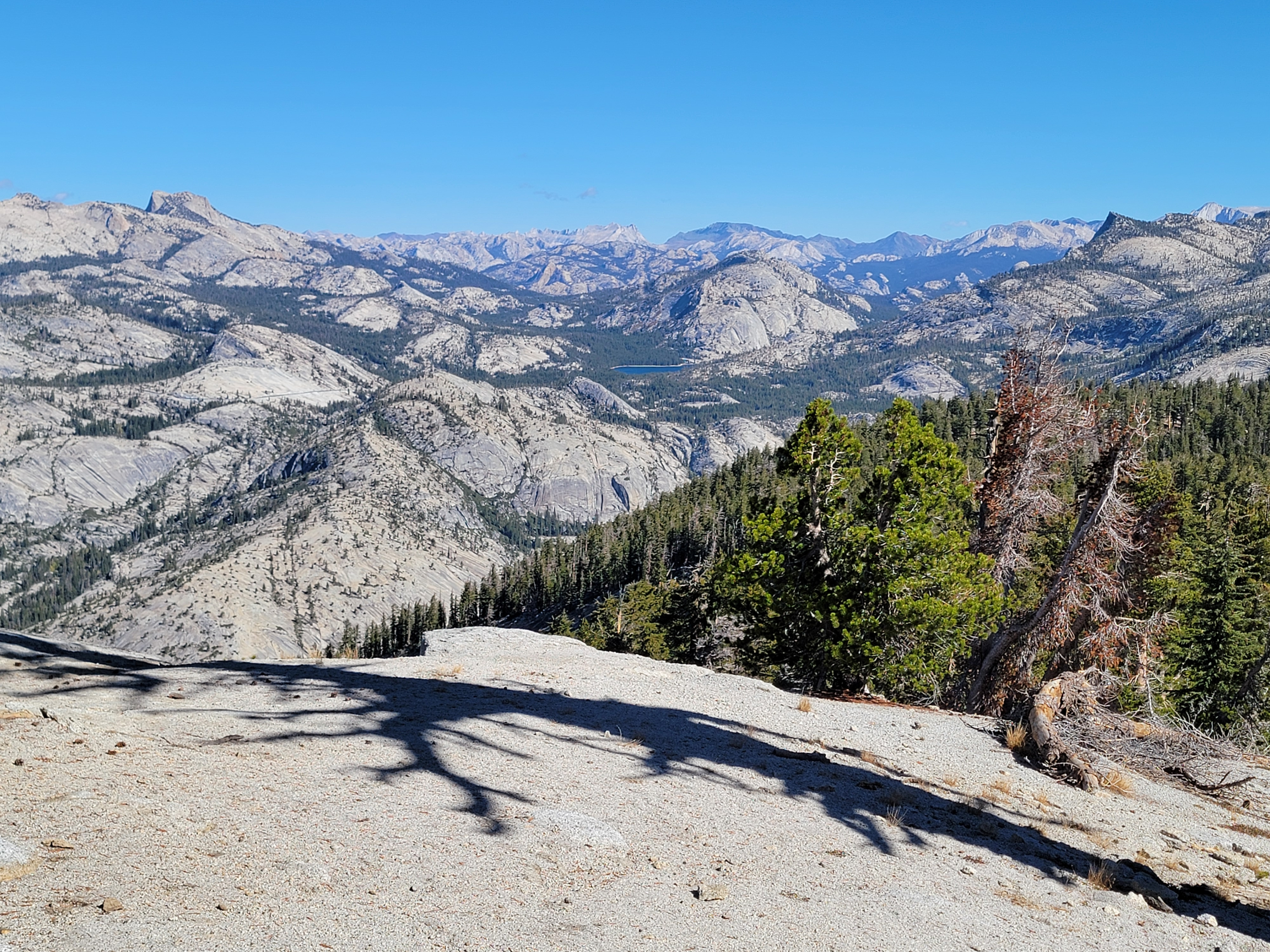
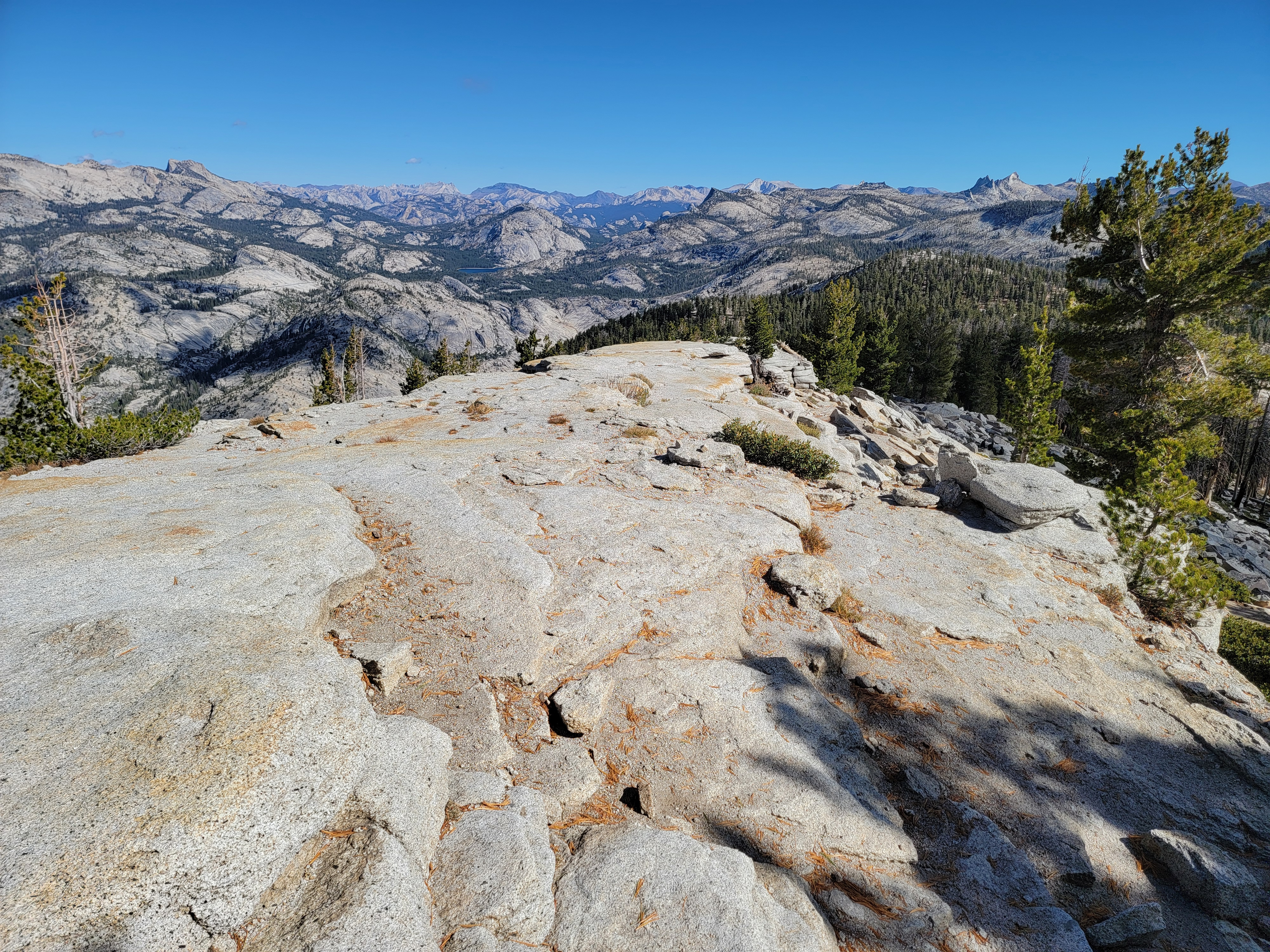
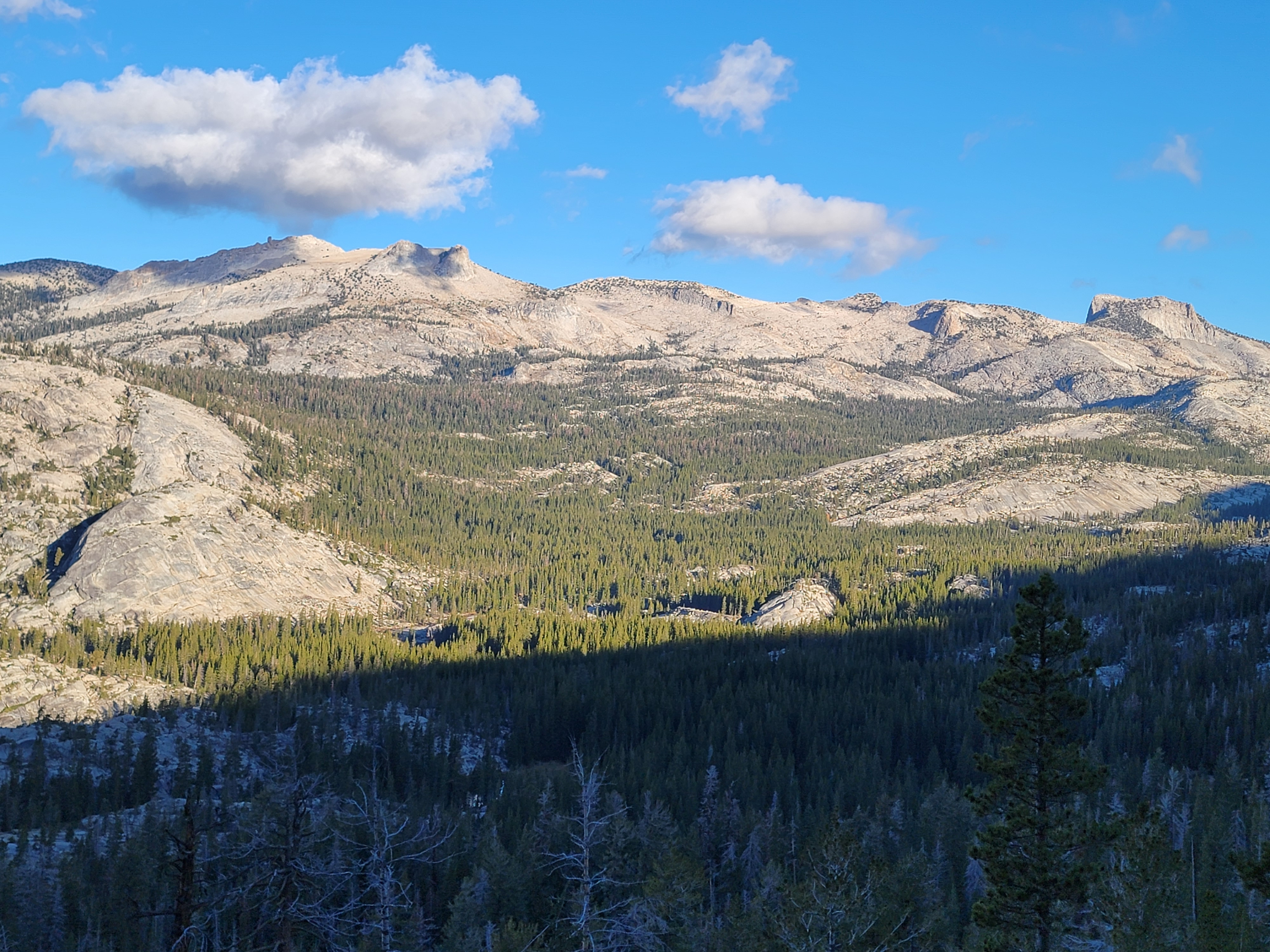 Early morning view towards Mt. Hoffman
I was shooting for the second weekend in October. We had a big trip to the South Pacific coming up less than two weeks later. It looked like there was a good weather window in the Sierras for the weekend, before about a week of rain and snow. It was probably my last chance for this year. I checked with Sandy and she was ok for me to go.
As usually happens, my plan changed at the last minute. The weather still looked good for Friday but the weekend started to look iffy, with a possibility of snow. Not good for climbing big mountains. Plus early in the week I had gone to the Sawtooths and did a hike up Observation Peak. I hadn't intended to do a hike as long and hard as that one, but road closures dictated what my options were. I was pretty wiped out after that climb and I only had one day to recover before I had to leave for the Sierras.
Time for a new plan. I would only do Clouds Rest. Yeah, Yosemite is a long way to drive just to do a day hike, but I really wanted to do this one. Besides, mentally and physically I don't think I was up to a three day peak bagging marathon at this point. One would have to suffice. At least it was a really good one.
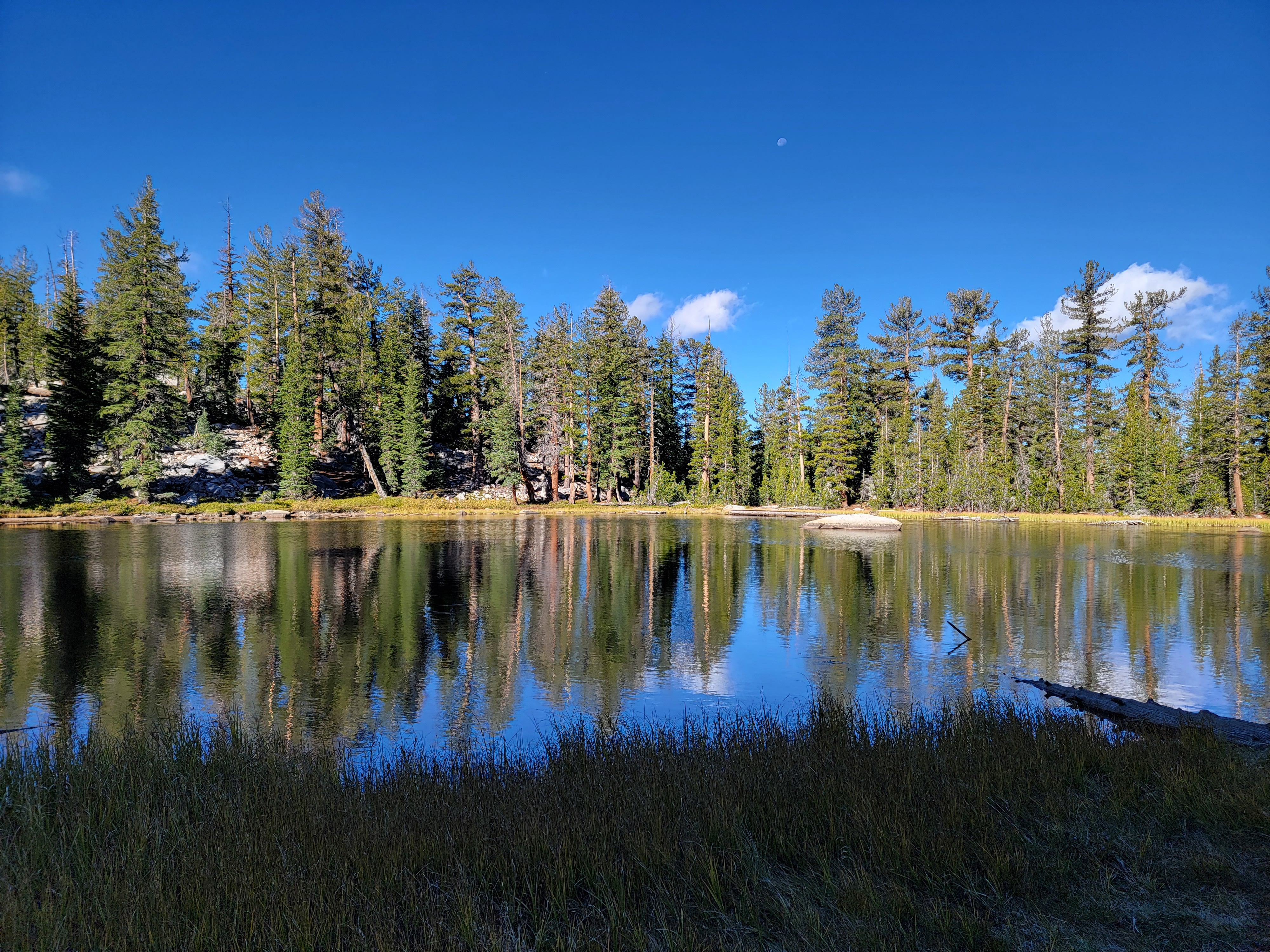 The trail passes this unnamed lake
Since I would only be gone one night, I decided to stay in Hawthorne Nevada. A small town in the middle of nowhere, it's my standard on-the-way-to-Yosemite overnight stop. I know a place there that is minimalist but clean. Nothing fancy, but it's cheap - only $70/night. I didn't even have to get up early on the day that I left. It's just seven and a half hours from Boise to Hawthorne. It's an easy drive, with no big cities or crowded freeways.
I had dinner at Lovelock Pizza. Why it's in Hawthorne and not Lovelock is beyond me, but the pizza was good.
It was pitch dark when I left at oh-dark-thirty the next morning. Hawthorne isn't that close to the park and it took me over an hour and a half to drive to the trailhead. There were very few cars in the lot when I got there, which is good. There isn't space for many cars and it can be hard to get a spot. Getting there early on a day late in the season, I had no problem.
 First view of the summit at roughly the half way point
There was just enough light for hiking when I started out at 7:15 am. Clouds Rest is a long hike - officially 12.6 miles round trip (although a lot of AllTrails users comment that their GPS said it was longer) with 3116 feet of elevation gain. Most of it is on a well maintained trail, with an easy scramble up the summit ridge at the end. There are dropoffs on both sides, but the ridge is wide enough to feel reasonably safe. It is exposed to the weather though. I was a little nervous today, because although it was clear, it was quite windy. That could be a problem up high. I wouldn't want to be blown off of that ridge.
The route started from the Tioga Pass road, just west of Tenaya Lake. The first mile was easy, relatively flat trail through forest. But as I hiked I could hear the wind howling up above in the trees and over the ridges. I have to admit that I was nervous. I thought about turning back. The weather was clear and I could have a great day driving around the park to various viewpoints. Glacier Point would provide a magnificent view of Half Dome and most of the route that I took to get up it. That sounded pretty good, and pretty easy too. I have to admit that I was physically and psychologically worn out after a long hiking season and a tough hike on Observation Peak only two days before.
 The view opens up when I reach the base of the summit ridge
Tempting as it was, I couldn't bring myself to give up on the climb. I just wouldn't have felt right quitting when there wasn't a cloud in the sky. I decided to keep going and see what conditions were like when I reached the summit ridge.
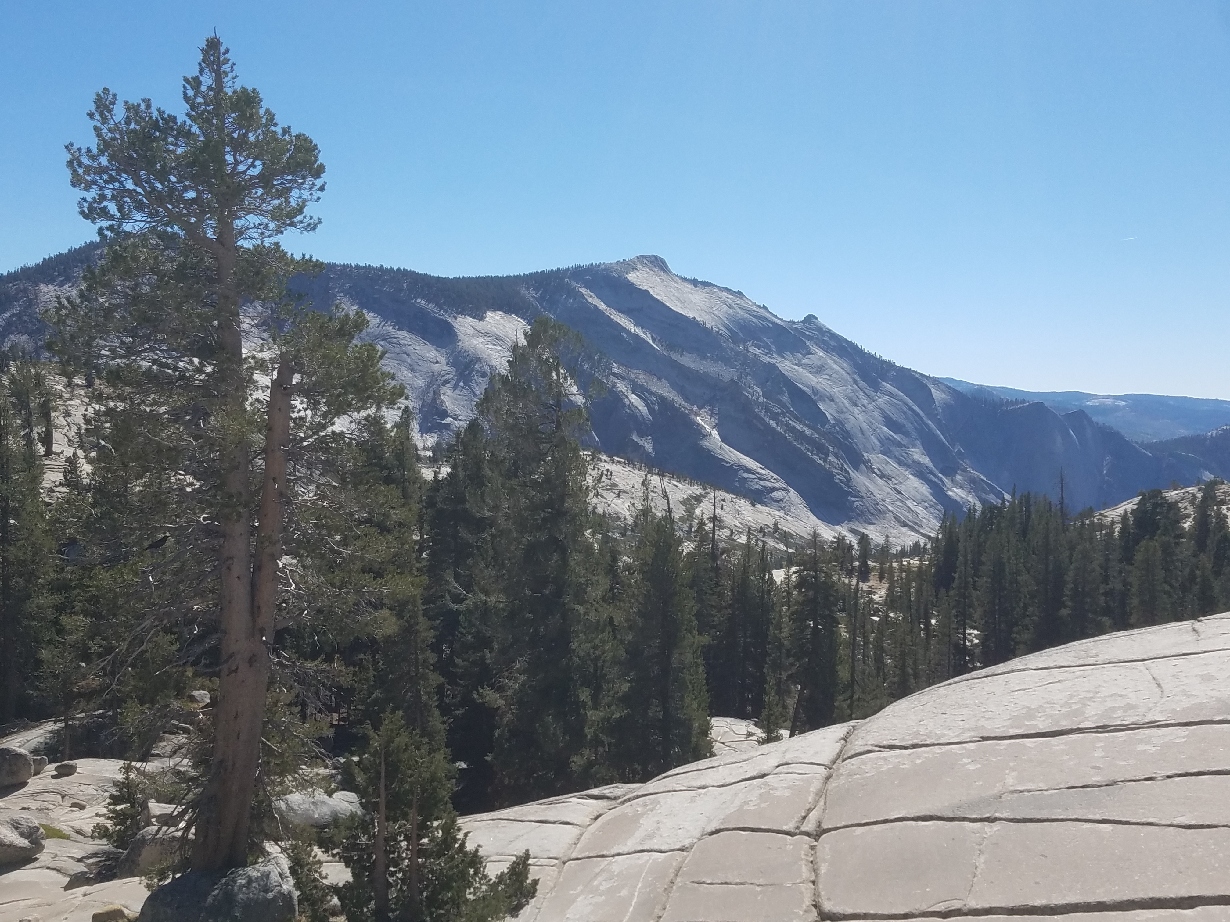
After the first easy mile, the trail started to climb steeply up (and over) a ridge. In places it was literally a staircase made of rocks. It was a little over a thousand feet of elevation gain. I just took my time. I may be old and slow but I get up the hill. As I got higher, impressive views opened up to the north through occasional gaps in the trees. I could see Mt. Hoffmann, a mountain that I would still like to climb again but will have to wait for another trip, another year. For now, I was focused on getting to the top of Clouds Rest.
After cresting the ridge, the trail headed downhill. That was discouraging, because I knew that I was still well below the summit of Clouds Rest. Every foot that I dropped down was elevation I had just worked hard to gain, and would have to work to gain again to reach the top of the mountain. And on the return trip, I would have to climb up and over the same ridge, again. It was frustrating but there was nothing I could do about it. I just kept plodding along.
 Looking up the final ridge towards the summit
After dropping 350 feet off the ridge the trail flattened out again for a while. At one point it passed a small lake. It was pretty, surrounded by woods. Surprisingly it didn't have a name. I guess it wasn't spectauclar enough. There were no views of Yosemite Valley or of distant peaks. It was very peaceful though.
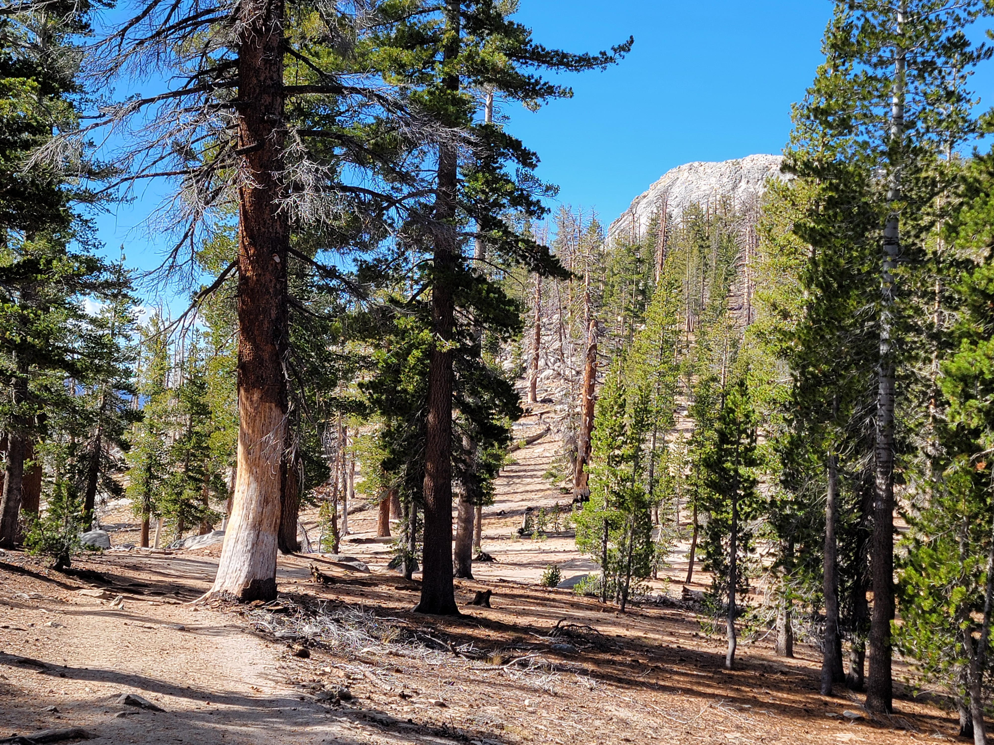
Eventually the trail started to climb again, although not as steeply as before. It circled around to the south side of Clouds Rest. Unlike the clean granite of the side facing Yosemite Valley, there was forest most of the way up. Only the last few hundred feet were a granite dome ending in the summit, now finally visible, still a long way off. Up to this point I hadn't seen other hikers, but now I passed a few who were on their way down. They must have started crazy early, and were probably a lot faster than me too. I asked everyone I passed how the wind was on top. The reports were pretty much the same - breezy, but not bad. Since coming onto the south side of Clouds Rest the wind seemed to have decreased from what it was early in the morning. I had made the right decision not to turn back earlier.
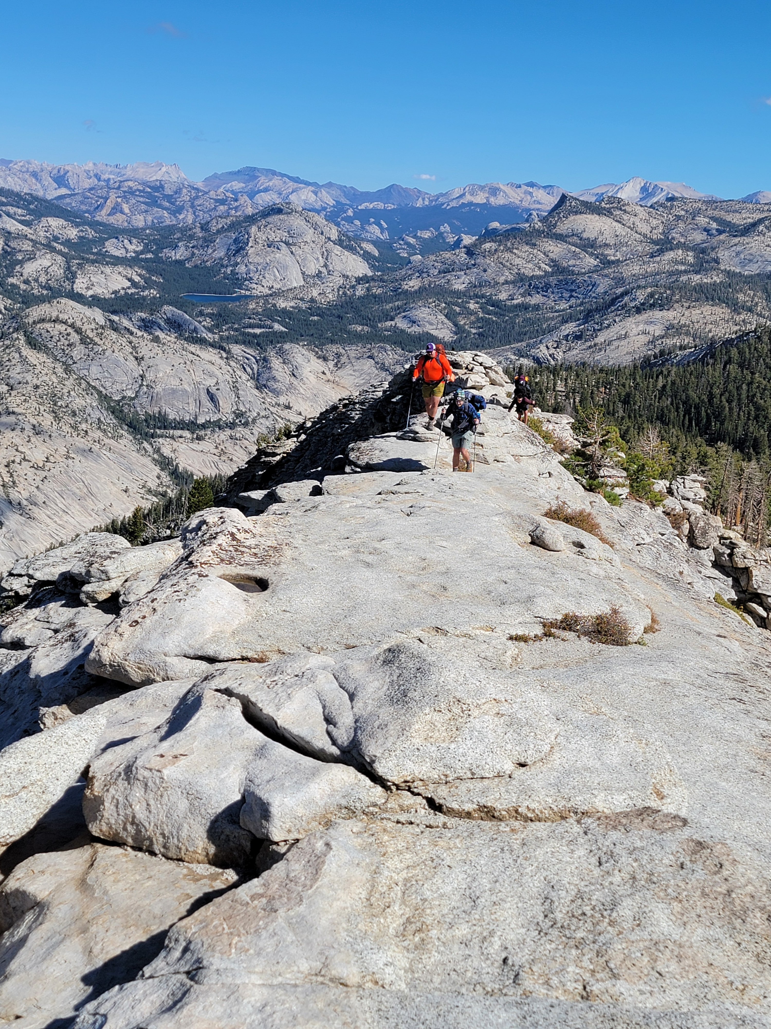 Are all four backpackers still on the ridge?
Eventually I reached the crest of the ridge that led to the summit. Now there were some spectacular views. To the south was Mt. Starr King, Mt. Clark and the upper portion of Little Yosemite Valley. To the north was Tenaya Canyon, leading to Tenaya Lake. That was where my car was parked, and it sure looked like it was a long way off. The weather was fair, blue sky with just a few puffy white clouds to add some contrast to pictures that I was taking. While it was breezy, it wasn't that bad after all.
For a while the trail climbed up the ridge through sparse trees. Finally the trail ended and there was just a narrow granite ridge continuing upward for the last .3 miles to the summit. On the right was a steep dropoff for thousands of feet into Tenaya Canyon. On the left the ride was rocky but not as steep, falling two or three hundred feet in a series of ledges and slabs to the forested slopes above Little Yosemite Valley. It was possible to walk on the very crest of the ridge, but at some points it was only a few feet wide with the steep cliff right there.
Not long after I started up this last stretch to the summit, I paused to look for the best way to proceed. Just then a guy passed me going down. He saw me studying the route and offered that it was best to stay to my left. That looked good to me an most of the way I did exactly that, staying to the left (south) side. Sometimes I was more below the actual top of the ridge, sometimes I was less,. It wasn't too scary but I was always aware of the abyss looming off the right side. I definitely wouldn't want to be up there with very strong winds blowing like I experienced earlier this summer climbing Mt. Lassen.
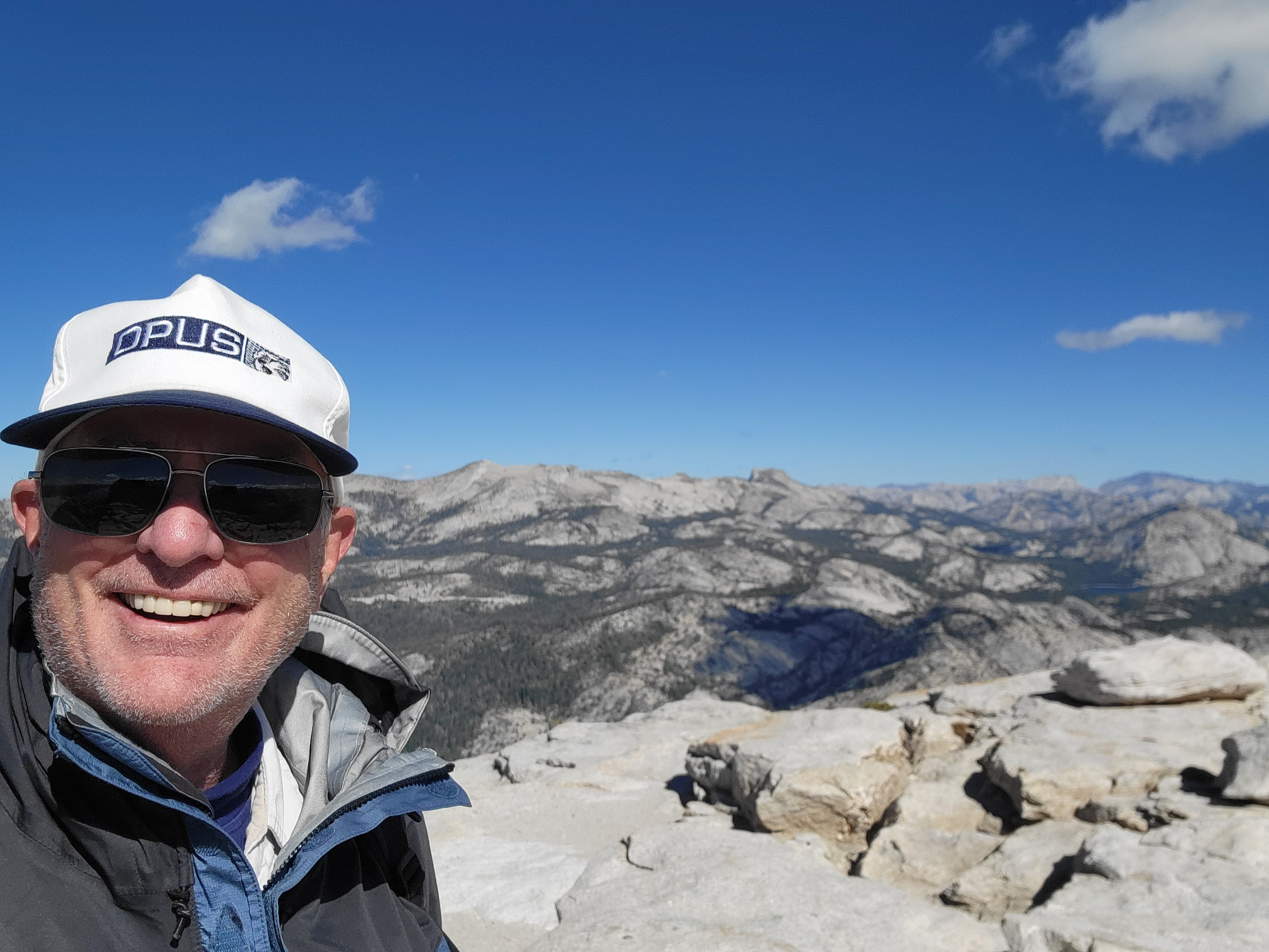
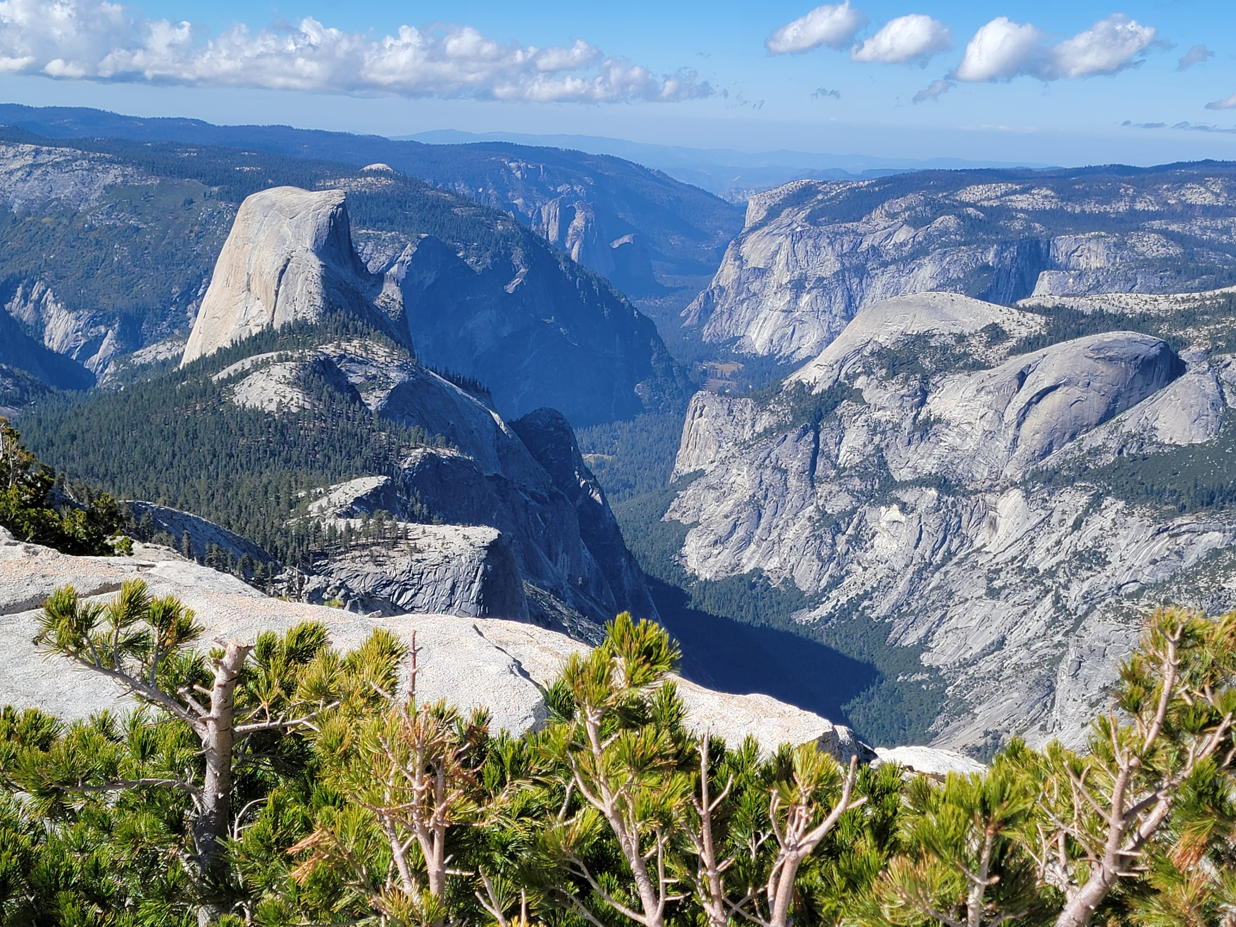 Half Dome and Yosemite Valley from the summit
There were four guys climbing ahead of me with full backpacks. They were moving very slowly and taking frequent rest stops. Eventually I caught up to them. Turns out they had been in the backcountry for several days. After summiting Clouds Rest they were planning to go down and camp in Little Yosemite Valley before heading out the next day. While one guy was telling me this, another was lobbying for making a push to hike all the way out today so they could get a hot shower and a cheeseburger and fries for dinner. I'm not sure how they resolved it.
I noticed that one guy had a Vikings hat while another had a Green Bay Packers hat. I told them I thought that was unusual in one group. Packer Hat Guy said that three of them were Packer fans and just the one guy was a Viking fan. At that point Viking Hat Guy interjected and said that if I heard a yell and turned around and saw him falling down the cliff, he had probably been pushed.
 The Old Man of the Mountains
When I reached the summit it turned out to be quite broad, much wider than the ridge leading up to it. There were several other people already there, enjoying the view. I found a spot a little out of the wind where I could sit in the sun. I took my time eating snacks, drinking some water, and just catching my breath. When the backpackers reached the top, I was glad to see that it was all four of them. I have to admit that if I was in their place, I definitely would have found a spot to stash my pack rather than carry it all the way up the mountain.
After eating and resting I felt my energy come back. I walked around the summit area, admiring the panorama and taking photos. Clouds Rest is the highest point around Yosemite Valley so the view is unobstructed. The only thing blocking it was the breadth of the summit itself. I had to walk down a few steps to the west to get a clear view of Half Dome. It was amazing. I could see most of the route I had taken to climb it back in June. I could see the subdome clearly and the cable route was a narrow white line where the granite had been polished by thousands of climbers over the decades. I'm still proud of that climb and I spent a long time standing there admiring the mountain.
 A glorius view heading back down the ridge
I took my time on the hike down. I felt good until I had to climb up that last 350 feet to get over the first ridge. That took a while and used up my last reserves of energy. I was pretty much exhausted on the steep final descent. At least this was one time that I had the foresight to bring a trekking pole along and it sure came in handy here.
The last mile out on the flat was just a mindless slog. Every time I came around a bend in the trail I would look ahead anxiously to see if now I could spot my car sitting at the trailhead.
Nope. Not yet.
Of course, it was farther than I thought. It always is near the end of a long hike when you are tired and ready to be done. I finally did reach my car about 5 pm. Less than ten hours total time, about nine hours actually hiking. Not bad for an old guy. I was very tired but felt a real sense of satisfaction for completing the hike and getting to the top of the mountain.
 Clouds Rest from viewpoint on Tioga Pass Road (2018)
The drive home was uneventful. Dinner at McDonalds in Hawthorne was delicious. That's how good I was feeling about doing the hike. A stop for gas and Diet Coke in Winnemucca and I was home about 2 am.
It was a wonderful way to cap off a great hiking season. I was physically tired, and mentally I was ready for the season to be over now. I was looking forward to our upcoming trip to the Cook Islands, where I could spend time lying on the beach under a palm tree. I was ready for a few months off from hiking.
