Arches National Park: Part 1
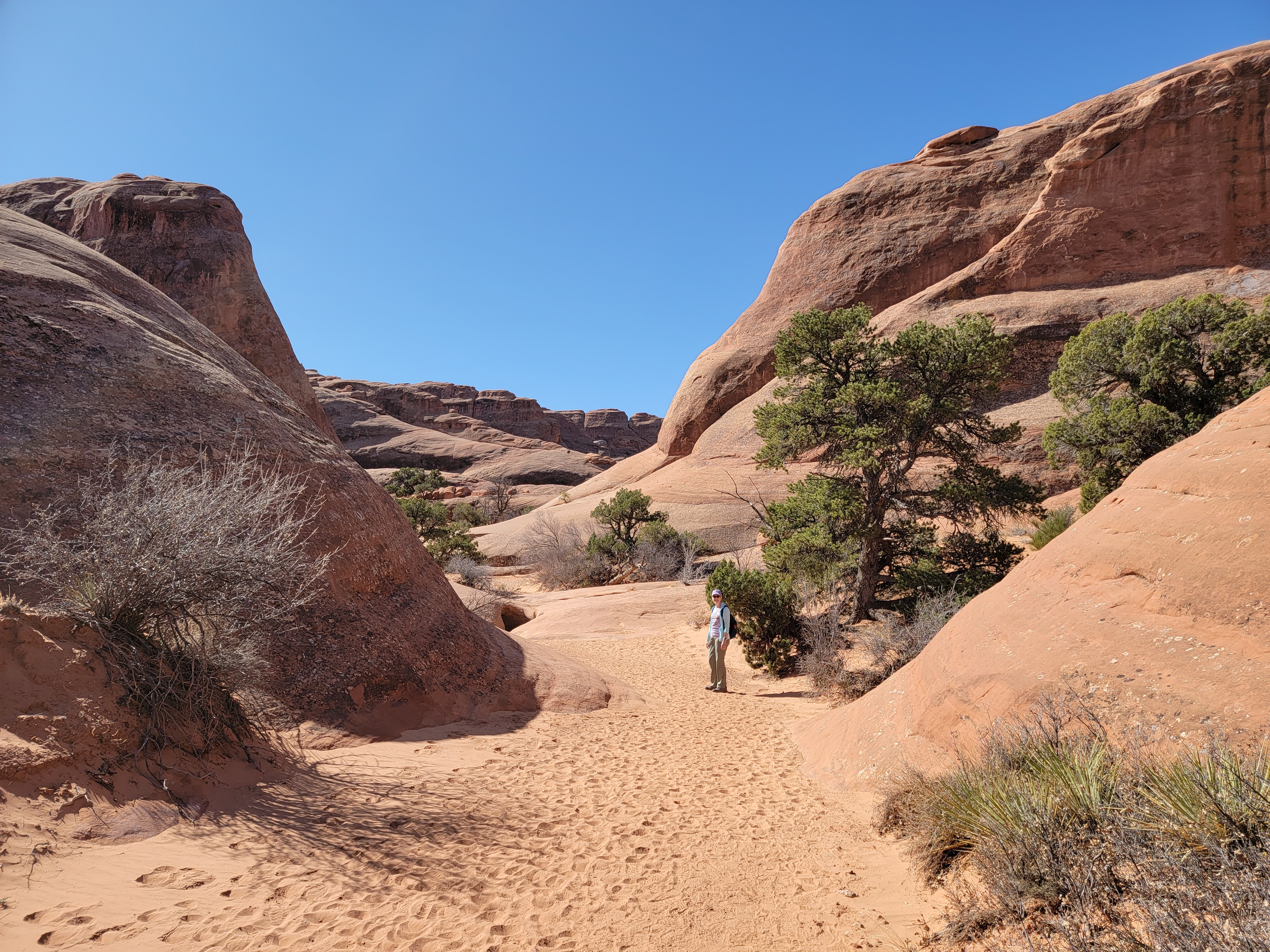 Hiking along a wash in Devil's Garden
I try to do at least one trip to Utah canyon country every spring, more if I can. This year, Sandy and I went to Zion National Park in January. That trip was opportunistic. A week ahead of time, we saw that the weather forecast was good and we were lucky that one of our friends was able to stay with Abby on short notice.
We also did a trip in early March which we planned way in advance. There's some risk with that. Early in spring, the weather can be very good or very bad or anywhere in between. We chose Moab as a destination. It's a fair sized town so we figured that if we did have some bad weather days, at least there would be shops and restaurants in town where we could spend some time. We scheduled our trip for the second week of March. That was a quick turnaround for me, as it was not quite a week after I got back from my dive trip to Bonaire with my son Mickey.
 Yes, the route really does go there
We left on Sunday morning and planned to return on Friday. That would give us four days to hike but would also avoid weekend crowds and weekend rates at the hotels. That's an advantage of being retired. The drive down was uneventful and we arrived about dinner time. As soon as we had checked into our room at the Comfort Suites, we walked to Pasta Jay's for something to eat. I love Italian food and make a point of going there every time that I am in Moab.
We seemed to be in luck. The weather forecast looked pretty good for this time of year. Monday and Wednesday were supposed to be sunny with temperatures pushing sixty degrees. Excellent hiking weather. Tuesday was forecast to be about the same temp but overcast. Not great for pictures but ok for hiking. The prediction for Thursday was colder, windy and overcast with rain in the afternoon. We figured that three out of four ain't bad.
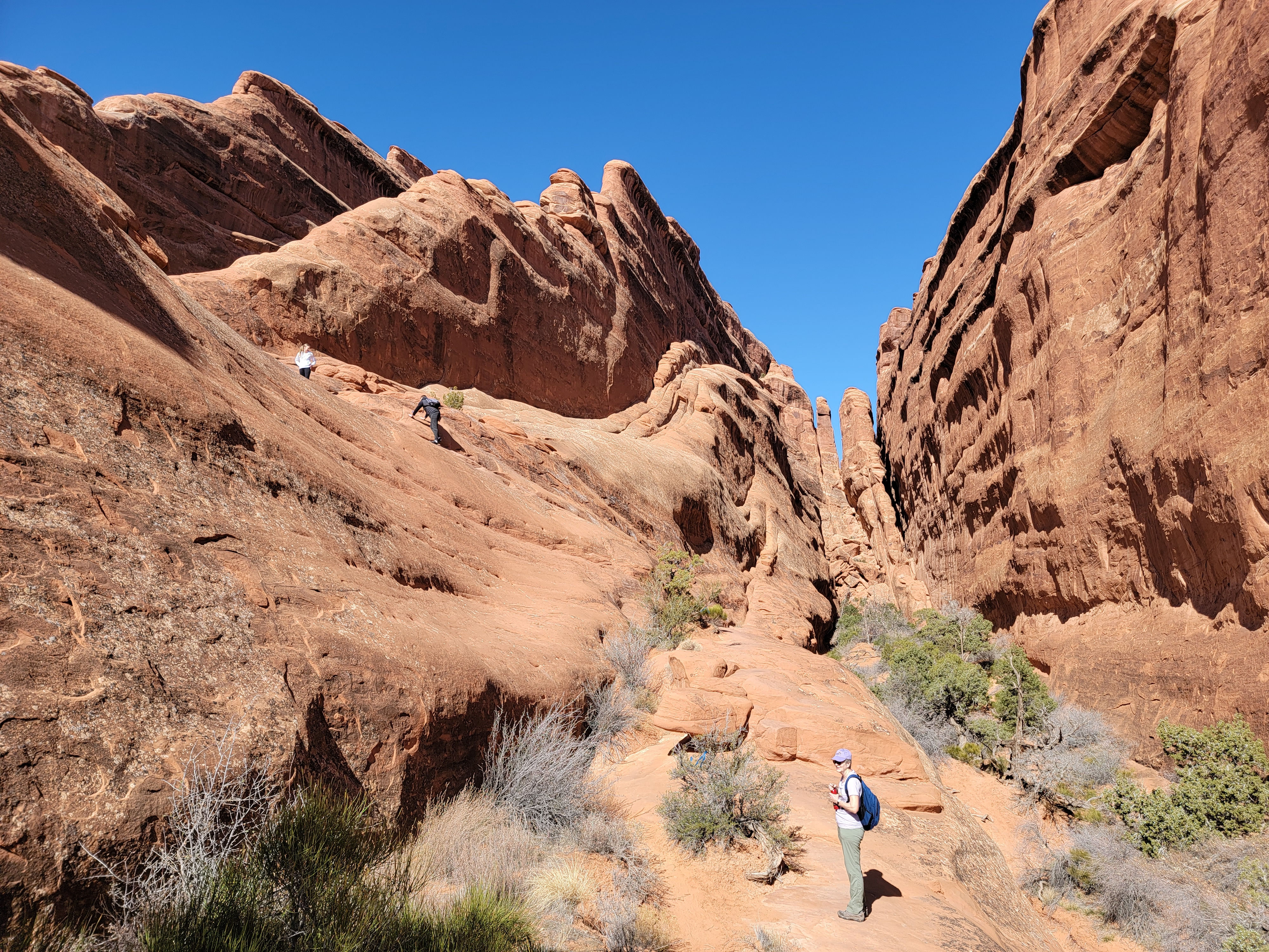
 Serious slickrock hiking
Since our first day looked to be the best weather-wise, we set out to do the Slickrock Trail. It's actually a mountain bike trail so most of the time I would avoid it. Cyclists and hikers don't always mix well on narrow slickrock trails. Because the route was developed by mountain bikers, I felt that they had first dibs on using it. But it was still early in the season. I figured it might be ok to do it as it likely wouldn't be too crowded. I had done it before three years ago at about this time of year and encountered very few riders. It is an awesome hike and I thought Sandy would really enjoy it. Unfortunately on the short drive to the trailhead, we saw multiple pickups hauling ATV's. There are several ATV trails in the same area so that was enough to dissuade us. We didn't want to hear and see ATV's, or smell their exhaust, all day. We turned around and headed back to town. It was time to develop Plan B......
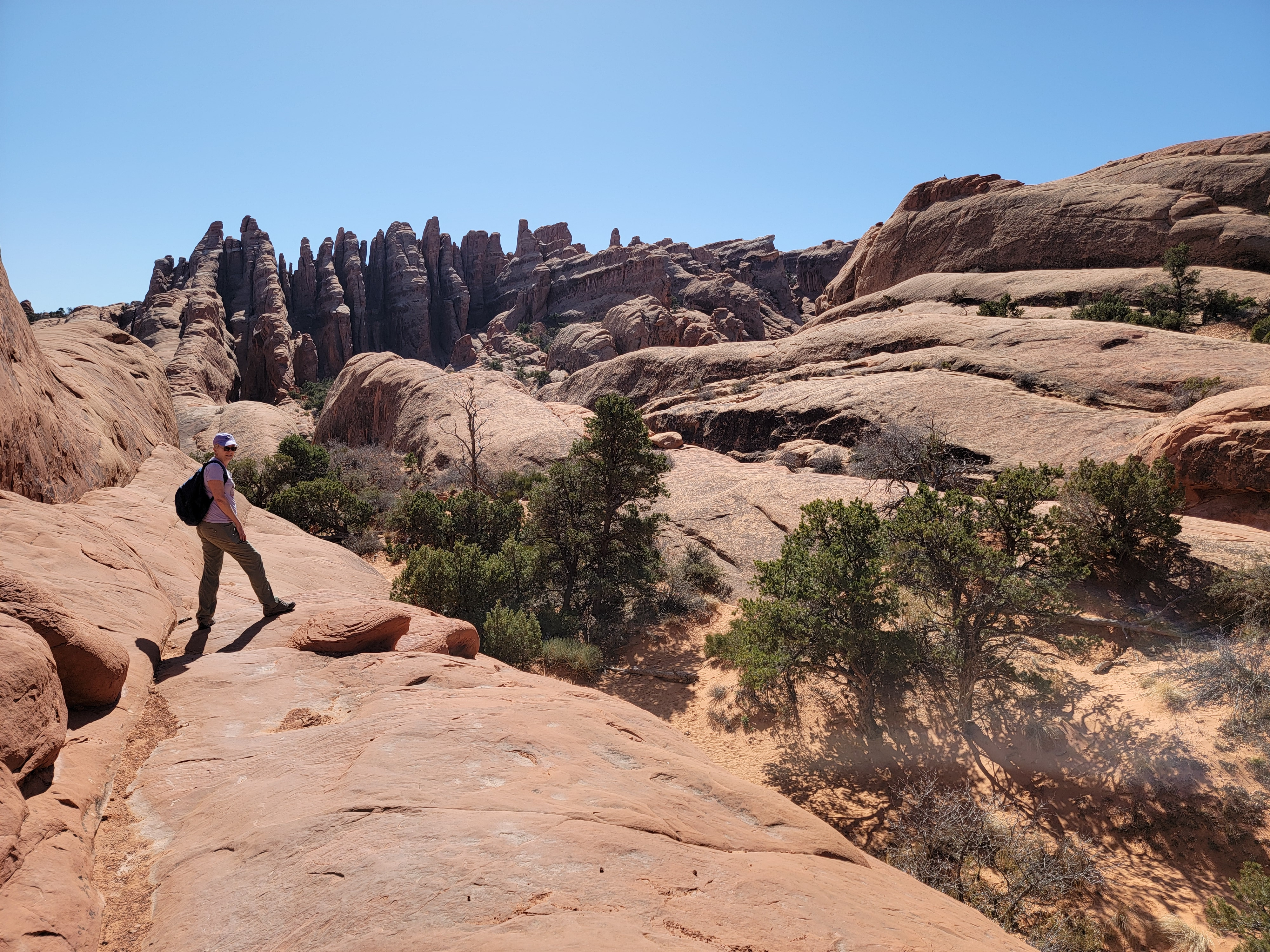
 Beautiful rock formations everywhere
......which was the Devil's Garden Trail in Arches National Park. The basic loop is only five and a half miles long, but tricky route finding and some hard scrambling on slickrock makes it a challenge. And quite a bit of work too. If you still have extra energy, there are several spur trails along the route that lead to viewpoints of various arches and add extra miles to the hike.
It's a bit of a drive to reach the trailhead, which is at the very end of the paved road in the park. The drive is scenic and since the park isn't that big, it's not that bad. Except for today. Shortly after entering the park, we had to pass a group on bicycles. They were hard to get around because the road is narrow and winding. Then we passed another group. And another. And another. Turns out that there was a big bike ride that day, and there were several hundred cyclists on the park road. Almost the entire way I was following someone on a bike, waiting for a chance to pass them. On straight stretches they would get up to fifteen or twenty mph. Going uphill they would slow to a crawl. It seemed to take forever but eventually we reached to the end of the road.
 The intrepid hikers at Double O Arch
Sandy and I had done this hike once before in 2012. That's a long time ago but we remembered it as an excellent hike. There is quite a bit of parking at the trailhead but it is a popular trail and the spots fill up. Last time we were here, we had to park about a half mile down the road. This time we got lucky and found a spot only a few steps from the start of the trail. After all the hassle with the bike riders this morning, I figured that the universe owed us some good karma. And it appeared that it did. Besides our primo parking spot, we had a beautiful day, with a bright blue sky and a high temperature forecasted to be in the sixties.
Sandy was optimistic and tried to go light when we started out but it was still a bit cool and breezy. After about three hundred yards she decided that the wind was a bit too cold. We went back to the car to get her jacket and then started out again. Good thing we were parked right next to the trail. Devil's Garden hike, Take Two.
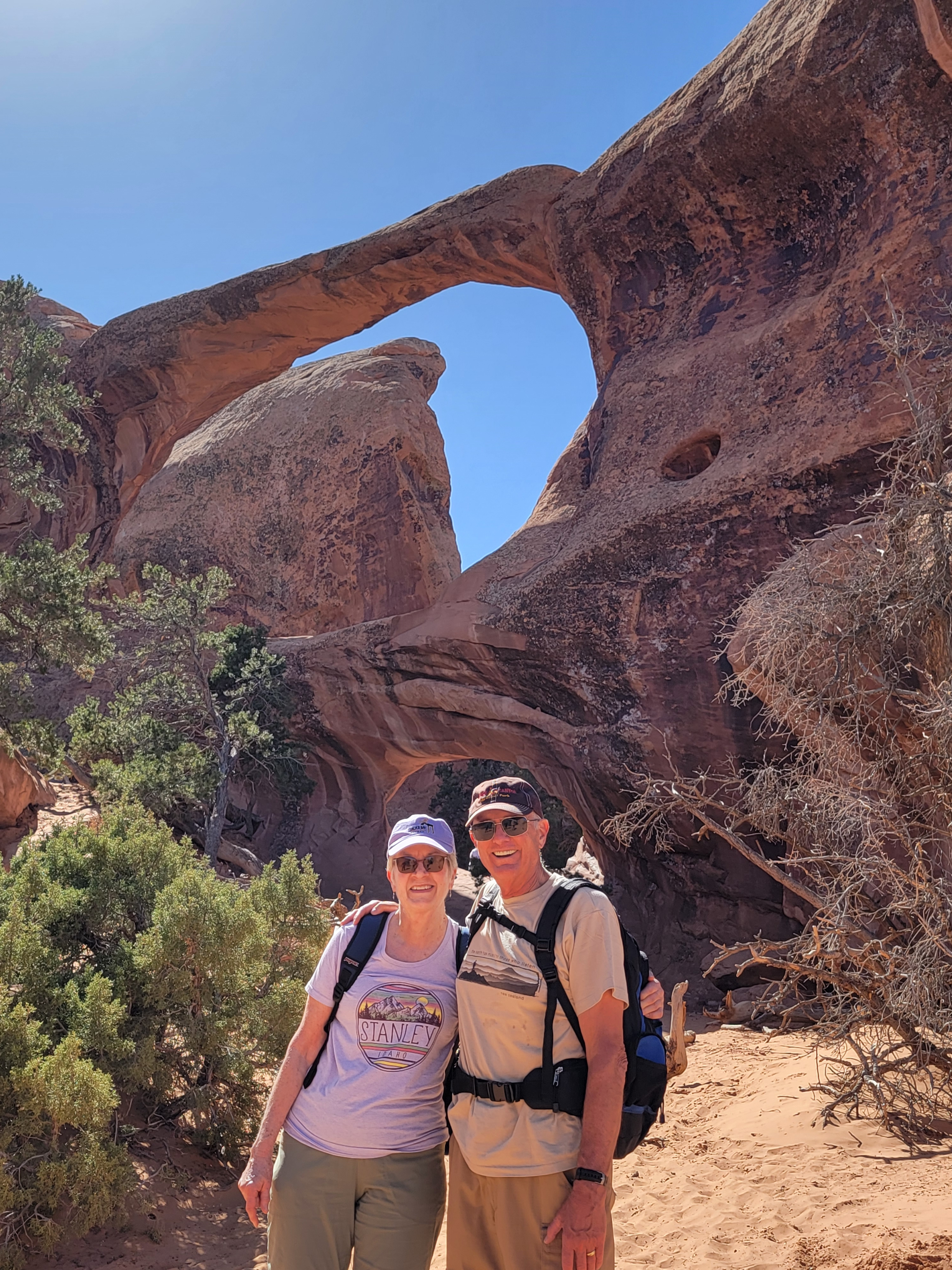
The first mile or so is an easy paved trail that leads to a view of Landscape Arch. Two hundred and ninety feet long, it's the longest arch in North America. It was thought to be the longest in the world until about twenty years ago when several arches in China were accurately measured to be longer. It's still very impressive.
 Sandy waits her turn while a hiker descends towards her
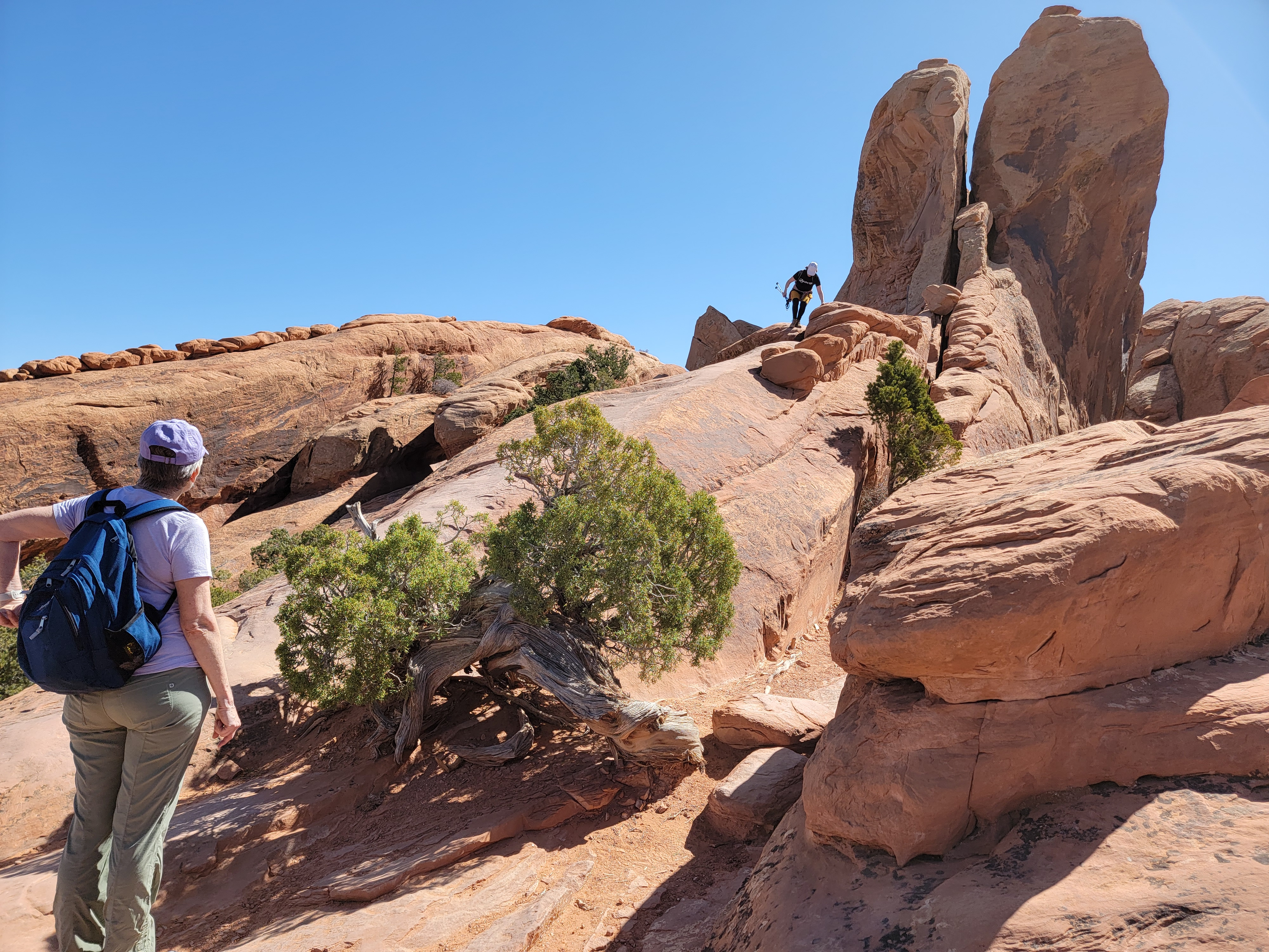
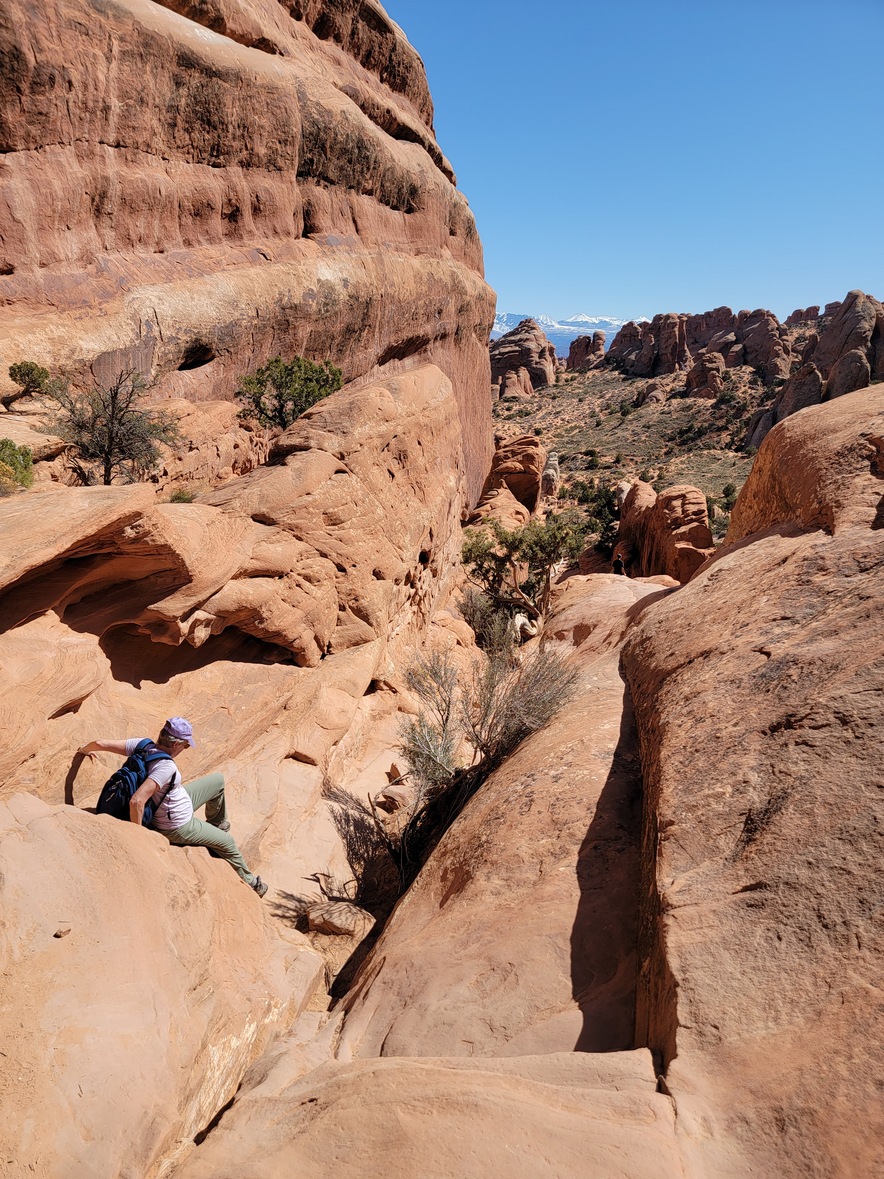
Just before the viewpoint for Landscape Arch the pavement ends and the trail splits to start the main loop. We turned right to do the loop counterclockwise. That's the preferred direction but it meant that we would have to wait till nearly the end of the hike for the best view of Landscape Arch. That was ok as there is fantastic scenery everywhere in this part of the park. The sandy trail was easy to follow through the desert terrain, winding among rock towers remiscent of The Needles in nearby Canyonlands National Park. After crossing a ridge the route dropped into a wash that served as a trail for a while. Eventually it led into a narrow, rocky canyon that looked like a dead end. The way out required a scary looking scramble up and over a sandstone ridge. Once we were on it though it turned out to be easier than it had looked from below. Not so scary after all.
 I take a break at a viewpoint along the trail
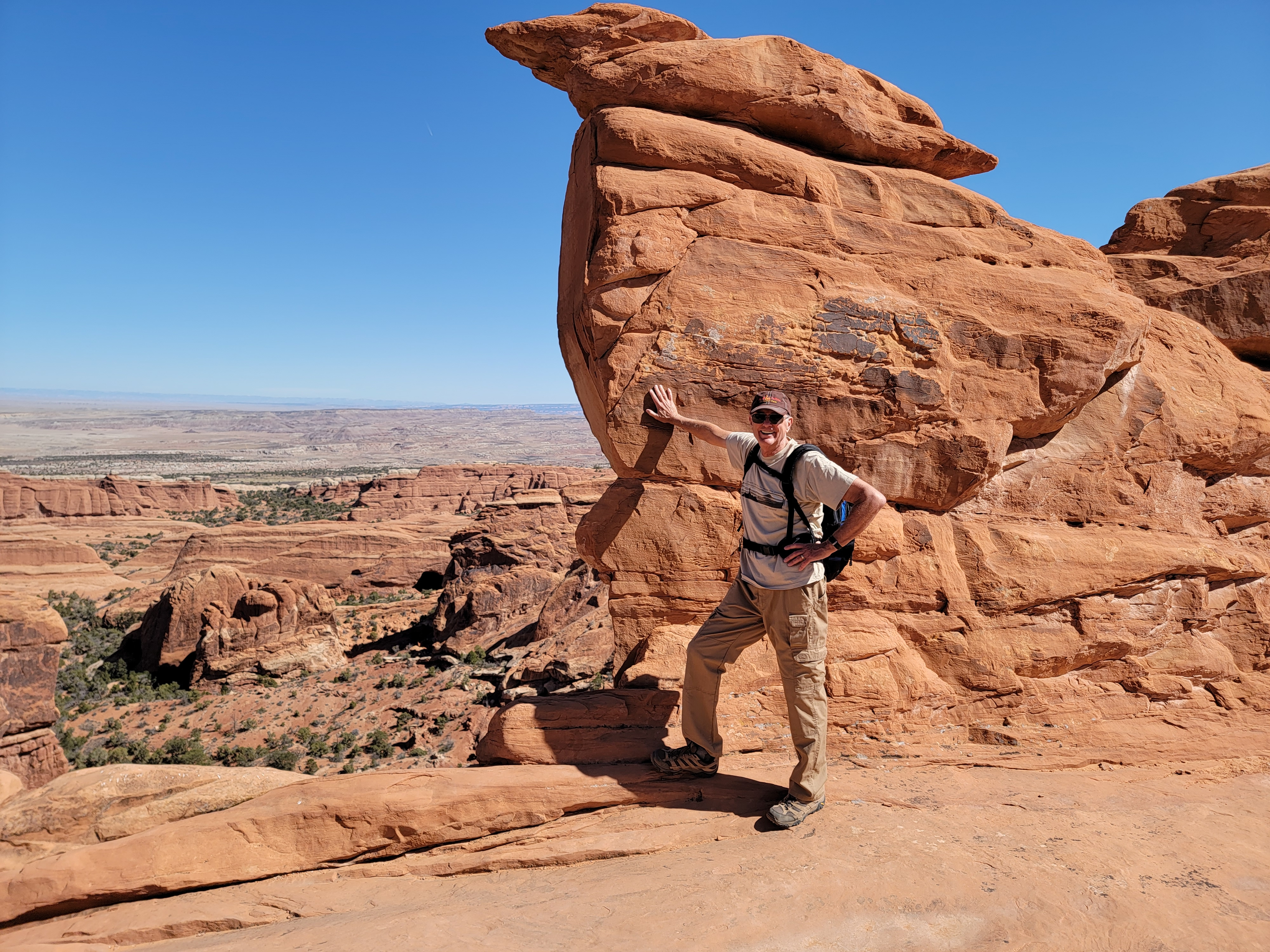
After following another wash we had to climb out and then cross a gap in the rock. I went across first but then Sandy said she was nervous about crossing. I went back to spot her and she did it with no problem. In fact she made it look easy. For some reason, I had trouble on my second try and slipped a couple of times. I eventually managed to get across again but certainly didn't win any style points for my technique. Good thing there wasn't anyone watching.
The route continued to wind through, between and sometimes up and over and then down beautiful rock formations. When we topped out after climbing one steeper bit of slickrock, there was a young couple sitting and resting in the shade. We must have impressed them because the guy said "Wow. I hope we can still do this when we get old too." As soon as he said it he looked embarassed and stammered "I mean, when we get a little older." We assured him that we were in fact old and that we were not offended. We appreciated that he was impressed that we could do this hike. Even we were impressed that we could do this hike.
 Sandy at Partition Arch
A little while later we heard a shout. It was the same guy, about a hundred yards behind us. He wanted to know if we had dropped something. Sandy checked and she was missing her phone. We waited till he caught up with us and sure enough, he had her phone. Apparently it had dropped out of her pocket while she was climbing down some rocks. We were very lucky to get it back and I think the guy felt better since he had been embarassed earlier by his remark. Everyone was happy.
We passed by several spur trails that led to viewpoints of other arches. We were getting enough of a workout with the main trail so we didn't make the extra effort to take any of them. The route did go right by Double O arch. It was impressive but it was hard to get a good picture of it. Several groups of hikers were hanging around right inside the arch and would always get in the shot. Not too cool. Usually hikers try to stay out of the way when others are taking pictures.
 Sandy finds the key to the descent
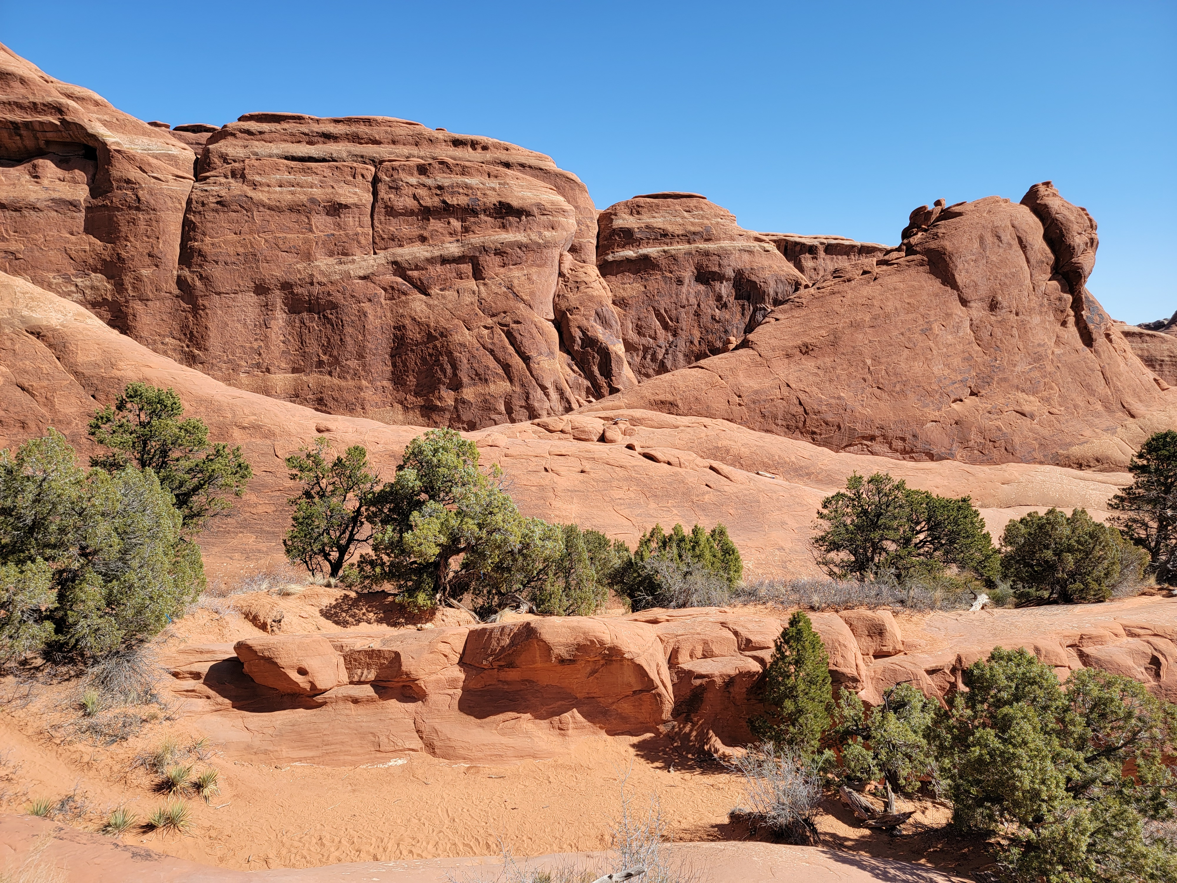
After Double O arch the route climbed up onto a rock ridge and followed the crest. It was a blast hiking over the slickrock. There were expansive views of the rock formations of Arches National Park. In the distance were the La Sal Mountains, still topped with snow. The route was safe because the ridges were wide but the sides fell away steeply enough to give a mild feeling of exposure. It was enough to make it exciting without making it scary.
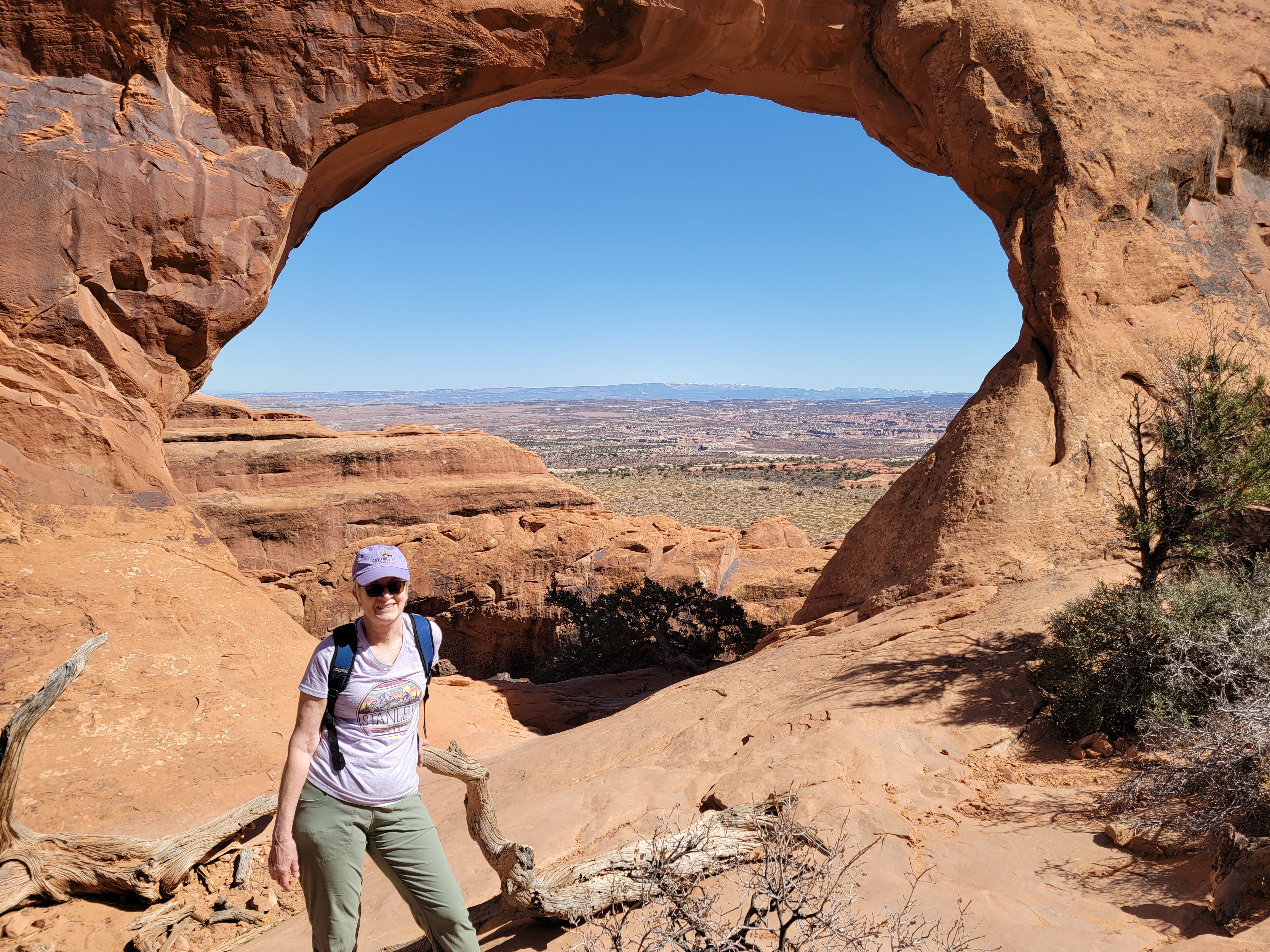
Since we were most of the way around the loop and still feeling good, we decided to take the side trail that went to Partition Arch. It only added about half a mile to the total distance, all of which was flat. The arch was just a big hole in a major rock ridge. Looking through it gave a spectacular view. There were a few hikers hanging out here but they were polite, staying out of the way while people took turns taking photos of the arch. No one was photobombing here.
When we returned to the main trail, we could see the viewpoint for Landscape Arch and the end of the loop part of trail. It was quite a way below us at the bottom of a steep gully. I had been routefinding most of the way but here I was not sure which way to go. The rocks looked pretty steep everywhere. While I hesitated, Sandy pushed ahead and found a good route through the steepest part. Soon we were down and on the paved trail again. Then it was just an easy walk back to the car.
 Dinner with a view at the Sunset Grill
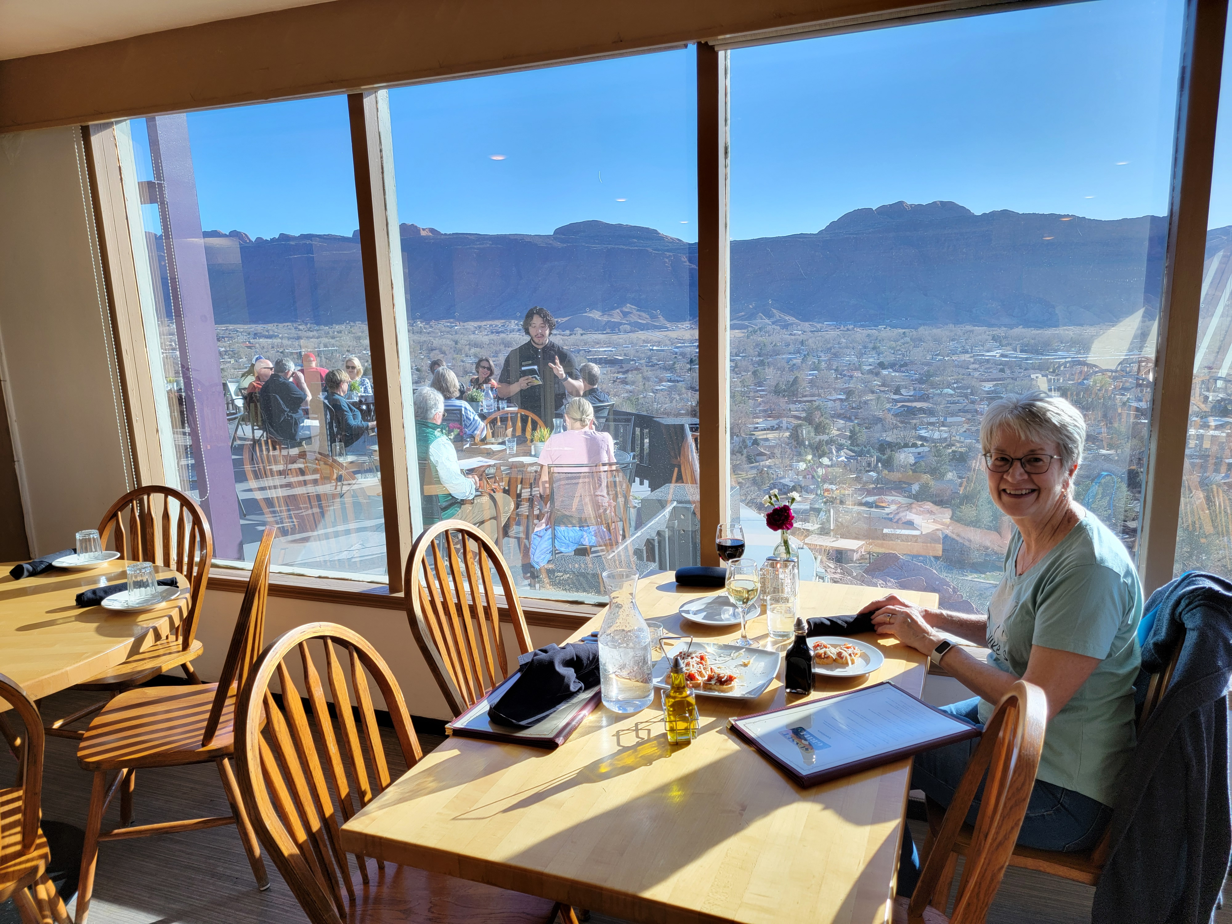
Since it was such a beautiful day, we decided to have dinner at the Sunset Grill. It's perched high up the canyon wall of the valley that contains Moab. Since it faces west, it features a beautiful view of the sunset. You probably would have guessed that from the name. We didn't have a reservation so we got there fifteen minutes before it opened. There were already some people waiting to get in. By the time it opened at four o'clock, there were a dozen people lined up at the door. There was both inside and outside seating. While some brave souls ate on the patio, it was cool enough that we wimped out and sat inside. We got a great table next to full lenght windows, so we could still enjoy the view of the town of Moab. Across the valley we could see Behind the Rocks, a BLM Wilderness Study Area where I've done several excellent hikes. Our dinners were good. It was a beautiful evening and the view was awesome. A great way to finish off an excellent day.
 I enjoy some rare sunshine while exploring the Windows
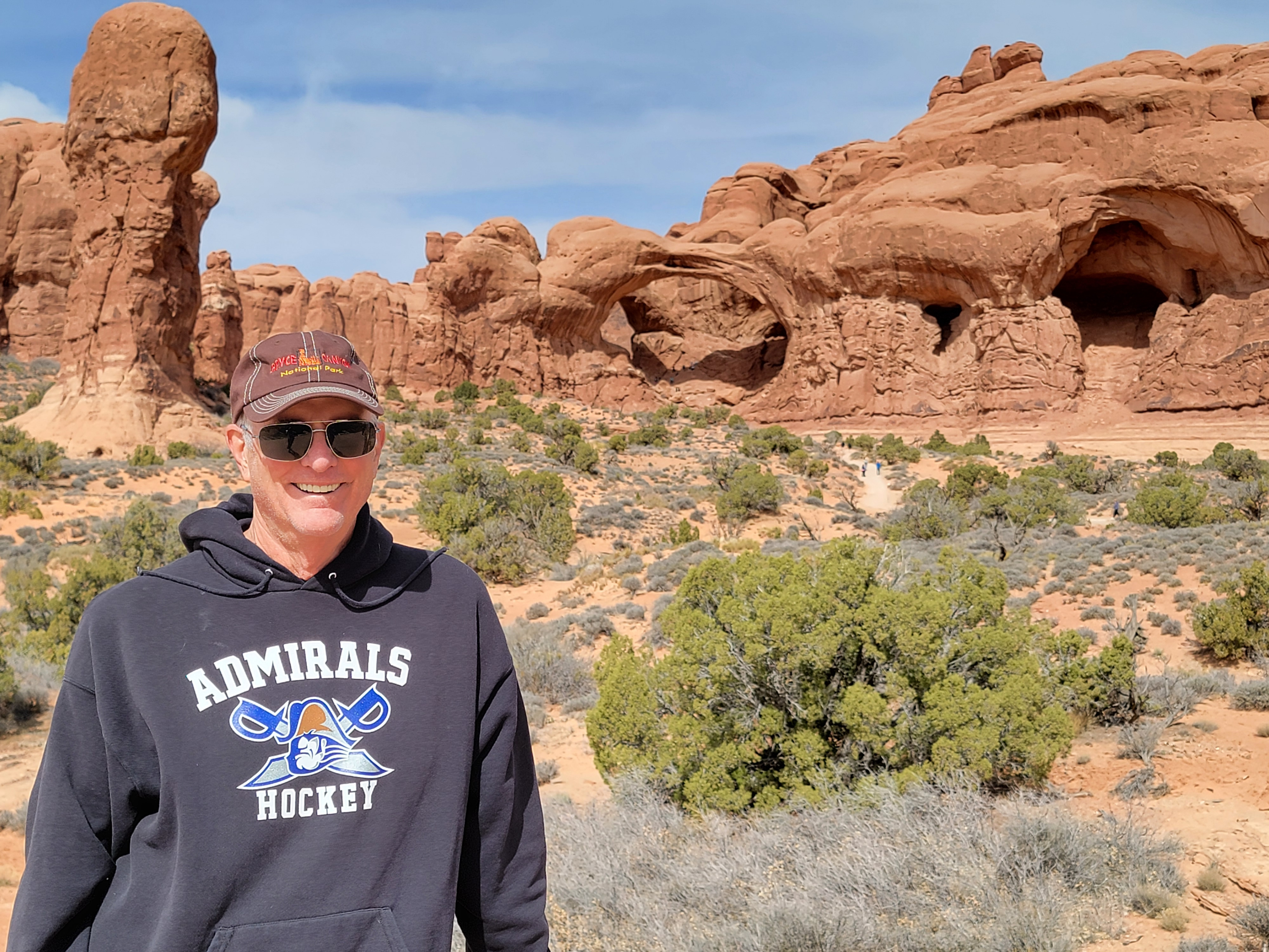
The next day the forecast was for mostly cloudy weather so we didn't plan anything too ambitious. We started by going to the Windows section of Arches National Park. There are several major arches there, all of them reached by a network of short trails. We visited Turret Arch, North and South Window, and Double Arch. Cloudy early on, we did get some sun later in the morning before the clouds moved in for good. The temperature was pleasant and we enjoyed wandering from arch to arch. Unfortunately, most of the time, the lighting was flat, which isn't conducive to great photos of the scenery.
In the afternoon we decided to try the Must Do of every trip to Arches National Park - hiking to Delicate Arch. The problem is that it is hugely popular and there is limited parking at the trailhead. Whether or not we could do it depended on whether or not we could find a parking spot. It was Tuesday and all the people who had been in town for the big cycling event over the weekend seemed to have finally left. Midweek, early in the season seemed like a good bet, but it was the middle of the day. Turns out we neeedn't have worried. When we got there, the lot was only half full.
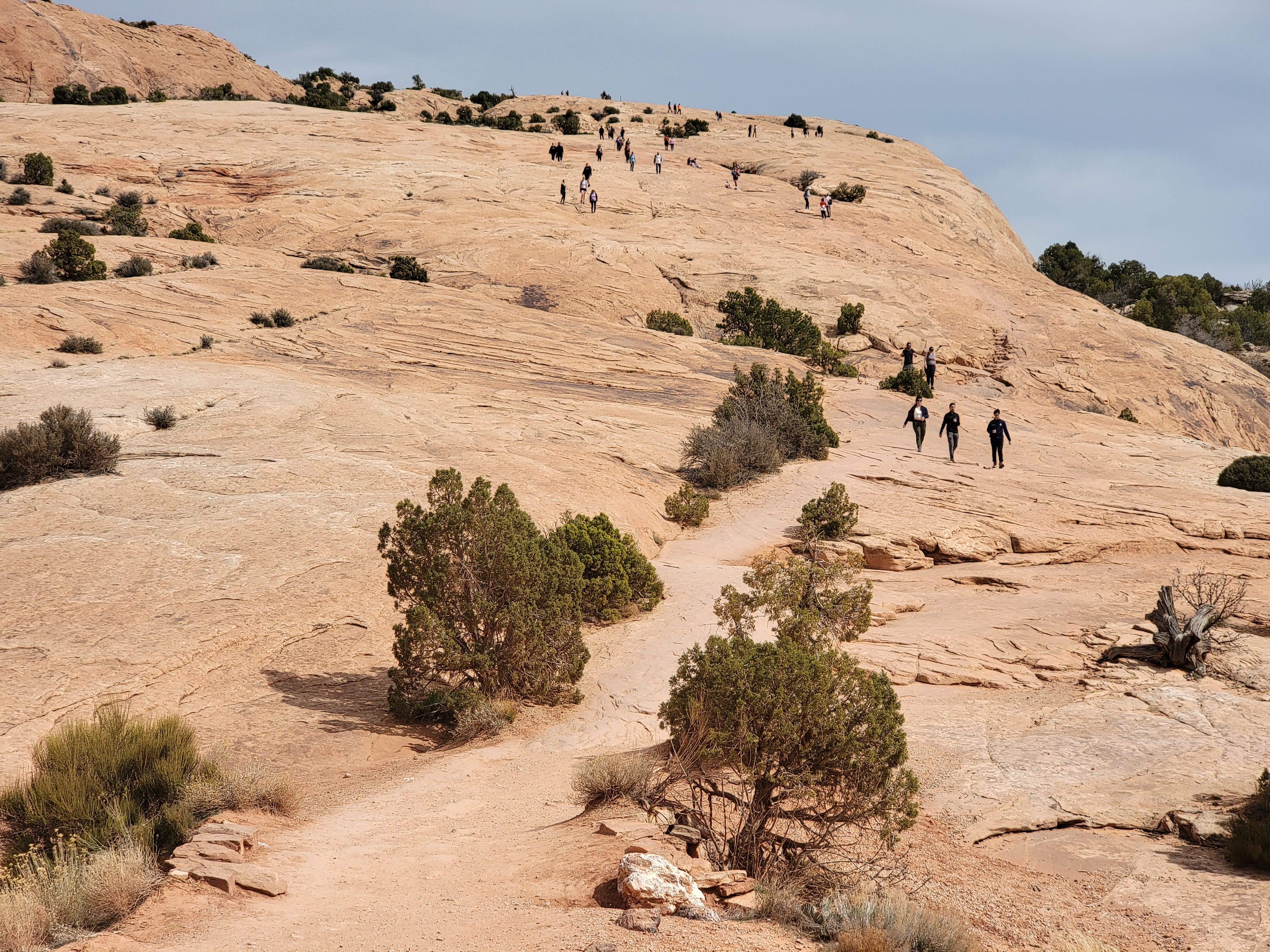 What "not crowded" looks like on the Delicat Arch hike
Delicate Arch is one of my favorite hikes. I've probably done it ten times and I never get tired of it. After an approach on an easy trail, the route goes up a long slickrocke slope. It's easy but I think hiking on slickrock is always fun. Near the end, the route follows a rock ledge around a corner. You don't see the arch until the very last moment. When we got there, it was an impressive sight. It always is. There was a crowd there, with a line of people waiting to go to the base of the arch to have their picture taken. There always is. At least they were being polite, self organizing to take turns. We've done photos under the arch before, so we didn't want to wait in line. We just admired the arch for a while and then headed back down. On the way back, we took the short side trail that leads to some petroglyphs. They are in surprisingly good shape considering how close they are to a very popular trail.
Back in town, we tried a new place for dinner, The Broken Oar Restaurant. It was just across the street from our hotel so we could just walk over. It had a log cabin motif, very appropriate for a hiking trip to Moab. Most importantly, the food was good.
We had a good two days to start our trip. I'll cover the second half
The first two days of our Moab trip had been great. I'll cover the second half in another post. Spoiler Alert: the weather forecast for day three was sunny and warm.
