Arches National Park: Part 2
 Starting the Fisher Towers Trail
The first half of our spring trip to Moab had been great. We had perfect weather the first day and we used it to hike the Devil's Garden Primitive Loop Trail. It's the longest trail in Arches National Park, very scenic and challenging enough to be a lot of fun. The following day was overcast much of the time but the temperatures were still mild. We did shorter hikes to several arches in the Windows section of the park. We also hiked to the granddaddy of them all, Delicate Arch. Besides hiking, we did some shopping in town and had two good dinners.
According to the forecast, the weather for day three looked really good. It was going to be sunny and warm, a perfect spring day. It looked like a chance to do something more ambitious. The hikes that we had done so far had been excellent, but we had done all of them before. Now I wanted to try something new. It was time to do some exploring.
 Approaching the towers
Although Arches is a beautiful park, there really aren't many trails. We had done just about all of them in our first two days. But besides the national park, there is also good hiking on BLM lands near Moab. Corona Arch is a fantastic hike, but we've done it before and I've done it multiple times. There is a good through hike in the Behind The Rocks Wilderness Study Area, but I've done that as well in two segments, hiking to the midpoint from the north and from the south. I've also done other nearby trails, like Longbow Arch and Grandstaff Canyon to Morning Glory Arch.
Sandy and I have also hiked the trails in Dead Horse Point State Park. There are still some hikes in the Island in the Sky District that I haven't done, but I wasn't too interested in them. I've never been too impressed by that part of Canyonlands National Park, although I do love the Needles District near Monticello.
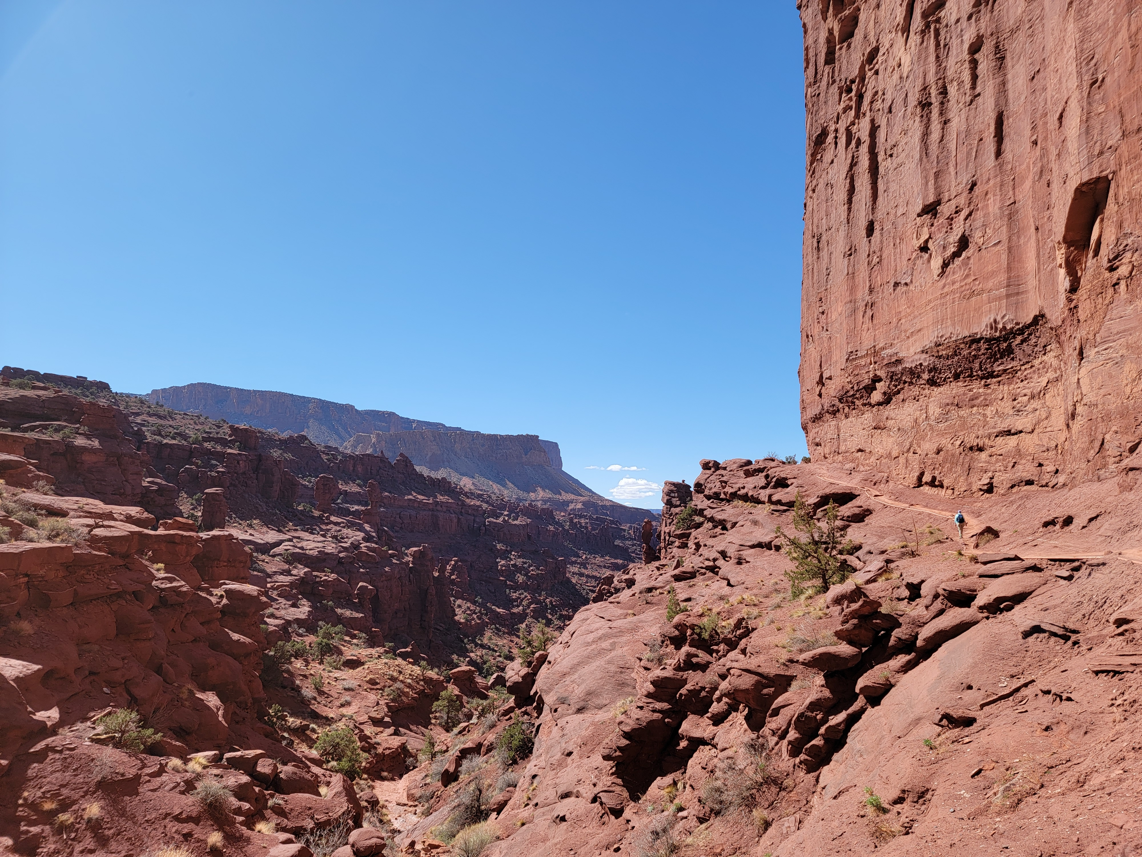
 Yes, that's where the route goes
The obvious choice was the Fisher Towers Trail. It's a little farther away, about thirty miles from Moab. I've always meant to do it but somehow never got around to it. Now was my chance.
As promised, the next morning there wasn't a cloud anywhere in the sky. We drove out of town and turned east on Utah 128 at the Colorado River. It's a pretty drive. The highway follows the river through a narrow canyon which widens as you go farther up river. When we reached our turnoff, it was about a mile on a good dirt road to the trailhead, about 45 minutes total from our hotel.
The trail started off heading into open desert but soon dropped into a wash where it turned to approach the towers. I hadn't been impressed by the pictures that I had seen of the them. Wikipedia says the towers are composed of "sandstone and mudstone". Mudstone? Although very steep, the rock faces are not clean like granite or hard sandstone would be. They do look like they are made of dried mud.
The reality of the towers was something else though. They aren't steep. They are STEEP!!! And after approaching through the wash, the trail wound right along the side of them. On one side was a long drop into the wash while on the other side a sheer cliff rose hundreds of feet above us. The tallest of the towers, the Titan, is indeed impressive. It rises 900 feet from it's base. It is considered the steepest peak in the United States and the largest free-standing, natural tower in the country.
 The towers up close and personal
Besides the scenery, the hiking itself was interesting. A lot of it crossed over slickrock, which I always enjoy. At one point, the route rounded a corner where the trail got very narrow with significant exposure on one side. It wasn't too scary but it did require care to negotiate. A little farther along, a narrow gully cut across the route. We needed to stretch along the edge to grab a ladder, climb down about ten feet, and then scramble up rocks on the other side to regain the trail. Definitely more interesting than a slog where you just put one foot in front of the other over and over again.
Eventually we passed the towers and started to move away from them along the crest of a ridge. Up close had provided one perspective as the rock faces soared high above us. As we got farther away we could appreciate the whole tower. It was certainly better for photos that showed the entirety of the rock formations.
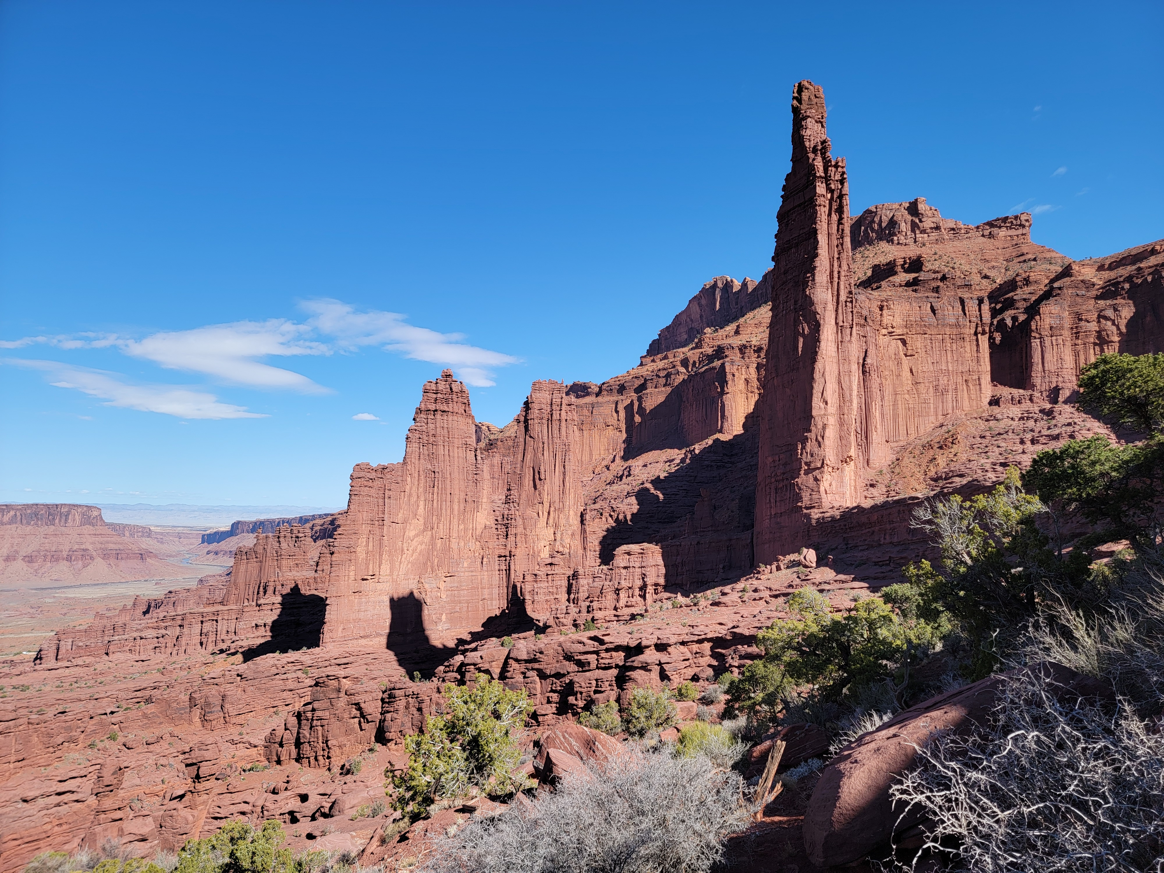 The Titan dominates the Fisher Towers
The trail didn't actually end at a destination. It just continued out along the ridge, getting fainter and fainter as it got farther from the towers. We eventually decided that we were far enough to appreciate their massive size. We found a comfortable spot to sit and have a drink and a snack while we admired the view. Then it was time to head back. The walk back took us by the towers again. They were just as impressive winding through them a second time.
When we got back to the car, my GPS and the AllTrails app said that the hike had been about five miles with 1654 feet of elevation gain. It was a good workout but not so much that we were wiped out. I had to admit that I was pleasantly surprised. It was definitely a five star hike.
I was also really thirsty and was looking forward to a Diet Coke as soon as I could get one. Driving back, it didn't take us long to reach the Red Cliffs Lodge. Set right next to the Colorado River, we have thought about staying there on one of our trips to Moab as an alternative to staying in town. I thought we could check it out and I could get my Diet Coke. No bueno though. There was a bunch of construction going on and everything was closed. Oh well. It meant that I had to wait the full forty five minutes to get back to town to get my Diet Coke. I survived, but just barely.
 Passing massive cliffs on the return
We still has some energy left and the weather was perfect. We went back into Arches National Park that afternoon and did one more short hike - Park Avenue. It's only a short drive from the park entrance. The view from the trailhead is spectacular, looking down a valley with steep rock formations lining both sides. It might be the best view of the entire hike, but it is still worth taking the trail that descends a series of stairs before leveling out to go through the valley. It's a short hike. In just under a mile the trail intersects the road again. We were almost there when Sandy said her foot was finally starting to bother her. I told her to go ahead to the end and wait for me by the road. Meanwhile I hustled back up the way we had come to get to our car and then drove drove down to pick her up. That was enough hiking for one day. We headed back into town and had dinner at Moab Brewery. We spent the rest of the evening checking out the tshirts (me) and jewelry (Sandy) in the shops in town. Hey, it wasn't just for us. We did buy some gifts for friends and relatives. They went in our stash of presents for birthdays and Christmas.
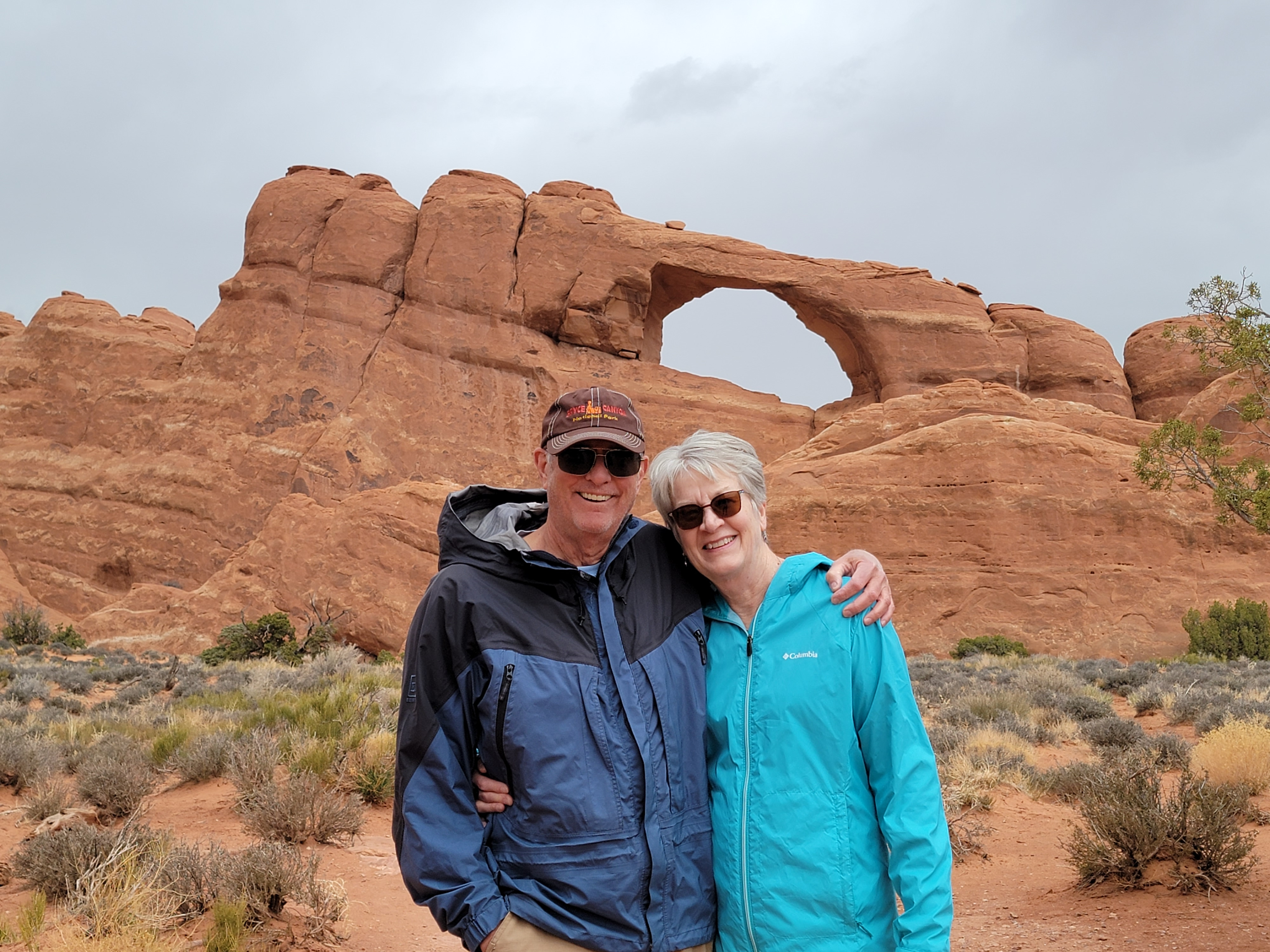 At Skyline Arch on our last day
On the last day our luck with the weather ran out. The morning was cloudy and rain was forecast for the afternoon. We took our time having breakfast at the Jailhouse Cafe. It was crowded but the food was good. And I did get a cool tshirt there. After eating we did go back to the park and did some more short hikes to a couple of arches, but eventually it started to rain. We called it good and headed back to town. We figured that good weather on three out of four days ain't bad.
That afternoon we tried a new place for linner (lunch/dinner) called Zax. They served pizza and pasta so it was my kind of place. They also had patio seating outside which Sandy likes. The patio was kind of weird though. We sat at one of two small tables in the front just off the sidewalk on the main drag through town. It was covered, which was good because of the rain, but it was kind of crammed in under an upstairs patio and a stairway leading to the upper patio. It was rather gloomy, which is not what you expect from an outside patio. At least the food was ok and we stayed dry, so we couldn't copmplain..
Next morning it was time to head home. On the way, we stopped for brunch at a Denny's in Spanish Fork. That's kind of a treat for us now. We always liked Denny's but about a year ago they closed almost all of their restaurants in the Treasure Valley. Now we only get to eat there when we travel. So that was a good way to finish off a good trip.
