Grand Slam #1: Cervidae Peak
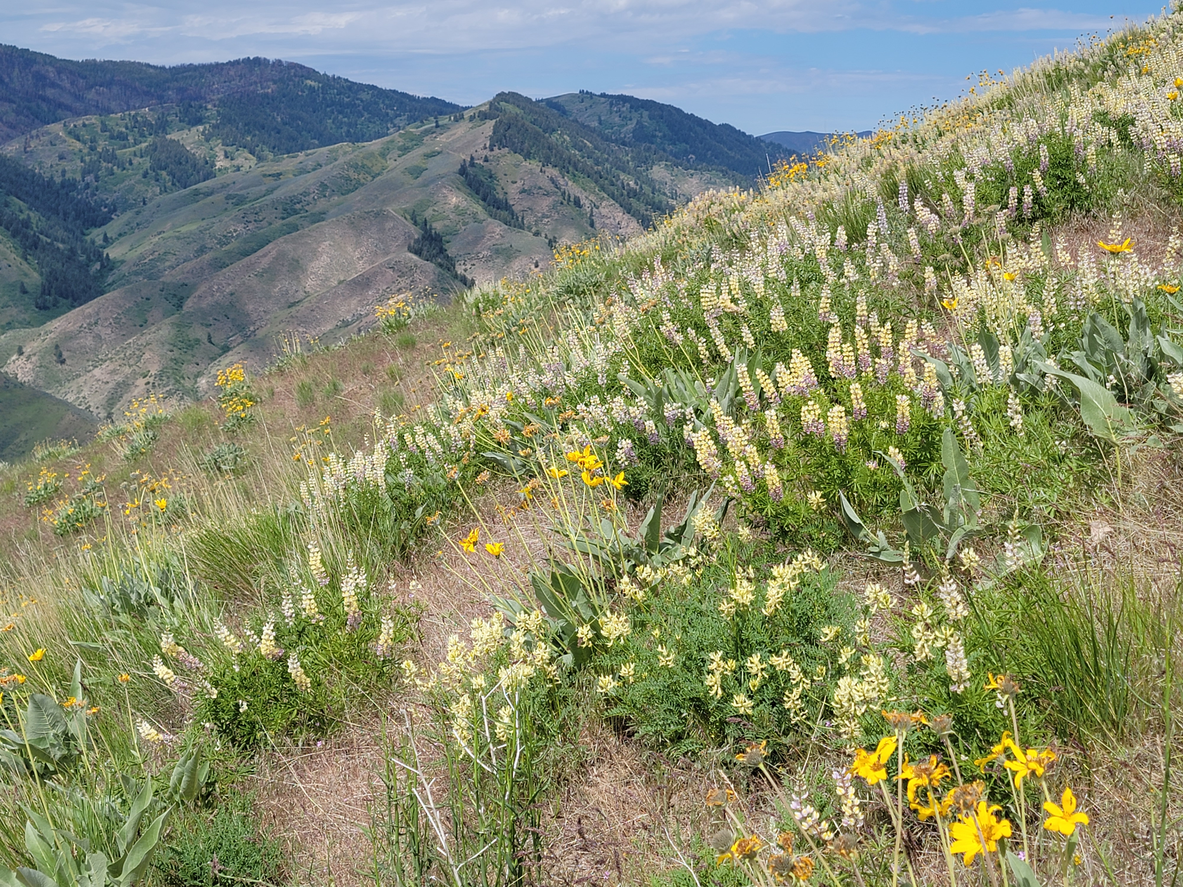 Lupine on the upper slopes of Cervidae
I'm pretty excited about the hiking season this year. In January 2024 I got a knee replacement. By that time, I struggled to do even moderate hikes because the arthritis in my knee was so bad. It took several months before I recovered enough to start hiking again, but at the end of last season I felt that I could do tough hikes again. This year I was looking forward to a full season of serious hiking. I'm off to a good start already, with trips to Zion National Park, Arches National Park and Escalante National Monument this spring.
To get ready for hiking in the high mountains this summer, I wanted to try to do the Boise Grand Slam Peaks. These are four mountains near Boise that are popular early season hikes. They're good preparation for hikes on bigger mountains later in the year when the snow melts in the high country. They are also worthwhile summits in their own right. They were first populariazed by Tom Lopez, author of Idaho: A Climbing Guide. He's probably the world's greatest expert on mountaineering in Idaho.
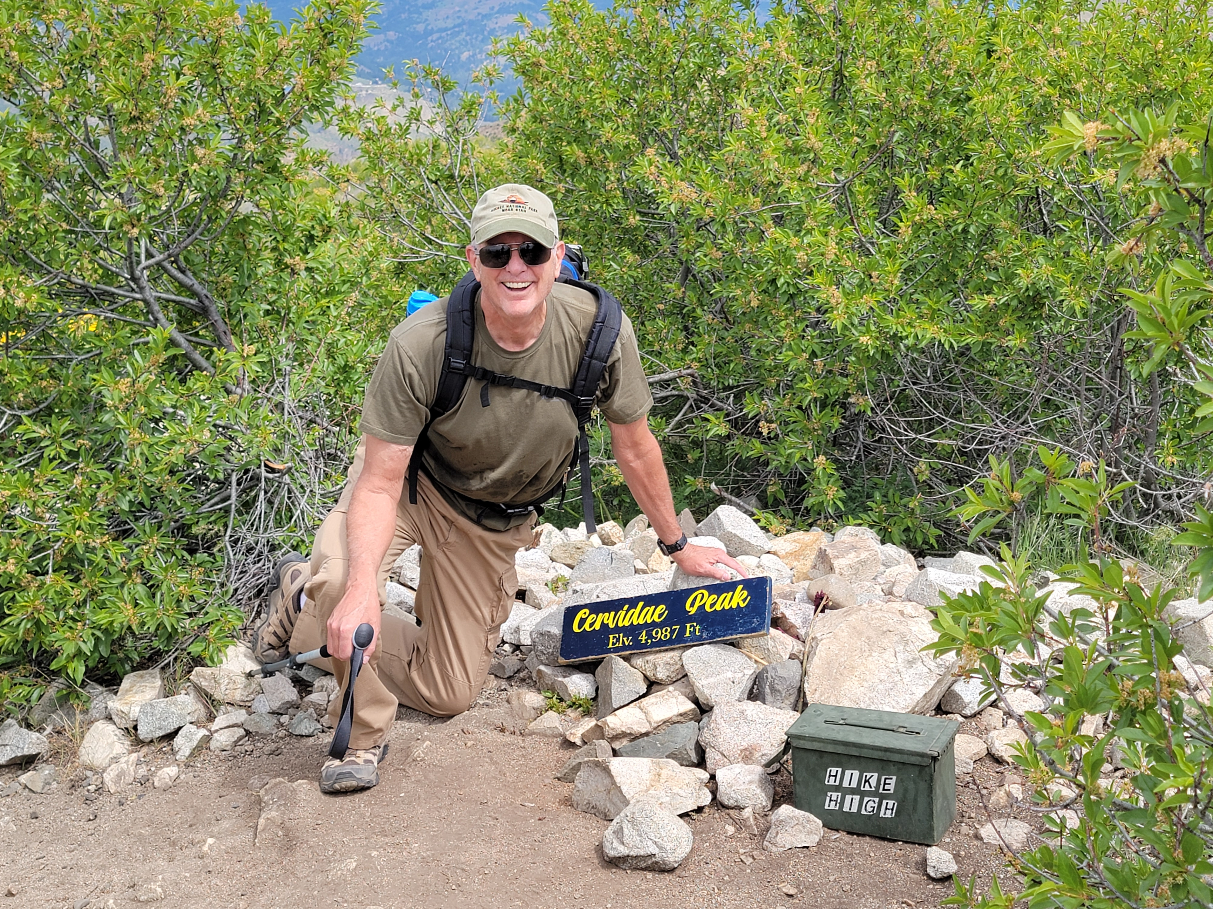
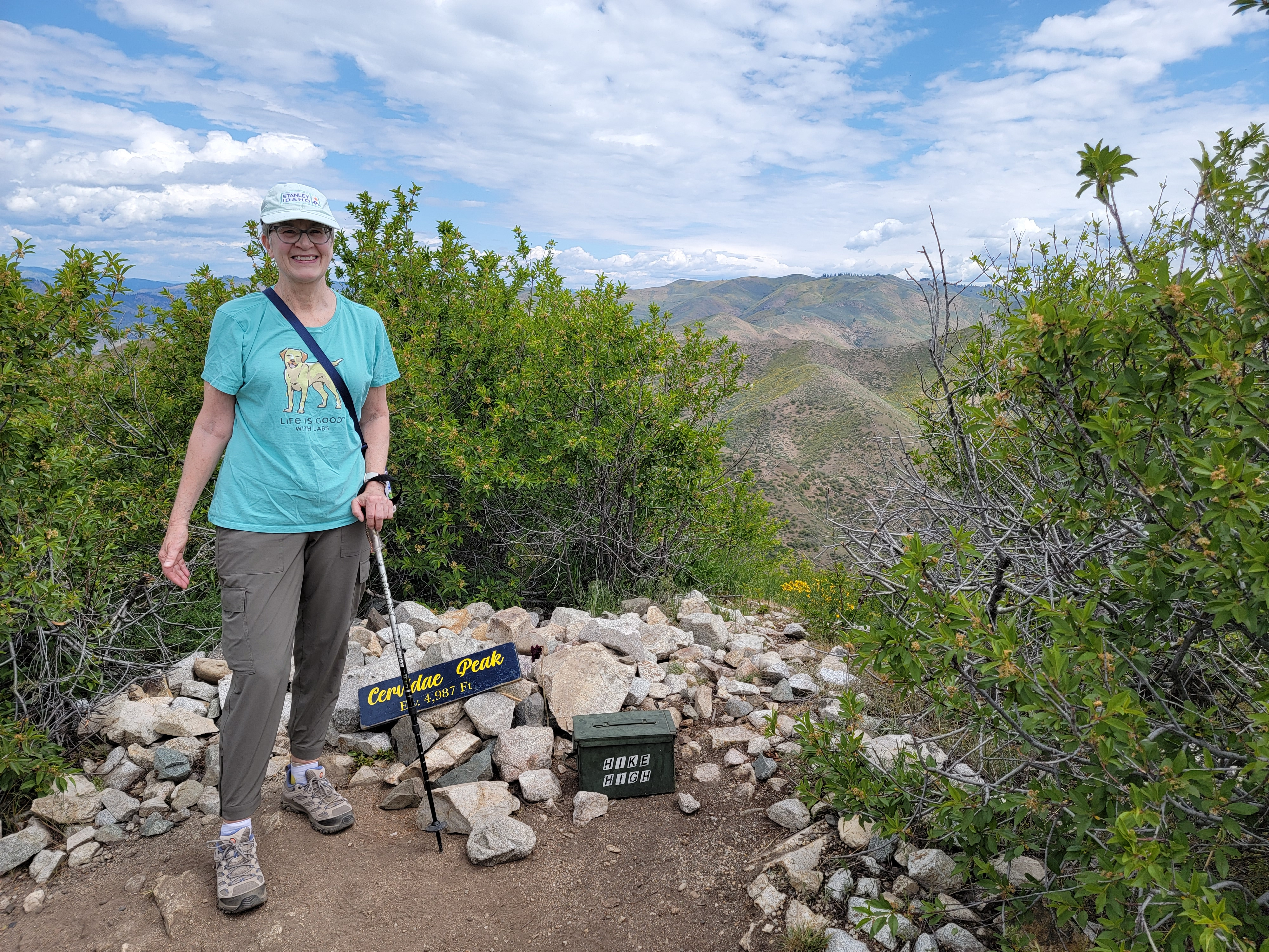 Sandy on the summit of Cervidae Peak
The Grand Slam Peaks are: Mount Heinen, Kepros Mountain, Cervidae Peak and Shaw Mountain/Lucky Peak. I decided to start with Cervidae Peak. It's the shortest of the four and has the least elevation gain. It's still a healthy hike though. I knew that because I climbed Cervidae Peak once before, with my dog Abby, back in 2022. This time Abby stayed home. She's getting older and doesn't do as well in the mountains as she used to. Instead, Sandy decided to go along so I wouldn't be hiking on my own.
The access for Cervidae is pretty easy. It's east of Boise, rising above Lucky Peak Reservoir. Most of the time it took us to drive there was the forty five minutes to get across town. Once you're at Lucky Peak Dam, it's only ten miles along Highway 21 to the turnoff. Then it's just another mile along the dirt road that runs beside the reservoir and past Lucky Peak Marina, to reach the parking area.
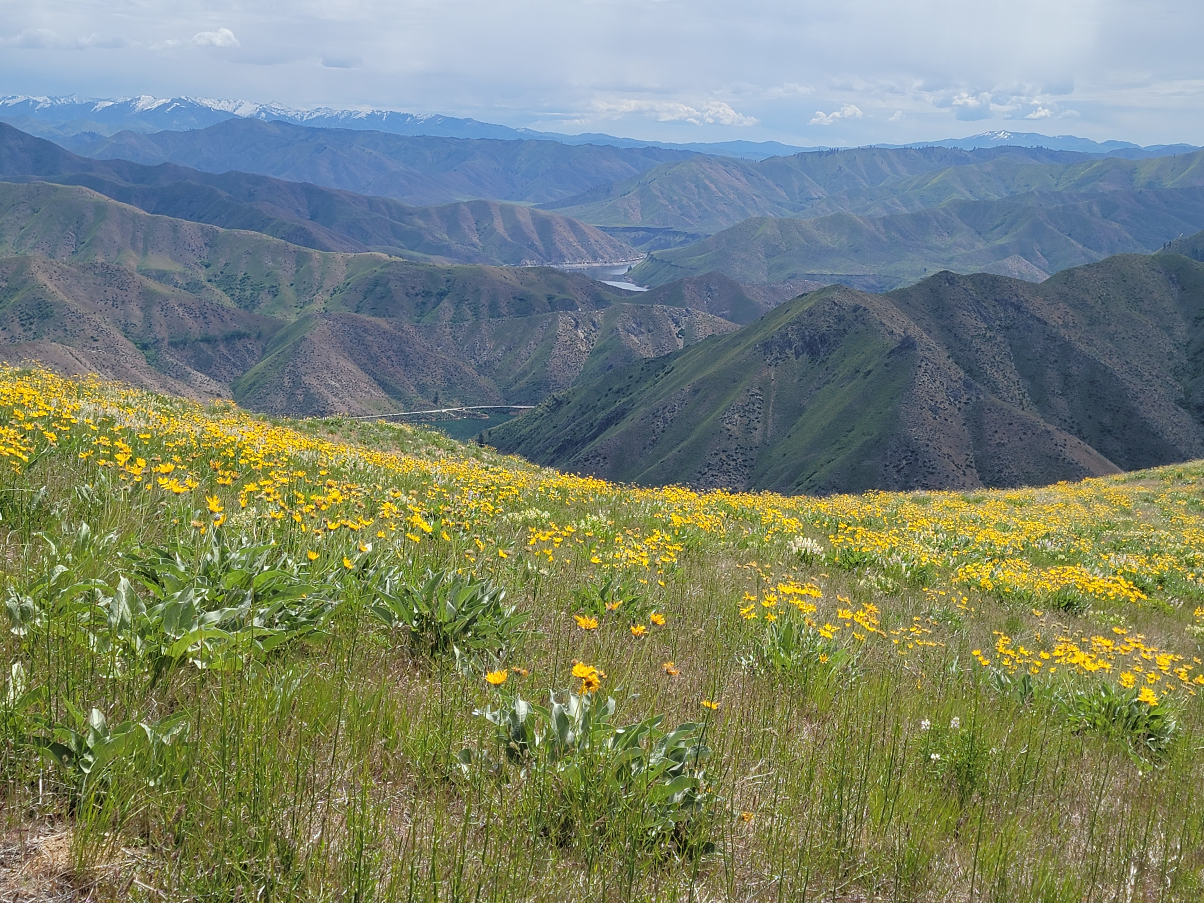
 Arrowleaf balsamroot lined the trail
It's a popular hike, so even though it was a Friday morning, there were quite a few cars at the starting point. Note that I don't refer to it as a trailhead, because although we were on the standard route, it is not a maintained trail. It's a dirt track worn by use - by hikers, mountain bikers, ATV's and 4WD vehicles. According to AllTrails, it's 4.6 miles round trip with 1932 feet of elevation gain. That's not that long a hike, but it's a lot of elevation to gain in that distance. And it's not a designed trail, so there are no switchbacks or rising traverses to ease the grade. The route climbs up onto a ridge and then follows the ridgeline all the way to the summit. There are really no level sections. It's either moderately steep, steep, or very steep. The only time it isn't going up is when it's going down, as it climbs up and over several bumps and intermediate summits along the ridge. Ok, full disclosure. There was one intermediate summit that had a sketchy secondary track that let us make a level traverse around instead of going up and over and down again. But only one.
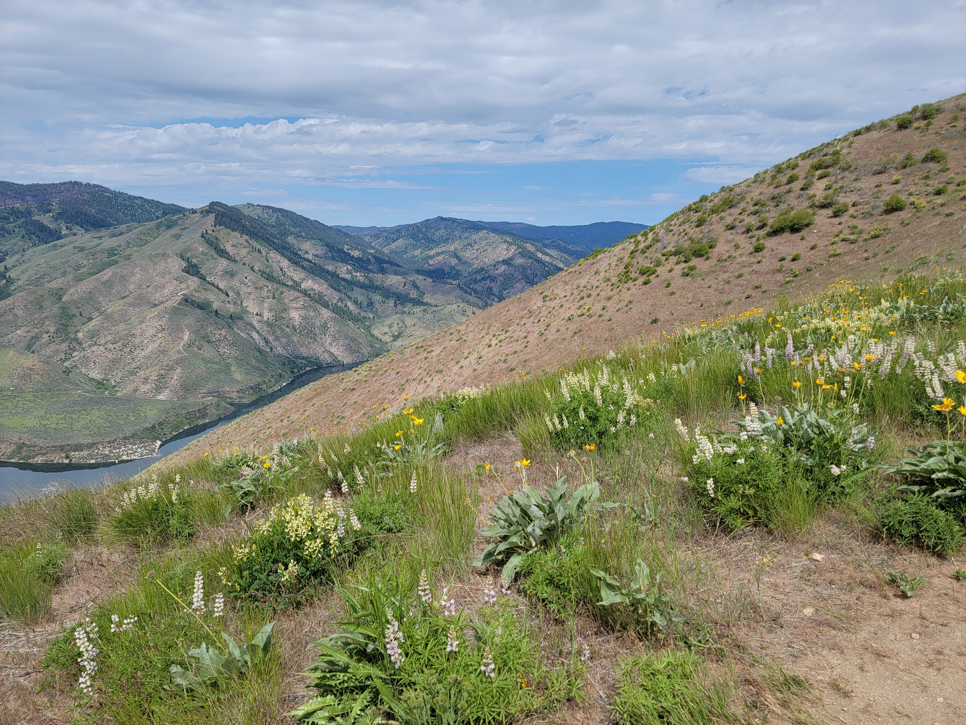
 Some slopes were completely covered in wildflowers
A nicely graded trail would have made it a lot more pleasant on the way up, but we managed ok. We felt strong and just took it slowly. We're old hikers and not proud. We didn't care if people passed us on the way up.
Since we were going slowly we had a lot of time to admire the wildflowers. They were everywhere. At this time of year, there are a lot of wildflowers on slopes below treeline, which is about 6,000 feet near Boise. Arroleaf balsamroot was everywhere. Some entire slopes turned yellow, completely covered by it. As we got higher, there were large fields of lupine. There were lots of other flowers scattered around. Some I recognized. Some I didn't Hikes at this time of year are worth it for the wildflower viewing alone.
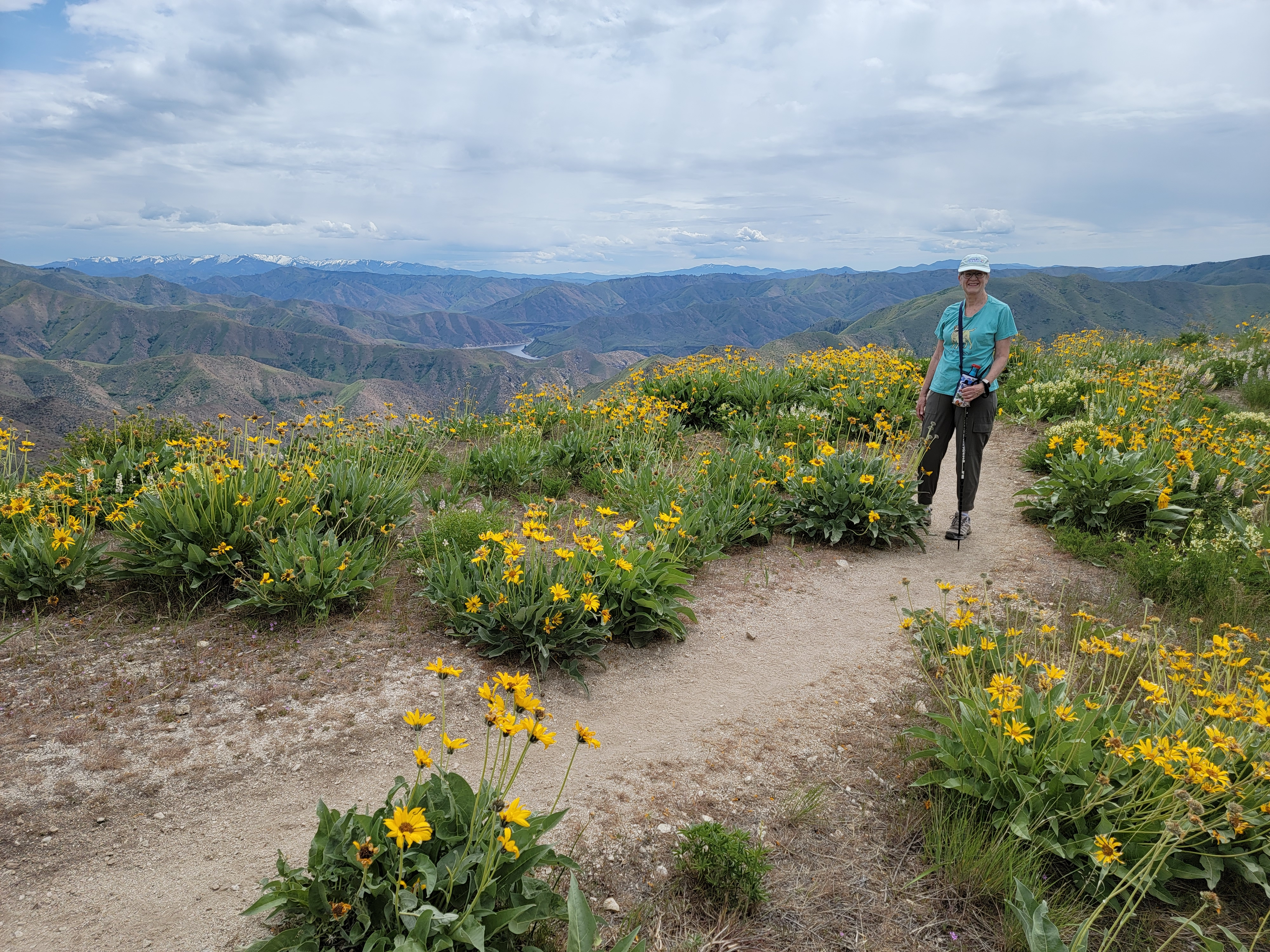
As we climbed, the view expanded in all directions. We were on a ridge and below treeline, so our view was unobstructed. We could see south to the Owhyhee Mountains, west to Bogus Basin, and north and east into the Boise Mountains. In the distance, the higher peaks still had snow on them.
 Yes, I made it to the summit too
It seemed like a long haul but we felt good when we finally reached the top. I'm not sure if it was a sense of accomplishment, or just relief that there was no more uphill. Probably both. The summit area had tall shrubs which partially obstructed the view, which had been better along the ridge on the way up. But there was a sign with the name of the mountain which was good to pose with in photos. There was also a summit register where we could document our success. That didn't take long so after five minutes on top we were ready to start down again.
Going down was much easier and much faster, at least most of the time. There were some very steep sections, which on the way up were just hard work. On the way down, they were quite treacherous. When descending very steep slopes of loose dirt, the entire time I felt like I was on the verge of slipping and falling on my butt. It wouldn't mean a serious injury but there could be cuts, scrapes, maybe even a sprained ankle of wrenched knee.
 More lupine and arrowleaf balsamroot
Since I had done this route before I knew what it was going to be like. I made sure that each of us brought a trekking pole along. That helped with balance and stability, and did make us a little more secure on the slippery slopes. Those sections still weren't fun, but we did manage to get down without mishap. No serious injuries, to our bodies or our pride.
Cervidae Peak provides a good workout. We felt a real sense of accomplishment for climbing a significant peak. The views were great and the wildflowers were spectacular. But I have to admit that the sections of really steep dirt just weren't fun. So while I was glad to have done the hike, it definitely isn't a favorite. It's not a hike I would want to do every year, like the Five Mile Gulch/Watchman/Three Bears hike in the Boise foothills, that I've done many times.. Sorry Tom Lopez.
