Bryce Canyon National Park
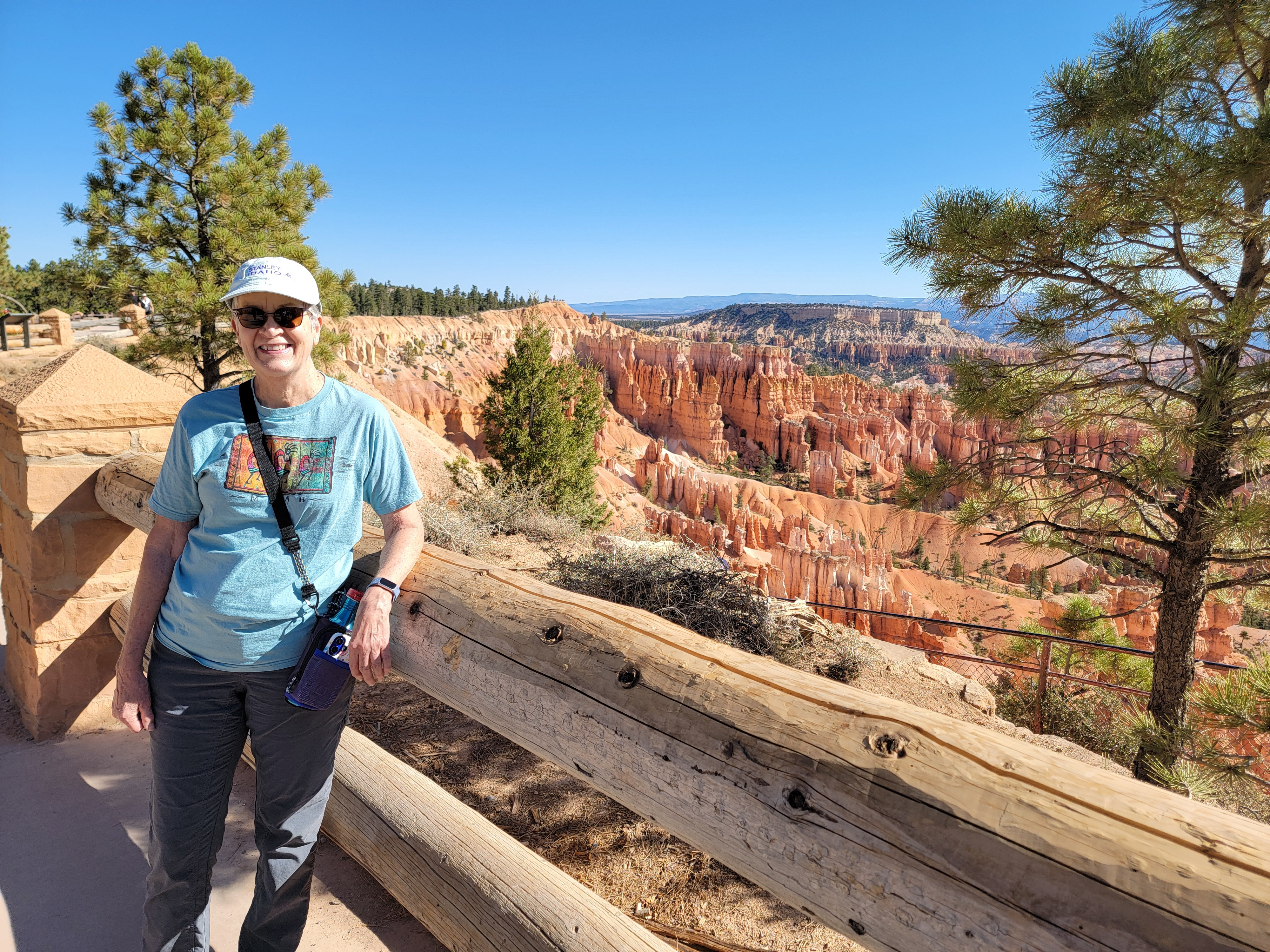 Starting our hike at Sunset Point
We were ready to start the last leg of our Utah canyon country vacation. We spent a weekend hiking in Capitol Reef National Park. We spent a couple of days hiking in Grand Staircase-Escalante National Monument and Kodachrome Basin State Park. Now it was time for us to move on to Bryce Canyon National Park. It's Sandy's favorite park so it would be the climax of the trip.
I had a strong feeling of deja vu driving there. We had gone three quarters of the way the day before when we went to Kodachrome Basin. We were just retracing our steps.
One thing we took note of as we drove by was the Clear Sky Resort. The area between Escalante and Bryce is very remote. It has very little light pollution and is one of the darkest places in the continental US. We had really enjoyed it when we drove outside of Escalante one night while we were there to look at the sky. Located between Cannonville and Henrieville (two very small towns), the resort lets you stay in glass, geodesic domes so that you can admire the sky for as much of the night as you wish. We thought it looked really cool. We might have to make a plan to go there next spring.
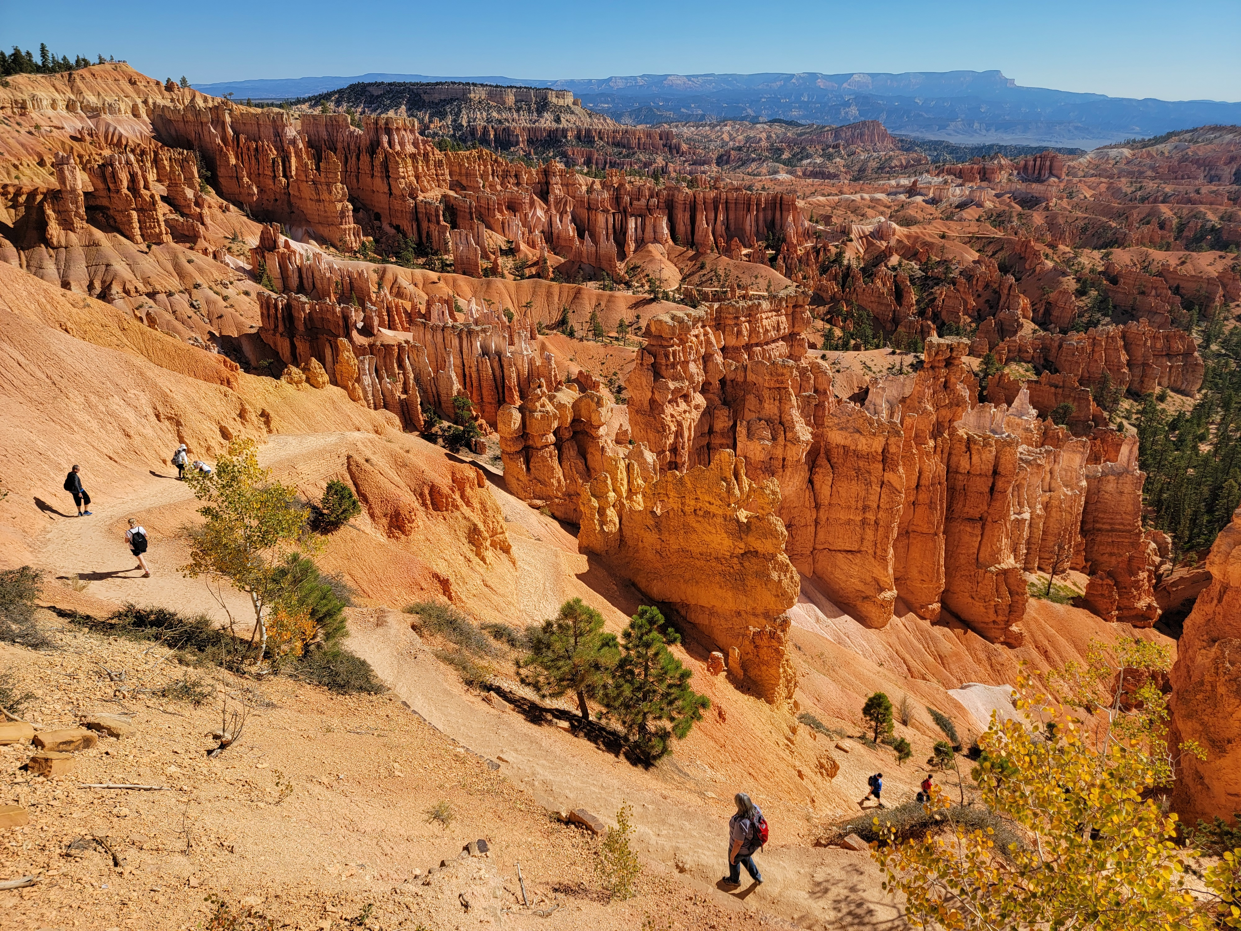 The beginning of the Navaho Loop Trail
Since the drive to Bryce would only take about an hour, we had time to stop for breakfast on the way. Yesterday we were going to try the Salt and Honey Bakery in Cannonville. We thought we would go right by it on the way to Kodachrome Basin. When we didn't see it we figured it had closed. Cannonville isn't that big a town. We didn't think there was any way that we could miss it. When we checked the map on our way back, it turned out that Cannonville actually has two streets, not just one. Sure enough, the bakery was located on the other street. We drove by to check and there is was.
Today, since we knew where to find it, we stopped at the bakery for breakfast. We got pastries and some coffee (well I got Diet Coke). It was a nice morning and we sat out on their patio while we ate. Properly fortified for a day of hiking, we got back on the road, heading to Bryce.
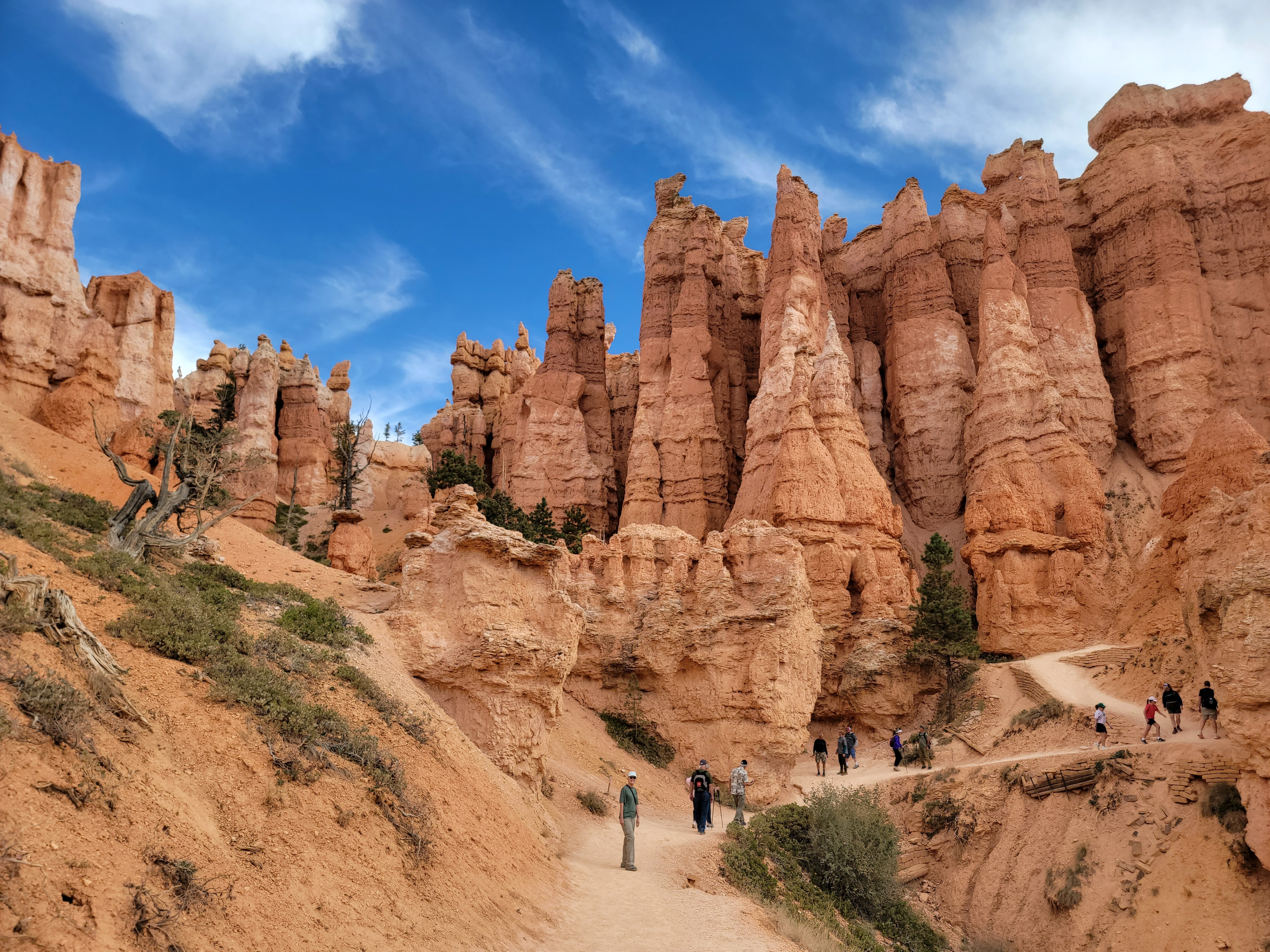
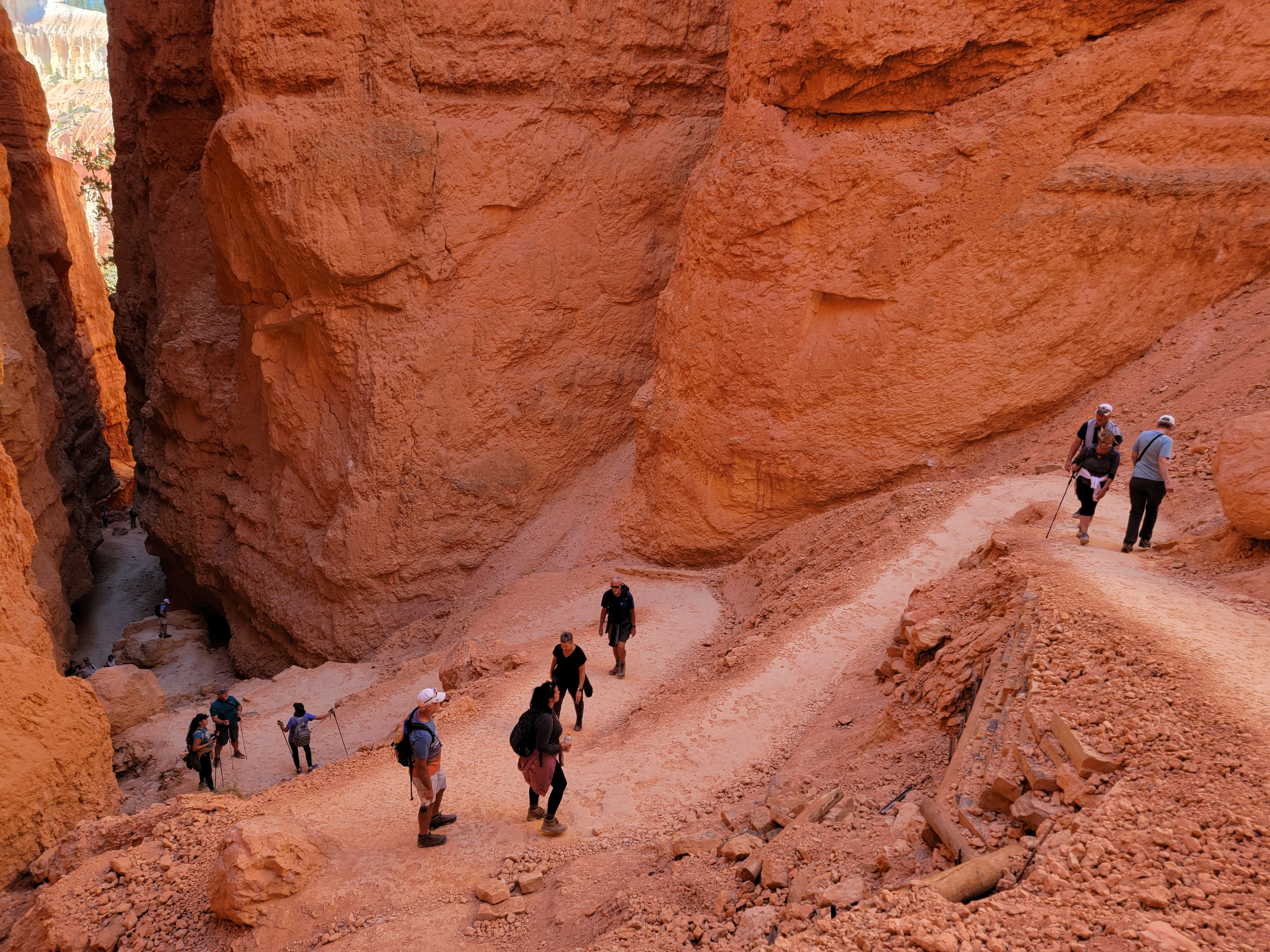 Descending through Wall Street
First stop was the visitor center so we could check out the shop. They had a lot of cool stuff, but since we had two days in Bryce, once again we decided to think about it before deciding what to get. Then we left our car in the visitor center parking lot and hopped on the free park shuttle. That way we didn't have to look for a parking space at the trailhead. Our experience in the past is that they can be hard to come by. Another advantage was that we didn't have to end up at the starting point of our hike. Since Bryce Canyon is not a canyon, but rather a long escarpment, the shuttle lets you do one way through hikes.
Hiking at Bryce is upside down compared to most hiking in the mountains. Usually you start by ascending to your destination, then hike downhill on the way back. Bryce is the opposite. Trails start on the rim and you begin by descending onto the face of the escarpment. Hikes end with climbs back up to the rim on the return. It's not more elevation gain than other trails, but it is never welcome at the end of a hike when you are tired. Out-of-shape visitors get in trouble because they descend further than they should and then struggle to make the climb back to the trailhead. I've only done a few inverted hikes like that. Grand Canyon was one. Grand Valley in Olympic National Park was another.
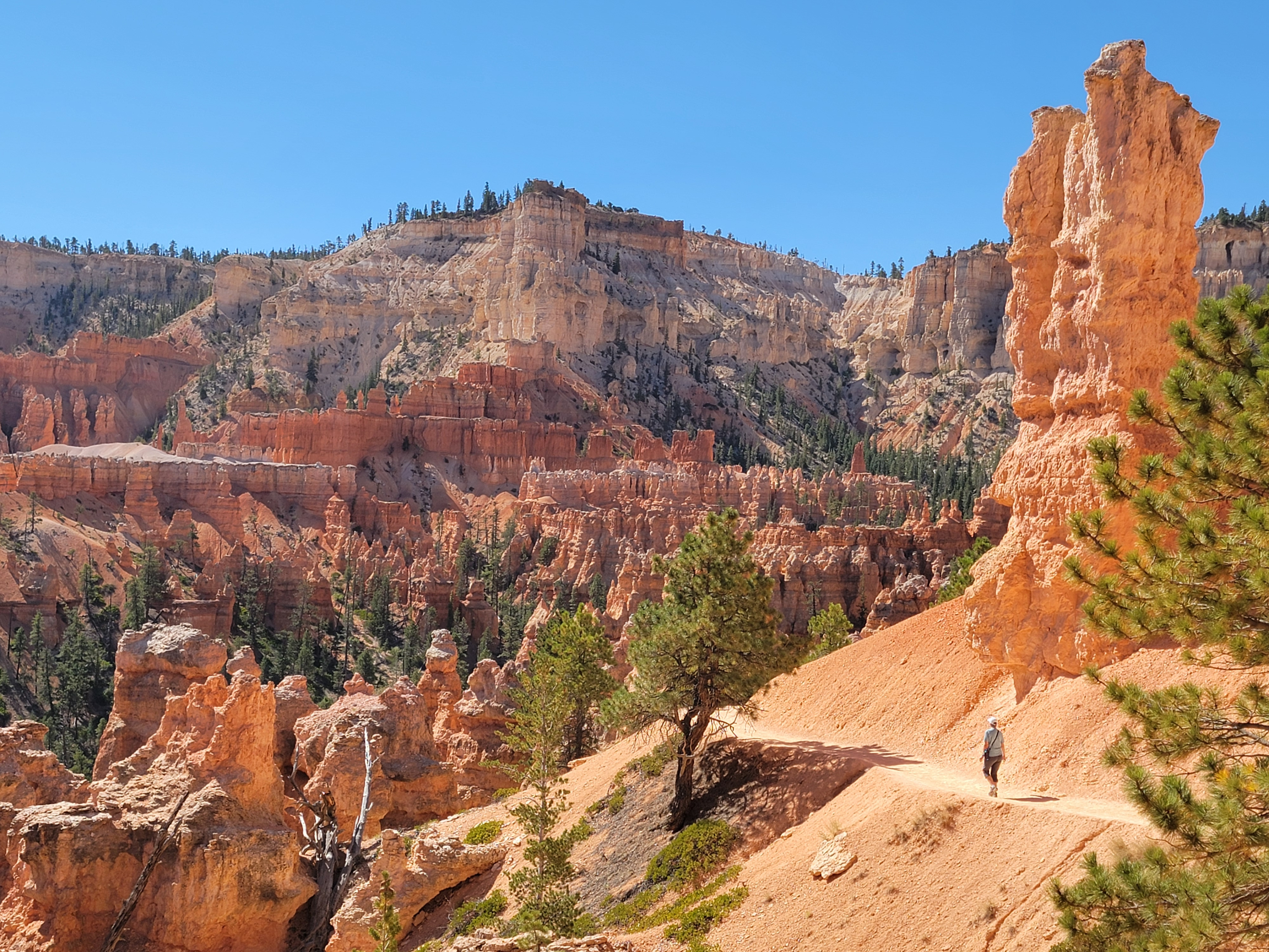 Sandy hiking on the connecting trail to the Peekaboo Loop
Bryce Canyon has an interconnecting network of trails that allows you to put together some interesting routes. We decided to combine the Navaho Loop Trail and the Peekaboo Loop Trail into a figure-eight, double loop hike. We began by taking the shuttle to Sunset Point. From there we descended a steep, tight series of switchbacks down one branch of the Navaho Loop Trail. It's known as Wall Street because you're in a narrow canyon between hoodoos that tower high above, reminiscent of the skyscrapers along Wall Street in Manhatten.
At the bottom of the Navaho Loop we reached a trail junction where a lot of people had stopped. I suspect most of them were on their way back up and were resting before starting the last, steep climb to the rim. We were going to take a break but we couldn't even find an empty rock to sit on. No rest for us. We just kept moving.
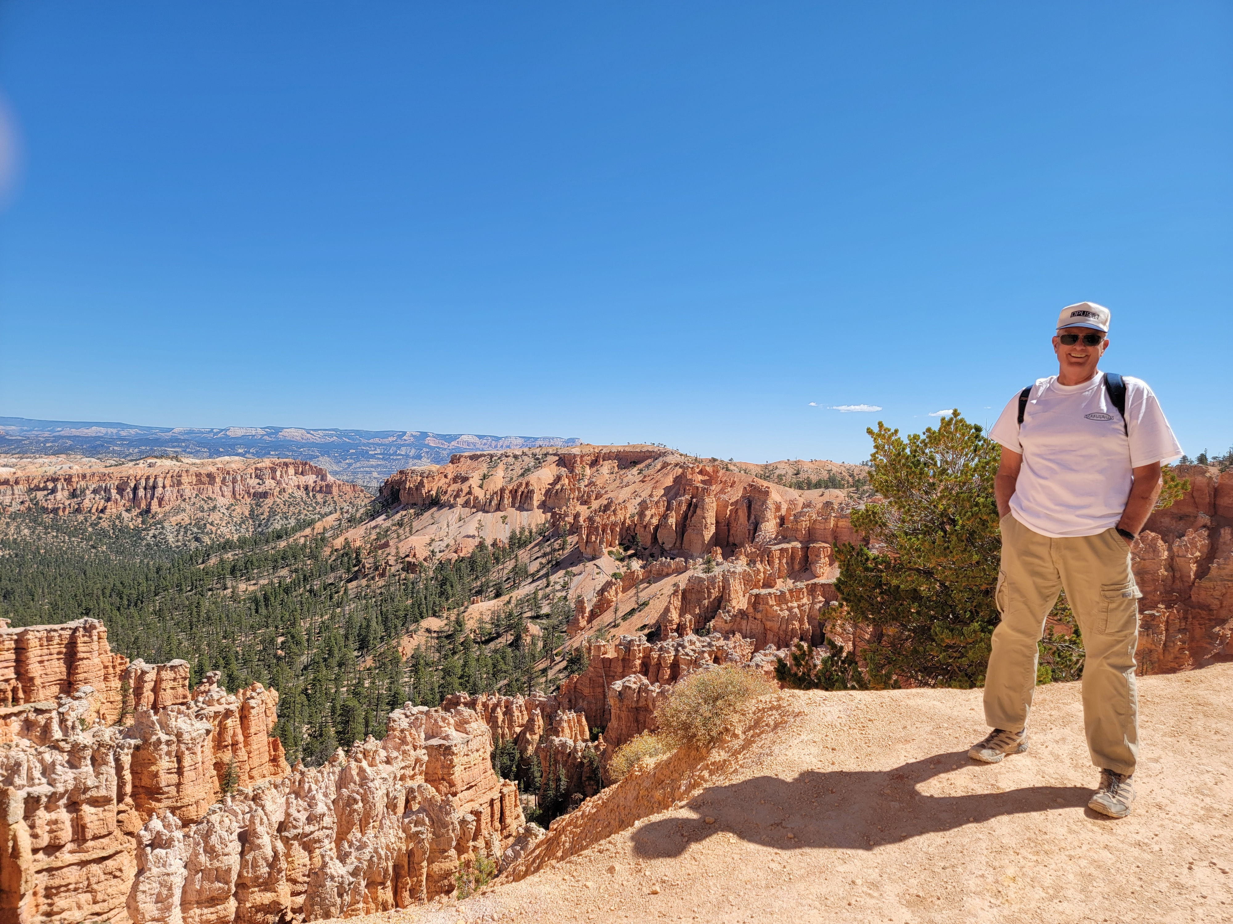 Steve near Bryce Point
From the junction we turned south on a connecting trail that continued to descend until it joined the Peekaboo Trail. As usual, the scenery all along the way was outstanding. The red rocks contrasted with the bright blue of the sky and a smattering of green trees. We wound in and out among the hoodoos, the rock formations that Bryce Canyon National Park is famous for. They're created by the wind eroding the soft stone into all sorts of fascinating shapes.
At the far end of the Peekaboo Loop, we reached a trail junction where we decided to change our plan. We wouldn't loop back to the start. Although on different trails more than half of the way, it still went through a section of the park we had already walked through. Instead we took a trail that continued south and climbed up to the rim at Bryce Point. We opted to explore new territory. The fact that it was shorter had nothing to do with it. Nope.
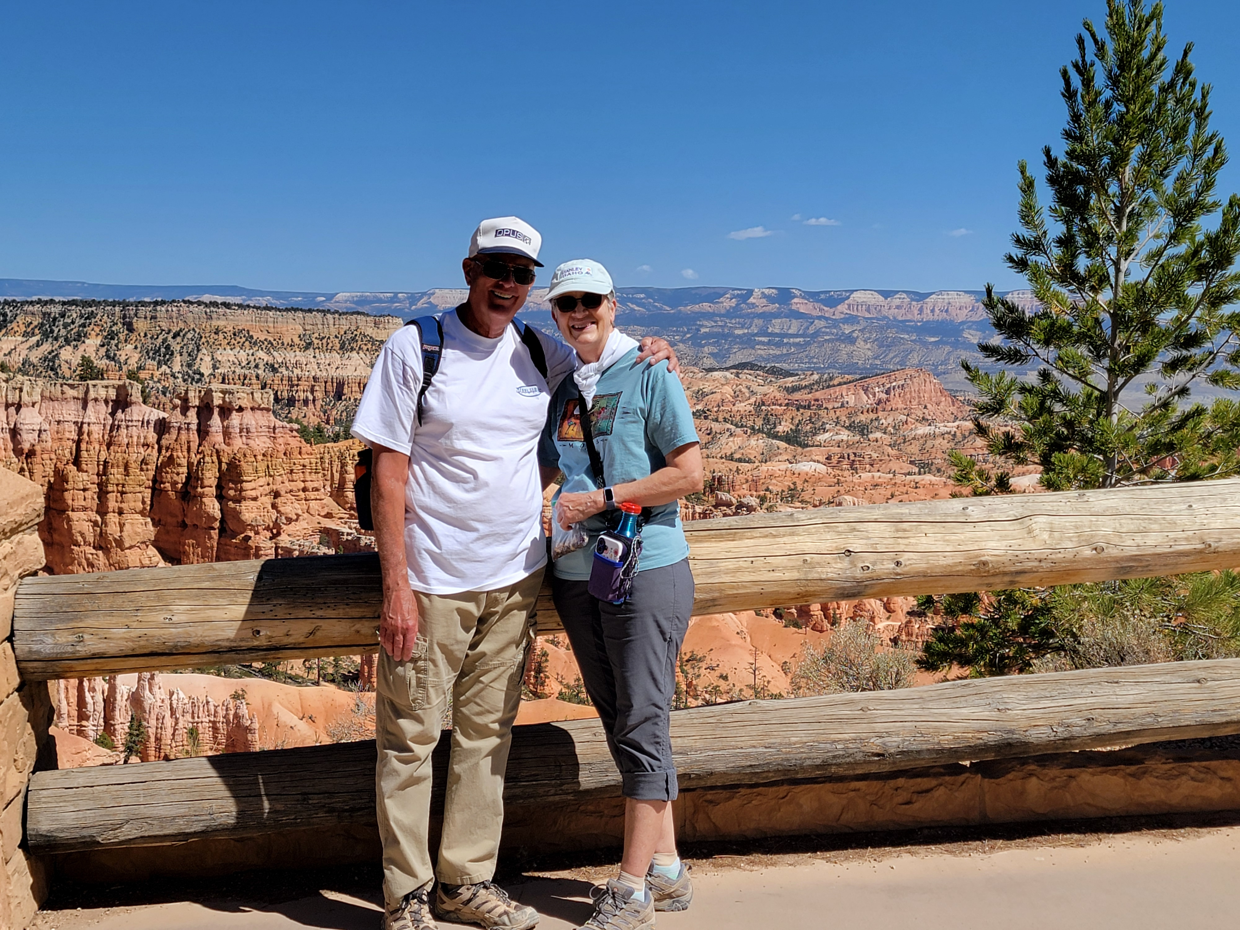 Bryce Point - we made it!
To be fair, Bryce Point is three hundred feet higher than Sunset Point, so we really weren't just being lazy. We were just taking advantage of the flexibility offered by using the park shuttle. We hopped on at Bryce Point and rode it back to our car at the Visitor Center.
Our totals for the day from the AllTrails app and my GPS were 4.1 miles, 1,178 feet of elevation gain and a hiking time of two hours and ten minutes. Just a moderate hike but with perfect weather and great views. You can see from the photos that it was a fantastic day to be out on the trail.
It was time to check-in at our hotel. We were hopeful that it would go more smoothly than it had in Escalante, when our dates got screwed up and for a while we thought we would end up sleeping in the car. We were staying in Bryce City, which really isn't a city. I don't think anyone actually lives there. It's three hotels, a restaurant and a campground, located not far from the park entrance. It is the most convenient place to stay when visiting Bryce, other than in the park itself.
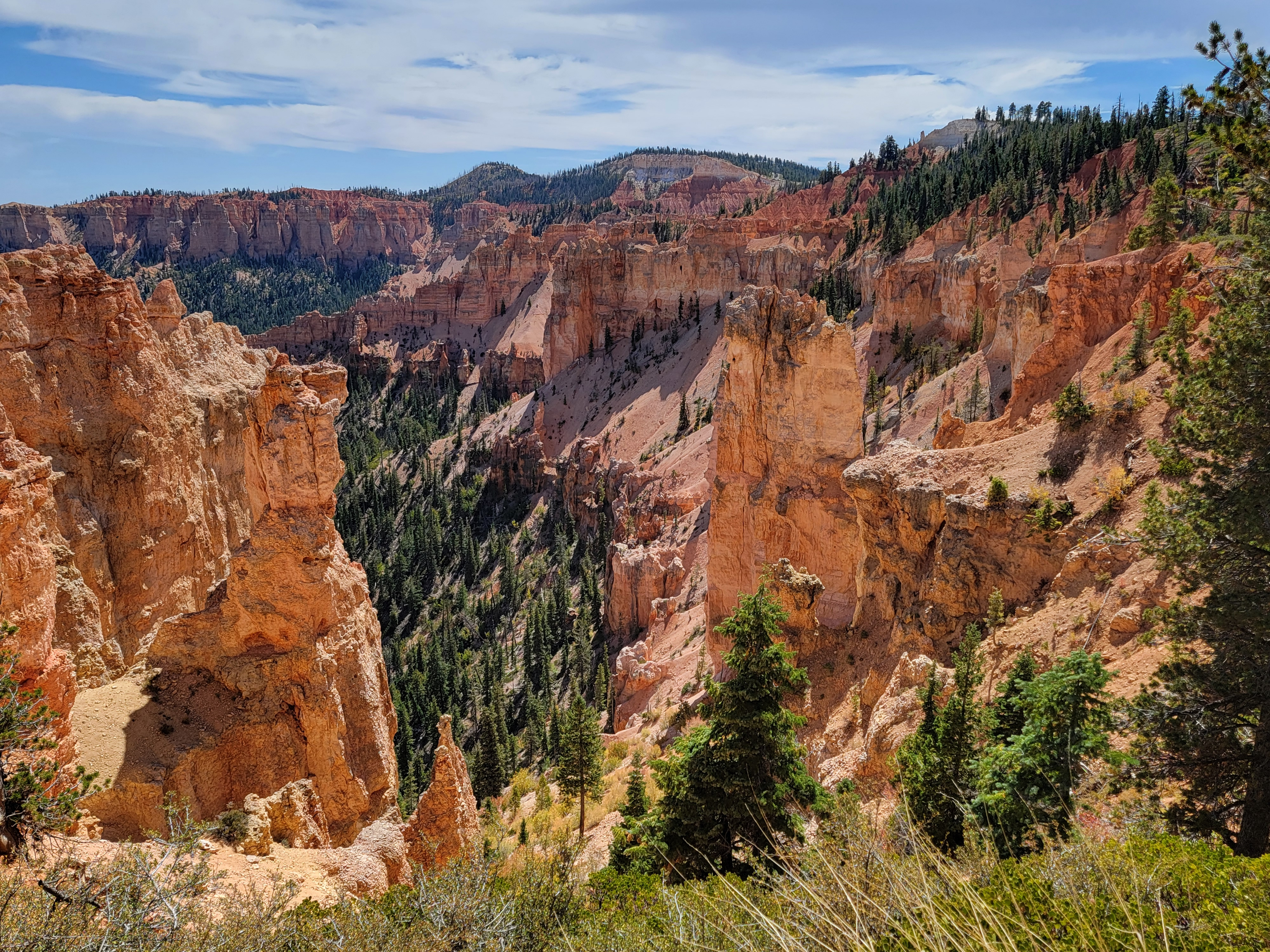
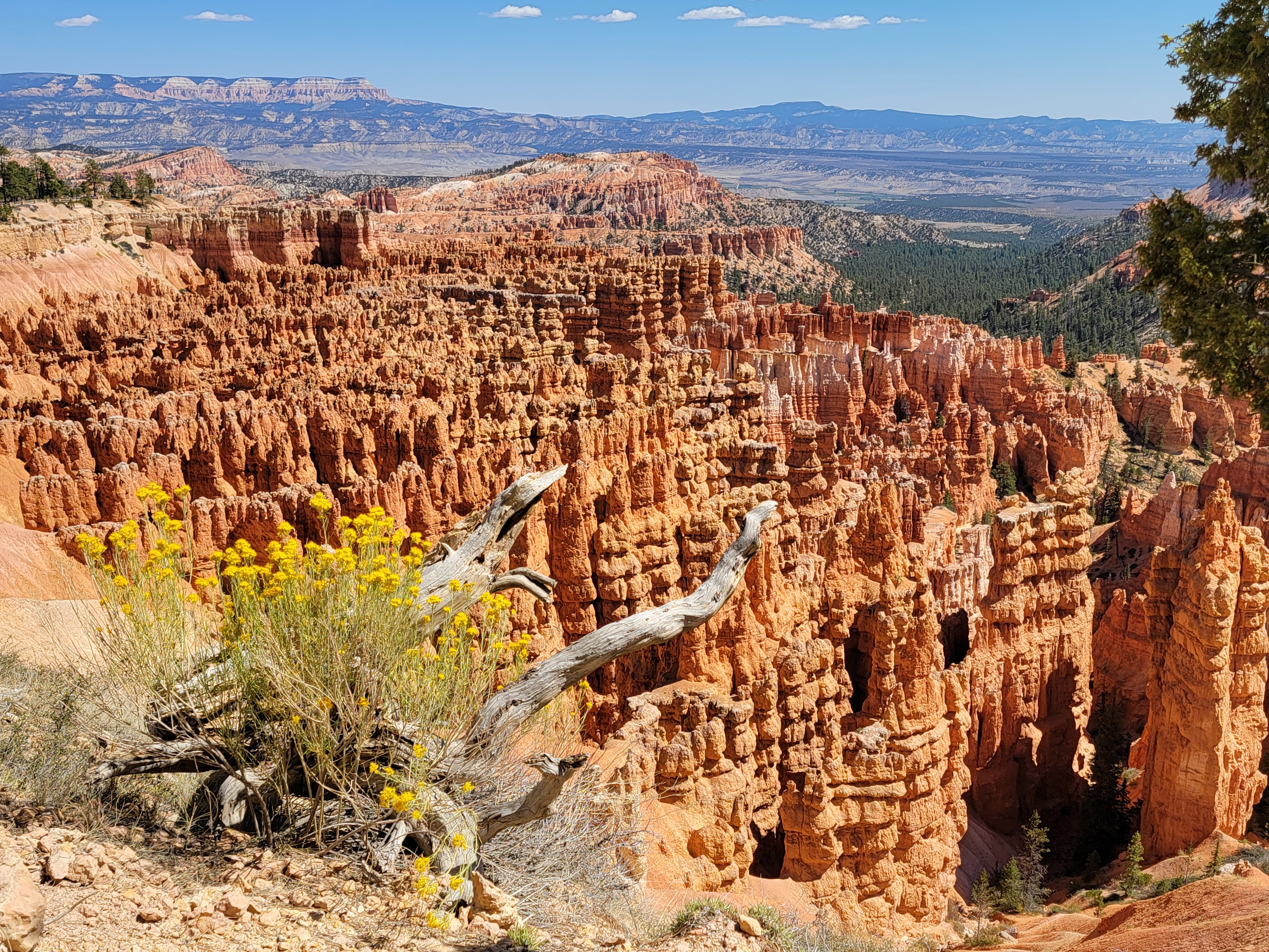 View from Bryce Point
We had reservations at the Bryce Canyon Grand Hotel. Sounds fancy but it was just a Best Western. When we got there, a large tour bus pulled in just ahead of us, stopped at the door, and started to unload. It was another tour full of old people - just like at Capitol Reef National Park! We hustled to find a parking spot, grab our stuff and get to the front desk before they overran the place. We didn't want to get stuck in line behind fifty people. Fortunately those old codgers were pretty slow collecting their luggage and getting inside. Not like us young kids. We made it ahead of all of them.
For dinner we went to the restaurant across the highway at Ruby's Inn. The place was huge and seemed to be set up to cater to large tour groups. It featured both a menu and also a buffet, the latter obviously targeted at the tour groups. The food wsa ok but not great. There was a really big gift shop attached that had quite a bit of cool stuff. We spent a lot of time in there after eating adding to the choices we were already considering for purchase.
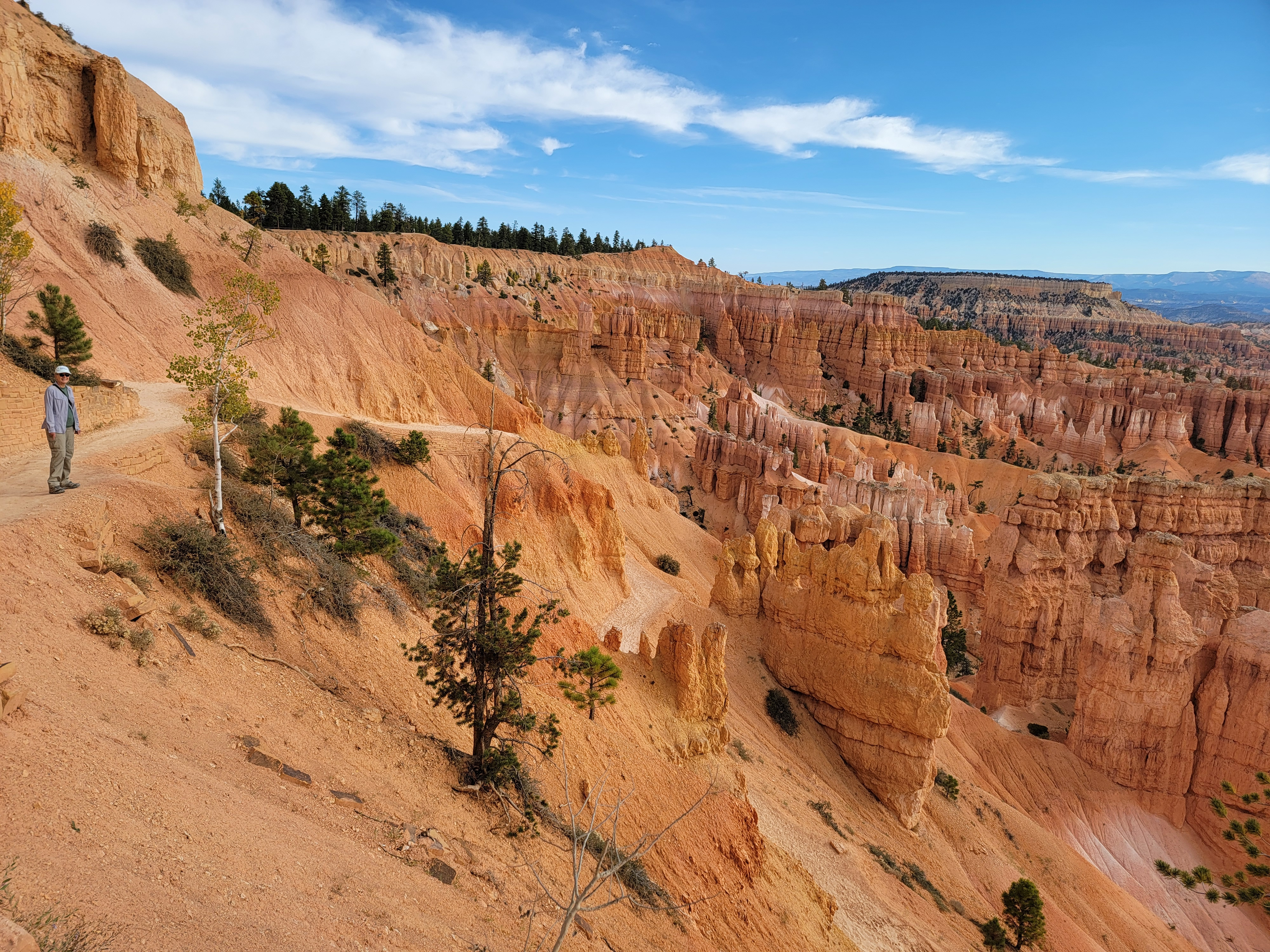 Another day, another hike. On the way to Queens Garden
The next morning we were back in the park. We took the shuttle from the Visitor Center to Sunset Point again. This time we descended the other branch of the Navaho Loop, down the cliffside to the same trail junction at the bottom of the loop. From there, instead of going south towards the Peekaboo Loop, we turned north on the Queen's Garden Trail. It wound through scores of hoodoos before climbing back to the rim at Sunrise Point. Another one way hike.
Although there were a lot of people on the first part of the hike yesterday, once we were off the Navaho Trail there weren't that many. Today, there were lots of people all the way, even though we were well past peak season for the park. The hike was still great. The scenery was still beautiful. But it certainly didn't feel like a wilderness experience. I'll channel Yogi Berra and say, pretty soon no one will go to the national parks because they're too crowded.
 Queens Garden - scenery but no solitude
When we reached the rim at Sunrise Point, the Lodge was nearby so we walked over to explore options for lunch. Next to the lodge we found Valhalla Pizza. Just what the doctor ordered. Lunch there was pretty good.
Our morning hike was about three and a half miles with six hundred feet of elevation gain. It took just under two hours. A moderate hike, we still had energy and time left for more activities. We took the shuttle back to our car and decided to take the park's scenic drive all the way to its end at Yavimpa Point. A loop trail starts there that goes by a number of bristlecone pine trees. Although not impressive to look at, you can't help being filled with awe when you are among them. They are the oldest living things on earth. The oldest tree in the park is at Yavimpa Point and is estimated to be 1600 years old.
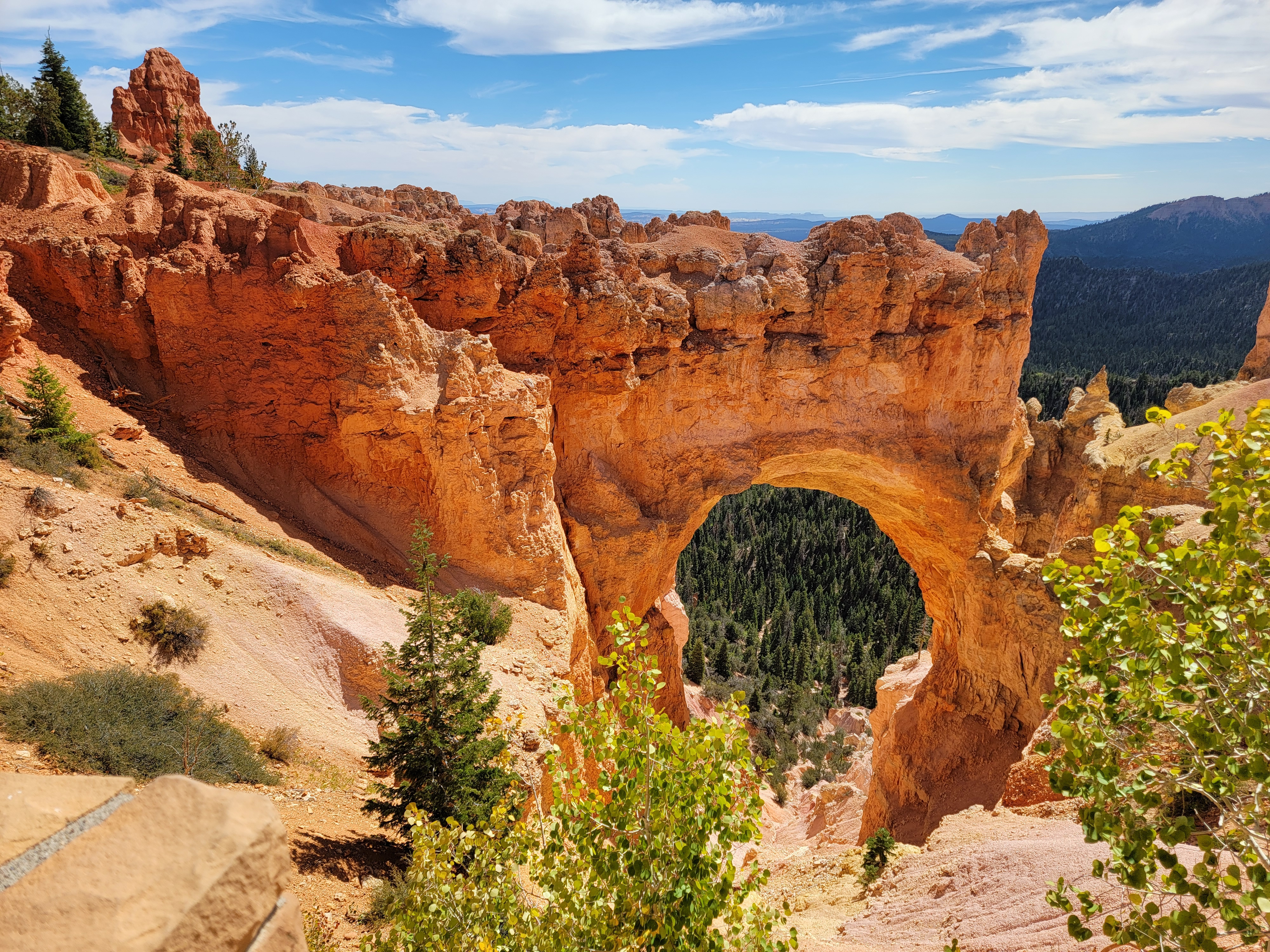 Natural Bridge from the Bryce Scenic Road
Even that is nowhere near the record. A bristlecone pine tree in the Ancient Bristlecone Pine Grove in the White Mountains, has been measured to be 4,847 years old. For a long time it was thought to be the oldest living thing on earth, until recently when another tree was discovered that is 5,065 years old. I visited that grove once on a climb of White Mountain, a California fourteener. It's a sad commentary on our species that the location of the oldest trees has to be kept secret to protect them from vandals.
When we reached Yavimpa Point the parking lot was full. Not too surprising. It's pretty common at Bryce. I drove around the loop twice to see if anyone was pulling out. No luck. We started back, but pulled out at the viewpoint for Black Birch Canyon, which is only two miles down the road. When we started out again, I turned around to give it one more try. This time we were lucky and got a parking spot.
 View from the Bristlecone Pine Trail
We did the Bristlecon Pine Trail. It's short, only about a mile, and mostly flat. Practically a stroll. This far south we were past the main "bryce-like" rock formations, but the hike was still worthwhile. Given the name, there were obviously some bristlecone pines scattered about. Once again, the oldest of them was not identified, to protect it. Very sad. There were also viewpoints that provided vistas that reached far to the south over much of the Grand Staircase region.
On our way back we stopped at several scenic viewpoints. They provided lots of opportunities for good photos. We also made a final stop at the Visitor Center to get our Bryce Canyon National Park merch. We'd had plenty of time to make up our minds about what to get. That night we drove back into the park one last time to one of the viewpoints to take advantage of another look at the extremely dark skies. We weren't the only ones. I was surprised that there were several cars at the overlook.
And that was it. Next day we drove home. It wasn't my Rim-to-Rim hike of the Grand Canyon that I had been hoping for. Not everything went exactly according to plan. But it was still a great trip
