Pinnacles NP/GMT Weekend
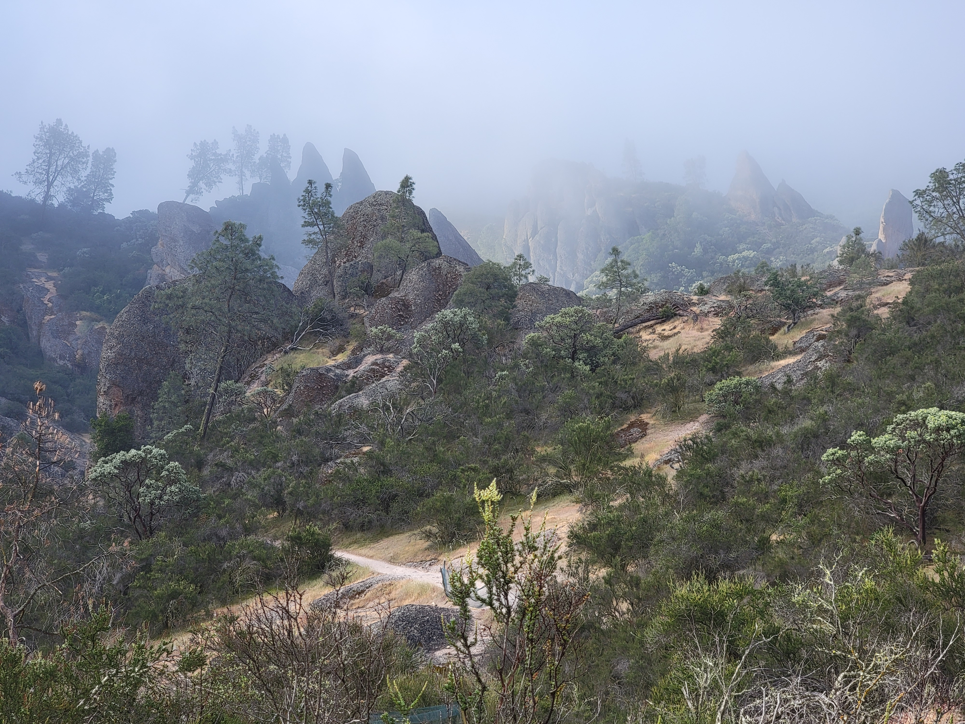 The fog begins to lift after I started out
I made plans to go to GMT Weekend at the Warehouse this April. Last year I missed Consimworld Expo and both GMT weekends, so I hadn't been to a wargame convention for a year and a half. I have to admit that my wargaming fell off quite a bit the past year. Part of the fun of going to GMT weekend is always the Saturday sale, when I can buy their games at a big discount. But lately GMT hasn't done too many games that I'm interested in, so a lot of that attraction was gone. Last year I was also focused more on recovery from my knee replacement, trying to get back into hiking again. This spring I came up with an idea. I would go to GMT weekend for some gaming, but I would also go to Pinnacles National Park for some hiking. It's in the central valley of California, not quite worth a trip from Boise on its own, but only a couple of hours drive from Hanford. I had been there once before, a long time ago, when I was a graduate student at Stanford. It had been on my list to visit again for the past few years because it would be easy to combine with a trip to GMT.
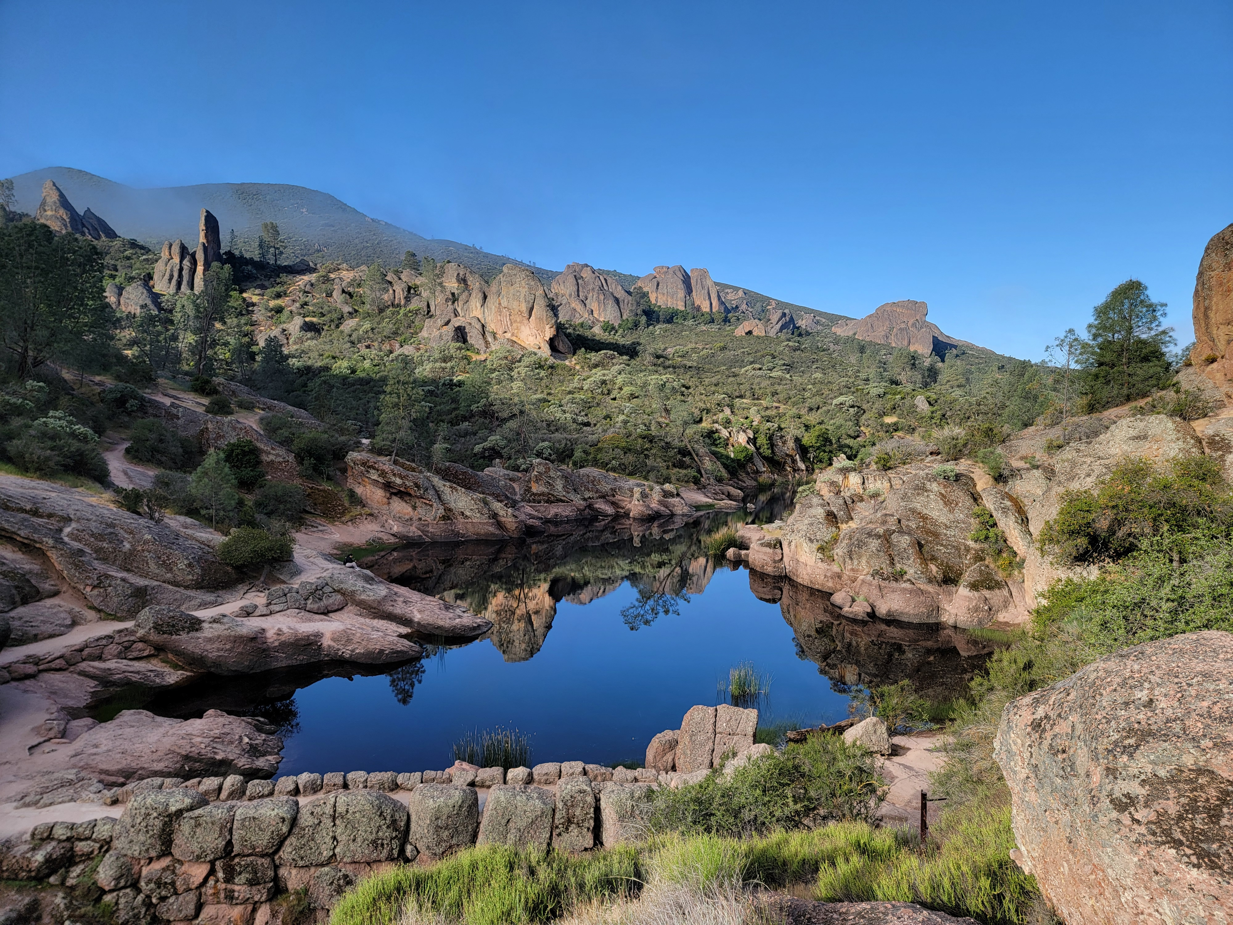 Mostly blue sky at Bear Gulch Reservoir
GMT weekend starts on Thurday morning. Saturday is the busiest day, with the sale in the morning. Plus people who couldn't get away from work during the week have shown up by then. Sunday is the last day, but it's pretty quiet, as people leave through the day to head for home. Since I need a whole day for travel, I usually drive to Hanford on Wednesday, spend Thursday through Saturday at GMT playing games, and then leave first thing Sunday morning to drive home. For this trip, I would go a day early to do some hiking, then I would leave GMT a day early, on Saturday right after the sale. That way I'd be gone the same number of days as usual. To get in position for hiking in Pinnacles National Park, I drove to Hollister instead of Hanford. It took about the same amount of time. I found an inexpensive motel (ok, a cheap motel). It was nothing fancy but it was clean, so I was ok with it. Everything is more expensive in California anyway, even cheap motels.
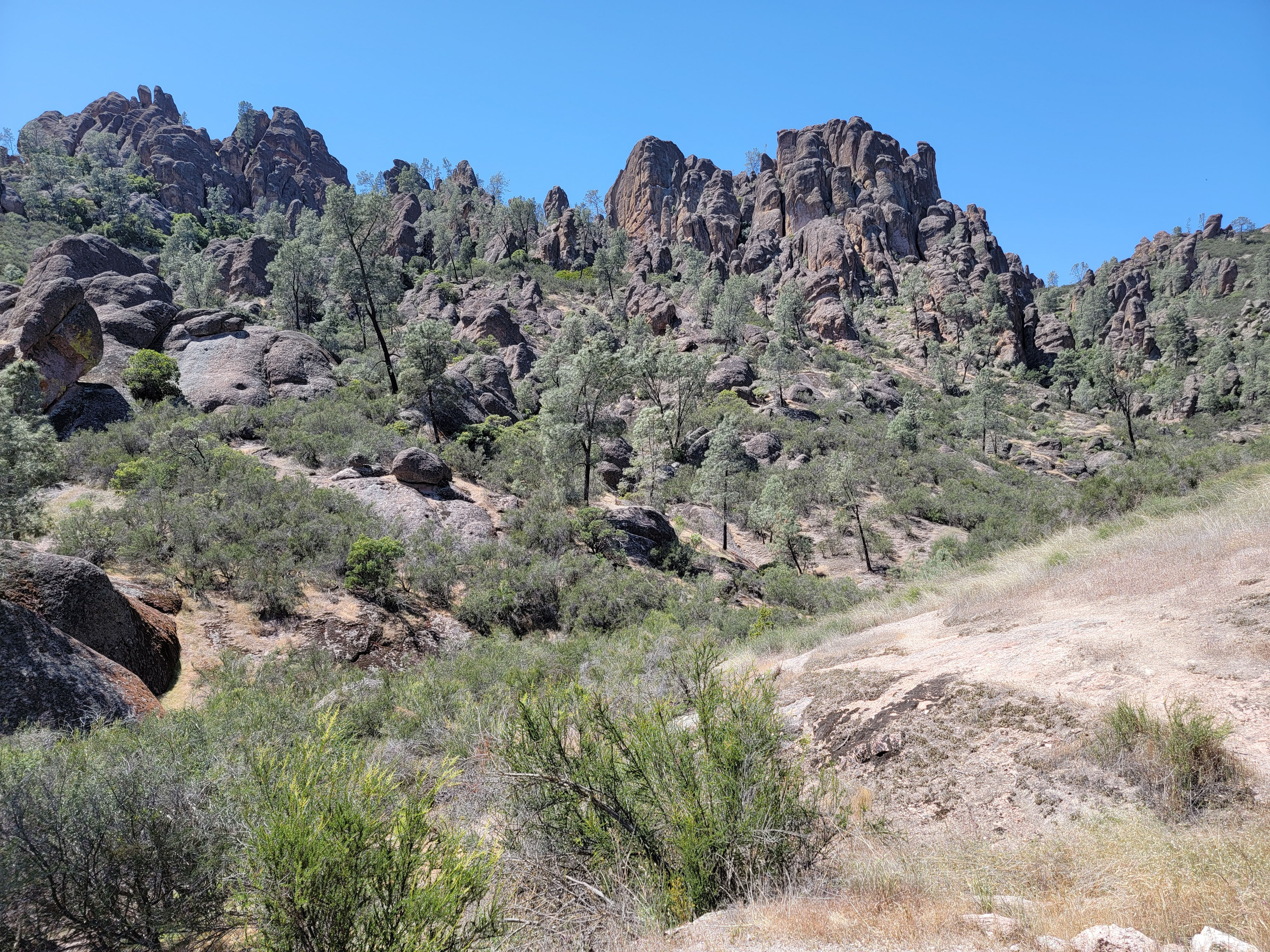
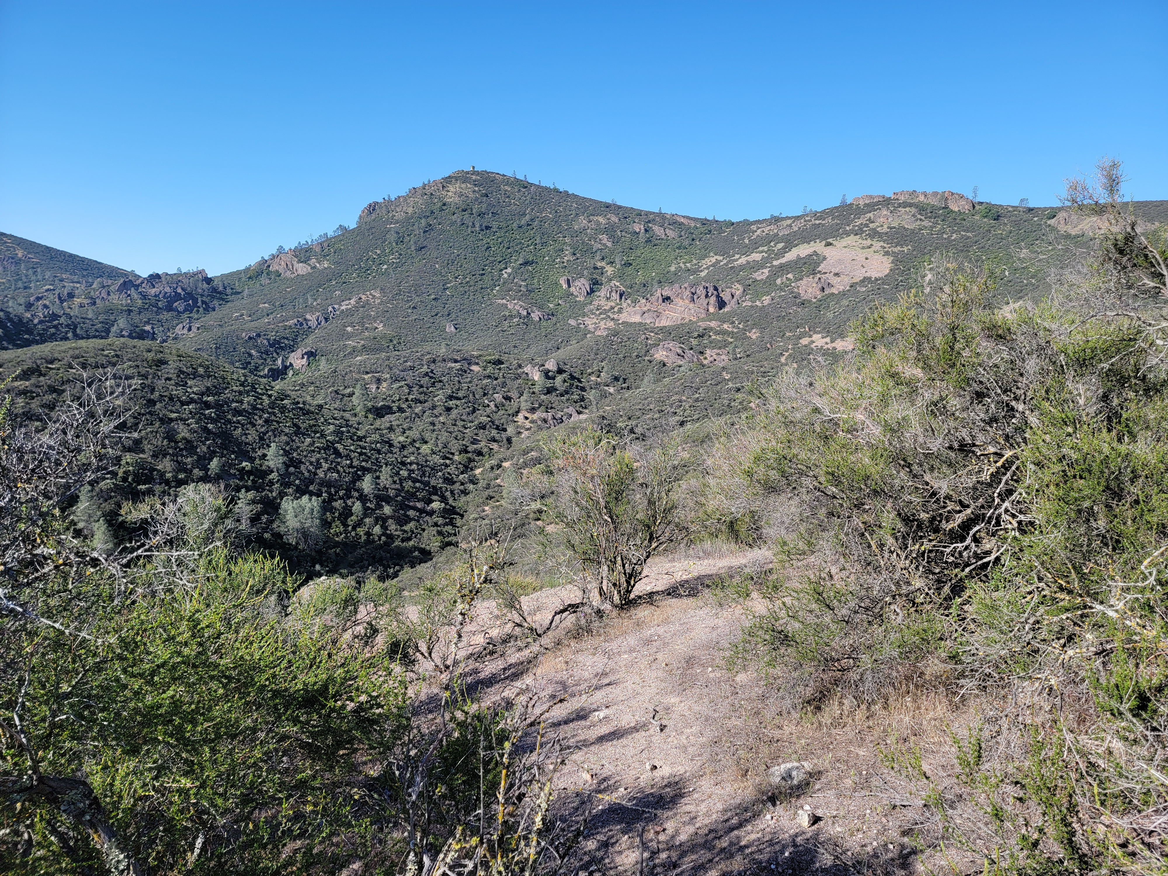 North Chalone Peak - a long way off and much higher
There was a pizza place across the street so I walked over for dinner. Just outside there were four police cars. About half a dozen cops were around a guy laying right in front of the door of the restaurant. He looked pretty scroungy, probably homeless. I stopped for a minute to see what was going on. The cops were asking him to move, very politely but he was so drunk he couldn't stand up. Every time they helped him up he would fall over as soon as they let go of him. It took several minutes but I finally managed to get by and into the pizza place. Welcome to California!
Checking out the menu, a small cheese pizza was $25. Adding a drink and Cali sales tax (high), I was looking at the cost of dinner being way north of $30. That was for just a small cheese pizza and a diet coke. Welcome to California, again! I decided to leave. The cops were still trying to get the drunk guy to move but I was able to weave my way through. I went to McDonald's next door. Just getting a two cheeseburger meal there was over ten bucks. Yeesh! I don't think that I'm moving to California anytime soon.
 South and Middle Chalone Peaks from North Chalone
My usual weather website didn't have a forecast specificly for the national park. The best I could do was the forecast for Hollister. It said there would be clouds early but that they would clear later in the morning. That would be good enough if it held for the park as well. Sure enough, when I left early the next morning there was heavy fog. I wasn't too worried. I learned back in my grad school days in the Bay Area that fog in the early morning usually burned off before long in this part of California. I did get nervous when it started to drizzle as I drove to the park. Maybe this wasn't just ground fog.
I entered the park from the east side. The road doesn't go all the way across the park. I drove it to where it ended at the Moses Spring parking area. Fortunately the rain had stopped by this time so I wasn't going to get wet. But the park was still wrapped in dense fog as I started out on the trail. At least I didn't have to worry about overheating or sunburn for a while.
 Distant view of High Peaks Trail descending Chalone Peak
I had two main options for hikes. One was the High Peaks Trail. It's about a five mile loop with 1600 feet of elevation gain. It traverses the ridge to the north of the main park road, winding through many of the rock pinnacles that give the park its name. It features a little bit of scrambling and exposure to make it more interesting. The other option was the Chalone Peak Trail, about 7.5 miles and 2200 feet of elevation gain. It climbs to the summit of North Chalone Peak. At 3,304 feet it's the highest mountain in the park, and for quite some distance around. The one time I had come to the park before I was in my early twenties and had done both trails in a day. But I had been working hard all winter getting ready for my dive trips to Bonaire. I had lost quite a bit of weight and felt strong. I wanted to test myself. If I felt good, I thought I would try to do both trails again.
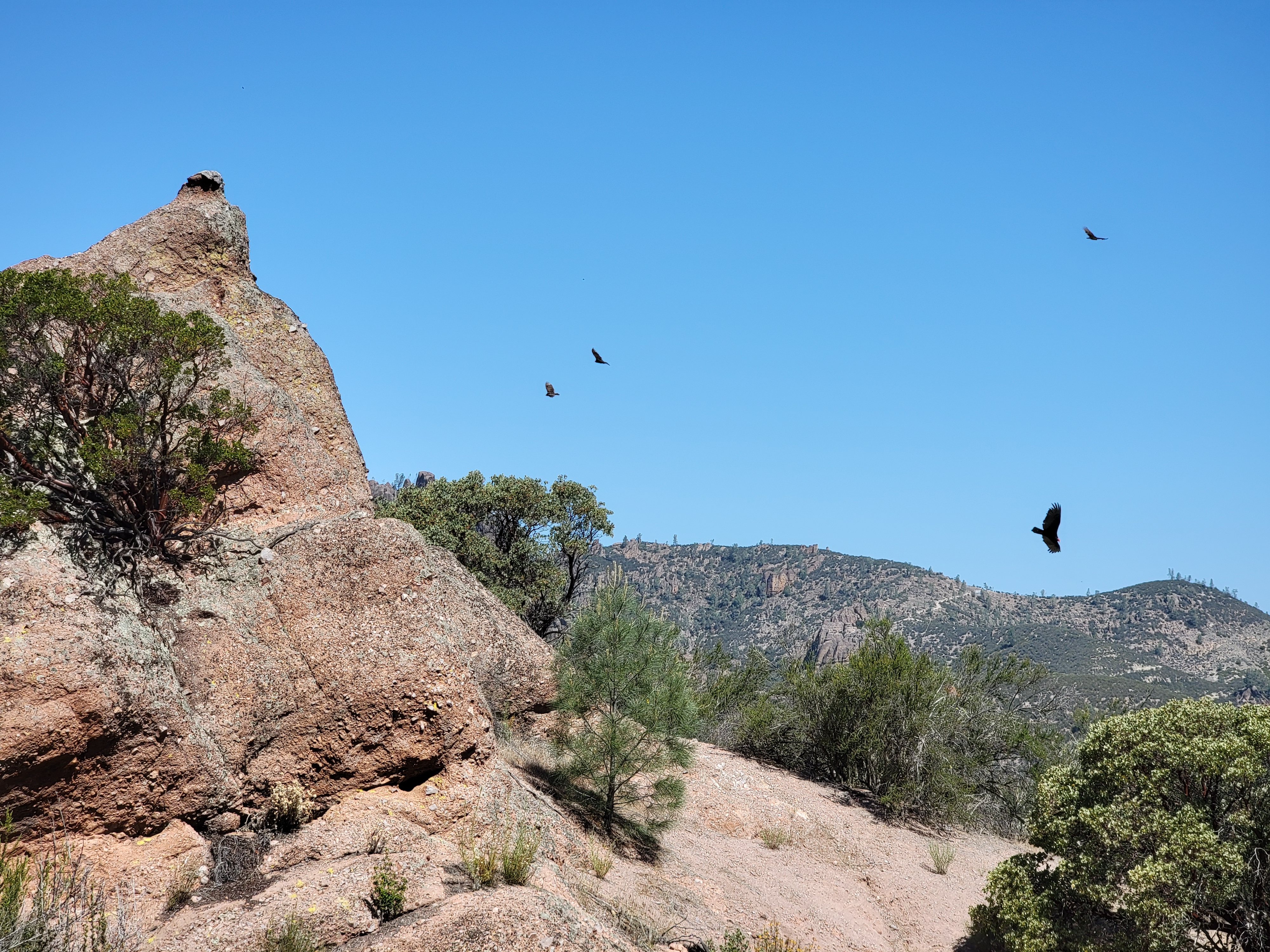 California condors were out in force
About five minutes after starting I reached a junction and had to make my first decision. A trail to the left took a diversion through Bear Gulch and some caves before joining up with the Chalone Peak Trail. The Moses Spring Trail continued straight ahead. Since I was planning on it was being a long day, I opted for the direct route. Besides, it was foggy and gloomy and damp enough without going through a series of caves.
Next I came to a junction with the High Peaks Trail. Looking to the south, the fog seemed to be lifting and the sun was starting to come through. I went towards the light, opting to go up North Chalone Peak first. Soon I reached Bear Gulch Resevoir. It's a small lake but very pretty, with rock formations rising steeply right out of the water. Because I had an early start there was no one else there. I had the place all to myself. It was dead calm and very still (it wouldn't have been foggy earlier if there was any wind). A beautiful spot. I took a some pictures and continued on. I had a peak to climb!
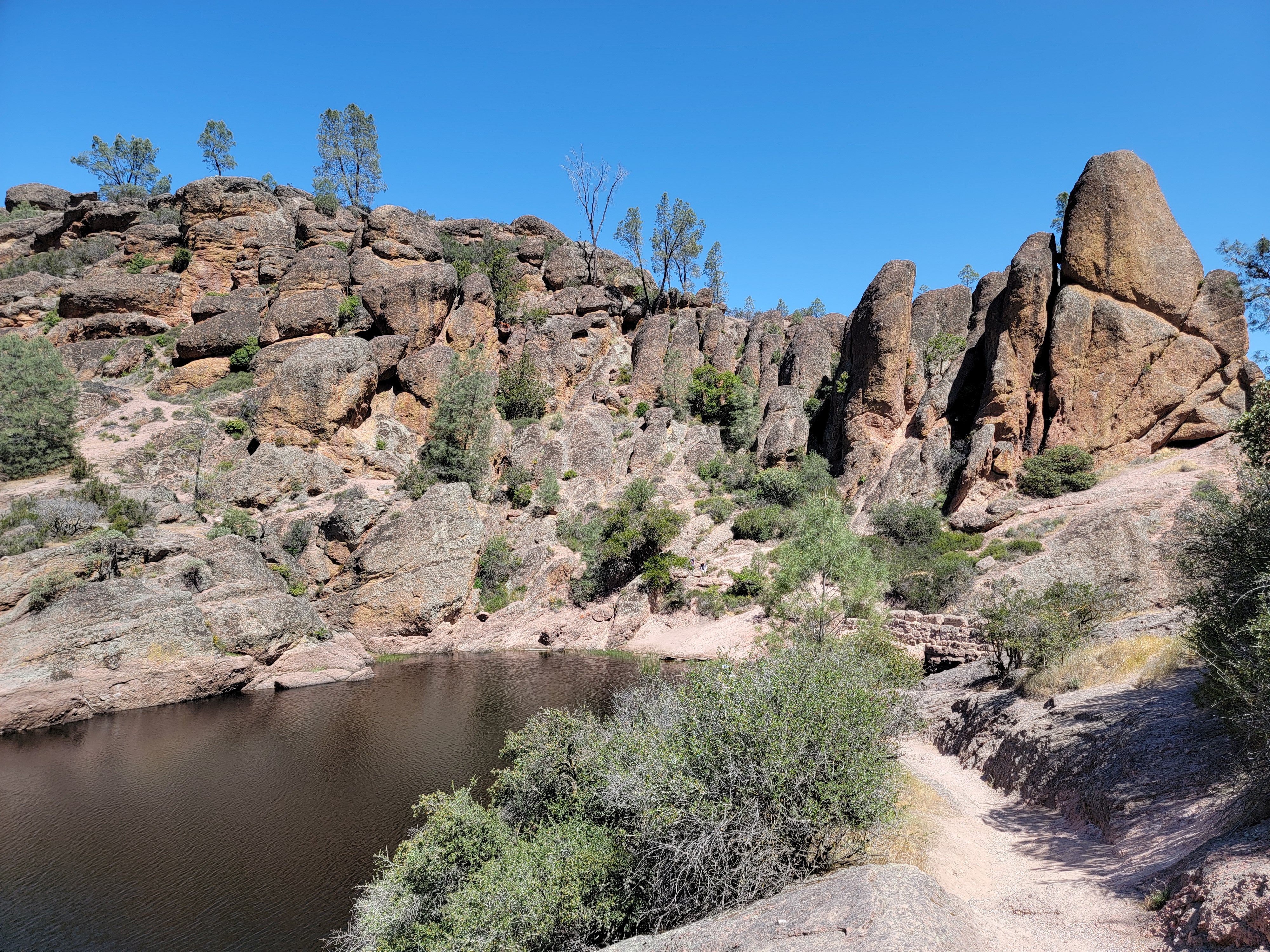 Back at the lake, it's bright and sunny at midday
Beyond the lake, the path wound up a valley. I passed a hiker, the only person I saw all the way up. It was unusual because I am definitely not a fast hiker, but I guess I'm not the absolute slowest hiker either.
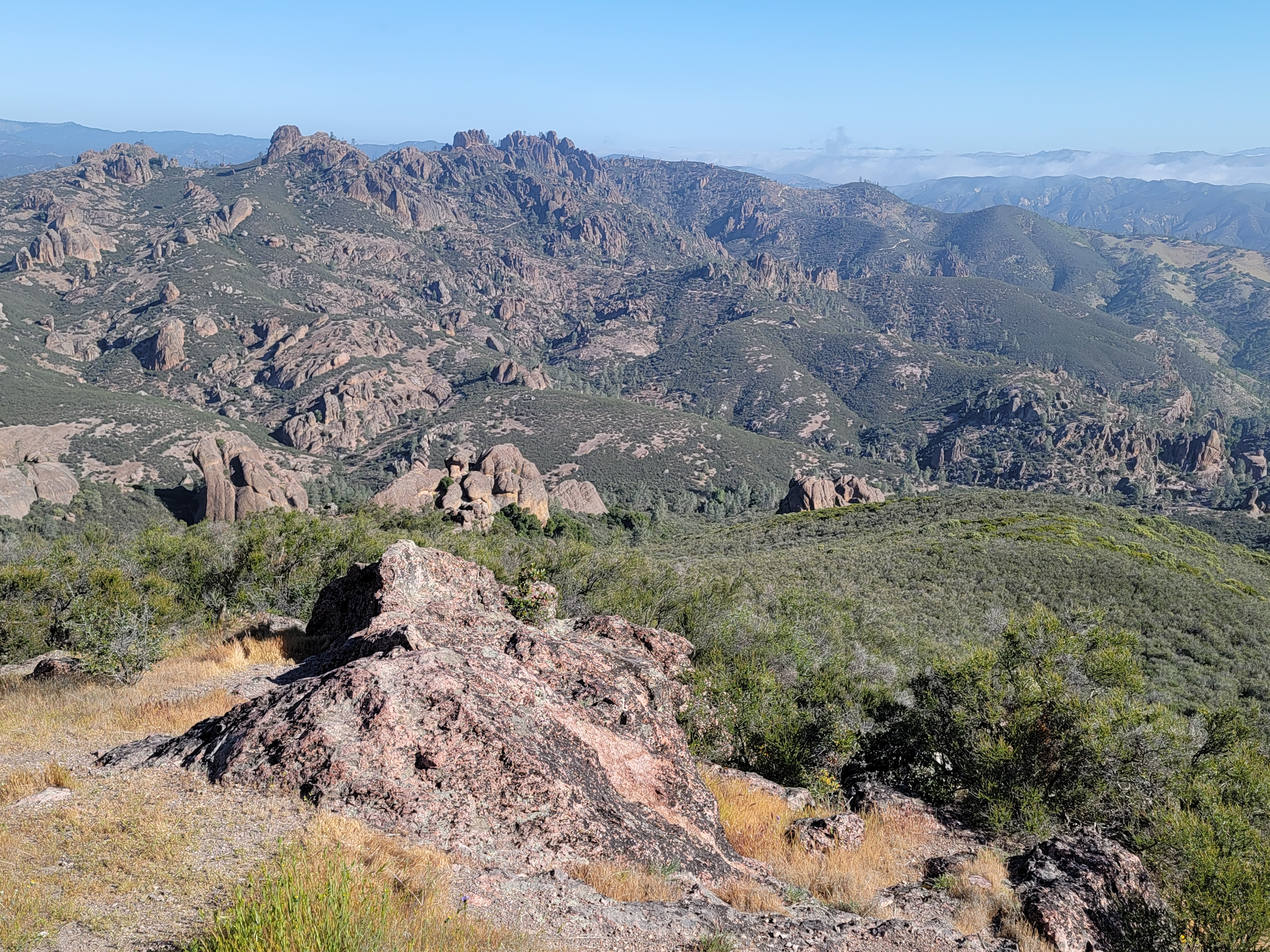
As the valley opened up the trail turned upward and climbed onto a ridge. Now I could see North Chalone Peak. It looked like it was still pretty far away and a lot higher than I was. I just kept plugging along. Eventually I reached the summit. There was an old lookout tower on top. That made sense because it was the highest point around for a long way in any direction. The veiw was exceptional. To the north I could see the High Peaks route, with most of the rock pinnacles that give the park it's name. To the south a ridge continued to Middle Chalone Peak and then further to South Chalone Peak. I had read of an unmaintained trail/hiker's track that continued all the way to South Chalone. I could see parts of it from from where I was. It was tempting to try to bag all three peaks but I decided not to. I still wanted to try to do the High Peaks Trail and the hike to just this summit would usually be enough for a good days work. I started back down.
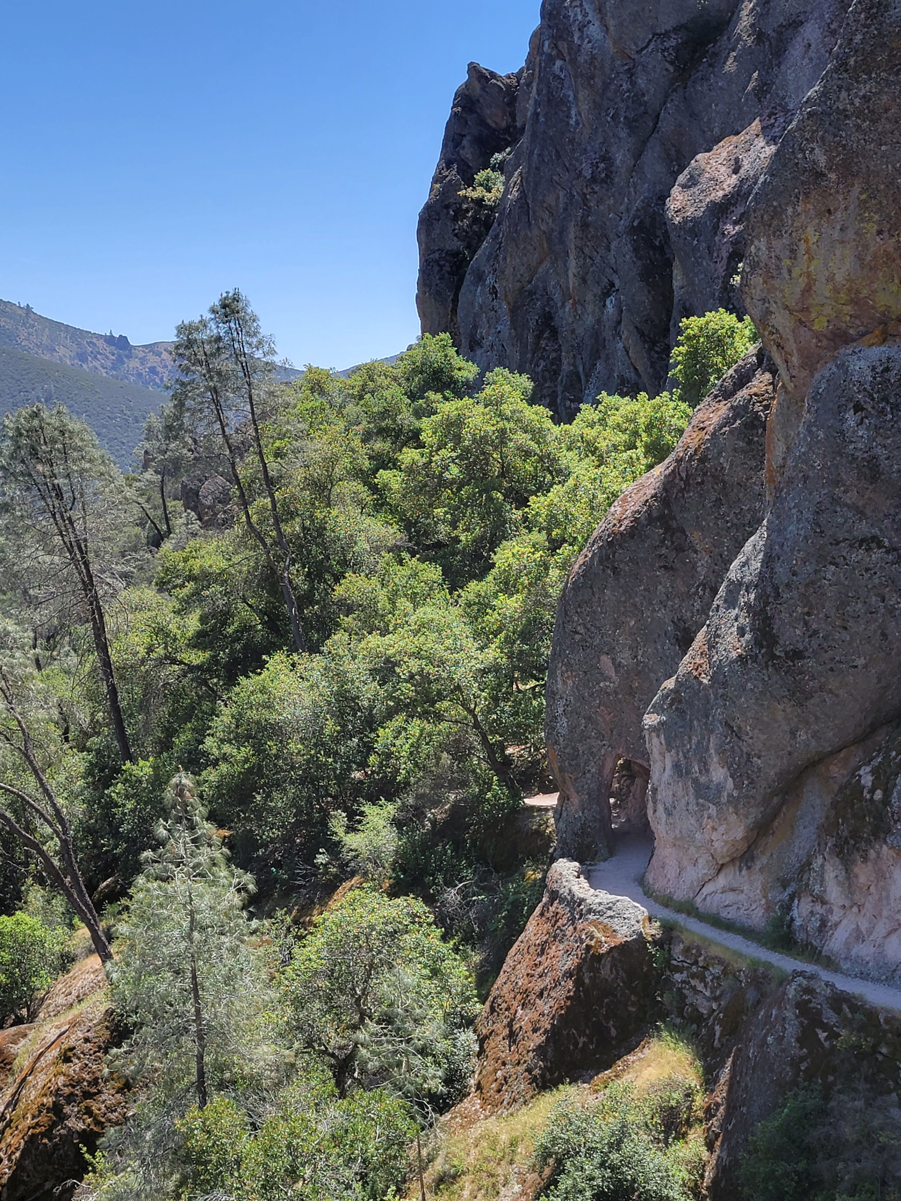 The trail goes right through the rock
Turns out I made the right decision. Reading a hiking blog afterwards, it said that the summit of South Chalone was quite broad with a lot of vegetation. The view was "meh". Besides, according to this guy, the trail was intermittent and not much fun to hike. So I had made a good decision, not wimped out.
On the way down the ridge from the summit I got a preview of the High Peaks Trail. I was facing towards it as I walked and could see much of the route that it took. It increased my resolve to do the trail today. First I still had to finish the one I was on though.
Further down, when I entered the valley again, there were multiple condors flying overhead. The California Condor nearly went extinct a few years ago. The total population was down to only twenty two individuals. These were captured and bred, and then released back into the wild. Today there are estimated to be about 300 birds in California, with 70-90 of them in and around Pinnacles National Park. It seemed to me that most of them were flying right overhead where I was hiking. Very cool.
I reached Bear Gulch Resevoir about three and a half hours after leaving on the way up. It was almost noon now and it looked different than when I had passed by before. It was in bright sun as opposed to the early morning light with wisps of fog on the surrounding hills. Plus there were people everywhere now. It was definitely a different feeling.
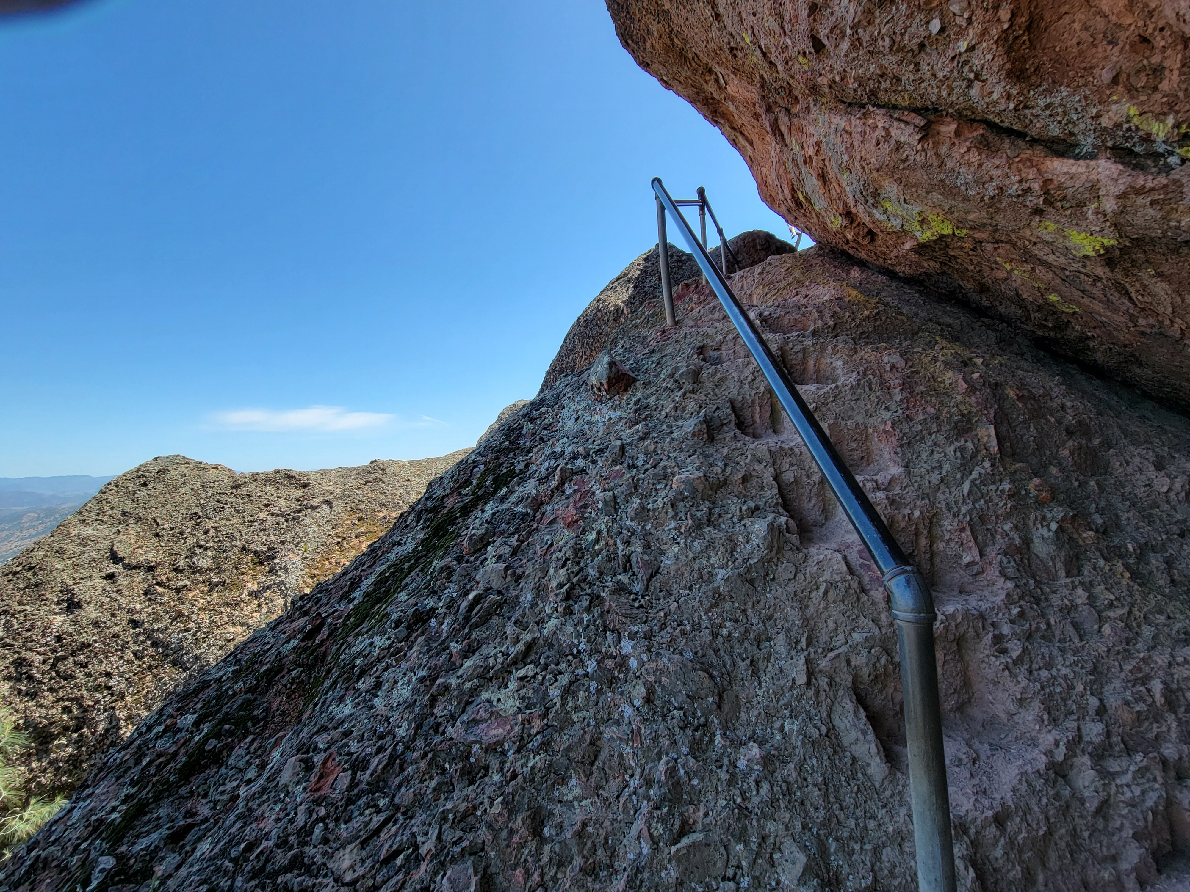
 Yes, that's where the trail goes
From the reservoir it wasn't much farther to the trail junction. North Chalone Peak is a worthy hike all by itself. I had already done 7.5 miles and 2200 feet of elevation gain. But I felt good and I only had one day here, so instead of heading back to the trailhead, I turned onto the High Peaks Trail. Time to do hike #2.
Of course, that meant that the trail went up instead of down. Gaining back elevation that you have just given up is always the hardest. I did spend a few minutes questioning my decision to do this second hike. But then I just decided to take it easy. It was a beautiful day. The scenery was great. I just took my time and climbed slowly. I had to do about another 1500 feet of elevation gain. After passing through a rock tunnel I reached the ridge crest. Here the elevation was roughly constant, and I do mean roughly because it was always going up and down. But the hiking was definitely interesting. There were many rock formations rising out of the ridge and the trail weaved in and out of them, up and down them. In places there were steps cut into the rock, and handrails where there were steep dropoffs. Definitely lots of fun.
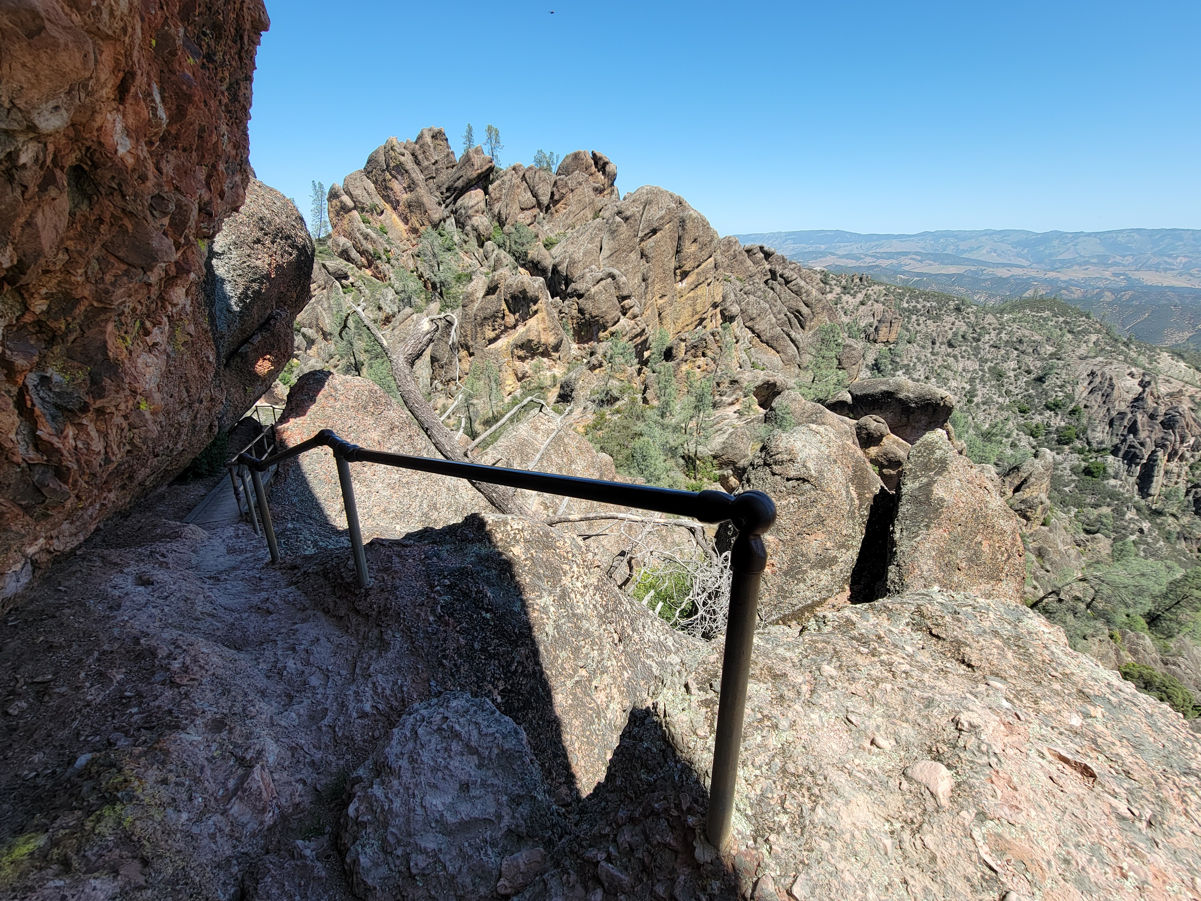 The route follows a narrow ledge along a cliffside
Finally the trail reached the end of the ridge and started down. There was a junction where I had the option to continue far to the east on a long, sweeping loop. Forget that. I chose the path that headed straight down towards the trailhead. Enough was enough. I was getting tired. But I still had enough energy to enjoy the hike back down to the road, which the trail reached about a half mile from the end. From there it was a short, level (and therefore easy!) walk on the trail beside the road to get back to my car.
According to AllTrails and my GPS, I did 13 miles and 3400 feet of elevation gain. A good days work, if you ask me. It was time to head to the Visitor Center and park store for a Diet Coke and a Pinnacles National Park tshirt. I figured that I had earned both. Then it was a two and a half hour drive to Hanford. After checking in at my hotel, I walked over to Round Table Pizza and enjoyed a well deserved dinner.
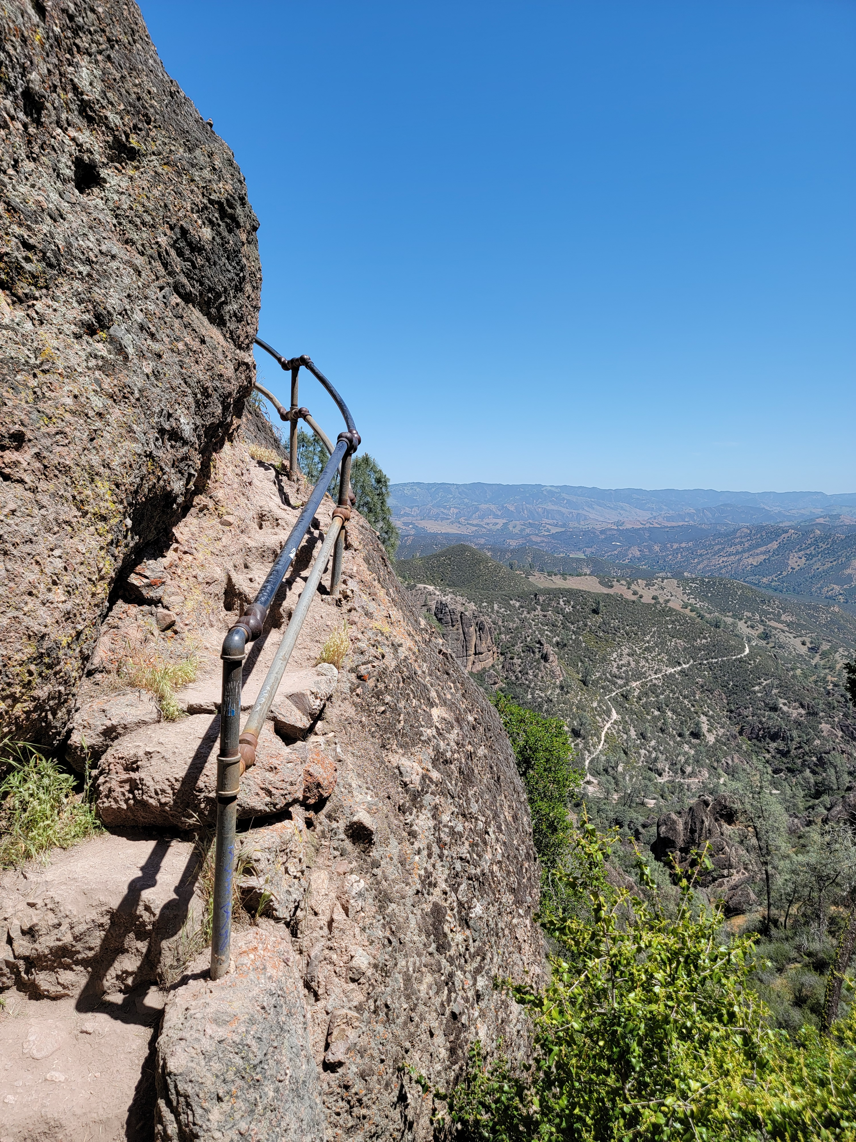 A steep cliffside - glad the railing is there
I spent the next two days at GMT playing wargames with my friend Larry Davidson. We played WWII Commander: Battle of the Bulge. It's an area impulse game on the Battle of the Bulge. It's moderate in size and complexity but I think it's a really good game. We were able to play it twice. On Thursday, I won a narrow victory as the Germans. On Friday we switched sides and Larry won decisively as the Germans. Although the Allies lost both times, I don't think the game is unbalanced. It was just a small sample size.
Since we are almost at the end of this post, you may have noticed by now that I have not included any photos of wargaming at GMT. It looks pretty much the same every time and I've posted a lot of photos from previous Weekends at the Warehouse. If you really want to see what it looks like, go here, or here, or here. For this post, I thought the pictures from hiking in Pinnacles National Park were a lot more interesting.
Since I had left home a day early to go hiking, I stuck with my plan to leave a day early to go home. So instead of leaving Sunday morning, I came to GMT on Saturday morning for their game sale and left right after that. The sale always used to be the high point of the weekend for me. I would cruise through the warehouse for the two days preceding it, deciding which games I would buy. I would always leave with an armful of games. Sometimes I would need to make multipe trips to my car to carry them all out.
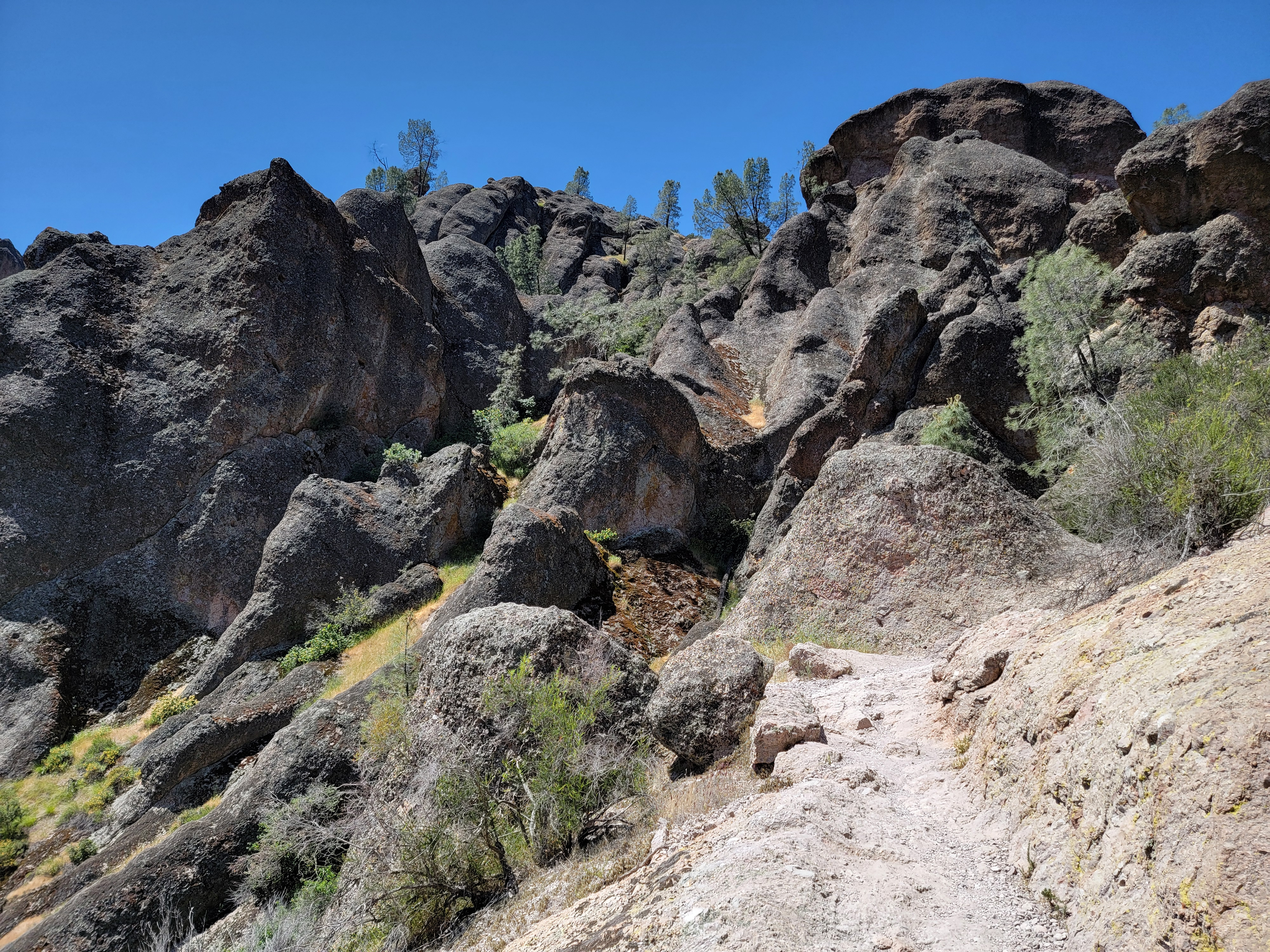
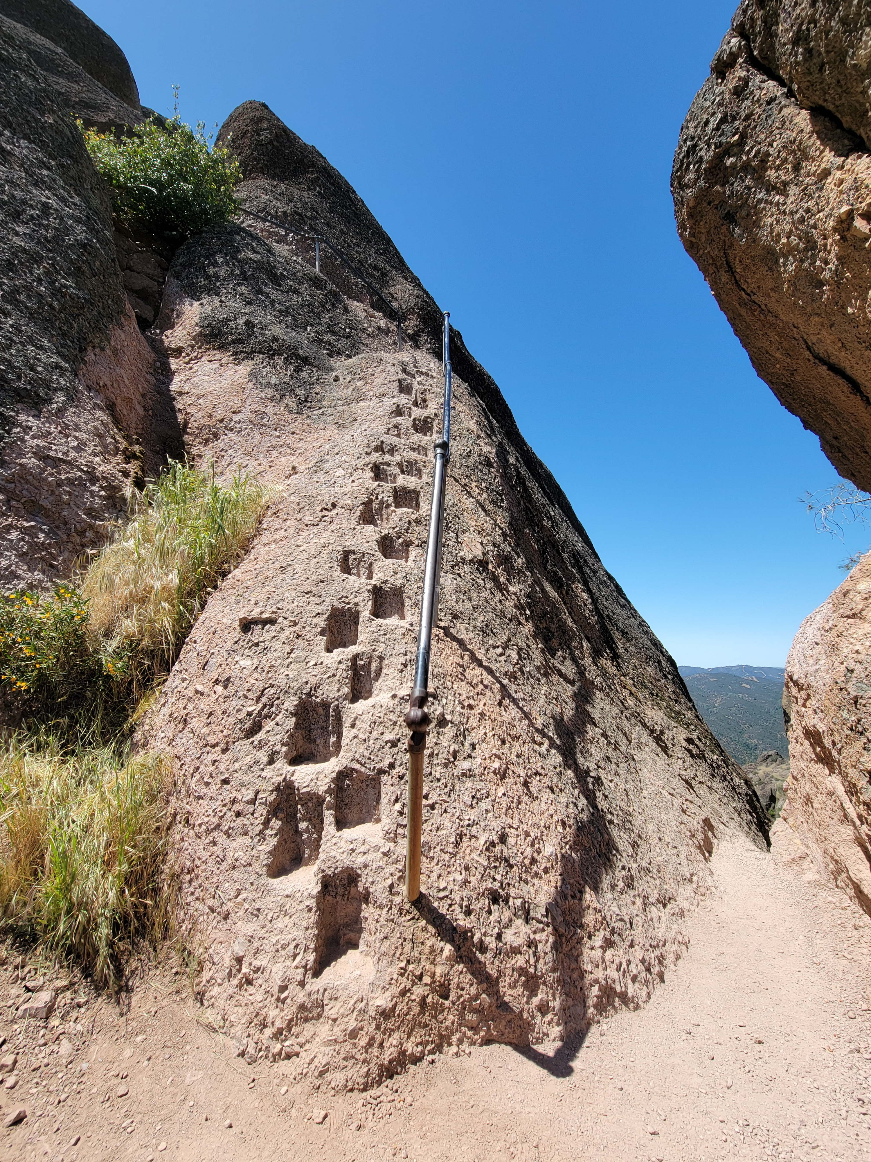 A lot of work went into making this trail
That's changed in recent years. There seem to be fewer and fewer GMT games that I am interested in. They still publish wargames, but many of them are new systems, like COIN or the Levy & Campaign series. I have a few of those but I just don't like them as much as good old fashioned wargames. Even when they do traditional designs, it seems like most of them are tactical games and I just don't care for them. I'm much more a fan of operational and strategic games.
This time I only bought two games and only one of them was from GMT. The other was from Hexasim, a European publisher. GMT acts as their distributor in the US. I took my two games and started for home. At least it only took me one trip to get them to my car.
My Sunday drive home is usually pretty easy since there isn't much traffic. This time, being a Saturday, there was quite a bit more, which was a nuisance on Highway 99 through the Central Valley. It seems like that road is always busy. Then to add more aggravation, I got a low tire pressure light somewhere around Merced. I got off at the next exit and went to a gas station. Their air pump wasn't working. Checking the tire, sure enough, it was really low. I got back on the expressway and anxiously drove to the next exit, where I found a gas station with a working air pump. I'd lost about half an hour by the time I was back on the road again, but it wasn't so bad if that was all.
 Another narrow ledge along a cliffside
That wasn't all. Two or three hours later I was almost past the Sacramento area when the tire pressure light came on again. Oh, oh. I obviously had a leak in the tire if I could only go two or three hours between air fills. The tire probably got a nail in it somewhere in the past day or so. That wasn't going to get me home since I would be driving late at night through middle-of-nowhere Nevada, where gas stations were few and far between.
I immediatly got off at the next exit, which was for Rocklin...and got lucky. There was a Les Schwab Tire Center right next to the exit. First I stopped at a gas station, right across the street and filled the tire with air again. Then I went over to Les Schwab. They said that they were busy, but could probably get to it in an hour or two if I was willing to wait.
 Looking back to the High Peaks traverse on the way down
No problem. As we used to say when I played on the chess team in high school, forced moves are easy. I took my time going across the street to a pizza place for lunch. It took about two hours, but they fixed my tire and I was back on my way. They didn't even charge me for it. I made it home without any more problems. Monday morning I went to the Les Schwab near my house and bought two new tires. I think I'll be a loyal customer for life.
In the end, it was a good trip. I had wanted to go to Pinnacles National Park on one of my GMT weekends for quite a while and I finally did it. I had a great day, with good weather and two excellent hikes. I had two fun days of wargaming. And I got VERY lucky on the trip home. Any other time that I went to GMT, coming home on a Sunday, I'm not sure how I would have made it back. In this case, I just had a long lunch break on my drive home. But that's how it is. In life as in wargaming trip, sometimes the dice just roll your way.
