Climbing Alpine Peak
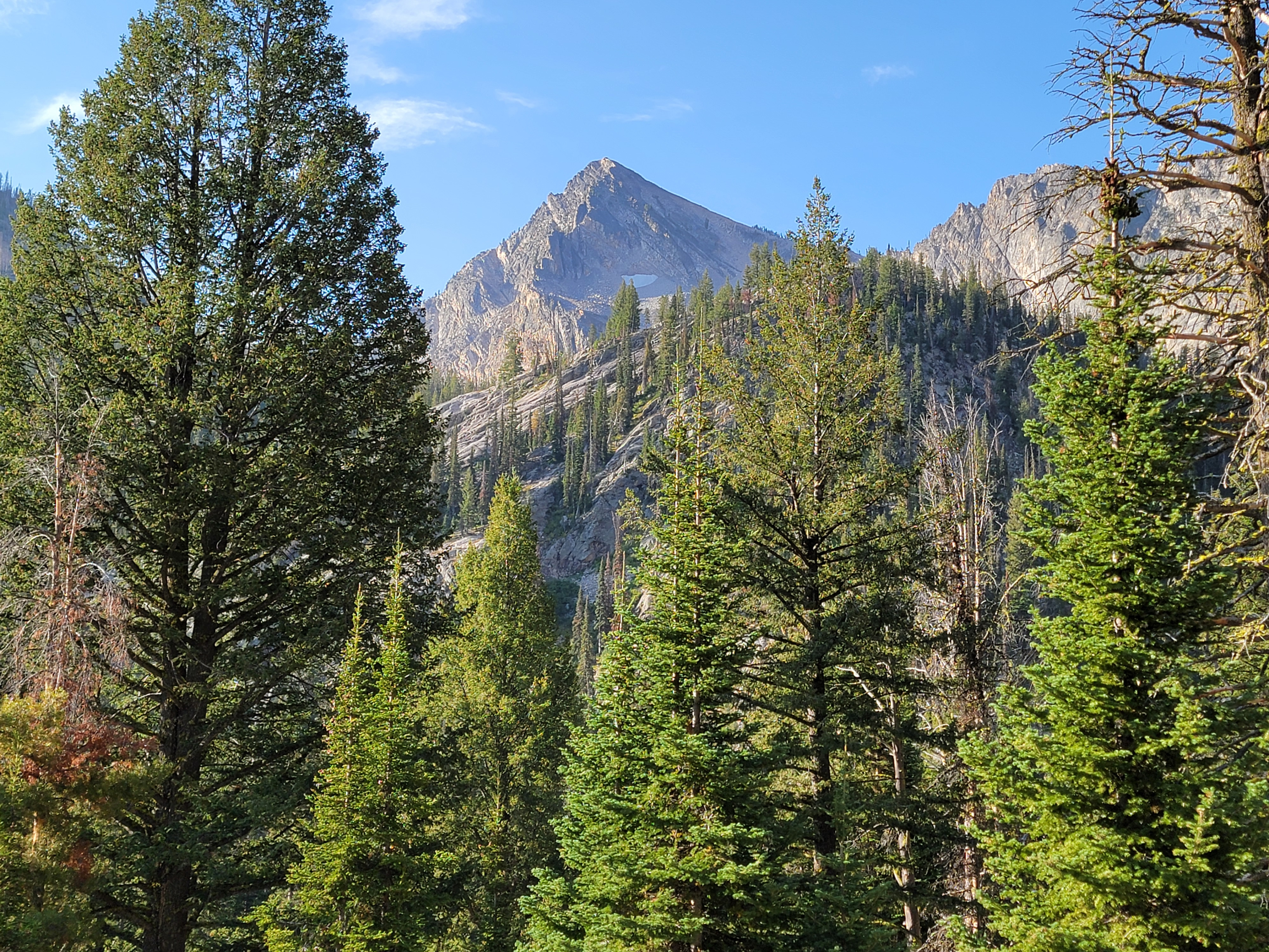 Alpine Peak on the approach hike - it's a long way off
Last week I climbed Lassen Peak. It's an impressive mountain and one that I wanted to climb for a while. Because I had an early start, there were very few people on the mountain on the way up, but I passed hordes on the trail as I came down. I wanted to do a mountain that had a little more of a wilderness feel. One that I have been thinking of for a while is Alpine Peak in the Sawtooth Wilderness. The approach is via Iron Creek and Sawtooth Lake, one of my favorite trails.
I wanted an early start so I got up at 4:30 am and was on the road at 5. It was dark for the first hour of driving and the deer were really out for some reason. Three times I passed deer that were very close to the road. Twice they were in the road, but got out of the way well before I came close. Although I was anxious to get to the trailhead, I drove slower than usual to be safe. It was a good thing because going through Garden Valley, a big racoon ran across the road right in front of me and I just barely missed him. It was a close call.
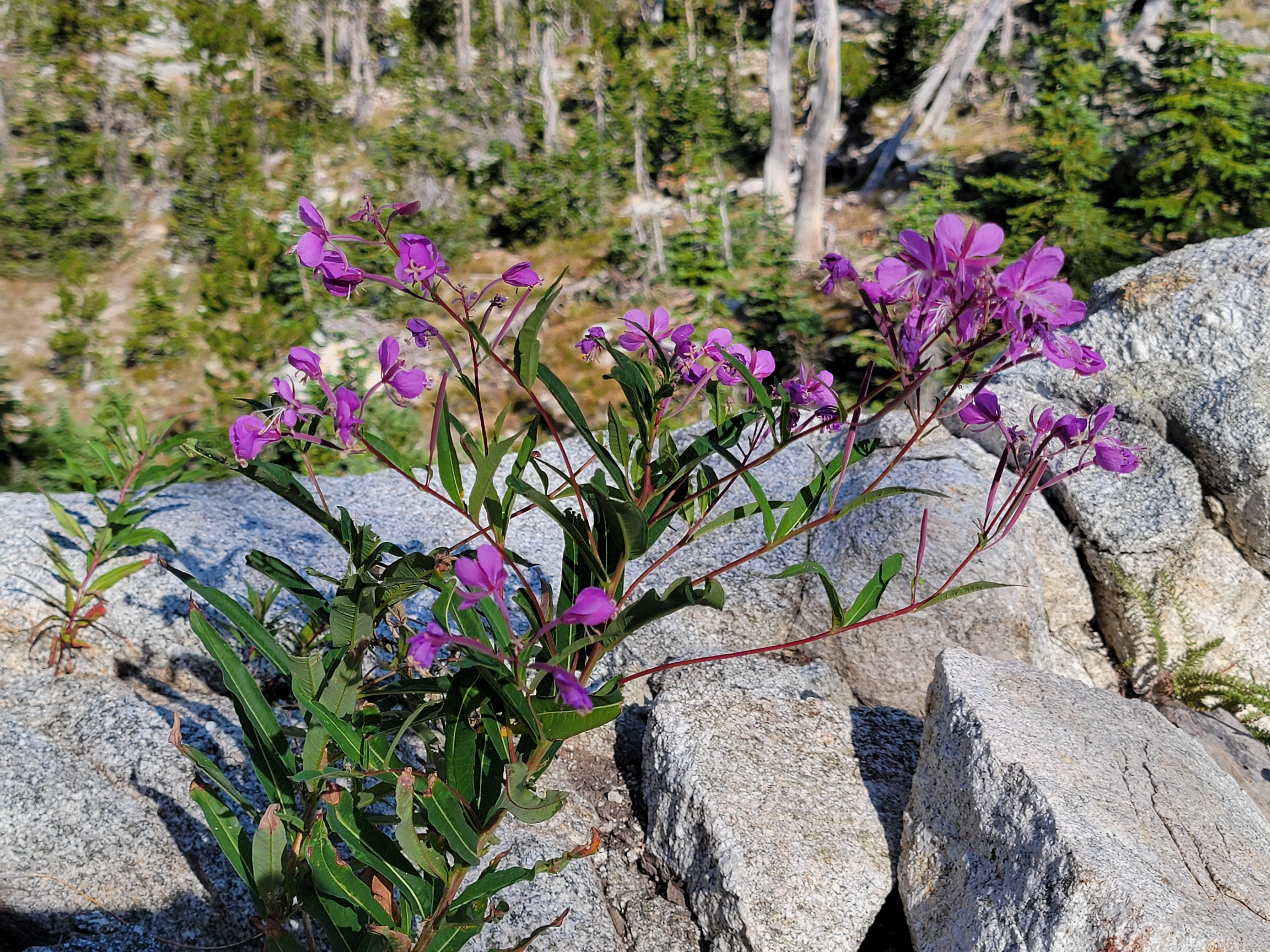 Still some wildflowers blooming up high
I started on the trail at 7:30 am. My car said it was only 37 degrees but it seemed warmer than last week when it was 50 degrees at the start of my hike up Boundary Creek. Go figure.
Because of my early start, I pretty much had the trail to myself. I only saw one single hiker and one couple all the way up to Sawtooth Lake. Not bad for such a popular trail.
When Sandy and I hiked this trail back in early July, we turned around at the stream crossing before the climb up to Alpine Lake. The water was really high and crossing required hopping across a few wet and slippery logs. This time the stream had about a quarter of the flow and there was a huge pile of logs to cross on. No problem today. I also got a great view of Alpine Peak on the approach. It looked a long way off and awfully high. I had a long way to go.
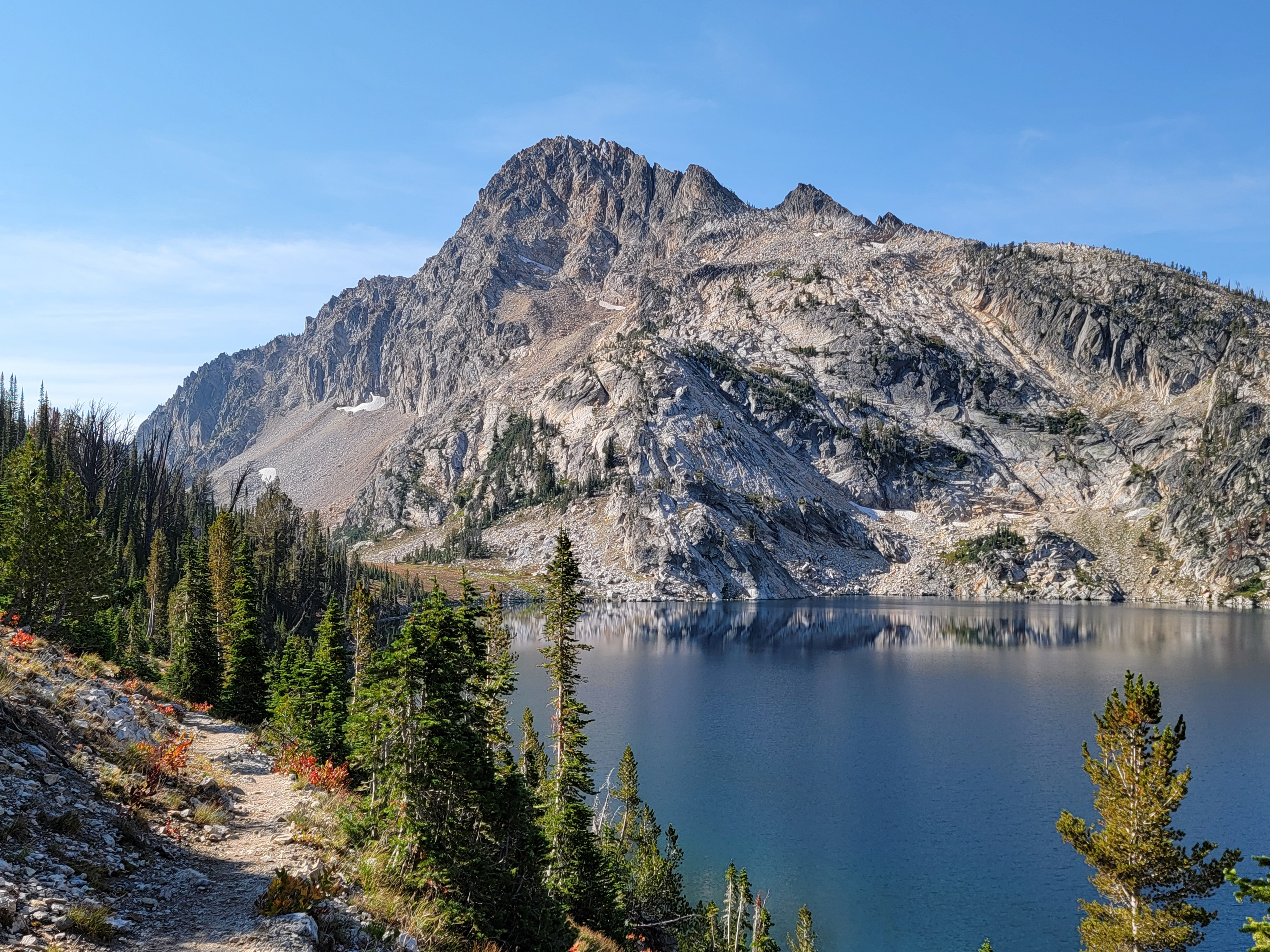 The classic view of Sawtooth Lake and Mt. Regan
Sawtooth Lake was my decision point. I felt good when I got there so I decided to give Alpine Peak a try. I have climbed it twice before but both times were many years ago. I didn't remember much about the route. I followed the map in the AllTrails app and took the trail to the south end of Sawtooth Lake where I turned off and started up the mountain.
The first part was a steep, grassy slope. It was hard work but doable as long as I took it slowly. Then came a gentle, slope that was easy going. But the final two thirds up to the summit ridge was a very steep, very loose slope. There was loose dirt, ball bearing scree and piles of large, unstable blocks. You could pick your poison. No matter what kind of slope I was on, a different slope nearby looked easier and more secure. Then after a long hard traverse to reach the new slope, it always turned out to be just as bad or even worse than the one I was on before. Climbing up was slow going and very hard work. I will admit that it wasn't much fun at all and it took me way longer than I expected to reach the top of the slope.
 Finally - on the summit of Alpine Peak
When I finally reached the crest I was expecting a short, easy ridge walk. Nope! I scrambled up a small rocky tower that looked to be the summit only to find out that it was a false summit and the true summit was further up the ridge. After climbing down and traversing carefully, the next tower turned out to be a false summit as well. I repeated this process four or five times, so many that I actually lost count. But finally I reached the true summit.
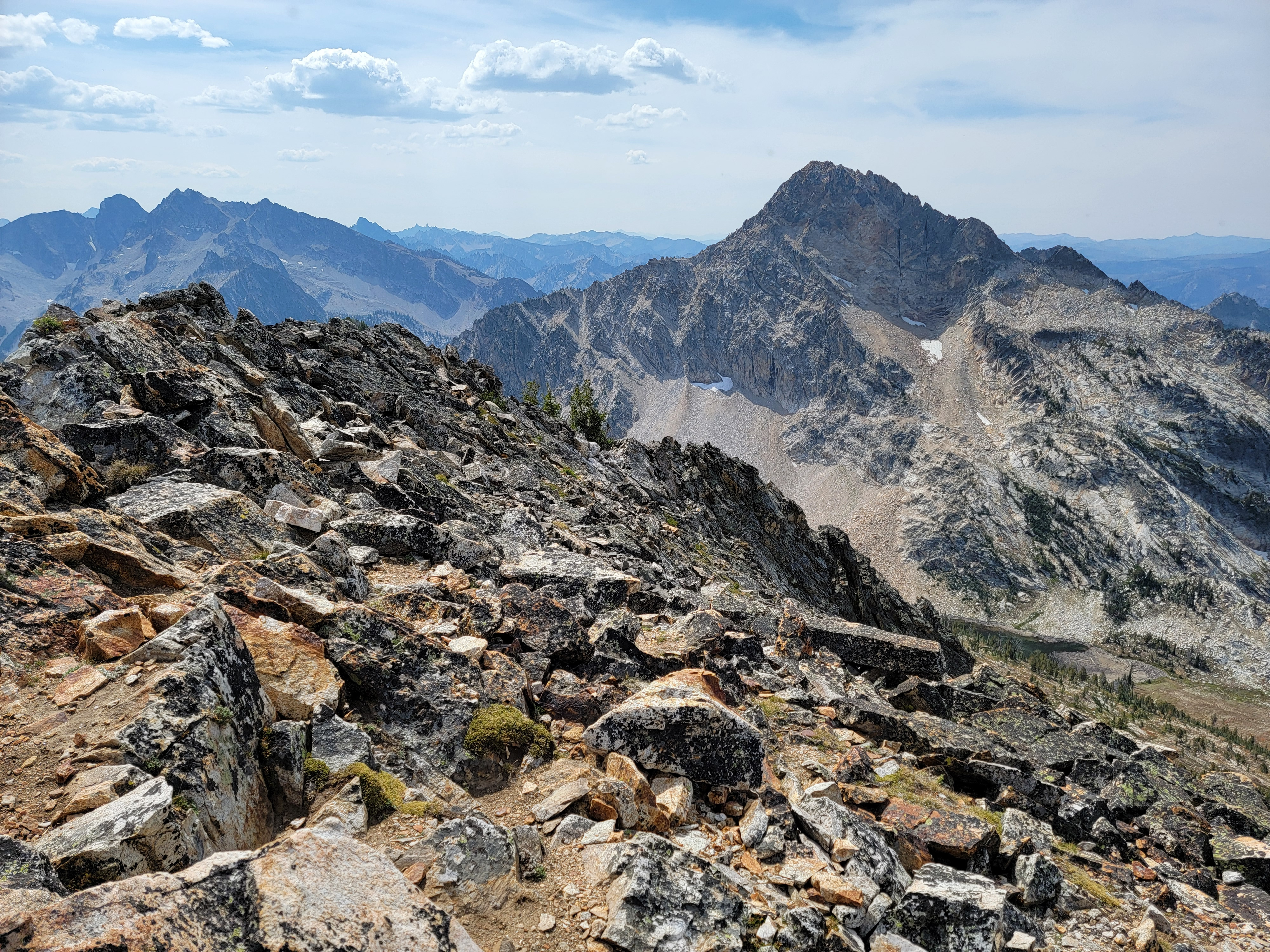
It had been a lot of effort but it was well worth it. The view from the top was spectacular. To the southwest, Mt. Regan towered over Sawtooth Lake, which was almost 1500 feet below me. To the southeast were several major Sawtooth peaks: Thompson Peak, Williams Peak and Mount Merritt. To the east, below Alpine Peak's steepest face, were two unnamed lakes that in all my years of hiking in the Sawtooths I had no idea existed. They were in a high, extremely remote basin above Alpine Lake and I suspect are almost never visited. In the distance to the east was Stanley and the Sawtooth Valley. I could also see the Iron Creek road which led to the trailhead where my car was parked. It seemed a long way off and I knew it would be a lot of work to get back there.
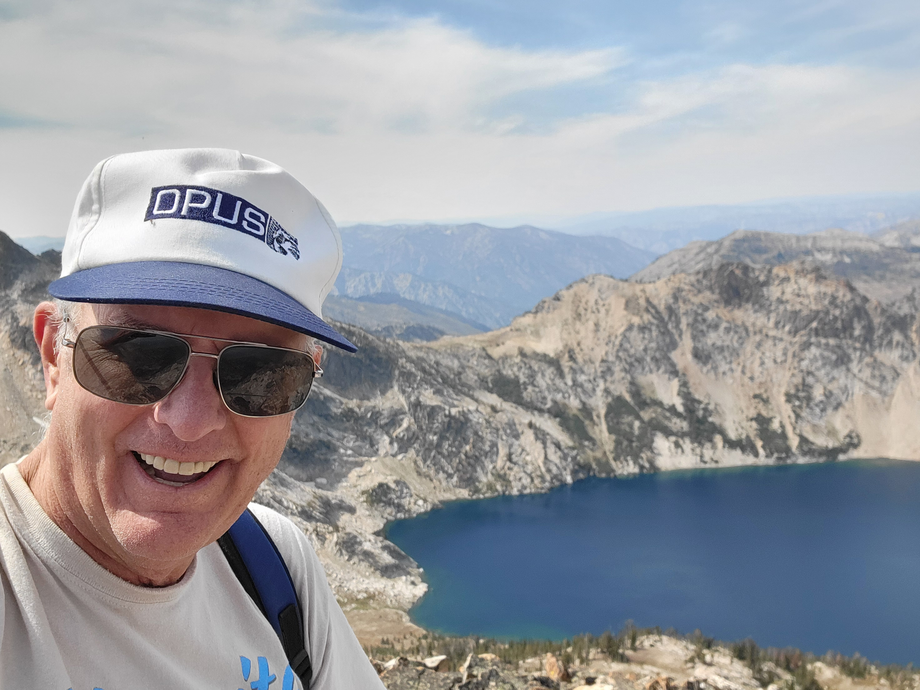 Obligatory summit selfie
I was a little disappointed that there was no summit register. It's always fun to see how many people climb a mountain and how often. There was no USGS survey marker either, which always makes for a good photo to prove that you made it to the top. I guess everyone will just have to take my word for it. I'm not usually one to sit on the summit for a long time. I'm usually - get there, sign the register, take pictures, head down. Not this time. I was pretty wasted after the long climb to reach the top. I spent well over half an hour catching my breath and resting up before starting the descent.
Heading down wasn't much fun either. I was already really tired and even though it was downhill it was still very hard work. There was no good ground climbing down from the ridge. Large blocks were unstable and often shifted when I stepped down and put my weight on them. Ball bearing scree was...well, no need to explain. There was a track where it looked like people had descended a steep dirt chute. I traversed over to that but it was just too steep and the dirt was too loose. Maybe running down it out of control would have worked, or maybe it wouldn't have. I didn't want to find out. I kept to the rocks instead.
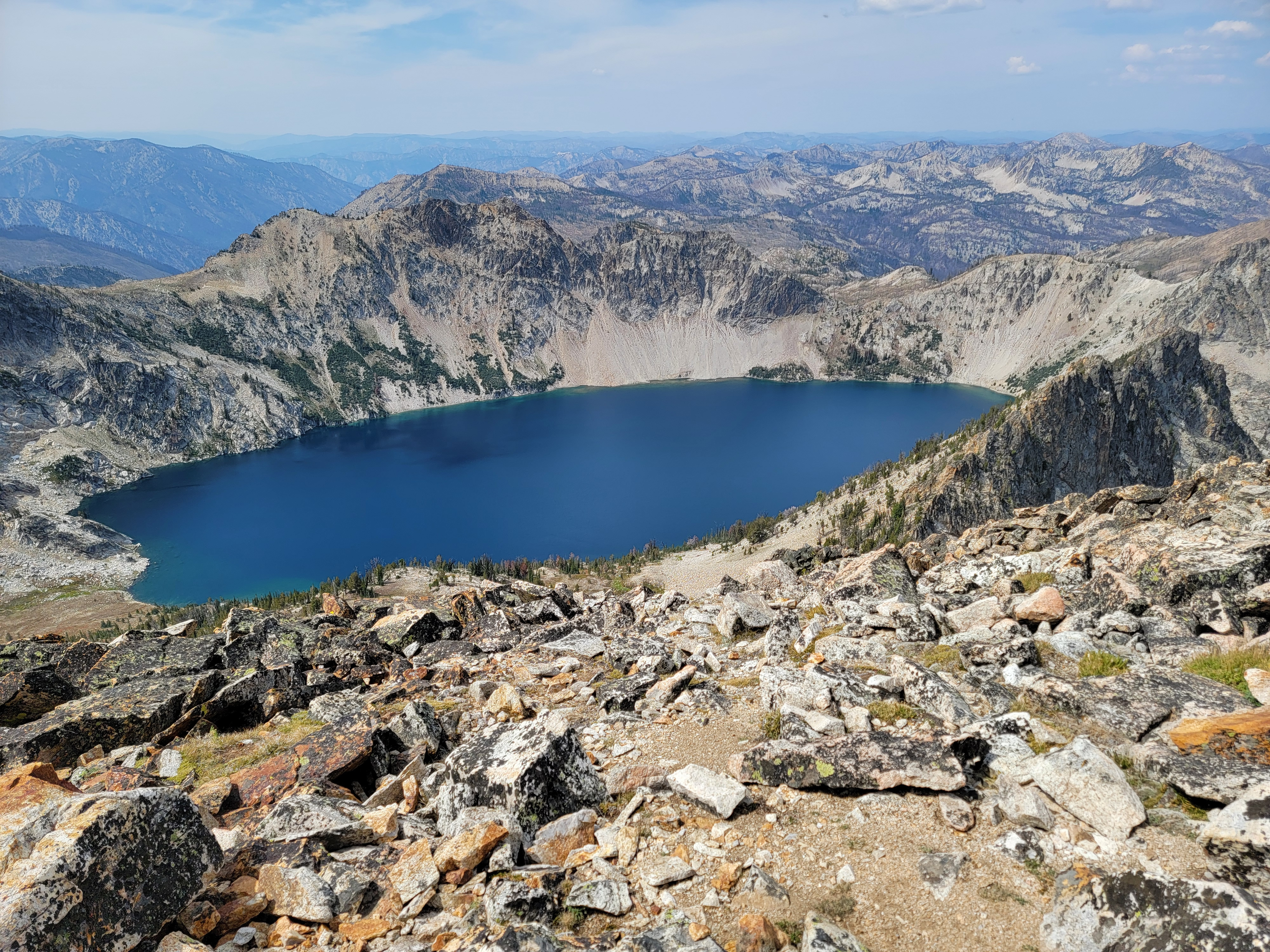 Sawtooth Lake from the summit of Alpine Peak
I made steady progress but it took a lot of effort and was very time consuming to descend carefully. I was really happy when I finally got back to the trail. By then I was so exhausted I had to sit down for fifteen minutes before I could continue.
I was on good trail so the walking was easy, but I still had five and a half miles to go. As tired as I was, this part was a real grind but I just kept pushing. Eventually I reached the trailhead just past 7:30 pm, a little over twelve hours after I had left. I was more tired than at the end of my Half Dome climb in June.
I made the short drive into Stanley and bought a couple of Diet Cokes for the ride home. I hadn't eaten all day but I didn't stop to have dinner. I didn't really have any appetite. The snacks that I had carried to eat on the hike were still in my backpack. I just wanted to get home as soon as I could. Sandy is pretty good about letting me go hiking but she asks that I text her to let her know how I am doing.
 Sawtooth Valley - my car is way down there somewhere
Unfortunately this hike was so long that my phone died. I plugged it in when I got to my car but its USB charges very slowly. My phone didn't have enough juice to turn on. I drove home as fast as I could, faster than I felt comfortable driving after all the wildlife encounters that I had in the morning to be honest. My phone didn't charge enough to send a text until I got to Horseshoe Bend - practically home. I didn't get home until 10:30 pm. Sure enough, Sandy was pretty worried and unhappy with me. I had to work hard to earn some extra husband points over the next few days to get back in her good graces.
Still, it was an awesome hike and climb. I was excited to reach an impressive Sawtooth summit. The weather was perfect. And although I was totally wiped out by the end of the day, I felt good that I was able to make it to the summit (and back!). Not bad for an old guy. I will admit that I wouldn't recommend the route. I probably won't be going up Alpine Peak again in the near future.
