Grand Slam #3: Kepros Mountain
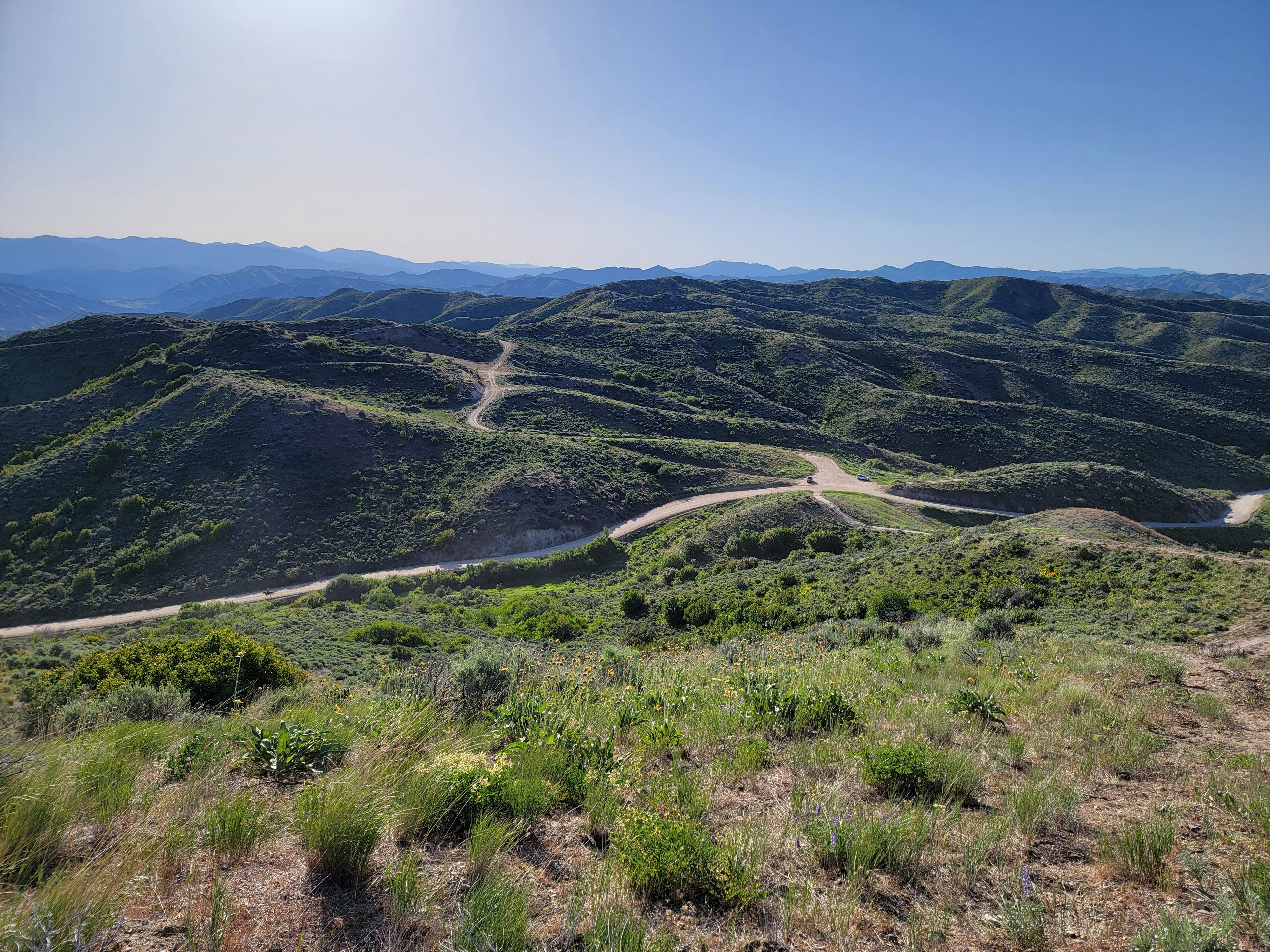 Looking down on my car, and the cowboy, at Blacks Creek Pass
I was half way through the Boise Grand Slam Peaks. In the past two weeks I had done Cervidae Peak with Sandy and Mount Heinen on my own. I decided to do Kepros Mountain next.
Kepros is in the Danskin Mountains and is further east than the other three Grand Slam Peaks, which are in the Boise Mountains. It's a little bit longer drive to reach the starting point. Even though it's not far from Boise, it's in an area that I hadn't been to before. I took I84 and got off east of Boise and headed north towards the South Fork of the Boise River and the town of Prairie. After a few miles the road turned to dirt and started to climb into the hills. Although I was the only car on the road, I still ran into a traffic jam. A large herd of cattle was moving up the road and they had it totally blocked. When I got close behind them, they didn't get off the road, they just hurried along it. Unfortunately cattle don't move very fast even when they are hurrying.
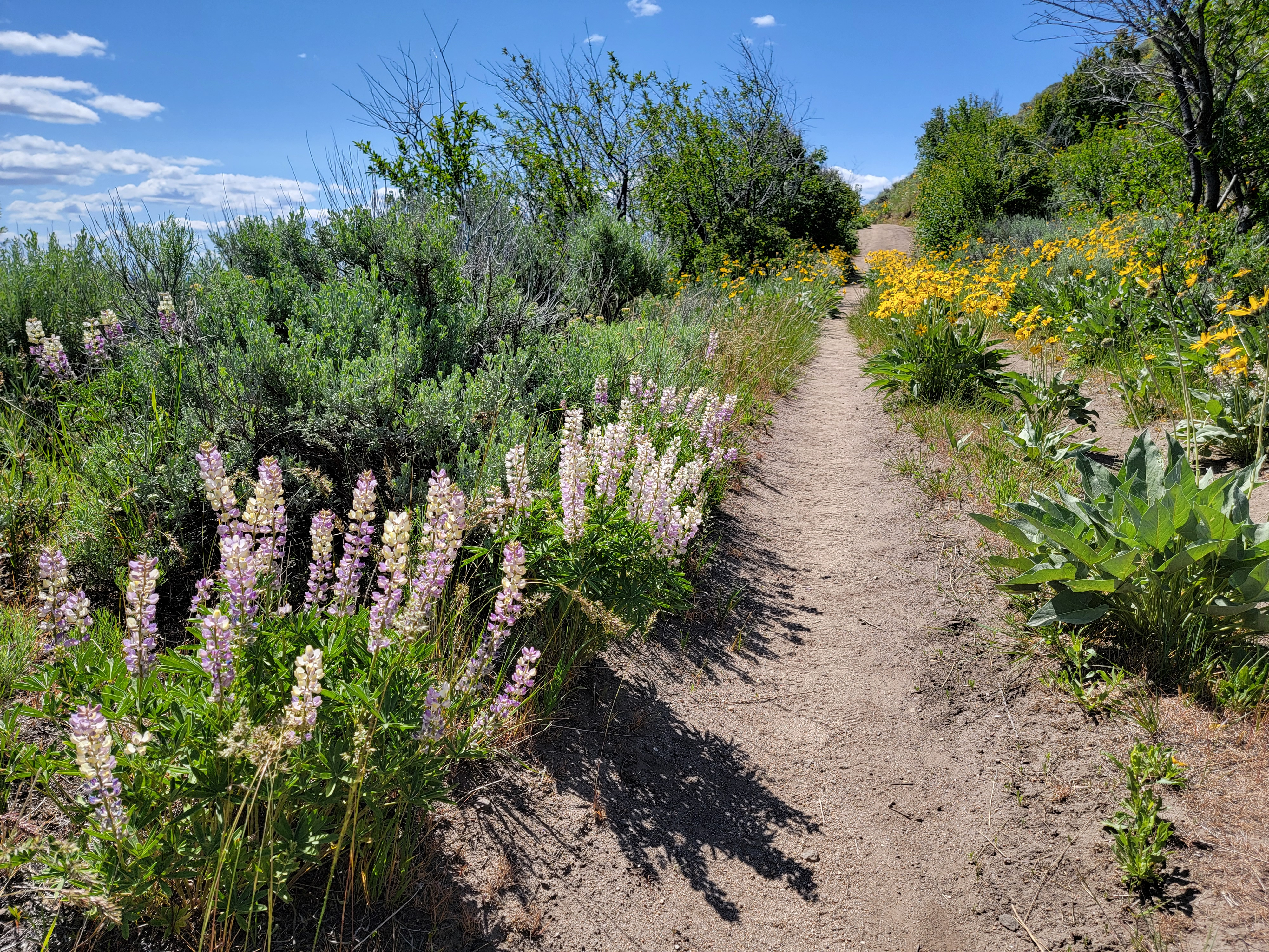 Lupine and arrowleaf balsamroot beside the trail
There was a cowboy on horseback who was working the herd, moving them along, but he didn't seem inclined to encourage them to get out of my way. As I followed right behind the cattle, occasionally one or two would peel off to the side and I could get by them. It still seemed like it took me forever to get past the main herd.
I was able to pick up speed then, although I still had to slow down for occasional individual animals. The road continued to climb until I reached Blacks Creek Pass, the starting point for the hike. There was a large parking area but only one car there. It looked like I wouldn't have to deal with as much traffic hiking as I had driving in. When I got out of the car another cowboy on horseback rode up and asked if I had seen his partner lower down, and what was he doing. I told I had seen his friend, and that he was on his way here with a zillion cattle. That must have been the right answer because he thanked me and started moving the few cattle nearby to continue down the road.
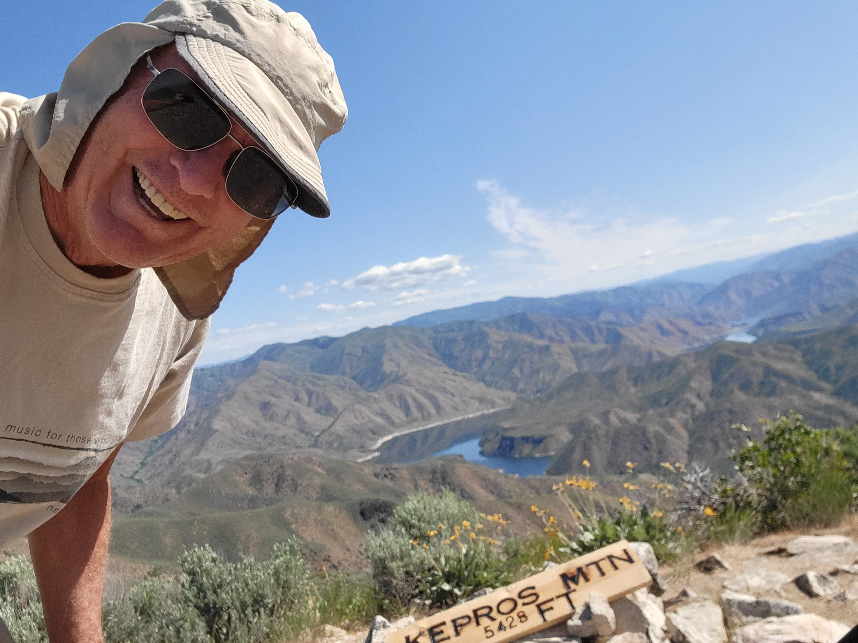 Summit selfie
The "trail" didn't look too inviting. It was just a slash in the steep slope beside the road, a track made by the passage of lots of motorcycles. Once I climbed up a bit, it became leveled out and became a more resonable track.
The initial part of the route climbs up onto a ridge near the summit of Three Point Mountain. It follows a combination of motorcycle paths, 4WD roads and hiker's tracks. The Forest Service has closed much of it to motorized travel now, so it is officially considered a hiking trail. I didn't see that they had put any effort into maintaining or improving it to make it a real trail though. It was steep, and a few sections were unpleasantly steep. Or at least they would be coming down. It was the treacherous, steep, loose-dirt-and-scree that I found to be so common on Cervidae Peak and Mt. Heinen. Fortunately I didn't have to deal with too much of it here.
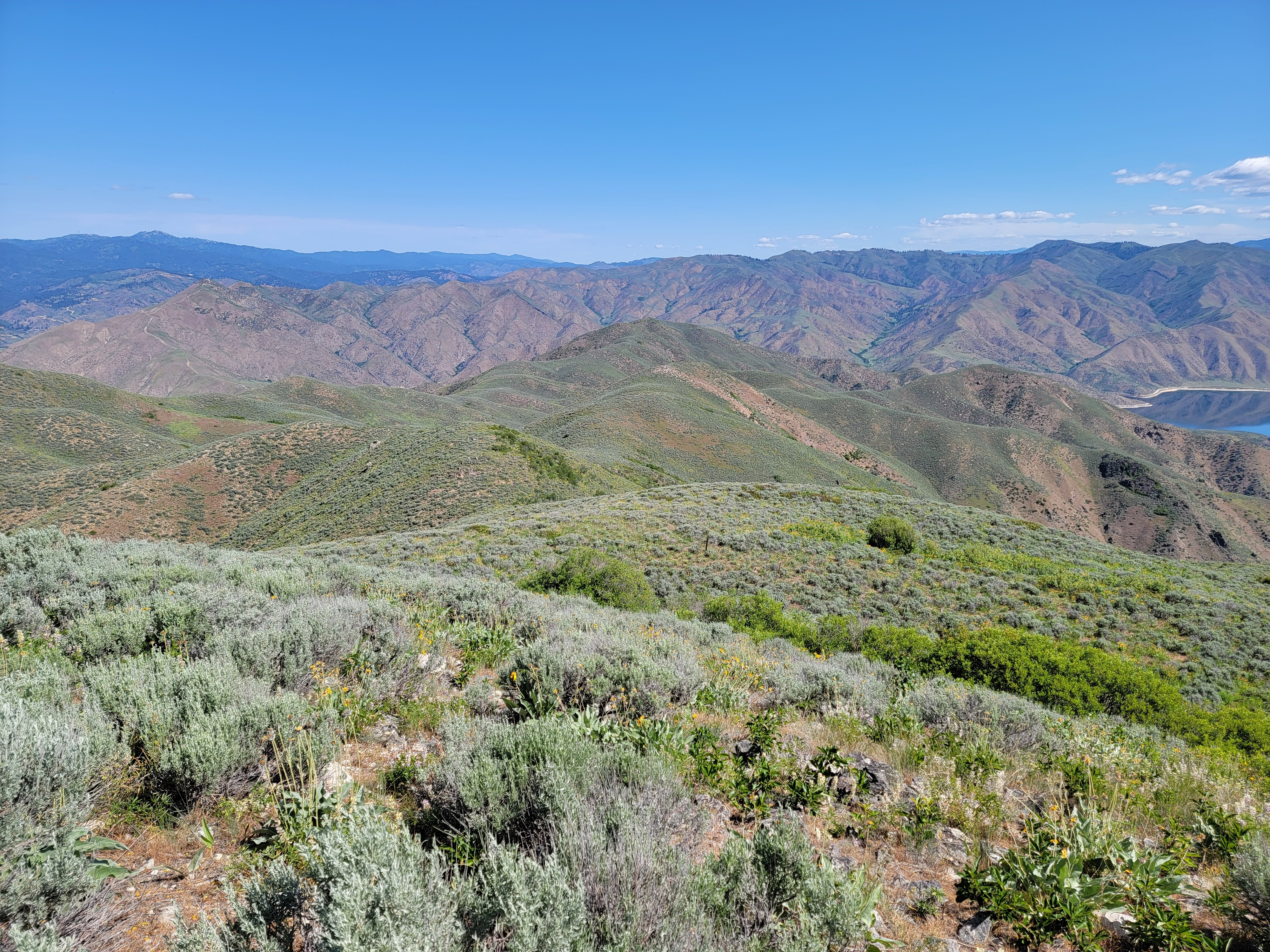 Cervidae (left middle) and Heinen (right skyline) from summit
Before I even topped out on this slope there was an alternative. I reached the first "bypass". This was a hiker's track that did a rising traverse as opposed to going straight up the slope. There are a number of these on the route that were marked off by Tom Lopez, the guy who originated the idea of the Boise Grand Slam Peaks. It was much better and much easier, although it still was just a light track and not a maintained trail. The USFS doesn't get any credit for it.
After about half a mile and four hundred feet of elevation gain, I reached a saddle. To the south was Three Point Mountain, about a quarter mile away and three hundred feet higher. A track led to the summit but I didn't take it. I had just started and had a long day ahead of me. I figured that I would decide on the way back if I had the energy required to bag the extra summit. Instead I turned north and started to climb up the ridgeline that ultimately led to Kepros.
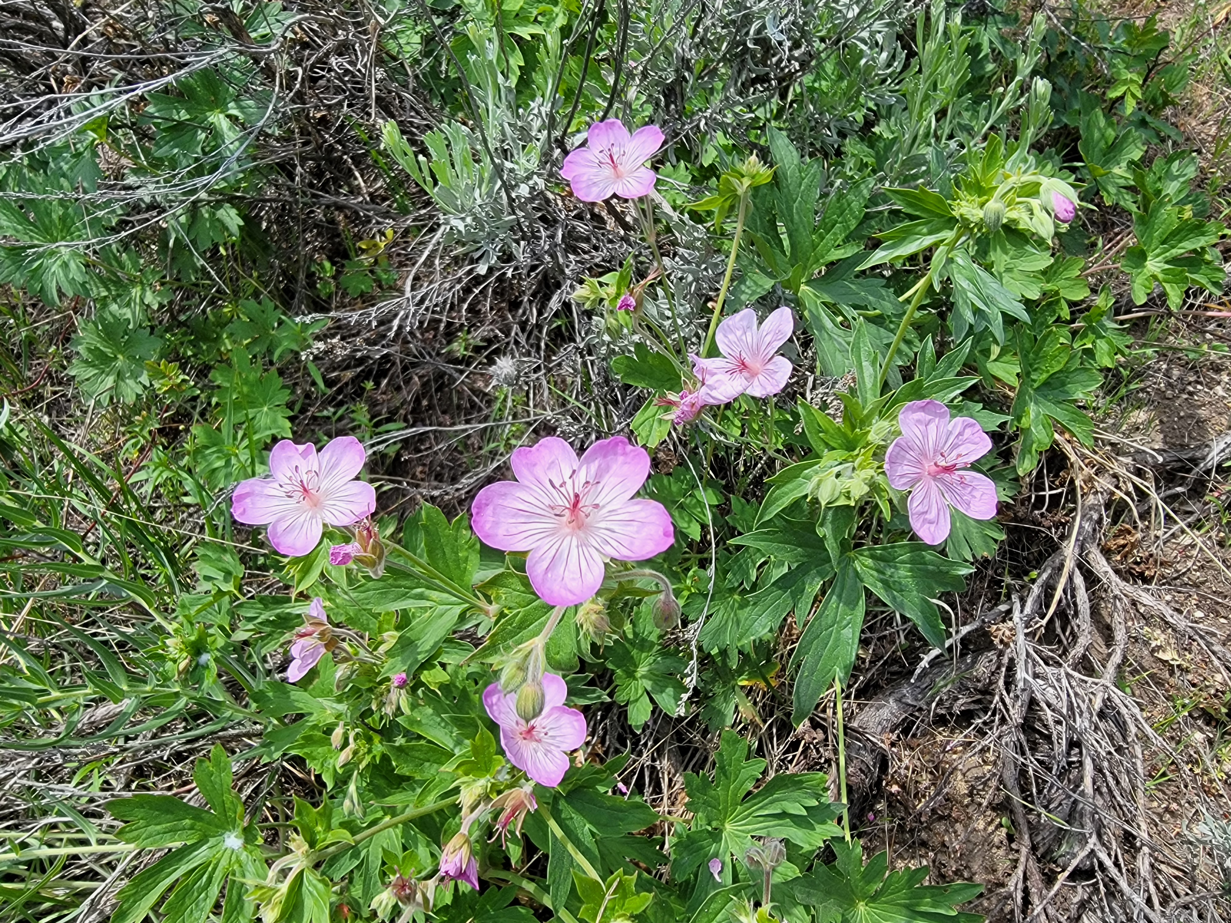 Sticky purple geranium (I think)
It's a long ridgeline. From where I was, the summit of Kepros was still over four miles away. It was only about three hundred feet higher, but the ridge has lots of ups and downs. As with the bypass lower down, in several places Tom Lopez has marked routes around several of the biggest bumps on the ridge. Over time, countless hikers have followed his cairns and have worn a track that is pretty easy to follow. That eliminated a lot of unneccessary elevation gain and loss. Instead of going up and over and back down every high point on the ridge, it's possible to make mostly level traverses around them.
There are five major bypasses along the route. I'm not proud, I took all of them, and taking them sure made the route a lot less work. In fact, it was quite pleasant. Hiking along an open ridge most of the time, the views were excellent in all directions. It was like taking a long walk in the sky. Even the weather was perfect.
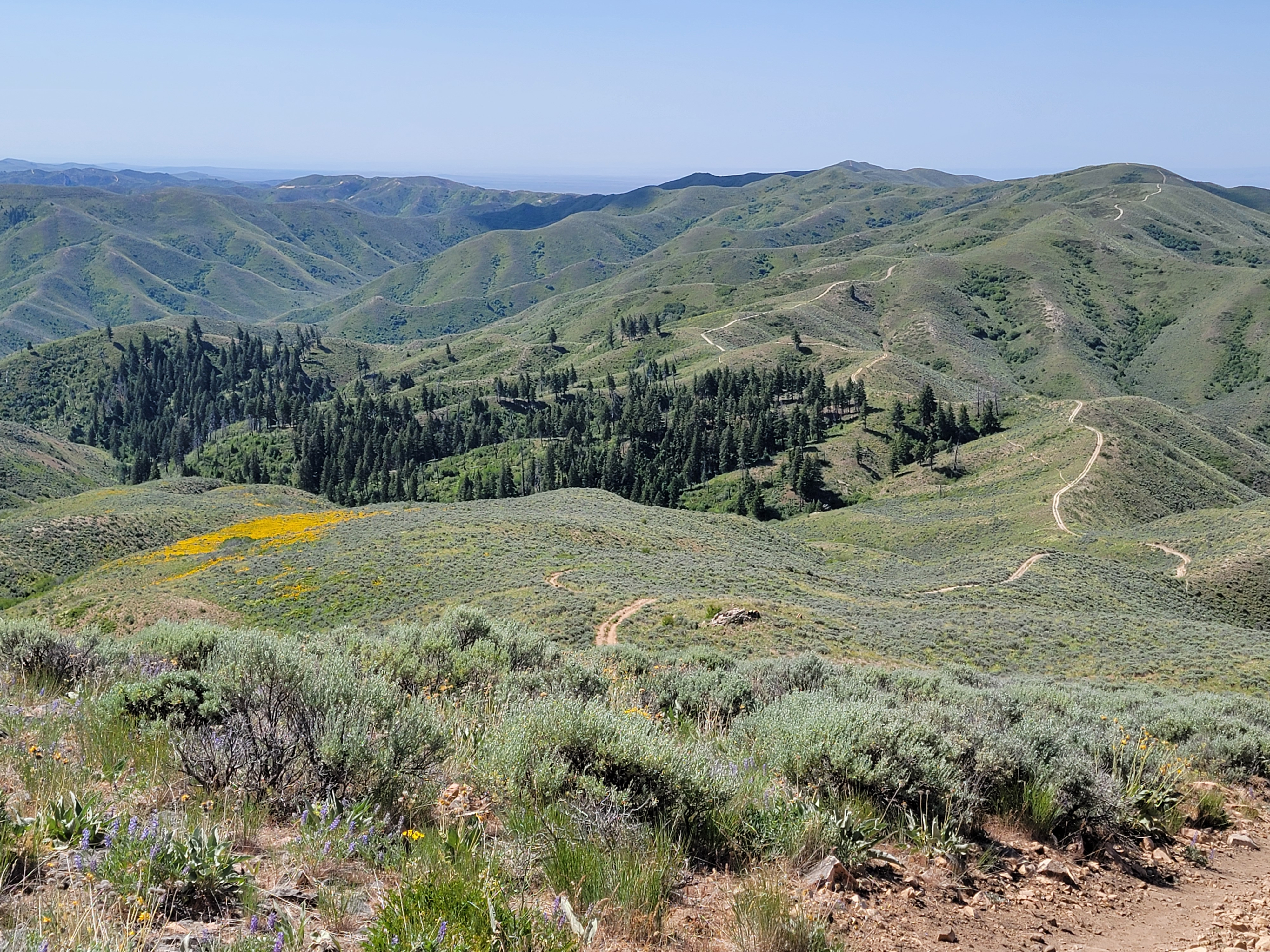 Looking back along the route from the summit
And although I had done several hikes this spring with abundant wildflowers, on this hike they were truly spectacular. They were everywhere, all different kinds. There were the usual suspects: lupine, penstemon, Indian paintbrush, Mariposa lily, purple geraniums, primrose and of course, lots and lots of arrowleaf balsamroot. There were many others that I couldn't name. I enjoy seeing wildflowers when I'm hiking but I have to admit that I'm not very good at identifying them. But according to Richard Feynman, one of my personal heroes, it's not important to know the name of a thing.
It was amazing that on such a beautiful day, I pretty much had the mountains to myself. While I was going up, one hiker passed me going down. He must have been the in the car parked at the trailhead when I started out. Later a couple caught up and passed me. They were younger and faster. It didn't bother me. On such a good hike I was in no hurry.
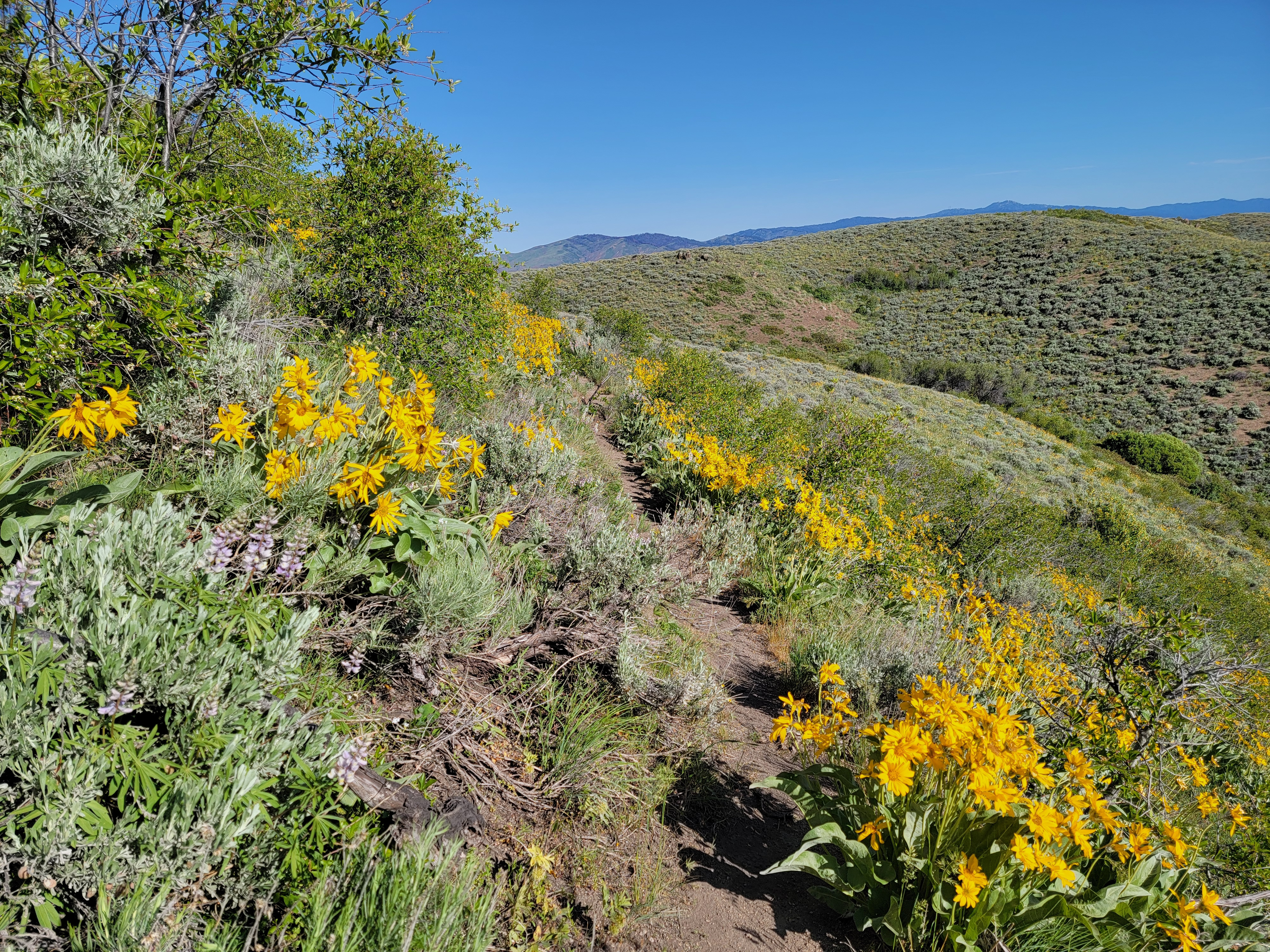 Did I mention there was a lot of arrowleaf balsamroot?
Near the end there was one more steep slope to go up and then I was at the top. There were impressive views all around so I took my time on the summit. I could see Cervidae Peak and Mt. Heinen to the west, across the reservoir. I must have been able to see Kepros when I was on top of them but hadn't known where it was so I wasn't able to pick it out.
Eventually I was ready to go and started down. The return hike was pretty relaxed. The bypasses meant there wasn't much up and down like on Mt. Heinen. That was especially appreciated on the way back when I was starting to get tired. Tired, but not totally wiped out. Still, when I got to the junction where I had the chance to go up Three Point Mountain. I declined. As opposed to the rest of the route, it looked steep and loose. I didn't want to spoil what had been a very enjoyable hike to this point. Sounded good enough to convince me. Too tired? Nah. It's just too much trouble.
According to the AllTrails app and my phone GPS, the hike was 9.6 miles round trip with 1709 feet of elevation gain. My time was 4 hours 34 minutes. A good workout but not exhausting. There were great views for most of the hike and especially from the summit. The wildflowers were spectacular, both in numbers and variety. A really good hike. I would definitely do this one again.
