Observation Peak
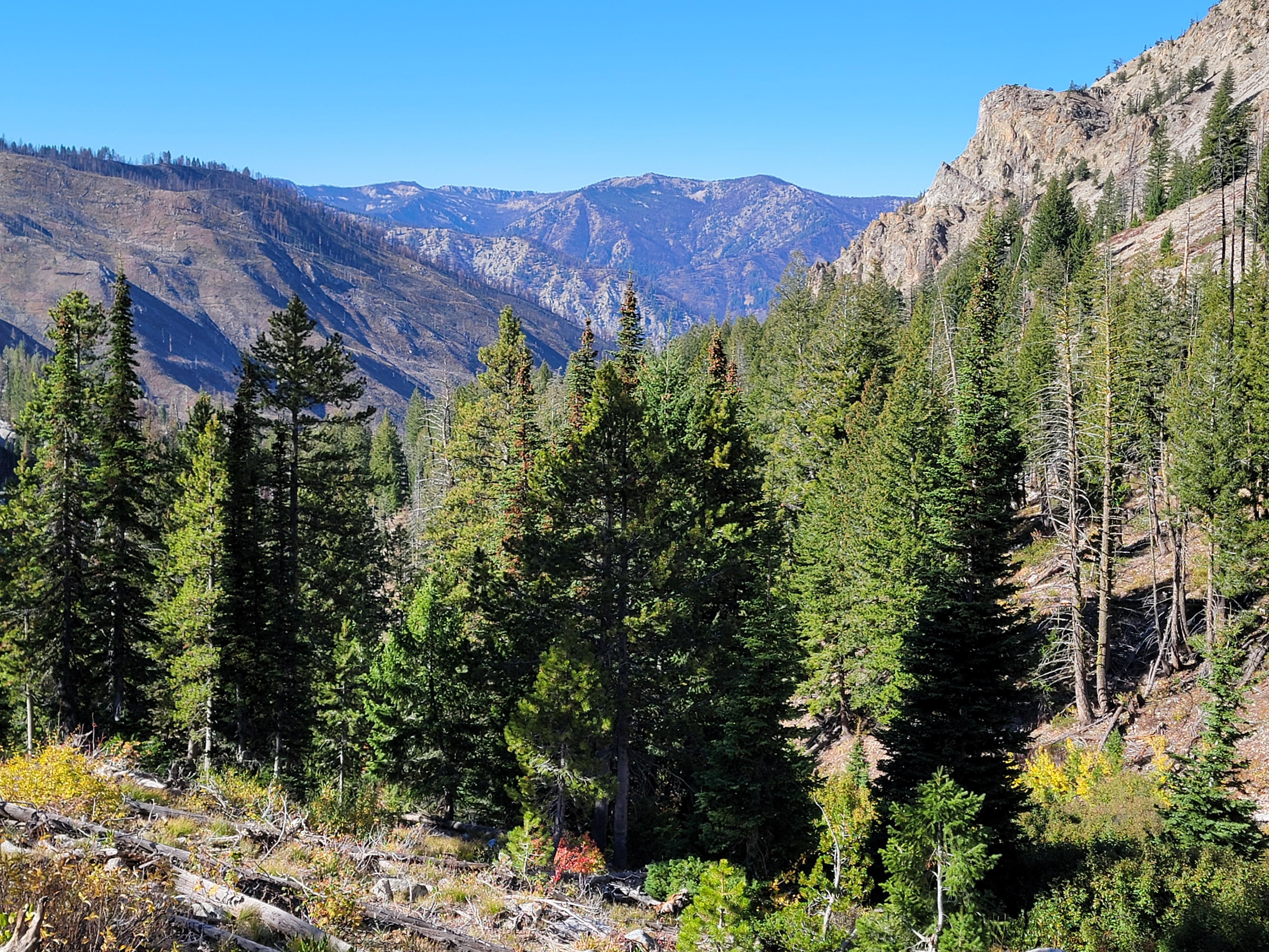
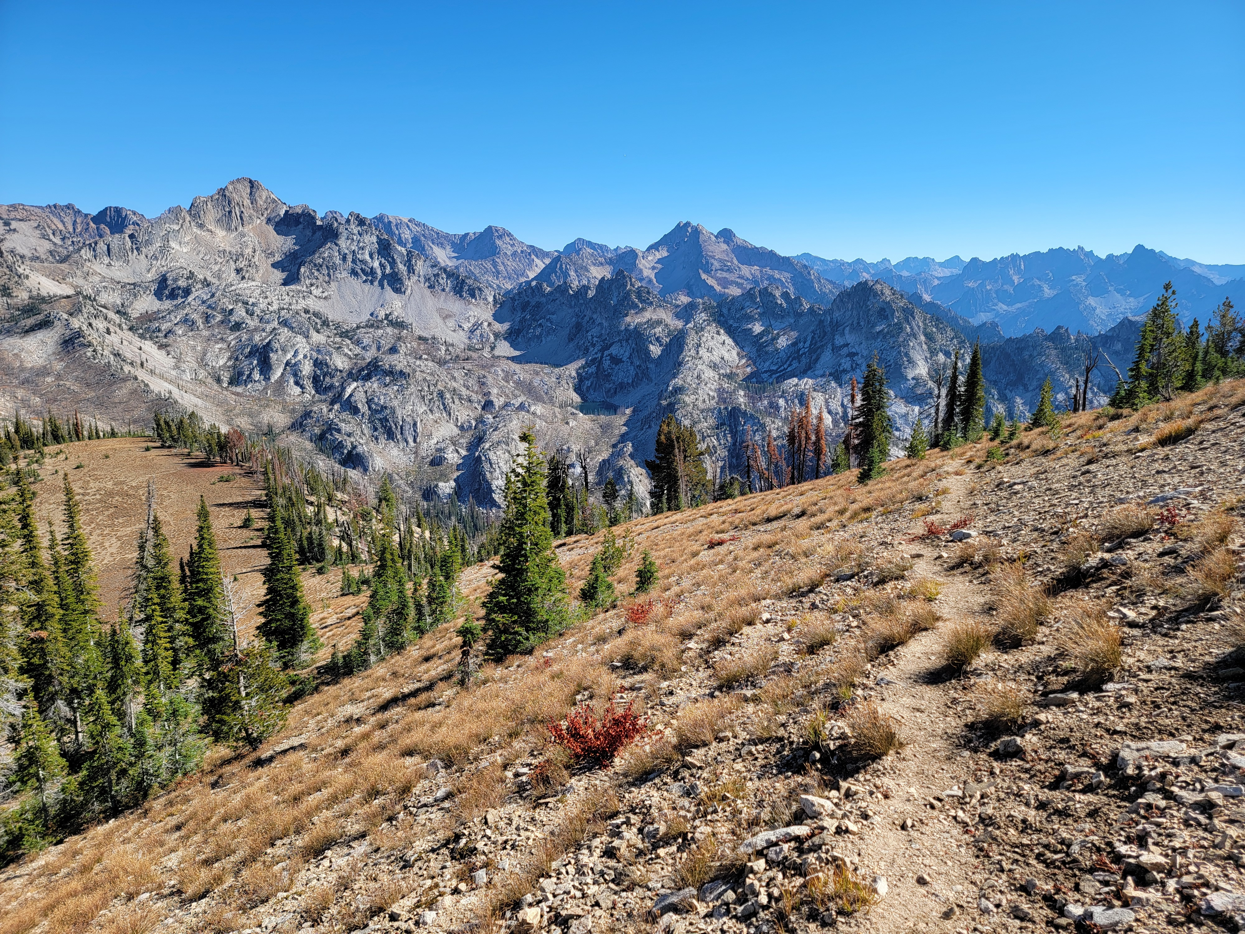
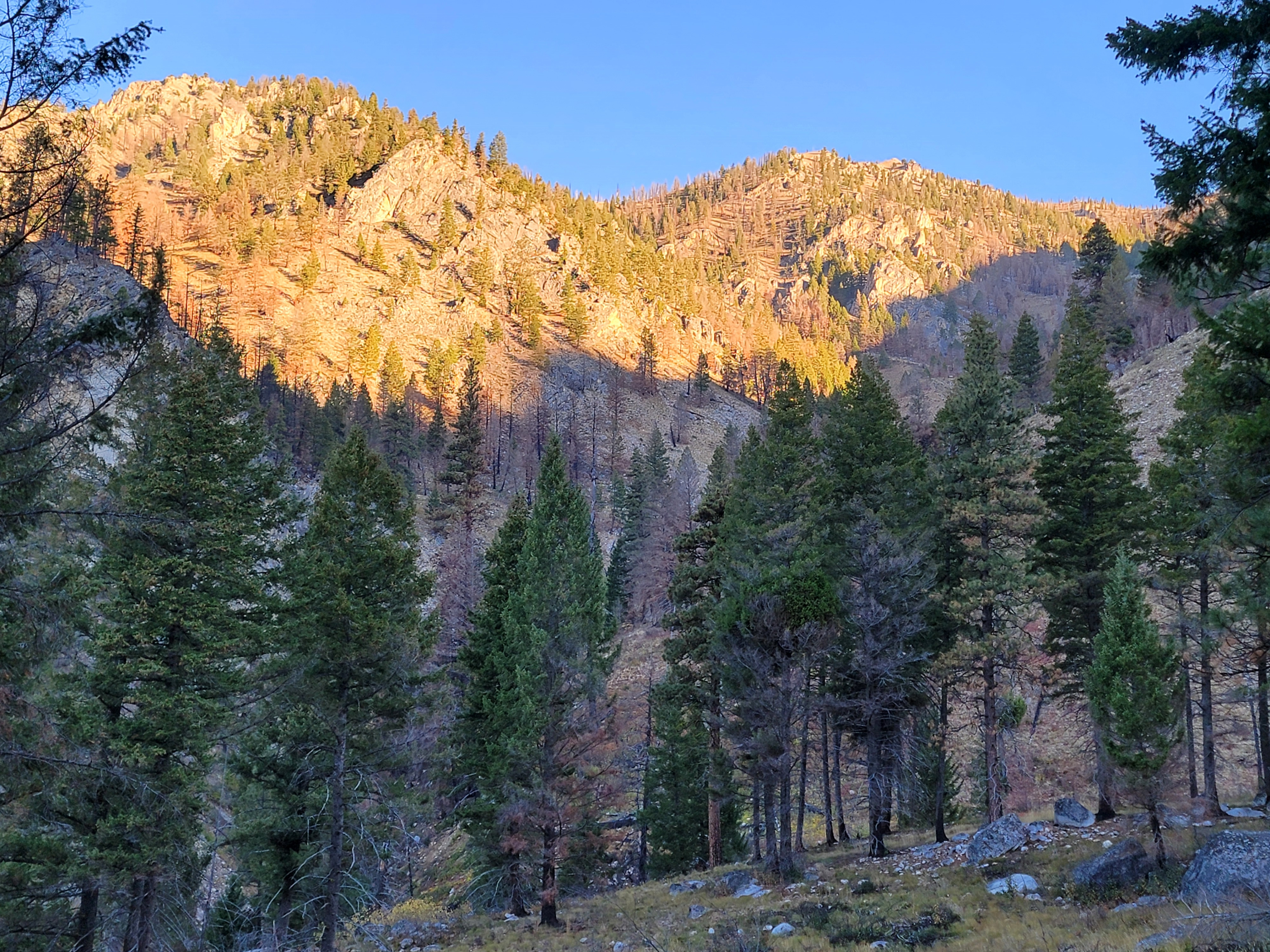 A beautiful morning in the Sawtooths
2025 has been a great year for hiking. My knee replacement from January 2024 was fully healed. I performed remarkably well on difficult tests like Half Dome and Alpine Peak. Smoke from forest fires, which can severely affect hiking any time from mid-July on, never was an issue. But by October, I knew the end of the season was getting close. Sunny days, continuous during the summer, were now mixed with rainy days from fall storms. I had to watch the forecasts for a window of fine weather. Businesses in Stanley were starting to close for the year. Hunting season would begin soon, a time I don't really like to be out in the mountains because there are too many idiots. Still, I had some hikes that I wanted to do before snow came to the high country and shut trails down until next spring. One that I wanted to do was Alpine Lake. It requires taking the shuttle across Redfish Lake from the marina at the lodge. When I saw that the lodge was going to close on Saturday at the end of the week, I knew I was about out of time. The forecast for Tuesday was good so I was up super early that morning and heading for Stanley long before there was any hint of the sun coming up.
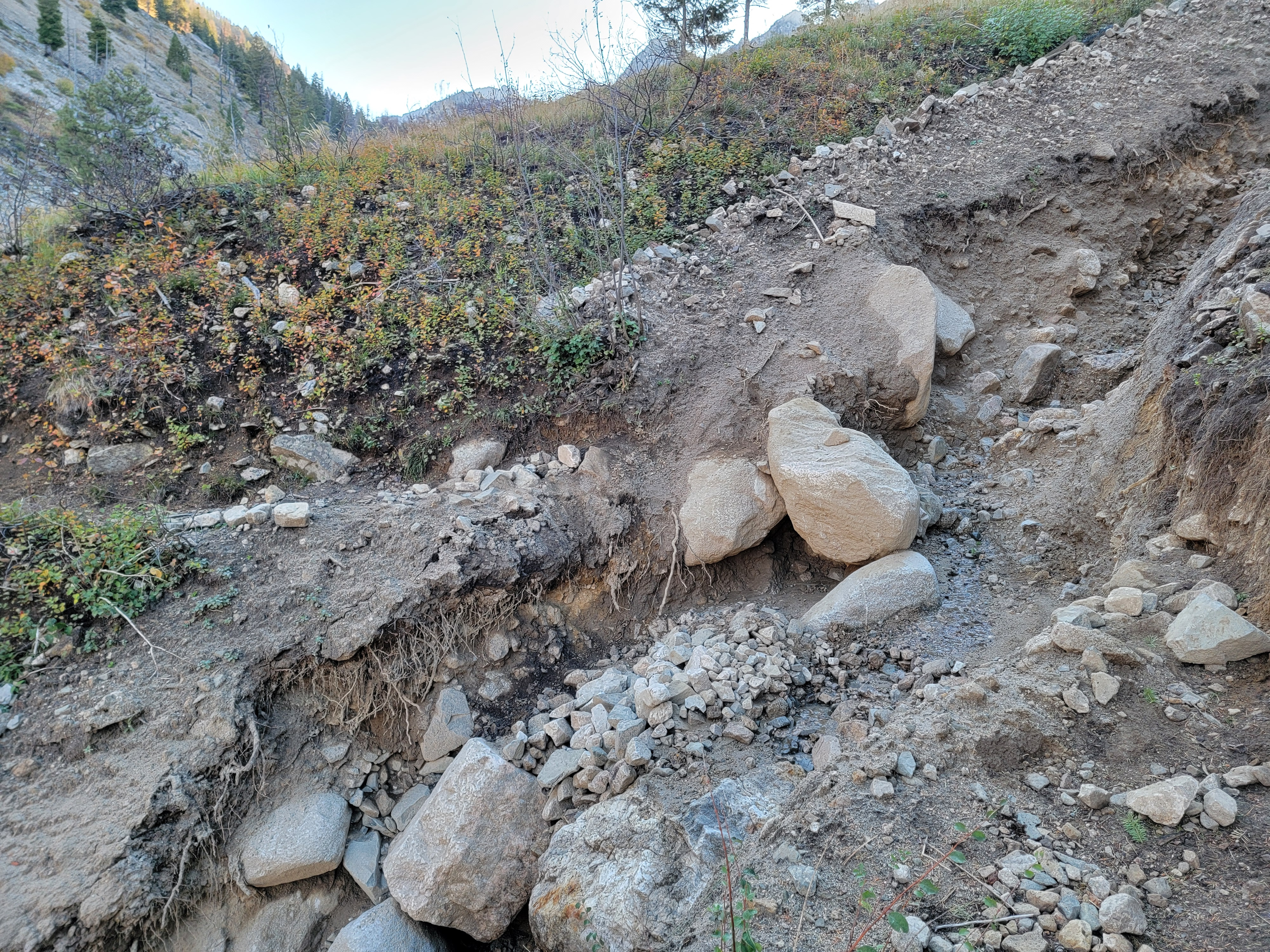 A washout of a section of the trail posed a challenge
I was feeling pretty good, at least for the first half hour. Then as I pulled out of Horseshoe Bend, I passed one of those big signs that they can tow and drop off by the side of the road. It was flashing a message that Idaho 21, the road to Stanley, was closed for construction at the Grandjean turnoff. What!? The only other way to Stanley was from the south through Sun Valley. That takes an hour longer to do from my house, not even counting that I would have to backtrack a half hour to get to Boise. I ran through alternatives in my head and quickly settled on Plan B.
There is a trailhead at Grandjean that provides access to the Sawtooths from the west. The main trail follows the South Fork of the Payette River for many miles. The drawback is that there are multiple river crossings. These aren't hop-across-on-boulder crossings, but serious fords. I've done hikes there a couple of times. I would carry sandals along to swap for my boots before rolling up my hiking pants and wading across. I didn't have my sandals with me. I don't like crossing barefoot as it is too easy to hurt your foot and not even feel it in the ice cold water. The Payette River Trail was out.
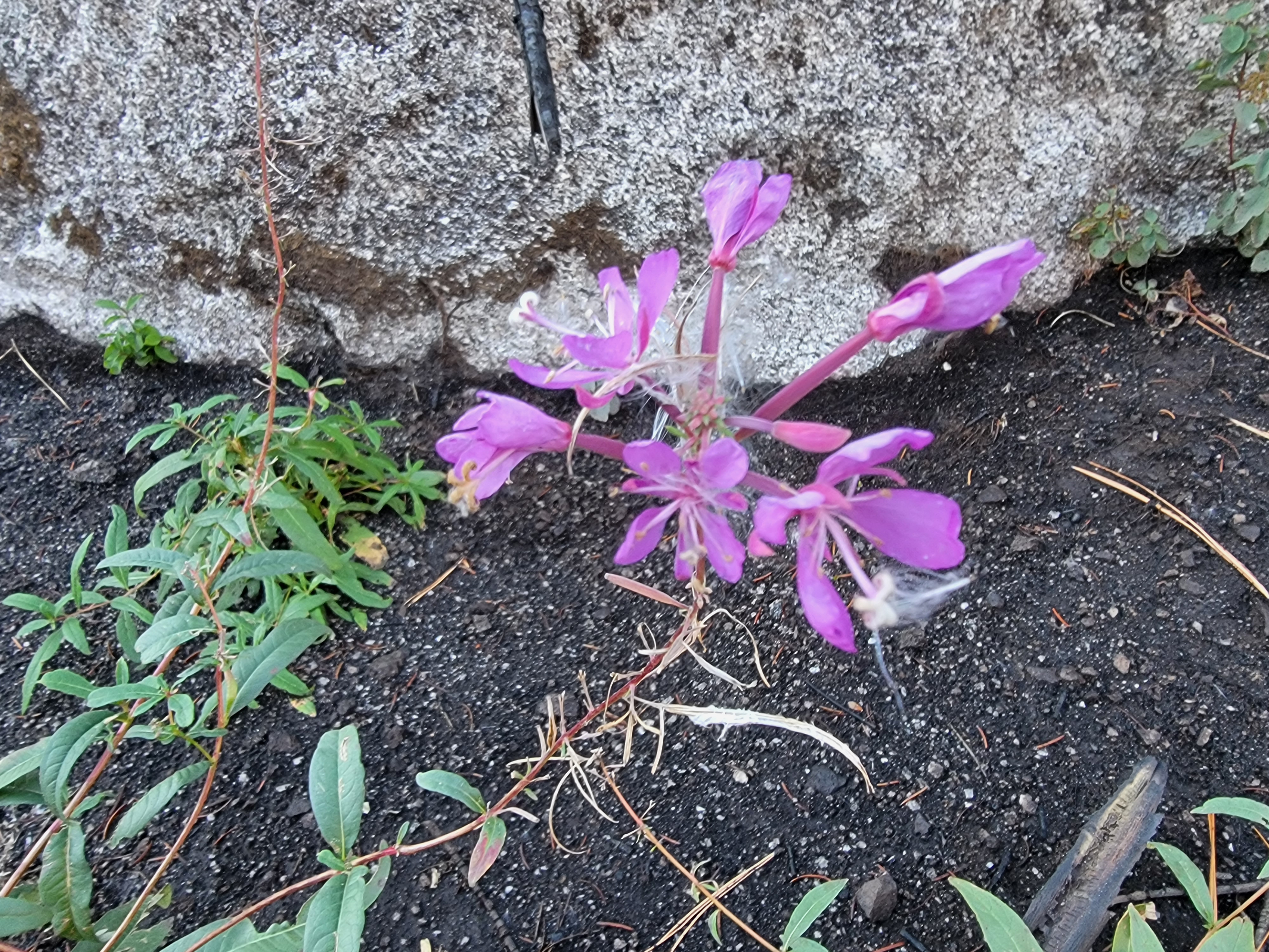 Even this late in the season there were beautiful wildflowers
That left just one possibility, Observation Peak. It's the only mountain in the Sawtooths with a trail to the summit. I've climbed it twice, although both times were many years ago. Once was from the east, starting at Stanley Lake. It's a long hike, 16.2 miles with over 2700 feet of elevation gain. But I couldn't get to the east side of the mountains because of the road closure.
I had also done it starting from Grandjean. It's not as long, "only" 13.4 miles, but since Grandjean is lower than the Stanley valley, it's 4000 feet of elevation gain. But that was my only option. As we used to say back when I played competetive chess, forced moves are easy. At least I would get a good workout, and I would get to the top of a mountain. As you can guess from the name, the view from the summit is expansive. Since that was the new plan, I downloaded the trail map into the AllTrails app when I stopped for gas in Garden Valley. It was the last place that I knew I would have reliable cell service, and therefore internet access.
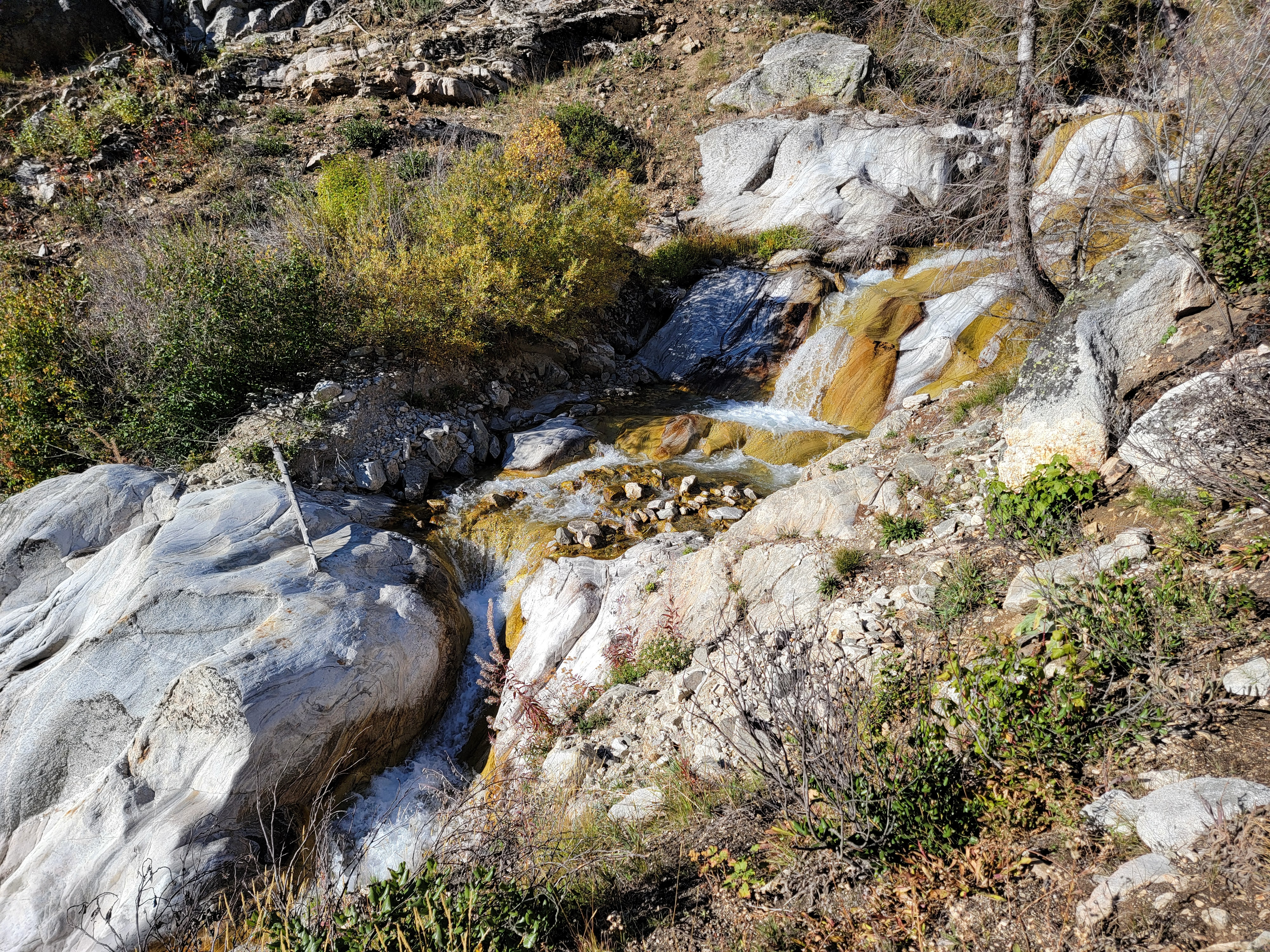 Waterfalls along Trail Creek
Although I left early, there were delays. At one point traffic was stopped by construction for about fifteen minutes. Then from the Grandjean turnoff, it was still quite a few miles of slow going on a dirt road to reach the trailhead. When I got there I was pleased to see only two other cars. I would have the mountains mostly to myself. It was 8:30 am when I hoisted my pack and started out on the trail. It was about forty degrees with no wind and a cloudless sky. Since it was fall there would be no bugs. It looked like a perfect day for hiking.
The trail was flat for the first five minutes. Then at a junction, the flat trail continued off to the right to follow the South Fork of the Payette. I took the Trail Creek Trail (now there's an imaginative name for you) instead, going off to the left. It immediatly started to climbe steeply up the side of the canyon in a series of switchbacks. That was pretty much how it was going to be all the way to the summit. At least it got my heart rate up. A half hour after starting my jacket was in my pack and I was hiking with just short sleeves.
 Looking back down the Trail Creek drainage
After about forty five minutes I hit a major obstacle. A section of the trail had washed out, leaving a gully about fifteen feet across and six to eight feet deep. The sides were very steep, loose dirt. It was in the middle of a steep, brushy slope so it would be hard to go either up or down to find an easy place to cross. Getting down into the gully wasn't too bad. My approach was kind of sit down, slide on my butt, then jump. Climbing out was tricky but I managed by trusting a large shrub with some of my weight to pull myself out. Fortunately it held. Definitely not fun though.
I had heard that with all the budget cuts early in the year, that the entire trail maintenance crew for the Sawtooth National Recreation Area had been laid off. Now this is what you get - an amazing trail in a beautiful area that is on the verge of being unusable. That was a very bad choice if you ask me. I guess Making America Great Again means letting all of our incredible resources decay and deteriorate to save a few bucks. Thank you Donald Trump. Thank you Elon Musk. Thank you DOGE (Department Of Government Efficiency).
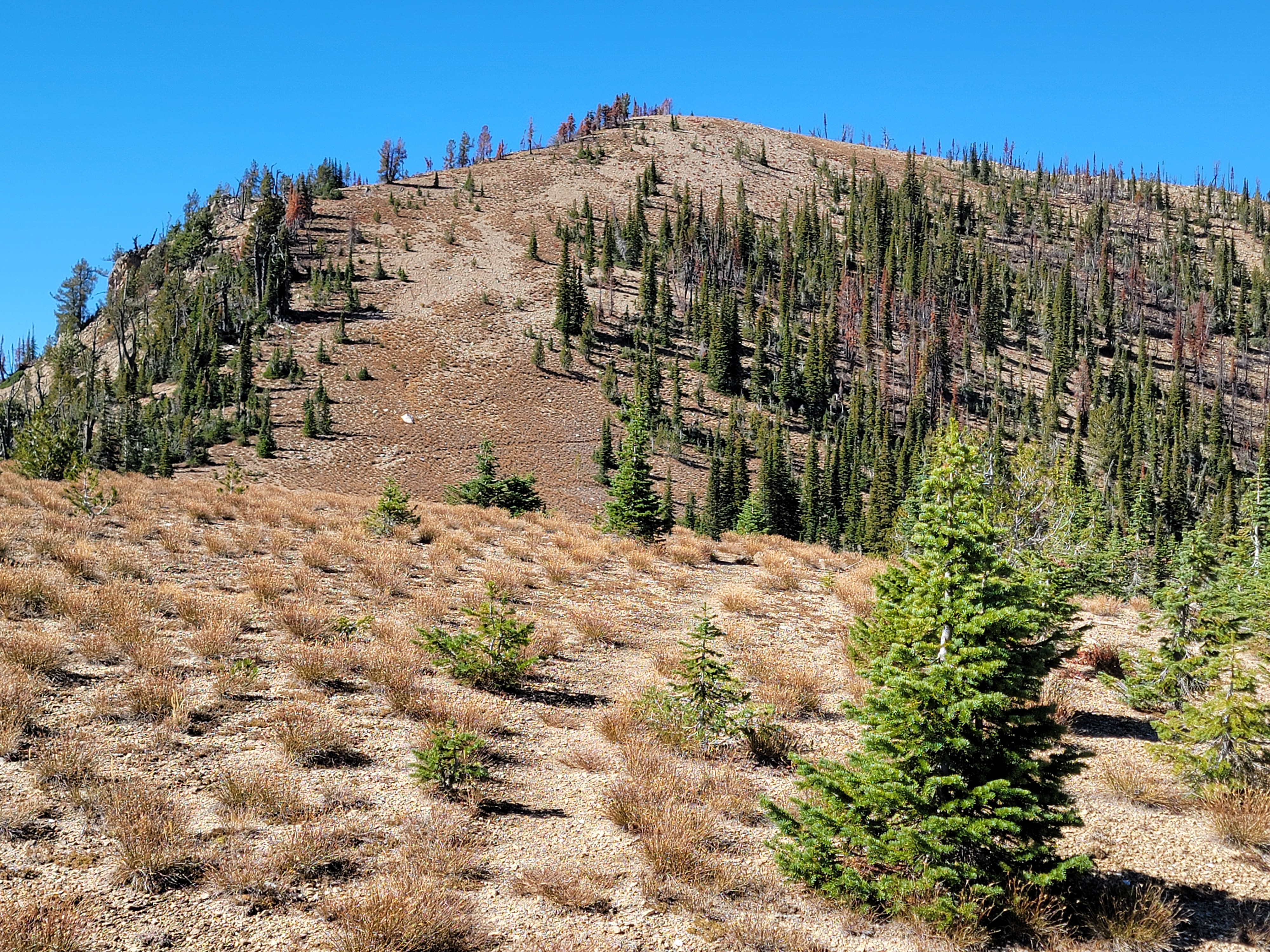 The summit finally comes into view
At least I was past the obstacle. From here the trail followed Trail Creek a long way, up to the Sawtooth crest. It would just be a mindless slog, right? Wrong!!! Soon the trail crossed the creek. This late in the season it was pretty low but was still a challenge. I have to admit that as I get older my balance isn't what it used to be. Hopping from boulder to boulder or balancing on top of a log isn't as easy as it used to be. I was careful though and did make it across.
...and later reached a second crossing. And then a third. And a fourth. The third one was the toughest but by then I had too much invested to even consider turning around. I don't usually hike with trekking poles but I was really regretting that I hadn't brought one along this time. Somehow I managed to make it across all four crossings without mishap. No slips. No injuries. Dry feet. I will admit that my form wasn't always the best but at least there was no one there to see how awkward I was.
 Almost there - view from the trail just below the summit
I was just about out of the Trail Creek drainage when I passed the junction for Trail Creek Lakes. They weren't far and I've never visited them. Some day I will have to come back and do that hike. Not today though. I had summit fever and wanted to get to the top of a mountain.
I continued climbing. Eventually I reached the pass between the Trail Creek and Stanley Lake Creek drainages. There was a four way junction. I had come up Trail Creek from the south. A trail went north and dropped down to Stanley Lake Creek, and eventually Stanley Lake. Another trail went east. It goes by the two small McGown Lakes and then crosses another pass into the Sawtooth Lake basin. One of the most popular hiking destinations in the area, probably 99% of the visitors get there via the Iron Creek Trail from the east. It's half the length and half the elevation gain of the western route. I have hiked it once, going up Trail Creek, past the McGown Lakes and Sawtooth Lake, and then following the North Fork of Baron Creek back to the Payette River and finally Grandjean. It was an awesome hike but a real monster in terms of both distance and elevation gain for a single day.
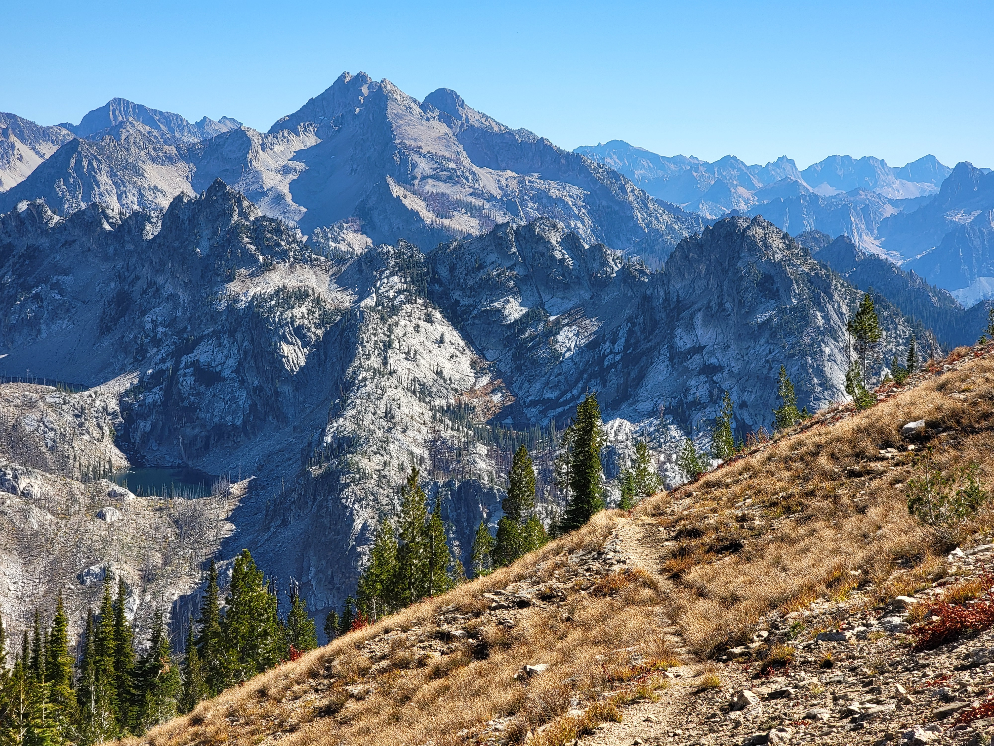
 Mt. Regan from Observation Peak
I took the path to the west, leading up to the summit of Observation Peak. I was really tired by this point, but my recollection was that it was fairly short and easy to reach the top from here. Well, I was wrong again. It was still another mile and over a thousand feet of elevation gain. Plus, it wasn't really a maintained (or graded) trail. It was more of a climber's track, steep in spots with loose dirt and rocks. Although I rarely stop to rest while hiking, I had to take two extended breaks on this last stretch to catch my breath. But finally I made it. I was on top of Observation Peak.
It wasn't your typical jagged, rocky Sawtooth summit. It was more of a broad, dirt mound. But the view was definitely worth it. The main Sawtooth crest ran just to the east, from McGown Peak in the north until the mountains disappeared in the south. Mt. Regan dominated the view with it's spectacular west face. To the south, I could see many famous Sawtooth peaks, like Warbonnet and the Rakers. To the west, the Boise Mountains extended to the west until they disappeared in the haze. Suddenly I didn't feel so tired anymore.
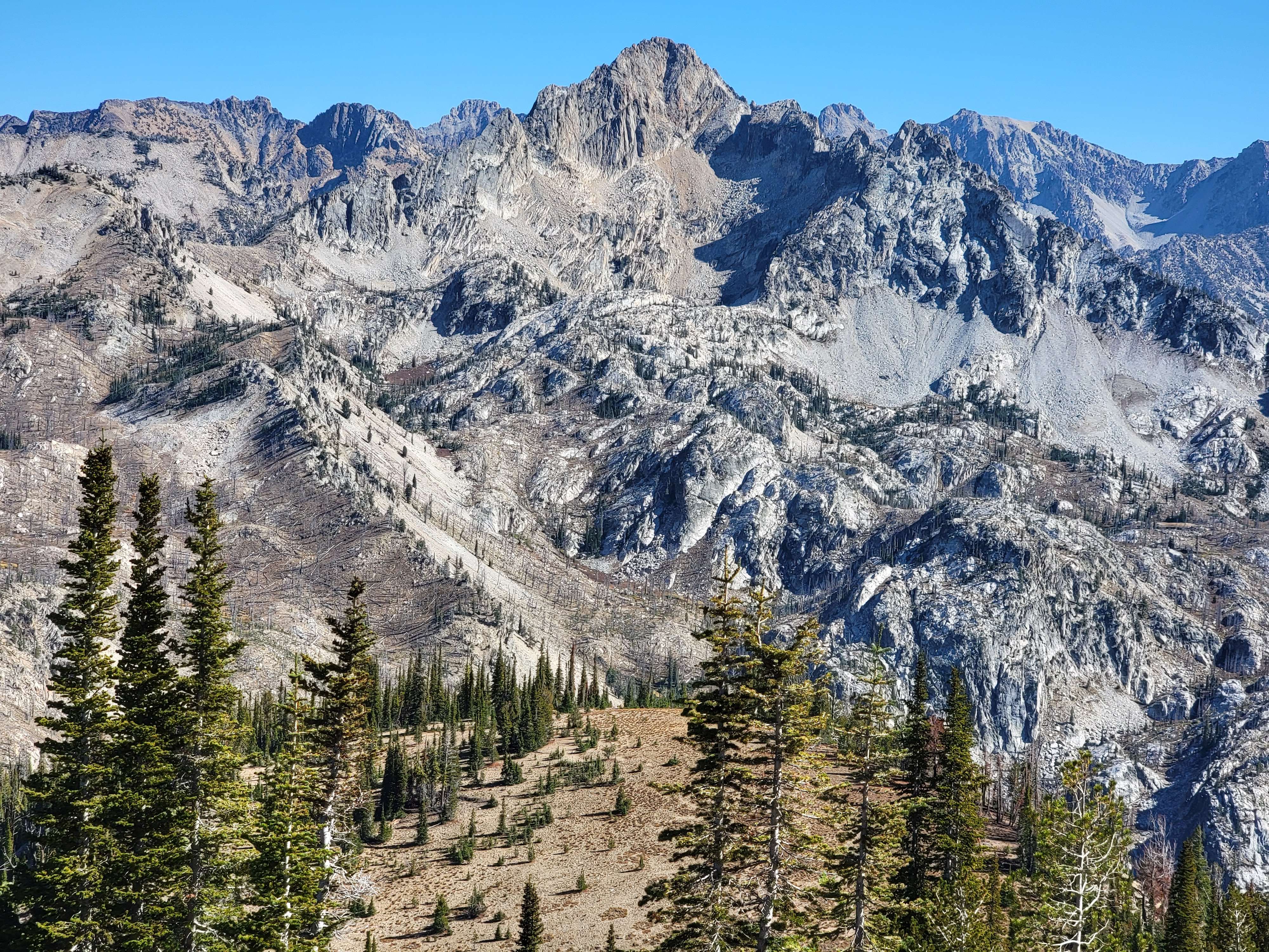
 Spectacular view as I start on my way down
I stayed on the summit for half an hour, longer than I usually do. Then I headed down. It was a long way back and I was very tired. The stream crossings were even harder going back. On one I did slip. One foot went partially in the warer. Not bad, but it did get a little wet. Worse, I grabbed a down tree branch to catch myself and got stabbed by a short piece of wood sticking out. Not serious but it did bleed for a while. The trail washout was also harder going back. Climbing up the steep, soft dirt to get out of the gully took a couple of tries before I finally made it. From there on I was just on autopilot, slogging along till I reached the trailhead at 6:30 pm. The hike took me almost ten hours exactly. Not a fast time but hey, I'm an old guy and it was a hard hike with a LOT of elevation gain. I thought that I did pretty well. I was exhausted but I felt really good about doing the climb. The drive home was uneventful.
Even though I didn't do the hike that I had set out to do, it was still a great day in the mountains.
