Tim's Hikes #2: Grand Staircase-Escalante NM
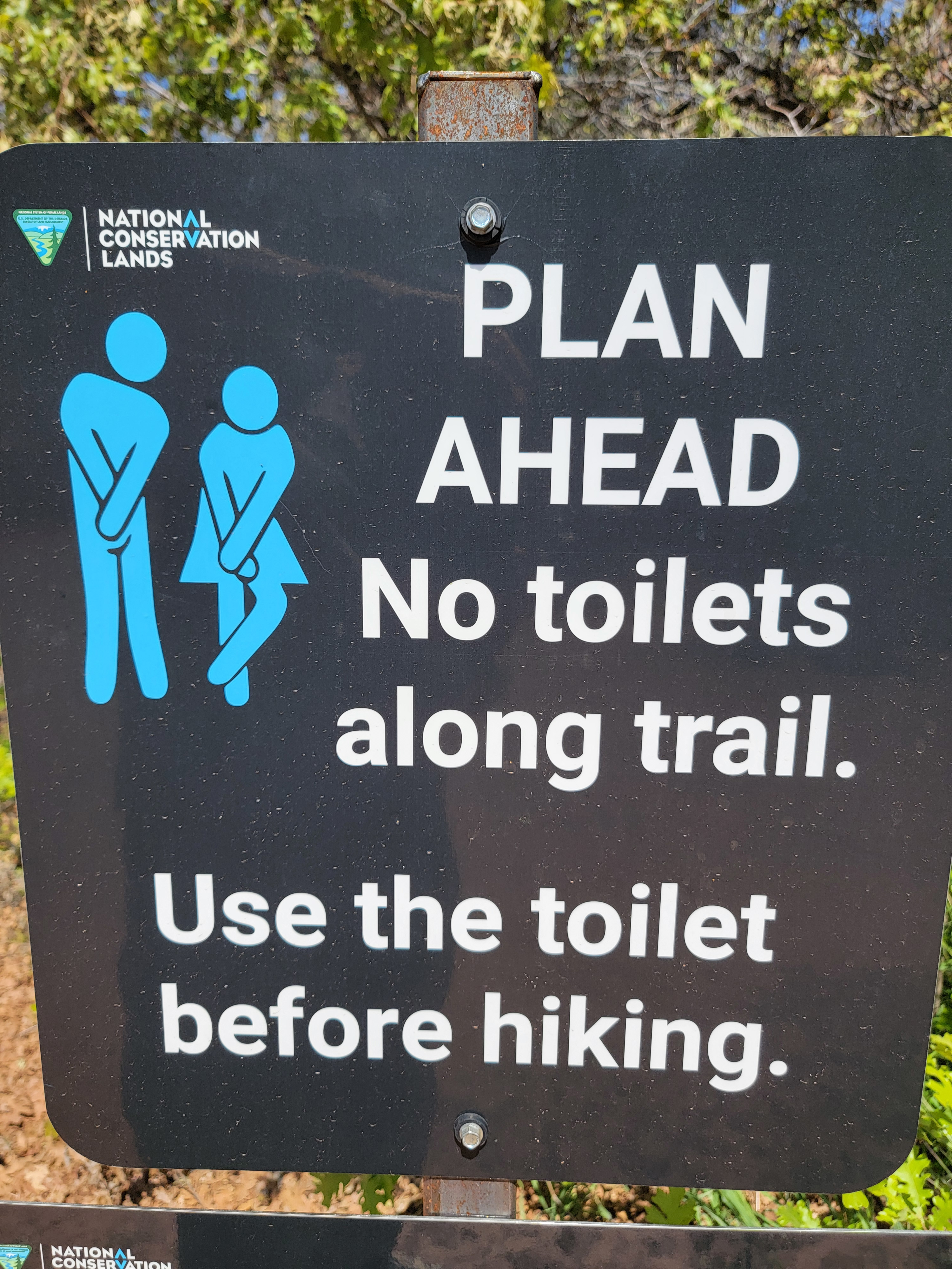 Sound advice at the trailhead
I was excited when my son Tim flew out to do a hiking trip with me. Since he had never been to canyon country, I planned to show him as much of the area as possible in the five days that we had allocated. We started in Capitol Reef National Park. It's my favorite of the five national parks in Utah. It has beautiful scenery. It has excellent hikes. But most importantly, it is the least known of the Utah parks. That means it has the fewest people and is the least crowded. That doesn't mean empty. It is a national park after all. But much less crowded than Zion or Arches. We did two hikes there, Cassidy Arch and Grand Wash. I think that gave Tim a good idea of what the park is like.
Now it was early afternoon and we were starting on the next segment of our trip. We left Torrey Utah, where we stayed the first night, and headed for Escalante Utah, where we would stay next. The drive is about an hour and a half on Utah Highway 12. The road is very scenic, more than just getting from point A to point B.
First we drove over the shoulder of Boulder Mountain. It's 11,317 feet high and separates Torrey and the Cathedral Valley from Grand Staircase National Monument. Broad and massive, it looks more like a huge ridge or plateau than a mountain. There is no peak. From a distance, you can't even tell where the highest point is. Near the high point of the road at almost ten thousand feet, we made a brief stop at Larb Hollow Overlook. It provided a spectacular view to the east, looking over the Waterpocket Fold, the geological formation which makes up Capitol Reef National Park.
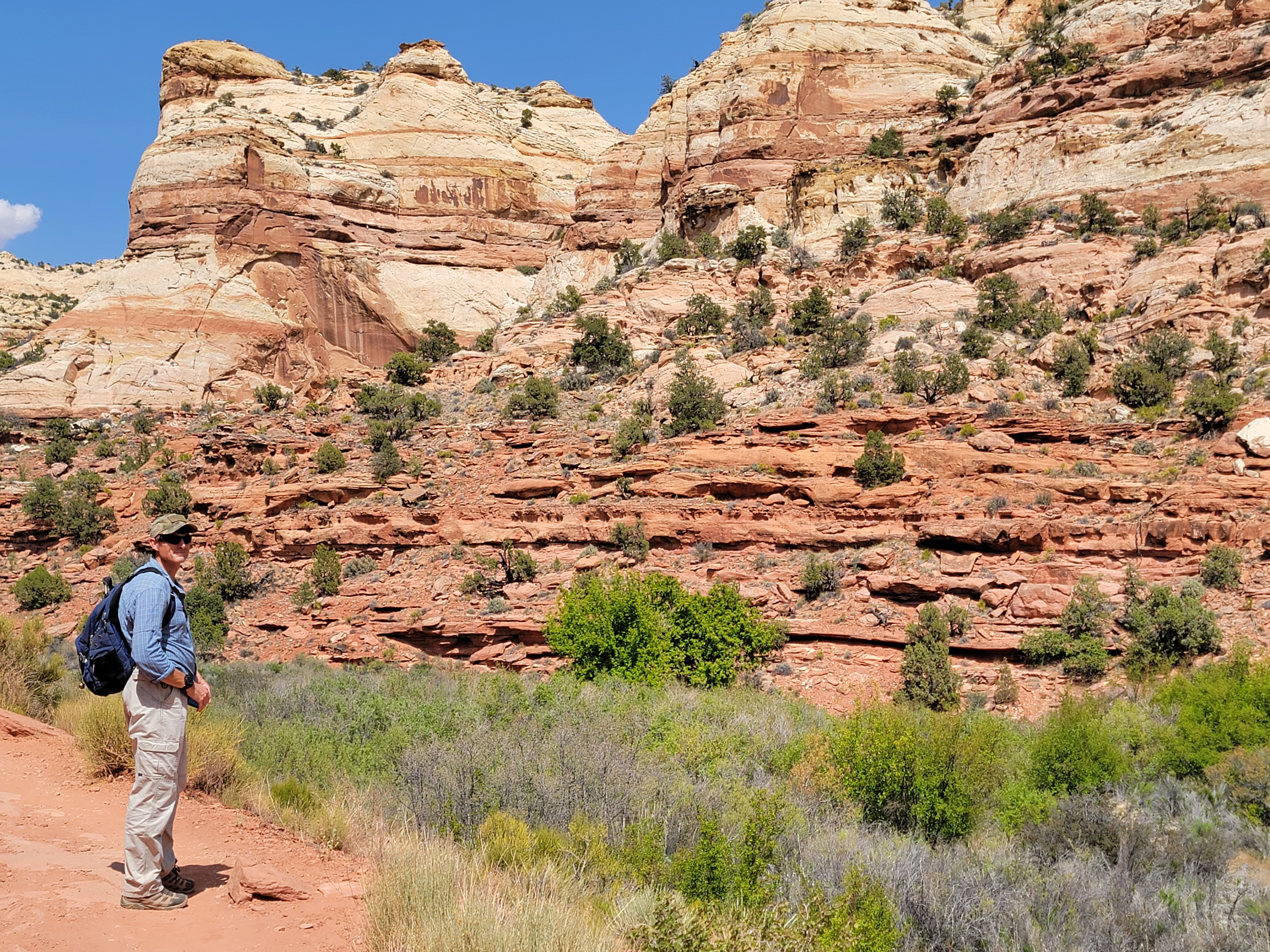 Tim starting out on the hike
After the viewpoint, the road drops down off the mountain and passes through Boulder, Utah. I'm not sure it deserves to be called a town. There's a small lodge with a restaurant. There's a gas station/market that's so run down I couldn't tell if it was abandoned or still open. There's the Anasazi State Park Museum. It's small but might be cool. I would like to check it out some day, but we didn't have time today. Finally, there is a t-junction that's the start of the Burr Trail - a road that travels 67 miles through extremely remote country to reach Bullfrog Marina on Lake Powell. I thought about including a hike from that road on this trip, but decided against it. There is no place to stay close to the trailheads, and since our time was short, I didn't want to spend all our time driving back and forth to a trailhead. I only explored this area once when I hiked Upper Muley Twist Canyon back in 2011. I thought it was awesome. I need to go back sometime and explore that area more.
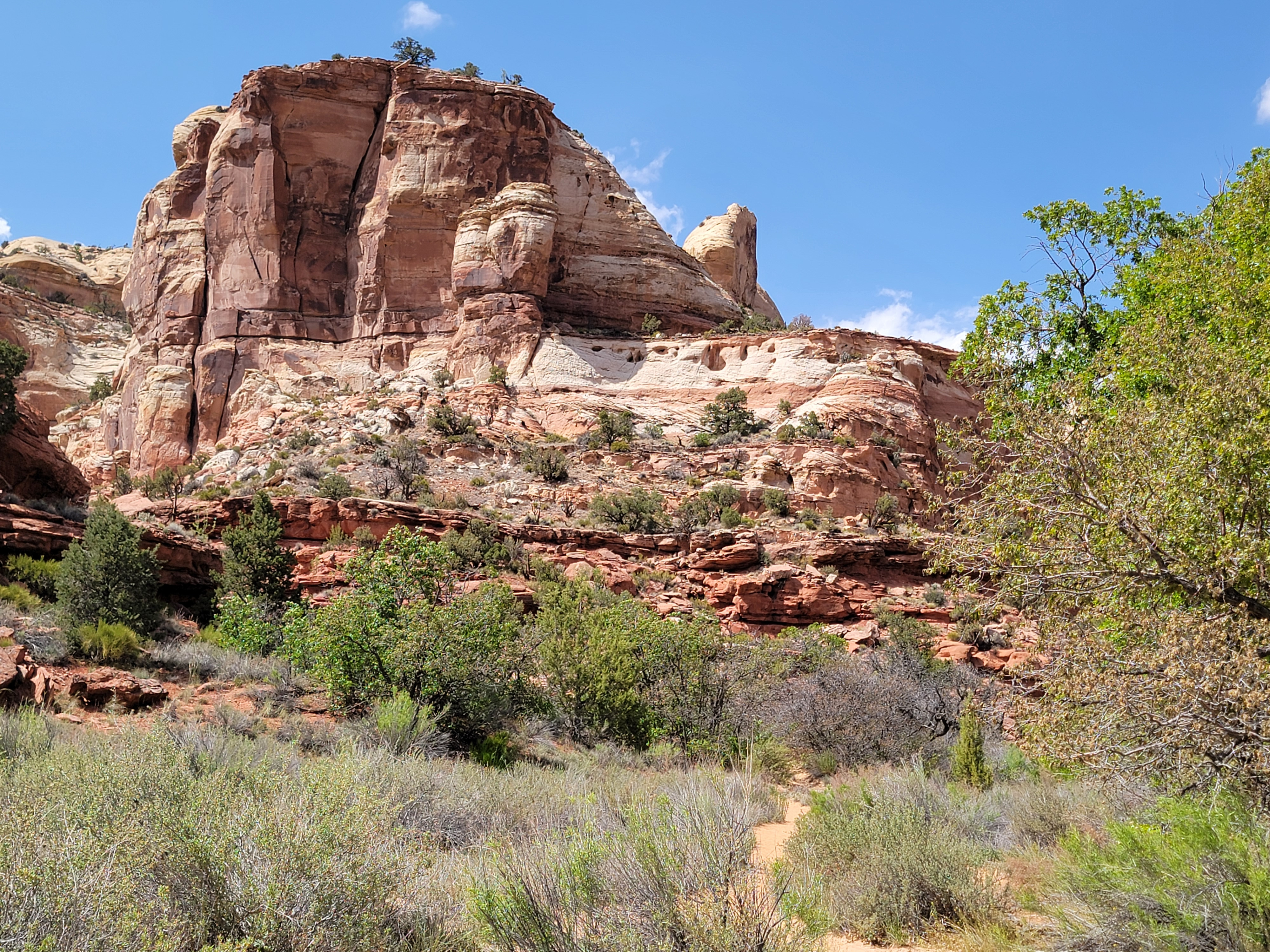 Following the trail into the canyon
On this trip we were staying on Highway 12 all the way to Escalante. After Boulder it enters Grand Staircase-Escalante National Monument, and includes a section known as The Hogback. The scenery is amazing. For miles in all directions, everything is bare slickrock. But you don't get much chance to admire it while you are driving. The road follows the narrow crest of a ridge between two canyons, with steep dropoffs on both sides. There are no guardrails, no shoulders, no pullouts. It's one of the most impressive roads in the continental US.
But we didn't come just for the scenic drive, but to do some hiking. My original reason for coming to Escalante on this trip was to do Peekaboo and Spooky. They are probably the most famous slot canyons in Utah. I tried to do them last year and failed. The entrance to Peekaboo is about fifteen feet above the wash and requires a steep scramble to get in. Because of all the hikers who do it, the rock has been worn smooth which makes it tricky. There was a steady stream of people going up when I was there the first time and most of them took quite a bit of time to climb up. I only had a brief moment when I was the only one there. I tried but was having trouble with a move that required moving up on my knee-replacement knee. It was silly but I didn't want to fail in front of an audience so I left, intending to come back another time, hopefully when it wasn't so crowded.
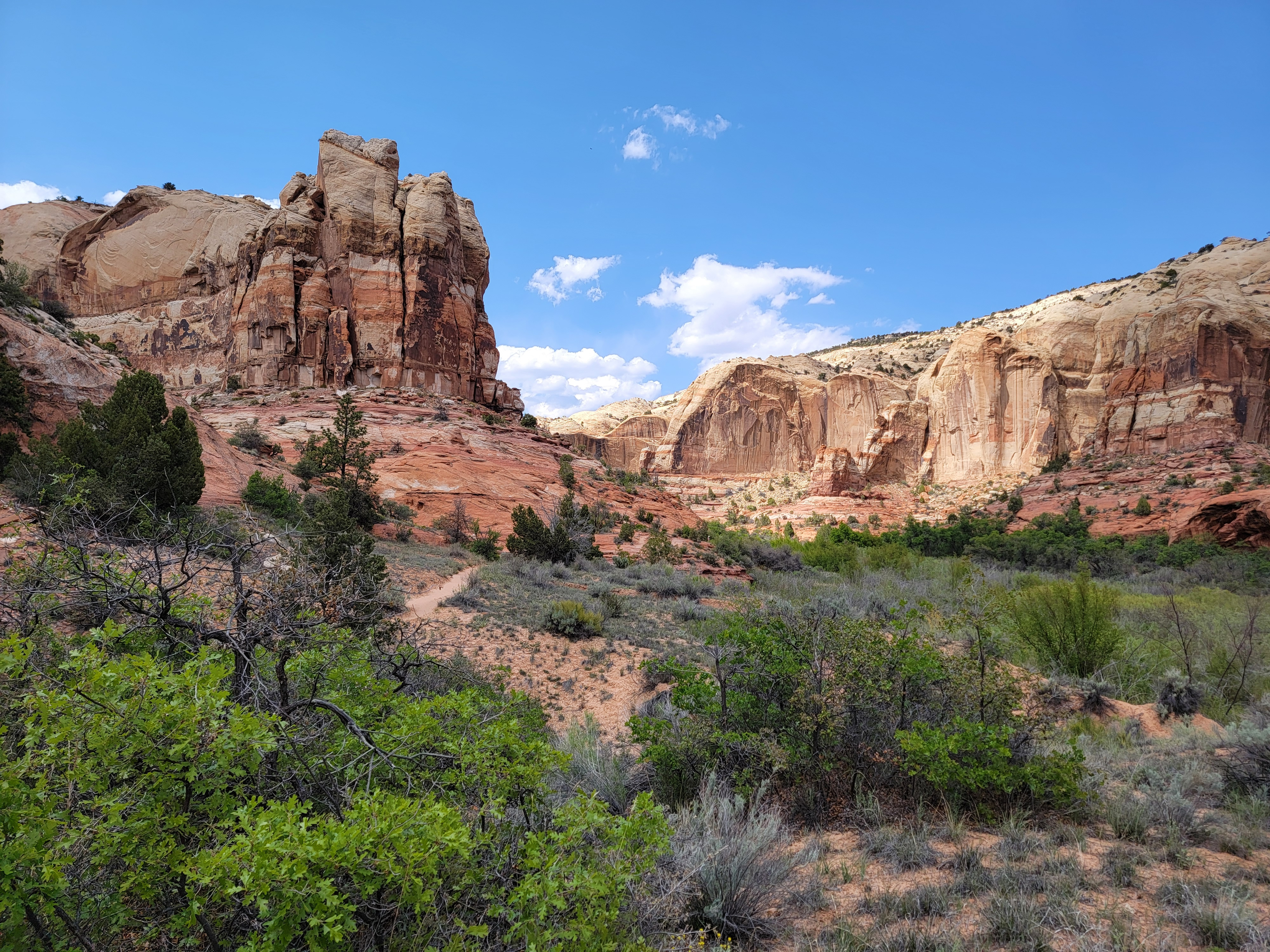 Beautiful scenery around every bend in the canyon
Well, this trip was going to be the next time. I figured that with Tim along, I could make it up with some encouragement from him. (And ok, maybe a bit of a boost too.)
I had an alternate hike as a backup. You can't do a slot canyon if there is any chance of rain anywhere in the area. A flash flood in one of those canyons would be disastrous. Even rain in the recent past could mean pools of water or mud in the canyon. That wouldn't be dangerous but wouldn't be fun. I've had an episode with mud in a slot canyon before. So has Sandy.
Those were Definitely Not Fun.
My alternate hike was Lower Calf Creek Falls. I've done it twice before, once with Sandy. It's a fantastic hike. In fact, it is so good a hike that I decided to promote it from an alternate. It was only midafternoon. We had plenty of daylight left. We had done an easy hike in the morning. When we drove past the trailhead on our way to Escalante, we stopped to do the hike. It meant we would have a late dinner that evening, but hey, we're tough.
 The canyon walls start closing in
Parking can be a problem since this is the most popular hike in Grand Staircase-Escalante National Monument. We found a spot no problem though. I think it was the same as the day before in Capitol Reef. We arrived late enough that people who started early had finished and left already. I was a little worried about the weather too. The forecast said it would cloud up in the afternoon. I didn't really expect rain but gray skies and flat light would mean poor photos. No need to worry though. When we started out, there were a few clouds but still plenty of sun and blue sky.
The trail proceeded up a broad canyon. It was very pretty, with steep cliffs on both sides. The bottom of the canyon was fairly broad, with a rare (for southern Utah) permanent stream flowing. There was deep green vegetation along the stream. It contrasted with the red and tan rock and the blue sky and puffy white clouds. It's definitely a beautiful place.
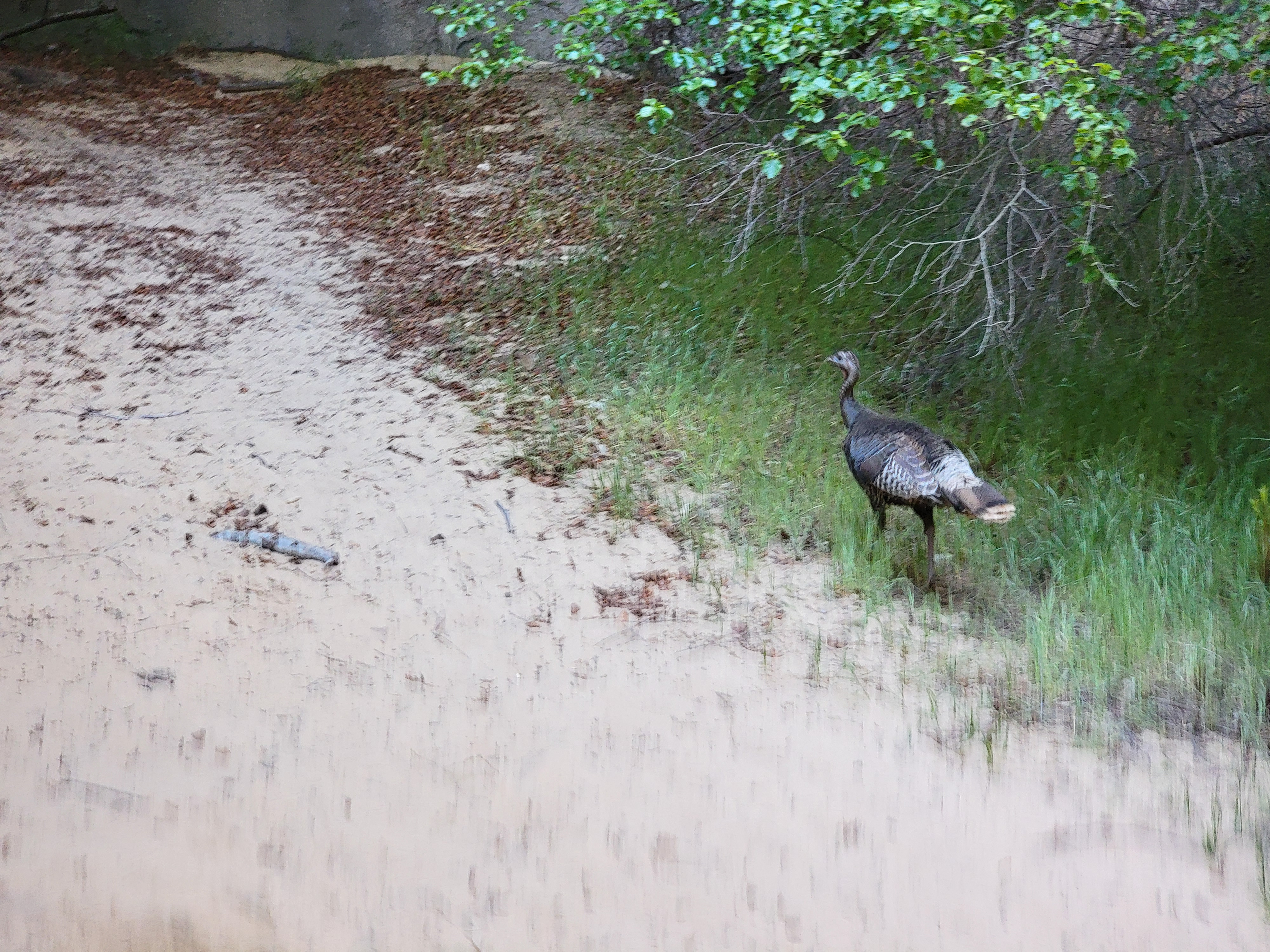 Wild turkey sighting (not the whiskey)
At about the halfway point there is a large petroglyph on a cliff across the canyon. It's easy to spot if you know where to look for it. I was watching the whole time so I could point it out to Tim. But as we came around a bend in the trail, a family with kids had stopped and the dad was pointing out the petroglyph. Tim was in the lead and he turned to me and said "Hey Dad. Look! A cool petroglyph." So much for me surprising him with how well I knew this trail.
Eventually the sides of the canyon closed in. We were walking through trees right next to the stream. Suddenly the canyon ended in a shaded alcove, with the stream plunging in a 125 foot waterfall into an emerald-colored pool. It's a fitting climax to a great hike. We took pictures from just about every angle. An added bonus was wildlife. There was a wild turkey walking around at the falls. And as we started back, we saw a deer just off the trail. It obviously wasn't afraid of people. That added to the large gopher snake that we had seen on the way in. A lot more wildlife than I expected.
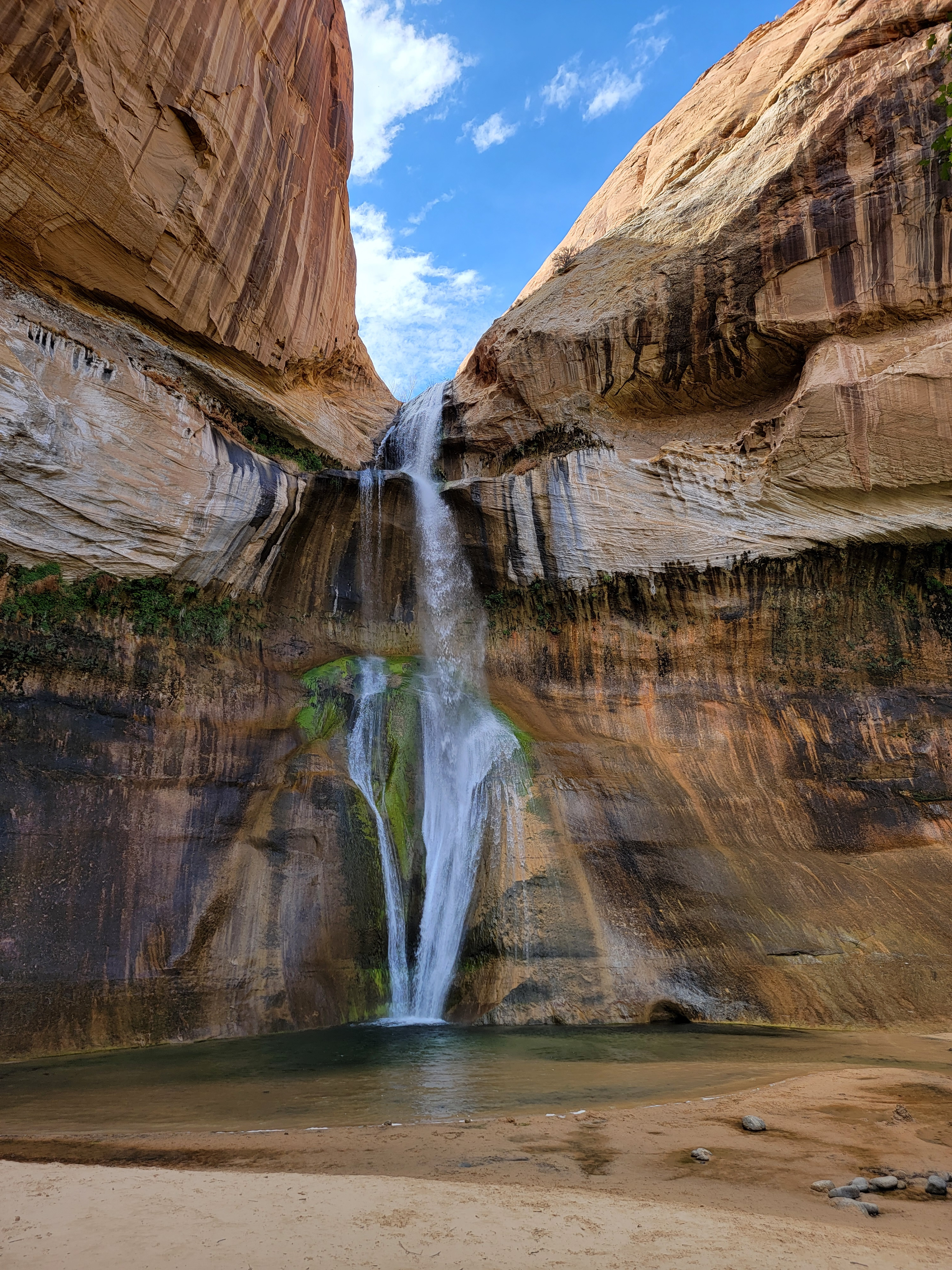 Lower Calf Creek Falls
We made pretty good time going back. It was a good trail, quite easy as it hadn't gained much elevation in the three miles we hiked from the trailhead. Slightly downhill on the way back was even easier and faster. By now the sky had clouded up and it was even beginning to look like it might rain. That provided extra motivation. Pretty soon we were back at the car.
Our GPS stats for the hike were as follows:
Mileage = 6.68 miles
Elevation gain = 919 feet (More than I expected. Lots of up and down I guess.)
Moving time = 3:09:16 Total time = 3:16:27
When we got to Escalante we went right to our hotel, the Prospector Inn. It's not fancy. It's relatively inexpensive, but it's adequate. It's where I stay when I come to Escalante by myself. I have to admit that I was impressed by their upgrades since I had been here last fall. There was no one in the lobby. Instead, I got an email from them with a code for the door. All the doors had new electronic combination locks. So I just let us into our room and that was that.
By now we were pretty hungry so we walked over to Escalante Outfitters. It's my usual place to eat in Escalante because they have good pizza. Unfortunately, they were crowded and there were about ten people in line to order. They were only taking orders as space cleared at the tables so it looked like we had a long wait. We decided to go somewhere else instead. But there isn't much somewhere else in Escalante. It's appeal is that there isn't much there.
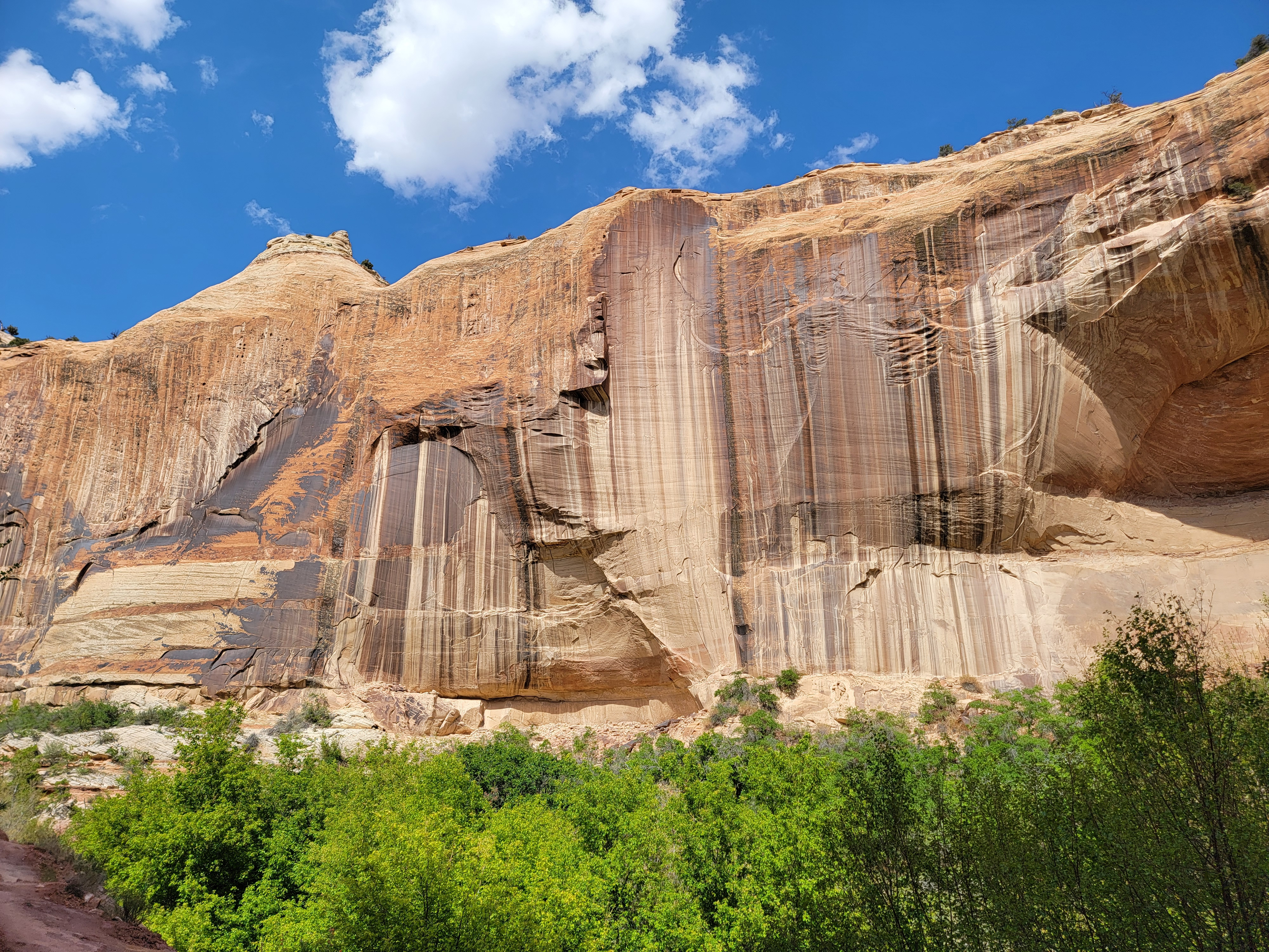 Beautiful streaking on the canyon walls
First we checked across the street at the 4th West Pub. Since it was Sunday, it was closed. Then there was Nemo's, a drive-in that serves burgers, but when we came into town we had noticed that it was closed too. Google maps showed a restaurant in the Canyon Country Lodge. Sandy and I had stayed there last fall. We had a heck of a time when the kid at the desk messed up and said we didn't have a reservation. When Tim and I got there, my old pal was on duty again. Oh boy! He told us that their restaurant had closed a few months ago. That was pretty simple and even he couldn't mess that up.
Well, we were out of luck. It was Subway, or wait in line at Escalante Outfitters. We waited in line. It turned out that it wasn't that bad. We only had to wait twenty minutes. When they assigned our table outside, Fortunately it was on the porch and not the patio. By now it had cooled off quite a bit and the wind had picked up, but we were sheltered from the wind on the porch. Our pizza was good but it was pretty late by the time we got back to our hotel. As we walked back, it looked like rain. Sure enough, not long after we got to our room, it started to rain. That ruled out Peekaboo and Spooky for tomorrow. We would need a new plan in the morning, but tonight we were feeling pretty content after a very good day.
