Tim's Hikes #3: Bryce Canyon and Zion NP's
 Beautiful day, beautiful views in Bryce Canyon
Our hiking trip was off to a good start. Tim and I had started with two hikes in Capitol Reef National Park: Cassidy Arch and Grand Wash. Then we did Lower Calf Creek Falls in Grand Staircase-Escalante National Monument. The weather had been good. I was feeling good. And I was having a blast. I think Tim was too, but he is a bit taciturn.
We were staying in Escalante for the night. The plan had been to try to do two slot canyons, Peekaboo and Spooky, early the next morning. Then we would move on to Bryce Canyon National Park and do a hike there in the afternoon. Unfortunately, it rained most of the night. According to the forecast, there was a good chance of more rain the following morning. Slot canyons are a no go when there is any chance of rain because a flash flood could be disastrous. We had to skip the slot canyons. We decided that we would just leave right away and head to Bryce. Instead of half a day there, we would have a full day. Spending a whole day in Bryce Canyon National Park is certainly not a bad thing, so we were ok with our new plan.
 Tim hiking on the Fairyland Trail
On the way to Bryce we drove through some rain showers. That confirmed that our decision to pass on Peekaboo and Spooky was the right thing to do. When we got to the park we went to Sunrise Point so Tim could get his first view of Bryce Canyon. He was definitely impressed. Looking to the east where we had just come through rain showers, the weather looked to have improved. The forecast said there would be a clearing trend through the day. We were going to allow a little more time for the weather to clear before starting our hike, but since it looked pretty good now, we decided to just go for it.
We were going to do the Fairyland Trail, an eight mile loop in the northern part of the park. Sandy and I had done it once before almost fifteen years ago and I remembered it as a great trail. We drove to Fairyland Point to start the hike...and had a problem. We couldn't find a parking spot. This was frustrating because we were about fifty yards behind a car as we drove to the trailhead. They found a spot, which turned out to be the last one. I drove around the parking area a couple of times to see if anyone had just stopped to check out the view and were coming right back to their car. Nope, there weren't any spots, and it didn't look like any would open up soon.
 Fantastic shapes and colors of rock formations
Next we drove to Sunrise Point, which is another possible starting point for the loop hike. There we were lucky and found a spot near the general store. We grabbed our packs and headed over to the rim to find the trail. By now the weather had cleared up, earlier than predicted, and was looking good. It was time to start hiking.
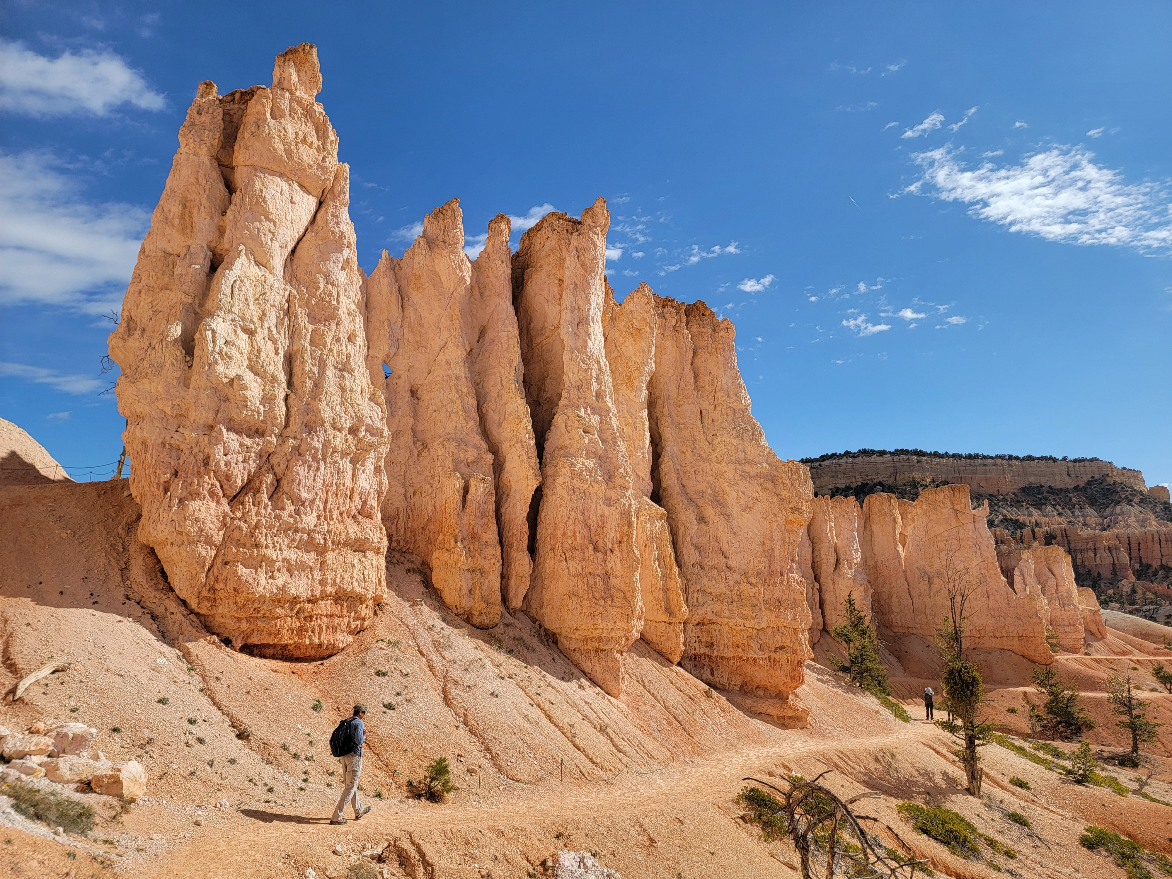
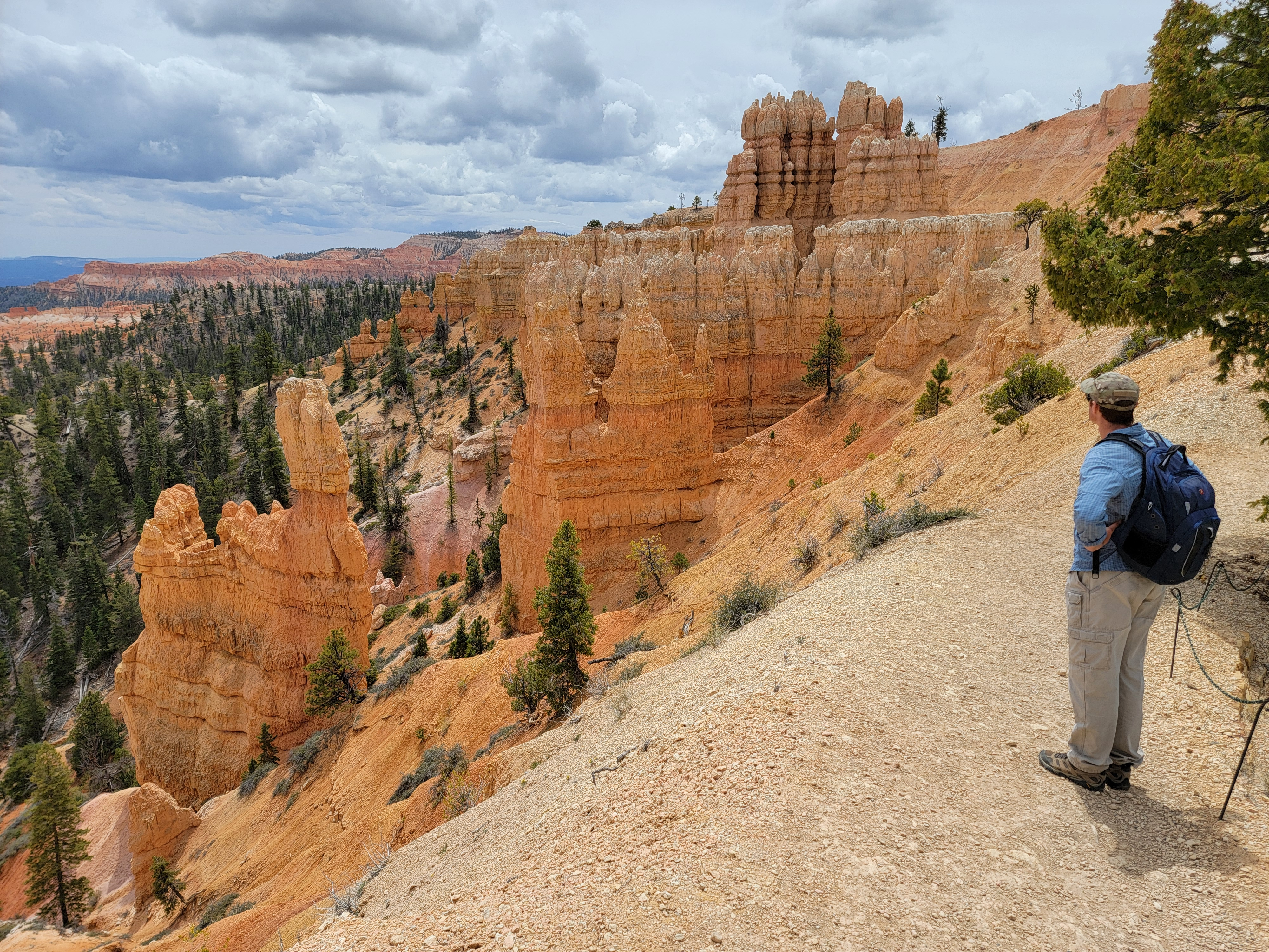
We started out on the Rim Trail. (For those of you who are not familiar with Bryce Canyon National Park, that's the trail that runs along the edge of the rim. Bet you never would have guessed.) After a short distance we came to a junction where we turned onto the Tower Bridge Trail. It immediatly started descending, dropping far below the rim. We wanted to descend into the canyon first and return along the Rim Trail. That's consistent with the Park Service recommendation to do the loop in a counterclockwise direction, so I guess that with our parking problems things actually worked out for the best.
 The trail would wind in, out and around incredible cliffs
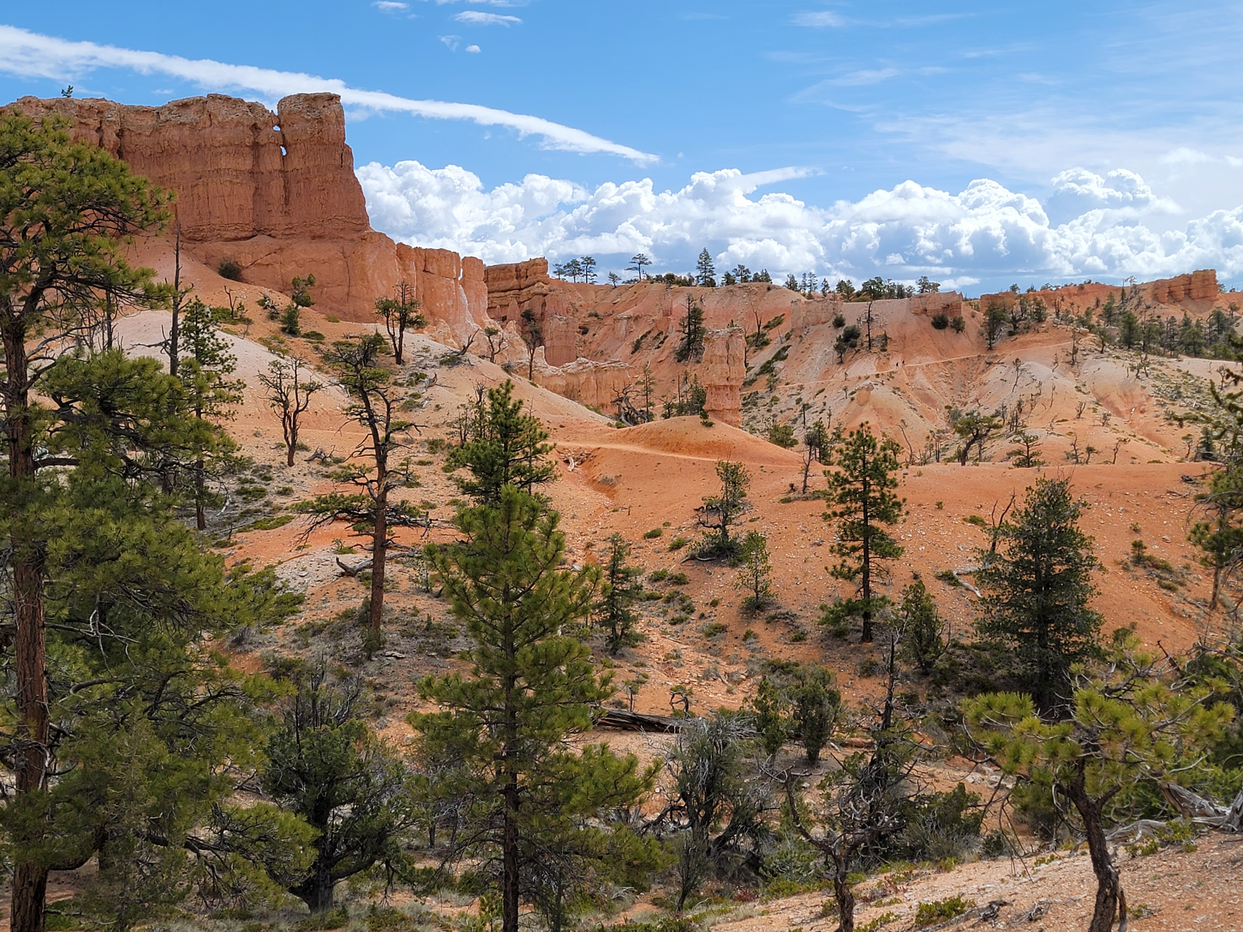
Most places, hikes start out climbing to reach your destination - an alpine lake or a viewpoint or a mountain summit. The elevation gain is on the way in and the return trip is downhill and much easier. That's good because you are usually tired on the way back and there isn't the motivation of trying to reach your goal. Bryce is different. It's one of those unusual places where the trails are "upside down". At Bryce, you start on the rim and descend into the maze of hoodoos lining the side of the canyon. Most of the elevation gain, the hard work, comes on the way back near the end of the hike.
I can only think of a few other hikes like that. Grand Valley in Olympic National Park is one. Kolob Arch in Zion National Park is another. Of course the Mother of all upside down hikes is in Grand Canyon National Park, hiking from the rim down to the Colorado River and back to the rim again. I've done it twice so I definitely know how that feels.
 We passed beneath rows and rows of tightly packed hoodoos
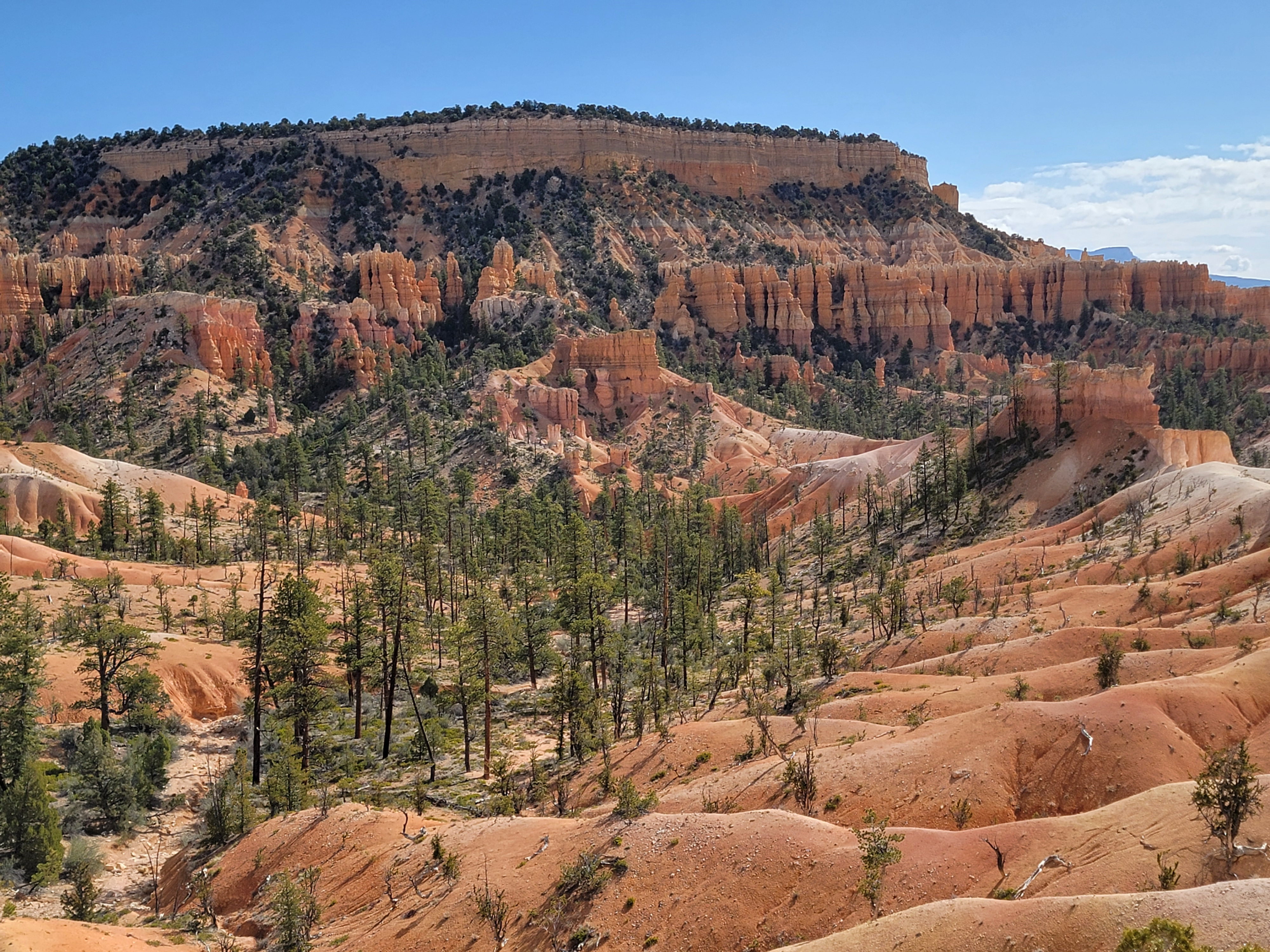
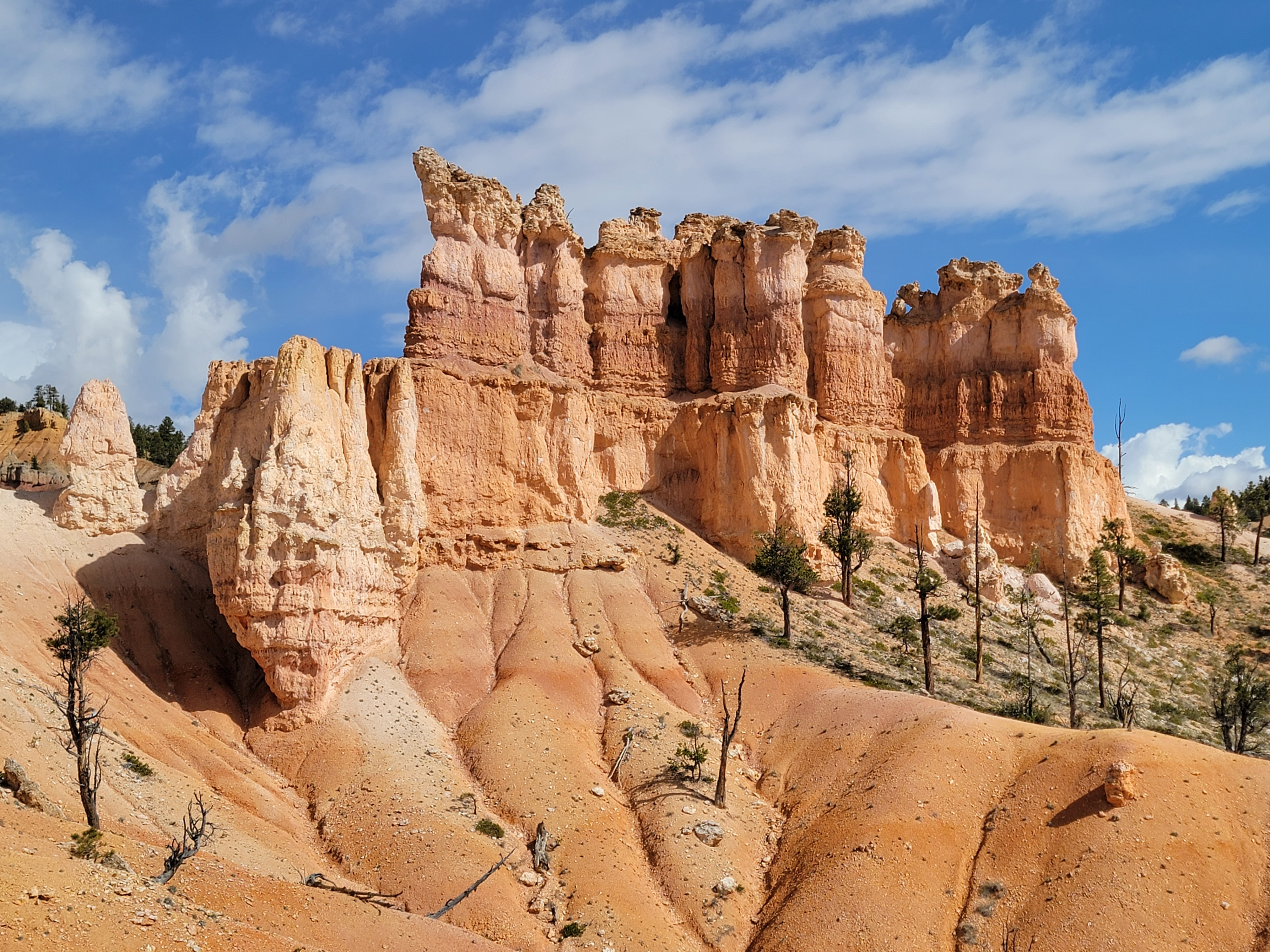
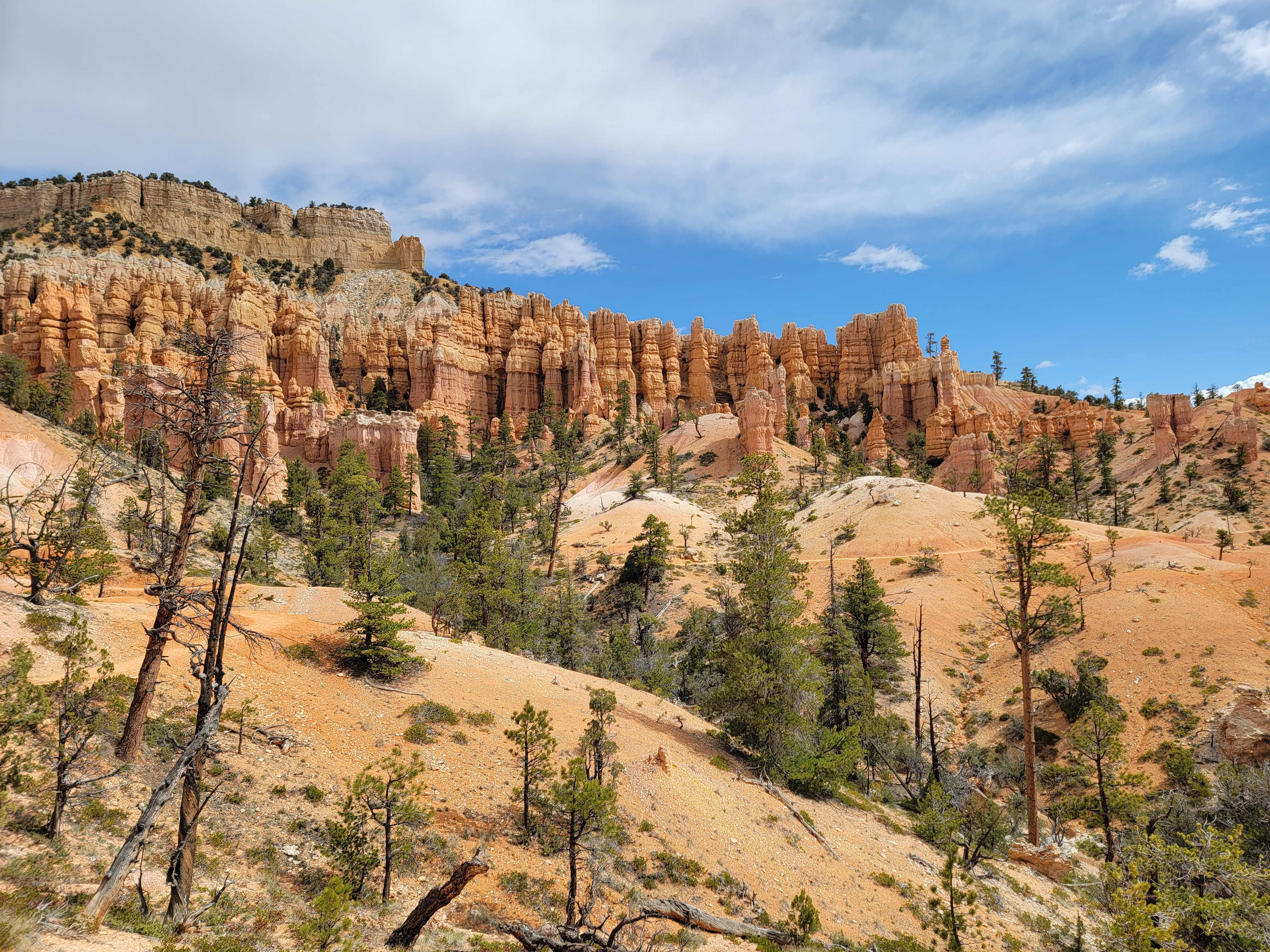
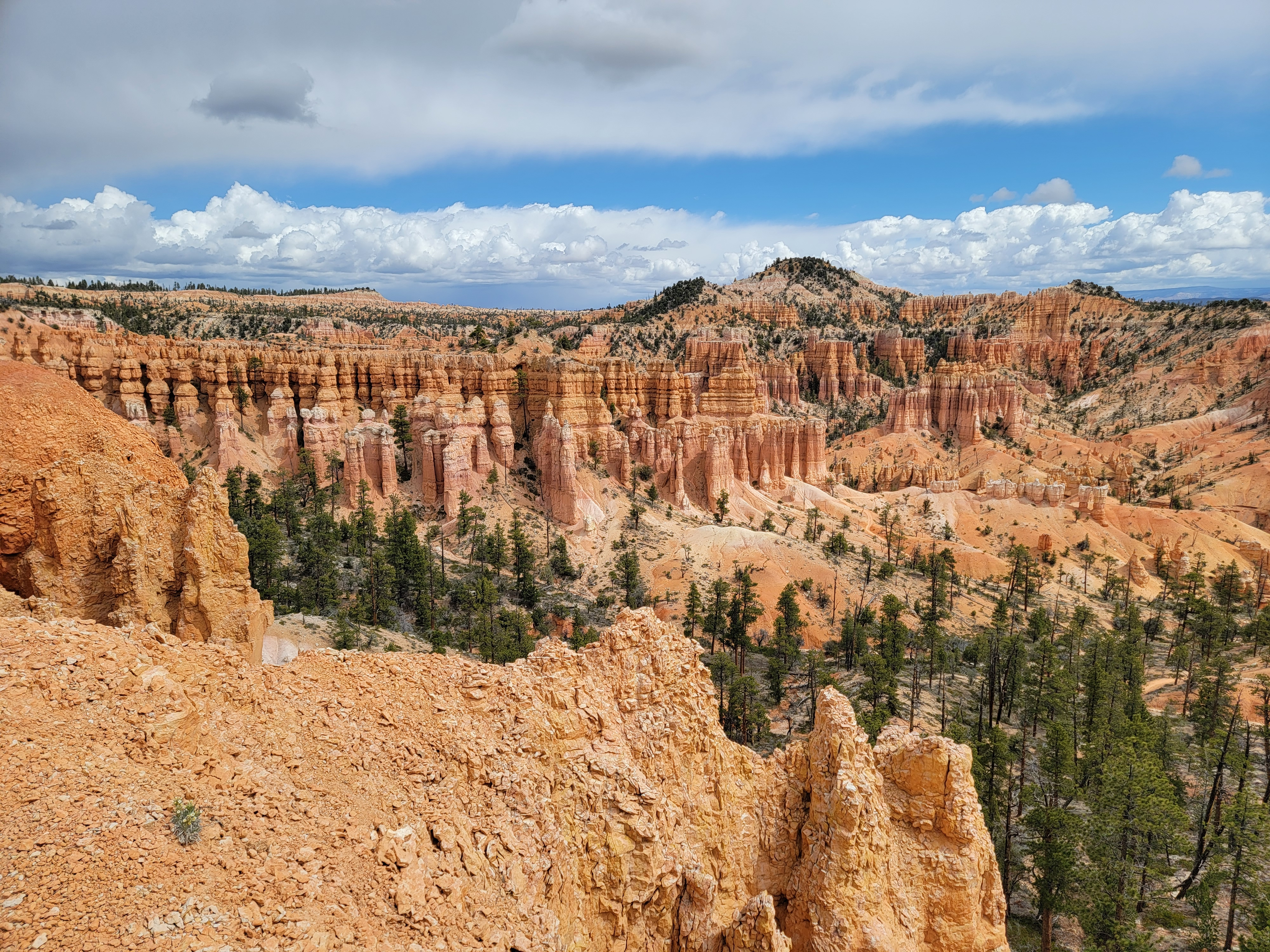
Bryce Canyon is really a misnomer. It's not a canyon. It's an escarpment where erosion has carved the rocks into incredible formations known as hoodoos. The Fairyland Trail wound up and down, in and out, of these rock formations. Every time we turned a corner we saw something new, something amazing. Sometimes it was a closeup view of weirdly shaped rocks. Other times it was distant views of large ampitheaters filled with rows and rows of densely packed hoodoos. It was always something different. And the colors were always striking - intense reds and yellows against the blue sky and white clouds.
After several hours the trail started the long climb back up to the rim, which we could see high above us. When we finally got there, we found that our work wasn't over. The rim has ups and downs too over its length, and we still had a few big hills to go up and over before we finally arrived back to the car. The timing was good because the forecast proved to be wrong. It had clouded up in the afternoon insteead of clearing and the sky was a starting to look threatening.
 Beautiful rock formations as far as the eye can see
The GPS stats for our hike were:
Distance = 8.9 miles
Elevation gain = 1,598 feet
Moving time = 4:11:12 Total time = 4:16:22
Since our car was parked next to the general store, we bought some cold drinks before heading for Bryce Canyon City. By the time we got there it was 2pm, and since we hadn't eaten yet today, both of us were starving. We went straight to Ruby's Inn, Cowboy's Buffet & Steak Room. Even the name is a mouthful. As you might guess from the name, they served large portions. The food was good so we were both filled up when we left. After eating we spent some time looking around the gift shop. Tim wanted to get something for his wife but was having trouble picking anything out. I finally found some kokopelli-themed jewelry for him that would be a good reminder of the trip. He may be all grown up now, but sometimes the Old Man still knows best.
 Near the end, Tim looks back to the start of the loop trail
I think Tim really liked Bryce. I know it's Sandy's favorite national park. It is definitely unique and it's spectacularly beautiful. But it also shows how some of the best national parks can be very crowded, in a way that significantly affects the experience there. That's why protecting them is so important.
After leaving Bryce, we had an hour drive to Kanab, where we stayed at the Comfort Suites. We finally had a place where we could get settled a bit, since we would be staying there for two nights instead of leaving right away the next morning.
After checking in we decided to do another short hike. We drove just a few miles outside of town and parked by the highway, where there is a short but very rough trail that leads to some fossil dinosaur footprints. The sky was clear again, either because the clouds had dissipated or because we had driven far enough to get away from them.
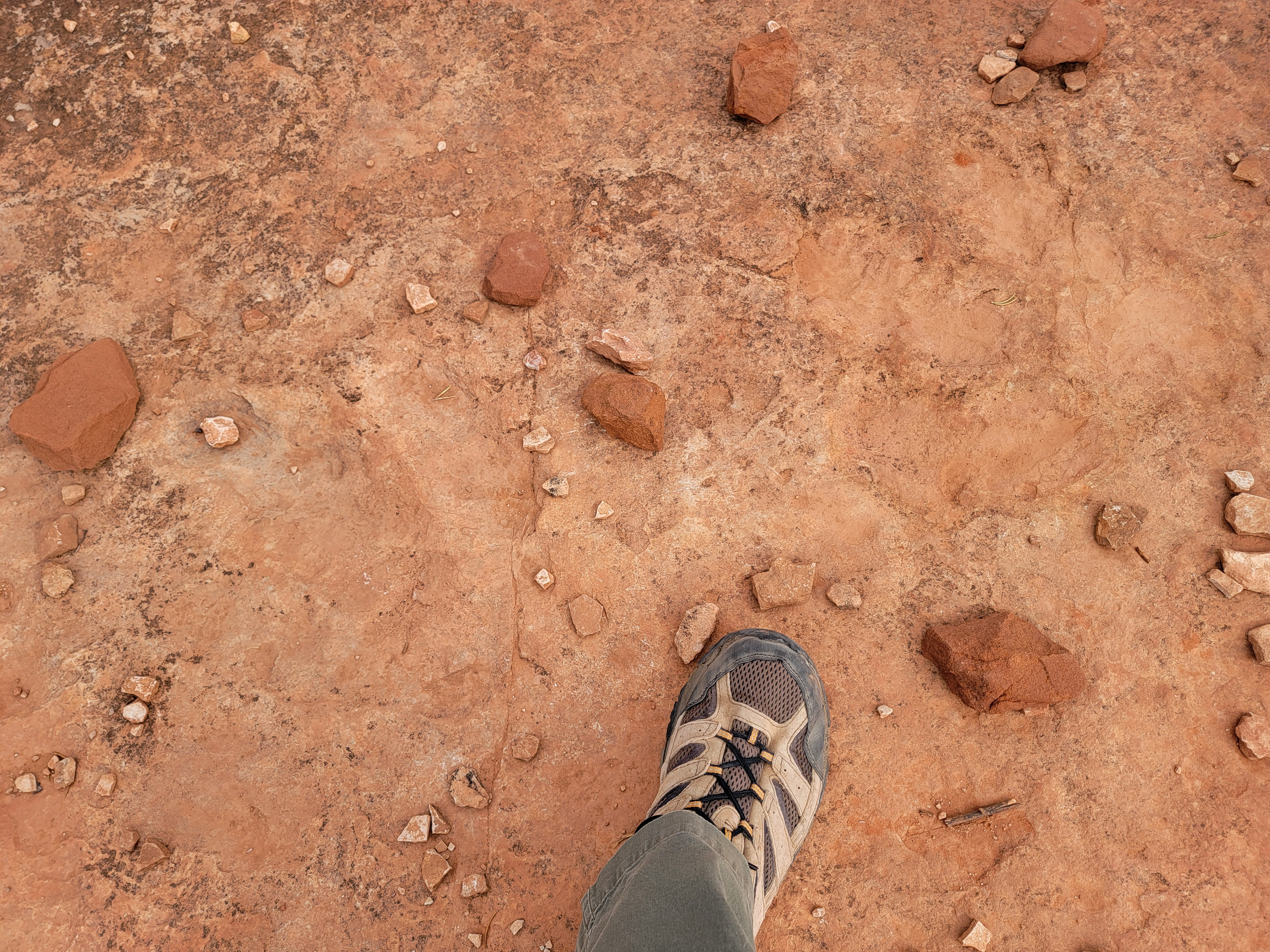 Three toed dinosaur footprint above my boot
There was a van parked at the trailhead, and we could see a big family with a bunch of kids (probably Mormons) that had left just a little before we got there. Unfortunately that meant we couldn't feel too heroic about the tough route that we were doing, since we were following right behind two little kids.
It actually turned out to be a pretty rough scramble, over rocks and up steep, loose dirt. I was impressed that mom got the two youngest kids up the route. At least it was short and pretty soon we reached the top of the bluff where the fossils were.
The dinosaur tracks were very faint. They would have been almost impossible to recognize if people hadn't marked them by ringing them with small stones. A few were quite well preserved and you could clearly see the shape of a three-toed foot. Tim was excited to see real fossils outside of a museum because he is a bit of a dinosaur enthusiast. He has a small dinosaur figure that he carries with him everywhere he travels. He calls it The Travelociraptor. He takes pictures of it at famous spots that he visits. Of course he had it with him on this trip.
 Zion Canyon from Observation Point
On the way down, I slipped as I was climbing down a large rock. A sharp edge on the rock put a big hole in the leg of my hiking pants, a small hole in my sock, and even a tiny hole in my leg just above my ankle. Any time a trail can draw blood, I figure that it's got to be a tough trail.
That evening we weren't very hungry after our big meal at Ruby's. We went out to a Cuban restaurant and just had drinks. Afterwards we retired to our hotel room where we watched a Brewer game and dug into the big box of snacks that we were carrying with us.
Next morning we went to a briefing for our hike to The Wave. It was at the BLM office in Kanab. The main thing I was interested in was the condition of the access road. I had read many times that if it was muddy it was impassable. At the briefing we were told that the road was in fine shape. We were glad to hear that since The Wave was going to be the climax of our trip. The briefing finished at 9 am, right on schedule. When we came out the sky was clear and it was a beautiful day. We'd done enough sitting around inside. It was time to do a hike.
 Yes, there were other hikers at Observation Point
We were fairly close to Zion National Park. It's one of my favorites and I wanted Tim to see it. But it is also one of the most highly visited parks. Since we didn't have an early start, driving around to the west entrance would mean standing in a long line for the park shuttle that goes into the canyon. That wasn't appealing. Instead, I wanted to hike to Observation Point, one of the most spectacular viewpoints in Zion. The hike to Observation Point from the floor of Zion Canyon used to be one of my all time favorites. I did it five or six times back in the day, but sadly it's no longer possible.
In 2019 there was a huge rockfall from Cable Mountain that fell across the trail. It's been closed ever since then. There is an alternative but I've never done it. Observation Point can be reached from the eastern boundary of the park via the East Mesa Trail. That was what I wanted to try today. We drove to Zion Ponerosa Ranch Resort, which is just east of the park and is reached by a paved road. From there, a dirt road continues about three miles to the East Mesa Trailhead. I've read that the road is very rough and deeply rutted near the end, and that parking at the trailhead is scarce. I didn't really want to deal with any of that. Fortunately the resort runs a hiker's shuttle to and from a dropoff point a half mile from the trailhead. For $7/person it seemed like the way to go.
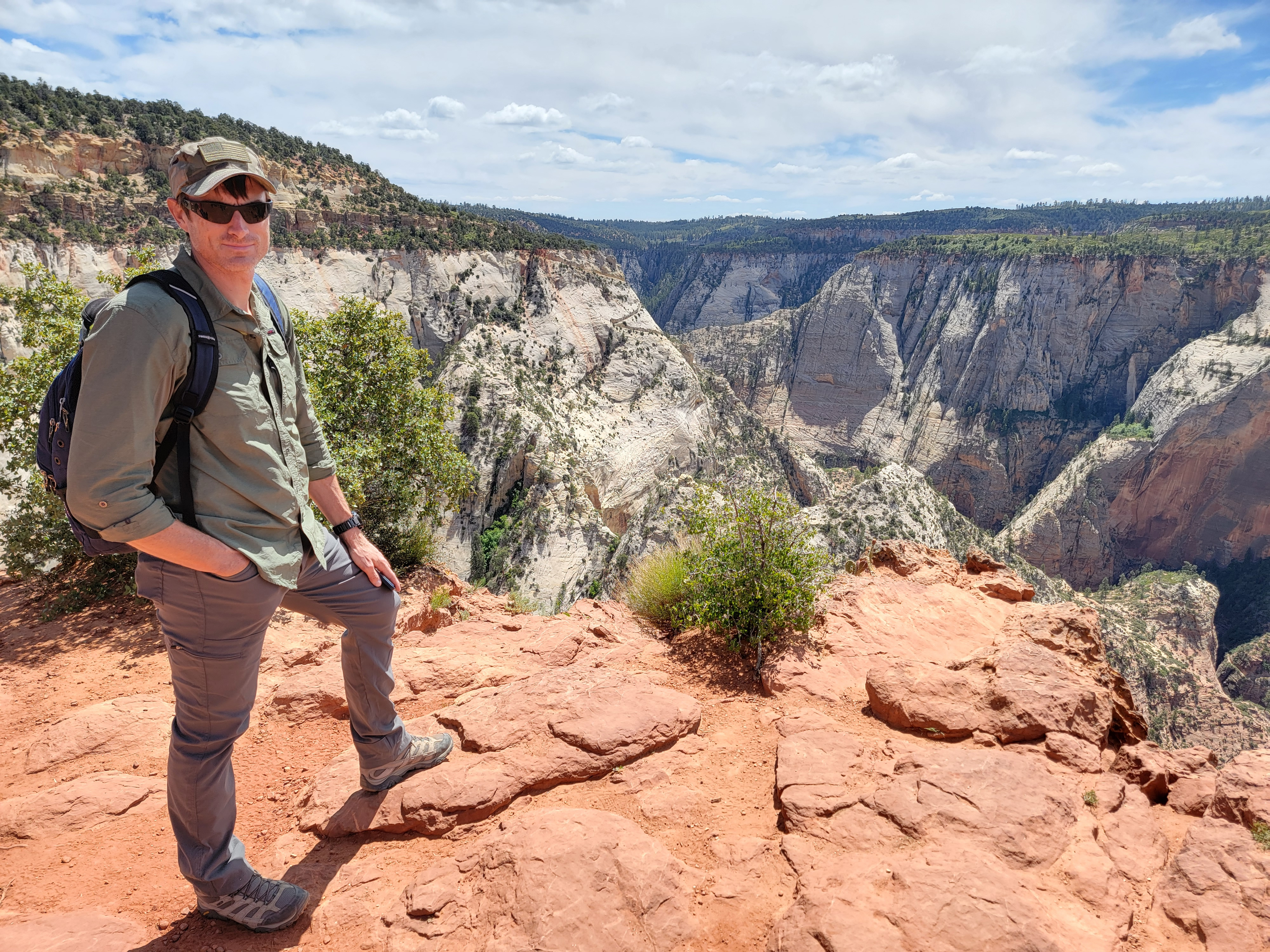 Tim at Observation Point, looking toward the old trail
It was possible to sign up for the shuttle online. According to their website, you could pick any time on the hour or half hour. I wanted to sign up ahead of time to make sure that the shuttle was available that day, but I wasn't sure exactly what time we would get there. In the end, I decided to just show up. Turns out I didn't need to worry about whether the shuttle would be running or not. We got there at 9:45 and got the last two seats (out of ten) for the 10 am shuttle. It turned out that the shuttle was a popular way to do the hike.
The road to the dropoff point was rough but not terrible. Unfortunately it wouldn't have been possible for us to drive only that far because there was nowhere to park there, or anywhere else along the road. The last half mile to the trailhead that we walked did have some horrible ruts. We probably could have made it in my Subie, but it would have been nervewracking. I was glad that we had decided to take the shuttle.
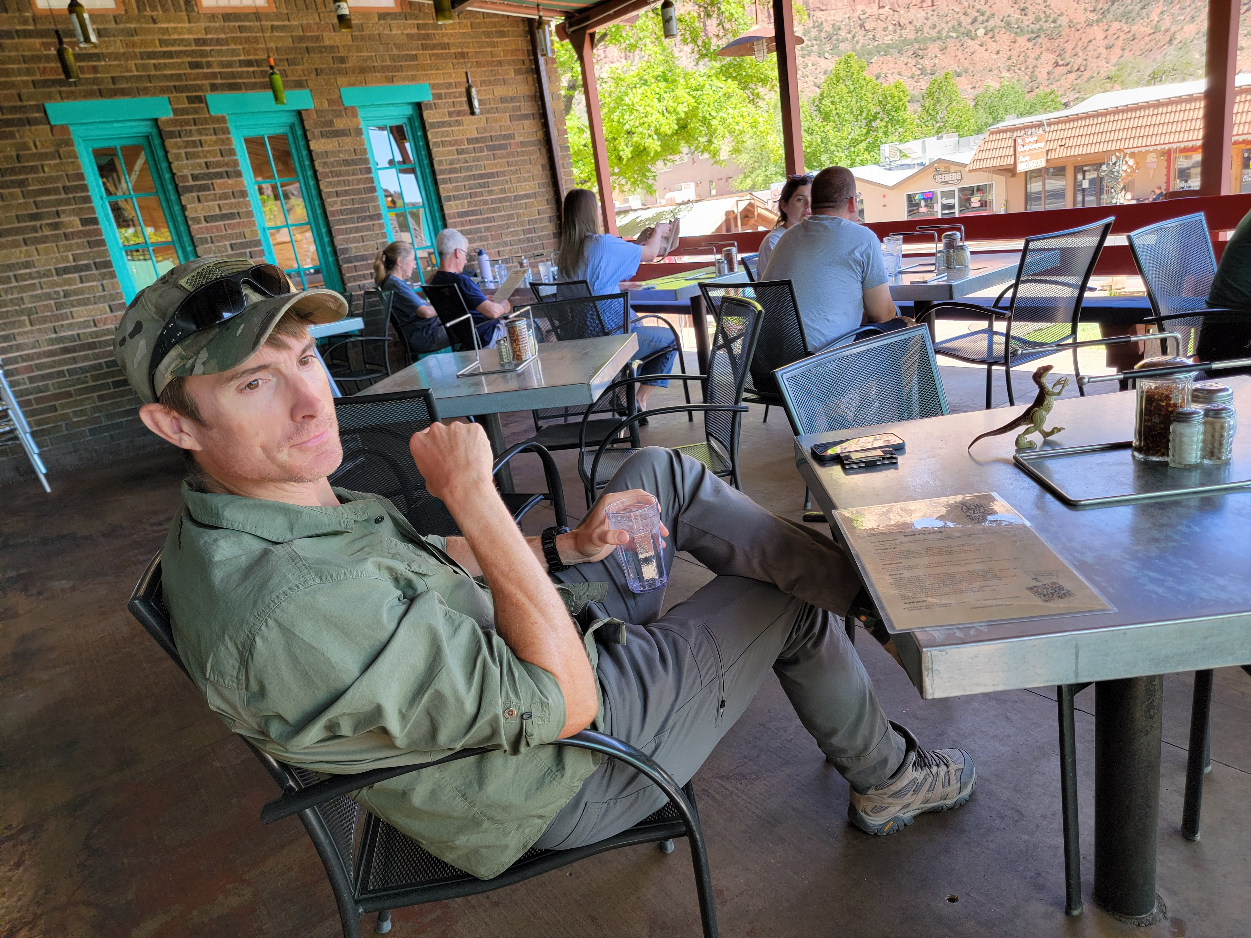 Tim waiting patiently for his beer after our hike
The hike was easy. Most of it was just a nice walk through the forest. We were high up so it was pleasantly cool and the trees provided some shade. Most of the trail was pretty flat. There was one steep descent just before we reached the end, so we did have to gain some elevation on the way back. Another upside down trail.
Because of the trees, we couldn't see the scenery until the very end when we reached Observation Point, but the view from there was world class. We could see most of Zion's famous landmarks. Angel's Landing. Scout Lookout. The Great White Throne. Cable Mountain. Deertrap Mountain. We could look down to the floor of the canyon and see the Virgin River winding through the valley. It was a beautiful day and an amazing view.
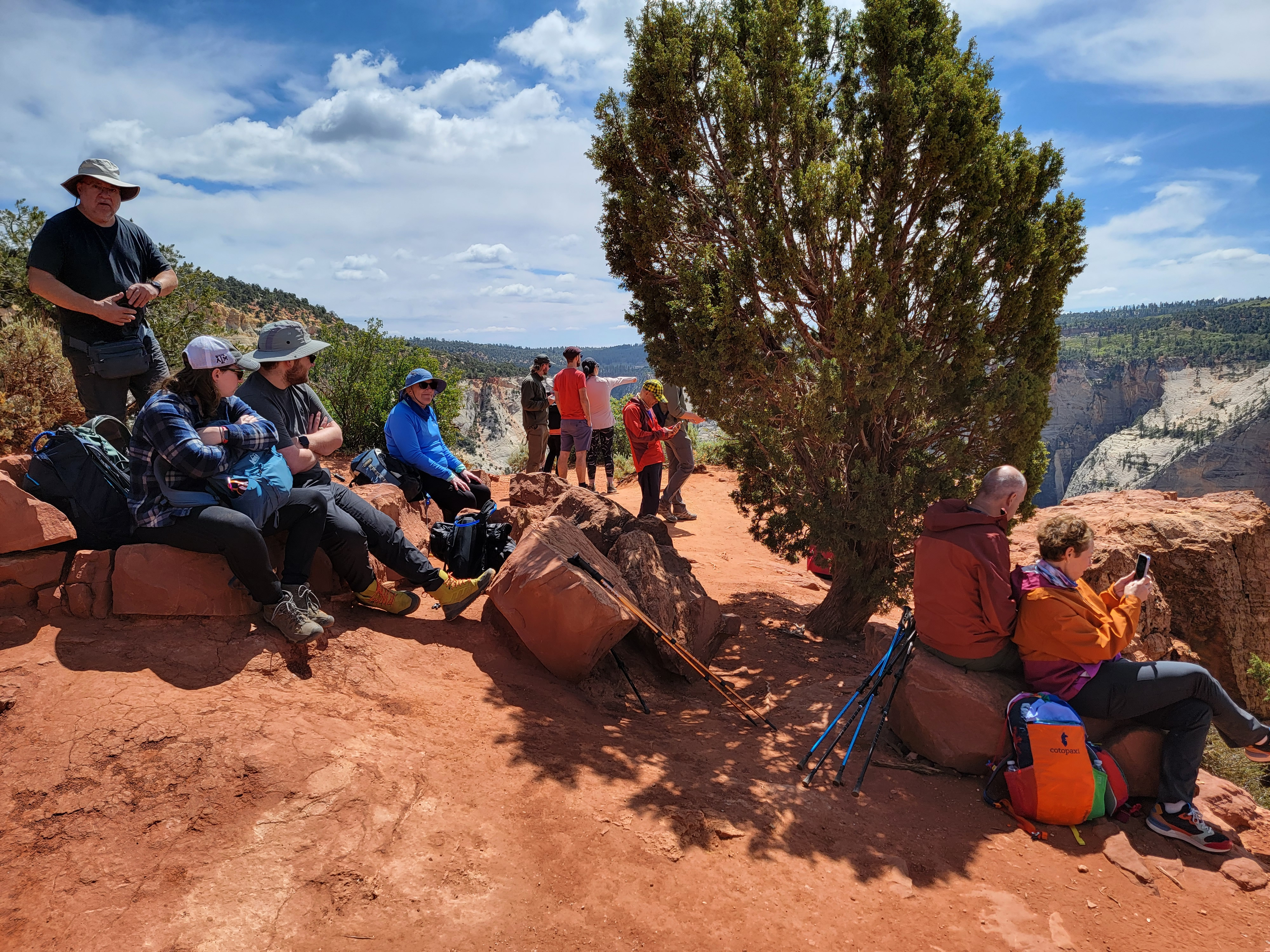
We had lots of people to share it with too. There were around thirty other hikers there. At least people were polite. They spread out. They stayed out of the way when you took pictures. It did give Tim an idea of what Zion National Park is like. It's incredibly beautiful, but much of the time, it's very crowded. There was a ranger hanging out at Observation Point, and I spent some time talking to him. He said that Zion had moved up to #2 in visitor days among national parks. A few years ago it was #5 but it passed up Grand Canyon, Yosemite and Yellowstone. The only park with more visitors is Great Smokey Mountain. Looking out from Observation Point, it was easy to understand why so many people came to Zion.
 I only got one picture of the Travelociraptor
I love Zion National Park, but now I only go there during off season. This trip was an exception, and we made a point of avoiding taking a shuttle into the canyon. Even approaching the park the roundabout way that we did, there were a lot of people. But I wanted Tim to get a chance to see it so I thought it was worth it.
I asked the ranger if the old trail from the canyon to Observation Point would ever be reopened. He said that it certainly would, he just didn't know what decade it would happen. I guess that means it will be a while. He did mention that there was a video online of the rockfall from Cable Mountain that forced the closure of the trail. It was taken by someone on the summit of Angel's Landing. It was fortunate that the trail had been closed earlier because of a minor rockfall. On an ordinary summer afternoon, that rockfall would have killed a hundred or more hikers.
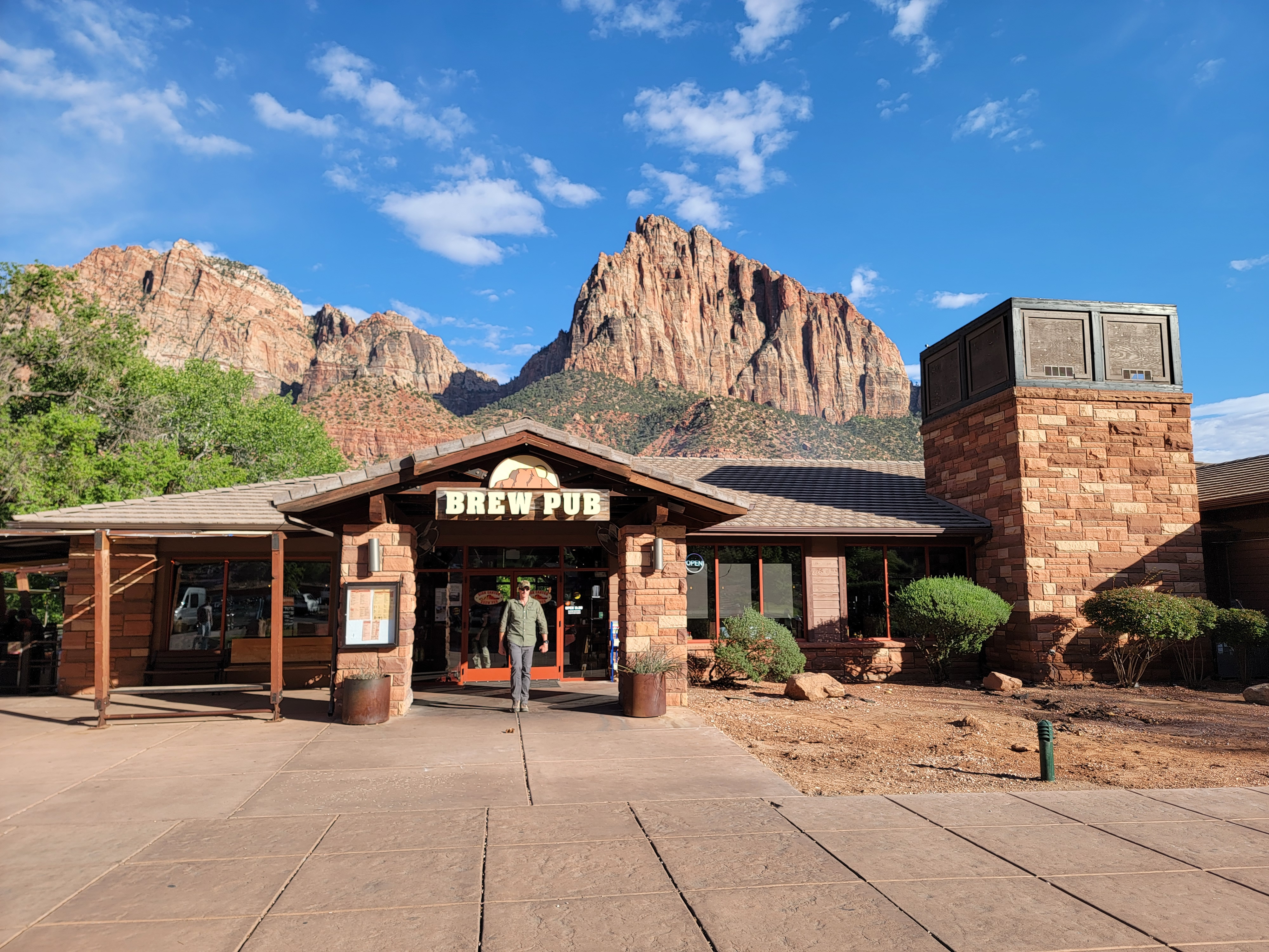 Zion Brewing Company with The Watchman behind
The hike back was easy, even with the climb on the return. We made better time going back than we expected. Close to the end, we started to hustle to try to make the 45 minutes past the hour pickup. We turned the last corner at exactly 1:45 and saw the van pull out, only fifty yards ahead of us. We reached the pickup point at exactly 1:46. Wow. I guess those guys run on schedule. It was ok, because there were a couple of benches and some shade below the trees. It was a nice day and it was pleasant to be out. When the next shuttle came it surprised me because I hadn't realized a half hour had already passed.
This time there were two resort employees in the shuttle. Apparently our driver on the way back was a trainee doing the route for the first time. Even with a noob at the wheel we survived the return trip and soon we were in our car and on the road again. Since it was still midafternoon and a nice day, we decided to drive through the park and have dinner in Springdale. That would give Tim a chance to see more of Zion.
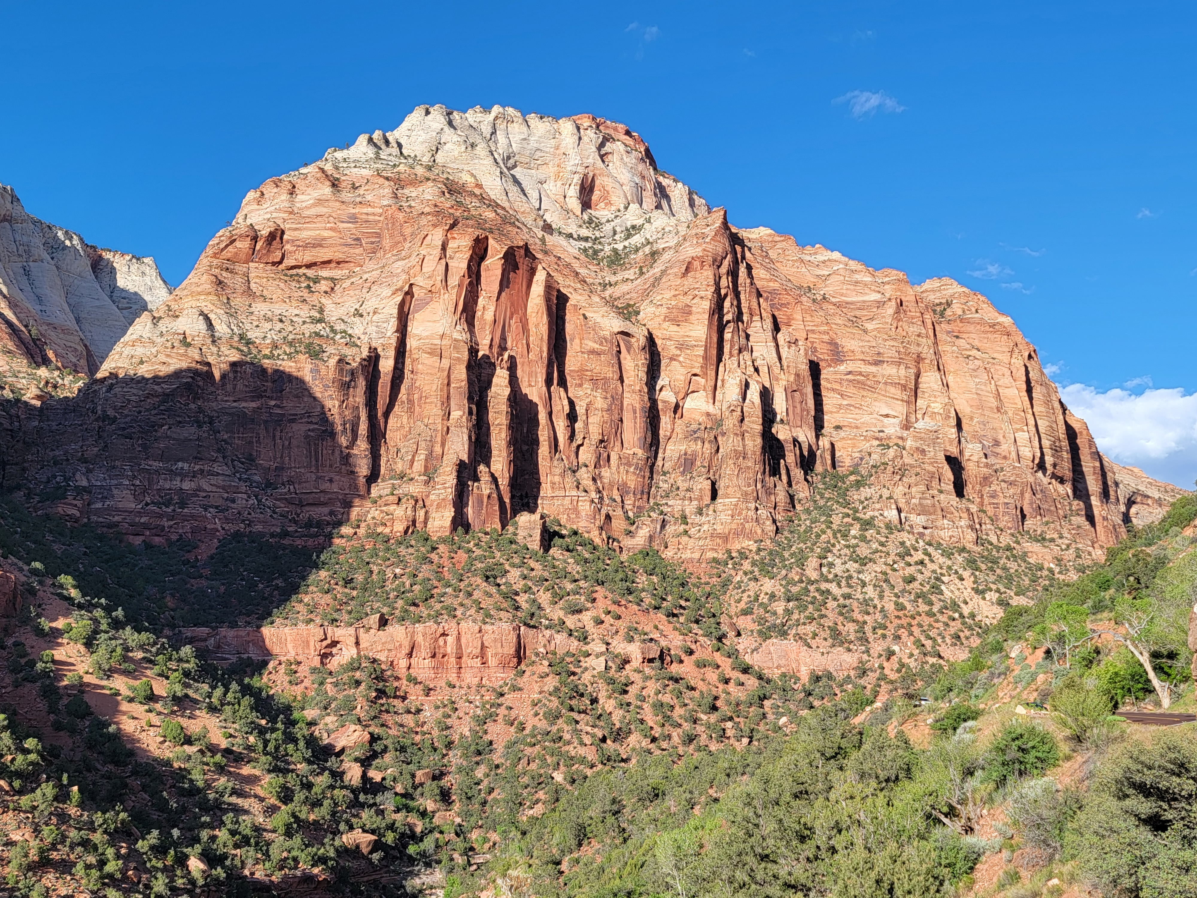 The East Temple - a mountain in Zion National Park
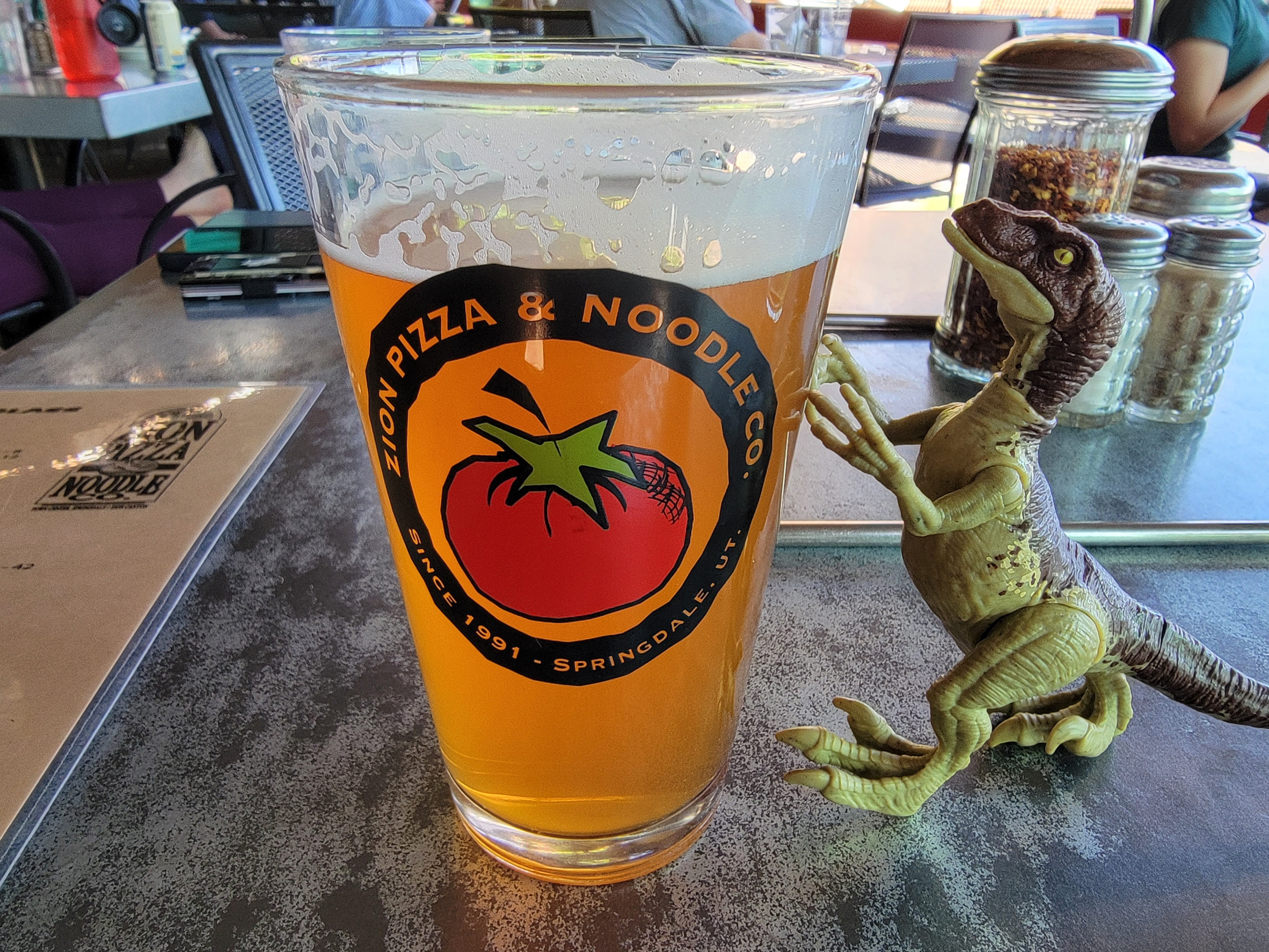
We had dinner at Zion Pizza and Noodle Company. We got there before they opened, so I got to check out two nearby tshirt shops. It's not Tim's favorite activity but we had twenty minutes to kill. We ate pizza on their patio while we enjoyed the view of the cliffs that towered above Springdale.
After dinner we went to Zion Brewing Company for a beer. They had a guy playing live music that had a very interesting technique. He would play the song multiple times and record it, each time playing a different part. Then he would play them all back together. So first he would play the entire song, strumming rhythm on his guitar, and record it. Then he would sing background vocals for the entire song, and record that. Then he would do percussion, drumming on the case of his accoustic guitar. Finally he would play them all at once while he sang the main vocal. It was fascinating to watch and listen to, and it was surprising how good the final version worked. I'm sure lots of artists do the same thing in the studio but it was weird to listen to it done live.
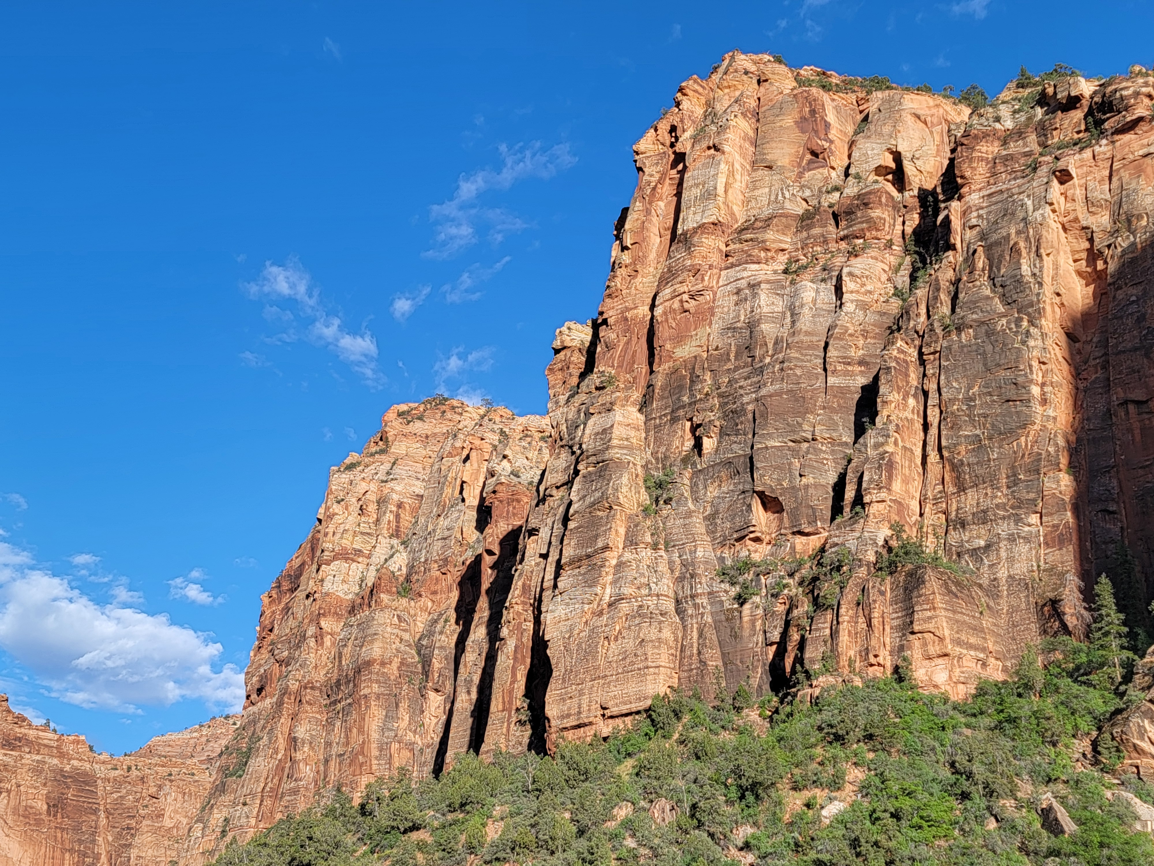 Steep cliffs in Zion National Park
To cap it off, he had a virtual tip jar. It was just a sign with a QR code where you could leave tips for him electronically. It made me feel pretty old. It's been a long time since I've been at a bar that had live music.
We were back to our hotel in Kanab in plenty of time to watch the Brewer game that evening. Then we packed everything up and got ready to leave. We wanted to get an early start the next morning. Tomorrow we would do The Wave, the Grand Finale of the trip, and then make the long drive back to Boise afterwards.
