Canyonlands National Park #1
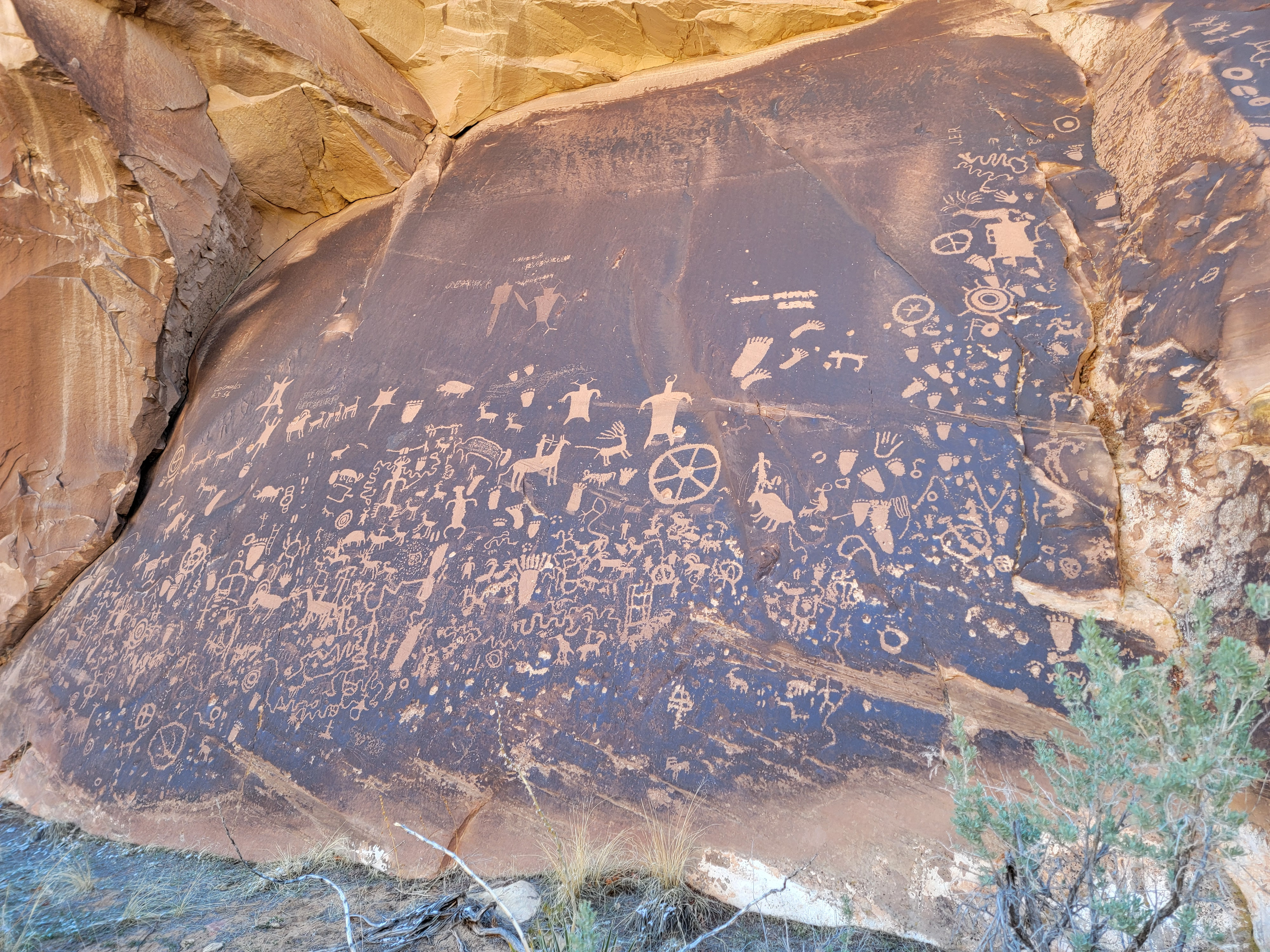 Newspaper Rock
Sandy and I just got back from a week of scuba diving in Bonaire. We have a trip to Bora Bora scheduled in two and a half weeks. There's lots to do at home during that short time. Cleaning dive gear. Packing for the next trip. So what did I do? I looked at the weather in Utah to see if I could get away for a couple of days of hiking in canyon country. Sure enough, there was a window of nice weather over the first weekend that we were back. Usually weekends are tougher for short term availability of hotels, but since it was still early in the season I was able to find openings. Sandy was ok with me going and even encouraged me to go for three days of hiking instead of just two, which was my original idea. So Friday, just my fifth day back after getting home from Bonaire, I was on my way to Utah.
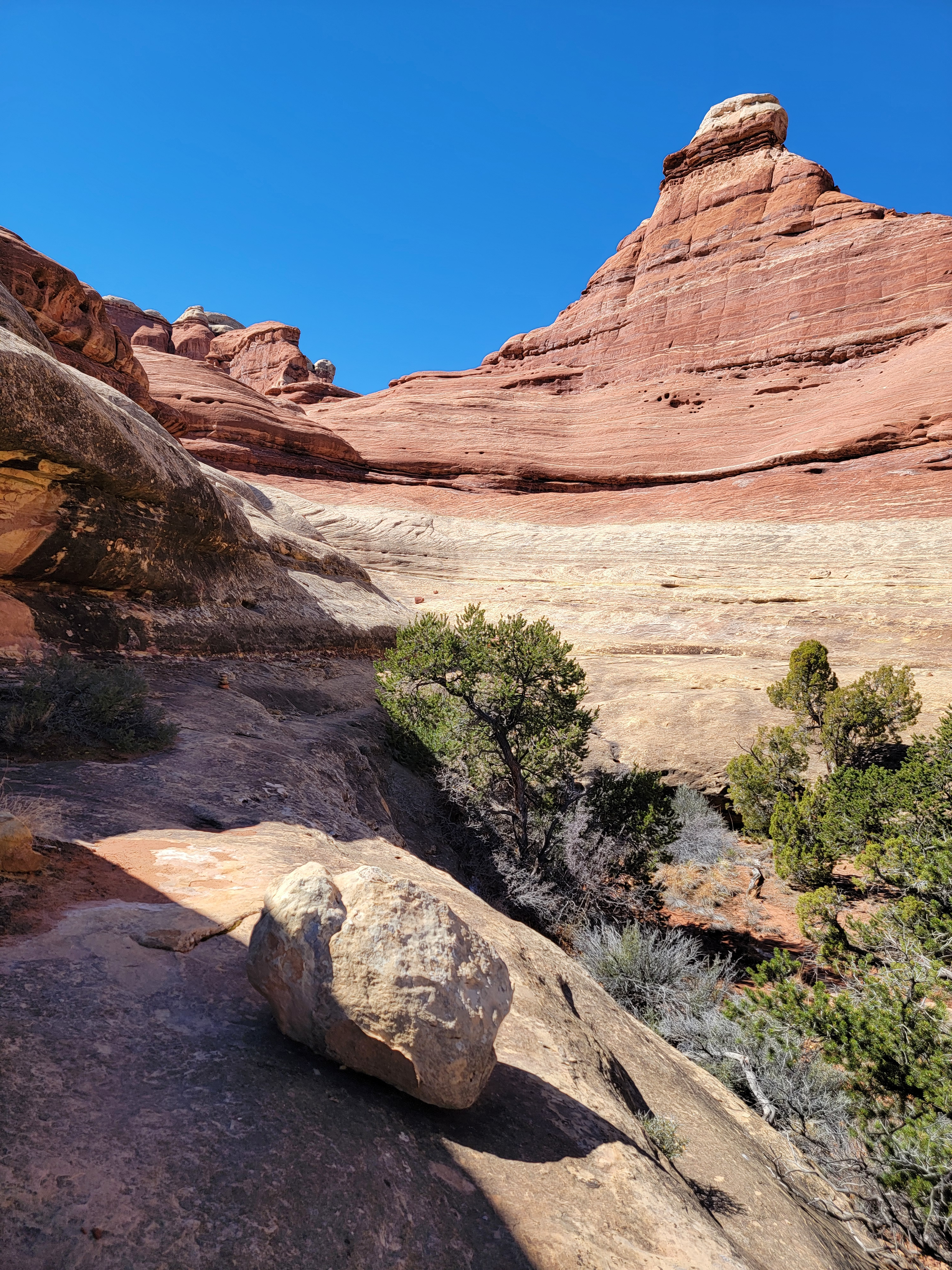
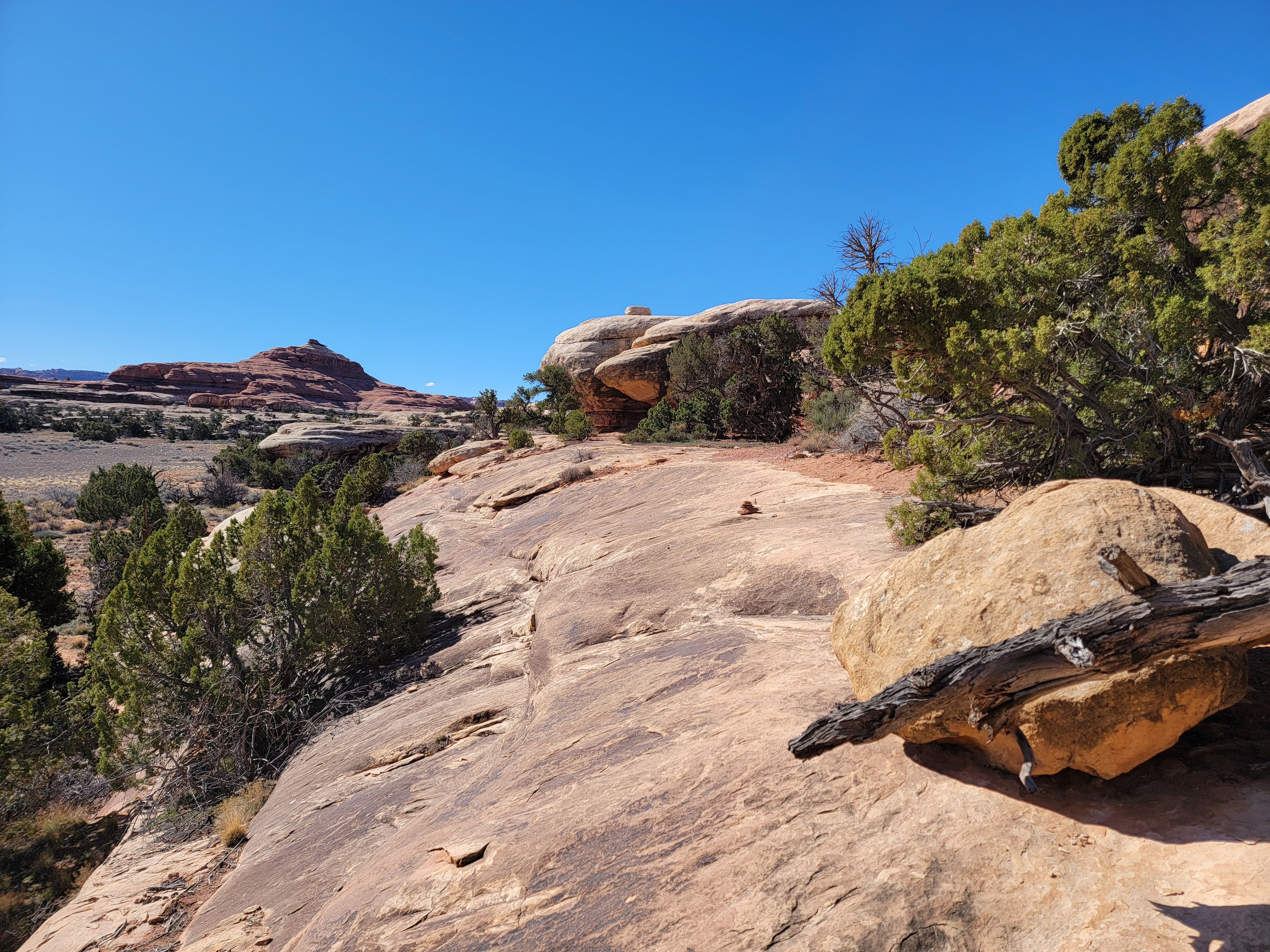 Following cairns along a slickrock ledge
I already had a trip to canyon country scheduled for May. After trying for several years, I finally got a permit to hike The Wave in early May. I was lucky because they are extremely hard to get. Unfortunately Sandy didn't think that she should go. Our dog sitter situation is somewhat precarious right now and she didn't want to add another trip that would require one. I offered the extra spot on my Wave permit to Tim and Mickey, and Tim took me up on it. So in May I would be hiking in southwestern Utah and northern Arizona. Given that, for this trip I decided to go to eastern Utah. I've been to Moab a lot and have hiked all of the trails nearby. Some, like Delicate Arch and Corona Arch I have done five or six times. But there are some really good hikes in the Needles District of Canyonlands National Park that I haven't done. Trails that I have done I've only done once. I decided to use Monticello, Utah as a base and spend a couple of days hiking in the Needles.
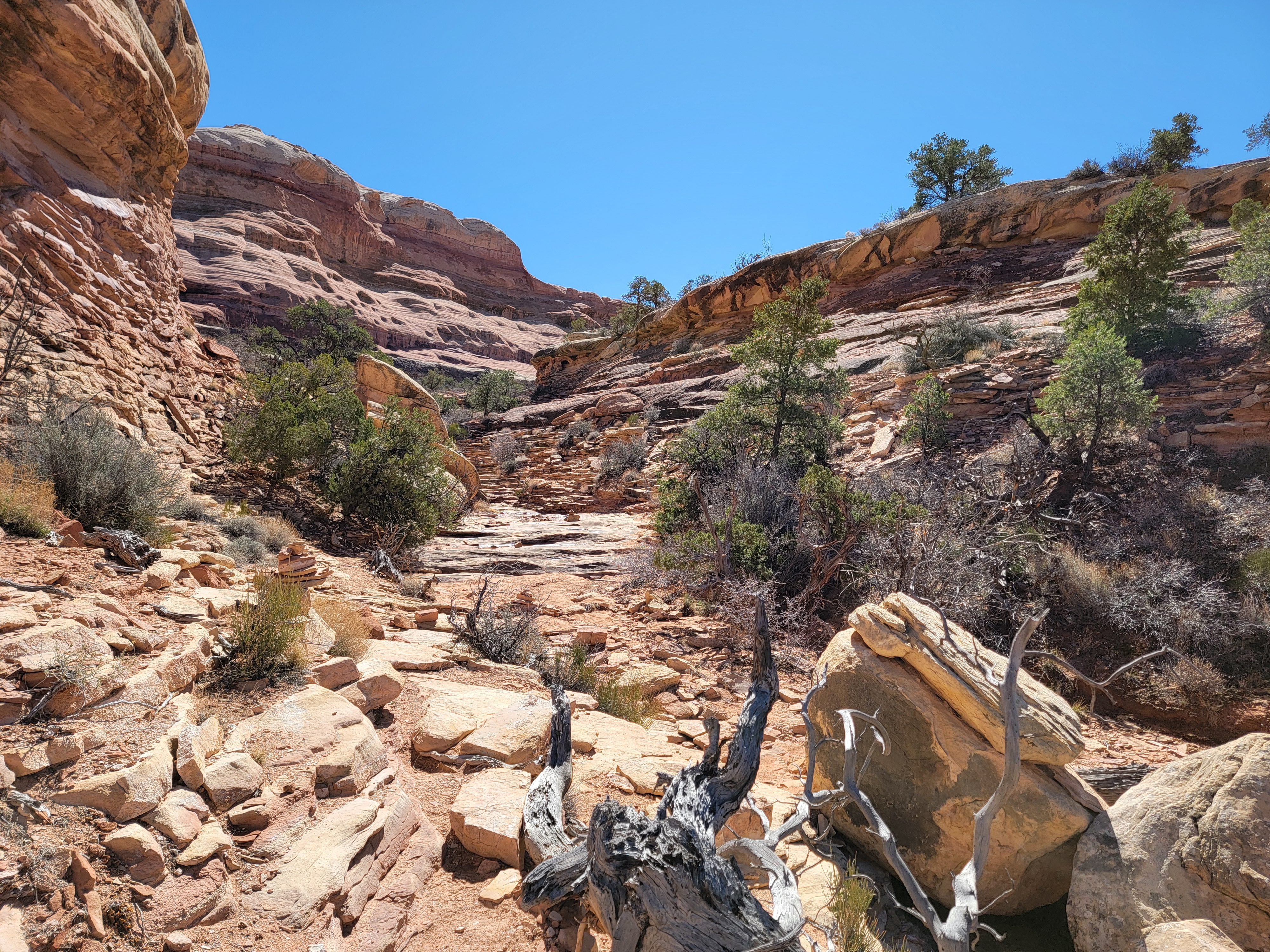 The trail up Big Springs Canyon
One benefit of this plan was that hotels in Monticello were cheap. I mean, really cheap. I got a room for three nights at $50/night. Nothing spectacular but it was clean. A hotel room for that price is unheard of these days. The downside is that there is almost nothing in Monticello. There are only two restaurants and one of them is closed on Sunday. There are no shops, so there would be no looking for tshirts or other souvenirs. I made sure to load several books on my Kindle to read in my hotel room when I got back from the trail.
Although the forecast for the weekend was good, it wasn't so great for the Friday drive down. But when I started out, it was mostly blue sky. It was that way all through Idaho and along I15 so I was feeling pretty good. Then I got off the interstate in Spanish Fork. There were ugly clouds looming over the pass across the Uintas Mountains. Not so good anymore. As the road climbed it started to snow, but it ended up being just flurries. Nothing stuck on the ground. The road was dry and there were no icy spots. So it wasn't a problem after all. The wind was blowing pretty good though and it was cold.
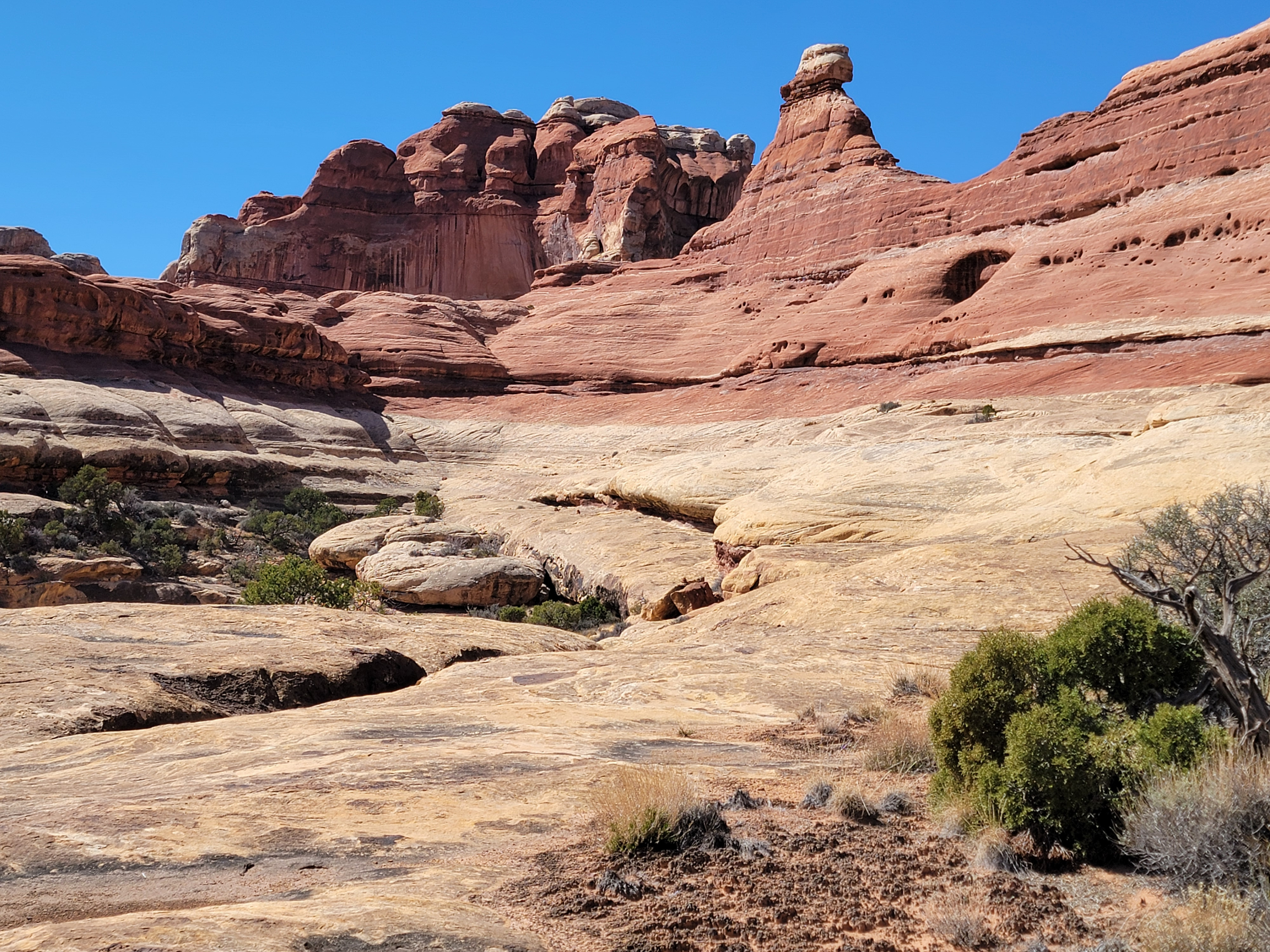
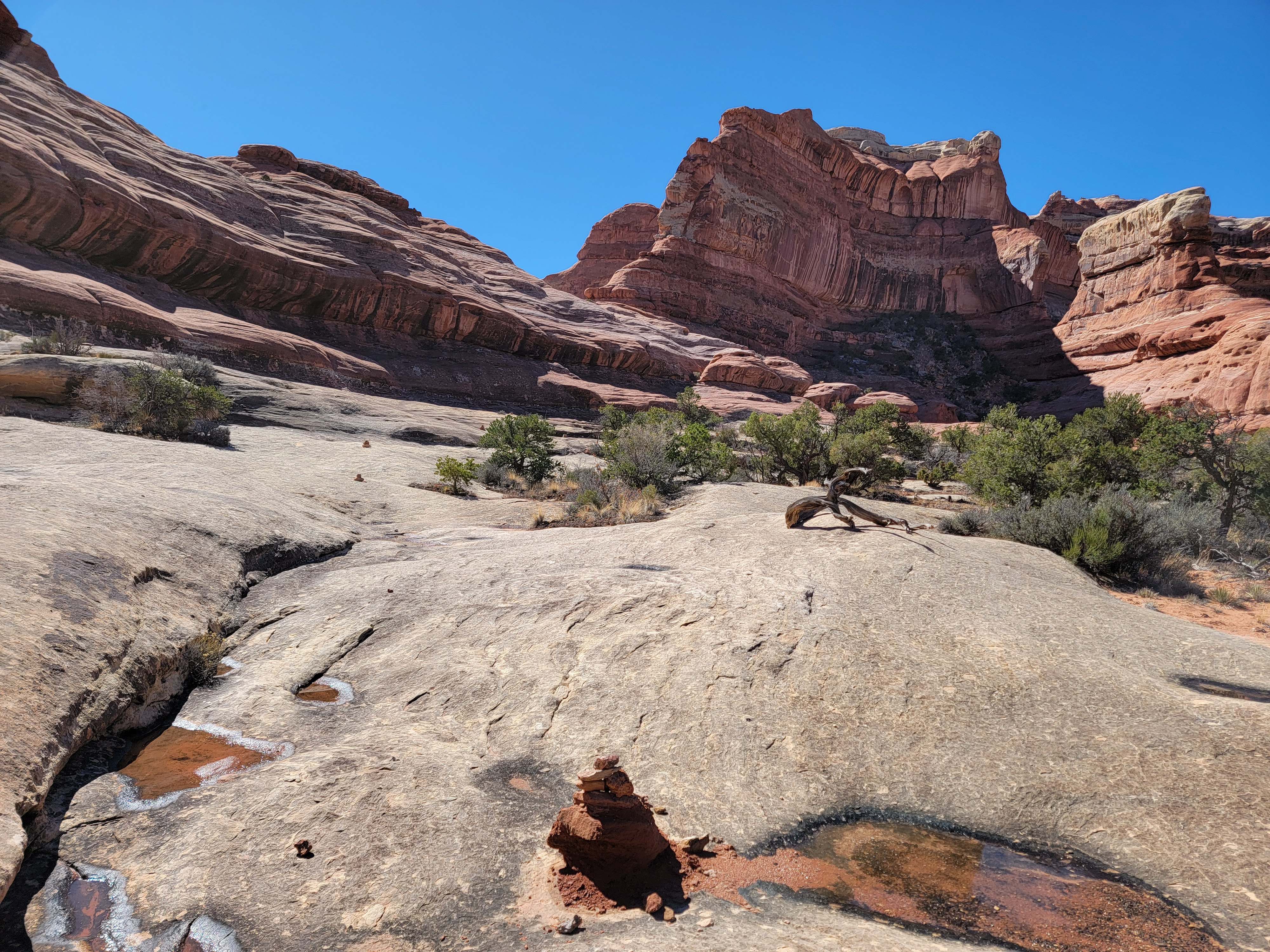 Head of Big Springs Canyon - follow the Karens
After stopping in Moab for dinner at McDonald's, I got to Monticello about 6 pm It was 30 degrees and there was a strong wind blowing. There usually is in Monticello - it's a windy place. When I stopped to fill up with gas I just about froze. I was shivering by the time I got back in the car and cranked my heater all the way up for the one block drive to my hotel. I checked in no problem, but was worried that the weather might not clear or that it might be really cold and windy the next day.
The next morning the sky was completely blue. So much for that worry. And while it was cold, there was no wind at all. I still waited around for a while before leaving for the park to give it a little time to warm up. Even though Monticello is the closest town to the Needles District, it still takes almost an hour to drive to the trailheads. Along the way, I made a brief stop at Newspaper Rock, a petroglyph site right next to the road. It was very impressive, although for me the most striking thing about it was that several modern people had scratched their names on the panel. It's hard to imagine how anyone could think that was a good idea.
 Needles line upper Big Springs Canyon
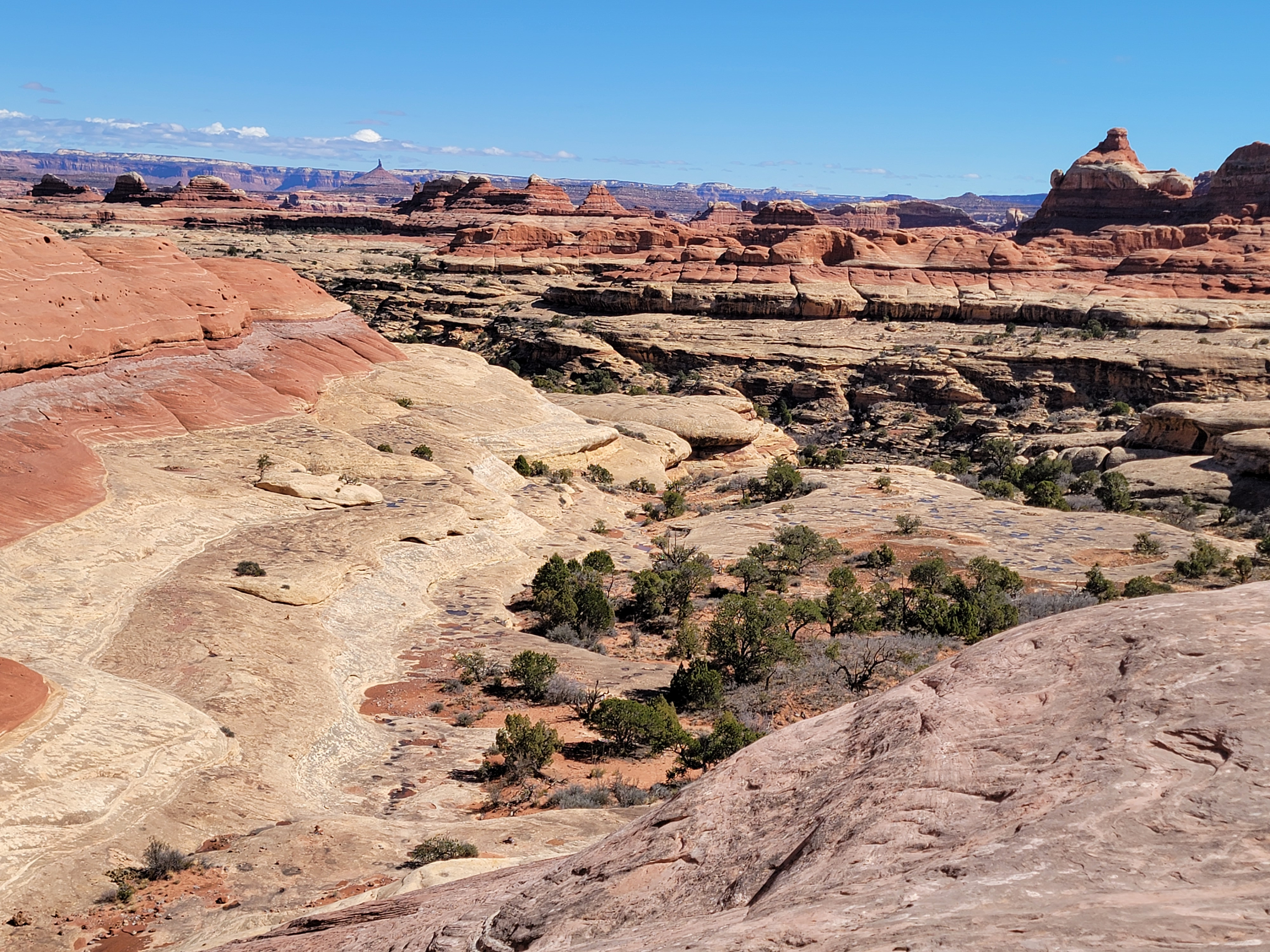
I hadn't been to the Needles District for several years and I forgot how impressive the scenery is just on the road to get to the park. The BLM land is now part of the Bears Ears National Monument. A good thing, although it will take just one stroke of the pen for Trump to reverse that. He reduced the size during his first term, but it was restored by the Biden administration. Trump seems to have his hands full with the war with Iran and immigration right now, so hopefully he won't get around to messing with it.
I stopped at the visitor center, and they did have some Canyonlands NP tshirts that were pretty cool. I decided to wait till after I hiked to buy anything though. I only wear tshirts if I earn them. From the visitor center it was just a short drive to the needles campground and the parking area for the trailhead. The temperature was 42 degrees, which sounds chilly, but it was bright and sunny with no wind. I started out wearing my jacket, warm hat and gloves, but that only lasted for about twenty minutes. Most of the day I was comfortable in just a long sleeve tshirt.
 Looking down on the hidden seam in the cliff that I climbed
About two minutes from the trailhead I reached a junction. One trail went to the right and looked like it went to the end of the campground, so I turned left. After about ten steps I had second thoughts. I checked AllTrails and sure enough, I wanted the other trail. So only two minutes into the hike I had to backtrack, even if it was only a couple of steps. Fortunately no one was around to see the Great Hiker mess up.
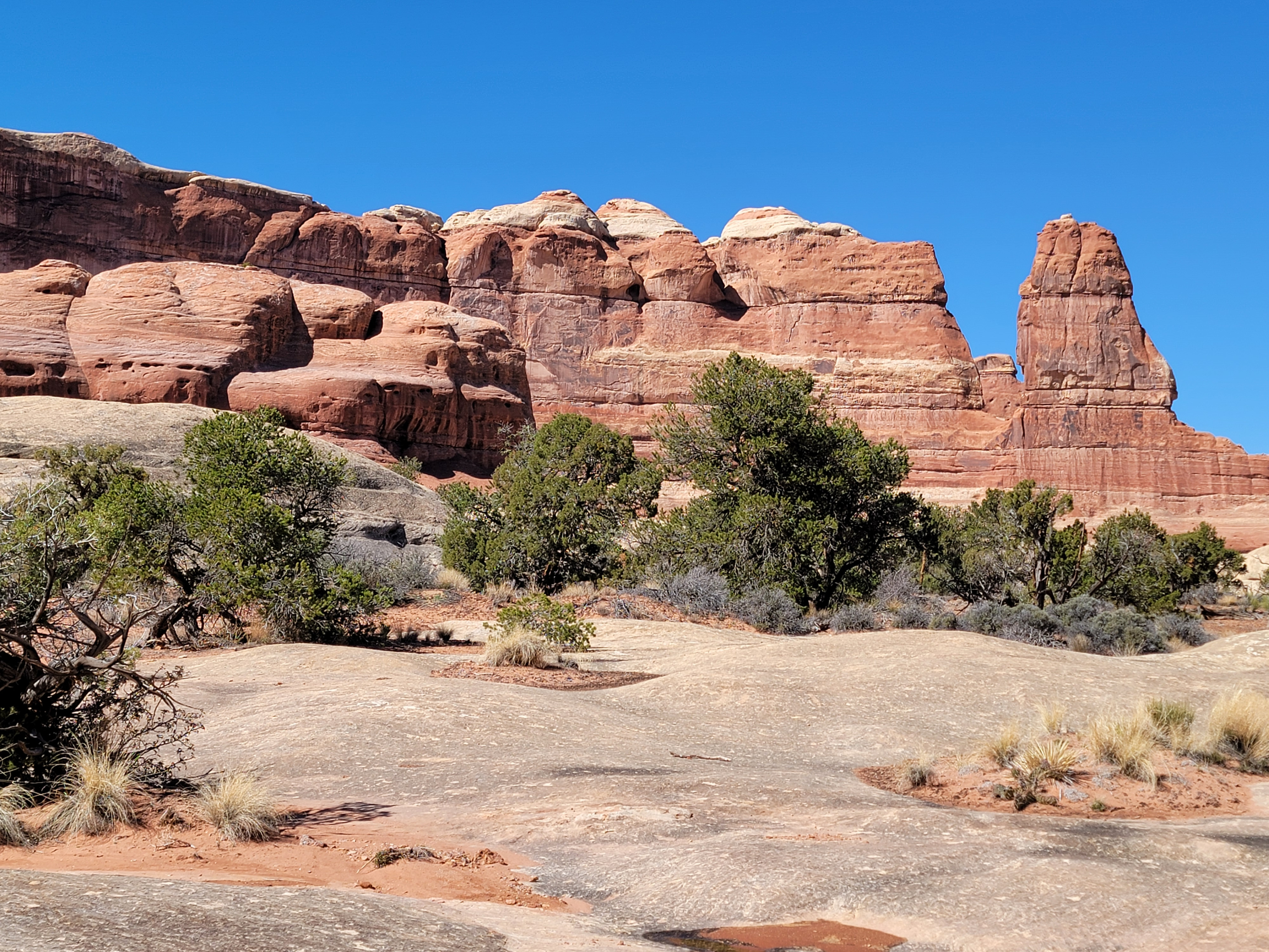
My plan for today was to do the Big Spring Canyon/Squaw Canyon loop. Sandy and I did the hike back in 2015 on our first ever trip to the Needles. I remembered that it was an excellent hike. It also wasn't too long - only seven miles. It seemed like a good starter hike for this trip so I could get an idea of what the present trail conditions were. There was an ominous sign at the trailhead about icy trail conditions in winter. Since hiking on slickrock depends a lot on friction, ice could be a significant problem. There could be some in sheltered or shaded areas even though the area in general seemed completely clear. I thought it was better to start out with a shorter hike that I was at least somewhat familiar with.
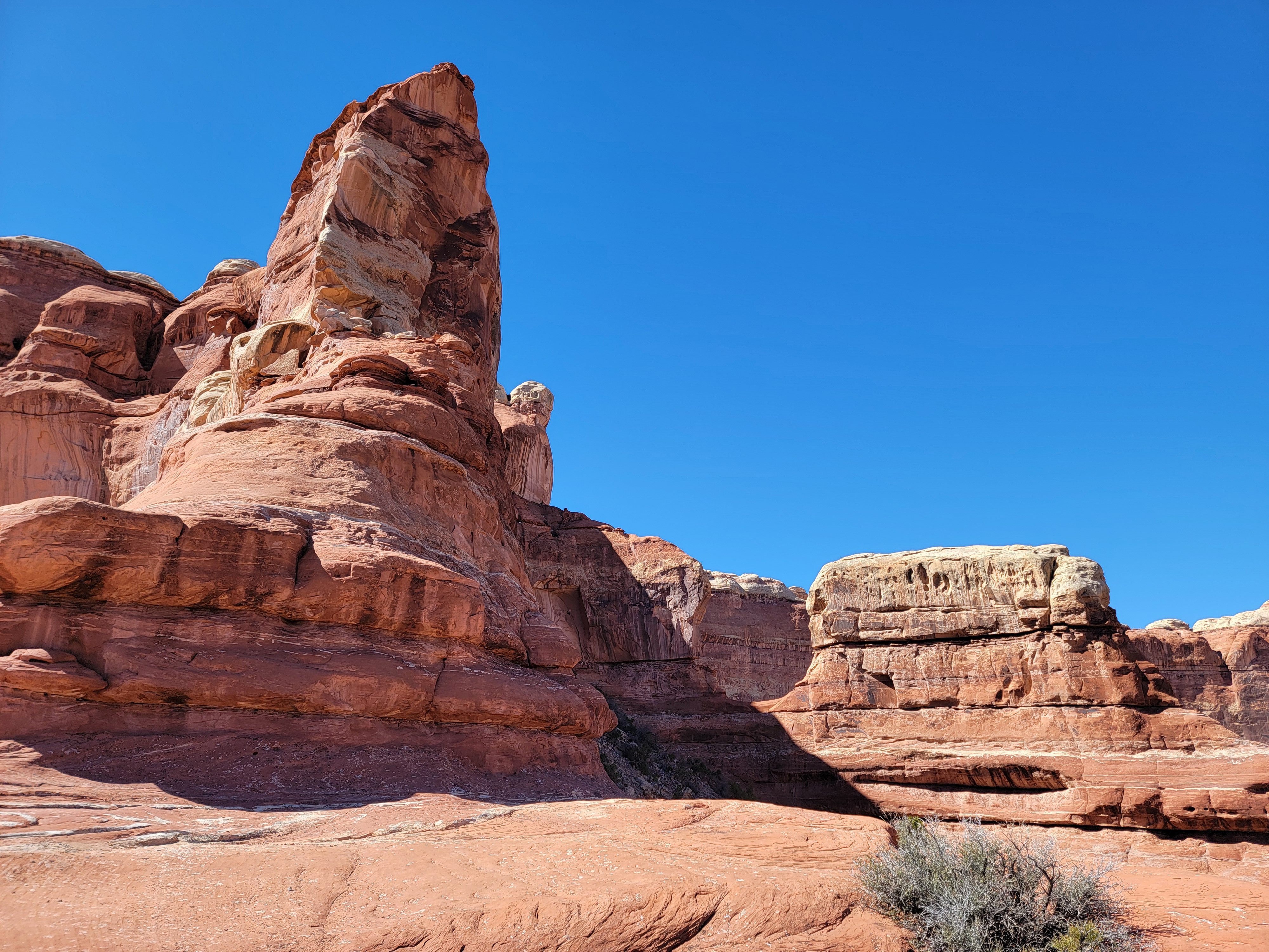 Rock formations towering over the saddle
It was a little tricky telling Sandy what hike I was doing. My go to guidebook, "Hiking from Here to WOW: Utah Canyon Country", is several years old but still my main reference for hikes. In that book the trail was called Big Spring Canyon/Squaw Canyon loop. But the Park Service called it Big Springs Canyon/Wooden Shoe Canyon. AllTrails called it Big Spring Canyon/Salt Flats. Apparently the use of the term squaw has fallen into disfavor with some people so everyone just makes up new names for the canyon. Totally confusing but at least no one is offended. Lost maybe, but not offended.
The trail starts by going up Big Spring Canyon, which is pretty but not spectacular. The fun starts as you near the head of the canyon. It's a dead end with sheer cliffs everywhere. It looks hopeless but the cairns marking the route over slickrock keep on going. Finally they led behind a rock that jutted out from the canyon wall. Behind the rock was a steep ramp, invisible from below, that led up the steep rock face. There was one rock step that was about waist high that was undercut. In my youth I probably could have gotten a leg up and stepped up on it. Between old age and a knee replacement that wasn't going to work. It took me two tries but I managed to get up. I would say that I did a mantle, a difficult technical climbing maneuver. Someone watching would say that I did a combination lunge and belly flop. Whatever you call it, it worked.
 Looking down Wooden Shoe Canyon
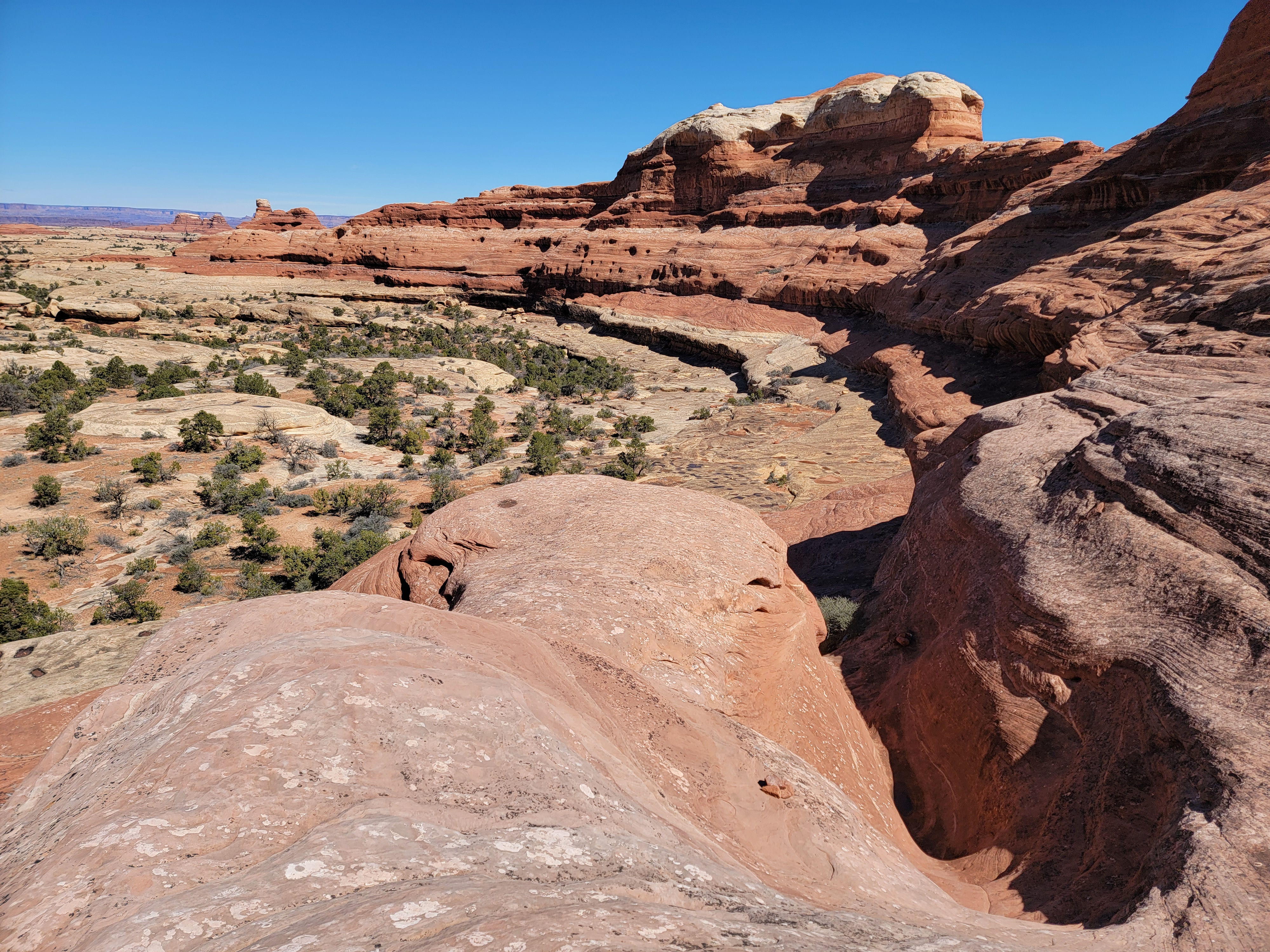
Above the rock step, a series of sloping ledges led upward and eventually I reached the saddle. It was pretty cool because from below it looked absolutely impossible. On the other side was an impressive view of Wooden Shoe Canyon, or whatever it's called. And at first glance, it looked just as steep on this side as on the one I had just climbed. It wasn't obvious how to get down into the canyon.
Again, I just trusted the cairns. They led back and forth across the face on a series of sloping ledges. Because they were sloping they didn't stand out when looking down from above, but they were always relatively easy going. In five minutes I was most of the way down from the saddle, another apparently impossible route. Instead of going all the way to the canyon floor, the route followed a rock shelf about a hundred feet above that contoured along the side of the canyon. Varying from as much as twenty feet to as little as five feet wide, it was an unlikely way to move down the canyon. A very cool route again.
 Looking back up to the saddle after descending
On a humorous note, I'll mention that I had checked the recent comments for the trail on AllTrails. I think one person meant to say "The route isn't obvious. Follow the cairns. Watch out for the cairns." They must have dictated it rather than typing it though because it said "The route isn't obvious. Follow the Karens. Watch out for the Karens." I think I knew what they really meant, but just to be safe, I did watch out for Karens all day.
After a long contour on the rocky shelf, the route descended to the bottom of the canyon and followed it till it opened up into a (mostly) flat area. The trail eventually joined up with the trail to Peekaboo, the one I had almost mistakenly taken right at the start. It was straightforward from there except for climbing over two low rock ridges. I was back at the car by 2:30. The temperature was 62 degrees, so it had warmed up twenty degrees during my hike.
 Following the rocky shelf above the canyon
The specs from AllTrails and my GPS were:
distance = 8.03 miles
elevation gain = 735 feet
hiking time = 3 hours and 42 minutes
Definitely a good hike on a beautiful day. I rewarded myself with a Canyonlands National Park tshirt at the visitor center on the way back. I showed restraint since I wanted to get two tshirts and a book. Then it took almost an hour to drive back to Monticello. After a shower I went to Thatzza Pizza for dinner. They also served ice cream so I had that for dessert. The pizza was good but the place was kind of weird. It was in two adjacent units in a building. You ordered in one where they made the pizza. Next door was a room with seating, with no connection between the two. I had the place to myself so it didn't matter.
I have to admit that when I got back to the hotel I was tired. Since clocks changed overnight I set my watch ahead. Even then, I was in bed by 9:30. Pretty unusual for me, but I wanted to be well rested to do a longer hike the next day.
